Location List
Modes
Levels of detail in the response - normal, detailed
Example - /locations/?mode=detailed
Filters
Parameters - active, country_code, id, name, name__contains, total_landing_count, total_landing_count__gt, total_landing_count__gte, total_landing_count__lt, total_landing_count__lte, total_launch_count, total_launch_count__gt, total_launch_count__gte, total_launch_count__lt, total_launch_count__lte
Example - /locations/?country_code=NZL
Search
Fields searched - country__alpha_3_code, name
Example - /locations/?search=Cape Canaveral
Ordering
Fields - name, total_landing_count, total_launch_count
Example - /locations/?ordering=-total_launch_count
Number of results
Use limit to control the number of objects in the response (max 100)
Example - /locations/?limit=2
Format
Switch to JSON output - /locations/?format=json
Help
Find all the FAQs and support links on the documentation homepage - lldev.thespacedevs.com/docs
GET /2.3.0/locations/?format=api
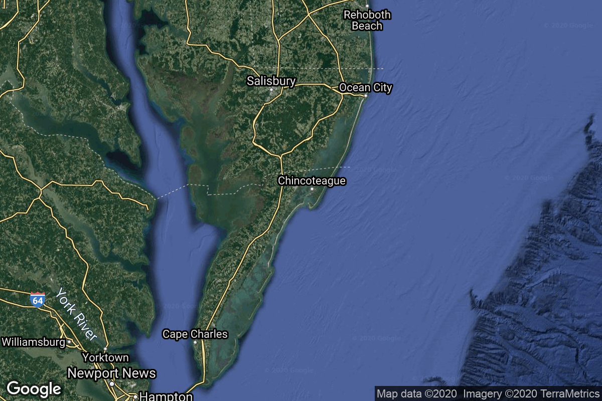
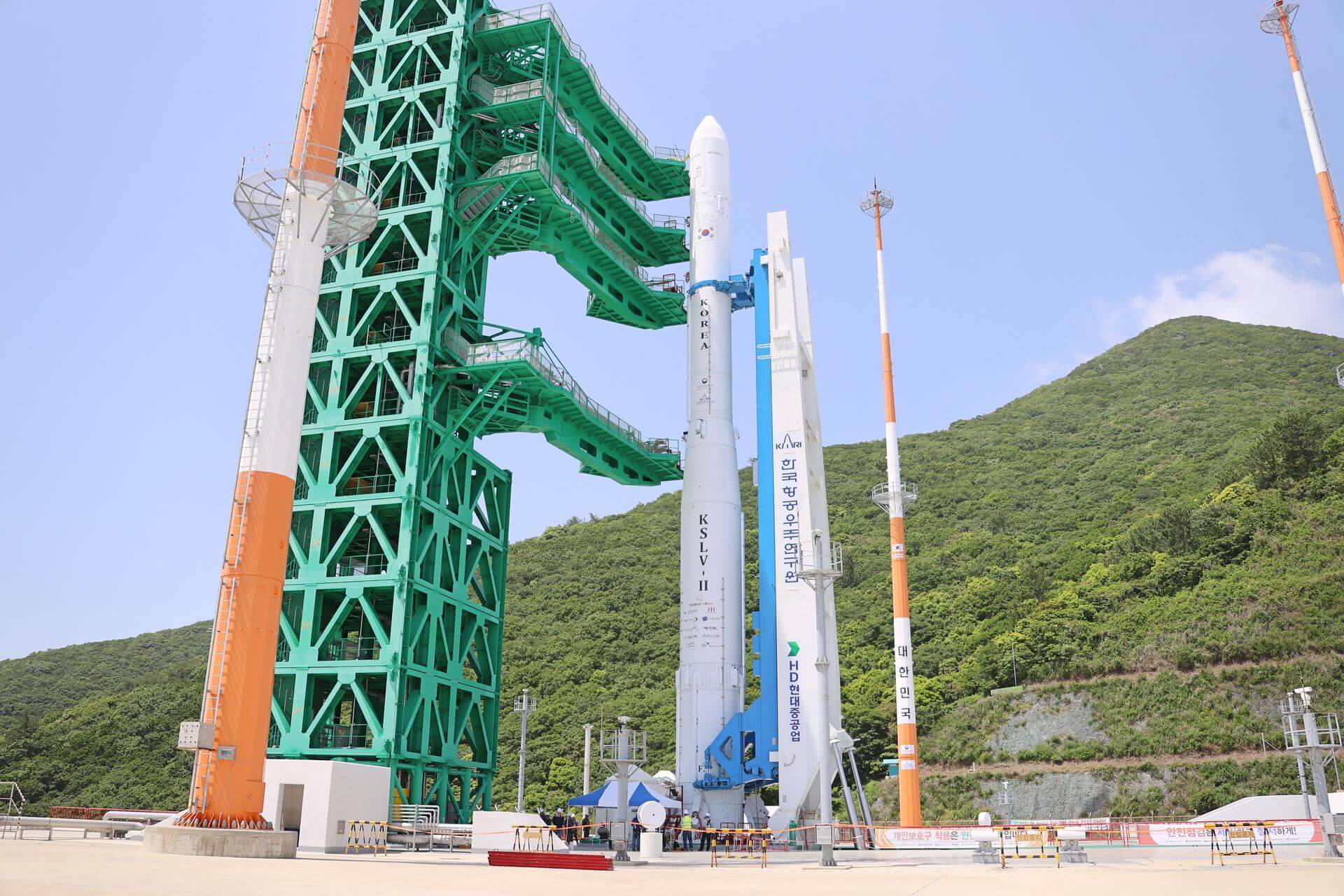
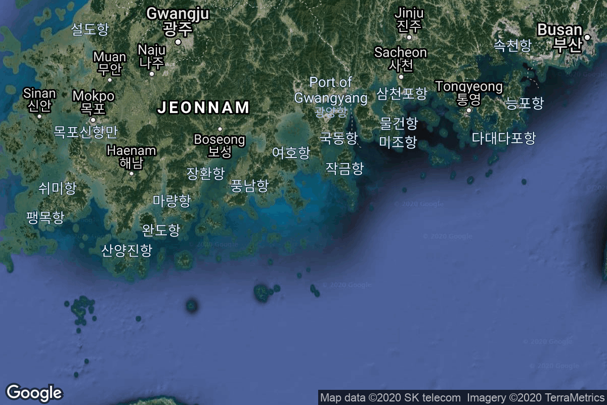
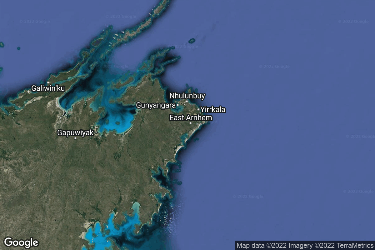
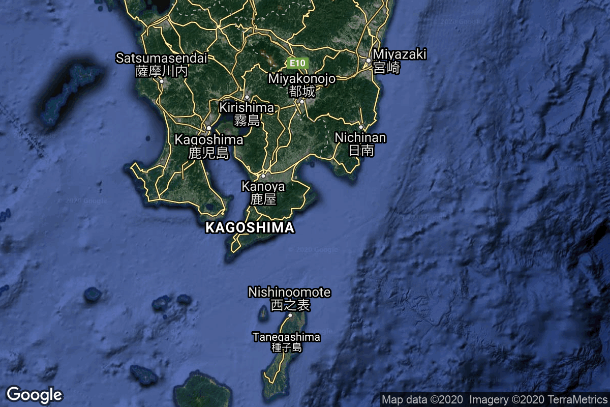
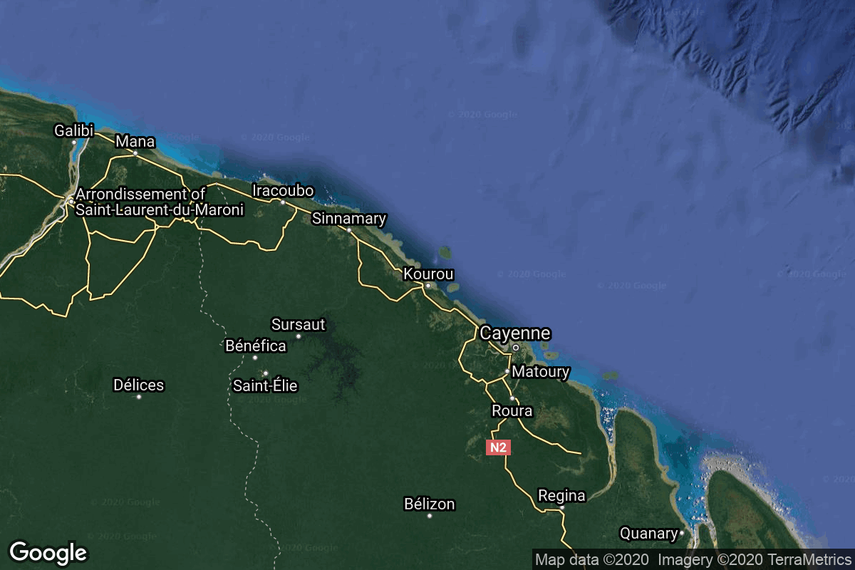
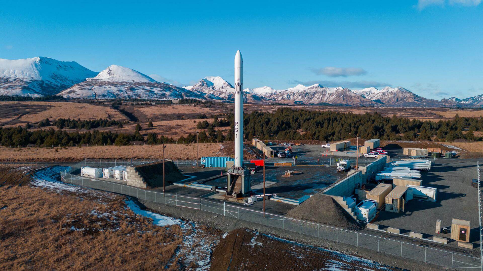
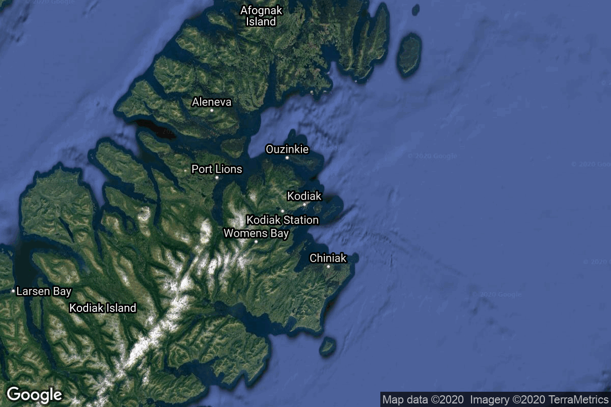
{ "count": 67, "next": "https://lldev.thespacedevs.com/2.3.0/locations/?format=api&limit=10&offset=10", "previous": null, "results": [ { "response_mode": "normal", "id": 144, "url": "https://lldev.thespacedevs.com/2.3.0/locations/144/?format=api", "name": "Air launch to Suborbital flight", "celestial_body": { "response_mode": "normal", "id": 1, "name": "Earth", "type": { "id": 1, "name": "Planet" }, "diameter": 12742000.0, "mass": 5.972168e+24, "gravity": 9.80655, "length_of_day": "1 00:00:00", "atmosphere": true, "image": { "id": 2040, "name": "Earth (Apollo 17)", "image_url": "https://thespacedevs-dev.nyc3.digitaloceanspaces.com/media/images/earth_2528apol_image_20240402194304.jpeg", "thumbnail_url": "https://thespacedevs-dev.nyc3.digitaloceanspaces.com/media/images/earth_2528apol_image_thumbnail_20240402194305.jpeg", "credit": "NASA", "license": { "id": 4, "name": "NASA Image and Media Guidelines", "priority": 0, "link": "https://www.nasa.gov/nasa-brand-center/images-and-media/" }, "single_use": true, "variants": [] }, "description": "Earth is the third planet from the Sun and the only astronomical object known to harbor life.", "wiki_url": "https://en.wikipedia.org/wiki/Earth", "total_attempted_launches": 7462, "successful_launches": 6908, "failed_launches": 554, "total_attempted_landings": 1285, "successful_landings": 1238, "failed_landings": 47 }, "active": true, "country": { "id": 17, "name": "Unknown", "alpha_2_code": "??", "alpha_3_code": "???", "nationality_name": "Earthling", "nationality_name_composed": "Earthling" }, "description": "", "image": { "id": 32, "name": "[AUTO] Virgin Galactic - image", "image_url": "https://thespacedevs-dev.nyc3.digitaloceanspaces.com/media/images/virgin_galactic_image_20210522131723.jpeg", "thumbnail_url": "https://thespacedevs-dev.nyc3.digitaloceanspaces.com/media/images/255bauto255d__image_thumbnail_20240305184711.jpeg", "credit": null, "license": { "id": 1, "name": "Unknown", "priority": 9, "link": null }, "single_use": true, "variants": [] }, "map_image": "https://thespacedevs-dev.nyc3.digitaloceanspaces.com/media/map_images/location_144_20200803142439.jpg", "longitude": null, "latitude": null, "timezone_name": "", "total_launch_count": 86, "total_landing_count": 0 }, { "response_mode": "normal", "id": 21, "url": "https://lldev.thespacedevs.com/2.3.0/locations/21/?format=api", "name": "Wallops Flight Facility, Virginia, USA", "celestial_body": { "response_mode": "normal", "id": 1, "name": "Earth", "type": { "id": 1, "name": "Planet" }, "diameter": 12742000.0, "mass": 5.972168e+24, "gravity": 9.80655, "length_of_day": "1 00:00:00", "atmosphere": true, "image": { "id": 2040, "name": "Earth (Apollo 17)", "image_url": "https://thespacedevs-dev.nyc3.digitaloceanspaces.com/media/images/earth_2528apol_image_20240402194304.jpeg", "thumbnail_url": "https://thespacedevs-dev.nyc3.digitaloceanspaces.com/media/images/earth_2528apol_image_thumbnail_20240402194305.jpeg", "credit": "NASA", "license": { "id": 4, "name": "NASA Image and Media Guidelines", "priority": 0, "link": "https://www.nasa.gov/nasa-brand-center/images-and-media/" }, "single_use": true, "variants": [] }, "description": "Earth is the third planet from the Sun and the only astronomical object known to harbor life.", "wiki_url": "https://en.wikipedia.org/wiki/Earth", "total_attempted_launches": 7462, "successful_launches": 6908, "failed_launches": 554, "total_attempted_landings": 1285, "successful_landings": 1238, "failed_landings": 47 }, "active": true, "country": { "id": 2, "name": "United States of America", "alpha_2_code": "US", "alpha_3_code": "USA", "nationality_name": "American", "nationality_name_composed": "Americano" }, "description": "Wallops Flight Facility is a rocket launch site on Wallops Island on the Eastern Shore of Virginia, United States, just east of the Delmarva Peninsula and north-northeast of Norfolk. The facility is operated by the Goddard Space Flight Center in Greenbelt, Maryland, and primarily serves to support science and exploration missions for NASA and other federal agencies. WFF includes an extensively instrumented range to support launches of more than a dozen types of sounding rockets; small expendable suborbital and orbital rockets; high-altitude balloon flights carrying scientific instruments for atmospheric and astronomical research; and, using its Research Airport, flight tests of aeronautical research aircraft, including uncrewed aerial vehicles.", "image": { "id": 2227, "name": "Wallops Flight Facility", "image_url": "https://thespacedevs-dev.nyc3.digitaloceanspaces.com/media/images/wallops_flight__image_20240920083715.jpg", "thumbnail_url": "https://thespacedevs-dev.nyc3.digitaloceanspaces.com/media/images/wallops_flight__image_thumbnail_20240920083715.jpeg", "credit": "NASA", "license": { "id": 4, "name": "NASA Image and Media Guidelines", "priority": 0, "link": "https://www.nasa.gov/nasa-brand-center/images-and-media/" }, "single_use": true, "variants": [] }, "map_image": "https://thespacedevs-dev.nyc3.digitaloceanspaces.com/media/map_images/location_21_20200803142423.jpg", "longitude": -75.467778, "latitude": 37.933333, "timezone_name": "America/New_York", "total_launch_count": 85, "total_landing_count": 0 }, { "response_mode": "normal", "id": 11, "url": "https://lldev.thespacedevs.com/2.3.0/locations/11/?format=api", "name": "Vandenberg SFB, CA, USA", "celestial_body": { "response_mode": "normal", "id": 1, "name": "Earth", "type": { "id": 1, "name": "Planet" }, "diameter": 12742000.0, "mass": 5.972168e+24, "gravity": 9.80655, "length_of_day": "1 00:00:00", "atmosphere": true, "image": { "id": 2040, "name": "Earth (Apollo 17)", "image_url": "https://thespacedevs-dev.nyc3.digitaloceanspaces.com/media/images/earth_2528apol_image_20240402194304.jpeg", "thumbnail_url": "https://thespacedevs-dev.nyc3.digitaloceanspaces.com/media/images/earth_2528apol_image_thumbnail_20240402194305.jpeg", "credit": "NASA", "license": { "id": 4, "name": "NASA Image and Media Guidelines", "priority": 0, "link": "https://www.nasa.gov/nasa-brand-center/images-and-media/" }, "single_use": true, "variants": [] }, "description": "Earth is the third planet from the Sun and the only astronomical object known to harbor life.", "wiki_url": "https://en.wikipedia.org/wiki/Earth", "total_attempted_launches": 7462, "successful_launches": 6908, "failed_launches": 554, "total_attempted_landings": 1285, "successful_landings": 1238, "failed_landings": 47 }, "active": true, "country": { "id": 2, "name": "United States of America", "alpha_2_code": "US", "alpha_3_code": "USA", "nationality_name": "American", "nationality_name_composed": "Americano" }, "description": "Vandenberg Space Force Base is a United States Space Force Base in Santa Barbara County, California. Established in 1941, Vandenberg Space Force Base is a space launch base, launching spacecraft from the Western Range, and also performs missile testing. The United States Space Force's Space Launch Delta 30 serves as the host delta for the base, equivalent to an Air Force air base wing. In addition to its military space launch mission, Vandenberg Space Force Base also hosts space launches for civil and commercial space entities, such as NASA and SpaceX.", "image": { "id": 2226, "name": "Vandenberg SFB imaged by Sentinel-2", "image_url": "https://thespacedevs-dev.nyc3.digitaloceanspaces.com/media/images/vandenberg_sfb__image_20240920082910.jpeg", "thumbnail_url": "https://thespacedevs-dev.nyc3.digitaloceanspaces.com/media/images/vandenberg_sfb__image_thumbnail_20240920082910.jpeg", "credit": "Contains modified Copernicus Sentinel data 2020", "license": { "id": 33, "name": "Copernicus Image Use Policy", "priority": 0, "link": "https://eur-lex.europa.eu/legal-content/EN/TXT/?uri=CELEX:32013R1159" }, "single_use": true, "variants": [] }, "map_image": "https://thespacedevs-dev.nyc3.digitaloceanspaces.com/media/map_images/location_11_20200803142416.jpg", "longitude": -120.52023, "latitude": 34.75133, "timezone_name": "America/Los_Angeles", "total_launch_count": 871, "total_landing_count": 33 }, { "response_mode": "normal", "id": 9, "url": "https://lldev.thespacedevs.com/2.3.0/locations/9/?format=api", "name": "Naro Space Center, South Korea", "celestial_body": { "response_mode": "normal", "id": 1, "name": "Earth", "type": { "id": 1, "name": "Planet" }, "diameter": 12742000.0, "mass": 5.972168e+24, "gravity": 9.80655, "length_of_day": "1 00:00:00", "atmosphere": true, "image": { "id": 2040, "name": "Earth (Apollo 17)", "image_url": "https://thespacedevs-dev.nyc3.digitaloceanspaces.com/media/images/earth_2528apol_image_20240402194304.jpeg", "thumbnail_url": "https://thespacedevs-dev.nyc3.digitaloceanspaces.com/media/images/earth_2528apol_image_thumbnail_20240402194305.jpeg", "credit": "NASA", "license": { "id": 4, "name": "NASA Image and Media Guidelines", "priority": 0, "link": "https://www.nasa.gov/nasa-brand-center/images-and-media/" }, "single_use": true, "variants": [] }, "description": "Earth is the third planet from the Sun and the only astronomical object known to harbor life.", "wiki_url": "https://en.wikipedia.org/wiki/Earth", "total_attempted_launches": 7462, "successful_launches": 6908, "failed_launches": 554, "total_attempted_landings": 1285, "successful_landings": 1238, "failed_landings": 47 }, "active": true, "country": { "id": 35, "name": "South Korea", "alpha_2_code": "KR", "alpha_3_code": "KOR", "nationality_name": "South Korean", "nationality_name_composed": "South Korean" }, "description": "The Naro Space Center is a South Korean spaceport in South Jeolla's Goheung County, operated by the state-run Korea Aerospace Research Institute.", "image": { "id": 1797, "name": "Nuri on the launch pad", "image_url": "https://thespacedevs-dev.nyc3.digitaloceanspaces.com/media/images/nuri_on_the_lau_image_20240307163812.jpeg", "thumbnail_url": "https://thespacedevs-dev.nyc3.digitaloceanspaces.com/media/images/nuri_on_the_lau_image_thumbnail_20240307163813.jpeg", "credit": "Korea Aerospace Research Institute", "license": { "id": 15, "name": "Korea Open Government License Type I: Attribution", "priority": 6, "link": "https://www.kogl.or.kr/edu/eduDataFileDown.do?dataIdx=97&dataFileIdx=1" }, "single_use": true, "variants": [] }, "map_image": "https://thespacedevs-dev.nyc3.digitaloceanspaces.com/media/map_images/location_9_20200803142441.jpg", "longitude": 127.535, "latitude": 34.431944, "timezone_name": "Asia/Seoul", "total_launch_count": 8, "total_landing_count": 0 }, { "response_mode": "normal", "id": 180, "url": "https://lldev.thespacedevs.com/2.3.0/locations/180/?format=api", "name": "Mare Frigoris", "celestial_body": { "response_mode": "normal", "id": 2, "name": "Moon", "type": { "id": 2, "name": "Moon" }, "diameter": 3474800.0, "mass": 7.342e+22, "gravity": 1.622, "length_of_day": "27 07:43:12", "atmosphere": false, "image": { "id": 2041, "name": "Moon (Apollo 11)", "image_url": "https://thespacedevs-dev.nyc3.digitaloceanspaces.com/media/images/moon_2528apoll_image_20240402195408.jpg", "thumbnail_url": "https://thespacedevs-dev.nyc3.digitaloceanspaces.com/media/images/moon_2528apoll_image_thumbnail_20240402195408.jpeg", "credit": "NASA", "license": { "id": 4, "name": "NASA Image and Media Guidelines", "priority": 0, "link": "https://www.nasa.gov/nasa-brand-center/images-and-media/" }, "single_use": false, "variants": [] }, "description": "The Moon is Earth's only natural satellite.", "wiki_url": "https://en.wikipedia.org/wiki/Moon", "total_attempted_launches": 11, "successful_launches": 11, "failed_launches": 0, "total_attempted_landings": 17, "successful_landings": 14, "failed_landings": 3 }, "active": false, "country": null, "description": "Mare Frigoris is a lunar mare in the far north of the Moon. It is located in the outer rings of the Procellarum basin, just north of Mare Imbrium, and stretches east to north of Mare Serenitatis. It is just north of the dark crater Plato.", "image": { "id": 2312, "name": "Mare Frigoris seen from Lunar Orbiter 4", "image_url": "https://thespacedevs-dev.nyc3.digitaloceanspaces.com/media/images/mare_frigoris_s_image_20250115090515.jpg", "thumbnail_url": "https://thespacedevs-dev.nyc3.digitaloceanspaces.com/media/images/mare_frigoris_s_image_thumbnail_20250115090515.jpeg", "credit": "James Stuby based on NASA imagery", "license": { "id": 25, "name": "CC0 1.0", "priority": 3, "link": "https://creativecommons.org/publicdomain/zero/1.0/deed.en" }, "single_use": false, "variants": [] }, "map_image": null, "longitude": 1.4, "latitude": 56.0, "timezone_name": "", "total_launch_count": 0, "total_landing_count": 0 }, { "response_mode": "normal", "id": 160, "url": "https://lldev.thespacedevs.com/2.3.0/locations/160/?format=api", "name": "Arnhem Space Centre", "celestial_body": { "response_mode": "normal", "id": 1, "name": "Earth", "type": { "id": 1, "name": "Planet" }, "diameter": 12742000.0, "mass": 5.972168e+24, "gravity": 9.80655, "length_of_day": "1 00:00:00", "atmosphere": true, "image": { "id": 2040, "name": "Earth (Apollo 17)", "image_url": "https://thespacedevs-dev.nyc3.digitaloceanspaces.com/media/images/earth_2528apol_image_20240402194304.jpeg", "thumbnail_url": "https://thespacedevs-dev.nyc3.digitaloceanspaces.com/media/images/earth_2528apol_image_thumbnail_20240402194305.jpeg", "credit": "NASA", "license": { "id": 4, "name": "NASA Image and Media Guidelines", "priority": 0, "link": "https://www.nasa.gov/nasa-brand-center/images-and-media/" }, "single_use": true, "variants": [] }, "description": "Earth is the third planet from the Sun and the only astronomical object known to harbor life.", "wiki_url": "https://en.wikipedia.org/wiki/Earth", "total_attempted_launches": 7462, "successful_launches": 6908, "failed_launches": 554, "total_attempted_landings": 1285, "successful_landings": 1238, "failed_landings": 47 }, "active": false, "country": { "id": 34, "name": "Australia", "alpha_2_code": "AU", "alpha_3_code": "AUS", "nationality_name": "Australian", "nationality_name_composed": "Australo" }, "description": "The Arnhem Space Centre was Australia's first commercial spaceport, located near Nhulunbuy, in Arnhem Land, Australia. It was owned and operated by Equatorial Launch Australia (ELA), and was the site of NASA's first non-orbital sounding rocket launch from a commercial port outside the United States on 27 June 2022.", "image": { "id": 2197, "name": "Arnhem Space Centre", "image_url": "https://thespacedevs-dev.nyc3.digitaloceanspaces.com/media/images/arnhem_space_ce_image_20240918150330.jpg", "thumbnail_url": "https://thespacedevs-dev.nyc3.digitaloceanspaces.com/media/images/arnhem_space_ce_image_thumbnail_20240918150331.jpeg", "credit": "Equatorial Launch Australia", "license": { "id": 29, "name": "ELA Image Use Policy", "priority": 8, "link": "https://ela.space/website-disclaimer" }, "single_use": false, "variants": [] }, "map_image": "https://thespacedevs-dev.nyc3.digitaloceanspaces.com/media/map_images/location_arnhem_space_centre_20220622160552.jpg", "longitude": 136.813889, "latitude": -12.381389, "timezone_name": "Australia/Darwin", "total_launch_count": 3, "total_landing_count": 0 }, { "response_mode": "normal", "id": 24, "url": "https://lldev.thespacedevs.com/2.3.0/locations/24/?format=api", "name": "Uchinoura Space Center, Japan", "celestial_body": { "response_mode": "normal", "id": 1, "name": "Earth", "type": { "id": 1, "name": "Planet" }, "diameter": 12742000.0, "mass": 5.972168e+24, "gravity": 9.80655, "length_of_day": "1 00:00:00", "atmosphere": true, "image": { "id": 2040, "name": "Earth (Apollo 17)", "image_url": "https://thespacedevs-dev.nyc3.digitaloceanspaces.com/media/images/earth_2528apol_image_20240402194304.jpeg", "thumbnail_url": "https://thespacedevs-dev.nyc3.digitaloceanspaces.com/media/images/earth_2528apol_image_thumbnail_20240402194305.jpeg", "credit": "NASA", "license": { "id": 4, "name": "NASA Image and Media Guidelines", "priority": 0, "link": "https://www.nasa.gov/nasa-brand-center/images-and-media/" }, "single_use": true, "variants": [] }, "description": "Earth is the third planet from the Sun and the only astronomical object known to harbor life.", "wiki_url": "https://en.wikipedia.org/wiki/Earth", "total_attempted_launches": 7462, "successful_launches": 6908, "failed_launches": 554, "total_attempted_landings": 1285, "successful_landings": 1238, "failed_landings": 47 }, "active": true, "country": { "id": 28, "name": "Japan", "alpha_2_code": "JP", "alpha_3_code": "JPN", "nationality_name": "Japanese", "nationality_name_composed": "Nippo" }, "description": "The Uchinoura Space Center is a space launch facility in the Japanese town of Kimotsuki, Kagoshima Prefecture. All of Japan's scientific satellites were launched from Uchinoura prior to the M-V launch vehicles being decommissioned in 2006. It continues to be used for suborbital launches, stratospheric balloons and has also been used for the Epsilon orbital launch vehicle. Additionally, the center has antennas for communication with interplanetary space probes.", "image": { "id": 2225, "name": "Uchinoura Space Center, Japan", "image_url": "https://thespacedevs-dev.nyc3.digitaloceanspaces.com/media/images/uchinoura_space_image_20240920082429.JPG", "thumbnail_url": "https://thespacedevs-dev.nyc3.digitaloceanspaces.com/media/images/uchinoura_space_image_thumbnail_20240920082429.jpeg", "credit": "Ippukucho", "license": { "id": 19, "name": "CC BY 3.0", "priority": 4, "link": "https://creativecommons.org/licenses/by/3.0/" }, "single_use": true, "variants": [] }, "map_image": "https://thespacedevs-dev.nyc3.digitaloceanspaces.com/media/map_images/location_24_20200803142411.jpg", "longitude": 131.081944, "latitude": 31.251944, "timezone_name": "Asia/Tokyo", "total_launch_count": 43, "total_landing_count": 0 }, { "response_mode": "normal", "id": 167, "url": "https://lldev.thespacedevs.com/2.3.0/locations/167/?format=api", "name": "Mare Tranquillitatis, Moon", "celestial_body": { "response_mode": "normal", "id": 2, "name": "Moon", "type": { "id": 2, "name": "Moon" }, "diameter": 3474800.0, "mass": 7.342e+22, "gravity": 1.622, "length_of_day": "27 07:43:12", "atmosphere": false, "image": { "id": 2041, "name": "Moon (Apollo 11)", "image_url": "https://thespacedevs-dev.nyc3.digitaloceanspaces.com/media/images/moon_2528apoll_image_20240402195408.jpg", "thumbnail_url": "https://thespacedevs-dev.nyc3.digitaloceanspaces.com/media/images/moon_2528apoll_image_thumbnail_20240402195408.jpeg", "credit": "NASA", "license": { "id": 4, "name": "NASA Image and Media Guidelines", "priority": 0, "link": "https://www.nasa.gov/nasa-brand-center/images-and-media/" }, "single_use": false, "variants": [] }, "description": "The Moon is Earth's only natural satellite.", "wiki_url": "https://en.wikipedia.org/wiki/Moon", "total_attempted_launches": 11, "successful_launches": 11, "failed_launches": 0, "total_attempted_landings": 17, "successful_landings": 14, "failed_landings": 3 }, "active": false, "country": null, "description": "Mare Tranquillitatis(Latin for Sea of Tranquillity) is a lunar mare that sits within the Tranquillitatis basin on the Moon. It contains Tranquility Base, the first location on another celestial body to be visited by humans.", "image": { "id": 2158, "name": "Mare Tranquillitatis", "image_url": "https://thespacedevs-dev.nyc3.digitaloceanspaces.com/media/images/mare_tranquilli_image_20240813071131.jpg", "thumbnail_url": "https://thespacedevs-dev.nyc3.digitaloceanspaces.com/media/images/mare_tranquilli_image_thumbnail_20240813071133.jpeg", "credit": "NASA", "license": { "id": 4, "name": "NASA Image and Media Guidelines", "priority": 0, "link": "https://www.nasa.gov/nasa-brand-center/images-and-media/" }, "single_use": true, "variants": [] }, "map_image": "https://thespacedevs-dev.nyc3.digitaloceanspaces.com/media/map_images/location_tranquility_base252c_mare_tranquillitatis252c_moon_20240813032508.jpg", "longitude": 31.4, "latitude": 8.5, "timezone_name": "", "total_launch_count": 1, "total_landing_count": 0 }, { "response_mode": "normal", "id": 13, "url": "https://lldev.thespacedevs.com/2.3.0/locations/13/?format=api", "name": "Guiana Space Centre, French Guiana", "celestial_body": { "response_mode": "normal", "id": 1, "name": "Earth", "type": { "id": 1, "name": "Planet" }, "diameter": 12742000.0, "mass": 5.972168e+24, "gravity": 9.80655, "length_of_day": "1 00:00:00", "atmosphere": true, "image": { "id": 2040, "name": "Earth (Apollo 17)", "image_url": "https://thespacedevs-dev.nyc3.digitaloceanspaces.com/media/images/earth_2528apol_image_20240402194304.jpeg", "thumbnail_url": "https://thespacedevs-dev.nyc3.digitaloceanspaces.com/media/images/earth_2528apol_image_thumbnail_20240402194305.jpeg", "credit": "NASA", "license": { "id": 4, "name": "NASA Image and Media Guidelines", "priority": 0, "link": "https://www.nasa.gov/nasa-brand-center/images-and-media/" }, "single_use": true, "variants": [] }, "description": "Earth is the third planet from the Sun and the only astronomical object known to harbor life.", "wiki_url": "https://en.wikipedia.org/wiki/Earth", "total_attempted_launches": 7462, "successful_launches": 6908, "failed_launches": 554, "total_attempted_landings": 1285, "successful_landings": 1238, "failed_landings": 47 }, "active": true, "country": { "id": 50, "name": "French Guiana", "alpha_2_code": "GF", "alpha_3_code": "GUF", "nationality_name": "French Guianan", "nationality_name_composed": "Franco-Guiano" }, "description": "The Guiana Space Centre is a European spaceport to the northwest of Kourou in French Guiana, a region of France in South America. Kourou is located at a latitude of 5°. In operation since 1968, it is a suitable location for a spaceport because of its equatorial location and open sea to the east.", "image": { "id": 2203, "name": "Vega & Ariane 5 pads at the Guiana Space Centre", "image_url": "https://thespacedevs-dev.nyc3.digitaloceanspaces.com/media/images/vega_2526_aria_image_20240918154413.jpg", "thumbnail_url": "https://thespacedevs-dev.nyc3.digitaloceanspaces.com/media/images/vega_2526_aria_image_thumbnail_20240918154414.jpeg", "credit": "ESA/S. Corvaja", "license": { "id": 2, "name": "ESA Standard Licence", "priority": 2, "link": "https://www.esa.int/ESA_Multimedia/Terms_and_conditions_of_use_of_images_and_videos_available_on_the_esa_website" }, "single_use": true, "variants": [] }, "map_image": "https://thespacedevs-dev.nyc3.digitaloceanspaces.com/media/map_images/location_13_20200803142412.jpg", "longitude": -52.6903, "latitude": 5.169, "timezone_name": "America/Cayenne", "total_launch_count": 331, "total_landing_count": 0 }, { "response_mode": "normal", "id": 25, "url": "https://lldev.thespacedevs.com/2.3.0/locations/25/?format=api", "name": "Pacific Spaceport Complex, Alaska, USA", "celestial_body": { "response_mode": "normal", "id": 1, "name": "Earth", "type": { "id": 1, "name": "Planet" }, "diameter": 12742000.0, "mass": 5.972168e+24, "gravity": 9.80655, "length_of_day": "1 00:00:00", "atmosphere": true, "image": { "id": 2040, "name": "Earth (Apollo 17)", "image_url": "https://thespacedevs-dev.nyc3.digitaloceanspaces.com/media/images/earth_2528apol_image_20240402194304.jpeg", "thumbnail_url": "https://thespacedevs-dev.nyc3.digitaloceanspaces.com/media/images/earth_2528apol_image_thumbnail_20240402194305.jpeg", "credit": "NASA", "license": { "id": 4, "name": "NASA Image and Media Guidelines", "priority": 0, "link": "https://www.nasa.gov/nasa-brand-center/images-and-media/" }, "single_use": true, "variants": [] }, "description": "Earth is the third planet from the Sun and the only astronomical object known to harbor life.", "wiki_url": "https://en.wikipedia.org/wiki/Earth", "total_attempted_launches": 7462, "successful_launches": 6908, "failed_launches": 554, "total_attempted_landings": 1285, "successful_landings": 1238, "failed_landings": 47 }, "active": true, "country": { "id": 2, "name": "United States of America", "alpha_2_code": "US", "alpha_3_code": "USA", "nationality_name": "American", "nationality_name_composed": "Americano" }, "description": "The Pacific Spaceport Complex – Alaska (PSCA), formerly known as the Kodiak Launch Complex (KLC), is a dual-use commercial and military spaceport for sub-orbital and orbital launch vehicles. The facility is owned and operated by the Alaska Aerospace Corporation, a corporation owned by the Government of Alaska, and is located on Kodiak Island in Alaska.", "image": { "id": 1817, "name": "RS1 on the pad (Flight 2)", "image_url": "https://thespacedevs-dev.nyc3.digitaloceanspaces.com/media/images/rs1_on_the_pad__image_20240325094914.jpeg", "thumbnail_url": "https://thespacedevs-dev.nyc3.digitaloceanspaces.com/media/images/rs1_on_the_pad__image_thumbnail_20240325094914.jpeg", "credit": "ABL Space Systems", "license": { "id": 1, "name": "Unknown", "priority": 9, "link": null }, "single_use": true, "variants": [] }, "map_image": "https://thespacedevs-dev.nyc3.digitaloceanspaces.com/media/map_images/location_25_20200803142500.jpg", "longitude": -152.34, "latitude": 57.435278, "timezone_name": "America/Anchorage", "total_launch_count": 9, "total_landing_count": 0 } ] }