Location List
Modes
Levels of detail in the response - normal, detailed
Example - /locations/?mode=detailed
Filters
Parameters - active, country_code, id, name, name__contains, total_landing_count, total_landing_count__gt, total_landing_count__gte, total_landing_count__lt, total_landing_count__lte, total_launch_count, total_launch_count__gt, total_launch_count__gte, total_launch_count__lt, total_launch_count__lte
Example - /locations/?country_code=NZL
Search
Fields searched - country__alpha_3_code, name
Example - /locations/?search=Cape Canaveral
Ordering
Fields - name, total_landing_count, total_launch_count
Example - /locations/?ordering=-total_launch_count
Number of results
Use limit to control the number of objects in the response (max 100)
Example - /locations/?limit=2
Format
Switch to JSON output - /locations/?format=json
Help
Find all the FAQs and support links on the documentation homepage - lldev.thespacedevs.com/docs
GET /2.3.0/locations/?format=api&ordering=total_launch_count
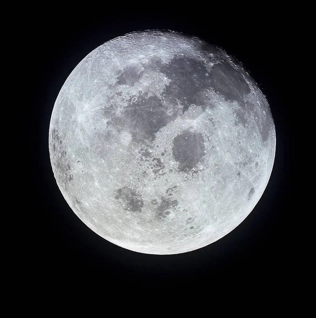
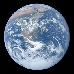
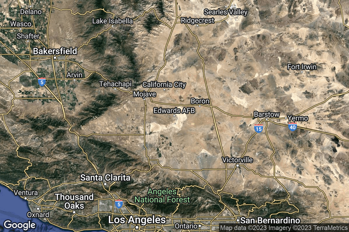
{ "count": 67, "next": "https://lldev.thespacedevs.com/2.3.0/locations/?format=api&limit=10&offset=10&ordering=total_launch_count", "previous": null, "results": [ { "response_mode": "normal", "id": 183, "url": "https://lldev.thespacedevs.com/2.3.0/locations/183/?format=api", "name": "Mons Mouton", "celestial_body": { "response_mode": "normal", "id": 2, "name": "Moon", "type": { "id": 2, "name": "Moon" }, "diameter": 3474800.0, "mass": 7.342e+22, "gravity": 1.622, "length_of_day": "27 07:43:12", "atmosphere": false, "image": { "id": 2041, "name": "Moon (Apollo 11)", "image_url": "https://thespacedevs-dev.nyc3.digitaloceanspaces.com/media/images/moon_2528apoll_image_20240402195408.jpg", "thumbnail_url": "https://thespacedevs-dev.nyc3.digitaloceanspaces.com/media/images/moon_2528apoll_image_thumbnail_20240402195408.jpeg", "credit": "NASA", "license": { "id": 4, "name": "NASA Image and Media Guidelines", "priority": 0, "link": "https://www.nasa.gov/nasa-brand-center/images-and-media/" }, "single_use": false, "variants": [] }, "description": "The Moon is Earth's only natural satellite.", "wiki_url": "https://en.wikipedia.org/wiki/Moon", "total_attempted_launches": 11, "successful_launches": 11, "failed_launches": 0, "total_attempted_landings": 17, "successful_landings": 14, "failed_landings": 3 }, "active": true, "country": null, "description": "Mons Mouton is the Moon's tallest mountain that has been officially named. The base to peak height of this flat-topped mountain is 6 km per altimetry data from the Lunar Reconnaissance Orbiter. It lies between the craters Nobile and Malapert, within 6° of the lunar South Pole on the Moon's near-side. This is a region of special interest because of the presence of Permanently Shadowed Regions (PSRs) that could be cold traps for water, together with areas of extended solar illumination in their proximity.", "image": { "id": 2339, "name": "Mons Mouton from LRO", "image_url": "https://thespacedevs-dev.nyc3.digitaloceanspaces.com/media/images/mons_mouton_fro_image_20250227085908.jpg", "thumbnail_url": "https://thespacedevs-dev.nyc3.digitaloceanspaces.com/media/images/mons_mouton_fro_image_thumbnail_20250227085908.jpeg", "credit": "NASA/Arizona State University", "license": { "id": 4, "name": "NASA Image and Media Guidelines", "priority": 0, "link": "https://www.nasa.gov/nasa-brand-center/images-and-media/" }, "single_use": false, "variants": [] }, "map_image": null, "longitude": -31.0, "latitude": -84.6, "timezone_name": "", "total_launch_count": 0, "total_landing_count": 0 }, { "response_mode": "normal", "id": 162, "url": "https://lldev.thespacedevs.com/2.3.0/locations/162/?format=api", "name": "Edwards Air Force Base", "celestial_body": { "response_mode": "normal", "id": 1, "name": "Earth", "type": { "id": 1, "name": "Planet" }, "diameter": 12742000.0, "mass": 5.972168e+24, "gravity": 9.80655, "length_of_day": "1 00:00:00", "atmosphere": true, "image": { "id": 2040, "name": "Earth (Apollo 17)", "image_url": "https://thespacedevs-dev.nyc3.digitaloceanspaces.com/media/images/earth_2528apol_image_20240402194304.jpeg", "thumbnail_url": "https://thespacedevs-dev.nyc3.digitaloceanspaces.com/media/images/earth_2528apol_image_thumbnail_20240402194305.jpeg", "credit": "NASA", "license": { "id": 4, "name": "NASA Image and Media Guidelines", "priority": 0, "link": "https://www.nasa.gov/nasa-brand-center/images-and-media/" }, "single_use": true, "variants": [] }, "description": "Earth is the third planet from the Sun and the only astronomical object known to harbor life.", "wiki_url": "https://en.wikipedia.org/wiki/Earth", "total_attempted_launches": 7470, "successful_launches": 6915, "failed_launches": 555, "total_attempted_landings": 1288, "successful_landings": 1241, "failed_landings": 47 }, "active": true, "country": { "id": 2, "name": "United States of America", "alpha_2_code": "US", "alpha_3_code": "USA", "nationality_name": "American", "nationality_name_composed": "Americano" }, "description": "Edwards Air Force Base is a United States Air Force installation in California. Edwards is the home of the Air Force Test Center, Air Force Test Pilot School, and NASA's Armstrong Flight Research Center. It is the Air Force Materiel Command center for conducting and supporting research and development of flight, as well as testing and evaluating aerospace systems from concept to combat. It also hosts many test activities conducted by America's commercial aerospace industry.", "image": { "id": 2202, "name": "Edwards Air Force Base from space", "image_url": "https://thespacedevs-dev.nyc3.digitaloceanspaces.com/media/images/edwards_air_for_image_20240918153919.jpg", "thumbnail_url": "https://thespacedevs-dev.nyc3.digitaloceanspaces.com/media/images/edwards_air_for_image_thumbnail_20240918153919.jpeg", "credit": "NASA", "license": { "id": 4, "name": "NASA Image and Media Guidelines", "priority": 0, "link": "https://www.nasa.gov/nasa-brand-center/images-and-media/" }, "single_use": true, "variants": [] }, "map_image": "https://thespacedevs-dev.nyc3.digitaloceanspaces.com/media/map_images/location_edwards_air_force_base_20230422085221.jpg", "longitude": -117.883611, "latitude": 34.905556, "timezone_name": "America/Los_Angeles", "total_launch_count": 0, "total_landing_count": 0 }, { "response_mode": "normal", "id": 157, "url": "https://lldev.thespacedevs.com/2.3.0/locations/157/?format=api", "name": "SaxaVord Spaceport", "celestial_body": { "response_mode": "normal", "id": 1, "name": "Earth", "type": { "id": 1, "name": "Planet" }, "diameter": 12742000.0, "mass": 5.972168e+24, "gravity": 9.80655, "length_of_day": "1 00:00:00", "atmosphere": true, "image": { "id": 2040, "name": "Earth (Apollo 17)", "image_url": "https://thespacedevs-dev.nyc3.digitaloceanspaces.com/media/images/earth_2528apol_image_20240402194304.jpeg", "thumbnail_url": "https://thespacedevs-dev.nyc3.digitaloceanspaces.com/media/images/earth_2528apol_image_thumbnail_20240402194305.jpeg", "credit": "NASA", "license": { "id": 4, "name": "NASA Image and Media Guidelines", "priority": 0, "link": "https://www.nasa.gov/nasa-brand-center/images-and-media/" }, "single_use": true, "variants": [] }, "description": "Earth is the third planet from the Sun and the only astronomical object known to harbor life.", "wiki_url": "https://en.wikipedia.org/wiki/Earth", "total_attempted_launches": 7470, "successful_launches": 6915, "failed_launches": 555, "total_attempted_landings": 1288, "successful_landings": 1241, "failed_landings": 47 }, "active": true, "country": { "id": 10, "name": "United Kingdom", "alpha_2_code": "GB", "alpha_3_code": "GBR", "nationality_name": "British", "nationality_name_composed": "Brito" }, "description": "SaxaVord Spaceport is a UK spaceport located on the Lamba Ness peninsula on Unst, the most northerly of the inhabited Shetland Islands off the coast of Scotland. The site is near the RAF Saxa Vord radar station and the settlement of Skaw, adjacent to the Saxa Vord distillery.", "image": { "id": 2213, "name": "SaxaVord Spaceport", "image_url": "https://thespacedevs-dev.nyc3.digitaloceanspaces.com/media/images/saxavord_spacep_image_20240919164412.jpg", "thumbnail_url": "https://thespacedevs-dev.nyc3.digitaloceanspaces.com/media/images/saxavord_spacep_image_thumbnail_20240919164413.jpeg", "credit": "SaxaVord", "license": { "id": 1, "name": "Unknown", "priority": 9, "link": null }, "single_use": true, "variants": [] }, "map_image": "https://thespacedevs-dev.nyc3.digitaloceanspaces.com/media/map_images/location_saxavord_spaceport_20211102161146.jpg", "longitude": -0.7692, "latitude": 60.8184, "timezone_name": "Europe/London", "total_launch_count": 0, "total_landing_count": 0 }, { "response_mode": "normal", "id": 182, "url": "https://lldev.thespacedevs.com/2.3.0/locations/182/?format=api", "name": "Malapert-A", "celestial_body": { "response_mode": "normal", "id": 2, "name": "Moon", "type": { "id": 2, "name": "Moon" }, "diameter": 3474800.0, "mass": 7.342e+22, "gravity": 1.622, "length_of_day": "27 07:43:12", "atmosphere": false, "image": { "id": 2041, "name": "Moon (Apollo 11)", "image_url": "https://thespacedevs-dev.nyc3.digitaloceanspaces.com/media/images/moon_2528apoll_image_20240402195408.jpg", "thumbnail_url": "https://thespacedevs-dev.nyc3.digitaloceanspaces.com/media/images/moon_2528apoll_image_thumbnail_20240402195408.jpeg", "credit": "NASA", "license": { "id": 4, "name": "NASA Image and Media Guidelines", "priority": 0, "link": "https://www.nasa.gov/nasa-brand-center/images-and-media/" }, "single_use": false, "variants": [] }, "description": "The Moon is Earth's only natural satellite.", "wiki_url": "https://en.wikipedia.org/wiki/Moon", "total_attempted_launches": 11, "successful_launches": 11, "failed_launches": 0, "total_attempted_landings": 17, "successful_landings": 14, "failed_landings": 3 }, "active": true, "country": null, "description": "Malapert is a lunar impact crater that lies near the south pole of the Moon, named for 17th century astronomer Charles Malapert.", "image": { "id": 2238, "name": "Malapert-A imaged by the LRO", "image_url": "https://thespacedevs-dev.nyc3.digitaloceanspaces.com/media/images/malapert-a_imag_image_20240920092256.png", "thumbnail_url": "https://thespacedevs-dev.nyc3.digitaloceanspaces.com/media/images/malapert-a_imag_image_thumbnail_20240920092256.png", "credit": "NASA", "license": { "id": 4, "name": "NASA Image and Media Guidelines", "priority": 0, "link": "https://www.nasa.gov/nasa-brand-center/images-and-media/" }, "single_use": true, "variants": [] }, "map_image": null, "longitude": 12.9, "latitude": -84.9, "timezone_name": "", "total_launch_count": 0, "total_landing_count": 0 }, { "response_mode": "normal", "id": 179, "url": "https://lldev.thespacedevs.com/2.3.0/locations/179/?format=api", "name": "Atlas crater, Moon", "celestial_body": { "response_mode": "normal", "id": 2, "name": "Moon", "type": { "id": 2, "name": "Moon" }, "diameter": 3474800.0, "mass": 7.342e+22, "gravity": 1.622, "length_of_day": "27 07:43:12", "atmosphere": false, "image": { "id": 2041, "name": "Moon (Apollo 11)", "image_url": "https://thespacedevs-dev.nyc3.digitaloceanspaces.com/media/images/moon_2528apoll_image_20240402195408.jpg", "thumbnail_url": "https://thespacedevs-dev.nyc3.digitaloceanspaces.com/media/images/moon_2528apoll_image_thumbnail_20240402195408.jpeg", "credit": "NASA", "license": { "id": 4, "name": "NASA Image and Media Guidelines", "priority": 0, "link": "https://www.nasa.gov/nasa-brand-center/images-and-media/" }, "single_use": false, "variants": [] }, "description": "The Moon is Earth's only natural satellite.", "wiki_url": "https://en.wikipedia.org/wiki/Moon", "total_attempted_launches": 11, "successful_launches": 11, "failed_launches": 0, "total_attempted_landings": 17, "successful_landings": 14, "failed_landings": 3 }, "active": false, "country": null, "description": "Atlas is a prominent lunar impact crater that is located in the northeast part of the Moon, to the southeast of Mare Frigoris. Just to the west is the slightly smaller but still prominent crater Hercules. Northeast of Atlas is the large crater Endymion.", "image": { "id": 2309, "name": "Atlas crater seen by the LRO (mosaic)", "image_url": "https://thespacedevs-dev.nyc3.digitaloceanspaces.com/media/images/atlas_crater_se_image_20250115074600.jpg", "thumbnail_url": "https://thespacedevs-dev.nyc3.digitaloceanspaces.com/media/images/atlas_crater_se_image_thumbnail_20250115074600.jpeg", "credit": "James Stuby based on NASA imagery", "license": { "id": 25, "name": "CC0 1.0", "priority": 3, "link": "https://creativecommons.org/publicdomain/zero/1.0/deed.en" }, "single_use": false, "variants": [] }, "map_image": null, "longitude": 44.4, "latitude": 46.7, "timezone_name": "", "total_launch_count": 0, "total_landing_count": 0 }, { "response_mode": "normal", "id": 180, "url": "https://lldev.thespacedevs.com/2.3.0/locations/180/?format=api", "name": "Mare Frigoris", "celestial_body": { "response_mode": "normal", "id": 2, "name": "Moon", "type": { "id": 2, "name": "Moon" }, "diameter": 3474800.0, "mass": 7.342e+22, "gravity": 1.622, "length_of_day": "27 07:43:12", "atmosphere": false, "image": { "id": 2041, "name": "Moon (Apollo 11)", "image_url": "https://thespacedevs-dev.nyc3.digitaloceanspaces.com/media/images/moon_2528apoll_image_20240402195408.jpg", "thumbnail_url": "https://thespacedevs-dev.nyc3.digitaloceanspaces.com/media/images/moon_2528apoll_image_thumbnail_20240402195408.jpeg", "credit": "NASA", "license": { "id": 4, "name": "NASA Image and Media Guidelines", "priority": 0, "link": "https://www.nasa.gov/nasa-brand-center/images-and-media/" }, "single_use": false, "variants": [] }, "description": "The Moon is Earth's only natural satellite.", "wiki_url": "https://en.wikipedia.org/wiki/Moon", "total_attempted_launches": 11, "successful_launches": 11, "failed_launches": 0, "total_attempted_landings": 17, "successful_landings": 14, "failed_landings": 3 }, "active": false, "country": null, "description": "Mare Frigoris is a lunar mare in the far north of the Moon. It is located in the outer rings of the Procellarum basin, just north of Mare Imbrium, and stretches east to north of Mare Serenitatis. It is just north of the dark crater Plato.", "image": { "id": 2312, "name": "Mare Frigoris seen from Lunar Orbiter 4", "image_url": "https://thespacedevs-dev.nyc3.digitaloceanspaces.com/media/images/mare_frigoris_s_image_20250115090515.jpg", "thumbnail_url": "https://thespacedevs-dev.nyc3.digitaloceanspaces.com/media/images/mare_frigoris_s_image_thumbnail_20250115090515.jpeg", "credit": "James Stuby based on NASA imagery", "license": { "id": 25, "name": "CC0 1.0", "priority": 3, "link": "https://creativecommons.org/publicdomain/zero/1.0/deed.en" }, "single_use": false, "variants": [] }, "map_image": null, "longitude": 1.4, "latitude": 56.0, "timezone_name": "", "total_launch_count": 0, "total_landing_count": 0 }, { "response_mode": "normal", "id": 178, "url": "https://lldev.thespacedevs.com/2.3.0/locations/178/?format=api", "name": "Esrange Space Center", "celestial_body": { "response_mode": "normal", "id": 1, "name": "Earth", "type": { "id": 1, "name": "Planet" }, "diameter": 12742000.0, "mass": 5.972168e+24, "gravity": 9.80655, "length_of_day": "1 00:00:00", "atmosphere": true, "image": { "id": 2040, "name": "Earth (Apollo 17)", "image_url": "https://thespacedevs-dev.nyc3.digitaloceanspaces.com/media/images/earth_2528apol_image_20240402194304.jpeg", "thumbnail_url": "https://thespacedevs-dev.nyc3.digitaloceanspaces.com/media/images/earth_2528apol_image_thumbnail_20240402194305.jpeg", "credit": "NASA", "license": { "id": 4, "name": "NASA Image and Media Guidelines", "priority": 0, "link": "https://www.nasa.gov/nasa-brand-center/images-and-media/" }, "single_use": true, "variants": [] }, "description": "Earth is the third planet from the Sun and the only astronomical object known to harbor life.", "wiki_url": "https://en.wikipedia.org/wiki/Earth", "total_attempted_launches": 7470, "successful_launches": 6915, "failed_launches": 555, "total_attempted_landings": 1288, "successful_landings": 1241, "failed_landings": 47 }, "active": true, "country": { "id": 15, "name": "Sweden", "alpha_2_code": "SE", "alpha_3_code": "SWE", "nationality_name": "Swedish", "nationality_name_composed": "Swedo" }, "description": "Esrange Space Center is a rocket range and research centre located about 40 kilometers east of the town of Kiruna in northern Sweden. It is a base for scientific research with high-altitude balloons, investigation of the aurora borealis, sounding rocket launches, and satellite tracking. Built in 1964 by ESRO, one of the predecessors of the European Space Agency, the site is currently operated by the Swedish Space Corporation. An orbital launch complex, LC-3, has been built in the early 2020s.", "image": { "id": 2475, "name": "Esrange Launch Complex 3", "image_url": "https://thespacedevs-dev.nyc3.digitaloceanspaces.com/media/images/esrange_launch__image_20250916092401.jpg", "thumbnail_url": "https://thespacedevs-dev.nyc3.digitaloceanspaces.com/media/images/esrange_launch__image_thumbnail_20250916092401.jpeg", "credit": "Copyright SSC", "license": { "id": 40, "name": "SSC Media Terms of Use", "priority": 4, "link": "https://sscspace.com/news/media-bank/" }, "single_use": false, "variants": [] }, "map_image": "https://thespacedevs-dev.nyc3.digitaloceanspaces.com/media/map_images/location_esrange_space_center_20241208021356.jpg", "longitude": 21.106944, "latitude": 67.893889, "timezone_name": "Europe/Stockholm", "total_launch_count": 0, "total_landing_count": 0 }, { "response_mode": "normal", "id": 159, "url": "https://lldev.thespacedevs.com/2.3.0/locations/159/?format=api", "name": "Sutherland Spaceport", "celestial_body": { "response_mode": "normal", "id": 1, "name": "Earth", "type": { "id": 1, "name": "Planet" }, "diameter": 12742000.0, "mass": 5.972168e+24, "gravity": 9.80655, "length_of_day": "1 00:00:00", "atmosphere": true, "image": { "id": 2040, "name": "Earth (Apollo 17)", "image_url": "https://thespacedevs-dev.nyc3.digitaloceanspaces.com/media/images/earth_2528apol_image_20240402194304.jpeg", "thumbnail_url": "https://thespacedevs-dev.nyc3.digitaloceanspaces.com/media/images/earth_2528apol_image_thumbnail_20240402194305.jpeg", "credit": "NASA", "license": { "id": 4, "name": "NASA Image and Media Guidelines", "priority": 0, "link": "https://www.nasa.gov/nasa-brand-center/images-and-media/" }, "single_use": true, "variants": [] }, "description": "Earth is the third planet from the Sun and the only astronomical object known to harbor life.", "wiki_url": "https://en.wikipedia.org/wiki/Earth", "total_attempted_launches": 7470, "successful_launches": 6915, "failed_launches": 555, "total_attempted_landings": 1288, "successful_landings": 1241, "failed_landings": 47 }, "active": true, "country": { "id": 10, "name": "United Kingdom", "alpha_2_code": "GB", "alpha_3_code": "GBR", "nationality_name": "British", "nationality_name_composed": "Brito" }, "description": "The Sutherland spaceport is a spaceport to be located in Sutherland in Scotland.", "image": { "id": 2220, "name": "Sutherland Spaceport render", "image_url": "https://thespacedevs-dev.nyc3.digitaloceanspaces.com/media/images/sutherland_spac_image_20240919170737.jpg", "thumbnail_url": "https://thespacedevs-dev.nyc3.digitaloceanspaces.com/media/images/sutherland_spac_image_thumbnail_20240919170737.jpeg", "credit": "NORR / HIE", "license": { "id": 1, "name": "Unknown", "priority": 9, "link": null }, "single_use": true, "variants": [] }, "map_image": "https://thespacedevs-dev.nyc3.digitaloceanspaces.com/media/map_images/location_sutherland_spaceport_20220511180155.jpg", "longitude": -4.5121, "latitude": 58.5107, "timezone_name": "Europe/London", "total_launch_count": 0, "total_landing_count": 0 }, { "response_mode": "normal", "id": 181, "url": "https://lldev.thespacedevs.com/2.3.0/locations/181/?format=api", "name": "Bowen Orbital Spaceport", "celestial_body": { "response_mode": "normal", "id": 1, "name": "Earth", "type": { "id": 1, "name": "Planet" }, "diameter": 12742000.0, "mass": 5.972168e+24, "gravity": 9.80655, "length_of_day": "1 00:00:00", "atmosphere": true, "image": { "id": 2040, "name": "Earth (Apollo 17)", "image_url": "https://thespacedevs-dev.nyc3.digitaloceanspaces.com/media/images/earth_2528apol_image_20240402194304.jpeg", "thumbnail_url": "https://thespacedevs-dev.nyc3.digitaloceanspaces.com/media/images/earth_2528apol_image_thumbnail_20240402194305.jpeg", "credit": "NASA", "license": { "id": 4, "name": "NASA Image and Media Guidelines", "priority": 0, "link": "https://www.nasa.gov/nasa-brand-center/images-and-media/" }, "single_use": true, "variants": [] }, "description": "Earth is the third planet from the Sun and the only astronomical object known to harbor life.", "wiki_url": "https://en.wikipedia.org/wiki/Earth", "total_attempted_launches": 7470, "successful_launches": 6915, "failed_launches": 555, "total_attempted_landings": 1288, "successful_landings": 1241, "failed_landings": 47 }, "active": true, "country": { "id": 34, "name": "Australia", "alpha_2_code": "AU", "alpha_3_code": "AUS", "nationality_name": "Australian", "nationality_name_composed": "Australo" }, "description": "Private orbital launch facility owned and operated by Gilmour Space.", "image": { "id": 1732, "name": "Eris on the launch pad (Maiden Flight)", "image_url": "https://thespacedevs-dev.nyc3.digitaloceanspaces.com/media/images/eris_on_the_lau_image_20250227073032.jpg", "thumbnail_url": "https://thespacedevs-dev.nyc3.digitaloceanspaces.com/media/images/eris_on_the_lau_image_thumbnail_20250227073032.jpeg", "credit": "Gilmour Space", "license": { "id": 1, "name": "Unknown", "priority": 9, "link": null }, "single_use": false, "variants": [] }, "map_image": "https://thespacedevs-dev.nyc3.digitaloceanspaces.com/media/map_images/location_bowen_orbital_spaceport_20250227073649.jpg", "longitude": 148.1129553, "latitude": -19.958151, "timezone_name": "Australia/Brisbane", "total_launch_count": 1, "total_landing_count": 0 }, { "response_mode": "normal", "id": 1, "url": "https://lldev.thespacedevs.com/2.3.0/locations/1/?format=api", "name": "Pacific Missile Range Facility, Barking Sands, HI, USA", "celestial_body": { "response_mode": "normal", "id": 1, "name": "Earth", "type": { "id": 1, "name": "Planet" }, "diameter": 12742000.0, "mass": 5.972168e+24, "gravity": 9.80655, "length_of_day": "1 00:00:00", "atmosphere": true, "image": { "id": 2040, "name": "Earth (Apollo 17)", "image_url": "https://thespacedevs-dev.nyc3.digitaloceanspaces.com/media/images/earth_2528apol_image_20240402194304.jpeg", "thumbnail_url": "https://thespacedevs-dev.nyc3.digitaloceanspaces.com/media/images/earth_2528apol_image_thumbnail_20240402194305.jpeg", "credit": "NASA", "license": { "id": 4, "name": "NASA Image and Media Guidelines", "priority": 0, "link": "https://www.nasa.gov/nasa-brand-center/images-and-media/" }, "single_use": true, "variants": [] }, "description": "Earth is the third planet from the Sun and the only astronomical object known to harbor life.", "wiki_url": "https://en.wikipedia.org/wiki/Earth", "total_attempted_launches": 7470, "successful_launches": 6915, "failed_launches": 555, "total_attempted_landings": 1288, "successful_landings": 1241, "failed_landings": 47 }, "active": true, "country": { "id": 2, "name": "United States of America", "alpha_2_code": "US", "alpha_3_code": "USA", "nationality_name": "American", "nationality_name_composed": "Americano" }, "description": "The Pacific Missile Range Facility, Barking Sands is a U.S. naval facility and airport located five nautical miles (9 km) northwest of the central business district of Kekaha, in Kauai County, Hawaii, United States.", "image": { "id": 2205, "name": "Pacific Missile Range Facility aerial picture", "image_url": "https://thespacedevs-dev.nyc3.digitaloceanspaces.com/media/images/pacific_missile_image_20240918160849.jpg", "thumbnail_url": "https://thespacedevs-dev.nyc3.digitaloceanspaces.com/media/images/pacific_missile_image_thumbnail_20240918160849.jpeg", "credit": "Polihale", "license": { "id": 21, "name": "CC BY-SA 3.0", "priority": 4, "link": "https://creativecommons.org/licenses/by-sa/3.0/deed.en" }, "single_use": true, "variants": [] }, "map_image": "https://thespacedevs-dev.nyc3.digitaloceanspaces.com/media/map_images/location_1_20200803142427.jpg", "longitude": -159.785, "latitude": 22.022778, "timezone_name": "Pacific/Honolulu", "total_launch_count": 1, "total_landing_count": 0 } ] }