Location List
Modes
Levels of detail in the response - normal, detailed
Example - /locations/?mode=detailed
Filters
Parameters - active, country_code, id, name, name__contains, total_landing_count, total_landing_count__gt, total_landing_count__gte, total_landing_count__lt, total_landing_count__lte, total_launch_count, total_launch_count__gt, total_launch_count__gte, total_launch_count__lt, total_launch_count__lte
Example - /locations/?country_code=NZL
Search
Fields searched - country__alpha_3_code, name
Example - /locations/?search=Cape Canaveral
Ordering
Fields - name, total_landing_count, total_launch_count
Example - /locations/?ordering=-total_launch_count
Number of results
Use limit to control the number of objects in the response (max 100)
Example - /locations/?limit=2
Format
Switch to JSON output - /locations/?format=json
Help
Find all the FAQs and support links on the documentation homepage - lldev.thespacedevs.com/docs
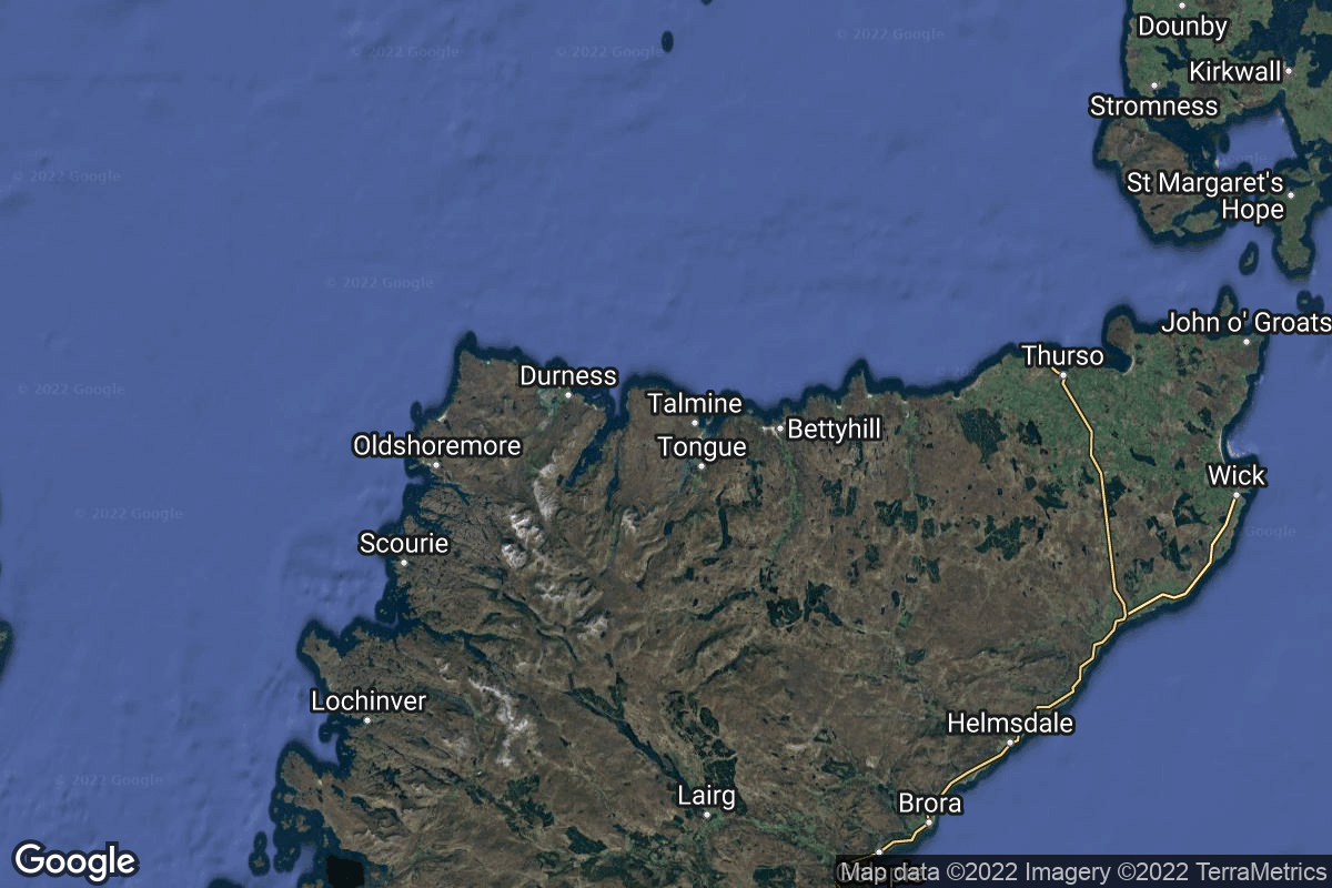
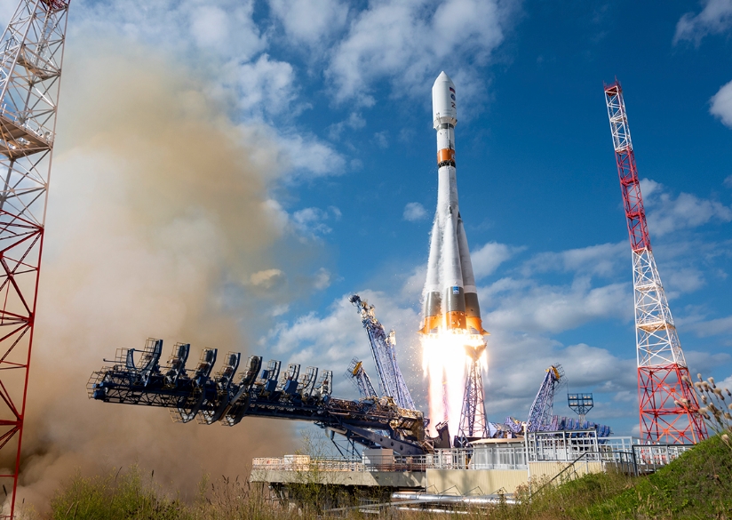
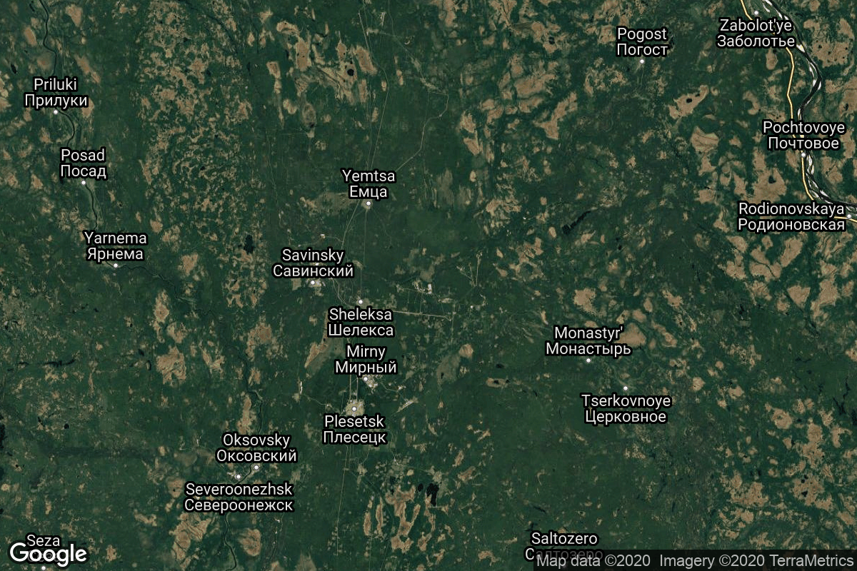
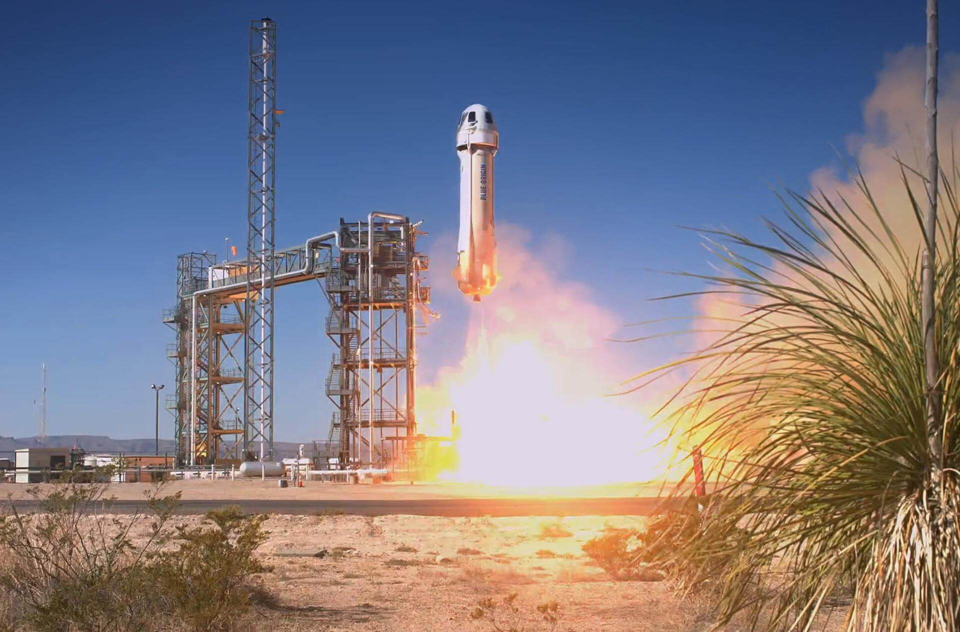
GET /2.3.0/locations/?format=api&offset=30
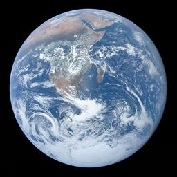
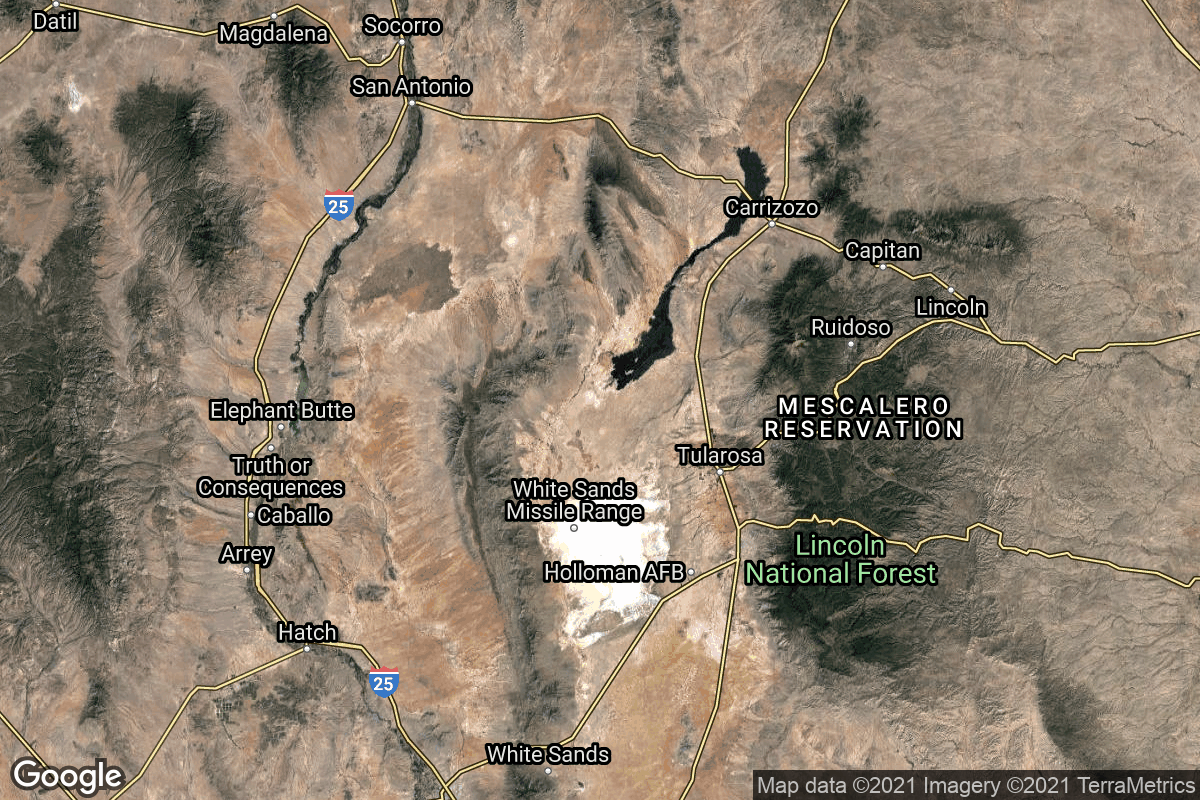
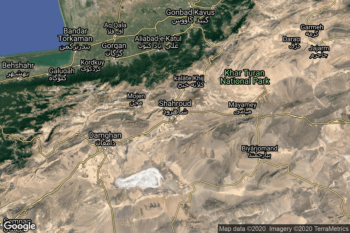
{ "count": 67, "next": "https://lldev.thespacedevs.com/2.3.0/locations/?format=api&limit=10&offset=40", "previous": "https://lldev.thespacedevs.com/2.3.0/locations/?format=api&limit=10&offset=20", "results": [ { "response_mode": "normal", "id": 155, "url": "https://lldev.thespacedevs.com/2.3.0/locations/155/?format=api", "name": "White Sands Missile Range", "celestial_body": { "response_mode": "normal", "id": 1, "name": "Earth", "type": { "id": 1, "name": "Planet" }, "diameter": 12742000.0, "mass": 5.972168e+24, "gravity": 9.80655, "length_of_day": "1 00:00:00", "atmosphere": true, "image": { "id": 2040, "name": "Earth (Apollo 17)", "image_url": "https://thespacedevs-dev.nyc3.digitaloceanspaces.com/media/images/earth_2528apol_image_20240402194304.jpeg", "thumbnail_url": "https://thespacedevs-dev.nyc3.digitaloceanspaces.com/media/images/earth_2528apol_image_thumbnail_20240402194305.jpeg", "credit": "NASA", "license": { "id": 4, "name": "NASA Image and Media Guidelines", "priority": 0, "link": "https://www.nasa.gov/nasa-brand-center/images-and-media/" }, "single_use": true, "variants": [] }, "description": "Earth is the third planet from the Sun and the only astronomical object known to harbor life.", "wiki_url": "https://en.wikipedia.org/wiki/Earth", "total_attempted_launches": 7462, "successful_launches": 6908, "failed_launches": 554, "total_attempted_landings": 1285, "successful_landings": 1238, "failed_landings": 47 }, "active": true, "country": { "id": 2, "name": "United States of America", "alpha_2_code": "US", "alpha_3_code": "USA", "nationality_name": "American", "nationality_name_composed": "Americano" }, "description": "White Sands Missile Range is a United States Army military testing area and firing range located in the US state of New Mexico. The range was originally established in 1941 as the Alamogordo Bombing and Gunnery Range, where the Trinity test site lay at the northern end of the Range, in Socorro County near the towns of Carrizozo and San Antonio. It then became the White Sands Proving Ground on 9 July 1945.", "image": { "id": 2229, "name": "Space Shuttle Columbia landing at White Sands (STS-3)", "image_url": "https://thespacedevs-dev.nyc3.digitaloceanspaces.com/media/images/space_shuttle_c_image_20240920084425.jpg", "thumbnail_url": "https://thespacedevs-dev.nyc3.digitaloceanspaces.com/media/images/space_shuttle_c_image_thumbnail_20240920084425.jpeg", "credit": "NASA", "license": { "id": 4, "name": "NASA Image and Media Guidelines", "priority": 0, "link": "https://www.nasa.gov/nasa-brand-center/images-and-media/" }, "single_use": false, "variants": [] }, "map_image": "https://thespacedevs-dev.nyc3.digitaloceanspaces.com/media/map_images/location_white_sands_missile_range_20210901072636.jpg", "longitude": -106.405833, "latitude": 32.335556, "timezone_name": "America/Denver", "total_launch_count": 5, "total_landing_count": 0 }, { "response_mode": "normal", "id": 145, "url": "https://lldev.thespacedevs.com/2.3.0/locations/145/?format=api", "name": "Shahrud Missile Test Site, Islamic Republic of Iran", "celestial_body": { "response_mode": "normal", "id": 1, "name": "Earth", "type": { "id": 1, "name": "Planet" }, "diameter": 12742000.0, "mass": 5.972168e+24, "gravity": 9.80655, "length_of_day": "1 00:00:00", "atmosphere": true, "image": { "id": 2040, "name": "Earth (Apollo 17)", "image_url": "https://thespacedevs-dev.nyc3.digitaloceanspaces.com/media/images/earth_2528apol_image_20240402194304.jpeg", "thumbnail_url": "https://thespacedevs-dev.nyc3.digitaloceanspaces.com/media/images/earth_2528apol_image_thumbnail_20240402194305.jpeg", "credit": "NASA", "license": { "id": 4, "name": "NASA Image and Media Guidelines", "priority": 0, "link": "https://www.nasa.gov/nasa-brand-center/images-and-media/" }, "single_use": true, "variants": [] }, "description": "Earth is the third planet from the Sun and the only astronomical object known to harbor life.", "wiki_url": "https://en.wikipedia.org/wiki/Earth", "total_attempted_launches": 7462, "successful_launches": 6908, "failed_launches": 554, "total_attempted_landings": 1285, "successful_landings": 1238, "failed_landings": 47 }, "active": true, "country": { "id": 32, "name": "Iran", "alpha_2_code": "IR", "alpha_3_code": "IRN", "nationality_name": "Iranian", "nationality_name_composed": "Irano" }, "description": "Shahroud Space Center is a Military Spaceport under control of the Islamic Revolutionary Guard Corps Aerospace Force (IRGCASF) located south-east of Shahroud Semnan Province, used to orbit military satellites for Iran's military space program.", "image": { "id": 2215, "name": "Qased on the pad (Noor)", "image_url": "https://thespacedevs-dev.nyc3.digitaloceanspaces.com/media/images/qased_on_the_pa_image_20240919164946.jpg", "thumbnail_url": "https://thespacedevs-dev.nyc3.digitaloceanspaces.com/media/images/qased_on_the_pa_image_thumbnail_20240919164947.jpeg", "credit": "FARS", "license": { "id": 30, "name": "CC BY 4.0", "priority": 4, "link": "https://creativecommons.org/licenses/by/4.0/" }, "single_use": true, "variants": [] }, "map_image": "https://thespacedevs-dev.nyc3.digitaloceanspaces.com/media/map_images/location_145_20200803142443.jpg", "longitude": 55.3339, "latitude": 36.2009, "timezone_name": "Asia/Tehran", "total_launch_count": 6, "total_landing_count": 0 }, { "response_mode": "normal", "id": 153, "url": "https://lldev.thespacedevs.com/2.3.0/locations/153/?format=api", "name": "Tonghae Satellite Launching Ground", "celestial_body": { "response_mode": "normal", "id": 1, "name": "Earth", "type": { "id": 1, "name": "Planet" }, "diameter": 12742000.0, "mass": 5.972168e+24, "gravity": 9.80655, "length_of_day": "1 00:00:00", "atmosphere": true, "image": { "id": 2040, "name": "Earth (Apollo 17)", "image_url": "https://thespacedevs-dev.nyc3.digitaloceanspaces.com/media/images/earth_2528apol_image_20240402194304.jpeg", "thumbnail_url": "https://thespacedevs-dev.nyc3.digitaloceanspaces.com/media/images/earth_2528apol_image_thumbnail_20240402194305.jpeg", "credit": "NASA", "license": { "id": 4, "name": "NASA Image and Media Guidelines", "priority": 0, "link": "https://www.nasa.gov/nasa-brand-center/images-and-media/" }, "single_use": true, "variants": [] }, "description": "Earth is the third planet from the Sun and the only astronomical object known to harbor life.", "wiki_url": "https://en.wikipedia.org/wiki/Earth", "total_attempted_launches": 7462, "successful_launches": 6908, "failed_launches": 554, "total_attempted_landings": 1285, "successful_landings": 1238, "failed_landings": 47 }, "active": false, "country": { "id": 53, "name": "North Korea", "alpha_2_code": "KP", "alpha_3_code": "PRK", "nationality_name": "North Korean", "nationality_name_composed": "North Korean" }, "description": "The Tonghae Satellite Launching Ground is a rocket launching site in North Korea.", "image": { "id": 2224, "name": "Tonghae Satellite Launching Ground from space", "image_url": "https://thespacedevs-dev.nyc3.digitaloceanspaces.com/media/images/tonghae_satelli_image_20240920082229.png", "thumbnail_url": "https://thespacedevs-dev.nyc3.digitaloceanspaces.com/media/images/tonghae_satelli_image_thumbnail_20240920082229.png", "credit": "Airbus", "license": { "id": 1, "name": "Unknown", "priority": 9, "link": null }, "single_use": true, "variants": [] }, "map_image": "https://thespacedevs-dev.nyc3.digitaloceanspaces.com/media/map_images/location_153_20200803142503.jpg", "longitude": 129.686389, "latitude": 40.858333, "timezone_name": "Asia/Pyongyang", "total_launch_count": 2, "total_landing_count": 0 }, { "response_mode": "normal", "id": 159, "url": "https://lldev.thespacedevs.com/2.3.0/locations/159/?format=api", "name": "Sutherland Spaceport", "celestial_body": { "response_mode": "normal", "id": 1, "name": "Earth", "type": { "id": 1, "name": "Planet" }, "diameter": 12742000.0, "mass": 5.972168e+24, "gravity": 9.80655, "length_of_day": "1 00:00:00", "atmosphere": true, "image": { "id": 2040, "name": "Earth (Apollo 17)", "image_url": "https://thespacedevs-dev.nyc3.digitaloceanspaces.com/media/images/earth_2528apol_image_20240402194304.jpeg", "thumbnail_url": "https://thespacedevs-dev.nyc3.digitaloceanspaces.com/media/images/earth_2528apol_image_thumbnail_20240402194305.jpeg", "credit": "NASA", "license": { "id": 4, "name": "NASA Image and Media Guidelines", "priority": 0, "link": "https://www.nasa.gov/nasa-brand-center/images-and-media/" }, "single_use": true, "variants": [] }, "description": "Earth is the third planet from the Sun and the only astronomical object known to harbor life.", "wiki_url": "https://en.wikipedia.org/wiki/Earth", "total_attempted_launches": 7462, "successful_launches": 6908, "failed_launches": 554, "total_attempted_landings": 1285, "successful_landings": 1238, "failed_landings": 47 }, "active": true, "country": { "id": 10, "name": "United Kingdom", "alpha_2_code": "GB", "alpha_3_code": "GBR", "nationality_name": "British", "nationality_name_composed": "Brito" }, "description": "The Sutherland spaceport is a spaceport to be located in Sutherland in Scotland.", "image": { "id": 2220, "name": "Sutherland Spaceport render", "image_url": "https://thespacedevs-dev.nyc3.digitaloceanspaces.com/media/images/sutherland_spac_image_20240919170737.jpg", "thumbnail_url": "https://thespacedevs-dev.nyc3.digitaloceanspaces.com/media/images/sutherland_spac_image_thumbnail_20240919170737.jpeg", "credit": "NORR / HIE", "license": { "id": 1, "name": "Unknown", "priority": 9, "link": null }, "single_use": true, "variants": [] }, "map_image": "https://thespacedevs-dev.nyc3.digitaloceanspaces.com/media/map_images/location_sutherland_spaceport_20220511180155.jpg", "longitude": -4.5121, "latitude": 58.5107, "timezone_name": "Europe/London", "total_launch_count": 0, "total_landing_count": 0 }, { "response_mode": "normal", "id": 6, "url": "https://lldev.thespacedevs.com/2.3.0/locations/6/?format=api", "name": "Plesetsk Cosmodrome, Russian Federation", "celestial_body": { "response_mode": "normal", "id": 1, "name": "Earth", "type": { "id": 1, "name": "Planet" }, "diameter": 12742000.0, "mass": 5.972168e+24, "gravity": 9.80655, "length_of_day": "1 00:00:00", "atmosphere": true, "image": { "id": 2040, "name": "Earth (Apollo 17)", "image_url": "https://thespacedevs-dev.nyc3.digitaloceanspaces.com/media/images/earth_2528apol_image_20240402194304.jpeg", "thumbnail_url": "https://thespacedevs-dev.nyc3.digitaloceanspaces.com/media/images/earth_2528apol_image_thumbnail_20240402194305.jpeg", "credit": "NASA", "license": { "id": 4, "name": "NASA Image and Media Guidelines", "priority": 0, "link": "https://www.nasa.gov/nasa-brand-center/images-and-media/" }, "single_use": true, "variants": [] }, "description": "Earth is the third planet from the Sun and the only astronomical object known to harbor life.", "wiki_url": "https://en.wikipedia.org/wiki/Earth", "total_attempted_launches": 7462, "successful_launches": 6908, "failed_launches": 554, "total_attempted_landings": 1285, "successful_landings": 1238, "failed_landings": 47 }, "active": true, "country": { "id": 5, "name": "Russia", "alpha_2_code": "RU", "alpha_3_code": "RUS", "nationality_name": "Russian", "nationality_name_composed": "Russo" }, "description": "Plesetsk Cosmodrome is a Russian spaceport located in Mirny, Arkhangelsk Oblast, about 800 km north of Moscow and approximately 200 km south of Arkhangelsk. Originally developed as an ICBM site for the R-7 missile, it also served for numerous satellite launches using the R-7 and other rockets. Its high latitude makes it useful only for certain types of launches, especially the Molniya orbits, so for much of the site's history it functioned as a secondary location, with most orbital launches taking place from Baikonur, in the Kazakh SSR. With the end of the Soviet Union, Baikonur became a foreign territory, and Kazakhstan charged $115 million usage fees annually. Consequently, Plesetsk has seen considerably more activity since the 2000s.", "image": { "id": 1461, "name": "Soyuz 2.1b/Fregat-M liftoff from pad 43/3 (Glonass-K2 No. 13, Kosmos 2569)", "image_url": "https://thespacedevs-dev.nyc3.digitaloceanspaces.com/media/images/soyuz25202.1b_image_20230807181912.jpg", "thumbnail_url": "https://thespacedevs-dev.nyc3.digitaloceanspaces.com/media/images/255bauto255d__image_thumbnail_20240305192834.jpeg", "credit": "Mil.ru", "license": { "id": 30, "name": "CC BY 4.0", "priority": 4, "link": "https://creativecommons.org/licenses/by/4.0/" }, "single_use": false, "variants": [] }, "map_image": "https://thespacedevs-dev.nyc3.digitaloceanspaces.com/media/map_images/location_6_20200803142434.jpg", "longitude": 40.577778, "latitude": 62.925556, "timezone_name": "Europe/Moscow", "total_launch_count": 1682, "total_landing_count": 0 }, { "response_mode": "normal", "id": 176, "url": "https://lldev.thespacedevs.com/2.3.0/locations/176/?format=api", "name": "Mons Rümker, Moon", "celestial_body": { "response_mode": "normal", "id": 2, "name": "Moon", "type": { "id": 2, "name": "Moon" }, "diameter": 3474800.0, "mass": 7.342e+22, "gravity": 1.622, "length_of_day": "27 07:43:12", "atmosphere": false, "image": { "id": 2041, "name": "Moon (Apollo 11)", "image_url": "https://thespacedevs-dev.nyc3.digitaloceanspaces.com/media/images/moon_2528apoll_image_20240402195408.jpg", "thumbnail_url": "https://thespacedevs-dev.nyc3.digitaloceanspaces.com/media/images/moon_2528apoll_image_thumbnail_20240402195408.jpeg", "credit": "NASA", "license": { "id": 4, "name": "NASA Image and Media Guidelines", "priority": 0, "link": "https://www.nasa.gov/nasa-brand-center/images-and-media/" }, "single_use": false, "variants": [] }, "description": "The Moon is Earth's only natural satellite.", "wiki_url": "https://en.wikipedia.org/wiki/Moon", "total_attempted_launches": 11, "successful_launches": 11, "failed_launches": 0, "total_attempted_landings": 17, "successful_landings": 14, "failed_landings": 3 }, "active": false, "country": null, "description": "Mons Rümker is an isolated volcanic formation that is located in the northwest part of the Moon's near side. The feature forms a large, elevated mound in the northern part of the Oceanus Procellarum.", "image": { "id": 2171, "name": "Mons Rümker seen from Apollo 15", "image_url": "https://thespacedevs-dev.nyc3.digitaloceanspaces.com/media/images/mons_r25c325b_image_20240813081840.jpg", "thumbnail_url": "https://thespacedevs-dev.nyc3.digitaloceanspaces.com/media/images/mons_r25c325b_image_thumbnail_20240813081841.jpeg", "credit": "NASA", "license": { "id": 4, "name": "NASA Image and Media Guidelines", "priority": 0, "link": "https://www.nasa.gov/nasa-brand-center/images-and-media/" }, "single_use": true, "variants": [] }, "map_image": "https://thespacedevs-dev.nyc3.digitaloceanspaces.com/media/map_images/location_chang25e225802599e_5_landing_site252c_mons_r25c325bcmker252c_moon_20240813035032.jpg", "longitude": null, "latitude": 40.8, "timezone_name": "", "total_launch_count": 1, "total_landing_count": 0 }, { "response_mode": "normal", "id": 179, "url": "https://lldev.thespacedevs.com/2.3.0/locations/179/?format=api", "name": "Atlas crater, Moon", "celestial_body": { "response_mode": "normal", "id": 2, "name": "Moon", "type": { "id": 2, "name": "Moon" }, "diameter": 3474800.0, "mass": 7.342e+22, "gravity": 1.622, "length_of_day": "27 07:43:12", "atmosphere": false, "image": { "id": 2041, "name": "Moon (Apollo 11)", "image_url": "https://thespacedevs-dev.nyc3.digitaloceanspaces.com/media/images/moon_2528apoll_image_20240402195408.jpg", "thumbnail_url": "https://thespacedevs-dev.nyc3.digitaloceanspaces.com/media/images/moon_2528apoll_image_thumbnail_20240402195408.jpeg", "credit": "NASA", "license": { "id": 4, "name": "NASA Image and Media Guidelines", "priority": 0, "link": "https://www.nasa.gov/nasa-brand-center/images-and-media/" }, "single_use": false, "variants": [] }, "description": "The Moon is Earth's only natural satellite.", "wiki_url": "https://en.wikipedia.org/wiki/Moon", "total_attempted_launches": 11, "successful_launches": 11, "failed_launches": 0, "total_attempted_landings": 17, "successful_landings": 14, "failed_landings": 3 }, "active": false, "country": null, "description": "Atlas is a prominent lunar impact crater that is located in the northeast part of the Moon, to the southeast of Mare Frigoris. Just to the west is the slightly smaller but still prominent crater Hercules. Northeast of Atlas is the large crater Endymion.", "image": { "id": 2309, "name": "Atlas crater seen by the LRO (mosaic)", "image_url": "https://thespacedevs-dev.nyc3.digitaloceanspaces.com/media/images/atlas_crater_se_image_20250115074600.jpg", "thumbnail_url": "https://thespacedevs-dev.nyc3.digitaloceanspaces.com/media/images/atlas_crater_se_image_thumbnail_20250115074600.jpeg", "credit": "James Stuby based on NASA imagery", "license": { "id": 25, "name": "CC0 1.0", "priority": 3, "link": "https://creativecommons.org/publicdomain/zero/1.0/deed.en" }, "single_use": false, "variants": [] }, "map_image": null, "longitude": 44.4, "latitude": 46.7, "timezone_name": "", "total_launch_count": 0, "total_landing_count": 0 }, { "response_mode": "normal", "id": 29, "url": "https://lldev.thespacedevs.com/2.3.0/locations/29/?format=api", "name": "Corn Ranch, Van Horn, TX, USA", "celestial_body": { "response_mode": "normal", "id": 1, "name": "Earth", "type": { "id": 1, "name": "Planet" }, "diameter": 12742000.0, "mass": 5.972168e+24, "gravity": 9.80655, "length_of_day": "1 00:00:00", "atmosphere": true, "image": { "id": 2040, "name": "Earth (Apollo 17)", "image_url": "https://thespacedevs-dev.nyc3.digitaloceanspaces.com/media/images/earth_2528apol_image_20240402194304.jpeg", "thumbnail_url": "https://thespacedevs-dev.nyc3.digitaloceanspaces.com/media/images/earth_2528apol_image_thumbnail_20240402194305.jpeg", "credit": "NASA", "license": { "id": 4, "name": "NASA Image and Media Guidelines", "priority": 0, "link": "https://www.nasa.gov/nasa-brand-center/images-and-media/" }, "single_use": true, "variants": [] }, "description": "Earth is the third planet from the Sun and the only astronomical object known to harbor life.", "wiki_url": "https://en.wikipedia.org/wiki/Earth", "total_attempted_launches": 7462, "successful_launches": 6908, "failed_launches": 554, "total_attempted_landings": 1285, "successful_landings": 1238, "failed_landings": 47 }, "active": true, "country": { "id": 2, "name": "United States of America", "alpha_2_code": "US", "alpha_3_code": "USA", "nationality_name": "American", "nationality_name_composed": "Americano" }, "description": "Corn Ranch, commonly referred to as Launch Site One (LSO), is a spaceport owned and operated by Blue Origin which is located approximately 30 miles north of the town of Van Horn, Texas, United States.", "image": { "id": 2098, "name": "New Shepard liftoff (NS-25)", "image_url": "https://thespacedevs-dev.nyc3.digitaloceanspaces.com/media/images/new_shepard_lif_image_20240621062033.jpeg", "thumbnail_url": "https://thespacedevs-dev.nyc3.digitaloceanspaces.com/media/images/new_shepard_lif_image_thumbnail_20240621062033.jpeg", "credit": "Blue Origin", "license": { "id": 1, "name": "Unknown", "priority": 9, "link": null }, "single_use": true, "variants": [] }, "map_image": "https://thespacedevs-dev.nyc3.digitaloceanspaces.com/media/map_images/location_29_20200803142436.jpg", "longitude": -104.757152, "latitude": 31.422927, "timezone_name": "America/Chicago", "total_launch_count": 38, "total_landing_count": 38 }, { "response_mode": "normal", "id": 5, "url": "https://lldev.thespacedevs.com/2.3.0/locations/5/?format=api", "name": "Dombarovskiy, Russian Federation", "celestial_body": { "response_mode": "normal", "id": 1, "name": "Earth", "type": { "id": 1, "name": "Planet" }, "diameter": 12742000.0, "mass": 5.972168e+24, "gravity": 9.80655, "length_of_day": "1 00:00:00", "atmosphere": true, "image": { "id": 2040, "name": "Earth (Apollo 17)", "image_url": "https://thespacedevs-dev.nyc3.digitaloceanspaces.com/media/images/earth_2528apol_image_20240402194304.jpeg", "thumbnail_url": "https://thespacedevs-dev.nyc3.digitaloceanspaces.com/media/images/earth_2528apol_image_thumbnail_20240402194305.jpeg", "credit": "NASA", "license": { "id": 4, "name": "NASA Image and Media Guidelines", "priority": 0, "link": "https://www.nasa.gov/nasa-brand-center/images-and-media/" }, "single_use": true, "variants": [] }, "description": "Earth is the third planet from the Sun and the only astronomical object known to harbor life.", "wiki_url": "https://en.wikipedia.org/wiki/Earth", "total_attempted_launches": 7462, "successful_launches": 6908, "failed_launches": 554, "total_attempted_landings": 1285, "successful_landings": 1238, "failed_landings": 47 }, "active": true, "country": { "id": 5, "name": "Russia", "alpha_2_code": "RU", "alpha_3_code": "RUS", "nationality_name": "Russian", "nationality_name_composed": "Russo" }, "description": "Dombarovsky is a military airbase near Yasny in Russia's Orenburg Oblast. Operated by the Soviet Air Defence Forces and later by the Russian Air Force, it hosted fighter interceptor squadrons and hosts an ICBM base (which has been adapted for commercial satellite launches) with a supporting helicopter base.", "image": { "id": 2201, "name": "Dnepr 1 liftoff (Prisma)", "image_url": "https://thespacedevs-dev.nyc3.digitaloceanspaces.com/media/images/dnepr_1_liftoff_image_20240918152530.jpg", "thumbnail_url": "https://thespacedevs-dev.nyc3.digitaloceanspaces.com/media/images/dnepr_1_liftoff_image_thumbnail_20240918152530.jpeg", "credit": "ISC Kosmotras", "license": { "id": 2, "name": "ESA Standard Licence", "priority": 2, "link": "https://www.esa.int/ESA_Multimedia/Terms_and_conditions_of_use_of_images_and_videos_available_on_the_esa_website" }, "single_use": true, "variants": [] }, "map_image": "https://thespacedevs-dev.nyc3.digitaloceanspaces.com/media/map_images/location_5_20200803142425.jpg", "longitude": 59.853333, "latitude": 51.048889, "timezone_name": "Asia/Yekaterinburg", "total_launch_count": 10, "total_landing_count": 0 }, { "response_mode": "normal", "id": 170, "url": "https://lldev.thespacedevs.com/2.3.0/locations/170/?format=api", "name": "Hadley–Apennine, Moon", "celestial_body": { "response_mode": "normal", "id": 2, "name": "Moon", "type": { "id": 2, "name": "Moon" }, "diameter": 3474800.0, "mass": 7.342e+22, "gravity": 1.622, "length_of_day": "27 07:43:12", "atmosphere": false, "image": { "id": 2041, "name": "Moon (Apollo 11)", "image_url": "https://thespacedevs-dev.nyc3.digitaloceanspaces.com/media/images/moon_2528apoll_image_20240402195408.jpg", "thumbnail_url": "https://thespacedevs-dev.nyc3.digitaloceanspaces.com/media/images/moon_2528apoll_image_thumbnail_20240402195408.jpeg", "credit": "NASA", "license": { "id": 4, "name": "NASA Image and Media Guidelines", "priority": 0, "link": "https://www.nasa.gov/nasa-brand-center/images-and-media/" }, "single_use": false, "variants": [] }, "description": "The Moon is Earth's only natural satellite.", "wiki_url": "https://en.wikipedia.org/wiki/Moon", "total_attempted_launches": 11, "successful_launches": 11, "failed_launches": 0, "total_attempted_landings": 17, "successful_landings": 14, "failed_landings": 3 }, "active": false, "country": null, "description": "Hadley–Apennine is a region on the near side of Earth's Moon that served as the landing site for the American Apollo 15 mission, the fourth crewed landing on the Moon and the first of the \"J-missions\", in July 1971. The site is located on the eastern edge of Mare Imbrium on a lava plain known as Palus Putredinis. Hadley–Apennine is bordered by the Montes Apenninus (often referred to as \"Apennine Front\"), a mountain range, and Hadley Rille, a meandering channel, on the east and west, respectively.", "image": { "id": 2144, "name": "Apollo 15 landing site at Hadley-Apennine", "image_url": "https://thespacedevs-dev.nyc3.digitaloceanspaces.com/media/images/apollo_15_landi_image_20240812112508.png", "thumbnail_url": "https://thespacedevs-dev.nyc3.digitaloceanspaces.com/media/images/apollo_15_landi_image_thumbnail_20240812112509.png", "credit": "NASA", "license": { "id": 4, "name": "NASA Image and Media Guidelines", "priority": 0, "link": "https://www.nasa.gov/nasa-brand-center/images-and-media/" }, "single_use": true, "variants": [] }, "map_image": "https://thespacedevs-dev.nyc3.digitaloceanspaces.com/media/map_images/location_apollo_15_landing_site252c_hadley25e225802593apennine252c_moon_20240813033431.jpg", "longitude": 3.6339, "latitude": 26.1322, "timezone_name": "", "total_launch_count": 1, "total_landing_count": 0 } ] }