API endpoint that allows all Events to be viewed.

GET: Return a list of all Events

SEARCH EXAMPLE: /2.0.0/event/?search=Dragon Searches through name

GET /2.0.0/event/1008/?format=api
HTTP 200 OK
Allow: GET
Content-Type: application/json
Vary: Accept

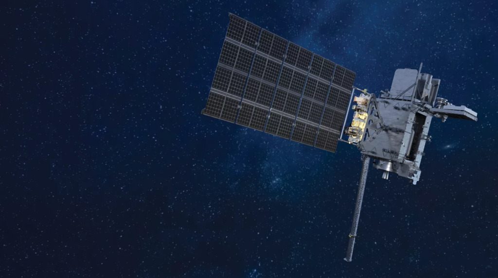
{
    "id": 1008,
    "url": "https://lldev.thespacedevs.com/2.0.0/event/1008/?format=api",
    "slug": "goes-u-science-briefing",
    "name": "GOES-U Science Briefing",
    "type": {
        "id": 20,
        "name": "Press Event"
    },
    "description": "GOES-U science briefing with the following participants: \r\n\r\n- Charles Webb, deputy director, Joint Agency Satellite Division, NASA \r\n- Ken Graham, director, NOAA’s National Weather Service \r\n- Dan Lindsey, chief scientist, GOES-R Program, NOAA \r\n- Elsayed Talaat, director, NOAA’s Office of Space Weather Observations \r\n- Chris Wood, NOAA Hurricane Hunter pilot",
    "location": "Kennedy Space Center",
    "news_url": "https://www.nasa.gov/news-release/nasa-sets-launch-coverage-for-noaa-weather-satellite/",
    "video_url": "https://www.youtube.com/watch?v=DvcdZTkrA_E",
    "feature_image": "https://thespacedevs-prod.nyc3.digitaloceanspaces.com/media/images/goes-u_render_image_20240623151909.jpg",
    "date": "2024-06-24T15:00:00Z",
    "launches": [
        {
            "id": "ad53f165-a118-43a6-ad46-6021accdaabd",
            "url": "https://lldev.thespacedevs.com/2.0.0/launch/ad53f165-a118-43a6-ad46-6021accdaabd/?format=api",
            "launch_library_id": null,
            "slug": "falcon-heavy-goes-u",
            "name": "Falcon Heavy | GOES-U",
            "status": {
                "id": 3,
                "name": "Success"
            },
            "net": "2024-06-25T21:26:00Z",
            "window_end": "2024-06-25T23:16:00Z",
            "window_start": "2024-06-25T21:16:00Z",
            "inhold": false,
            "tbdtime": false,
            "tbddate": false,
            "probability": 70,
            "holdreason": "",
            "failreason": "",
            "hashtag": null,
            "launch_service_provider": {
                "id": 121,
                "url": "https://lldev.thespacedevs.com/2.0.0/agencies/121/?format=api",
                "name": "SpaceX",
                "type": "Commercial"
            },
            "rocket": {
                "id": 7449,
                "configuration": {
                    "id": 161,
                    "launch_library_id": 58,
                    "url": "https://lldev.thespacedevs.com/2.0.0/config/launcher/161/?format=api",
                    "name": "Falcon Heavy",
                    "family": "Falcon",
                    "full_name": "Falcon Heavy",
                    "variant": "Heavy"
                }
            },
            "mission": {
                "id": 5841,
                "launch_library_id": null,
                "name": "GOES-U",
                "description": "The Geostationary Operational Environmental Satellite-U (GOES-U) is the fourth of the next generation of geostationary weather satellites, known as the GOES-R series. The four satellites of the series provide advanced imaging with increased spatial resolution and faster coverage for more accurate forecasts, real-time mapping of lightning activity, and improved monitoring of solar activity. Once GOES-U reaches orbit, it will be renamed GOES-19.",
                "launch_designator": null,
                "type": "Earth Science",
                "orbit": {
                    "id": 2,
                    "name": "Geostationary Transfer Orbit",
                    "abbrev": "GTO"
                }
            },
            "pad": {
                "id": 87,
                "url": "https://lldev.thespacedevs.com/2.0.0/pad/87/?format=api",
                "agency_id": 121,
                "name": "Launch Complex 39A",
                "info_url": null,
                "wiki_url": "https://en.wikipedia.org/wiki/Kennedy_Space_Center_Launch_Complex_39#Launch_Pad_39A",
                "map_url": "https://www.google.com/maps?q=28.60822681,-80.60428186",
                "latitude": "28.60822681",
                "longitude": "-80.60428186",
                "location": {
                    "id": 27,
                    "url": "https://lldev.thespacedevs.com/2.0.0/location/27/?format=api",
                    "name": "Kennedy Space Center, FL, USA",
                    "country_code": "USA",
                    "map_image": "https://thespacedevs-prod.nyc3.digitaloceanspaces.com/media/map_images/location_27_20200803142447.jpg",
                    "total_launch_count": 265,
                    "total_landing_count": 0
                },
                "map_image": "https://thespacedevs-prod.nyc3.digitaloceanspaces.com/media/map_images/pad_87_20200803143537.jpg",
                "total_launch_count": 207
            },
            "webcast_live": false,
            "image": "https://thespacedevs-prod.nyc3.digitaloceanspaces.com/media/images/fh_liftoff_from_image_20240626200232.jpeg",
            "infographic": null,
            "program": [
                {
                    "id": 37,
                    "url": "https://lldev.thespacedevs.com/2.0.0/program/37/?format=api",
                    "name": "Geostationary Operational Environmental Satellite",
                    "description": "The Geostationary Operational Environmental Satellite (GOES), operated by the United States' National Oceanic and Atmospheric Administration (NOAA)'s National Environmental Satellite, Data, and Information Service division, supports weather forecasting, severe storm tracking, and meteorology research",
                    "agencies": [
                        {
                            "id": 44,
                            "url": "https://lldev.thespacedevs.com/2.0.0/agencies/44/?format=api",
                            "name": "National Aeronautics and Space Administration",
                            "type": "Government"
                        },
                        {
                            "id": 210,
                            "url": "https://lldev.thespacedevs.com/2.0.0/agencies/210/?format=api",
                            "name": "National Oceanic and Atmospheric Administration",
                            "type": "Government"
                        }
                    ],
                    "image_url": "https://thespacedevs-prod.nyc3.digitaloceanspaces.com/media/images/goes-u_render_image_20240623151909.jpg",
                    "start_date": "1975-10-16T22:40:00Z",
                    "end_date": null,
                    "info_url": null,
                    "wiki_url": "https://en.wikipedia.org/wiki/Geostationary_Operational_Environmental_Satellite"
                }
            ]
        }
    ],
    "expeditions": [],
    "spacestations": [],
    "program": [
        {
            "id": 37,
            "url": "https://lldev.thespacedevs.com/2.0.0/program/37/?format=api",
            "name": "Geostationary Operational Environmental Satellite",
            "description": "The Geostationary Operational Environmental Satellite (GOES), operated by the United States' National Oceanic and Atmospheric Administration (NOAA)'s National Environmental Satellite, Data, and Information Service division, supports weather forecasting, severe storm tracking, and meteorology research",
            "agencies": [
                {
                    "id": 44,
                    "url": "https://lldev.thespacedevs.com/2.0.0/agencies/44/?format=api",
                    "name": "National Aeronautics and Space Administration",
                    "type": "Government"
                },
                {
                    "id": 210,
                    "url": "https://lldev.thespacedevs.com/2.0.0/agencies/210/?format=api",
                    "name": "National Oceanic and Atmospheric Administration",
                    "type": "Government"
                }
            ],
            "image_url": "https://thespacedevs-prod.nyc3.digitaloceanspaces.com/media/images/goes-u_render_image_20240623151909.jpg",
            "start_date": "1975-10-16T22:40:00Z",
            "end_date": null,
            "info_url": null,
            "wiki_url": "https://en.wikipedia.org/wiki/Geostationary_Operational_Environmental_Satellite"
        }
    ]
}