Pad List
Filters
Parameters - active, agencies_ids, id, id__contains, latitude__gt, latitude__gte, latitude__lt, latitude__lte, location__id, location__name, location__name__contains, longitude__gt, longitude__gte, longitude__lt, longitude__lte, name, name__contains, orbital_launch_attempt_count, orbital_launch_attempt_count__gt, orbital_launch_attempt_count__gte, orbital_launch_attempt_count__lt, orbital_launch_attempt_count__lte, total_launch_count, total_launch_count__gt, total_launch_count__gte, total_launch_count__lt, total_launch_count__lte
Example - /pads/?location__id=11
Search
Fields searched - location__name, name, orbital_launch_attempt_count, total_launch_count
Example - /pads/?search=39A
Ordering
Fields - id, location__id, location__name, name, orbital_launch_attempt_count, total_launch_count
Example - /pads/?ordering=-orbital_launch_attempt_count
Number of results
Use limit to control the number of objects in the response (max 100)
Example - /pads/?limit=2
Format
Switch to JSON output - /pads/?format=json
Help
Find all the FAQs and support links on the documentation homepage - lldev.thespacedevs.com/docs
GET /2.3.0/pads/?format=api&offset=90&ordering=orbital_launch_attempt_count
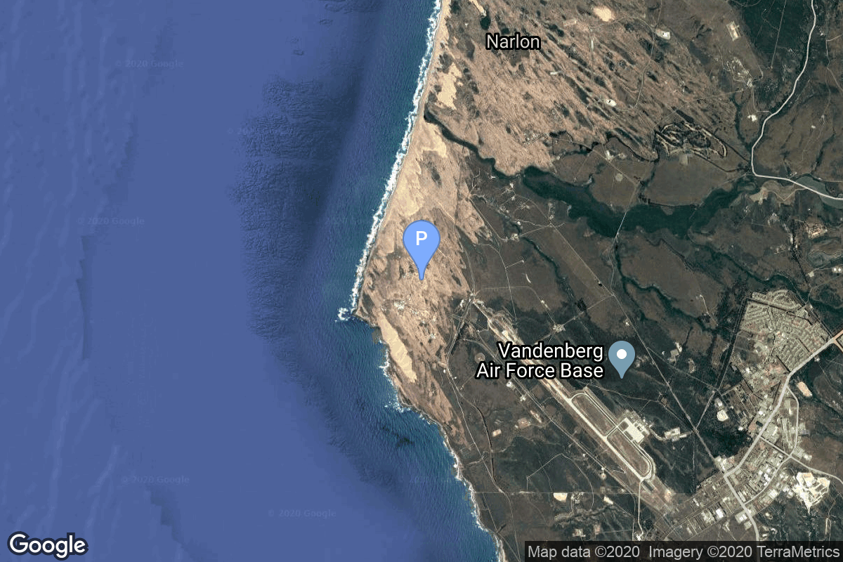
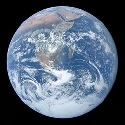
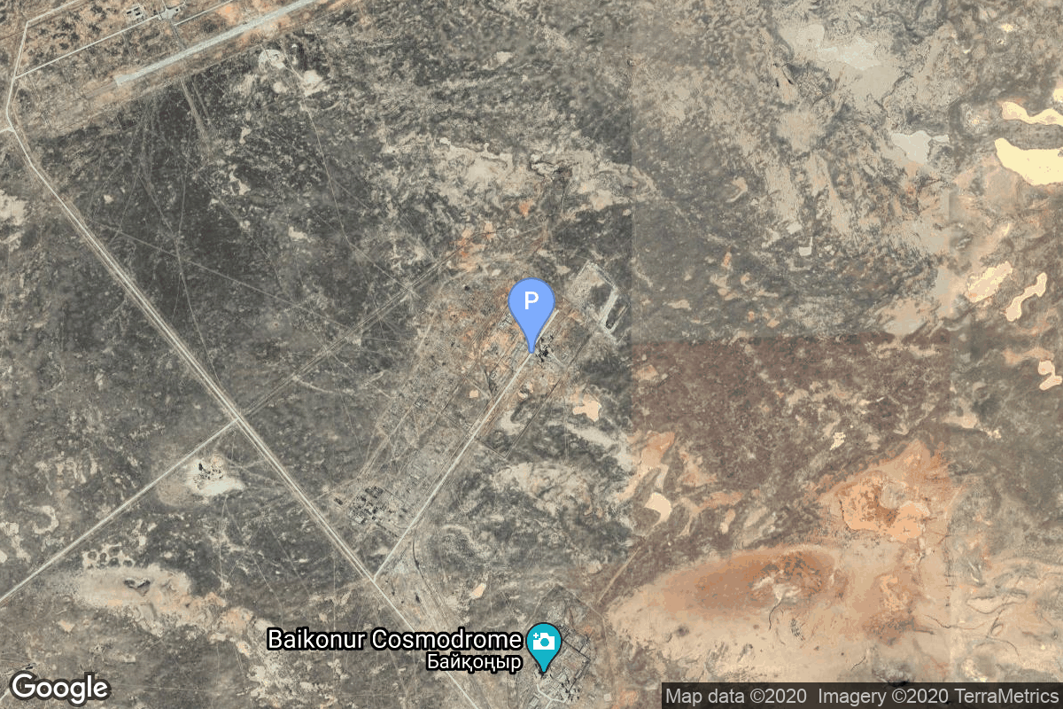
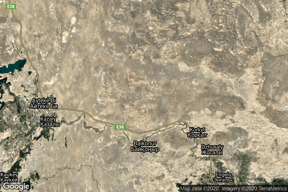
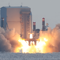
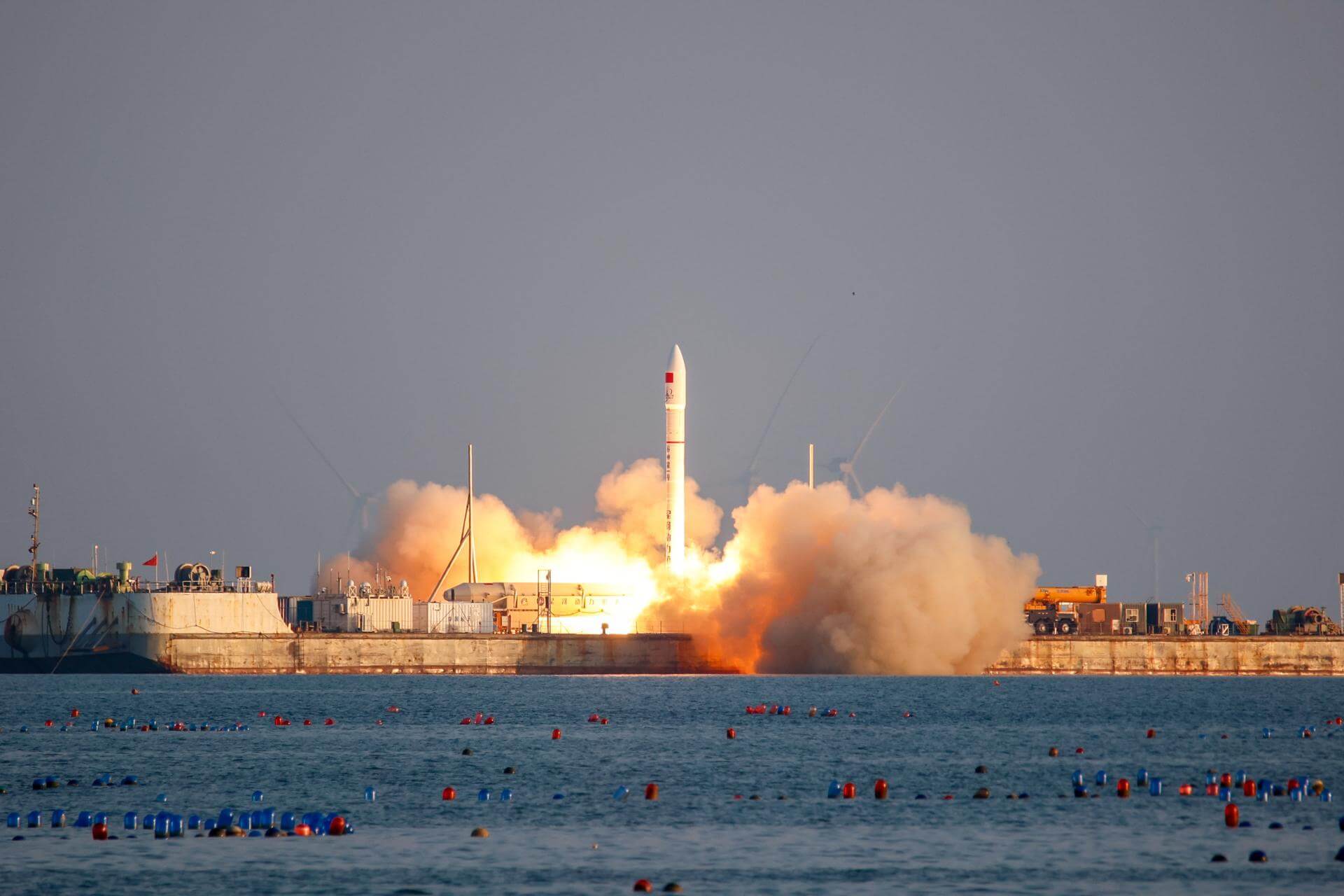
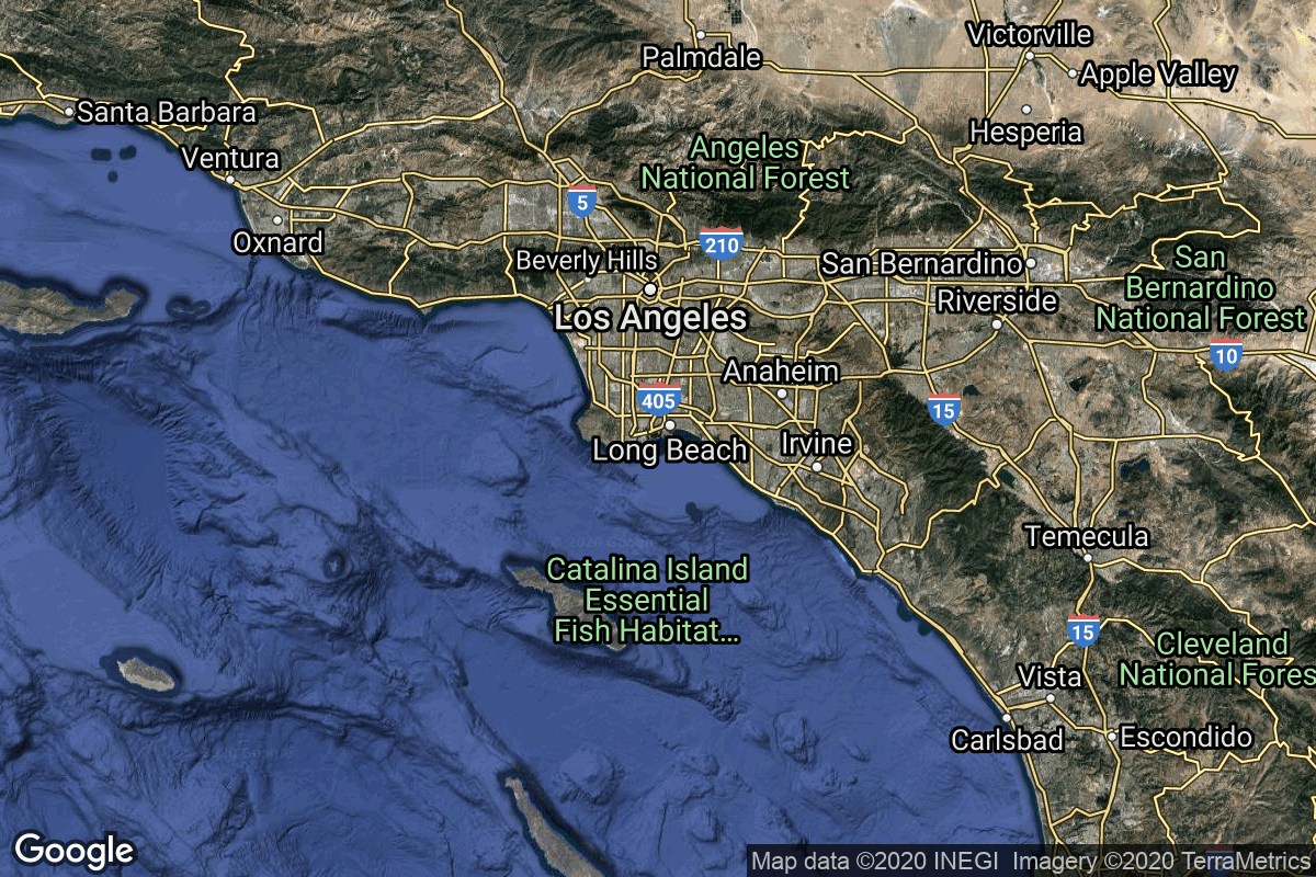
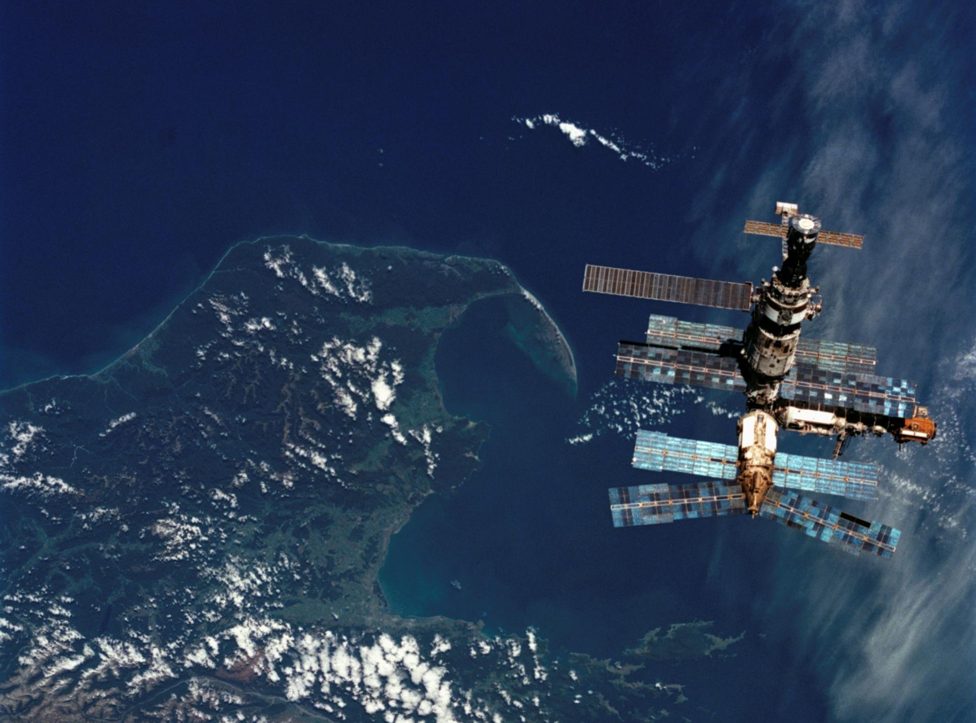
{ "count": 245, "next": "https://lldev.thespacedevs.com/2.3.0/pads/?format=api&limit=10&offset=100&ordering=orbital_launch_attempt_count", "previous": "https://lldev.thespacedevs.com/2.3.0/pads/?format=api&limit=10&offset=80&ordering=orbital_launch_attempt_count", "results": [ { "id": 61, "url": "https://lldev.thespacedevs.com/2.3.0/pads/61/?format=api", "active": false, "agencies": [ { "response_mode": "normal", "id": 161, "url": "https://lldev.thespacedevs.com/2.3.0/agencies/161/?format=api", "name": "United States Air Force", "abbrev": "USAF", "type": { "id": 1, "name": "Government" }, "featured": false, "country": [ { "id": 2, "name": "United States of America", "alpha_2_code": "US", "alpha_3_code": "USA", "nationality_name": "American", "nationality_name_composed": "Americano" } ], "description": "The United States Air Force (USAF) is the air service branch of the United States Armed Forces, and is one of the eight uniformed services of the United States. Originally created on 1 August 1907, as a part of the United States Army Signal Corps, the USAF was established as a separate branch of the United States Armed Forces in 1947 with the enactment of the National Security Act of 1947.", "administrator": "Commander-in-Chief: President of the US", "founding_year": 1947, "launchers": "", "spacecraft": "", "parent": null, "image": null, "logo": { "id": 193, "name": "[AUTO] United States Air Force - logo", "image_url": "https://thespacedevs-dev.nyc3.digitaloceanspaces.com/media/images/united2520states2520air2520force_logo_20230804084626.png", "thumbnail_url": "https://thespacedevs-dev.nyc3.digitaloceanspaces.com/media/images/255bauto255d__image_thumbnail_20240305185152.png", "credit": null, "license": { "id": 1, "name": "Unknown", "priority": 9, "link": null }, "single_use": true, "variants": [] }, "social_logo": { "id": 99, "name": "[AUTO] United States Air Force - social_logo", "image_url": "https://thespacedevs-dev.nyc3.digitaloceanspaces.com/media/images/united2520states2520air2520force_nation_20230804085132.jpg", "thumbnail_url": "https://thespacedevs-dev.nyc3.digitaloceanspaces.com/media/images/255bauto255d__image_thumbnail_20240305184855.jpeg", "credit": null, "license": { "id": 1, "name": "Unknown", "priority": 9, "link": null }, "single_use": true, "variants": [] } } ], "name": "Space Launch Complex 10E", "image": null, "description": "Space Launch Complex 10, or Missile Launch Complex 10, is located on Vandenberg Space Force Base in Lompoc, California. It was built in 1958 to test ballistic missiles and developed into a space launching facility in 1963.", "info_url": null, "wiki_url": "https://en.wikipedia.org/wiki/Vandenberg_Space_Launch_Complex_10", "map_url": "https://www.google.com/maps?q=34.7626,-120.6213", "latitude": 34.7626, "longitude": -120.6213, "country": { "id": 2, "name": "United States of America", "alpha_2_code": "US", "alpha_3_code": "USA", "nationality_name": "American", "nationality_name_composed": "Americano" }, "map_image": "https://thespacedevs-dev.nyc3.digitaloceanspaces.com/media/map_images/pad_61_20200803143410.jpg", "total_launch_count": 1, "orbital_launch_attempt_count": 1, "fastest_turnaround": null, "location": { "response_mode": "normal", "id": 11, "url": "https://lldev.thespacedevs.com/2.3.0/locations/11/?format=api", "name": "Vandenberg SFB, CA, USA", "celestial_body": { "response_mode": "normal", "id": 1, "name": "Earth", "type": { "id": 1, "name": "Planet" }, "diameter": 12742000.0, "mass": 5.972168e+24, "gravity": 9.80655, "length_of_day": "1 00:00:00", "atmosphere": true, "image": { "id": 2040, "name": "Earth (Apollo 17)", "image_url": "https://thespacedevs-dev.nyc3.digitaloceanspaces.com/media/images/earth_2528apol_image_20240402194304.jpeg", "thumbnail_url": "https://thespacedevs-dev.nyc3.digitaloceanspaces.com/media/images/earth_2528apol_image_thumbnail_20240402194305.jpeg", "credit": "NASA", "license": { "id": 4, "name": "NASA Image and Media Guidelines", "priority": 0, "link": "https://www.nasa.gov/nasa-brand-center/images-and-media/" }, "single_use": true, "variants": [] }, "description": "Earth is the third planet from the Sun and the only astronomical object known to harbor life.", "wiki_url": "https://en.wikipedia.org/wiki/Earth", "total_attempted_launches": 7470, "successful_launches": 6915, "failed_launches": 555, "total_attempted_landings": 1288, "successful_landings": 1241, "failed_landings": 47 }, "active": true, "country": { "id": 2, "name": "United States of America", "alpha_2_code": "US", "alpha_3_code": "USA", "nationality_name": "American", "nationality_name_composed": "Americano" }, "description": "Vandenberg Space Force Base is a United States Space Force Base in Santa Barbara County, California. Established in 1941, Vandenberg Space Force Base is a space launch base, launching spacecraft from the Western Range, and also performs missile testing. The United States Space Force's Space Launch Delta 30 serves as the host delta for the base, equivalent to an Air Force air base wing. In addition to its military space launch mission, Vandenberg Space Force Base also hosts space launches for civil and commercial space entities, such as NASA and SpaceX.", "image": { "id": 2226, "name": "Vandenberg SFB imaged by Sentinel-2", "image_url": "https://thespacedevs-dev.nyc3.digitaloceanspaces.com/media/images/vandenberg_sfb__image_20240920082910.jpeg", "thumbnail_url": "https://thespacedevs-dev.nyc3.digitaloceanspaces.com/media/images/vandenberg_sfb__image_thumbnail_20240920082910.jpeg", "credit": "Contains modified Copernicus Sentinel data 2020", "license": { "id": 33, "name": "Copernicus Image Use Policy", "priority": 0, "link": "https://eur-lex.europa.eu/legal-content/EN/TXT/?uri=CELEX:32013R1159" }, "single_use": true, "variants": [] }, "map_image": "https://thespacedevs-dev.nyc3.digitaloceanspaces.com/media/map_images/location_11_20200803142416.jpg", "longitude": -120.52023, "latitude": 34.75133, "timezone_name": "America/Los_Angeles", "total_launch_count": 872, "total_landing_count": 33 } }, { "id": 163, "url": "https://lldev.thespacedevs.com/2.3.0/pads/163/?format=api", "active": true, "agencies": [], "name": "250", "image": null, "description": null, "info_url": null, "wiki_url": "https://en.wikipedia.org/wiki/Baikonur_Cosmodrome", "map_url": "https://www.google.com/maps?q=46.008,63.302806", "latitude": 46.008, "longitude": 63.302806, "country": { "id": 44, "name": "Kazakhstan", "alpha_2_code": "KZ", "alpha_3_code": "KAZ", "nationality_name": "Kazakh", "nationality_name_composed": "Kazakhstani" }, "map_image": "https://thespacedevs-dev.nyc3.digitaloceanspaces.com/media/map_images/pad_163_20200803143510.jpg", "total_launch_count": 1, "orbital_launch_attempt_count": 1, "fastest_turnaround": null, "location": { "response_mode": "normal", "id": 15, "url": "https://lldev.thespacedevs.com/2.3.0/locations/15/?format=api", "name": "Baikonur Cosmodrome, Republic of Kazakhstan", "celestial_body": { "response_mode": "normal", "id": 1, "name": "Earth", "type": { "id": 1, "name": "Planet" }, "diameter": 12742000.0, "mass": 5.972168e+24, "gravity": 9.80655, "length_of_day": "1 00:00:00", "atmosphere": true, "image": { "id": 2040, "name": "Earth (Apollo 17)", "image_url": "https://thespacedevs-dev.nyc3.digitaloceanspaces.com/media/images/earth_2528apol_image_20240402194304.jpeg", "thumbnail_url": "https://thespacedevs-dev.nyc3.digitaloceanspaces.com/media/images/earth_2528apol_image_thumbnail_20240402194305.jpeg", "credit": "NASA", "license": { "id": 4, "name": "NASA Image and Media Guidelines", "priority": 0, "link": "https://www.nasa.gov/nasa-brand-center/images-and-media/" }, "single_use": true, "variants": [] }, "description": "Earth is the third planet from the Sun and the only astronomical object known to harbor life.", "wiki_url": "https://en.wikipedia.org/wiki/Earth", "total_attempted_launches": 7470, "successful_launches": 6915, "failed_launches": 555, "total_attempted_landings": 1288, "successful_landings": 1241, "failed_landings": 47 }, "active": true, "country": { "id": 44, "name": "Kazakhstan", "alpha_2_code": "KZ", "alpha_3_code": "KAZ", "nationality_name": "Kazakh", "nationality_name_composed": "Kazakhstani" }, "description": "The Baikonur Cosmodrome is a spaceport operated by Russia within Kazakhstan. Located in the Kazakh city of Baikonur, it is the largest operational space launch facility in terms of area. All Russian crewed spaceflights are launched from Baikonur.", "image": { "id": 2198, "name": "Soyuz launch pad at the Baikonur Cosmodrome", "image_url": "https://thespacedevs-dev.nyc3.digitaloceanspaces.com/media/images/soyuz_launch_pa_image_20240918150530.jpg", "thumbnail_url": "https://thespacedevs-dev.nyc3.digitaloceanspaces.com/media/images/soyuz_launch_pa_image_thumbnail_20240918150530.jpeg", "credit": "NASA/Bill Ingalls", "license": { "id": 4, "name": "NASA Image and Media Guidelines", "priority": 0, "link": "https://www.nasa.gov/nasa-brand-center/images-and-media/" }, "single_use": true, "variants": [] }, "map_image": "https://thespacedevs-dev.nyc3.digitaloceanspaces.com/media/map_images/location_15_20200803142517.jpg", "longitude": 63.305, "latitude": 45.965, "timezone_name": "Asia/Qyzylorda", "total_launch_count": 1561, "total_landing_count": 0 } }, { "id": 225, "url": "https://lldev.thespacedevs.com/2.3.0/pads/225/?format=api", "active": false, "agencies": [ { "response_mode": "normal", "id": 44, "url": "https://lldev.thespacedevs.com/2.3.0/agencies/44/?format=api", "name": "National Aeronautics and Space Administration", "abbrev": "NASA", "type": { "id": 1, "name": "Government" }, "featured": true, "country": [ { "id": 2, "name": "United States of America", "alpha_2_code": "US", "alpha_3_code": "USA", "nationality_name": "American", "nationality_name_composed": "Americano" } ], "description": "The National Aeronautics and Space Administration is an independent agency of the executive branch of the United States federal government responsible for the civilian space program, as well as aeronautics and aerospace research. NASA have many launch facilities but most are inactive. The most commonly used pad will be LC-39B at Kennedy Space Center in Florida.", "administrator": "Administrator: Jared Isaacman", "founding_year": 1958, "launchers": "Space Shuttle | SLS", "spacecraft": "Orion", "parent": null, "image": { "id": 19, "name": "[AUTO] National Aeronautics and Space Administration - image", "image_url": "https://thespacedevs-dev.nyc3.digitaloceanspaces.com/media/images/national2520aeronautics2520and2520space2520administration_image_20190207032448.jpeg", "thumbnail_url": "https://thespacedevs-dev.nyc3.digitaloceanspaces.com/media/images/255bauto255d__image_thumbnail_20240305184631.jpeg", "credit": null, "license": { "id": 1, "name": "Unknown", "priority": 9, "link": null }, "single_use": true, "variants": [] }, "logo": { "id": 161, "name": "[AUTO] National Aeronautics and Space Administration - logo", "image_url": "https://thespacedevs-dev.nyc3.digitaloceanspaces.com/media/images/national2520aeronautics2520and2520space2520administration_logo_20190207032448.png", "thumbnail_url": "https://thespacedevs-dev.nyc3.digitaloceanspaces.com/media/images/255bauto255d__image_thumbnail_20240305185043.png", "credit": null, "license": { "id": 1, "name": "Unknown", "priority": 9, "link": null }, "single_use": true, "variants": [] }, "social_logo": { "id": 76, "name": "[AUTO] National Aeronautics and Space Administration - social_logo", "image_url": "https://thespacedevs-dev.nyc3.digitaloceanspaces.com/media/images/national2520aeronautics2520and2520space2520administration_nation_20230803040809.jpg", "thumbnail_url": "https://thespacedevs-dev.nyc3.digitaloceanspaces.com/media/images/255bauto255d__image_thumbnail_20240305184823.jpeg", "credit": null, "license": { "id": 1, "name": "Unknown", "priority": 9, "link": null }, "single_use": true, "variants": [] } } ], "name": "Apollo 14 landing site", "image": { "id": 2161, "name": "Apollo 14 LM on the lunar surface", "image_url": "https://thespacedevs-dev.nyc3.digitaloceanspaces.com/media/images/apollo_14_lm_on_image_20240813073933.jpg", "thumbnail_url": "https://thespacedevs-dev.nyc3.digitaloceanspaces.com/media/images/apollo_14_lm_on_image_thumbnail_20240813073933.jpeg", "credit": "NASA", "license": { "id": 4, "name": "NASA Image and Media Guidelines", "priority": 0, "link": "https://www.nasa.gov/nasa-brand-center/images-and-media/" }, "single_use": false, "variants": [] }, "description": "Landing site of Apollo 14’s lunar module Antares on 5 February 1971.", "info_url": null, "wiki_url": "https://en.wikipedia.org/wiki/Apollo_14", "map_url": null, "latitude": -3.6453, "longitude": -17.47136, "country": null, "map_image": "https://thespacedevs-dev.nyc3.digitaloceanspaces.com/media/map_images/pad_apollo_14_landing_site_20240813035741.jpg", "total_launch_count": 1, "orbital_launch_attempt_count": 1, "fastest_turnaround": null, "location": { "response_mode": "normal", "id": 169, "url": "https://lldev.thespacedevs.com/2.3.0/locations/169/?format=api", "name": "Fra Mauro Formation, Moon", "celestial_body": { "response_mode": "normal", "id": 2, "name": "Moon", "type": { "id": 2, "name": "Moon" }, "diameter": 3474800.0, "mass": 7.342e+22, "gravity": 1.622, "length_of_day": "27 07:43:12", "atmosphere": false, "image": { "id": 2041, "name": "Moon (Apollo 11)", "image_url": "https://thespacedevs-dev.nyc3.digitaloceanspaces.com/media/images/moon_2528apoll_image_20240402195408.jpg", "thumbnail_url": "https://thespacedevs-dev.nyc3.digitaloceanspaces.com/media/images/moon_2528apoll_image_thumbnail_20240402195408.jpeg", "credit": "NASA", "license": { "id": 4, "name": "NASA Image and Media Guidelines", "priority": 0, "link": "https://www.nasa.gov/nasa-brand-center/images-and-media/" }, "single_use": false, "variants": [] }, "description": "The Moon is Earth's only natural satellite.", "wiki_url": "https://en.wikipedia.org/wiki/Moon", "total_attempted_launches": 11, "successful_launches": 11, "failed_launches": 0, "total_attempted_landings": 17, "successful_landings": 14, "failed_landings": 3 }, "active": false, "country": null, "description": "The Fra Mauro formation (or Fra Mauro Highlands) is a formation on the near side of Earth's Moon that served as the landing site for the American Apollo 14 mission in 1971. It is named after the 80-kilometer-diameter crater Fra Mauro, located within it. The formation, as well as Fra Mauro crater, take their names from a 15th-century Italian monk and mapmaker of the same name.", "image": { "id": 2142, "name": "Fra Mauro from lunar orbit (Apollo 12)", "image_url": "https://thespacedevs-dev.nyc3.digitaloceanspaces.com/media/images/fra_mauro_from__image_20240812111040.jpg", "thumbnail_url": "https://thespacedevs-dev.nyc3.digitaloceanspaces.com/media/images/fra_mauro_from__image_thumbnail_20240812111041.jpeg", "credit": "NASA", "license": { "id": 4, "name": "NASA Image and Media Guidelines", "priority": 0, "link": "https://www.nasa.gov/nasa-brand-center/images-and-media/" }, "single_use": true, "variants": [] }, "map_image": "https://thespacedevs-dev.nyc3.digitaloceanspaces.com/media/map_images/location_apollo_14_landing_site252c_fra_mauro252c_moon_20240813033131.jpg", "longitude": -17.0, "latitude": -6.0, "timezone_name": "", "total_launch_count": 1, "total_landing_count": 0 } }, { "id": 238, "url": "https://lldev.thespacedevs.com/2.3.0/pads/238/?format=api", "active": true, "agencies": [ { "response_mode": "normal", "id": 188, "url": "https://lldev.thespacedevs.com/2.3.0/agencies/188/?format=api", "name": "Gilmour Space Technologies", "abbrev": "GST", "type": { "id": 5, "name": "Private" }, "featured": false, "country": [ { "id": 34, "name": "Australia", "alpha_2_code": "AU", "alpha_3_code": "AUS", "nationality_name": "Australian", "nationality_name_composed": "Australo" }, { "id": 69, "name": "Singapore", "alpha_2_code": "SG", "alpha_3_code": "SGP", "nationality_name": "Singaporean", "nationality_name_composed": "Singaporean" } ], "description": "Gilmour Space Technologies is a venture-funded Australian space company headquartered in Queensland, Australia that is developing hybrid-engine rockets and associated technology to support the development of a low-cost space launch vehicle.", "administrator": "CEO: Adam Gilmour", "founding_year": 2013, "launchers": "Eris", "spacecraft": "", "parent": null, "image": { "id": 1732, "name": "Eris on the launch pad (Maiden Flight)", "image_url": "https://thespacedevs-dev.nyc3.digitaloceanspaces.com/media/images/eris_on_the_lau_image_20250227073032.jpg", "thumbnail_url": "https://thespacedevs-dev.nyc3.digitaloceanspaces.com/media/images/eris_on_the_lau_image_thumbnail_20250227073032.jpeg", "credit": "Gilmour Space", "license": { "id": 1, "name": "Unknown", "priority": 9, "link": null }, "single_use": false, "variants": [] }, "logo": { "id": 2337, "name": "Gilmour Space logo", "image_url": "https://thespacedevs-dev.nyc3.digitaloceanspaces.com/media/images/gilmour_space_l_image_20250227072818.png", "thumbnail_url": "https://thespacedevs-dev.nyc3.digitaloceanspaces.com/media/images/gilmour_space_l_image_thumbnail_20250227072818.png", "credit": "Gilmour Space", "license": { "id": 1, "name": "Unknown", "priority": 9, "link": null }, "single_use": true, "variants": [] }, "social_logo": { "id": 2336, "name": "Gilmour Space social logo", "image_url": "https://thespacedevs-dev.nyc3.digitaloceanspaces.com/media/images/gilmour_space_s_image_20250227072733.jpg", "thumbnail_url": "https://thespacedevs-dev.nyc3.digitaloceanspaces.com/media/images/gilmour_space_s_image_thumbnail_20250227072733.jpeg", "credit": "Gilmour Space", "license": { "id": 1, "name": "Unknown", "priority": 9, "link": null }, "single_use": true, "variants": [] } } ], "name": "Eris Pad", "image": { "id": 1732, "name": "Eris on the launch pad (Maiden Flight)", "image_url": "https://thespacedevs-dev.nyc3.digitaloceanspaces.com/media/images/eris_on_the_lau_image_20250227073032.jpg", "thumbnail_url": "https://thespacedevs-dev.nyc3.digitaloceanspaces.com/media/images/eris_on_the_lau_image_thumbnail_20250227073032.jpeg", "credit": "Gilmour Space", "license": { "id": 1, "name": "Unknown", "priority": 9, "link": null }, "single_use": false, "variants": [] }, "description": "Launch pad for Gilmour Space's orbital rocket Eris.", "info_url": null, "wiki_url": "https://en.wikipedia.org/wiki/Gilmour_Space_Technologies#Bowen_Orbital_Spaceport_(BOS)", "map_url": null, "latitude": -19.958151, "longitude": 148.1129553, "country": { "id": 34, "name": "Australia", "alpha_2_code": "AU", "alpha_3_code": "AUS", "nationality_name": "Australian", "nationality_name_composed": "Australo" }, "map_image": "https://thespacedevs-dev.nyc3.digitaloceanspaces.com/media/map_images/pad_eris_pad_20250227074117.jpg", "total_launch_count": 1, "orbital_launch_attempt_count": 1, "fastest_turnaround": null, "location": { "response_mode": "normal", "id": 181, "url": "https://lldev.thespacedevs.com/2.3.0/locations/181/?format=api", "name": "Bowen Orbital Spaceport", "celestial_body": { "response_mode": "normal", "id": 1, "name": "Earth", "type": { "id": 1, "name": "Planet" }, "diameter": 12742000.0, "mass": 5.972168e+24, "gravity": 9.80655, "length_of_day": "1 00:00:00", "atmosphere": true, "image": { "id": 2040, "name": "Earth (Apollo 17)", "image_url": "https://thespacedevs-dev.nyc3.digitaloceanspaces.com/media/images/earth_2528apol_image_20240402194304.jpeg", "thumbnail_url": "https://thespacedevs-dev.nyc3.digitaloceanspaces.com/media/images/earth_2528apol_image_thumbnail_20240402194305.jpeg", "credit": "NASA", "license": { "id": 4, "name": "NASA Image and Media Guidelines", "priority": 0, "link": "https://www.nasa.gov/nasa-brand-center/images-and-media/" }, "single_use": true, "variants": [] }, "description": "Earth is the third planet from the Sun and the only astronomical object known to harbor life.", "wiki_url": "https://en.wikipedia.org/wiki/Earth", "total_attempted_launches": 7470, "successful_launches": 6915, "failed_launches": 555, "total_attempted_landings": 1288, "successful_landings": 1241, "failed_landings": 47 }, "active": true, "country": { "id": 34, "name": "Australia", "alpha_2_code": "AU", "alpha_3_code": "AUS", "nationality_name": "Australian", "nationality_name_composed": "Australo" }, "description": "Private orbital launch facility owned and operated by Gilmour Space.", "image": { "id": 1732, "name": "Eris on the launch pad (Maiden Flight)", "image_url": "https://thespacedevs-dev.nyc3.digitaloceanspaces.com/media/images/eris_on_the_lau_image_20250227073032.jpg", "thumbnail_url": "https://thespacedevs-dev.nyc3.digitaloceanspaces.com/media/images/eris_on_the_lau_image_thumbnail_20250227073032.jpeg", "credit": "Gilmour Space", "license": { "id": 1, "name": "Unknown", "priority": 9, "link": null }, "single_use": false, "variants": [] }, "map_image": "https://thespacedevs-dev.nyc3.digitaloceanspaces.com/media/map_images/location_bowen_orbital_spaceport_20250227073649.jpg", "longitude": 148.1129553, "latitude": -19.958151, "timezone_name": "Australia/Brisbane", "total_launch_count": 1, "total_landing_count": 0 } }, { "id": 233, "url": "https://lldev.thespacedevs.com/2.3.0/pads/233/?format=api", "active": false, "agencies": [ { "response_mode": "normal", "id": 17, "url": "https://lldev.thespacedevs.com/2.3.0/agencies/17/?format=api", "name": "China National Space Administration", "abbrev": "CNSA", "type": { "id": 1, "name": "Government" }, "featured": true, "country": [ { "id": 6, "name": "China", "alpha_2_code": "CN", "alpha_3_code": "CHN", "nationality_name": "Chinese", "nationality_name_composed": "Sino" } ], "description": "The China National Space Administration (CNSA) is the national space agency of the People's Republic of China. It is responsible for the national space program and for planning and development of space activities. CNSA and China Aerospace Corporation (CASC) assumed the authority over space development efforts previously held by the Ministry of Aerospace Industry. The CNSA has many launch sites around China with their orbital sites located in Jiuquan, Xichang, Taiyuan and Wenchang.", "administrator": "Administrator: Tang Dengjie", "founding_year": 1993, "launchers": "", "spacecraft": "Shenzhou", "parent": null, "image": { "id": 9, "name": "[AUTO] China National Space Administration - image", "image_url": "https://thespacedevs-dev.nyc3.digitaloceanspaces.com/media/images/china2520national2520space2520administration_image_20190207032431.jpeg", "thumbnail_url": "https://thespacedevs-dev.nyc3.digitaloceanspaces.com/media/images/255bauto255d__image_thumbnail_20240305184601.jpeg", "credit": null, "license": { "id": 1, "name": "Unknown", "priority": 9, "link": null }, "single_use": true, "variants": [] }, "logo": { "id": 125, "name": "[AUTO] China National Space Administration - logo", "image_url": "https://thespacedevs-dev.nyc3.digitaloceanspaces.com/media/images/china2520national2520space2520administration_logo_20190207032431.png", "thumbnail_url": "https://thespacedevs-dev.nyc3.digitaloceanspaces.com/media/images/255bauto255d__image_thumbnail_20240305184936.png", "credit": null, "license": { "id": 1, "name": "Unknown", "priority": 9, "link": null }, "single_use": true, "variants": [] }, "social_logo": { "id": 51, "name": "[AUTO] China National Space Administration - social_logo", "image_url": "https://thespacedevs-dev.nyc3.digitaloceanspaces.com/media/images/china2520national2520space2520administration_nation_20190602114400.png", "thumbnail_url": "https://thespacedevs-dev.nyc3.digitaloceanspaces.com/media/images/255bauto255d__image_thumbnail_20240305184747.png", "credit": null, "license": { "id": 1, "name": "Unknown", "priority": 9, "link": null }, "single_use": true, "variants": [] } } ], "name": "Chang’e 6 landing site", "image": { "id": 2170, "name": "Chang'e 6 on the lunar surface", "image_url": "https://thespacedevs-dev.nyc3.digitaloceanspaces.com/media/images/chang2527e_6_o_image_20240813081610.jpg", "thumbnail_url": "https://thespacedevs-dev.nyc3.digitaloceanspaces.com/media/images/chang2527e_6_o_image_thumbnail_20240813081611.jpeg", "credit": "CNSA", "license": { "id": 1, "name": "Unknown", "priority": 9, "link": null }, "single_use": false, "variants": [] }, "description": "Landing site of the Chinese lunar sample return mission Chang’e 6 on 1 June 2024.", "info_url": null, "wiki_url": "https://en.wikipedia.org/wiki/Chang'e_6", "map_url": null, "latitude": -41.6385, "longitude": -153.9852, "country": null, "map_image": "https://thespacedevs-dev.nyc3.digitaloceanspaces.com/media/map_images/pad_chang25e225802599e_6_landing_site_20240813041009.jpg", "total_launch_count": 1, "orbital_launch_attempt_count": 1, "fastest_turnaround": null, "location": { "response_mode": "normal", "id": 177, "url": "https://lldev.thespacedevs.com/2.3.0/locations/177/?format=api", "name": "Apollo crater, Moon", "celestial_body": { "response_mode": "normal", "id": 2, "name": "Moon", "type": { "id": 2, "name": "Moon" }, "diameter": 3474800.0, "mass": 7.342e+22, "gravity": 1.622, "length_of_day": "27 07:43:12", "atmosphere": false, "image": { "id": 2041, "name": "Moon (Apollo 11)", "image_url": "https://thespacedevs-dev.nyc3.digitaloceanspaces.com/media/images/moon_2528apoll_image_20240402195408.jpg", "thumbnail_url": "https://thespacedevs-dev.nyc3.digitaloceanspaces.com/media/images/moon_2528apoll_image_thumbnail_20240402195408.jpeg", "credit": "NASA", "license": { "id": 4, "name": "NASA Image and Media Guidelines", "priority": 0, "link": "https://www.nasa.gov/nasa-brand-center/images-and-media/" }, "single_use": false, "variants": [] }, "description": "The Moon is Earth's only natural satellite.", "wiki_url": "https://en.wikipedia.org/wiki/Moon", "total_attempted_launches": 11, "successful_launches": 11, "failed_launches": 0, "total_attempted_landings": 17, "successful_landings": 14, "failed_landings": 3 }, "active": false, "country": null, "description": "Apollo, also called the Apollo basin, is an enormous impact crater located in the southern hemisphere on the far side of the Moon. This formation dwarfs the large crater Oppenheimer that is located next to the western rim. The crater Barringer lies across the northern wall. To the southeast is the crater Anders, and Kleymenov is just to the east of the rim.", "image": { "id": 2169, "name": "Apollo Crater", "image_url": "https://thespacedevs-dev.nyc3.digitaloceanspaces.com/media/images/apollo_crater_image_20240813081303.jpg", "thumbnail_url": "https://thespacedevs-dev.nyc3.digitaloceanspaces.com/media/images/apollo_crater_image_thumbnail_20240813081303.jpeg", "credit": "James Stuby, NASA", "license": { "id": 25, "name": "CC0 1.0", "priority": 3, "link": "https://creativecommons.org/publicdomain/zero/1.0/deed.en" }, "single_use": true, "variants": [] }, "map_image": "https://thespacedevs-dev.nyc3.digitaloceanspaces.com/media/map_images/location_chang25e225802599e_6_landing_site252c_apollo_basin252c_moon_20240813035211.jpg", "longitude": -151.8, "latitude": -36.1, "timezone_name": "", "total_launch_count": 1, "total_landing_count": 0 } }, { "id": 216, "url": "https://lldev.thespacedevs.com/2.3.0/pads/216/?format=api", "active": true, "agencies": [], "name": "ADD Offshore launch platform", "image": { "id": 1338, "name": "South Korean ADD Solid-Fuel SLV (3 stage) liftoff (S-STEP)", "image_url": "https://thespacedevs-dev.nyc3.digitaloceanspaces.com/media/images/south2520korea_image_20231204145331.png", "thumbnail_url": "https://thespacedevs-dev.nyc3.digitaloceanspaces.com/media/images/255bauto255d__image_thumbnail_20240305192440.png", "credit": "Yonhap", "license": { "id": 1, "name": "Unknown", "priority": 9, "link": null }, "single_use": false, "variants": [] }, "description": "Offshore launch platform for the South Korean military small satellite launch vehicle.", "info_url": null, "wiki_url": null, "map_url": null, "latitude": 33.216667, "longitude": 126.366667, "country": { "id": 35, "name": "South Korea", "alpha_2_code": "KR", "alpha_3_code": "KOR", "nationality_name": "South Korean", "nationality_name_composed": "South Korean" }, "map_image": "https://thespacedevs-dev.nyc3.digitaloceanspaces.com/media/map_images/pad_add_offshore_launch_platform_20231204142359.jpg", "total_launch_count": 1, "orbital_launch_attempt_count": 1, "fastest_turnaround": null, "location": { "response_mode": "normal", "id": 3, "url": "https://lldev.thespacedevs.com/2.3.0/locations/3/?format=api", "name": "Sea Launch", "celestial_body": { "response_mode": "normal", "id": 1, "name": "Earth", "type": { "id": 1, "name": "Planet" }, "diameter": 12742000.0, "mass": 5.972168e+24, "gravity": 9.80655, "length_of_day": "1 00:00:00", "atmosphere": true, "image": { "id": 2040, "name": "Earth (Apollo 17)", "image_url": "https://thespacedevs-dev.nyc3.digitaloceanspaces.com/media/images/earth_2528apol_image_20240402194304.jpeg", "thumbnail_url": "https://thespacedevs-dev.nyc3.digitaloceanspaces.com/media/images/earth_2528apol_image_thumbnail_20240402194305.jpeg", "credit": "NASA", "license": { "id": 4, "name": "NASA Image and Media Guidelines", "priority": 0, "link": "https://www.nasa.gov/nasa-brand-center/images-and-media/" }, "single_use": true, "variants": [] }, "description": "Earth is the third planet from the Sun and the only astronomical object known to harbor life.", "wiki_url": "https://en.wikipedia.org/wiki/Earth", "total_attempted_launches": 7470, "successful_launches": 6915, "failed_launches": 555, "total_attempted_landings": 1288, "successful_landings": 1241, "failed_landings": 47 }, "active": true, "country": { "id": 17, "name": "Unknown", "alpha_2_code": "??", "alpha_3_code": "???", "nationality_name": "Earthling", "nationality_name_composed": "Earthling" }, "description": "", "image": { "id": 1418, "name": "Ceres-1S liftoff from DeFu-15002 (4x Tianqi)", "image_url": "https://thespacedevs-dev.nyc3.digitaloceanspaces.com/media/images/ceres-1s25202_image_20230905114300.jpeg", "thumbnail_url": "https://thespacedevs-dev.nyc3.digitaloceanspaces.com/media/images/255bauto255d__image_thumbnail_20240305192712.jpeg", "credit": "CASC", "license": { "id": 1, "name": "Unknown", "priority": 9, "link": null }, "single_use": false, "variants": [] }, "map_image": "https://thespacedevs-dev.nyc3.digitaloceanspaces.com/media/map_images/location_3_20200803142448.jpg", "longitude": null, "latitude": null, "timezone_name": "", "total_launch_count": 40, "total_landing_count": 0 } }, { "id": 224, "url": "https://lldev.thespacedevs.com/2.3.0/pads/224/?format=api", "active": false, "agencies": [ { "response_mode": "normal", "id": 44, "url": "https://lldev.thespacedevs.com/2.3.0/agencies/44/?format=api", "name": "National Aeronautics and Space Administration", "abbrev": "NASA", "type": { "id": 1, "name": "Government" }, "featured": true, "country": [ { "id": 2, "name": "United States of America", "alpha_2_code": "US", "alpha_3_code": "USA", "nationality_name": "American", "nationality_name_composed": "Americano" } ], "description": "The National Aeronautics and Space Administration is an independent agency of the executive branch of the United States federal government responsible for the civilian space program, as well as aeronautics and aerospace research. NASA have many launch facilities but most are inactive. The most commonly used pad will be LC-39B at Kennedy Space Center in Florida.", "administrator": "Administrator: Jared Isaacman", "founding_year": 1958, "launchers": "Space Shuttle | SLS", "spacecraft": "Orion", "parent": null, "image": { "id": 19, "name": "[AUTO] National Aeronautics and Space Administration - image", "image_url": "https://thespacedevs-dev.nyc3.digitaloceanspaces.com/media/images/national2520aeronautics2520and2520space2520administration_image_20190207032448.jpeg", "thumbnail_url": "https://thespacedevs-dev.nyc3.digitaloceanspaces.com/media/images/255bauto255d__image_thumbnail_20240305184631.jpeg", "credit": null, "license": { "id": 1, "name": "Unknown", "priority": 9, "link": null }, "single_use": true, "variants": [] }, "logo": { "id": 161, "name": "[AUTO] National Aeronautics and Space Administration - logo", "image_url": "https://thespacedevs-dev.nyc3.digitaloceanspaces.com/media/images/national2520aeronautics2520and2520space2520administration_logo_20190207032448.png", "thumbnail_url": "https://thespacedevs-dev.nyc3.digitaloceanspaces.com/media/images/255bauto255d__image_thumbnail_20240305185043.png", "credit": null, "license": { "id": 1, "name": "Unknown", "priority": 9, "link": null }, "single_use": true, "variants": [] }, "social_logo": { "id": 76, "name": "[AUTO] National Aeronautics and Space Administration - social_logo", "image_url": "https://thespacedevs-dev.nyc3.digitaloceanspaces.com/media/images/national2520aeronautics2520and2520space2520administration_nation_20230803040809.jpg", "thumbnail_url": "https://thespacedevs-dev.nyc3.digitaloceanspaces.com/media/images/255bauto255d__image_thumbnail_20240305184823.jpeg", "credit": null, "license": { "id": 1, "name": "Unknown", "priority": 9, "link": null }, "single_use": true, "variants": [] } } ], "name": "Apollo 12 landing site", "image": { "id": 2159, "name": "Apollo 12 LM, Pete Conrad, and Surveyor III on the lunar surface", "image_url": "https://thespacedevs-dev.nyc3.digitaloceanspaces.com/media/images/apollo_12_lm_an_image_20240813071938.jpg", "thumbnail_url": "https://thespacedevs-dev.nyc3.digitaloceanspaces.com/media/images/apollo_12_lm_an_image_thumbnail_20240813071938.jpeg", "credit": "NASA/Alan L. Bean", "license": { "id": 4, "name": "NASA Image and Media Guidelines", "priority": 0, "link": "https://www.nasa.gov/nasa-brand-center/images-and-media/" }, "single_use": false, "variants": [] }, "description": "Landing site of Apollo 12’s lunar module Intrepid on 19 November 1969.", "info_url": null, "wiki_url": "https://en.wikipedia.org/wiki/Apollo_12", "map_url": null, "latitude": -3.01239, "longitude": -23.42157, "country": null, "map_image": "https://thespacedevs-dev.nyc3.digitaloceanspaces.com/media/map_images/pad_apollo_12_landing_site_20240813035604.jpg", "total_launch_count": 1, "orbital_launch_attempt_count": 1, "fastest_turnaround": null, "location": { "response_mode": "normal", "id": 168, "url": "https://lldev.thespacedevs.com/2.3.0/locations/168/?format=api", "name": "Oceanus Procellarum, Moon", "celestial_body": { "response_mode": "normal", "id": 2, "name": "Moon", "type": { "id": 2, "name": "Moon" }, "diameter": 3474800.0, "mass": 7.342e+22, "gravity": 1.622, "length_of_day": "27 07:43:12", "atmosphere": false, "image": { "id": 2041, "name": "Moon (Apollo 11)", "image_url": "https://thespacedevs-dev.nyc3.digitaloceanspaces.com/media/images/moon_2528apoll_image_20240402195408.jpg", "thumbnail_url": "https://thespacedevs-dev.nyc3.digitaloceanspaces.com/media/images/moon_2528apoll_image_thumbnail_20240402195408.jpeg", "credit": "NASA", "license": { "id": 4, "name": "NASA Image and Media Guidelines", "priority": 0, "link": "https://www.nasa.gov/nasa-brand-center/images-and-media/" }, "single_use": false, "variants": [] }, "description": "The Moon is Earth's only natural satellite.", "wiki_url": "https://en.wikipedia.org/wiki/Moon", "total_attempted_launches": 11, "successful_launches": 11, "failed_launches": 0, "total_attempted_landings": 17, "successful_landings": 14, "failed_landings": 3 }, "active": false, "country": null, "description": "Oceanus Procellarum is a vast lunar mare on the western edge of the near side of the Moon.", "image": { "id": 2141, "name": "Oceanus Procellarum", "image_url": "https://thespacedevs-dev.nyc3.digitaloceanspaces.com/media/images/mosaic_of_the_m_image_20240812093743.png", "thumbnail_url": "https://thespacedevs-dev.nyc3.digitaloceanspaces.com/media/images/mosaic_of_the_m_image_thumbnail_20240812093744.png", "credit": "NASA", "license": { "id": 4, "name": "NASA Image and Media Guidelines", "priority": 0, "link": "https://www.nasa.gov/nasa-brand-center/images-and-media/" }, "single_use": true, "variants": [] }, "map_image": "https://thespacedevs-dev.nyc3.digitaloceanspaces.com/media/map_images/location_apollo_12_landing_site252c_oceanus_procellarum252c_moon_20240813032914.jpg", "longitude": -57.4, "latitude": 18.4, "timezone_name": "", "total_launch_count": 1, "total_landing_count": 0 } }, { "id": 230, "url": "https://lldev.thespacedevs.com/2.3.0/pads/230/?format=api", "active": false, "agencies": [ { "response_mode": "normal", "id": 66, "url": "https://lldev.thespacedevs.com/2.3.0/agencies/66/?format=api", "name": "Soviet Space Program", "abbrev": "CCCP", "type": { "id": 1, "name": "Government" }, "featured": false, "country": [ { "id": 5, "name": "Russia", "alpha_2_code": "RU", "alpha_3_code": "RUS", "nationality_name": "Russian", "nationality_name_composed": "Russo" } ], "description": "The Soviet space program, was the national space program of the Union of Soviet Socialist Republics (USSR) actived from 1930s until disintegration of the Soviet Union in 1991.\r\n\r\nThe Soviet Union's space program was mainly based on the cosmonautic exploration of space and the development of the expandable launch vehicles, which had been split between many design bureaus competing against each other. Over its 60-years of history, the Russian program was responsible for a number of pioneering feats and accomplishments in the human space flight, including the first intercontinental ballistic missile (R-7), first satellite (Sputnik 1), first animal in Earth orbit (the dog Laika on Sputnik 2), first human in space and Earth orbit (cosmonaut Yuri Gagarin on Vostok 1), first woman in space and Earth orbit (cosmonaut Valentina Tereshkova on Vostok 6), first spacewalk (cosmonaut Alexei Leonov on Voskhod 2), first Moon impact (Luna 2), first image of the far side of the Moon (Luna 3) and unmanned lunar soft landing (Luna 9), first space rover (Lunokhod 1), first sample of lunar soil automatically extracted and brought to Earth (Luna 16), and first space station (Salyut 1). Further notable records included the first interplanetary probes: Venera 1 and Mars 1 to fly by Venus and Mars, respectively, Venera 3 and Mars 2 to impact the respective planet surface, and Venera 7 and Mars 3 to make soft landings on these planets.", "administrator": null, "founding_year": 1931, "launchers": "", "spacecraft": "", "parent": null, "image": { "id": 28, "name": "[AUTO] Soviet Space Program - image", "image_url": "https://thespacedevs-dev.nyc3.digitaloceanspaces.com/media/images/soviet2520space2520program_image_20191229081306.jpeg", "thumbnail_url": "https://thespacedevs-dev.nyc3.digitaloceanspaces.com/media/images/255bauto255d__image_thumbnail_20240305184701.jpeg", "credit": null, "license": { "id": 1, "name": "Unknown", "priority": 9, "link": null }, "single_use": true, "variants": [] }, "logo": { "id": 182, "name": "Soviet Space Program logo", "image_url": "https://thespacedevs-dev.nyc3.digitaloceanspaces.com/media/images/soviet2520space2520program_logo_20191229081307.png", "thumbnail_url": "https://thespacedevs-dev.nyc3.digitaloceanspaces.com/media/images/255bauto255d__image_thumbnail_20240305185129.png", "credit": "USSR", "license": { "id": 1, "name": "Unknown", "priority": 9, "link": null }, "single_use": true, "variants": [] }, "social_logo": { "id": 92, "name": "Soviet Space Program social logo", "image_url": "https://thespacedevs-dev.nyc3.digitaloceanspaces.com/media/images/soviet_space_pr_image_20251017113333.png", "thumbnail_url": "https://thespacedevs-dev.nyc3.digitaloceanspaces.com/media/images/soviet_space_pr_image_thumbnail_20251017113333.png", "credit": "USSR", "license": { "id": 1, "name": "Unknown", "priority": 9, "link": null }, "single_use": true, "variants": [] } } ], "name": "Luna 20 landing site", "image": { "id": 2166, "name": "Luna 20 landing site at Terra Apollonius seen from LRO", "image_url": "https://thespacedevs-dev.nyc3.digitaloceanspaces.com/media/images/luna_20_landing_image_20240813080158.png", "thumbnail_url": "https://thespacedevs-dev.nyc3.digitaloceanspaces.com/media/images/luna_20_landing_image_thumbnail_20240813080159.png", "credit": "NASA", "license": { "id": 4, "name": "NASA Image and Media Guidelines", "priority": 0, "link": "https://www.nasa.gov/nasa-brand-center/images-and-media/" }, "single_use": false, "variants": [] }, "description": "Landing site of the successful Soviet lunar sample return mission Luna 20 on 21 February 1972.", "info_url": null, "wiki_url": "https://en.wikipedia.org/wiki/Luna_20", "map_url": null, "latitude": 3.7863, "longitude": 56.6242, "country": null, "map_image": "https://thespacedevs-dev.nyc3.digitaloceanspaces.com/media/map_images/pad_luna_20_landing_site_20240813040537.jpg", "total_launch_count": 1, "orbital_launch_attempt_count": 1, "fastest_turnaround": null, "location": { "response_mode": "normal", "id": 174, "url": "https://lldev.thespacedevs.com/2.3.0/locations/174/?format=api", "name": "Terra Apollonius, Moon", "celestial_body": { "response_mode": "normal", "id": 2, "name": "Moon", "type": { "id": 2, "name": "Moon" }, "diameter": 3474800.0, "mass": 7.342e+22, "gravity": 1.622, "length_of_day": "27 07:43:12", "atmosphere": false, "image": { "id": 2041, "name": "Moon (Apollo 11)", "image_url": "https://thespacedevs-dev.nyc3.digitaloceanspaces.com/media/images/moon_2528apoll_image_20240402195408.jpg", "thumbnail_url": "https://thespacedevs-dev.nyc3.digitaloceanspaces.com/media/images/moon_2528apoll_image_thumbnail_20240402195408.jpeg", "credit": "NASA", "license": { "id": 4, "name": "NASA Image and Media Guidelines", "priority": 0, "link": "https://www.nasa.gov/nasa-brand-center/images-and-media/" }, "single_use": false, "variants": [] }, "description": "The Moon is Earth's only natural satellite.", "wiki_url": "https://en.wikipedia.org/wiki/Moon", "total_attempted_launches": 11, "successful_launches": 11, "failed_launches": 0, "total_attempted_landings": 17, "successful_landings": 14, "failed_landings": 3 }, "active": false, "country": null, "description": "Mountainous area near Mare Fecunditatis (Sea of Fertility).", "image": { "id": 2166, "name": "Luna 20 landing site at Terra Apollonius seen from LRO", "image_url": "https://thespacedevs-dev.nyc3.digitaloceanspaces.com/media/images/luna_20_landing_image_20240813080158.png", "thumbnail_url": "https://thespacedevs-dev.nyc3.digitaloceanspaces.com/media/images/luna_20_landing_image_thumbnail_20240813080159.png", "credit": "NASA", "license": { "id": 4, "name": "NASA Image and Media Guidelines", "priority": 0, "link": "https://www.nasa.gov/nasa-brand-center/images-and-media/" }, "single_use": false, "variants": [] }, "map_image": "https://thespacedevs-dev.nyc3.digitaloceanspaces.com/media/map_images/location_luna_20_landing_site252c_terra_apollonius252c_moon_20240813034436.jpg", "longitude": 56.6242, "latitude": 3.7863, "timezone_name": "", "total_launch_count": 1, "total_landing_count": 0 } }, { "id": 251, "url": "https://lldev.thespacedevs.com/2.3.0/pads/251/?format=api", "active": true, "agencies": [ { "response_mode": "normal", "id": 88, "url": "https://lldev.thespacedevs.com/2.3.0/agencies/88/?format=api", "name": "China Aerospace Science and Technology Corporation", "abbrev": "CASC", "type": { "id": 1, "name": "Government" }, "featured": true, "country": [ { "id": 6, "name": "China", "alpha_2_code": "CN", "alpha_3_code": "CHN", "nationality_name": "Chinese", "nationality_name_composed": "Sino" } ], "description": "The China Aerospace Science and Technology Corporation (CASC) is the main contractor for the Chinese space program. It is state-owned and has a number of subordinate entities which design, develop and manufacture a range of spacecraft, launch vehicles, strategic and tactical missile systems, and ground equipment. It was officially established in July 1999 as part of a Chinese government reform drive, having previously been one part of the former China Aerospace Corporation. Various incarnations of the program date back to 1956.", "administrator": "Chairman & President: Lei Fanpei", "founding_year": 1999, "launchers": "Long March", "spacecraft": "", "parent": null, "image": { "id": 8, "name": "[AUTO] China Aerospace Science and Technology Corporation - image", "image_url": "https://thespacedevs-dev.nyc3.digitaloceanspaces.com/media/images/china2520aerospace2520science2520and2520technology2520corporation_image_20191228094408.jpeg", "thumbnail_url": "https://thespacedevs-dev.nyc3.digitaloceanspaces.com/media/images/255bauto255d__image_thumbnail_20240305184558.jpeg", "credit": null, "license": { "id": 1, "name": "Unknown", "priority": 9, "link": null }, "single_use": true, "variants": [] }, "logo": { "id": 124, "name": "[AUTO] China Aerospace Science and Technology Corporation - logo", "image_url": "https://thespacedevs-dev.nyc3.digitaloceanspaces.com/media/images/china2520aerospace2520science2520and2520technology2520corporation_logo_20220826093937.png", "thumbnail_url": "https://thespacedevs-dev.nyc3.digitaloceanspaces.com/media/images/255bauto255d__image_thumbnail_20240305184933.png", "credit": null, "license": { "id": 1, "name": "Unknown", "priority": 9, "link": null }, "single_use": true, "variants": [] }, "social_logo": { "id": 50, "name": "[AUTO] China Aerospace Science and Technology Corporation - social_logo", "image_url": "https://thespacedevs-dev.nyc3.digitaloceanspaces.com/media/images/china2520aerospace2520science2520and2520technology2520corporation_nation_20230604193716.png", "thumbnail_url": "https://thespacedevs-dev.nyc3.digitaloceanspaces.com/media/images/255bauto255d__image_thumbnail_20240305184746.png", "credit": null, "license": { "id": 1, "name": "Unknown", "priority": 9, "link": null }, "single_use": true, "variants": [] } } ], "name": "South China Sea (launch location 3)", "image": null, "description": "", "info_url": null, "wiki_url": null, "map_url": "https://www.google.com/maps?q=21.366667,112.116667", "latitude": 21.366667, "longitude": 112.116667, "country": { "id": 6, "name": "China", "alpha_2_code": "CN", "alpha_3_code": "CHN", "nationality_name": "Chinese", "nationality_name_composed": "Sino" }, "map_image": "https://thespacedevs-dev.nyc3.digitaloceanspaces.com/media/map_images/pad_south_china_sea_2528launch_location_32529_20260116130538.jpg", "total_launch_count": 1, "orbital_launch_attempt_count": 1, "fastest_turnaround": null, "location": { "response_mode": "normal", "id": 185, "url": "https://lldev.thespacedevs.com/2.3.0/locations/185/?format=api", "name": "Haiyang Oriental Spaceport", "celestial_body": { "response_mode": "normal", "id": 1, "name": "Earth", "type": { "id": 1, "name": "Planet" }, "diameter": 12742000.0, "mass": 5.972168e+24, "gravity": 9.80655, "length_of_day": "1 00:00:00", "atmosphere": true, "image": { "id": 2040, "name": "Earth (Apollo 17)", "image_url": "https://thespacedevs-dev.nyc3.digitaloceanspaces.com/media/images/earth_2528apol_image_20240402194304.jpeg", "thumbnail_url": "https://thespacedevs-dev.nyc3.digitaloceanspaces.com/media/images/earth_2528apol_image_thumbnail_20240402194305.jpeg", "credit": "NASA", "license": { "id": 4, "name": "NASA Image and Media Guidelines", "priority": 0, "link": "https://www.nasa.gov/nasa-brand-center/images-and-media/" }, "single_use": true, "variants": [] }, "description": "Earth is the third planet from the Sun and the only astronomical object known to harbor life.", "wiki_url": "https://en.wikipedia.org/wiki/Earth", "total_attempted_launches": 7470, "successful_launches": 6915, "failed_launches": 555, "total_attempted_landings": 1288, "successful_landings": 1241, "failed_landings": 47 }, "active": true, "country": { "id": 6, "name": "China", "alpha_2_code": "CN", "alpha_3_code": "CHN", "nationality_name": "Chinese", "nationality_name_composed": "Sino" }, "description": "Chinese orbital launch vehicle launches supporting sea port located at Haiyang, Shandong Province, with dedicated piers and rocket/payload processing facilities for Chinese launch vehicles’ sea launches, and (as part of its expansion project) land based launch pads on artificial islands for various test vehicles and launch vehicles of private and government launch services providers.\r\n\r\nIn operation as a remote base of Taiyuan Satellite Launch Center since 2019.", "image": { "id": 1355, "name": "Gravity-1 liftoff from Haiyang Spaceport (Maiden flight)", "image_url": "https://thespacedevs-dev.nyc3.digitaloceanspaces.com/media/images/gravity-12520_image_20240112065126.jpg", "thumbnail_url": "https://thespacedevs-dev.nyc3.digitaloceanspaces.com/media/images/255bauto255d__image_thumbnail_20240305192513.jpeg", "credit": "OrienSpace", "license": { "id": 1, "name": "Unknown", "priority": 9, "link": null }, "single_use": true, "variants": [] }, "map_image": "https://thespacedevs-dev.nyc3.digitaloceanspaces.com/media/map_images/location_haiyang_oriental_spaceport_20251128181322.jpg", "longitude": 121.235103, "latitude": 36.676794, "timezone_name": "Asia/Shanghai", "total_launch_count": 24, "total_landing_count": 0 } }, { "id": 217, "url": "https://lldev.thespacedevs.com/2.3.0/pads/217/?format=api", "active": true, "agencies": [ { "response_mode": "normal", "id": 88, "url": "https://lldev.thespacedevs.com/2.3.0/agencies/88/?format=api", "name": "China Aerospace Science and Technology Corporation", "abbrev": "CASC", "type": { "id": 1, "name": "Government" }, "featured": true, "country": [ { "id": 6, "name": "China", "alpha_2_code": "CN", "alpha_3_code": "CHN", "nationality_name": "Chinese", "nationality_name_composed": "Sino" } ], "description": "The China Aerospace Science and Technology Corporation (CASC) is the main contractor for the Chinese space program. It is state-owned and has a number of subordinate entities which design, develop and manufacture a range of spacecraft, launch vehicles, strategic and tactical missile systems, and ground equipment. It was officially established in July 1999 as part of a Chinese government reform drive, having previously been one part of the former China Aerospace Corporation. Various incarnations of the program date back to 1956.", "administrator": "Chairman & President: Lei Fanpei", "founding_year": 1999, "launchers": "Long March", "spacecraft": "", "parent": null, "image": { "id": 8, "name": "[AUTO] China Aerospace Science and Technology Corporation - image", "image_url": "https://thespacedevs-dev.nyc3.digitaloceanspaces.com/media/images/china2520aerospace2520science2520and2520technology2520corporation_image_20191228094408.jpeg", "thumbnail_url": "https://thespacedevs-dev.nyc3.digitaloceanspaces.com/media/images/255bauto255d__image_thumbnail_20240305184558.jpeg", "credit": null, "license": { "id": 1, "name": "Unknown", "priority": 9, "link": null }, "single_use": true, "variants": [] }, "logo": { "id": 124, "name": "[AUTO] China Aerospace Science and Technology Corporation - logo", "image_url": "https://thespacedevs-dev.nyc3.digitaloceanspaces.com/media/images/china2520aerospace2520science2520and2520technology2520corporation_logo_20220826093937.png", "thumbnail_url": "https://thespacedevs-dev.nyc3.digitaloceanspaces.com/media/images/255bauto255d__image_thumbnail_20240305184933.png", "credit": null, "license": { "id": 1, "name": "Unknown", "priority": 9, "link": null }, "single_use": true, "variants": [] }, "social_logo": { "id": 50, "name": "[AUTO] China Aerospace Science and Technology Corporation - social_logo", "image_url": "https://thespacedevs-dev.nyc3.digitaloceanspaces.com/media/images/china2520aerospace2520science2520and2520technology2520corporation_nation_20230604193716.png", "thumbnail_url": "https://thespacedevs-dev.nyc3.digitaloceanspaces.com/media/images/255bauto255d__image_thumbnail_20240305184746.png", "credit": null, "license": { "id": 1, "name": "Unknown", "priority": 9, "link": null }, "single_use": true, "variants": [] } } ], "name": "South China Sea (launch location 1)", "image": { "id": 1407, "name": "Smart Dragon 3 liftoff from Bo Run Jiu Zhou (9 satellites)", "image_url": "https://thespacedevs-dev.nyc3.digitaloceanspaces.com/media/images/smart2520drago_image_20240204094625.jpeg", "thumbnail_url": "https://thespacedevs-dev.nyc3.digitaloceanspaces.com/media/images/255bauto255d__image_thumbnail_20240305192650.jpeg", "credit": "China Daily/Chen Xiaolong", "license": { "id": 1, "name": "Unknown", "priority": 9, "link": null }, "single_use": false, "variants": [] }, "description": "", "info_url": null, "wiki_url": null, "map_url": "https://www.google.com/maps?q=21.283333,112.0", "latitude": 21.283333, "longitude": 112.0, "country": { "id": 6, "name": "China", "alpha_2_code": "CN", "alpha_3_code": "CHN", "nationality_name": "Chinese", "nationality_name_composed": "Sino" }, "map_image": "https://thespacedevs-dev.nyc3.digitaloceanspaces.com/media/map_images/pad_bo_run_jiu_zhou_mobile_launch_platform_20231206001303.jpg", "total_launch_count": 2, "orbital_launch_attempt_count": 2, "fastest_turnaround": "P20DT3H15M", "location": { "response_mode": "normal", "id": 185, "url": "https://lldev.thespacedevs.com/2.3.0/locations/185/?format=api", "name": "Haiyang Oriental Spaceport", "celestial_body": { "response_mode": "normal", "id": 1, "name": "Earth", "type": { "id": 1, "name": "Planet" }, "diameter": 12742000.0, "mass": 5.972168e+24, "gravity": 9.80655, "length_of_day": "1 00:00:00", "atmosphere": true, "image": { "id": 2040, "name": "Earth (Apollo 17)", "image_url": "https://thespacedevs-dev.nyc3.digitaloceanspaces.com/media/images/earth_2528apol_image_20240402194304.jpeg", "thumbnail_url": "https://thespacedevs-dev.nyc3.digitaloceanspaces.com/media/images/earth_2528apol_image_thumbnail_20240402194305.jpeg", "credit": "NASA", "license": { "id": 4, "name": "NASA Image and Media Guidelines", "priority": 0, "link": "https://www.nasa.gov/nasa-brand-center/images-and-media/" }, "single_use": true, "variants": [] }, "description": "Earth is the third planet from the Sun and the only astronomical object known to harbor life.", "wiki_url": "https://en.wikipedia.org/wiki/Earth", "total_attempted_launches": 7470, "successful_launches": 6915, "failed_launches": 555, "total_attempted_landings": 1288, "successful_landings": 1241, "failed_landings": 47 }, "active": true, "country": { "id": 6, "name": "China", "alpha_2_code": "CN", "alpha_3_code": "CHN", "nationality_name": "Chinese", "nationality_name_composed": "Sino" }, "description": "Chinese orbital launch vehicle launches supporting sea port located at Haiyang, Shandong Province, with dedicated piers and rocket/payload processing facilities for Chinese launch vehicles’ sea launches, and (as part of its expansion project) land based launch pads on artificial islands for various test vehicles and launch vehicles of private and government launch services providers.\r\n\r\nIn operation as a remote base of Taiyuan Satellite Launch Center since 2019.", "image": { "id": 1355, "name": "Gravity-1 liftoff from Haiyang Spaceport (Maiden flight)", "image_url": "https://thespacedevs-dev.nyc3.digitaloceanspaces.com/media/images/gravity-12520_image_20240112065126.jpg", "thumbnail_url": "https://thespacedevs-dev.nyc3.digitaloceanspaces.com/media/images/255bauto255d__image_thumbnail_20240305192513.jpeg", "credit": "OrienSpace", "license": { "id": 1, "name": "Unknown", "priority": 9, "link": null }, "single_use": true, "variants": [] }, "map_image": "https://thespacedevs-dev.nyc3.digitaloceanspaces.com/media/map_images/location_haiyang_oriental_spaceport_20251128181322.jpg", "longitude": 121.235103, "latitude": 36.676794, "timezone_name": "Asia/Shanghai", "total_launch_count": 24, "total_landing_count": 0 } } ] }