Pad List
Filters
Parameters - active, agencies_ids, id, id__contains, latitude__gt, latitude__gte, latitude__lt, latitude__lte, location__id, location__name, location__name__contains, longitude__gt, longitude__gte, longitude__lt, longitude__lte, name, name__contains, orbital_launch_attempt_count, orbital_launch_attempt_count__gt, orbital_launch_attempt_count__gte, orbital_launch_attempt_count__lt, orbital_launch_attempt_count__lte, total_launch_count, total_launch_count__gt, total_launch_count__gte, total_launch_count__lt, total_launch_count__lte
Example - /pads/?location__id=11
Search
Fields searched - location__name, name, orbital_launch_attempt_count, total_launch_count
Example - /pads/?search=39A
Ordering
Fields - id, location__id, location__name, name, orbital_launch_attempt_count, total_launch_count
Example - /pads/?ordering=-orbital_launch_attempt_count
Number of results
Use limit to control the number of objects in the response (max 100)
Example - /pads/?limit=2
Format
Switch to JSON output - /pads/?format=json
Help
Find all the FAQs and support links on the documentation homepage - lldev.thespacedevs.com/docs
GET /2.3.0/pads/?format=api&offset=140&ordering=total_launch_count
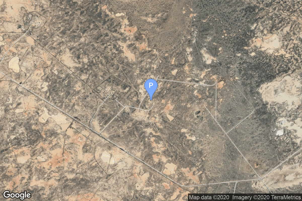
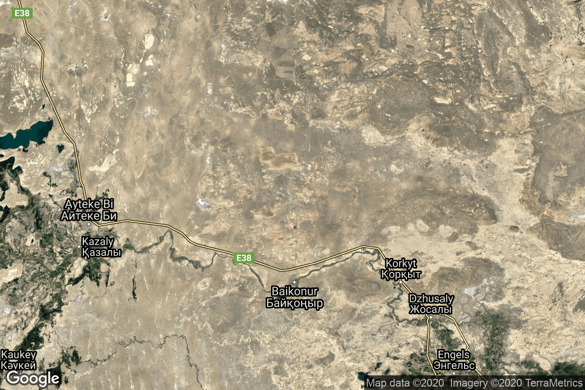
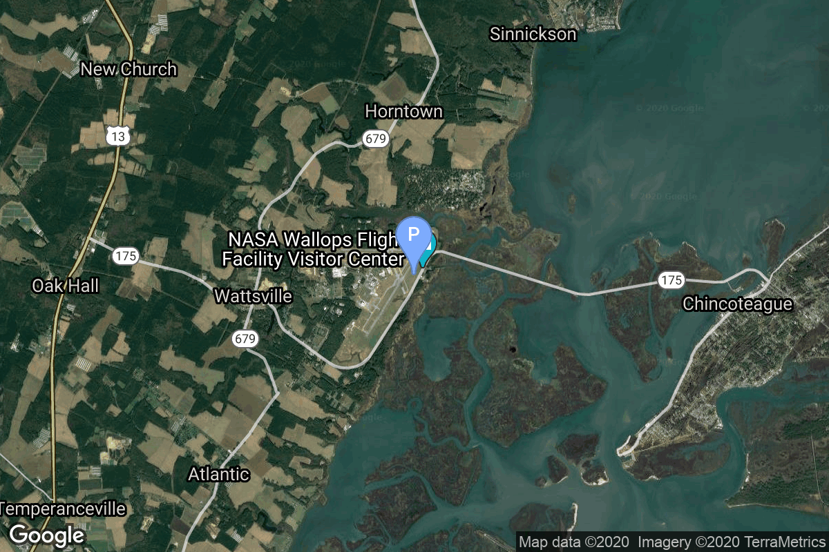
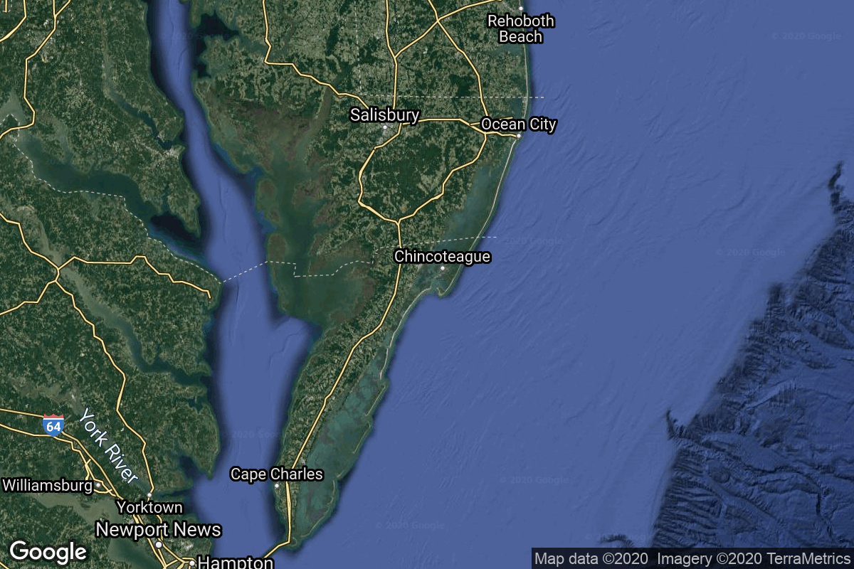
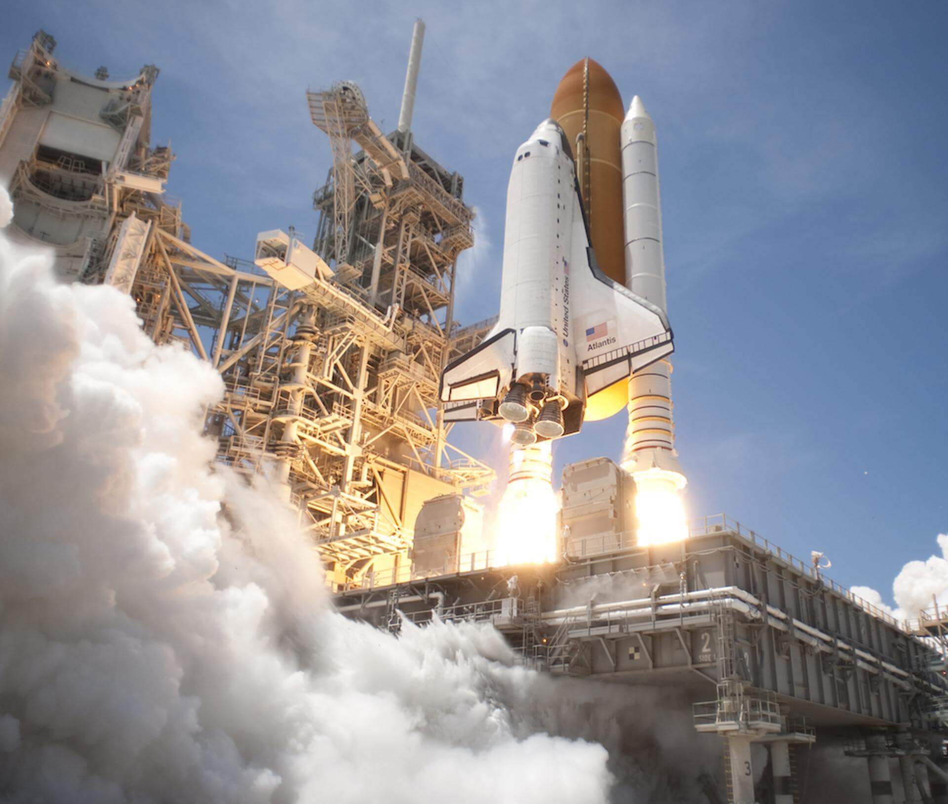
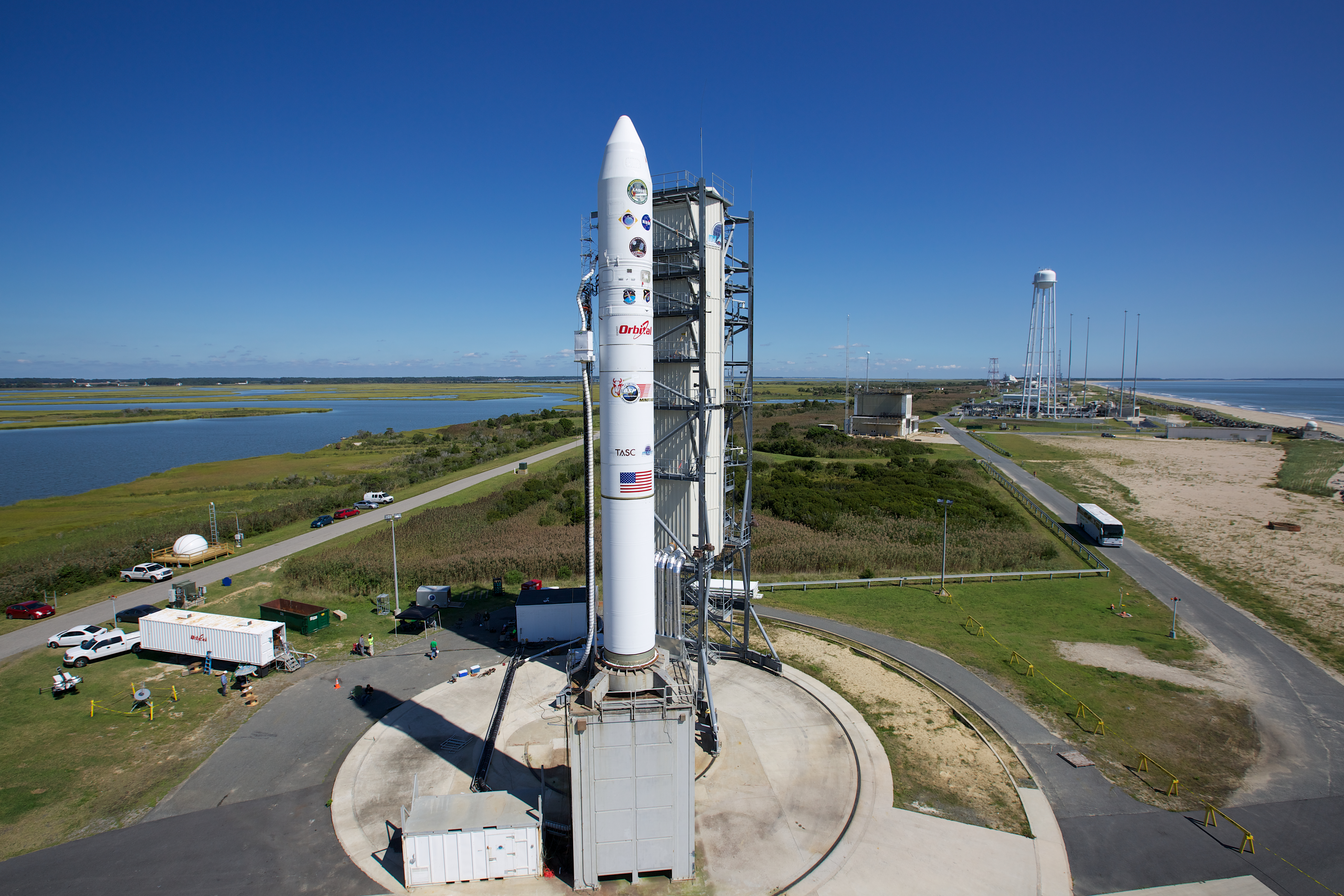
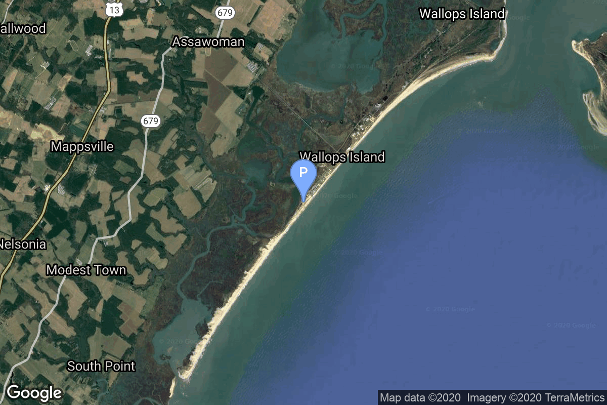
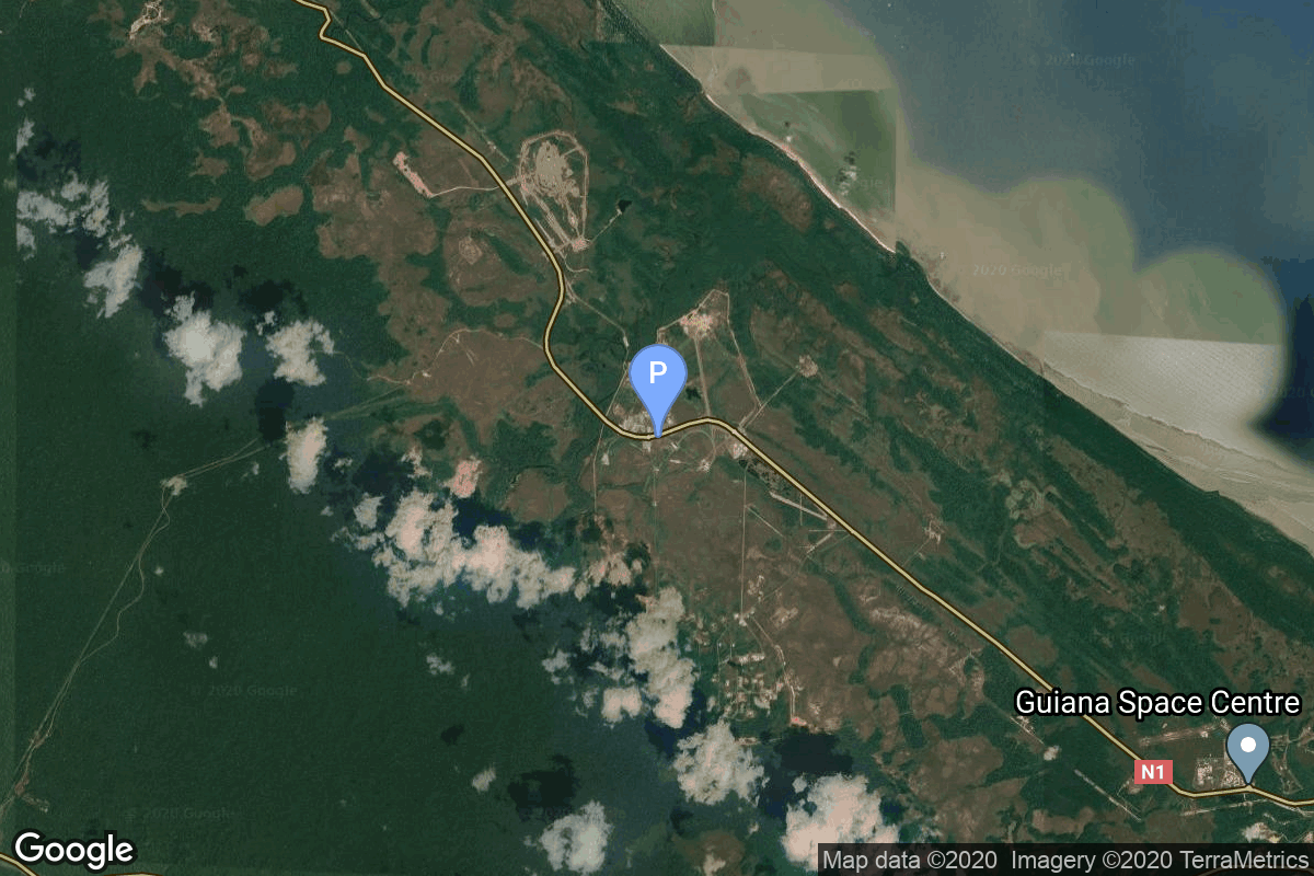
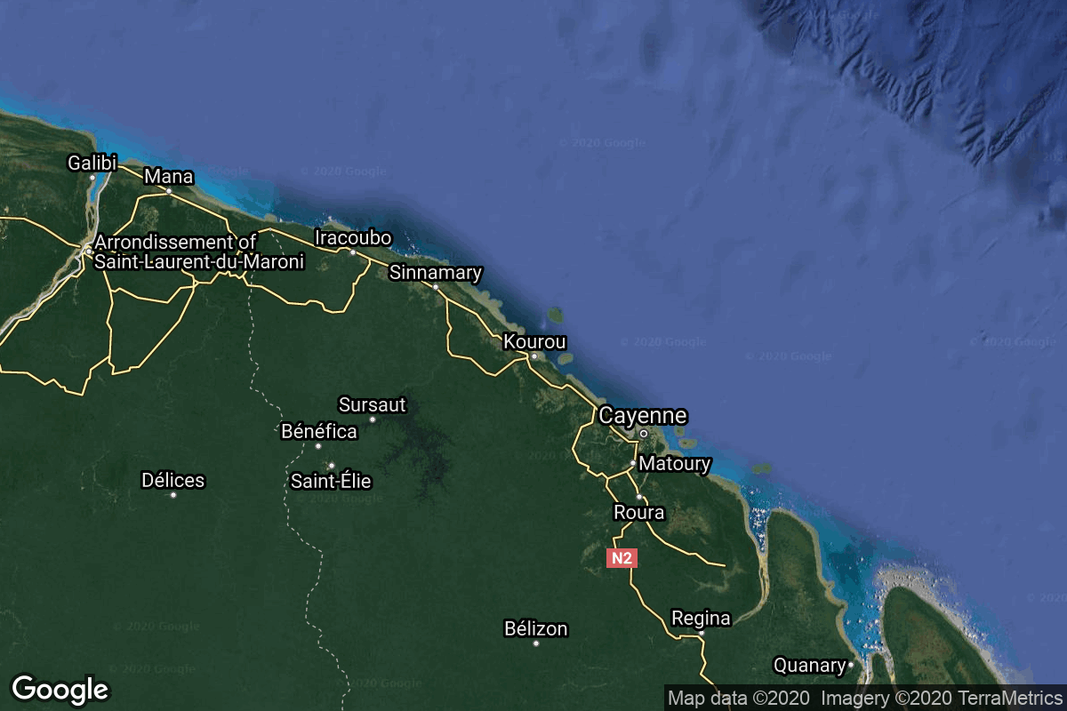
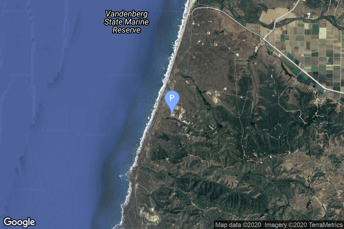
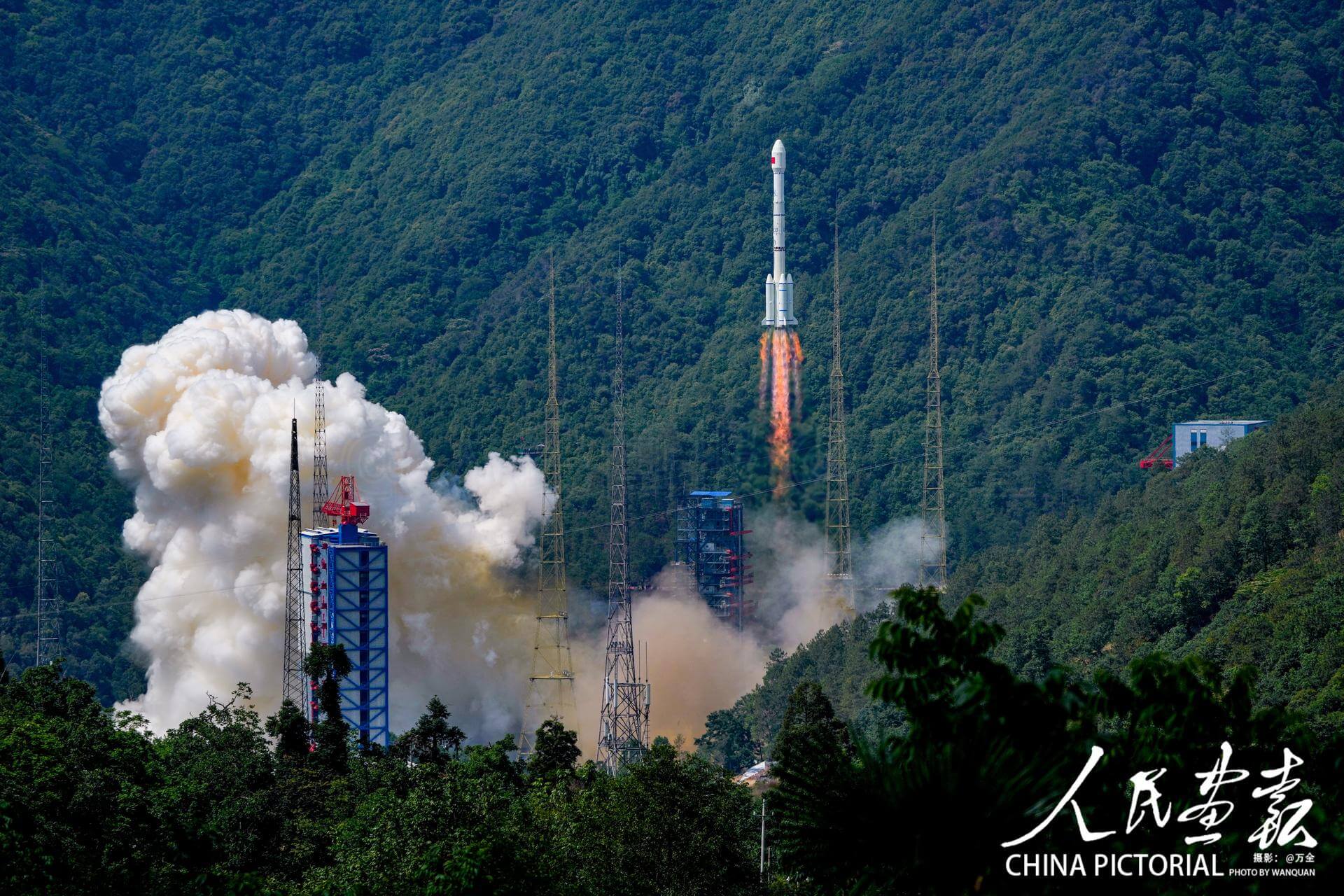
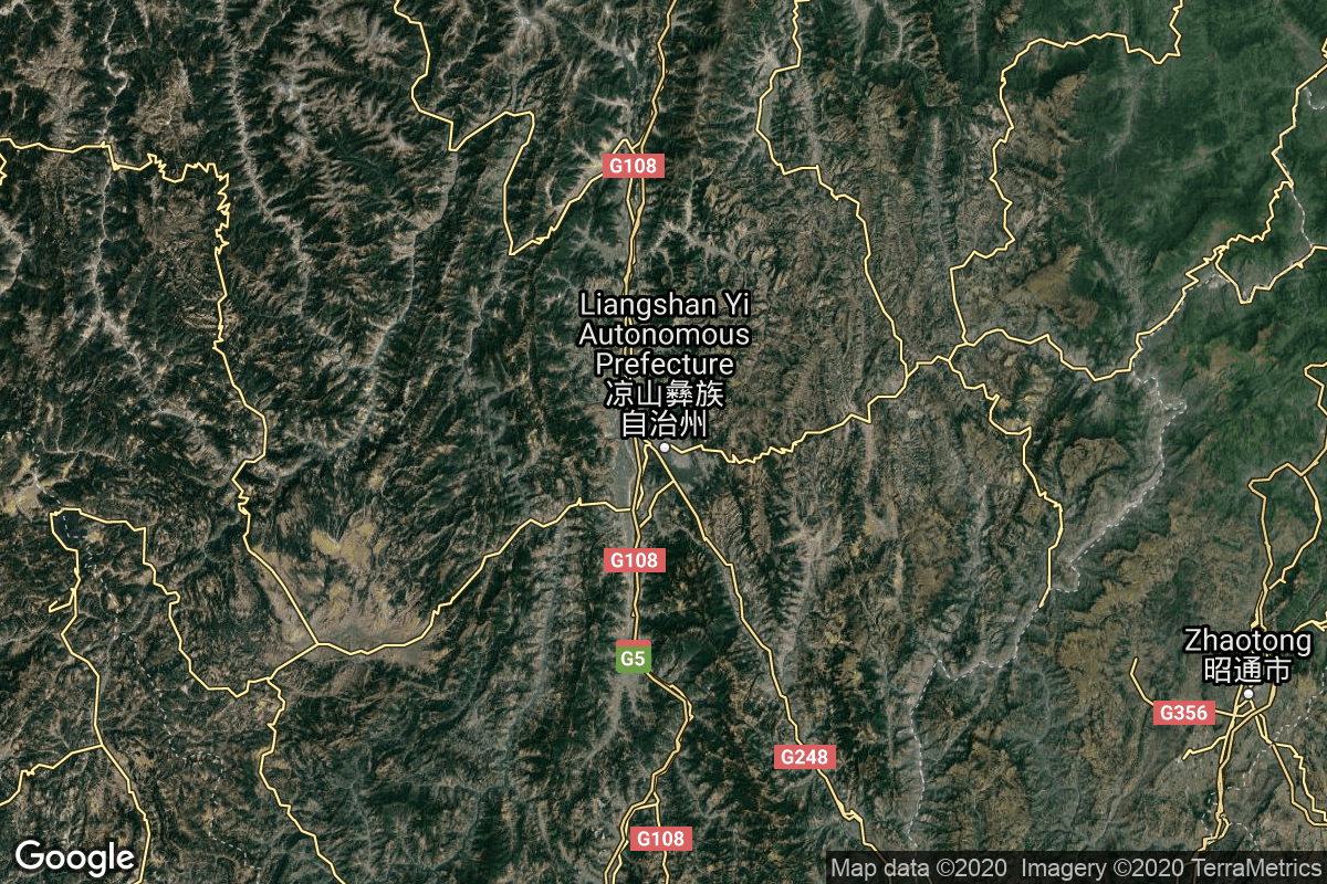
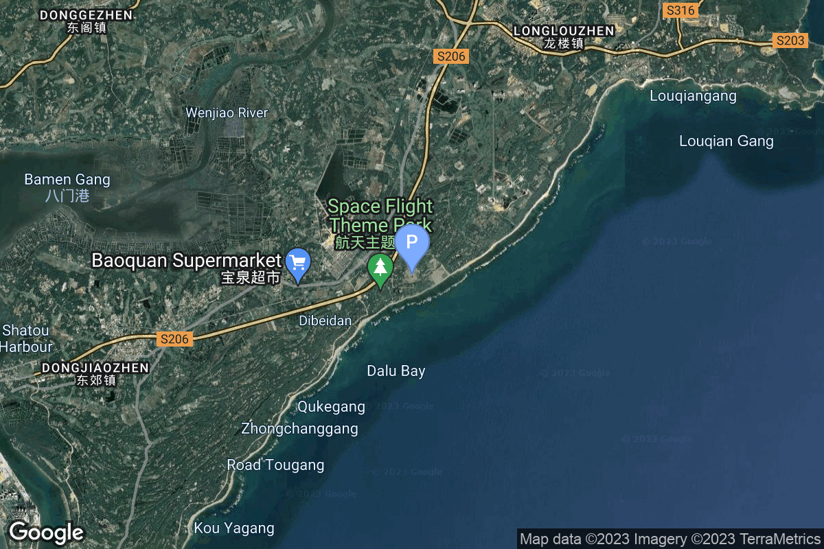
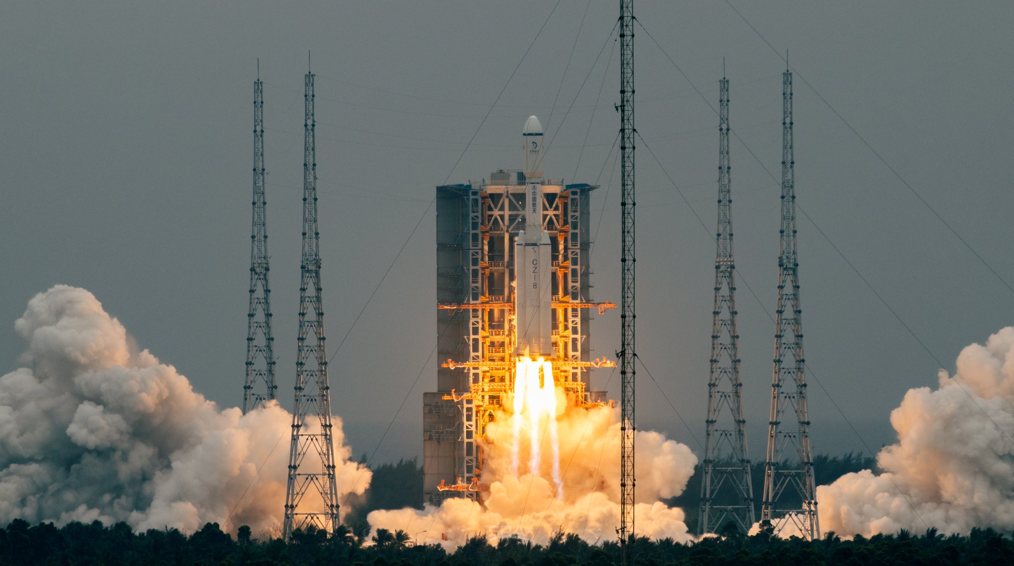
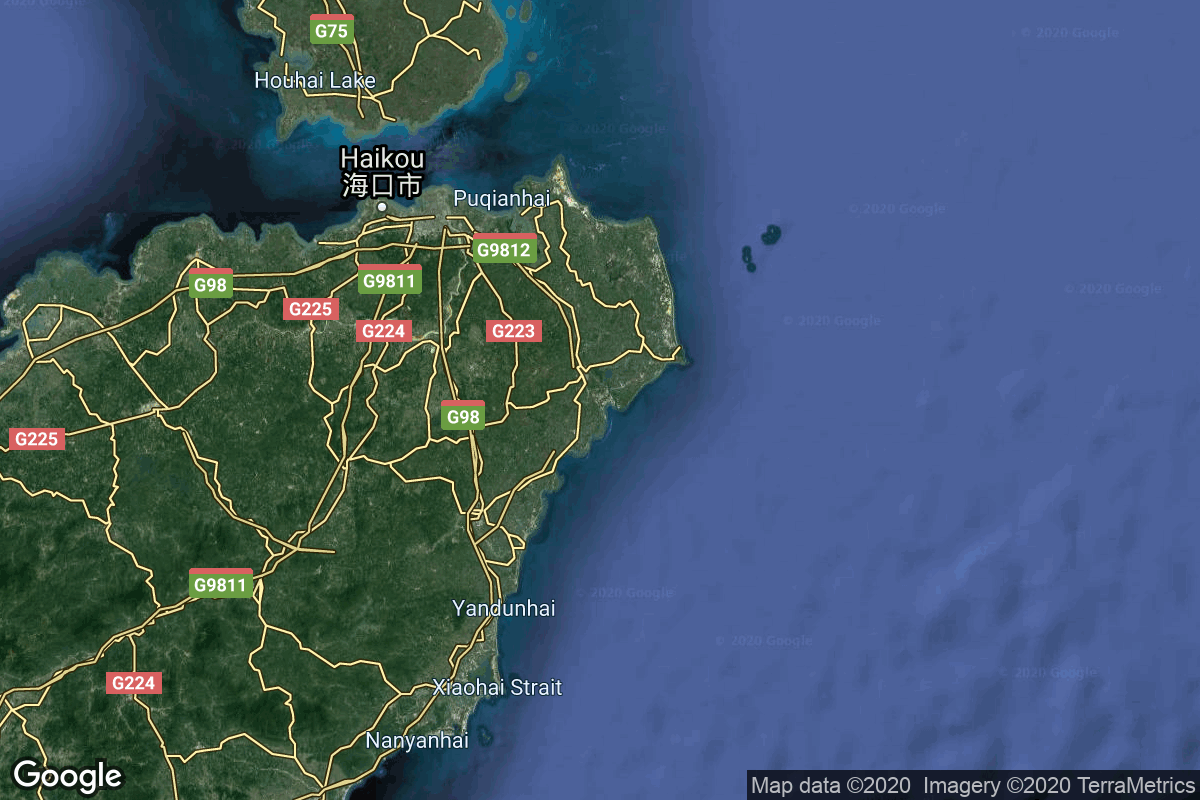
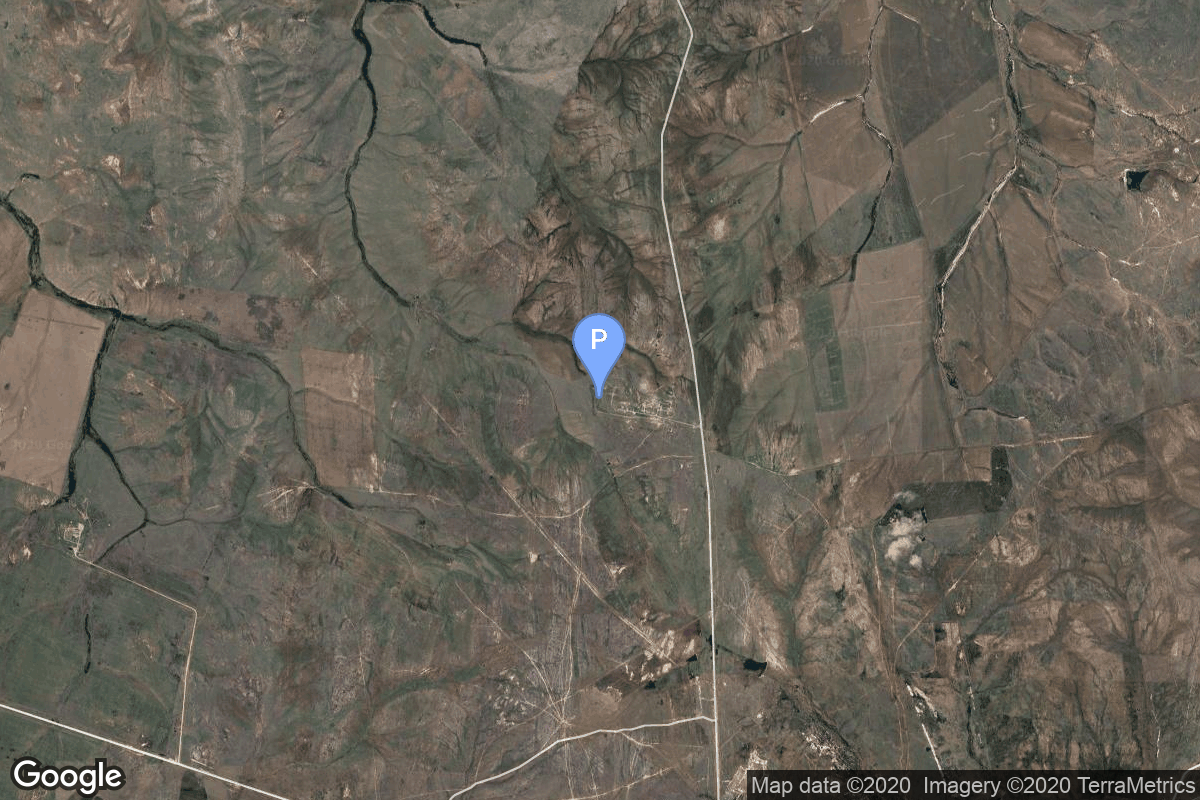
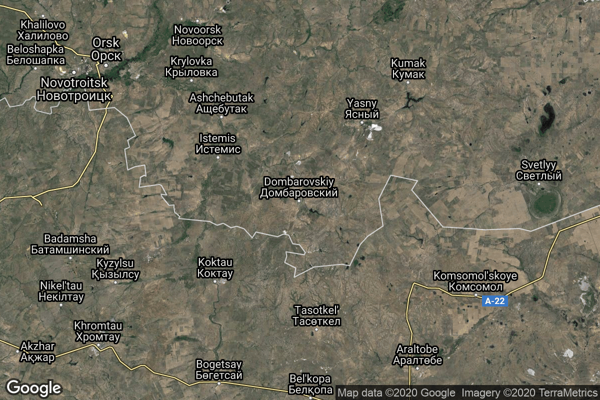
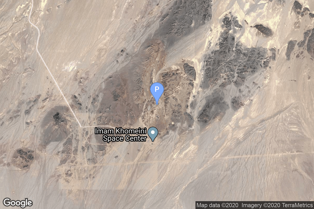
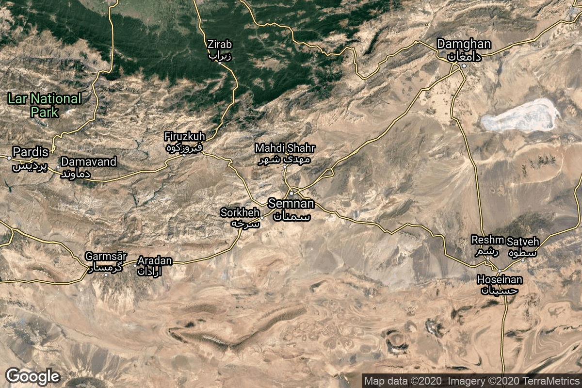
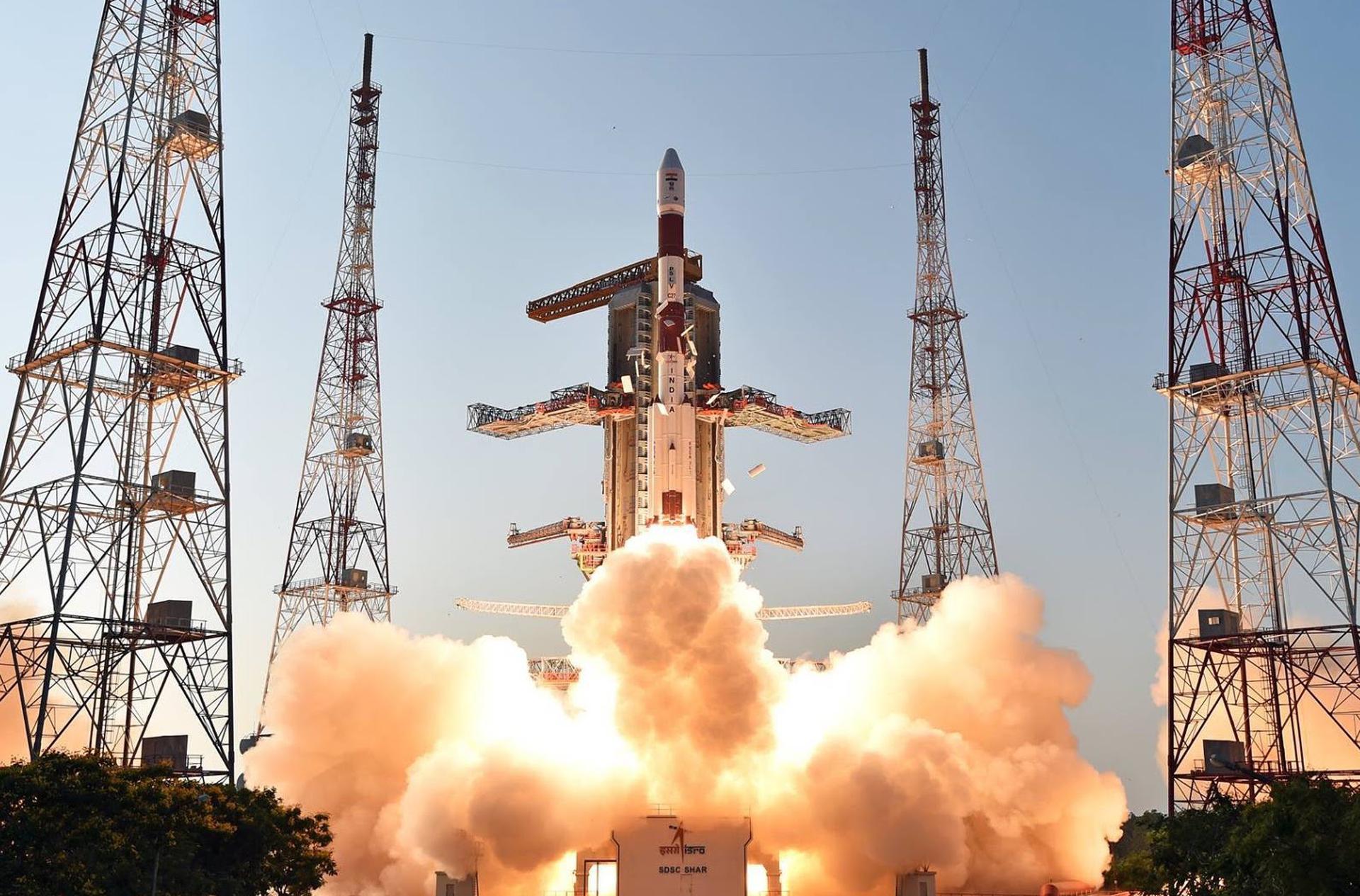
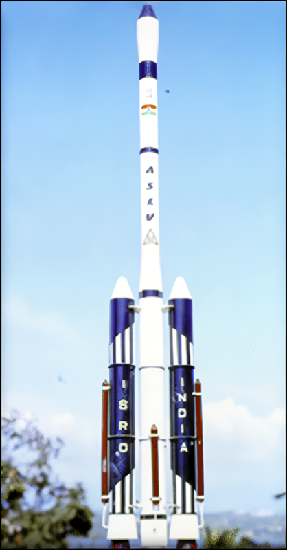
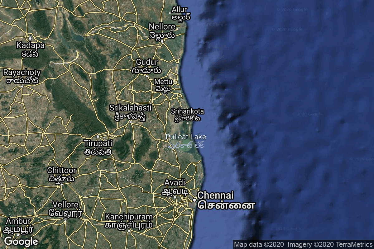
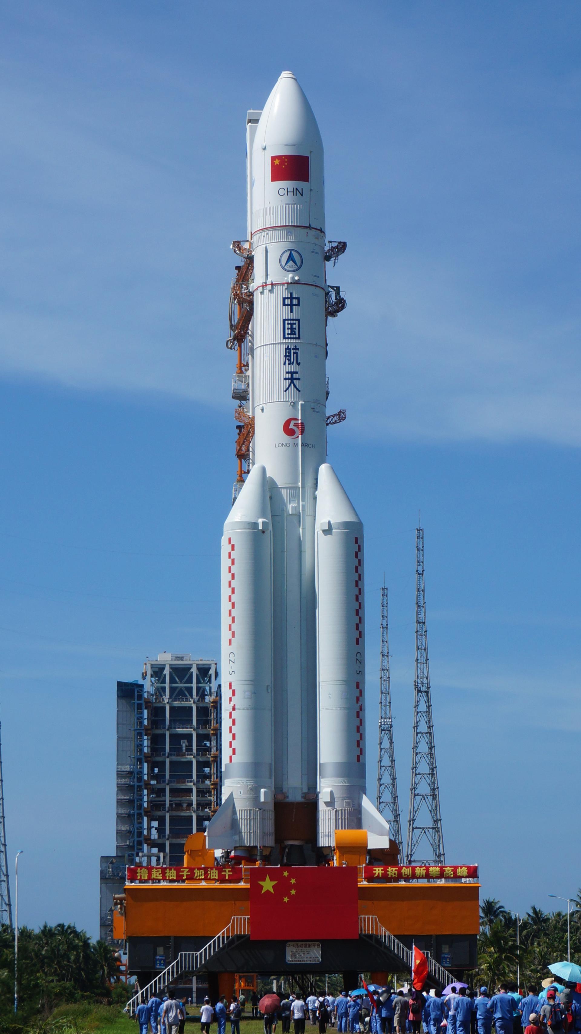
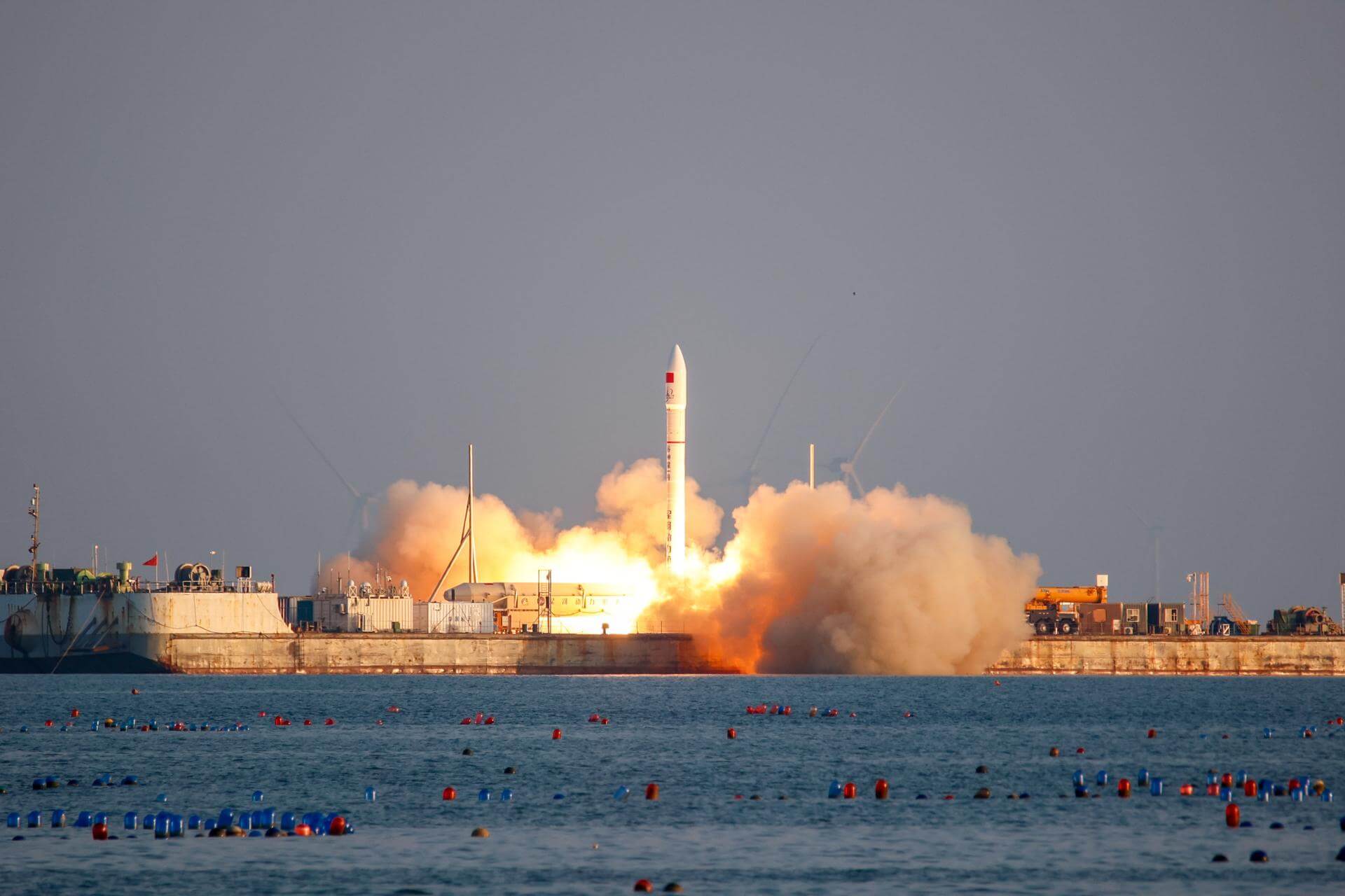
{ "count": 245, "next": "https://lldev.thespacedevs.com/2.3.0/pads/?format=api&limit=10&offset=150&ordering=total_launch_count", "previous": "https://lldev.thespacedevs.com/2.3.0/pads/?format=api&limit=10&offset=130&ordering=total_launch_count", "results": [ { "id": 160, "url": "https://lldev.thespacedevs.com/2.3.0/pads/160/?format=api", "active": true, "agencies": [], "name": "161/35", "image": null, "description": null, "info_url": null, "wiki_url": "https://en.wikipedia.org/wiki/Baikonur_Cosmodrome", "map_url": "https://www.google.com/maps?q=46.034,63.060806", "latitude": 46.034, "longitude": 63.060806, "country": { "id": 44, "name": "Kazakhstan", "alpha_2_code": "KZ", "alpha_3_code": "KAZ", "nationality_name": "Kazakh", "nationality_name_composed": "Kazakhstani" }, "map_image": "https://thespacedevs-dev.nyc3.digitaloceanspaces.com/media/map_images/pad_160_20200803143414.jpg", "total_launch_count": 7, "orbital_launch_attempt_count": 7, "fastest_turnaround": "P28DT22H44M58S", "location": { "response_mode": "normal", "id": 15, "url": "https://lldev.thespacedevs.com/2.3.0/locations/15/?format=api", "name": "Baikonur Cosmodrome, Republic of Kazakhstan", "celestial_body": { "response_mode": "normal", "id": 1, "name": "Earth", "type": { "id": 1, "name": "Planet" }, "diameter": 12742000.0, "mass": 5.972168e+24, "gravity": 9.80655, "length_of_day": "1 00:00:00", "atmosphere": true, "image": { "id": 2040, "name": "Earth (Apollo 17)", "image_url": "https://thespacedevs-dev.nyc3.digitaloceanspaces.com/media/images/earth_2528apol_image_20240402194304.jpeg", "thumbnail_url": "https://thespacedevs-dev.nyc3.digitaloceanspaces.com/media/images/earth_2528apol_image_thumbnail_20240402194305.jpeg", "credit": "NASA", "license": { "id": 4, "name": "NASA Image and Media Guidelines", "priority": 0, "link": "https://www.nasa.gov/nasa-brand-center/images-and-media/" }, "single_use": true, "variants": [] }, "description": "Earth is the third planet from the Sun and the only astronomical object known to harbor life.", "wiki_url": "https://en.wikipedia.org/wiki/Earth", "total_attempted_launches": 7470, "successful_launches": 6915, "failed_launches": 555, "total_attempted_landings": 1288, "successful_landings": 1241, "failed_landings": 47 }, "active": true, "country": { "id": 44, "name": "Kazakhstan", "alpha_2_code": "KZ", "alpha_3_code": "KAZ", "nationality_name": "Kazakh", "nationality_name_composed": "Kazakhstani" }, "description": "The Baikonur Cosmodrome is a spaceport operated by Russia within Kazakhstan. Located in the Kazakh city of Baikonur, it is the largest operational space launch facility in terms of area. All Russian crewed spaceflights are launched from Baikonur.", "image": { "id": 2198, "name": "Soyuz launch pad at the Baikonur Cosmodrome", "image_url": "https://thespacedevs-dev.nyc3.digitaloceanspaces.com/media/images/soyuz_launch_pa_image_20240918150530.jpg", "thumbnail_url": "https://thespacedevs-dev.nyc3.digitaloceanspaces.com/media/images/soyuz_launch_pa_image_thumbnail_20240918150530.jpeg", "credit": "NASA/Bill Ingalls", "license": { "id": 4, "name": "NASA Image and Media Guidelines", "priority": 0, "link": "https://www.nasa.gov/nasa-brand-center/images-and-media/" }, "single_use": true, "variants": [] }, "map_image": "https://thespacedevs-dev.nyc3.digitaloceanspaces.com/media/map_images/location_15_20200803142517.jpg", "longitude": 63.305, "latitude": 45.965, "timezone_name": "Asia/Qyzylorda", "total_launch_count": 1561, "total_landing_count": 0 } }, { "id": 177, "url": "https://lldev.thespacedevs.com/2.3.0/pads/177/?format=api", "active": true, "agencies": [], "name": "Unknown Pad", "image": null, "description": null, "info_url": null, "wiki_url": "https://en.wikipedia.org/wiki/Wallops_Flight_Facility", "map_url": "https://www.google.com/maps?q=37.9386111,-75.4594162", "latitude": 37.9386111, "longitude": -75.4594162, "country": { "id": 2, "name": "United States of America", "alpha_2_code": "US", "alpha_3_code": "USA", "nationality_name": "American", "nationality_name_composed": "Americano" }, "map_image": "https://thespacedevs-dev.nyc3.digitaloceanspaces.com/media/map_images/pad_177_20200803143406.jpg", "total_launch_count": 8, "orbital_launch_attempt_count": 0, "fastest_turnaround": "P150DT3H55M", "location": { "response_mode": "normal", "id": 21, "url": "https://lldev.thespacedevs.com/2.3.0/locations/21/?format=api", "name": "Wallops Flight Facility, Virginia, USA", "celestial_body": { "response_mode": "normal", "id": 1, "name": "Earth", "type": { "id": 1, "name": "Planet" }, "diameter": 12742000.0, "mass": 5.972168e+24, "gravity": 9.80655, "length_of_day": "1 00:00:00", "atmosphere": true, "image": { "id": 2040, "name": "Earth (Apollo 17)", "image_url": "https://thespacedevs-dev.nyc3.digitaloceanspaces.com/media/images/earth_2528apol_image_20240402194304.jpeg", "thumbnail_url": "https://thespacedevs-dev.nyc3.digitaloceanspaces.com/media/images/earth_2528apol_image_thumbnail_20240402194305.jpeg", "credit": "NASA", "license": { "id": 4, "name": "NASA Image and Media Guidelines", "priority": 0, "link": "https://www.nasa.gov/nasa-brand-center/images-and-media/" }, "single_use": true, "variants": [] }, "description": "Earth is the third planet from the Sun and the only astronomical object known to harbor life.", "wiki_url": "https://en.wikipedia.org/wiki/Earth", "total_attempted_launches": 7470, "successful_launches": 6915, "failed_launches": 555, "total_attempted_landings": 1288, "successful_landings": 1241, "failed_landings": 47 }, "active": true, "country": { "id": 2, "name": "United States of America", "alpha_2_code": "US", "alpha_3_code": "USA", "nationality_name": "American", "nationality_name_composed": "Americano" }, "description": "Wallops Flight Facility is a rocket launch site on Wallops Island on the Eastern Shore of Virginia, United States, just east of the Delmarva Peninsula and north-northeast of Norfolk. The facility is operated by the Goddard Space Flight Center in Greenbelt, Maryland, and primarily serves to support science and exploration missions for NASA and other federal agencies. WFF includes an extensively instrumented range to support launches of more than a dozen types of sounding rockets; small expendable suborbital and orbital rockets; high-altitude balloon flights carrying scientific instruments for atmospheric and astronomical research; and, using its Research Airport, flight tests of aeronautical research aircraft, including uncrewed aerial vehicles.", "image": { "id": 2227, "name": "Wallops Flight Facility", "image_url": "https://thespacedevs-dev.nyc3.digitaloceanspaces.com/media/images/wallops_flight__image_20240920083715.jpg", "thumbnail_url": "https://thespacedevs-dev.nyc3.digitaloceanspaces.com/media/images/wallops_flight__image_thumbnail_20240920083715.jpeg", "credit": "NASA", "license": { "id": 4, "name": "NASA Image and Media Guidelines", "priority": 0, "link": "https://www.nasa.gov/nasa-brand-center/images-and-media/" }, "single_use": true, "variants": [] }, "map_image": "https://thespacedevs-dev.nyc3.digitaloceanspaces.com/media/map_images/location_21_20200803142423.jpg", "longitude": -75.467778, "latitude": 37.933333, "timezone_name": "America/New_York", "total_launch_count": 85, "total_landing_count": 0 } }, { "id": 56, "url": "https://lldev.thespacedevs.com/2.3.0/pads/56/?format=api", "active": true, "agencies": [ { "response_mode": "normal", "id": 44, "url": "https://lldev.thespacedevs.com/2.3.0/agencies/44/?format=api", "name": "National Aeronautics and Space Administration", "abbrev": "NASA", "type": { "id": 1, "name": "Government" }, "featured": true, "country": [ { "id": 2, "name": "United States of America", "alpha_2_code": "US", "alpha_3_code": "USA", "nationality_name": "American", "nationality_name_composed": "Americano" } ], "description": "The National Aeronautics and Space Administration is an independent agency of the executive branch of the United States federal government responsible for the civilian space program, as well as aeronautics and aerospace research. NASA have many launch facilities but most are inactive. The most commonly used pad will be LC-39B at Kennedy Space Center in Florida.", "administrator": "Administrator: Jared Isaacman", "founding_year": 1958, "launchers": "Space Shuttle | SLS", "spacecraft": "Orion", "parent": null, "image": { "id": 19, "name": "[AUTO] National Aeronautics and Space Administration - image", "image_url": "https://thespacedevs-dev.nyc3.digitaloceanspaces.com/media/images/national2520aeronautics2520and2520space2520administration_image_20190207032448.jpeg", "thumbnail_url": "https://thespacedevs-dev.nyc3.digitaloceanspaces.com/media/images/255bauto255d__image_thumbnail_20240305184631.jpeg", "credit": null, "license": { "id": 1, "name": "Unknown", "priority": 9, "link": null }, "single_use": true, "variants": [] }, "logo": { "id": 161, "name": "[AUTO] National Aeronautics and Space Administration - logo", "image_url": "https://thespacedevs-dev.nyc3.digitaloceanspaces.com/media/images/national2520aeronautics2520and2520space2520administration_logo_20190207032448.png", "thumbnail_url": "https://thespacedevs-dev.nyc3.digitaloceanspaces.com/media/images/255bauto255d__image_thumbnail_20240305185043.png", "credit": null, "license": { "id": 1, "name": "Unknown", "priority": 9, "link": null }, "single_use": true, "variants": [] }, "social_logo": { "id": 76, "name": "[AUTO] National Aeronautics and Space Administration - social_logo", "image_url": "https://thespacedevs-dev.nyc3.digitaloceanspaces.com/media/images/national2520aeronautics2520and2520space2520administration_nation_20230803040809.jpg", "thumbnail_url": "https://thespacedevs-dev.nyc3.digitaloceanspaces.com/media/images/255bauto255d__image_thumbnail_20240305184823.jpeg", "credit": null, "license": { "id": 1, "name": "Unknown", "priority": 9, "link": null }, "single_use": true, "variants": [] } } ], "name": "Launch Area 0 B", "image": { "id": 1983, "name": "Pad-0B", "image_url": "https://thespacedevs-dev.nyc3.digitaloceanspaces.com/media/images/pad-0b_image_20240310200126.jpeg", "thumbnail_url": "https://thespacedevs-dev.nyc3.digitaloceanspaces.com/media/images/pad-0b_image_thumbnail_20240310200128.jpeg", "credit": "NASA/NASA Edge/Franklin Fitzgerald", "license": { "id": 4, "name": "NASA Image and Media Guidelines", "priority": 0, "link": "https://www.nasa.gov/nasa-brand-center/images-and-media/" }, "single_use": true, "variants": [] }, "description": "LP-0B became operational in 1999,and was subsequently upgraded in 2003 with the construction of a mobile service tower, which was completed in 2004. It is active, and is currently used by Northrop Grumman Minotaur rockets. The first launch from LP-0B was of a Minotaur I in December 2006, and was the first launch from the Mid-Atlantic Regional Spaceport.", "info_url": null, "wiki_url": "https://en.wikipedia.org/wiki/Mid-Atlantic_Regional_Spaceport_Launch_Pad_0#Pad-0B", "map_url": "https://www.google.com/maps?q=37.831,-75.4911", "latitude": 37.831, "longitude": -75.4911, "country": { "id": 2, "name": "United States of America", "alpha_2_code": "US", "alpha_3_code": "USA", "nationality_name": "American", "nationality_name_composed": "Americano" }, "map_image": "https://thespacedevs-dev.nyc3.digitaloceanspaces.com/media/map_images/pad_56_20200803143541.jpg", "total_launch_count": 8, "orbital_launch_attempt_count": 8, "fastest_turnaround": "P73DT21H48M", "location": { "response_mode": "normal", "id": 21, "url": "https://lldev.thespacedevs.com/2.3.0/locations/21/?format=api", "name": "Wallops Flight Facility, Virginia, USA", "celestial_body": { "response_mode": "normal", "id": 1, "name": "Earth", "type": { "id": 1, "name": "Planet" }, "diameter": 12742000.0, "mass": 5.972168e+24, "gravity": 9.80655, "length_of_day": "1 00:00:00", "atmosphere": true, "image": { "id": 2040, "name": "Earth (Apollo 17)", "image_url": "https://thespacedevs-dev.nyc3.digitaloceanspaces.com/media/images/earth_2528apol_image_20240402194304.jpeg", "thumbnail_url": "https://thespacedevs-dev.nyc3.digitaloceanspaces.com/media/images/earth_2528apol_image_thumbnail_20240402194305.jpeg", "credit": "NASA", "license": { "id": 4, "name": "NASA Image and Media Guidelines", "priority": 0, "link": "https://www.nasa.gov/nasa-brand-center/images-and-media/" }, "single_use": true, "variants": [] }, "description": "Earth is the third planet from the Sun and the only astronomical object known to harbor life.", "wiki_url": "https://en.wikipedia.org/wiki/Earth", "total_attempted_launches": 7470, "successful_launches": 6915, "failed_launches": 555, "total_attempted_landings": 1288, "successful_landings": 1241, "failed_landings": 47 }, "active": true, "country": { "id": 2, "name": "United States of America", "alpha_2_code": "US", "alpha_3_code": "USA", "nationality_name": "American", "nationality_name_composed": "Americano" }, "description": "Wallops Flight Facility is a rocket launch site on Wallops Island on the Eastern Shore of Virginia, United States, just east of the Delmarva Peninsula and north-northeast of Norfolk. The facility is operated by the Goddard Space Flight Center in Greenbelt, Maryland, and primarily serves to support science and exploration missions for NASA and other federal agencies. WFF includes an extensively instrumented range to support launches of more than a dozen types of sounding rockets; small expendable suborbital and orbital rockets; high-altitude balloon flights carrying scientific instruments for atmospheric and astronomical research; and, using its Research Airport, flight tests of aeronautical research aircraft, including uncrewed aerial vehicles.", "image": { "id": 2227, "name": "Wallops Flight Facility", "image_url": "https://thespacedevs-dev.nyc3.digitaloceanspaces.com/media/images/wallops_flight__image_20240920083715.jpg", "thumbnail_url": "https://thespacedevs-dev.nyc3.digitaloceanspaces.com/media/images/wallops_flight__image_thumbnail_20240920083715.jpeg", "credit": "NASA", "license": { "id": 4, "name": "NASA Image and Media Guidelines", "priority": 0, "link": "https://www.nasa.gov/nasa-brand-center/images-and-media/" }, "single_use": true, "variants": [] }, "map_image": "https://thespacedevs-dev.nyc3.digitaloceanspaces.com/media/map_images/location_21_20200803142423.jpg", "longitude": -75.467778, "latitude": 37.933333, "timezone_name": "America/New_York", "total_launch_count": 85, "total_landing_count": 0 } }, { "id": 125, "url": "https://lldev.thespacedevs.com/2.3.0/pads/125/?format=api", "active": false, "agencies": [ { "response_mode": "normal", "id": 46, "url": "https://lldev.thespacedevs.com/2.3.0/agencies/46/?format=api", "name": "National Center of Space Research", "abbrev": "CNES", "type": { "id": 1, "name": "Government" }, "featured": false, "country": [ { "id": 1, "name": "France", "alpha_2_code": "FR", "alpha_3_code": "FRA", "nationality_name": "French", "nationality_name_composed": "Franco" } ], "description": "The National Center of Space Research, or CNES, is a French National Agency in charge of France's space program. In partnership with the US and Russia, they have put 10 people in space. CNES works in tandem with the larger ESA to develop the Ariane 5 and work on other probes and satellites. They are working with Germany to develop a cheaper and more efficient reusable rocket, which hopefully will be ready to fly by 2026.", "administrator": "CEO: François Jacq", "founding_year": 1961, "launchers": "Ariane 5", "spacecraft": "Mars/Venus Express | Rosetta", "parent": null, "image": { "id": 2425, "name": "CNES Toulouse entrance", "image_url": "https://thespacedevs-dev.nyc3.digitaloceanspaces.com/media/images/cnes_toulouse_e_image_20250722090314.jpg", "thumbnail_url": "https://thespacedevs-dev.nyc3.digitaloceanspaces.com/media/images/cnes_toulouse_e_image_thumbnail_20250722090314.jpeg", "credit": "CNES", "license": { "id": 26, "name": "CNES Image Use Policy", "priority": 2, "link": "https://phototheque.cnes.fr/cnes/info2.do" }, "single_use": true, "variants": [] }, "logo": { "id": 2426, "name": "CNES logo", "image_url": "https://thespacedevs-dev.nyc3.digitaloceanspaces.com/media/images/cnes_logo_image_20250722090832.png", "thumbnail_url": "https://thespacedevs-dev.nyc3.digitaloceanspaces.com/media/images/cnes_logo_image_thumbnail_20250722090832.png", "credit": "CNES", "license": { "id": 26, "name": "CNES Image Use Policy", "priority": 2, "link": "https://phototheque.cnes.fr/cnes/info2.do" }, "single_use": true, "variants": [ { "id": 17, "type": { "id": 1, "name": "transparent for light background" }, "image_url": "https://thespacedevs-dev.nyc3.digitaloceanspaces.com/media/image_variants/logo_cnes_2017__image_20250722090832.png" }, { "id": 18, "type": { "id": 2, "name": "transparent for dark background" }, "image_url": "https://thespacedevs-dev.nyc3.digitaloceanspaces.com/media/image_variants/logo_cnes_2017__image_20250722090832.png" } ] }, "social_logo": { "id": 2427, "name": "CNES social logo", "image_url": "https://thespacedevs-dev.nyc3.digitaloceanspaces.com/media/images/cnes_social_log_image_20250722090952.jpg", "thumbnail_url": "https://thespacedevs-dev.nyc3.digitaloceanspaces.com/media/images/cnes_social_log_image_thumbnail_20250722090953.jpeg", "credit": "CNES", "license": { "id": 26, "name": "CNES Image Use Policy", "priority": 2, "link": "https://phototheque.cnes.fr/cnes/info2.do" }, "single_use": true, "variants": [] } } ], "name": "Diamant Launch Area", "image": { "id": 2477, "name": "ELM Diamant render", "image_url": "https://thespacedevs-dev.nyc3.digitaloceanspaces.com/media/images/elm_diamant_ren_image_20250916111400.webp", "thumbnail_url": "https://thespacedevs-dev.nyc3.digitaloceanspaces.com/media/images/elm_diamant_ren_image_thumbnail_20250916111400.jpeg", "credit": "CNES/L'Œil du Chat", "license": { "id": 26, "name": "CNES Image Use Policy", "priority": 2, "link": "https://phototheque.cnes.fr/cnes/info2.do" }, "single_use": false, "variants": [] }, "description": "", "info_url": null, "wiki_url": null, "map_url": "https://www.google.com/maps?q=5.2222222,-52.7758051", "latitude": 5.2222222, "longitude": -52.7758051, "country": { "id": 50, "name": "French Guiana", "alpha_2_code": "GF", "alpha_3_code": "GUF", "nationality_name": "French Guianan", "nationality_name_composed": "Franco-Guiano" }, "map_image": "https://thespacedevs-dev.nyc3.digitaloceanspaces.com/media/map_images/pad_125_20200803143236.jpg", "total_launch_count": 8, "orbital_launch_attempt_count": 8, "fastest_turnaround": "P99DT17H57M", "location": { "response_mode": "normal", "id": 13, "url": "https://lldev.thespacedevs.com/2.3.0/locations/13/?format=api", "name": "Guiana Space Centre, French Guiana", "celestial_body": { "response_mode": "normal", "id": 1, "name": "Earth", "type": { "id": 1, "name": "Planet" }, "diameter": 12742000.0, "mass": 5.972168e+24, "gravity": 9.80655, "length_of_day": "1 00:00:00", "atmosphere": true, "image": { "id": 2040, "name": "Earth (Apollo 17)", "image_url": "https://thespacedevs-dev.nyc3.digitaloceanspaces.com/media/images/earth_2528apol_image_20240402194304.jpeg", "thumbnail_url": "https://thespacedevs-dev.nyc3.digitaloceanspaces.com/media/images/earth_2528apol_image_thumbnail_20240402194305.jpeg", "credit": "NASA", "license": { "id": 4, "name": "NASA Image and Media Guidelines", "priority": 0, "link": "https://www.nasa.gov/nasa-brand-center/images-and-media/" }, "single_use": true, "variants": [] }, "description": "Earth is the third planet from the Sun and the only astronomical object known to harbor life.", "wiki_url": "https://en.wikipedia.org/wiki/Earth", "total_attempted_launches": 7470, "successful_launches": 6915, "failed_launches": 555, "total_attempted_landings": 1288, "successful_landings": 1241, "failed_landings": 47 }, "active": true, "country": { "id": 50, "name": "French Guiana", "alpha_2_code": "GF", "alpha_3_code": "GUF", "nationality_name": "French Guianan", "nationality_name_composed": "Franco-Guiano" }, "description": "The Guiana Space Centre is a European spaceport to the northwest of Kourou in French Guiana, a region of France in South America. Kourou is located at a latitude of 5°. In operation since 1968, it is a suitable location for a spaceport because of its equatorial location and open sea to the east.", "image": { "id": 2203, "name": "Vega & Ariane 5 pads at the Guiana Space Centre", "image_url": "https://thespacedevs-dev.nyc3.digitaloceanspaces.com/media/images/vega_2526_aria_image_20240918154413.jpg", "thumbnail_url": "https://thespacedevs-dev.nyc3.digitaloceanspaces.com/media/images/vega_2526_aria_image_thumbnail_20240918154414.jpeg", "credit": "ESA/S. Corvaja", "license": { "id": 2, "name": "ESA Standard Licence", "priority": 2, "link": "https://www.esa.int/ESA_Multimedia/Terms_and_conditions_of_use_of_images_and_videos_available_on_the_esa_website" }, "single_use": true, "variants": [] }, "map_image": "https://thespacedevs-dev.nyc3.digitaloceanspaces.com/media/map_images/location_13_20200803142412.jpg", "longitude": -52.6903, "latitude": 5.169, "timezone_name": "America/Cayenne", "total_launch_count": 331, "total_landing_count": 0 } }, { "id": 157, "url": "https://lldev.thespacedevs.com/2.3.0/pads/157/?format=api", "active": true, "agencies": [], "name": "Mobile Launcher Pad", "image": null, "description": null, "info_url": null, "wiki_url": "https://en.wikipedia.org/wiki/Xichang_Satellite_Launch_Center", "map_url": "https://www.google.com/maps?q=28.242774,102.032944", "latitude": 28.242774, "longitude": 102.032944, "country": { "id": 6, "name": "China", "alpha_2_code": "CN", "alpha_3_code": "CHN", "nationality_name": "Chinese", "nationality_name_composed": "Sino" }, "map_image": "https://thespacedevs-dev.nyc3.digitaloceanspaces.com/media/map_images/pad_157_20200803143359.jpg", "total_launch_count": 8, "orbital_launch_attempt_count": 8, "fastest_turnaround": "P74DT19H3M", "location": { "response_mode": "normal", "id": 16, "url": "https://lldev.thespacedevs.com/2.3.0/locations/16/?format=api", "name": "Xichang Satellite Launch Center, People's Republic of China", "celestial_body": { "response_mode": "normal", "id": 1, "name": "Earth", "type": { "id": 1, "name": "Planet" }, "diameter": 12742000.0, "mass": 5.972168e+24, "gravity": 9.80655, "length_of_day": "1 00:00:00", "atmosphere": true, "image": { "id": 2040, "name": "Earth (Apollo 17)", "image_url": "https://thespacedevs-dev.nyc3.digitaloceanspaces.com/media/images/earth_2528apol_image_20240402194304.jpeg", "thumbnail_url": "https://thespacedevs-dev.nyc3.digitaloceanspaces.com/media/images/earth_2528apol_image_thumbnail_20240402194305.jpeg", "credit": "NASA", "license": { "id": 4, "name": "NASA Image and Media Guidelines", "priority": 0, "link": "https://www.nasa.gov/nasa-brand-center/images-and-media/" }, "single_use": true, "variants": [] }, "description": "Earth is the third planet from the Sun and the only astronomical object known to harbor life.", "wiki_url": "https://en.wikipedia.org/wiki/Earth", "total_attempted_launches": 7470, "successful_launches": 6915, "failed_launches": 555, "total_attempted_landings": 1288, "successful_landings": 1241, "failed_landings": 47 }, "active": true, "country": { "id": 6, "name": "China", "alpha_2_code": "CN", "alpha_3_code": "CHN", "nationality_name": "Chinese", "nationality_name_composed": "Sino" }, "description": "The Xichang Satellite Launch Center is a spaceport in China. It is located in Zeyuan Town, northwest of Xichang, Liangshan Yi Autonomous Prefecture in Sichuan.", "image": { "id": 1421, "name": "Long March 3B/E liftoff from LC-2 (Beidou-3 G4)", "image_url": "https://thespacedevs-dev.nyc3.digitaloceanspaces.com/media/images/long2520march_image_20230728061656.jpeg", "thumbnail_url": "https://thespacedevs-dev.nyc3.digitaloceanspaces.com/media/images/255bauto255d__image_thumbnail_20240305192718.jpeg", "credit": "China Pictorial/Wanquan", "license": { "id": 1, "name": "Unknown", "priority": 9, "link": null }, "single_use": false, "variants": [] }, "map_image": "https://thespacedevs-dev.nyc3.digitaloceanspaces.com/media/map_images/location_16_20200803142513.jpg", "longitude": 102.026556, "latitude": 28.246017, "timezone_name": "Asia/Shanghai", "total_launch_count": 238, "total_landing_count": 0 } }, { "id": 218, "url": "https://lldev.thespacedevs.com/2.3.0/pads/218/?format=api", "active": true, "agencies": [], "name": "Commercial LC-1", "image": null, "description": "", "info_url": null, "wiki_url": "https://en.wikipedia.org/wiki/Wenchang_Commercial_Space_Launch_Site", "map_url": "https://www.google.com/maps?q=19.597275,110.930753", "latitude": 19.597275, "longitude": 110.930753, "country": { "id": 6, "name": "China", "alpha_2_code": "CN", "alpha_3_code": "CHN", "nationality_name": "Chinese", "nationality_name_composed": "Sino" }, "map_image": "https://thespacedevs-dev.nyc3.digitaloceanspaces.com/media/map_images/pad_commercial_lc-1_20231225074041.jpg", "total_launch_count": 8, "orbital_launch_attempt_count": 8, "fastest_turnaround": "P18DT15H59M", "location": { "response_mode": "normal", "id": 8, "url": "https://lldev.thespacedevs.com/2.3.0/locations/8/?format=api", "name": "Wenchang Space Launch Site, People's Republic of China", "celestial_body": { "response_mode": "normal", "id": 1, "name": "Earth", "type": { "id": 1, "name": "Planet" }, "diameter": 12742000.0, "mass": 5.972168e+24, "gravity": 9.80655, "length_of_day": "1 00:00:00", "atmosphere": true, "image": { "id": 2040, "name": "Earth (Apollo 17)", "image_url": "https://thespacedevs-dev.nyc3.digitaloceanspaces.com/media/images/earth_2528apol_image_20240402194304.jpeg", "thumbnail_url": "https://thespacedevs-dev.nyc3.digitaloceanspaces.com/media/images/earth_2528apol_image_thumbnail_20240402194305.jpeg", "credit": "NASA", "license": { "id": 4, "name": "NASA Image and Media Guidelines", "priority": 0, "link": "https://www.nasa.gov/nasa-brand-center/images-and-media/" }, "single_use": true, "variants": [] }, "description": "Earth is the third planet from the Sun and the only astronomical object known to harbor life.", "wiki_url": "https://en.wikipedia.org/wiki/Earth", "total_attempted_launches": 7470, "successful_launches": 6915, "failed_launches": 555, "total_attempted_landings": 1288, "successful_landings": 1241, "failed_landings": 47 }, "active": true, "country": { "id": 6, "name": "China", "alpha_2_code": "CN", "alpha_3_code": "CHN", "nationality_name": "Chinese", "nationality_name_composed": "Sino" }, "description": "The Wenchang Space Launch Site is a rocket launch site located in Wenchang on the island of Hainan, in China.\r\n\r\nFormally a suborbital test center, it currently serves as China's southernmost spaceport. The site was selected for its low latitude, 19° north of the equator, allowing for larger payloads to be launched. It is capable of launching the Long March 5, the heaviest Chinese rocket. Unlike launch facilities on the mainland, Wenchang uses its seaport for deliveries.", "image": { "id": 2019, "name": "CZ-8 liftoff from pad 201 (Queqiao-2)", "image_url": "https://thespacedevs-dev.nyc3.digitaloceanspaces.com/media/images/cz-8_liftoff_2_image_20240320175819.jpeg", "thumbnail_url": "https://thespacedevs-dev.nyc3.digitaloceanspaces.com/media/images/cz-8_liftoff_2_image_thumbnail_20240320175820.jpeg", "credit": "秦英健/Qin Yingjian", "license": { "id": 1, "name": "Unknown", "priority": 9, "link": null }, "single_use": false, "variants": [] }, "map_image": "https://thespacedevs-dev.nyc3.digitaloceanspaces.com/media/map_images/location_8_20200803142445.jpg", "longitude": 110.951133, "latitude": 19.614492, "timezone_name": "Asia/Shanghai", "total_launch_count": 58, "total_landing_count": 0 } }, { "id": 183, "url": "https://lldev.thespacedevs.com/2.3.0/pads/183/?format=api", "active": true, "agencies": [], "name": "370/13", "image": null, "description": null, "info_url": null, "wiki_url": "https://en.wikipedia.org/wiki/Dombarovsky_Air_Base", "map_url": "https://www.google.com/maps?q=51.0938889,59.8400282", "latitude": 51.0938889, "longitude": 59.8400282, "country": { "id": 5, "name": "Russia", "alpha_2_code": "RU", "alpha_3_code": "RUS", "nationality_name": "Russian", "nationality_name_composed": "Russo" }, "map_image": "https://thespacedevs-dev.nyc3.digitaloceanspaces.com/media/map_images/pad_183_20200803143512.jpg", "total_launch_count": 8, "orbital_launch_attempt_count": 8, "fastest_turnaround": "P90DT16H30M58S", "location": { "response_mode": "normal", "id": 5, "url": "https://lldev.thespacedevs.com/2.3.0/locations/5/?format=api", "name": "Dombarovskiy, Russian Federation", "celestial_body": { "response_mode": "normal", "id": 1, "name": "Earth", "type": { "id": 1, "name": "Planet" }, "diameter": 12742000.0, "mass": 5.972168e+24, "gravity": 9.80655, "length_of_day": "1 00:00:00", "atmosphere": true, "image": { "id": 2040, "name": "Earth (Apollo 17)", "image_url": "https://thespacedevs-dev.nyc3.digitaloceanspaces.com/media/images/earth_2528apol_image_20240402194304.jpeg", "thumbnail_url": "https://thespacedevs-dev.nyc3.digitaloceanspaces.com/media/images/earth_2528apol_image_thumbnail_20240402194305.jpeg", "credit": "NASA", "license": { "id": 4, "name": "NASA Image and Media Guidelines", "priority": 0, "link": "https://www.nasa.gov/nasa-brand-center/images-and-media/" }, "single_use": true, "variants": [] }, "description": "Earth is the third planet from the Sun and the only astronomical object known to harbor life.", "wiki_url": "https://en.wikipedia.org/wiki/Earth", "total_attempted_launches": 7470, "successful_launches": 6915, "failed_launches": 555, "total_attempted_landings": 1288, "successful_landings": 1241, "failed_landings": 47 }, "active": true, "country": { "id": 5, "name": "Russia", "alpha_2_code": "RU", "alpha_3_code": "RUS", "nationality_name": "Russian", "nationality_name_composed": "Russo" }, "description": "Dombarovsky is a military airbase near Yasny in Russia's Orenburg Oblast. Operated by the Soviet Air Defence Forces and later by the Russian Air Force, it hosted fighter interceptor squadrons and hosts an ICBM base (which has been adapted for commercial satellite launches) with a supporting helicopter base.", "image": { "id": 2201, "name": "Dnepr 1 liftoff (Prisma)", "image_url": "https://thespacedevs-dev.nyc3.digitaloceanspaces.com/media/images/dnepr_1_liftoff_image_20240918152530.jpg", "thumbnail_url": "https://thespacedevs-dev.nyc3.digitaloceanspaces.com/media/images/dnepr_1_liftoff_image_thumbnail_20240918152530.jpeg", "credit": "ISC Kosmotras", "license": { "id": 2, "name": "ESA Standard Licence", "priority": 2, "link": "https://www.esa.int/ESA_Multimedia/Terms_and_conditions_of_use_of_images_and_videos_available_on_the_esa_website" }, "single_use": true, "variants": [] }, "map_image": "https://thespacedevs-dev.nyc3.digitaloceanspaces.com/media/map_images/location_5_20200803142425.jpg", "longitude": 59.853333, "latitude": 51.048889, "timezone_name": "Asia/Yekaterinburg", "total_launch_count": 10, "total_landing_count": 0 } }, { "id": 58, "url": "https://lldev.thespacedevs.com/2.3.0/pads/58/?format=api", "active": true, "agencies": [], "name": "Safir Launch Pad", "image": null, "description": null, "info_url": null, "wiki_url": "https://en.wikipedia.org/wiki/Semnan_Space_Center#Circular_launch_platform", "map_url": "https://www.google.com/maps?q=35.23462,53.920936", "latitude": 35.23462, "longitude": 53.920936, "country": { "id": 32, "name": "Iran", "alpha_2_code": "IR", "alpha_3_code": "IRN", "nationality_name": "Iranian", "nationality_name_composed": "Irano" }, "map_image": "https://thespacedevs-dev.nyc3.digitaloceanspaces.com/media/map_images/pad_58_20200803143301.jpg", "total_launch_count": 8, "orbital_launch_attempt_count": 8, "fastest_turnaround": "P109DT23H56M", "location": { "response_mode": "normal", "id": 2, "url": "https://lldev.thespacedevs.com/2.3.0/locations/2/?format=api", "name": "Semnan Space Center, Islamic Republic of Iran", "celestial_body": { "response_mode": "normal", "id": 1, "name": "Earth", "type": { "id": 1, "name": "Planet" }, "diameter": 12742000.0, "mass": 5.972168e+24, "gravity": 9.80655, "length_of_day": "1 00:00:00", "atmosphere": true, "image": { "id": 2040, "name": "Earth (Apollo 17)", "image_url": "https://thespacedevs-dev.nyc3.digitaloceanspaces.com/media/images/earth_2528apol_image_20240402194304.jpeg", "thumbnail_url": "https://thespacedevs-dev.nyc3.digitaloceanspaces.com/media/images/earth_2528apol_image_thumbnail_20240402194305.jpeg", "credit": "NASA", "license": { "id": 4, "name": "NASA Image and Media Guidelines", "priority": 0, "link": "https://www.nasa.gov/nasa-brand-center/images-and-media/" }, "single_use": true, "variants": [] }, "description": "Earth is the third planet from the Sun and the only astronomical object known to harbor life.", "wiki_url": "https://en.wikipedia.org/wiki/Earth", "total_attempted_launches": 7470, "successful_launches": 6915, "failed_launches": 555, "total_attempted_landings": 1288, "successful_landings": 1241, "failed_landings": 47 }, "active": true, "country": { "id": 32, "name": "Iran", "alpha_2_code": "IR", "alpha_3_code": "IRN", "nationality_name": "Iranian", "nationality_name_composed": "Irano" }, "description": "Semnan Space Center is the primary Iranian spaceport, located 50 km southeast of the city of Semnan in the north of the country.", "image": { "id": 2214, "name": "Simorgh liftoff in July 2017", "image_url": "https://thespacedevs-dev.nyc3.digitaloceanspaces.com/media/images/semnan_space_ce_image_20240919164557.jpg", "thumbnail_url": "https://thespacedevs-dev.nyc3.digitaloceanspaces.com/media/images/semnan_space_ce_image_thumbnail_20240919164557.jpeg", "credit": "Tasnim News Agency", "license": { "id": 30, "name": "CC BY 4.0", "priority": 4, "link": "https://creativecommons.org/licenses/by/4.0/" }, "single_use": true, "variants": [] }, "map_image": "https://thespacedevs-dev.nyc3.digitaloceanspaces.com/media/map_images/location_2_20200803142458.jpg", "longitude": 53.9221, "latitude": 35.2346, "timezone_name": "Asia/Tehran", "total_launch_count": 15, "total_landing_count": 0 } }, { "id": 40, "url": "https://lldev.thespacedevs.com/2.3.0/pads/40/?format=api", "active": false, "agencies": [ { "response_mode": "normal", "id": 31, "url": "https://lldev.thespacedevs.com/2.3.0/agencies/31/?format=api", "name": "Indian Space Research Organization", "abbrev": "ISRO", "type": { "id": 1, "name": "Government" }, "featured": true, "country": [ { "id": 9, "name": "India", "alpha_2_code": "IN", "alpha_3_code": "IND", "nationality_name": "Indian", "nationality_name_composed": "Indo" } ], "description": "The Indian Space Research Organisation (ISRO) is the space agency of the Government of India headquartered in the city of Bangalore. Its vision is to \"harness space technology for national development while pursuing space science research and planetary exploration.\"", "administrator": "Chairman: V. Narayanan", "founding_year": 1969, "launchers": "PSLV | GSLV", "spacecraft": "Gaganyaan", "parent": null, "image": { "id": 14, "name": "[AUTO] Indian Space Research Organization - image", "image_url": "https://thespacedevs-dev.nyc3.digitaloceanspaces.com/media/images/indian2520space2520research2520organization_image_20190215225409.jpeg", "thumbnail_url": "https://thespacedevs-dev.nyc3.digitaloceanspaces.com/media/images/255bauto255d__image_thumbnail_20240305184615.jpeg", "credit": null, "license": { "id": 1, "name": "Unknown", "priority": 9, "link": null }, "single_use": true, "variants": [] }, "logo": { "id": 141, "name": "[AUTO] Indian Space Research Organization - logo", "image_url": "https://thespacedevs-dev.nyc3.digitaloceanspaces.com/media/images/indian2520space2520research2520organization_logo_20190215225409.png", "thumbnail_url": "https://thespacedevs-dev.nyc3.digitaloceanspaces.com/media/images/255bauto255d__image_thumbnail_20240305185007.png", "credit": null, "license": { "id": 1, "name": "Unknown", "priority": 9, "link": null }, "single_use": true, "variants": [] }, "social_logo": { "id": 63, "name": "[AUTO] Indian Space Research Organization - social_logo", "image_url": "https://thespacedevs-dev.nyc3.digitaloceanspaces.com/media/images/indian2520space2520research2520organization_nation_20230624125733.jpg", "thumbnail_url": "https://thespacedevs-dev.nyc3.digitaloceanspaces.com/media/images/255bauto255d__image_thumbnail_20240305184805.jpeg", "credit": null, "license": { "id": 1, "name": "Unknown", "priority": 9, "link": null }, "single_use": true, "variants": [] } } ], "name": "SLV-3 Launch Pad", "image": { "id": 1693, "name": "ASLV", "image_url": "https://thespacedevs-dev.nyc3.digitaloceanspaces.com/media/images/aslv_image_20240210153603.png", "thumbnail_url": "https://thespacedevs-dev.nyc3.digitaloceanspaces.com/media/images/255bauto255d__image_thumbnail_20240305193516.png", "credit": "ISRO", "license": { "id": 11, "name": "Government Open Data License - India (GODL)", "priority": 3, "link": "https://data.gov.in/sites/default/files/Gazette_Notification_OGDL.pdf" }, "single_use": false, "variants": [] }, "description": "The SLV3 Launch Pad, began operation in 1979 and was decommissioned in 1994. It was used by two launch vehicles of the ISRO: the Satellite Launch Vehicle (SLV) and the Augmented Satellite Launch Vehicle (ASLV) Initially it was built for launching SLV-3s but was later also used as an ASLV launch complex.", "info_url": null, "wiki_url": "https://en.wikipedia.org/wiki/Satish_Dhawan_Space_Centre_SLV_Launch_Pad", "map_url": "https://www.google.com/maps?q=13.666193,80.227231", "latitude": 13.666193, "longitude": 80.227231, "country": { "id": 9, "name": "India", "alpha_2_code": "IN", "alpha_3_code": "IND", "nationality_name": "Indian", "nationality_name_composed": "Indo" }, "map_image": "https://thespacedevs-dev.nyc3.digitaloceanspaces.com/media/map_images/pad_40_20200803143325.jpg", "total_launch_count": 8, "orbital_launch_attempt_count": 8, "fastest_turnaround": "P317DT1H1S", "location": { "response_mode": "normal", "id": 14, "url": "https://lldev.thespacedevs.com/2.3.0/locations/14/?format=api", "name": "Satish Dhawan Space Centre, India", "celestial_body": { "response_mode": "normal", "id": 1, "name": "Earth", "type": { "id": 1, "name": "Planet" }, "diameter": 12742000.0, "mass": 5.972168e+24, "gravity": 9.80655, "length_of_day": "1 00:00:00", "atmosphere": true, "image": { "id": 2040, "name": "Earth (Apollo 17)", "image_url": "https://thespacedevs-dev.nyc3.digitaloceanspaces.com/media/images/earth_2528apol_image_20240402194304.jpeg", "thumbnail_url": "https://thespacedevs-dev.nyc3.digitaloceanspaces.com/media/images/earth_2528apol_image_thumbnail_20240402194305.jpeg", "credit": "NASA", "license": { "id": 4, "name": "NASA Image and Media Guidelines", "priority": 0, "link": "https://www.nasa.gov/nasa-brand-center/images-and-media/" }, "single_use": true, "variants": [] }, "description": "Earth is the third planet from the Sun and the only astronomical object known to harbor life.", "wiki_url": "https://en.wikipedia.org/wiki/Earth", "total_attempted_launches": 7470, "successful_launches": 6915, "failed_launches": 555, "total_attempted_landings": 1288, "successful_landings": 1241, "failed_landings": 47 }, "active": true, "country": { "id": 9, "name": "India", "alpha_2_code": "IN", "alpha_3_code": "IND", "nationality_name": "Indian", "nationality_name_composed": "Indo" }, "description": "Satish Dhawan Space Centre – SDSC (formerly Sriharikota Range – SHAR),[1] is the primary spaceport of the Indian Space Research Organisation (ISRO), located in Sriharikota, Andhra Pradesh.", "image": { "id": 2212, "name": "Satish Dhawan Space Centre", "image_url": "https://thespacedevs-dev.nyc3.digitaloceanspaces.com/media/images/satish_dhawan_s_image_20240919164153.png", "thumbnail_url": "https://thespacedevs-dev.nyc3.digitaloceanspaces.com/media/images/satish_dhawan_s_image_thumbnail_20240919164154.png", "credit": "ISRO", "license": { "id": 11, "name": "Government Open Data License - India (GODL)", "priority": 3, "link": "https://data.gov.in/sites/default/files/Gazette_Notification_OGDL.pdf" }, "single_use": true, "variants": [] }, "map_image": "https://thespacedevs-dev.nyc3.digitaloceanspaces.com/media/map_images/location_14_20200803142403.jpg", "longitude": 80.23, "latitude": 13.72, "timezone_name": "Asia/Kolkata", "total_launch_count": 103, "total_landing_count": 0 } }, { "id": 89, "url": "https://lldev.thespacedevs.com/2.3.0/pads/89/?format=api", "active": true, "agencies": [ { "response_mode": "normal", "id": 88, "url": "https://lldev.thespacedevs.com/2.3.0/agencies/88/?format=api", "name": "China Aerospace Science and Technology Corporation", "abbrev": "CASC", "type": { "id": 1, "name": "Government" }, "featured": true, "country": [ { "id": 6, "name": "China", "alpha_2_code": "CN", "alpha_3_code": "CHN", "nationality_name": "Chinese", "nationality_name_composed": "Sino" } ], "description": "The China Aerospace Science and Technology Corporation (CASC) is the main contractor for the Chinese space program. It is state-owned and has a number of subordinate entities which design, develop and manufacture a range of spacecraft, launch vehicles, strategic and tactical missile systems, and ground equipment. It was officially established in July 1999 as part of a Chinese government reform drive, having previously been one part of the former China Aerospace Corporation. Various incarnations of the program date back to 1956.", "administrator": "Chairman & President: Lei Fanpei", "founding_year": 1999, "launchers": "Long March", "spacecraft": "", "parent": null, "image": { "id": 8, "name": "[AUTO] China Aerospace Science and Technology Corporation - image", "image_url": "https://thespacedevs-dev.nyc3.digitaloceanspaces.com/media/images/china2520aerospace2520science2520and2520technology2520corporation_image_20191228094408.jpeg", "thumbnail_url": "https://thespacedevs-dev.nyc3.digitaloceanspaces.com/media/images/255bauto255d__image_thumbnail_20240305184558.jpeg", "credit": null, "license": { "id": 1, "name": "Unknown", "priority": 9, "link": null }, "single_use": true, "variants": [] }, "logo": { "id": 124, "name": "[AUTO] China Aerospace Science and Technology Corporation - logo", "image_url": "https://thespacedevs-dev.nyc3.digitaloceanspaces.com/media/images/china2520aerospace2520science2520and2520technology2520corporation_logo_20220826093937.png", "thumbnail_url": "https://thespacedevs-dev.nyc3.digitaloceanspaces.com/media/images/255bauto255d__image_thumbnail_20240305184933.png", "credit": null, "license": { "id": 1, "name": "Unknown", "priority": 9, "link": null }, "single_use": true, "variants": [] }, "social_logo": { "id": 50, "name": "[AUTO] China Aerospace Science and Technology Corporation - social_logo", "image_url": "https://thespacedevs-dev.nyc3.digitaloceanspaces.com/media/images/china2520aerospace2520science2520and2520technology2520corporation_nation_20230604193716.png", "thumbnail_url": "https://thespacedevs-dev.nyc3.digitaloceanspaces.com/media/images/255bauto255d__image_thumbnail_20240305184746.png", "credit": null, "license": { "id": 1, "name": "Unknown", "priority": 9, "link": null }, "single_use": true, "variants": [] } } ], "name": "Haiyang offshore launch location", "image": { "id": 1418, "name": "Ceres-1S liftoff from DeFu-15002 (4x Tianqi)", "image_url": "https://thespacedevs-dev.nyc3.digitaloceanspaces.com/media/images/ceres-1s25202_image_20230905114300.jpeg", "thumbnail_url": "https://thespacedevs-dev.nyc3.digitaloceanspaces.com/media/images/255bauto255d__image_thumbnail_20240305192712.jpeg", "credit": "CASC", "license": { "id": 1, "name": "Unknown", "priority": 9, "link": null }, "single_use": false, "variants": [] }, "description": "", "info_url": null, "wiki_url": null, "map_url": "https://www.google.com/maps?q=36.631333,121.198361", "latitude": 36.631333, "longitude": 121.198361, "country": { "id": 6, "name": "China", "alpha_2_code": "CN", "alpha_3_code": "CHN", "nationality_name": "Chinese", "nationality_name_composed": "Sino" }, "map_image": "https://thespacedevs-dev.nyc3.digitaloceanspaces.com/media/map_images/pad_89_20200803143242.jpg", "total_launch_count": 9, "orbital_launch_attempt_count": 9, "fastest_turnaround": "P25DT21H9M", "location": { "response_mode": "normal", "id": 185, "url": "https://lldev.thespacedevs.com/2.3.0/locations/185/?format=api", "name": "Haiyang Oriental Spaceport", "celestial_body": { "response_mode": "normal", "id": 1, "name": "Earth", "type": { "id": 1, "name": "Planet" }, "diameter": 12742000.0, "mass": 5.972168e+24, "gravity": 9.80655, "length_of_day": "1 00:00:00", "atmosphere": true, "image": { "id": 2040, "name": "Earth (Apollo 17)", "image_url": "https://thespacedevs-dev.nyc3.digitaloceanspaces.com/media/images/earth_2528apol_image_20240402194304.jpeg", "thumbnail_url": "https://thespacedevs-dev.nyc3.digitaloceanspaces.com/media/images/earth_2528apol_image_thumbnail_20240402194305.jpeg", "credit": "NASA", "license": { "id": 4, "name": "NASA Image and Media Guidelines", "priority": 0, "link": "https://www.nasa.gov/nasa-brand-center/images-and-media/" }, "single_use": true, "variants": [] }, "description": "Earth is the third planet from the Sun and the only astronomical object known to harbor life.", "wiki_url": "https://en.wikipedia.org/wiki/Earth", "total_attempted_launches": 7470, "successful_launches": 6915, "failed_launches": 555, "total_attempted_landings": 1288, "successful_landings": 1241, "failed_landings": 47 }, "active": true, "country": { "id": 6, "name": "China", "alpha_2_code": "CN", "alpha_3_code": "CHN", "nationality_name": "Chinese", "nationality_name_composed": "Sino" }, "description": "Chinese orbital launch vehicle launches supporting sea port located at Haiyang, Shandong Province, with dedicated piers and rocket/payload processing facilities for Chinese launch vehicles’ sea launches, and (as part of its expansion project) land based launch pads on artificial islands for various test vehicles and launch vehicles of private and government launch services providers.\r\n\r\nIn operation as a remote base of Taiyuan Satellite Launch Center since 2019.", "image": { "id": 1355, "name": "Gravity-1 liftoff from Haiyang Spaceport (Maiden flight)", "image_url": "https://thespacedevs-dev.nyc3.digitaloceanspaces.com/media/images/gravity-12520_image_20240112065126.jpg", "thumbnail_url": "https://thespacedevs-dev.nyc3.digitaloceanspaces.com/media/images/255bauto255d__image_thumbnail_20240305192513.jpeg", "credit": "OrienSpace", "license": { "id": 1, "name": "Unknown", "priority": 9, "link": null }, "single_use": true, "variants": [] }, "map_image": "https://thespacedevs-dev.nyc3.digitaloceanspaces.com/media/map_images/location_haiyang_oriental_spaceport_20251128181322.jpg", "longitude": 121.235103, "latitude": 36.676794, "timezone_name": "Asia/Shanghai", "total_launch_count": 24, "total_landing_count": 0 } } ] }