Launch List
Modes
Levels of detail in the response - list, normal, detailed
Example - /launches/?mode=list
Filters
Parameters - agency_launch_attempt_count, agency_launch_attempt_count__gt, agency_launch_attempt_count__gte, agency_launch_attempt_count__lt, agency_launch_attempt_count__lte, agency_launch_attempt_count_year, agency_launch_attempt_count_year__gt, agency_launch_attempt_count_year__gte, agency_launch_attempt_count_year__lt, agency_launch_attempt_count_year__lte, day, id, include_suborbital, is_crewed, last_updated__gte, last_updated__lte, launch_designator, launcher_config__id, location__ids, location_launch_attempt_count, location_launch_attempt_count__gt, location_launch_attempt_count__gte, location_launch_attempt_count__lt, location_launch_attempt_count__lte, location_launch_attempt_count_year, location_launch_attempt_count_year__gt, location_launch_attempt_count_year__gte, location_launch_attempt_count_year__lt, location_launch_attempt_count_year__lte, lsp__id, lsp__name, mission__agency__ids, mission__orbit__celestial_body__id, mission__orbit__name, mission__orbit__name__icontains, month, name, net__gt, net__gte, net__lt, net__lte, orbital_launch_attempt_count, orbital_launch_attempt_count__gt, orbital_launch_attempt_count__gte, orbital_launch_attempt_count__lt, orbital_launch_attempt_count__lte, orbital_launch_attempt_count_year, orbital_launch_attempt_count_year__gt, orbital_launch_attempt_count_year__gte, orbital_launch_attempt_count_year__lt, orbital_launch_attempt_count_year__lte, pad, pad__location, pad__location__celestial_body__id, pad_launch_attempt_count, pad_launch_attempt_count__gt, pad_launch_attempt_count__gte, pad_launch_attempt_count__lt, pad_launch_attempt_count__lte, pad_launch_attempt_count_year, pad_launch_attempt_count_year__gt, pad_launch_attempt_count_year__gte, pad_launch_attempt_count_year__lt, pad_launch_attempt_count_year__lte, program, related_lsp__id, related_lsp__name, rocket__configuration__full_name, rocket__configuration__full_name__icontains, rocket__configuration__id, rocket__configuration__manufacturer__name, rocket__configuration__manufacturer__name__icontains, rocket__configuration__name, rocket__spacecraftflight__spacecraft__id, rocket__spacecraftflight__spacecraft__name, rocket__spacecraftflight__spacecraft__name__icontains, serial_number, slug, spacecraft_config__ids, status, status__ids, video_url, window_end__gt, window_end__gte, window_end__lt, window_end__lte, window_start__gt, window_start__gte, window_start__lt, window_start__lte, year
Example - /launches/?pad__location=13
Search
Fields searched - launch_designator, launch_service_provider__name, mission__name, name, pad__location__name, pad__name, rocket__configuration__manufacturer__abbrev, rocket__configuration__manufacturer__name, rocket__configuration__name, rocket__spacecraftflight__spacecraft__name
Example - /launches/?search=Starlink
Ordering
Fields - id, last_updated, name, net
Example - /launches/?ordering=-last_updated
Number of results
Use limit to control the number of objects in the response (max 100)
Example - /launches/?limit=2
Format
Switch to JSON output - /launches/?format=json
Help
Find all the FAQs and support links on the documentation homepage - lldev.thespacedevs.com/docs
GET /2.3.0/launches/?format=api&offset=80&ordering=-net
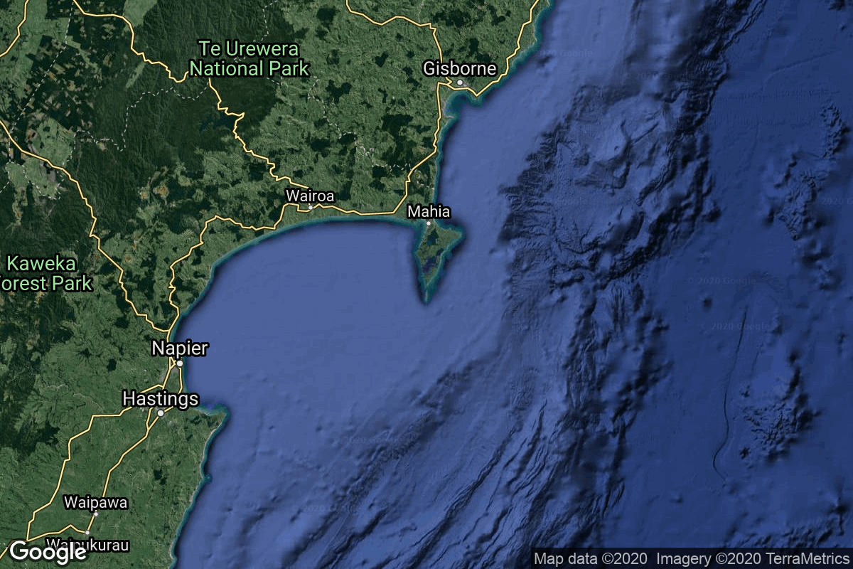
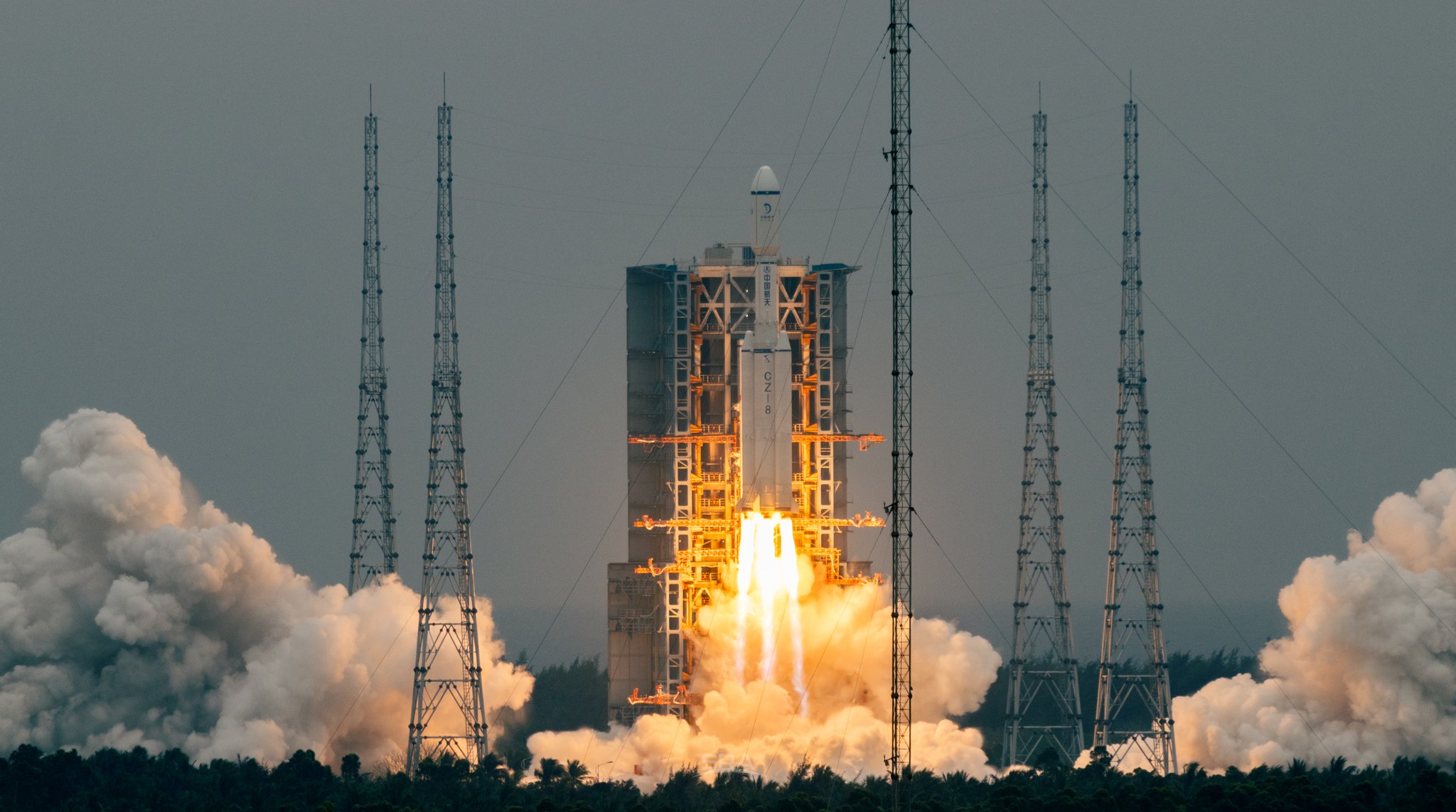
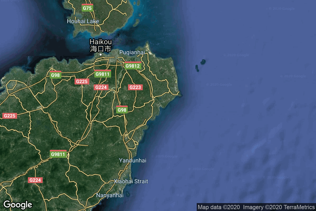
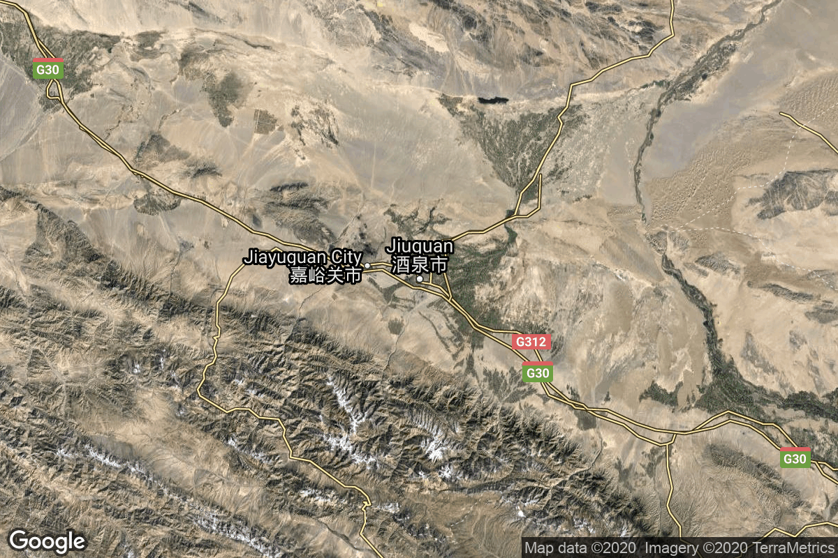
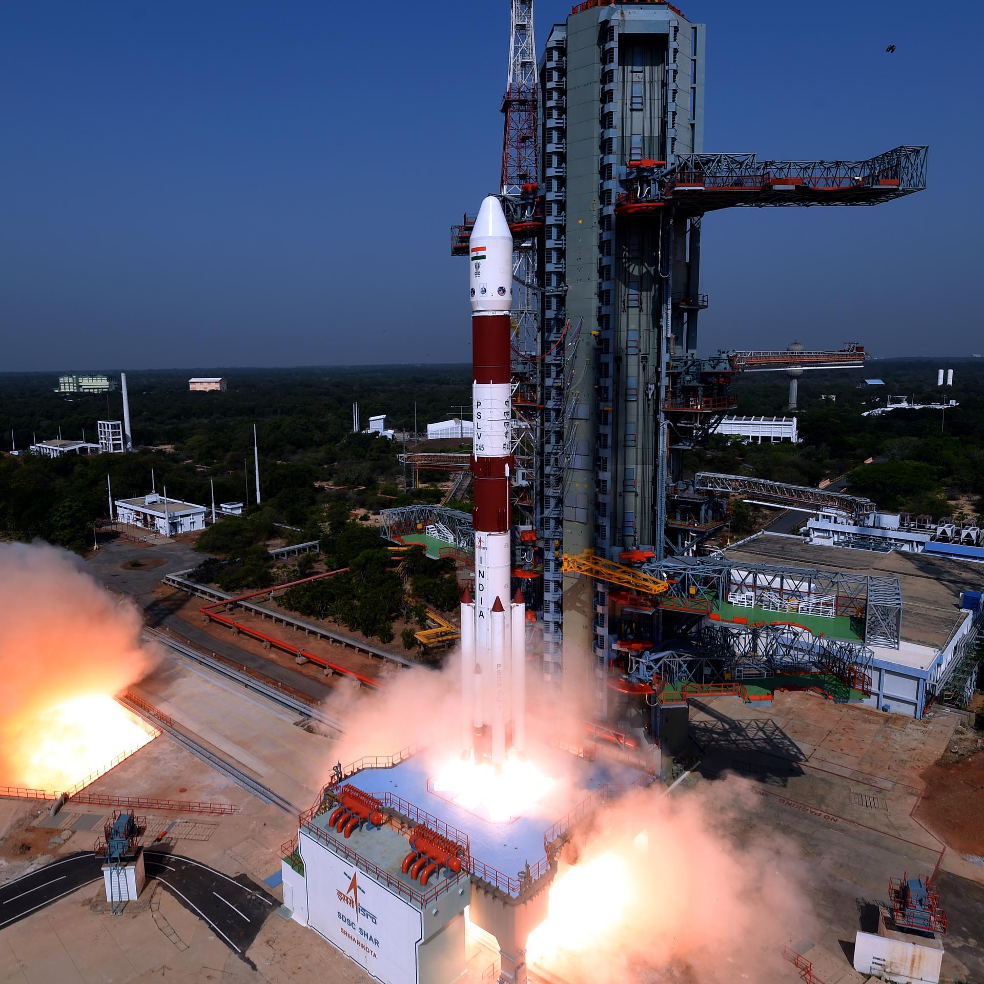
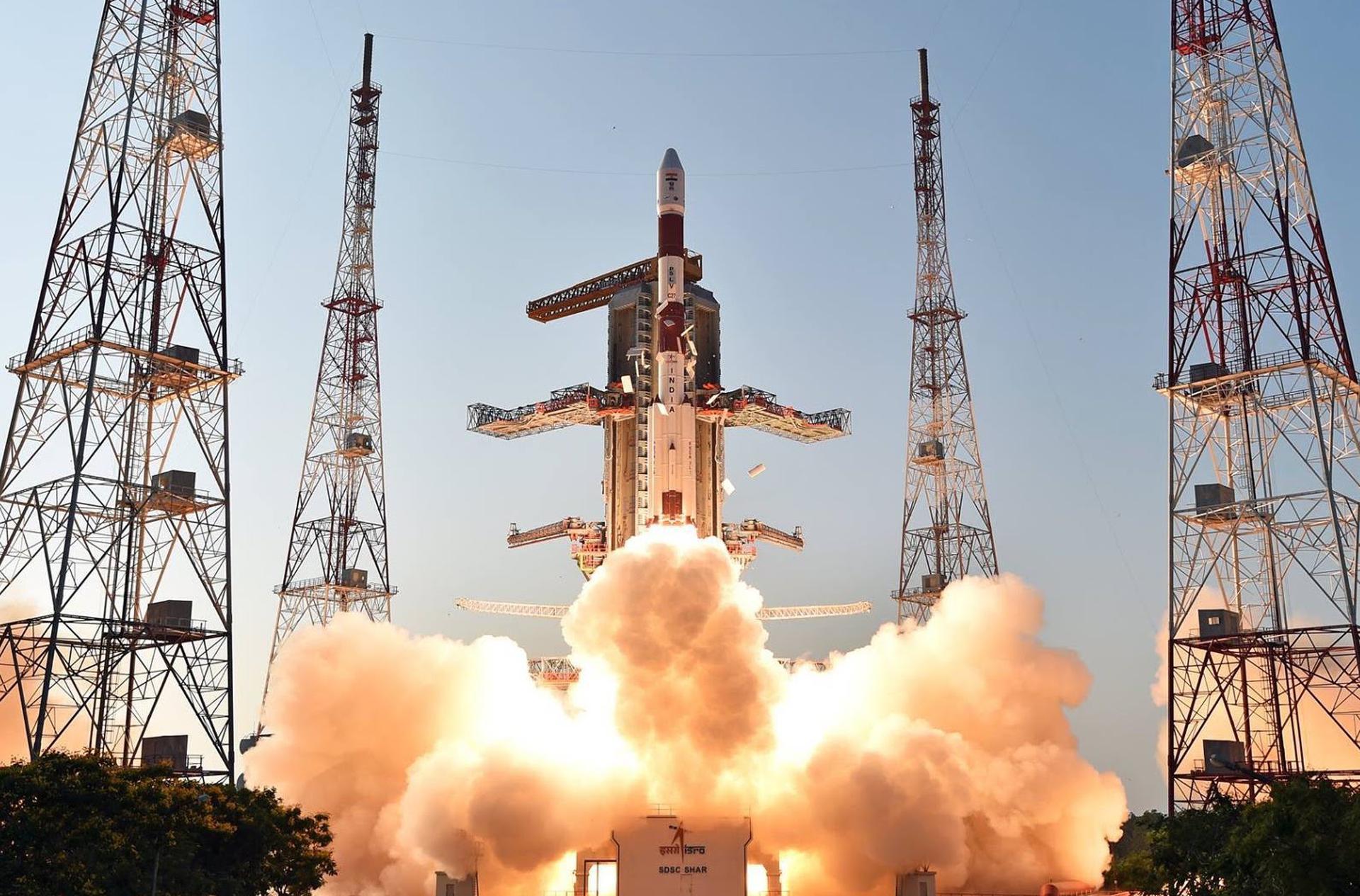
{ "count": 551, "next": "https://lldev.thespacedevs.com/2.3.0/launches/?format=api&limit=10&offset=90&ordering=-net", "previous": "https://lldev.thespacedevs.com/2.3.0/launches/?format=api&limit=10&offset=70&ordering=-net", "results": [ { "id": "3ac1bd74-bf9a-4afe-ae00-3e1d180142dd", "url": "https://lldev.thespacedevs.com/2.3.0/launches/3ac1bd74-bf9a-4afe-ae00-3e1d180142dd/?format=api", "name": "Astra Rocket 4 | Maiden Flight", "response_mode": "normal", "slug": "astra-rocket-4-maiden-flight", "launch_designator": null, "status": { "id": 2, "name": "To Be Determined", "abbrev": "TBD", "description": "Current date is a placeholder or rough estimation based on unreliable or interpreted sources." }, "last_updated": "2025-09-18T17:07:25Z", "net": "2026-12-31T00:00:00Z", "net_precision": { "id": 14, "name": "Year", "abbrev": "Y", "description": "The T-0 is expected in the given year." }, "window_end": "2026-12-31T00:00:00Z", "window_start": "2026-12-31T00:00:00Z", "image": { "id": 2479, "name": "Astra Rocket 4", "image_url": "https://thespacedevs-dev.nyc3.digitaloceanspaces.com/media/images/astra_rocket_4_image_20250918165934.jpg", "thumbnail_url": "https://thespacedevs-dev.nyc3.digitaloceanspaces.com/media/images/astra_rocket_4_image_thumbnail_20250918165934.jpeg", "credit": "Astra Space", "license": { "id": 1, "name": "Unknown", "priority": 9, "link": null }, "single_use": false, "variants": [] }, "infographic": null, "probability": null, "weather_concerns": null, "failreason": "", "hashtag": null, "launch_service_provider": { "response_mode": "list", "id": 285, "url": "https://lldev.thespacedevs.com/2.3.0/agencies/285/?format=api", "name": "Astra Space", "abbrev": "AS", "type": { "id": 3, "name": "Commercial" } }, "rocket": { "id": 8720, "configuration": { "response_mode": "list", "id": 526, "url": "https://lldev.thespacedevs.com/2.3.0/launcher_configurations/526/?format=api", "name": "Astra Rocket 4", "families": [ { "response_mode": "list", "id": 64, "name": "Astra Rocket" } ], "full_name": "Astra Rocket 4", "variant": "4" } }, "mission": { "id": 7312, "name": "Maiden Flight", "type": "Test Flight", "description": "First flight of Astra Space's second generation small satellite launch vehicle.", "image": null, "orbit": { "id": 8, "name": "Low Earth Orbit", "abbrev": "LEO", "celestial_body": { "response_mode": "list", "id": 1, "name": "Earth" } }, "agencies": [], "info_urls": [], "vid_urls": [] }, "pad": { "id": 27, "url": "https://lldev.thespacedevs.com/2.3.0/pads/27/?format=api", "active": true, "agencies": [], "name": "Space Launch Complex 46", "image": null, "description": null, "info_url": null, "wiki_url": "https://en.wikipedia.org/wiki/Spaceport_Florida_Launch_Complex_46", "map_url": "https://www.google.com/maps?q=28.4584,-80.5284", "latitude": 28.4584, "longitude": -80.5284, "country": { "id": 2, "name": "United States of America", "alpha_2_code": "US", "alpha_3_code": "USA", "nationality_name": "American", "nationality_name_composed": "Americano" }, "map_image": "https://thespacedevs-dev.nyc3.digitaloceanspaces.com/media/map_images/pad_27_20200803143319.jpg", "total_launch_count": 6, "orbital_launch_attempt_count": 5, "fastest_turnaround": "P121DT21H43M", "location": { "response_mode": "normal", "id": 12, "url": "https://lldev.thespacedevs.com/2.3.0/locations/12/?format=api", "name": "Cape Canaveral SFS, FL, USA", "celestial_body": { "response_mode": "normal", "id": 1, "name": "Earth", "type": { "id": 1, "name": "Planet" }, "diameter": 12742000.0, "mass": 5.972168e+24, "gravity": 9.80655, "length_of_day": "1 00:00:00", "atmosphere": true, "image": { "id": 2040, "name": "Earth (Apollo 17)", "image_url": "https://thespacedevs-dev.nyc3.digitaloceanspaces.com/media/images/earth_2528apol_image_20240402194304.jpeg", "thumbnail_url": "https://thespacedevs-dev.nyc3.digitaloceanspaces.com/media/images/earth_2528apol_image_thumbnail_20240402194305.jpeg", "credit": "NASA", "license": { "id": 4, "name": "NASA Image and Media Guidelines", "priority": 0, "link": "https://www.nasa.gov/nasa-brand-center/images-and-media/" }, "single_use": true, "variants": [] }, "description": "Earth is the third planet from the Sun and the only astronomical object known to harbor life.", "wiki_url": "https://en.wikipedia.org/wiki/Earth", "total_attempted_launches": 7470, "successful_launches": 6915, "failed_launches": 555, "total_attempted_landings": 1288, "successful_landings": 1241, "failed_landings": 47 }, "active": true, "country": { "id": 2, "name": "United States of America", "alpha_2_code": "US", "alpha_3_code": "USA", "nationality_name": "American", "nationality_name_composed": "Americano" }, "description": "Cape Canaveral Space Force Station (CCSFS) is an installation of the United States Space Force's Space Launch Delta 45, located on Cape Canaveral in Brevard County, Florida.", "image": { "id": 2200, "name": "Cape Canaveral & KSC seen from orbit (STS-43)", "image_url": "https://thespacedevs-dev.nyc3.digitaloceanspaces.com/media/images/cape_canaveral__image_20240918151615.jpg", "thumbnail_url": "https://thespacedevs-dev.nyc3.digitaloceanspaces.com/media/images/cape_canaveral__image_thumbnail_20240918151616.jpeg", "credit": "NASA", "license": { "id": 4, "name": "NASA Image and Media Guidelines", "priority": 0, "link": "https://www.nasa.gov/nasa-brand-center/images-and-media/" }, "single_use": true, "variants": [] }, "map_image": "https://thespacedevs-dev.nyc3.digitaloceanspaces.com/media/map_images/location_12_20200803142519.jpg", "longitude": -80.577778, "latitude": 28.488889, "timezone_name": "America/New_York", "total_launch_count": 1100, "total_landing_count": 71 } }, "webcast_live": false, "program": [], "orbital_launch_attempt_count": 7441, "location_launch_attempt_count": 1159, "pad_launch_attempt_count": 7, "agency_launch_attempt_count": 8, "orbital_launch_attempt_count_year": 268, "location_launch_attempt_count_year": 83, "pad_launch_attempt_count_year": 1, "agency_launch_attempt_count_year": 1 }, { "id": "db3500ac-965b-4ad8-b417-cb8d8d005586", "url": "https://lldev.thespacedevs.com/2.3.0/launches/db3500ac-965b-4ad8-b417-cb8d8d005586/?format=api", "name": "Electron | iQPS Launch 10", "response_mode": "normal", "slug": "electron-iqps-launch-10", "launch_designator": null, "status": { "id": 2, "name": "To Be Determined", "abbrev": "TBD", "description": "Current date is a placeholder or rough estimation based on unreliable or interpreted sources." }, "last_updated": "2025-10-08T03:25:49Z", "net": "2026-12-31T00:00:00Z", "net_precision": { "id": 14, "name": "Year", "abbrev": "Y", "description": "The T-0 is expected in the given year." }, "window_end": "2026-12-31T00:00:00Z", "window_start": "2026-12-31T00:00:00Z", "image": { "id": 1727, "name": "[AUTO] Electron - image", "image_url": "https://thespacedevs-dev.nyc3.digitaloceanspaces.com/media/images/electron_image_20190705175640.jpeg", "thumbnail_url": "https://thespacedevs-dev.nyc3.digitaloceanspaces.com/media/images/255bauto255d__image_thumbnail_20240305193613.jpeg", "credit": null, "license": { "id": 1, "name": "Unknown", "priority": 9, "link": null }, "single_use": true, "variants": [] }, "infographic": null, "probability": null, "weather_concerns": null, "failreason": "", "hashtag": null, "launch_service_provider": { "response_mode": "list", "id": 147, "url": "https://lldev.thespacedevs.com/2.3.0/agencies/147/?format=api", "name": "Rocket Lab", "abbrev": "RL", "type": { "id": 3, "name": "Commercial" } }, "rocket": { "id": 8762, "configuration": { "response_mode": "list", "id": 26, "url": "https://lldev.thespacedevs.com/2.3.0/launcher_configurations/26/?format=api", "name": "Electron", "families": [], "full_name": "Electron", "variant": "" } }, "mission": { "id": 7353, "name": "iQPS Launch 10", "type": "Earth Science", "description": "Synthetic aperture radar Earth observation satellite for Japanese Earth imaging company iQPS.", "image": null, "orbit": { "id": 8, "name": "Low Earth Orbit", "abbrev": "LEO", "celestial_body": { "response_mode": "list", "id": 1, "name": "Earth" } }, "agencies": [], "info_urls": [], "vid_urls": [] }, "pad": { "id": 210, "url": "https://lldev.thespacedevs.com/2.3.0/pads/210/?format=api", "active": true, "agencies": [], "name": "Unknown Pad", "image": null, "description": null, "info_url": null, "wiki_url": null, "map_url": null, "latitude": -39.260881, "longitude": 177.865826, "country": { "id": 51, "name": "New Zealand", "alpha_2_code": "NZ", "alpha_3_code": "NZL", "nationality_name": "Kiwi", "nationality_name_composed": "Kiwi" }, "map_image": "https://thespacedevs-dev.nyc3.digitaloceanspaces.com/media/map_images/pad_210_20230819165718.jpg", "total_launch_count": 0, "orbital_launch_attempt_count": 0, "fastest_turnaround": null, "location": { "response_mode": "normal", "id": 10, "url": "https://lldev.thespacedevs.com/2.3.0/locations/10/?format=api", "name": "Rocket Lab Launch Complex 1, Mahia Peninsula, New Zealand", "celestial_body": { "response_mode": "normal", "id": 1, "name": "Earth", "type": { "id": 1, "name": "Planet" }, "diameter": 12742000.0, "mass": 5.972168e+24, "gravity": 9.80655, "length_of_day": "1 00:00:00", "atmosphere": true, "image": { "id": 2040, "name": "Earth (Apollo 17)", "image_url": "https://thespacedevs-dev.nyc3.digitaloceanspaces.com/media/images/earth_2528apol_image_20240402194304.jpeg", "thumbnail_url": "https://thespacedevs-dev.nyc3.digitaloceanspaces.com/media/images/earth_2528apol_image_thumbnail_20240402194305.jpeg", "credit": "NASA", "license": { "id": 4, "name": "NASA Image and Media Guidelines", "priority": 0, "link": "https://www.nasa.gov/nasa-brand-center/images-and-media/" }, "single_use": true, "variants": [] }, "description": "Earth is the third planet from the Sun and the only astronomical object known to harbor life.", "wiki_url": "https://en.wikipedia.org/wiki/Earth", "total_attempted_launches": 7470, "successful_launches": 6915, "failed_launches": 555, "total_attempted_landings": 1288, "successful_landings": 1241, "failed_landings": 47 }, "active": true, "country": { "id": 51, "name": "New Zealand", "alpha_2_code": "NZ", "alpha_3_code": "NZL", "nationality_name": "Kiwi", "nationality_name_composed": "Kiwi" }, "description": "Rocket Lab Launch Complex 1 is a commercial spaceport located close to Ahuriri Point at the southern tip of Māhia Peninsula, on the east coast of New Zealand's North Island. It is owned and operated by private spaceflight company Rocket Lab and supports launches of the company's Electron rocket for small satellites. With the launch of Electron on 25 May 2017, it became the first private spaceport to host an orbital launch attempt, and the first site in New Zealand to host an orbital launch attempt. With the Electron launch of 21 January 2018, it became the first private spaceport to host a successful orbital launch.", "image": { "id": 2206, "name": "Rocket Lab Launch Complex 1", "image_url": "https://thespacedevs-dev.nyc3.digitaloceanspaces.com/media/images/rocket_lab_laun_image_20240918164228.jpg", "thumbnail_url": "https://thespacedevs-dev.nyc3.digitaloceanspaces.com/media/images/rocket_lab_laun_image_thumbnail_20240918164228.jpeg", "credit": "Rocket Lab", "license": { "id": 7, "name": "Rocket Lab Image Use Policy", "priority": 3, "link": "https://www.rocketlabusa.com/about/gallery/" }, "single_use": true, "variants": [] }, "map_image": "https://thespacedevs-dev.nyc3.digitaloceanspaces.com/media/map_images/location_10_20200803142509.jpg", "longitude": 177.86586, "latitude": -39.26085, "timezone_name": "Pacific/Auckland", "total_launch_count": 74, "total_landing_count": 17 } }, "webcast_live": false, "program": [], "orbital_launch_attempt_count": 7441, "location_launch_attempt_count": 93, "pad_launch_attempt_count": 19, "agency_launch_attempt_count": 109, "orbital_launch_attempt_count_year": 268, "location_launch_attempt_count_year": 24, "pad_launch_attempt_count_year": 19, "agency_launch_attempt_count_year": 30 }, { "id": "8d2a11e2-51e3-4841-a616-d41589373025", "url": "https://lldev.thespacedevs.com/2.3.0/launches/8d2a11e2-51e3-4841-a616-d41589373025/?format=api", "name": "Long March 10A | Demo Flight", "response_mode": "normal", "slug": "long-march-10a-demo-flight", "launch_designator": null, "status": { "id": 2, "name": "To Be Determined", "abbrev": "TBD", "description": "Current date is a placeholder or rough estimation based on unreliable or interpreted sources." }, "last_updated": "2025-12-01T16:44:21Z", "net": "2026-12-31T00:00:00Z", "net_precision": { "id": 14, "name": "Year", "abbrev": "Y", "description": "The T-0 is expected in the given year." }, "window_end": "2026-12-31T00:00:00Z", "window_start": "2026-12-31T00:00:00Z", "image": null, "infographic": null, "probability": null, "weather_concerns": null, "failreason": "", "hashtag": null, "launch_service_provider": { "response_mode": "list", "id": 88, "url": "https://lldev.thespacedevs.com/2.3.0/agencies/88/?format=api", "name": "China Aerospace Science and Technology Corporation", "abbrev": "CASC", "type": { "id": 1, "name": "Government" } }, "rocket": { "id": 8819, "configuration": { "response_mode": "list", "id": 537, "url": "https://lldev.thespacedevs.com/2.3.0/launcher_configurations/537/?format=api", "name": "Long March 10A", "families": [ { "response_mode": "list", "id": 106, "name": "Long March" }, { "response_mode": "list", "id": 213, "name": "Long March 10" } ], "full_name": "Long March 10A", "variant": "" } }, "mission": { "id": 7410, "name": "Demo Flight", "type": "Test Flight", "description": "First test launch of CASC/CALT’s Long March 10A rocket. Payload is expected to be a prototype of the Low Earth Orbit mission version of the Mengzhou crew spacecraft.", "image": null, "orbit": { "id": 25, "name": "Unknown", "abbrev": "N/A", "celestial_body": { "response_mode": "list", "id": 1, "name": "Earth" } }, "agencies": [], "info_urls": [], "vid_urls": [] }, "pad": { "id": 241, "url": "https://lldev.thespacedevs.com/2.3.0/pads/241/?format=api", "active": true, "agencies": [], "name": "301", "image": null, "description": "Launch pad for the Long March 10 and 10A rockets for future Chinese crew missions to the lunar surface and Low Earth Orbit space station.", "info_url": null, "wiki_url": "https://en.wikipedia.org/wiki/Wenchang_Space_Launch_Site", "map_url": "https://www.google.com/maps?q=19.610019,110.944443", "latitude": 19.610019, "longitude": 110.944443, "country": { "id": 6, "name": "China", "alpha_2_code": "CN", "alpha_3_code": "CHN", "nationality_name": "Chinese", "nationality_name_composed": "Sino" }, "map_image": "https://thespacedevs-dev.nyc3.digitaloceanspaces.com/media/map_images/pad_301_20251128182017.jpg", "total_launch_count": 0, "orbital_launch_attempt_count": 0, "fastest_turnaround": null, "location": { "response_mode": "normal", "id": 8, "url": "https://lldev.thespacedevs.com/2.3.0/locations/8/?format=api", "name": "Wenchang Space Launch Site, People's Republic of China", "celestial_body": { "response_mode": "normal", "id": 1, "name": "Earth", "type": { "id": 1, "name": "Planet" }, "diameter": 12742000.0, "mass": 5.972168e+24, "gravity": 9.80655, "length_of_day": "1 00:00:00", "atmosphere": true, "image": { "id": 2040, "name": "Earth (Apollo 17)", "image_url": "https://thespacedevs-dev.nyc3.digitaloceanspaces.com/media/images/earth_2528apol_image_20240402194304.jpeg", "thumbnail_url": "https://thespacedevs-dev.nyc3.digitaloceanspaces.com/media/images/earth_2528apol_image_thumbnail_20240402194305.jpeg", "credit": "NASA", "license": { "id": 4, "name": "NASA Image and Media Guidelines", "priority": 0, "link": "https://www.nasa.gov/nasa-brand-center/images-and-media/" }, "single_use": true, "variants": [] }, "description": "Earth is the third planet from the Sun and the only astronomical object known to harbor life.", "wiki_url": "https://en.wikipedia.org/wiki/Earth", "total_attempted_launches": 7470, "successful_launches": 6915, "failed_launches": 555, "total_attempted_landings": 1288, "successful_landings": 1241, "failed_landings": 47 }, "active": true, "country": { "id": 6, "name": "China", "alpha_2_code": "CN", "alpha_3_code": "CHN", "nationality_name": "Chinese", "nationality_name_composed": "Sino" }, "description": "The Wenchang Space Launch Site is a rocket launch site located in Wenchang on the island of Hainan, in China.\r\n\r\nFormally a suborbital test center, it currently serves as China's southernmost spaceport. The site was selected for its low latitude, 19° north of the equator, allowing for larger payloads to be launched. It is capable of launching the Long March 5, the heaviest Chinese rocket. Unlike launch facilities on the mainland, Wenchang uses its seaport for deliveries.", "image": { "id": 2019, "name": "CZ-8 liftoff from pad 201 (Queqiao-2)", "image_url": "https://thespacedevs-dev.nyc3.digitaloceanspaces.com/media/images/cz-8_liftoff_2_image_20240320175819.jpeg", "thumbnail_url": "https://thespacedevs-dev.nyc3.digitaloceanspaces.com/media/images/cz-8_liftoff_2_image_thumbnail_20240320175820.jpeg", "credit": "秦英健/Qin Yingjian", "license": { "id": 1, "name": "Unknown", "priority": 9, "link": null }, "single_use": false, "variants": [] }, "map_image": "https://thespacedevs-dev.nyc3.digitaloceanspaces.com/media/map_images/location_8_20200803142445.jpg", "longitude": 110.951133, "latitude": 19.614492, "timezone_name": "Asia/Shanghai", "total_launch_count": 58, "total_landing_count": 0 } }, "webcast_live": false, "program": [], "orbital_launch_attempt_count": 7441, "location_launch_attempt_count": 64, "pad_launch_attempt_count": 1, "agency_launch_attempt_count": 591, "orbital_launch_attempt_count_year": 268, "location_launch_attempt_count_year": 9, "pad_launch_attempt_count_year": 1, "agency_launch_attempt_count_year": 21 }, { "id": "a927b2f9-f9a5-4196-9abb-2e275e4a6b96", "url": "https://lldev.thespacedevs.com/2.3.0/launches/a927b2f9-f9a5-4196-9abb-2e275e4a6b96/?format=api", "name": "Pallas-1 | Demo Flight", "response_mode": "normal", "slug": "pallas-1-demo-flight", "launch_designator": null, "status": { "id": 2, "name": "To Be Determined", "abbrev": "TBD", "description": "Current date is a placeholder or rough estimation based on unreliable or interpreted sources." }, "last_updated": "2025-12-18T17:34:00Z", "net": "2026-12-31T00:00:00Z", "net_precision": { "id": 14, "name": "Year", "abbrev": "Y", "description": "The T-0 is expected in the given year." }, "window_end": "2026-12-31T00:00:00Z", "window_start": "2026-12-31T00:00:00Z", "image": null, "infographic": null, "probability": null, "weather_concerns": null, "failreason": "", "hashtag": null, "launch_service_provider": { "response_mode": "list", "id": 1021, "url": "https://lldev.thespacedevs.com/2.3.0/agencies/1021/?format=api", "name": "Galactic Energy", "abbrev": "GE", "type": { "id": 3, "name": "Commercial" } }, "rocket": { "id": 8824, "configuration": { "response_mode": "list", "id": 542, "url": "https://lldev.thespacedevs.com/2.3.0/launcher_configurations/542/?format=api", "name": "Pallas-1", "families": [], "full_name": "Pallas-1", "variant": "" } }, "mission": { "id": 7415, "name": "Demo Flight", "type": "Test Flight", "description": "First test launch of Galactic Energy’s Pallas-1 rocket.", "image": null, "orbit": { "id": 25, "name": "Unknown", "abbrev": "N/A", "celestial_body": { "response_mode": "list", "id": 1, "name": "Earth" } }, "agencies": [], "info_urls": [], "vid_urls": [] }, "pad": { "id": 246, "url": "https://lldev.thespacedevs.com/2.3.0/pads/246/?format=api", "active": true, "agencies": [ { "response_mode": "normal", "id": 1021, "url": "https://lldev.thespacedevs.com/2.3.0/agencies/1021/?format=api", "name": "Galactic Energy", "abbrev": "GE", "type": { "id": 3, "name": "Commercial" }, "featured": false, "country": [ { "id": 6, "name": "China", "alpha_2_code": "CN", "alpha_3_code": "CHN", "nationality_name": "Chinese", "nationality_name_composed": "Sino" } ], "description": "Galactic Energy is a private aerospace company headquartered in Beijing, China. Established by senior engineers in 2018, Galactic Energy engages in low-cost commercial space launch business.", "administrator": null, "founding_year": 2018, "launchers": "Ceres-1 | Pallas-1", "spacecraft": "", "parent": null, "image": { "id": 11, "name": "[AUTO] Galactic Energy - image", "image_url": "https://thespacedevs-dev.nyc3.digitaloceanspaces.com/media/images/galactic_energy_image_20201106095228.jpeg", "thumbnail_url": "https://thespacedevs-dev.nyc3.digitaloceanspaces.com/media/images/255bauto255d__image_thumbnail_20240305184607.jpeg", "credit": null, "license": { "id": 1, "name": "Unknown", "priority": 9, "link": null }, "single_use": true, "variants": [] }, "logo": { "id": 135, "name": "[AUTO] Galactic Energy - logo", "image_url": "https://thespacedevs-dev.nyc3.digitaloceanspaces.com/media/images/galactic2520energy_logo_20201106095229.png", "thumbnail_url": "https://thespacedevs-dev.nyc3.digitaloceanspaces.com/media/images/255bauto255d__image_thumbnail_20240305184957.png", "credit": null, "license": { "id": 1, "name": "Unknown", "priority": 9, "link": null }, "single_use": true, "variants": [] }, "social_logo": { "id": 59, "name": "[AUTO] Galactic Energy - social_logo", "image_url": "https://thespacedevs-dev.nyc3.digitaloceanspaces.com/media/images/galactic2520energy_nation_20230703094321.png", "thumbnail_url": "https://thespacedevs-dev.nyc3.digitaloceanspaces.com/media/images/255bauto255d__image_thumbnail_20240305184759.png", "credit": null, "license": { "id": 1, "name": "Unknown", "priority": 9, "link": null }, "single_use": true, "variants": [] } } ], "name": "Pallas-1 Launch Pad", "image": null, "description": "", "info_url": null, "wiki_url": "https://en.wikipedia.org/wiki/Pallas-1", "map_url": "https://www.google.com/maps?q=40.77596,100.10733", "latitude": 40.77596, "longitude": 100.10733, "country": { "id": 6, "name": "China", "alpha_2_code": "CN", "alpha_3_code": "CHN", "nationality_name": "Chinese", "nationality_name_composed": "Sino" }, "map_image": "https://thespacedevs-dev.nyc3.digitaloceanspaces.com/media/map_images/pad_pallas-1_launch_pad_20251128223637.jpg", "total_launch_count": 0, "orbital_launch_attempt_count": 0, "fastest_turnaround": null, "location": { "response_mode": "normal", "id": 17, "url": "https://lldev.thespacedevs.com/2.3.0/locations/17/?format=api", "name": "Jiuquan Satellite Launch Center, People's Republic of China", "celestial_body": { "response_mode": "normal", "id": 1, "name": "Earth", "type": { "id": 1, "name": "Planet" }, "diameter": 12742000.0, "mass": 5.972168e+24, "gravity": 9.80655, "length_of_day": "1 00:00:00", "atmosphere": true, "image": { "id": 2040, "name": "Earth (Apollo 17)", "image_url": "https://thespacedevs-dev.nyc3.digitaloceanspaces.com/media/images/earth_2528apol_image_20240402194304.jpeg", "thumbnail_url": "https://thespacedevs-dev.nyc3.digitaloceanspaces.com/media/images/earth_2528apol_image_thumbnail_20240402194305.jpeg", "credit": "NASA", "license": { "id": 4, "name": "NASA Image and Media Guidelines", "priority": 0, "link": "https://www.nasa.gov/nasa-brand-center/images-and-media/" }, "single_use": true, "variants": [] }, "description": "Earth is the third planet from the Sun and the only astronomical object known to harbor life.", "wiki_url": "https://en.wikipedia.org/wiki/Earth", "total_attempted_launches": 7470, "successful_launches": 6915, "failed_launches": 555, "total_attempted_landings": 1288, "successful_landings": 1241, "failed_landings": 47 }, "active": true, "country": { "id": 6, "name": "China", "alpha_2_code": "CN", "alpha_3_code": "CHN", "nationality_name": "Chinese", "nationality_name_composed": "Sino" }, "description": "Jiuquan Satellite Launch Center is a Chinese spaceport located between the Ejin, Alxa, Inner Mongolia and Hangtian Town, Jinta County, Jiuquan, Gansu Province. It is part of the Dongfeng Aerospace City (Base 10).", "image": { "id": 1374, "name": "Long March 2F/G liftoff (Shenzhou 16)", "image_url": "https://thespacedevs-dev.nyc3.digitaloceanspaces.com/media/images/long2520march_image_20240101085213.jpeg", "thumbnail_url": "https://thespacedevs-dev.nyc3.digitaloceanspaces.com/media/images/255bauto255d__image_thumbnail_20240305192548.jpeg", "credit": "CMS", "license": { "id": 1, "name": "Unknown", "priority": 9, "link": null }, "single_use": false, "variants": [] }, "map_image": "https://thespacedevs-dev.nyc3.digitaloceanspaces.com/media/map_images/location_17_20200803142429.jpg", "longitude": 100.291111, "latitude": 40.958056, "timezone_name": "Asia/Shanghai", "total_launch_count": 281, "total_landing_count": 2 } }, "webcast_live": false, "program": [], "orbital_launch_attempt_count": 7441, "location_launch_attempt_count": 287, "pad_launch_attempt_count": 1, "agency_launch_attempt_count": 25, "orbital_launch_attempt_count_year": 268, "location_launch_attempt_count_year": 14, "pad_launch_attempt_count_year": 1, "agency_launch_attempt_count_year": 3 }, { "id": "b5a9bccb-30d7-4af6-8ad1-fabb563be53c", "url": "https://lldev.thespacedevs.com/2.3.0/launches/b5a9bccb-30d7-4af6-8ad1-fabb563be53c/?format=api", "name": "PSLV | TDS-01", "response_mode": "normal", "slug": "pslv-tds-01", "launch_designator": null, "status": { "id": 2, "name": "To Be Determined", "abbrev": "TBD", "description": "Current date is a placeholder or rough estimation based on unreliable or interpreted sources." }, "last_updated": "2026-03-17T13:56:25Z", "net": "2026-12-31T00:00:00Z", "net_precision": { "id": 14, "name": "Year", "abbrev": "Y", "description": "The T-0 is expected in the given year." }, "window_end": "2026-12-31T00:00:00Z", "window_start": "2026-12-31T00:00:00Z", "image": { "id": 1808, "name": "PSLV-QL launching", "image_url": "https://thespacedevs-dev.nyc3.digitaloceanspaces.com/media/images/pslv_image_20190508083736.jpeg", "thumbnail_url": "https://thespacedevs-dev.nyc3.digitaloceanspaces.com/media/images/255bauto255d__image_thumbnail_20240305193826.jpeg", "credit": "Indian Space Research Organisation", "license": { "id": 11, "name": "Government Open Data License - India (GODL)", "priority": 3, "link": "https://data.gov.in/sites/default/files/Gazette_Notification_OGDL.pdf" }, "single_use": false, "variants": [] }, "infographic": null, "probability": null, "weather_concerns": null, "failreason": "", "hashtag": null, "launch_service_provider": { "response_mode": "list", "id": 31, "url": "https://lldev.thespacedevs.com/2.3.0/agencies/31/?format=api", "name": "Indian Space Research Organization", "abbrev": "ISRO", "type": { "id": 1, "name": "Government" } }, "rocket": { "id": 7595, "configuration": { "response_mode": "list", "id": 7, "url": "https://lldev.thespacedevs.com/2.3.0/launcher_configurations/7/?format=api", "name": "PSLV", "families": [ { "response_mode": "list", "id": 131, "name": "PSLV" } ], "full_name": "PSLV", "variant": "" } }, "mission": { "id": 6037, "name": "TDS-01", "type": "Technology", "description": "TDS-01 (Technology Demonstration Satellite-01) is an Indian geostationary orbit technology demonstration satellite carrying payloads for the Indian Space Research Organisation (ISRO)’s Institute of Plasma Research, Gandhinagar and the CSIR-CEERI, Pilani. \r\n\r\nPayloads to be tested included an internally developed 300 mN electric powered thrusters, atomic clocks, travelling wave tube amplifiers (TWTA) & a quantum communication suite (QuTDS).", "image": null, "orbit": { "id": 2, "name": "Geostationary Transfer Orbit", "abbrev": "GTO", "celestial_body": { "response_mode": "list", "id": 1, "name": "Earth" } }, "agencies": [], "info_urls": [], "vid_urls": [] }, "pad": { "id": 50, "url": "https://lldev.thespacedevs.com/2.3.0/pads/50/?format=api", "active": true, "agencies": [ { "response_mode": "normal", "id": 31, "url": "https://lldev.thespacedevs.com/2.3.0/agencies/31/?format=api", "name": "Indian Space Research Organization", "abbrev": "ISRO", "type": { "id": 1, "name": "Government" }, "featured": true, "country": [ { "id": 9, "name": "India", "alpha_2_code": "IN", "alpha_3_code": "IND", "nationality_name": "Indian", "nationality_name_composed": "Indo" } ], "description": "The Indian Space Research Organisation (ISRO) is the space agency of the Government of India headquartered in the city of Bangalore. Its vision is to \"harness space technology for national development while pursuing space science research and planetary exploration.\"", "administrator": "Chairman: V. Narayanan", "founding_year": 1969, "launchers": "PSLV | GSLV", "spacecraft": "Gaganyaan", "parent": null, "image": { "id": 14, "name": "[AUTO] Indian Space Research Organization - image", "image_url": "https://thespacedevs-dev.nyc3.digitaloceanspaces.com/media/images/indian2520space2520research2520organization_image_20190215225409.jpeg", "thumbnail_url": "https://thespacedevs-dev.nyc3.digitaloceanspaces.com/media/images/255bauto255d__image_thumbnail_20240305184615.jpeg", "credit": null, "license": { "id": 1, "name": "Unknown", "priority": 9, "link": null }, "single_use": true, "variants": [] }, "logo": { "id": 141, "name": "[AUTO] Indian Space Research Organization - logo", "image_url": "https://thespacedevs-dev.nyc3.digitaloceanspaces.com/media/images/indian2520space2520research2520organization_logo_20190215225409.png", "thumbnail_url": "https://thespacedevs-dev.nyc3.digitaloceanspaces.com/media/images/255bauto255d__image_thumbnail_20240305185007.png", "credit": null, "license": { "id": 1, "name": "Unknown", "priority": 9, "link": null }, "single_use": true, "variants": [] }, "social_logo": { "id": 63, "name": "[AUTO] Indian Space Research Organization - social_logo", "image_url": "https://thespacedevs-dev.nyc3.digitaloceanspaces.com/media/images/indian2520space2520research2520organization_nation_20230624125733.jpg", "thumbnail_url": "https://thespacedevs-dev.nyc3.digitaloceanspaces.com/media/images/255bauto255d__image_thumbnail_20240305184805.jpeg", "credit": null, "license": { "id": 1, "name": "Unknown", "priority": 9, "link": null }, "single_use": true, "variants": [] } } ], "name": "Satish Dhawan Space Centre First Launch Pad", "image": { "id": 1993, "name": "First Launch Pad", "image_url": "https://thespacedevs-dev.nyc3.digitaloceanspaces.com/media/images/first_launch_pa_image_20240311093432.jpeg", "thumbnail_url": "https://thespacedevs-dev.nyc3.digitaloceanspaces.com/media/images/first_launch_pa_image_thumbnail_20240311093432.jpeg", "credit": "Indian Space Research Organisation", "license": { "id": 11, "name": "Government Open Data License - India (GODL)", "priority": 3, "link": "https://data.gov.in/sites/default/files/Gazette_Notification_OGDL.pdf" }, "single_use": true, "variants": [] }, "description": "India has two launch pads at the site. The First Launch Pad, operational since 1993, is used for Polar Satellite Launch Vehicle, Small Satellite Launch Vehicle and formerly used by Geosynchronous Satellite Launch Vehicle.", "info_url": null, "wiki_url": "https://en.wikipedia.org/wiki/Satish_Dhawan_Space_Centre_First_Launch_Pad", "map_url": "https://www.google.com/maps?q=13.733,80.235", "latitude": 13.733, "longitude": 80.235, "country": { "id": 9, "name": "India", "alpha_2_code": "IN", "alpha_3_code": "IND", "nationality_name": "Indian", "nationality_name_composed": "Indo" }, "map_image": "https://thespacedevs-dev.nyc3.digitaloceanspaces.com/media/map_images/pad_50_20200803143457.jpg", "total_launch_count": 63, "orbital_launch_attempt_count": 62, "fastest_turnaround": "P25DT5H56M15S", "location": { "response_mode": "normal", "id": 14, "url": "https://lldev.thespacedevs.com/2.3.0/locations/14/?format=api", "name": "Satish Dhawan Space Centre, India", "celestial_body": { "response_mode": "normal", "id": 1, "name": "Earth", "type": { "id": 1, "name": "Planet" }, "diameter": 12742000.0, "mass": 5.972168e+24, "gravity": 9.80655, "length_of_day": "1 00:00:00", "atmosphere": true, "image": { "id": 2040, "name": "Earth (Apollo 17)", "image_url": "https://thespacedevs-dev.nyc3.digitaloceanspaces.com/media/images/earth_2528apol_image_20240402194304.jpeg", "thumbnail_url": "https://thespacedevs-dev.nyc3.digitaloceanspaces.com/media/images/earth_2528apol_image_thumbnail_20240402194305.jpeg", "credit": "NASA", "license": { "id": 4, "name": "NASA Image and Media Guidelines", "priority": 0, "link": "https://www.nasa.gov/nasa-brand-center/images-and-media/" }, "single_use": true, "variants": [] }, "description": "Earth is the third planet from the Sun and the only astronomical object known to harbor life.", "wiki_url": "https://en.wikipedia.org/wiki/Earth", "total_attempted_launches": 7470, "successful_launches": 6915, "failed_launches": 555, "total_attempted_landings": 1288, "successful_landings": 1241, "failed_landings": 47 }, "active": true, "country": { "id": 9, "name": "India", "alpha_2_code": "IN", "alpha_3_code": "IND", "nationality_name": "Indian", "nationality_name_composed": "Indo" }, "description": "Satish Dhawan Space Centre – SDSC (formerly Sriharikota Range – SHAR),[1] is the primary spaceport of the Indian Space Research Organisation (ISRO), located in Sriharikota, Andhra Pradesh.", "image": { "id": 2212, "name": "Satish Dhawan Space Centre", "image_url": "https://thespacedevs-dev.nyc3.digitaloceanspaces.com/media/images/satish_dhawan_s_image_20240919164153.png", "thumbnail_url": "https://thespacedevs-dev.nyc3.digitaloceanspaces.com/media/images/satish_dhawan_s_image_thumbnail_20240919164154.png", "credit": "ISRO", "license": { "id": 11, "name": "Government Open Data License - India (GODL)", "priority": 3, "link": "https://data.gov.in/sites/default/files/Gazette_Notification_OGDL.pdf" }, "single_use": true, "variants": [] }, "map_image": "https://thespacedevs-dev.nyc3.digitaloceanspaces.com/media/map_images/location_14_20200803142403.jpg", "longitude": 80.23, "latitude": 13.72, "timezone_name": "Asia/Kolkata", "total_launch_count": 103, "total_landing_count": 0 } }, "webcast_live": false, "program": [], "orbital_launch_attempt_count": 7441, "location_launch_attempt_count": 116, "pad_launch_attempt_count": 68, "agency_launch_attempt_count": 111, "orbital_launch_attempt_count_year": 268, "location_launch_attempt_count_year": 14, "pad_launch_attempt_count_year": 6, "agency_launch_attempt_count_year": 13 }, { "id": "9e24bef7-c44b-4fdc-ba52-68545ce9457e", "url": "https://lldev.thespacedevs.com/2.3.0/launches/9e24bef7-c44b-4fdc-ba52-68545ce9457e/?format=api", "name": "Electron | StriX Launch 13", "response_mode": "normal", "slug": "electron-strix-launch-13", "launch_designator": null, "status": { "id": 2, "name": "To Be Determined", "abbrev": "TBD", "description": "Current date is a placeholder or rough estimation based on unreliable or interpreted sources." }, "last_updated": "2026-03-27T00:34:00Z", "net": "2026-12-31T00:00:00Z", "net_precision": { "id": 7, "name": "Month", "abbrev": "M", "description": "The T-0 is expected in the given month." }, "window_end": "2026-12-31T00:00:00Z", "window_start": "2026-12-31T00:00:00Z", "image": { "id": 1727, "name": "[AUTO] Electron - image", "image_url": "https://thespacedevs-dev.nyc3.digitaloceanspaces.com/media/images/electron_image_20190705175640.jpeg", "thumbnail_url": "https://thespacedevs-dev.nyc3.digitaloceanspaces.com/media/images/255bauto255d__image_thumbnail_20240305193613.jpeg", "credit": null, "license": { "id": 1, "name": "Unknown", "priority": 9, "link": null }, "single_use": true, "variants": [] }, "infographic": null, "probability": null, "weather_concerns": null, "failreason": "", "hashtag": null, "launch_service_provider": { "response_mode": "list", "id": 147, "url": "https://lldev.thespacedevs.com/2.3.0/agencies/147/?format=api", "name": "Rocket Lab", "abbrev": "RL", "type": { "id": 3, "name": "Commercial" } }, "rocket": { "id": 8269, "configuration": { "response_mode": "list", "id": 26, "url": "https://lldev.thespacedevs.com/2.3.0/launcher_configurations/26/?format=api", "name": "Electron", "families": [], "full_name": "Electron", "variant": "" } }, "mission": { "id": 6850, "name": "StriX Launch 13", "type": "Earth Science", "description": "Synthetic aperture radar satellite for Japanese Earth imaging company Synspective.", "image": null, "orbit": { "id": 17, "name": "Sun-Synchronous Orbit", "abbrev": "SSO", "celestial_body": { "response_mode": "list", "id": 1, "name": "Earth" } }, "agencies": [ { "response_mode": "normal", "id": 1071, "url": "https://lldev.thespacedevs.com/2.3.0/agencies/1071/?format=api", "name": "Synspective", "abbrev": "", "type": { "id": 5, "name": "Private" }, "featured": false, "country": [ { "id": 28, "name": "Japan", "alpha_2_code": "JP", "alpha_3_code": "JPN", "nationality_name": "Japanese", "nationality_name_composed": "Nippo" } ], "description": "Synspective was established with the aim to integrate SAR satellite technology in society through the agility of a start-up company. Synspective derives its name from the company concept of “Synthetic Data for Perspective on Sustainable Development.", "administrator": "CEO: Dr. Motoyuki Arai", "founding_year": 2018, "launchers": "", "spacecraft": "", "parent": null, "image": null, "logo": { "id": 2029, "name": "Synspective logo", "image_url": "https://thespacedevs-dev.nyc3.digitaloceanspaces.com/media/images/synspective_log_image_20240325082018.png", "thumbnail_url": "https://thespacedevs-dev.nyc3.digitaloceanspaces.com/media/images/synspective_log_image_thumbnail_20240325082018.png", "credit": "Synspective", "license": { "id": 1, "name": "Unknown", "priority": 9, "link": null }, "single_use": true, "variants": [ { "id": 7, "type": { "id": 1, "name": "transparent for light background" }, "image_url": "https://thespacedevs-dev.nyc3.digitaloceanspaces.com/media/image_variants/lightbg.png_tra_image_20240325082021.png" }, { "id": 8, "type": { "id": 2, "name": "transparent for dark background" }, "image_url": "https://thespacedevs-dev.nyc3.digitaloceanspaces.com/media/image_variants/darkbg.png_tran_image_20240325082023.png" } ] }, "social_logo": { "id": 95, "name": "Synspective social logo", "image_url": "https://thespacedevs-dev.nyc3.digitaloceanspaces.com/media/images/synspective_nation_20240228091738.jpg", "thumbnail_url": "https://thespacedevs-dev.nyc3.digitaloceanspaces.com/media/images/255bauto255d__image_thumbnail_20240305184850.jpeg", "credit": "Synspective", "license": { "id": 1, "name": "Unknown", "priority": 9, "link": null }, "single_use": true, "variants": [] }, "total_launch_count": 0, "consecutive_successful_launches": 0, "successful_launches": 0, "failed_launches": 0, "pending_launches": 0, "consecutive_successful_landings": 0, "successful_landings": 0, "failed_landings": 0, "attempted_landings": 0, "successful_landings_spacecraft": 0, "failed_landings_spacecraft": 0, "attempted_landings_spacecraft": 0, "successful_landings_payload": 0, "failed_landings_payload": 0, "attempted_landings_payload": 0, "info_url": "https://synspective.com/", "wiki_url": null, "social_media_links": [] } ], "info_urls": [], "vid_urls": [] }, "pad": { "id": 210, "url": "https://lldev.thespacedevs.com/2.3.0/pads/210/?format=api", "active": true, "agencies": [], "name": "Unknown Pad", "image": null, "description": null, "info_url": null, "wiki_url": null, "map_url": null, "latitude": -39.260881, "longitude": 177.865826, "country": { "id": 51, "name": "New Zealand", "alpha_2_code": "NZ", "alpha_3_code": "NZL", "nationality_name": "Kiwi", "nationality_name_composed": "Kiwi" }, "map_image": "https://thespacedevs-dev.nyc3.digitaloceanspaces.com/media/map_images/pad_210_20230819165718.jpg", "total_launch_count": 0, "orbital_launch_attempt_count": 0, "fastest_turnaround": null, "location": { "response_mode": "normal", "id": 10, "url": "https://lldev.thespacedevs.com/2.3.0/locations/10/?format=api", "name": "Rocket Lab Launch Complex 1, Mahia Peninsula, New Zealand", "celestial_body": { "response_mode": "normal", "id": 1, "name": "Earth", "type": { "id": 1, "name": "Planet" }, "diameter": 12742000.0, "mass": 5.972168e+24, "gravity": 9.80655, "length_of_day": "1 00:00:00", "atmosphere": true, "image": { "id": 2040, "name": "Earth (Apollo 17)", "image_url": "https://thespacedevs-dev.nyc3.digitaloceanspaces.com/media/images/earth_2528apol_image_20240402194304.jpeg", "thumbnail_url": "https://thespacedevs-dev.nyc3.digitaloceanspaces.com/media/images/earth_2528apol_image_thumbnail_20240402194305.jpeg", "credit": "NASA", "license": { "id": 4, "name": "NASA Image and Media Guidelines", "priority": 0, "link": "https://www.nasa.gov/nasa-brand-center/images-and-media/" }, "single_use": true, "variants": [] }, "description": "Earth is the third planet from the Sun and the only astronomical object known to harbor life.", "wiki_url": "https://en.wikipedia.org/wiki/Earth", "total_attempted_launches": 7470, "successful_launches": 6915, "failed_launches": 555, "total_attempted_landings": 1288, "successful_landings": 1241, "failed_landings": 47 }, "active": true, "country": { "id": 51, "name": "New Zealand", "alpha_2_code": "NZ", "alpha_3_code": "NZL", "nationality_name": "Kiwi", "nationality_name_composed": "Kiwi" }, "description": "Rocket Lab Launch Complex 1 is a commercial spaceport located close to Ahuriri Point at the southern tip of Māhia Peninsula, on the east coast of New Zealand's North Island. It is owned and operated by private spaceflight company Rocket Lab and supports launches of the company's Electron rocket for small satellites. With the launch of Electron on 25 May 2017, it became the first private spaceport to host an orbital launch attempt, and the first site in New Zealand to host an orbital launch attempt. With the Electron launch of 21 January 2018, it became the first private spaceport to host a successful orbital launch.", "image": { "id": 2206, "name": "Rocket Lab Launch Complex 1", "image_url": "https://thespacedevs-dev.nyc3.digitaloceanspaces.com/media/images/rocket_lab_laun_image_20240918164228.jpg", "thumbnail_url": "https://thespacedevs-dev.nyc3.digitaloceanspaces.com/media/images/rocket_lab_laun_image_thumbnail_20240918164228.jpeg", "credit": "Rocket Lab", "license": { "id": 7, "name": "Rocket Lab Image Use Policy", "priority": 3, "link": "https://www.rocketlabusa.com/about/gallery/" }, "single_use": true, "variants": [] }, "map_image": "https://thespacedevs-dev.nyc3.digitaloceanspaces.com/media/map_images/location_10_20200803142509.jpg", "longitude": 177.86586, "latitude": -39.26085, "timezone_name": "Pacific/Auckland", "total_launch_count": 74, "total_landing_count": 17 } }, "webcast_live": false, "program": [], "orbital_launch_attempt_count": 7441, "location_launch_attempt_count": 93, "pad_launch_attempt_count": 19, "agency_launch_attempt_count": 109, "orbital_launch_attempt_count_year": 268, "location_launch_attempt_count_year": 24, "pad_launch_attempt_count_year": 19, "agency_launch_attempt_count_year": 30 }, { "id": "d6615c37-dcef-45d1-96c1-3d1a5250bf13", "url": "https://lldev.thespacedevs.com/2.3.0/launches/d6615c37-dcef-45d1-96c1-3d1a5250bf13/?format=api", "name": "Falcon 9 Block 5 | Telesat Lightspeed 3", "response_mode": "normal", "slug": "falcon-9-block-5-telesat-lightspeed-3", "launch_designator": null, "status": { "id": 2, "name": "To Be Determined", "abbrev": "TBD", "description": "Current date is a placeholder or rough estimation based on unreliable or interpreted sources." }, "last_updated": "2023-09-11T12:40:48Z", "net": "2026-12-31T00:00:00Z", "net_precision": { "id": 14, "name": "Year", "abbrev": "Y", "description": "The T-0 is expected in the given year." }, "window_end": "2026-12-31T00:00:00Z", "window_start": "2026-12-31T00:00:00Z", "image": { "id": 1736, "name": "[AUTO] Falcon 9 - image", "image_url": "https://thespacedevs-dev.nyc3.digitaloceanspaces.com/media/images/falcon_9_image_20230807133459.jpeg", "thumbnail_url": "https://thespacedevs-dev.nyc3.digitaloceanspaces.com/media/images/255bauto255d__image_thumbnail_20240305193628.jpeg", "credit": null, "license": { "id": 1, "name": "Unknown", "priority": 9, "link": null }, "single_use": true, "variants": [] }, "infographic": null, "probability": null, "weather_concerns": null, "failreason": "", "hashtag": null, "launch_service_provider": { "response_mode": "list", "id": 121, "url": "https://lldev.thespacedevs.com/2.3.0/agencies/121/?format=api", "name": "SpaceX", "abbrev": "SpX", "type": { "id": 3, "name": "Commercial" } }, "rocket": { "id": 8006, "configuration": { "response_mode": "list", "id": 164, "url": "https://lldev.thespacedevs.com/2.3.0/launcher_configurations/164/?format=api", "name": "Falcon 9", "families": [ { "response_mode": "list", "id": 1, "name": "Falcon" }, { "response_mode": "list", "id": 176, "name": "Falcon 9" } ], "full_name": "Falcon 9 Block 5", "variant": "Block 5" } }, "mission": { "id": 6542, "name": "Telesat Lightspeed 3", "type": "Communications", "description": "Up to 18 satellites manufactured by MDA for Canadian satellite operator Telesat's Lightspeed constellation.", "image": null, "orbit": { "id": 8, "name": "Low Earth Orbit", "abbrev": "LEO", "celestial_body": { "response_mode": "list", "id": 1, "name": "Earth" } }, "agencies": [ { "response_mode": "normal", "id": 208, "url": "https://lldev.thespacedevs.com/2.3.0/agencies/208/?format=api", "name": "Telesat", "abbrev": "TELE", "type": { "id": 3, "name": "Commercial" }, "featured": false, "country": [ { "id": 26, "name": "Canada", "alpha_2_code": "CA", "alpha_3_code": "CAN", "nationality_name": "Canadian", "nationality_name_composed": "Canado" } ], "description": "Telesat, formerly Telesat Canada, is a Canadian satellite communications company founded on May 2, 1969.", "administrator": null, "founding_year": null, "launchers": "", "spacecraft": "", "parent": null, "image": null, "logo": null, "social_logo": null, "total_launch_count": 0, "consecutive_successful_launches": 0, "successful_launches": 0, "failed_launches": 0, "pending_launches": 0, "consecutive_successful_landings": 0, "successful_landings": 0, "failed_landings": 0, "attempted_landings": 0, "successful_landings_spacecraft": 0, "failed_landings_spacecraft": 0, "attempted_landings_spacecraft": 0, "successful_landings_payload": 0, "failed_landings_payload": 0, "attempted_landings_payload": 0, "info_url": "https://www.telesat.com/", "wiki_url": "https://en.wikipedia.org/wiki/Telesat", "social_media_links": [] } ], "info_urls": [], "vid_urls": [] }, "pad": { "id": 72, "url": "https://lldev.thespacedevs.com/2.3.0/pads/72/?format=api", "active": true, "agencies": [], "name": "Unknown Pad", "image": null, "description": null, "info_url": null, "wiki_url": "", "map_url": "https://www.google.com/maps?q=28.458,-80.528", "latitude": 28.458, "longitude": -80.528, "country": { "id": 2, "name": "United States of America", "alpha_2_code": "US", "alpha_3_code": "USA", "nationality_name": "American", "nationality_name_composed": "Americano" }, "map_image": "https://thespacedevs-dev.nyc3.digitaloceanspaces.com/media/map_images/pad_72_20200803143403.jpg", "total_launch_count": 0, "orbital_launch_attempt_count": 0, "fastest_turnaround": null, "location": { "response_mode": "normal", "id": 12, "url": "https://lldev.thespacedevs.com/2.3.0/locations/12/?format=api", "name": "Cape Canaveral SFS, FL, USA", "celestial_body": { "response_mode": "normal", "id": 1, "name": "Earth", "type": { "id": 1, "name": "Planet" }, "diameter": 12742000.0, "mass": 5.972168e+24, "gravity": 9.80655, "length_of_day": "1 00:00:00", "atmosphere": true, "image": { "id": 2040, "name": "Earth (Apollo 17)", "image_url": "https://thespacedevs-dev.nyc3.digitaloceanspaces.com/media/images/earth_2528apol_image_20240402194304.jpeg", "thumbnail_url": "https://thespacedevs-dev.nyc3.digitaloceanspaces.com/media/images/earth_2528apol_image_thumbnail_20240402194305.jpeg", "credit": "NASA", "license": { "id": 4, "name": "NASA Image and Media Guidelines", "priority": 0, "link": "https://www.nasa.gov/nasa-brand-center/images-and-media/" }, "single_use": true, "variants": [] }, "description": "Earth is the third planet from the Sun and the only astronomical object known to harbor life.", "wiki_url": "https://en.wikipedia.org/wiki/Earth", "total_attempted_launches": 7470, "successful_launches": 6915, "failed_launches": 555, "total_attempted_landings": 1288, "successful_landings": 1241, "failed_landings": 47 }, "active": true, "country": { "id": 2, "name": "United States of America", "alpha_2_code": "US", "alpha_3_code": "USA", "nationality_name": "American", "nationality_name_composed": "Americano" }, "description": "Cape Canaveral Space Force Station (CCSFS) is an installation of the United States Space Force's Space Launch Delta 45, located on Cape Canaveral in Brevard County, Florida.", "image": { "id": 2200, "name": "Cape Canaveral & KSC seen from orbit (STS-43)", "image_url": "https://thespacedevs-dev.nyc3.digitaloceanspaces.com/media/images/cape_canaveral__image_20240918151615.jpg", "thumbnail_url": "https://thespacedevs-dev.nyc3.digitaloceanspaces.com/media/images/cape_canaveral__image_thumbnail_20240918151616.jpeg", "credit": "NASA", "license": { "id": 4, "name": "NASA Image and Media Guidelines", "priority": 0, "link": "https://www.nasa.gov/nasa-brand-center/images-and-media/" }, "single_use": true, "variants": [] }, "map_image": "https://thespacedevs-dev.nyc3.digitaloceanspaces.com/media/map_images/location_12_20200803142519.jpg", "longitude": -80.577778, "latitude": 28.488889, "timezone_name": "America/New_York", "total_launch_count": 1100, "total_landing_count": 71 } }, "webcast_live": false, "program": [], "orbital_launch_attempt_count": 7441, "location_launch_attempt_count": 1159, "pad_launch_attempt_count": 28, "agency_launch_attempt_count": 722, "orbital_launch_attempt_count_year": 268, "location_launch_attempt_count_year": 83, "pad_launch_attempt_count_year": 28, "agency_launch_attempt_count_year": 103 }, { "id": "f494692f-471c-4a75-b78e-667842fea27f", "url": "https://lldev.thespacedevs.com/2.3.0/launches/f494692f-471c-4a75-b78e-667842fea27f/?format=api", "name": "Vulcan | USSF-25", "response_mode": "normal", "slug": "vulcan-ussf-25", "launch_designator": null, "status": { "id": 2, "name": "To Be Determined", "abbrev": "TBD", "description": "Current date is a placeholder or rough estimation based on unreliable or interpreted sources." }, "last_updated": "2023-10-31T19:54:59Z", "net": "2026-12-31T00:00:00Z", "net_precision": { "id": 14, "name": "Year", "abbrev": "Y", "description": "The T-0 is expected in the given year." }, "window_end": "2026-12-31T00:00:00Z", "window_start": "2026-12-31T00:00:00Z", "image": { "id": 1863, "name": "Vulcan VC2S at SLC-41", "image_url": "https://thespacedevs-dev.nyc3.digitaloceanspaces.com/media/images/vulcan_image_20240107162928.jpeg", "thumbnail_url": "https://thespacedevs-dev.nyc3.digitaloceanspaces.com/media/images/255bauto255d__image_thumbnail_20240305193953.jpeg", "credit": "United Launch Alliance", "license": { "id": 10, "name": "ULA Image Use Policy", "priority": 3, "link": "https://www.ulalaunch.com/terms-and-conditions" }, "single_use": false, "variants": [] }, "infographic": null, "probability": null, "weather_concerns": null, "failreason": "", "hashtag": null, "launch_service_provider": { "response_mode": "list", "id": 124, "url": "https://lldev.thespacedevs.com/2.3.0/agencies/124/?format=api", "name": "United Launch Alliance", "abbrev": "ULA", "type": { "id": 3, "name": "Commercial" } }, "rocket": { "id": 8070, "configuration": { "response_mode": "list", "id": 200, "url": "https://lldev.thespacedevs.com/2.3.0/launcher_configurations/200/?format=api", "name": "Vulcan", "families": [ { "response_mode": "list", "id": 170, "name": "Vulcan" } ], "full_name": "Vulcan", "variant": "Vulcan" } }, "mission": { "id": 6623, "name": "USSF-25", "type": "Government/Top Secret", "description": "Payload is the Defense Advanced Research Projects Agency’s (DARPA) Demonstration Rocket for Agile Cislunar Operations (DRACO) nuclear thermal spacecraft.", "image": null, "orbit": { "id": 8, "name": "Low Earth Orbit", "abbrev": "LEO", "celestial_body": { "response_mode": "list", "id": 1, "name": "Earth" } }, "agencies": [ { "response_mode": "normal", "id": 1054, "url": "https://lldev.thespacedevs.com/2.3.0/agencies/1054/?format=api", "name": "Defense Advanced Research Projects Agency", "abbrev": "DARPA", "type": { "id": 1, "name": "Government" }, "featured": false, "country": [ { "id": 2, "name": "United States of America", "alpha_2_code": "US", "alpha_3_code": "USA", "nationality_name": "American", "nationality_name_composed": "Americano" } ], "description": "The Defense Advanced Research Projects Agency (DARPA) is a research and development agency of the United States Department of Defense responsible for the development of emerging technologies for use by the military.", "administrator": "Director: Stefanie Tompkins", "founding_year": 1958, "launchers": "", "spacecraft": "", "parent": null, "image": null, "logo": { "id": 128, "name": "[AUTO] Defense Advanced Research Projects Agency - logo", "image_url": "https://thespacedevs-dev.nyc3.digitaloceanspaces.com/media/images/defense2520advanced2520research2520projects2520agency_logo_20230726143005.png", "thumbnail_url": "https://thespacedevs-dev.nyc3.digitaloceanspaces.com/media/images/255bauto255d__image_thumbnail_20240305184942.png", "credit": null, "license": { "id": 1, "name": "Unknown", "priority": 9, "link": null }, "single_use": true, "variants": [] }, "social_logo": { "id": 53, "name": "[AUTO] Defense Advanced Research Projects Agency - social_logo", "image_url": "https://thespacedevs-dev.nyc3.digitaloceanspaces.com/media/images/defense2520advanced2520research2520projects2520agency_nation_20230726143005.jpg", "thumbnail_url": "https://thespacedevs-dev.nyc3.digitaloceanspaces.com/media/images/255bauto255d__image_thumbnail_20240305184750.jpeg", "credit": null, "license": { "id": 1, "name": "Unknown", "priority": 9, "link": null }, "single_use": true, "variants": [] }, "total_launch_count": 0, "consecutive_successful_launches": 0, "successful_launches": 0, "failed_launches": 0, "pending_launches": 0, "consecutive_successful_landings": 0, "successful_landings": 0, "failed_landings": 0, "attempted_landings": 0, "successful_landings_spacecraft": 0, "failed_landings_spacecraft": 0, "attempted_landings_spacecraft": 0, "successful_landings_payload": 0, "failed_landings_payload": 0, "attempted_landings_payload": 0, "info_url": "https://www.darpa.mil/", "wiki_url": "https://en.wikipedia.org/wiki/DARPA", "social_media_links": [] }, { "response_mode": "normal", "id": 1041, "url": "https://lldev.thespacedevs.com/2.3.0/agencies/1041/?format=api", "name": "United States Space Force", "abbrev": "USSF", "type": { "id": 1, "name": "Government" }, "featured": false, "country": [ { "id": 2, "name": "United States of America", "alpha_2_code": "US", "alpha_3_code": "USA", "nationality_name": "American", "nationality_name_composed": "Americano" } ], "description": "The United States Space Force (USSF) is the space service branch of the U.S. Armed Forces, one of the eight U.S. uniformed services.", "administrator": null, "founding_year": 2019, "launchers": "", "spacecraft": "", "parent": null, "image": null, "logo": { "id": 194, "name": "United States Space Force logo", "image_url": "https://thespacedevs-dev.nyc3.digitaloceanspaces.com/media/images/united2520states2520space2520force_logo_20221102113048.png", "thumbnail_url": "https://thespacedevs-dev.nyc3.digitaloceanspaces.com/media/images/255bauto255d__image_thumbnail_20240305185155.png", "credit": "USSF", "license": { "id": 17, "name": "Department of Defense Image Use Policy", "priority": 6, "link": "https://www.dimoc.mil/resources/limitations/" }, "single_use": true, "variants": [] }, "social_logo": { "id": 2472, "name": "United States Space Force social logo", "image_url": "https://thespacedevs-dev.nyc3.digitaloceanspaces.com/media/images/united_states_s_image_20250916065613.jpg", "thumbnail_url": "https://thespacedevs-dev.nyc3.digitaloceanspaces.com/media/images/united_states_s_image_thumbnail_20250916065613.jpeg", "credit": "USSF", "license": { "id": 17, "name": "Department of Defense Image Use Policy", "priority": 6, "link": "https://www.dimoc.mil/resources/limitations/" }, "single_use": true, "variants": [] }, "total_launch_count": 0, "consecutive_successful_launches": 0, "successful_launches": 0, "failed_launches": 0, "pending_launches": 0, "consecutive_successful_landings": 0, "successful_landings": 0, "failed_landings": 0, "attempted_landings": 0, "successful_landings_spacecraft": 0, "failed_landings_spacecraft": 0, "attempted_landings_spacecraft": 0, "successful_landings_payload": 0, "failed_landings_payload": 0, "attempted_landings_payload": 0, "info_url": "https://www.spaceforce.mil/", "wiki_url": "https://en.wikipedia.org/wiki/United_States_Space_Force", "social_media_links": [] } ], "info_urls": [], "vid_urls": [] }, "pad": { "id": 29, "url": "https://lldev.thespacedevs.com/2.3.0/pads/29/?format=api", "active": true, "agencies": [], "name": "Space Launch Complex 41", "image": { "id": 1394, "name": "Atlas V 541 on the pad (Mars 2020/Perseverance rover & Ingenuity helicopter)", "image_url": "https://thespacedevs-dev.nyc3.digitaloceanspaces.com/media/images/atlas2520v252_image_20200729144937.jpg", "thumbnail_url": "https://thespacedevs-dev.nyc3.digitaloceanspaces.com/media/images/255bauto255d__image_thumbnail_20240305192627.jpeg", "credit": "United Launch Alliance", "license": { "id": 10, "name": "ULA Image Use Policy", "priority": 3, "link": "https://www.ulalaunch.com/terms-and-conditions" }, "single_use": false, "variants": [] }, "description": "", "info_url": null, "wiki_url": "https://en.wikipedia.org/wiki/Cape_Canaveral_Air_Force_Station_Space_Launch_Complex_41", "map_url": "https://www.google.com/maps?q=28.58341025,-80.58303644", "latitude": 28.58341025, "longitude": -80.58303644, "country": { "id": 2, "name": "United States of America", "alpha_2_code": "US", "alpha_3_code": "USA", "nationality_name": "American", "nationality_name_composed": "Americano" }, "map_image": "https://thespacedevs-dev.nyc3.digitaloceanspaces.com/media/map_images/pad_29_20200803143528.jpg", "total_launch_count": 122, "orbital_launch_attempt_count": 122, "fastest_turnaround": "P15DT22H26M17S", "location": { "response_mode": "normal", "id": 12, "url": "https://lldev.thespacedevs.com/2.3.0/locations/12/?format=api", "name": "Cape Canaveral SFS, FL, USA", "celestial_body": { "response_mode": "normal", "id": 1, "name": "Earth", "type": { "id": 1, "name": "Planet" }, "diameter": 12742000.0, "mass": 5.972168e+24, "gravity": 9.80655, "length_of_day": "1 00:00:00", "atmosphere": true, "image": { "id": 2040, "name": "Earth (Apollo 17)", "image_url": "https://thespacedevs-dev.nyc3.digitaloceanspaces.com/media/images/earth_2528apol_image_20240402194304.jpeg", "thumbnail_url": "https://thespacedevs-dev.nyc3.digitaloceanspaces.com/media/images/earth_2528apol_image_thumbnail_20240402194305.jpeg", "credit": "NASA", "license": { "id": 4, "name": "NASA Image and Media Guidelines", "priority": 0, "link": "https://www.nasa.gov/nasa-brand-center/images-and-media/" }, "single_use": true, "variants": [] }, "description": "Earth is the third planet from the Sun and the only astronomical object known to harbor life.", "wiki_url": "https://en.wikipedia.org/wiki/Earth", "total_attempted_launches": 7470, "successful_launches": 6915, "failed_launches": 555, "total_attempted_landings": 1288, "successful_landings": 1241, "failed_landings": 47 }, "active": true, "country": { "id": 2, "name": "United States of America", "alpha_2_code": "US", "alpha_3_code": "USA", "nationality_name": "American", "nationality_name_composed": "Americano" }, "description": "Cape Canaveral Space Force Station (CCSFS) is an installation of the United States Space Force's Space Launch Delta 45, located on Cape Canaveral in Brevard County, Florida.", "image": { "id": 2200, "name": "Cape Canaveral & KSC seen from orbit (STS-43)", "image_url": "https://thespacedevs-dev.nyc3.digitaloceanspaces.com/media/images/cape_canaveral__image_20240918151615.jpg", "thumbnail_url": "https://thespacedevs-dev.nyc3.digitaloceanspaces.com/media/images/cape_canaveral__image_thumbnail_20240918151616.jpeg", "credit": "NASA", "license": { "id": 4, "name": "NASA Image and Media Guidelines", "priority": 0, "link": "https://www.nasa.gov/nasa-brand-center/images-and-media/" }, "single_use": true, "variants": [] }, "map_image": "https://thespacedevs-dev.nyc3.digitaloceanspaces.com/media/map_images/location_12_20200803142519.jpg", "longitude": -80.577778, "latitude": 28.488889, "timezone_name": "America/New_York", "total_launch_count": 1100, "total_landing_count": 71 } }, "webcast_live": false, "program": [], "orbital_launch_attempt_count": 7441, "location_launch_attempt_count": 1159, "pad_launch_attempt_count": 142, "agency_launch_attempt_count": 199, "orbital_launch_attempt_count_year": 268, "location_launch_attempt_count_year": 83, "pad_launch_attempt_count_year": 22, "agency_launch_attempt_count_year": 29 }, { "id": "b3a7aacd-4f23-45a8-aa6c-da9f34804452", "url": "https://lldev.thespacedevs.com/2.3.0/launches/b3a7aacd-4f23-45a8-aa6c-da9f34804452/?format=api", "name": "Unknown | Owlet-01", "response_mode": "normal", "slug": "unknown-owlet-01", "launch_designator": null, "status": { "id": 2, "name": "To Be Determined", "abbrev": "TBD", "description": "Current date is a placeholder or rough estimation based on unreliable or interpreted sources." }, "last_updated": "2025-11-14T15:27:56Z", "net": "2026-12-31T00:00:00Z", "net_precision": { "id": 14, "name": "Year", "abbrev": "Y", "description": "The T-0 is expected in the given year." }, "window_end": "2026-12-31T00:00:00Z", "window_start": "2026-12-31T00:00:00Z", "image": null, "infographic": null, "probability": null, "weather_concerns": null, "failreason": "", "hashtag": null, "launch_service_provider": { "response_mode": "list", "id": 183, "url": "https://lldev.thespacedevs.com/2.3.0/agencies/183/?format=api", "name": "Unknown", "abbrev": "UNK", "type": { "id": 6, "name": "Unknown" } }, "rocket": { "id": 8262, "configuration": { "response_mode": "list", "id": 511, "url": "https://lldev.thespacedevs.com/2.3.0/launcher_configurations/511/?format=api", "name": "Unknown Launch Vehicle", "families": [], "full_name": "Unknown Launch Vehicle", "variant": "" } }, "mission": { "id": 6843, "name": "Owlet-01", "type": "Earth Science", "description": "Telescope satellite for Scout Space, a startup specializing in space domain awareness through in-space observation.", "image": null, "orbit": { "id": 8, "name": "Low Earth Orbit", "abbrev": "LEO", "celestial_body": { "response_mode": "list", "id": 1, "name": "Earth" } }, "agencies": [], "info_urls": [], "vid_urls": [] }, "pad": { "id": 72, "url": "https://lldev.thespacedevs.com/2.3.0/pads/72/?format=api", "active": true, "agencies": [], "name": "Unknown Pad", "image": null, "description": null, "info_url": null, "wiki_url": "", "map_url": "https://www.google.com/maps?q=28.458,-80.528", "latitude": 28.458, "longitude": -80.528, "country": { "id": 2, "name": "United States of America", "alpha_2_code": "US", "alpha_3_code": "USA", "nationality_name": "American", "nationality_name_composed": "Americano" }, "map_image": "https://thespacedevs-dev.nyc3.digitaloceanspaces.com/media/map_images/pad_72_20200803143403.jpg", "total_launch_count": 0, "orbital_launch_attempt_count": 0, "fastest_turnaround": null, "location": { "response_mode": "normal", "id": 12, "url": "https://lldev.thespacedevs.com/2.3.0/locations/12/?format=api", "name": "Cape Canaveral SFS, FL, USA", "celestial_body": { "response_mode": "normal", "id": 1, "name": "Earth", "type": { "id": 1, "name": "Planet" }, "diameter": 12742000.0, "mass": 5.972168e+24, "gravity": 9.80655, "length_of_day": "1 00:00:00", "atmosphere": true, "image": { "id": 2040, "name": "Earth (Apollo 17)", "image_url": "https://thespacedevs-dev.nyc3.digitaloceanspaces.com/media/images/earth_2528apol_image_20240402194304.jpeg", "thumbnail_url": "https://thespacedevs-dev.nyc3.digitaloceanspaces.com/media/images/earth_2528apol_image_thumbnail_20240402194305.jpeg", "credit": "NASA", "license": { "id": 4, "name": "NASA Image and Media Guidelines", "priority": 0, "link": "https://www.nasa.gov/nasa-brand-center/images-and-media/" }, "single_use": true, "variants": [] }, "description": "Earth is the third planet from the Sun and the only astronomical object known to harbor life.", "wiki_url": "https://en.wikipedia.org/wiki/Earth", "total_attempted_launches": 7470, "successful_launches": 6915, "failed_launches": 555, "total_attempted_landings": 1288, "successful_landings": 1241, "failed_landings": 47 }, "active": true, "country": { "id": 2, "name": "United States of America", "alpha_2_code": "US", "alpha_3_code": "USA", "nationality_name": "American", "nationality_name_composed": "Americano" }, "description": "Cape Canaveral Space Force Station (CCSFS) is an installation of the United States Space Force's Space Launch Delta 45, located on Cape Canaveral in Brevard County, Florida.", "image": { "id": 2200, "name": "Cape Canaveral & KSC seen from orbit (STS-43)", "image_url": "https://thespacedevs-dev.nyc3.digitaloceanspaces.com/media/images/cape_canaveral__image_20240918151615.jpg", "thumbnail_url": "https://thespacedevs-dev.nyc3.digitaloceanspaces.com/media/images/cape_canaveral__image_thumbnail_20240918151616.jpeg", "credit": "NASA", "license": { "id": 4, "name": "NASA Image and Media Guidelines", "priority": 0, "link": "https://www.nasa.gov/nasa-brand-center/images-and-media/" }, "single_use": true, "variants": [] }, "map_image": "https://thespacedevs-dev.nyc3.digitaloceanspaces.com/media/map_images/location_12_20200803142519.jpg", "longitude": -80.577778, "latitude": 28.488889, "timezone_name": "America/New_York", "total_launch_count": 1100, "total_landing_count": 71 } }, "webcast_live": false, "program": [], "orbital_launch_attempt_count": 7441, "location_launch_attempt_count": 1159, "pad_launch_attempt_count": 28, "agency_launch_attempt_count": 2, "orbital_launch_attempt_count_year": 268, "location_launch_attempt_count_year": 83, "pad_launch_attempt_count_year": 28, "agency_launch_attempt_count_year": 2 }, { "id": "c3f48f48-0e0a-4bca-917e-de494cfca35b", "url": "https://lldev.thespacedevs.com/2.3.0/launches/c3f48f48-0e0a-4bca-917e-de494cfca35b/?format=api", "name": "Falcon 9 Block 5 | BlueBird Block 2 #3", "response_mode": "normal", "slug": "falcon-9-block-5-bluebird-block-2-3", "launch_designator": null, "status": { "id": 2, "name": "To Be Determined", "abbrev": "TBD", "description": "Current date is a placeholder or rough estimation based on unreliable or interpreted sources." }, "last_updated": "2025-11-10T22:54:23Z", "net": "2026-12-31T00:00:00Z", "net_precision": { "id": 14, "name": "Year", "abbrev": "Y", "description": "The T-0 is expected in the given year." }, "window_end": "2026-12-31T00:00:00Z", "window_start": "2026-12-31T00:00:00Z", "image": { "id": 2210, "name": "F9 on SLC-40 (BlueBird 1)", "image_url": "https://thespacedevs-dev.nyc3.digitaloceanspaces.com/media/images/f9_on_slc-40_2_image_20240919072420.jpg", "thumbnail_url": "https://thespacedevs-dev.nyc3.digitaloceanspaces.com/media/images/f9_on_slc-40_2_image_thumbnail_20240919072420.jpeg", "credit": "SpaceX", "license": { "id": 1, "name": "Unknown", "priority": 9, "link": null }, "single_use": true, "variants": [] }, "infographic": null, "probability": null, "weather_concerns": null, "failreason": "", "hashtag": null, "launch_service_provider": { "response_mode": "list", "id": 121, "url": "https://lldev.thespacedevs.com/2.3.0/agencies/121/?format=api", "name": "SpaceX", "abbrev": "SpX", "type": { "id": 3, "name": "Commercial" } }, "rocket": { "id": 8410, "configuration": { "response_mode": "list", "id": 164, "url": "https://lldev.thespacedevs.com/2.3.0/launcher_configurations/164/?format=api", "name": "Falcon 9", "families": [ { "response_mode": "list", "id": 1, "name": "Falcon" }, { "response_mode": "list", "id": 176, "name": "Falcon 9" } ], "full_name": "Falcon 9 Block 5", "variant": "Block 5" } }, "mission": { "id": 6998, "name": "BlueBird Block 2 #3", "type": "Communications", "description": "AST SpaceMobile’s Block 2 BlueBird satellites are designed to deliver up to 10 times the bandwidth capacity of the BlueBird Block 1 satellites, required to achieve 24/7 continuous cellular broadband service coverage in the United States, with beams designed to support a capacity of up to 40 MHz, enabling peak data transmission speeds up to 120 Mbps, supporting voice, full data and video applications. The Block 2 BlueBirds, featuring as large as 2400 square foot communications arrays, will be the largest satellites ever commercially deployed in Low Earth orbit once launched.\r\n\r\nThis launch will feature 4 satellites.", "image": null, "orbit": { "id": 8, "name": "Low Earth Orbit", "abbrev": "LEO", "celestial_body": { "response_mode": "list", "id": 1, "name": "Earth" } }, "agencies": [], "info_urls": [], "vid_urls": [] }, "pad": { "id": 72, "url": "https://lldev.thespacedevs.com/2.3.0/pads/72/?format=api", "active": true, "agencies": [], "name": "Unknown Pad", "image": null, "description": null, "info_url": null, "wiki_url": "", "map_url": "https://www.google.com/maps?q=28.458,-80.528", "latitude": 28.458, "longitude": -80.528, "country": { "id": 2, "name": "United States of America", "alpha_2_code": "US", "alpha_3_code": "USA", "nationality_name": "American", "nationality_name_composed": "Americano" }, "map_image": "https://thespacedevs-dev.nyc3.digitaloceanspaces.com/media/map_images/pad_72_20200803143403.jpg", "total_launch_count": 0, "orbital_launch_attempt_count": 0, "fastest_turnaround": null, "location": { "response_mode": "normal", "id": 12, "url": "https://lldev.thespacedevs.com/2.3.0/locations/12/?format=api", "name": "Cape Canaveral SFS, FL, USA", "celestial_body": { "response_mode": "normal", "id": 1, "name": "Earth", "type": { "id": 1, "name": "Planet" }, "diameter": 12742000.0, "mass": 5.972168e+24, "gravity": 9.80655, "length_of_day": "1 00:00:00", "atmosphere": true, "image": { "id": 2040, "name": "Earth (Apollo 17)", "image_url": "https://thespacedevs-dev.nyc3.digitaloceanspaces.com/media/images/earth_2528apol_image_20240402194304.jpeg", "thumbnail_url": "https://thespacedevs-dev.nyc3.digitaloceanspaces.com/media/images/earth_2528apol_image_thumbnail_20240402194305.jpeg", "credit": "NASA", "license": { "id": 4, "name": "NASA Image and Media Guidelines", "priority": 0, "link": "https://www.nasa.gov/nasa-brand-center/images-and-media/" }, "single_use": true, "variants": [] }, "description": "Earth is the third planet from the Sun and the only astronomical object known to harbor life.", "wiki_url": "https://en.wikipedia.org/wiki/Earth", "total_attempted_launches": 7470, "successful_launches": 6915, "failed_launches": 555, "total_attempted_landings": 1288, "successful_landings": 1241, "failed_landings": 47 }, "active": true, "country": { "id": 2, "name": "United States of America", "alpha_2_code": "US", "alpha_3_code": "USA", "nationality_name": "American", "nationality_name_composed": "Americano" }, "description": "Cape Canaveral Space Force Station (CCSFS) is an installation of the United States Space Force's Space Launch Delta 45, located on Cape Canaveral in Brevard County, Florida.", "image": { "id": 2200, "name": "Cape Canaveral & KSC seen from orbit (STS-43)", "image_url": "https://thespacedevs-dev.nyc3.digitaloceanspaces.com/media/images/cape_canaveral__image_20240918151615.jpg", "thumbnail_url": "https://thespacedevs-dev.nyc3.digitaloceanspaces.com/media/images/cape_canaveral__image_thumbnail_20240918151616.jpeg", "credit": "NASA", "license": { "id": 4, "name": "NASA Image and Media Guidelines", "priority": 0, "link": "https://www.nasa.gov/nasa-brand-center/images-and-media/" }, "single_use": true, "variants": [] }, "map_image": "https://thespacedevs-dev.nyc3.digitaloceanspaces.com/media/map_images/location_12_20200803142519.jpg", "longitude": -80.577778, "latitude": 28.488889, "timezone_name": "America/New_York", "total_launch_count": 1100, "total_landing_count": 71 } }, "webcast_live": false, "program": [], "orbital_launch_attempt_count": 7441, "location_launch_attempt_count": 1159, "pad_launch_attempt_count": 28, "agency_launch_attempt_count": 722, "orbital_launch_attempt_count_year": 268, "location_launch_attempt_count_year": 83, "pad_launch_attempt_count_year": 28, "agency_launch_attempt_count_year": 103 } ] }