Launch List
Modes
Levels of detail in the response - list, normal, detailed
Example - /launches/?mode=list
Filters
Parameters - agency_launch_attempt_count, agency_launch_attempt_count__gt, agency_launch_attempt_count__gte, agency_launch_attempt_count__lt, agency_launch_attempt_count__lte, agency_launch_attempt_count_year, agency_launch_attempt_count_year__gt, agency_launch_attempt_count_year__gte, agency_launch_attempt_count_year__lt, agency_launch_attempt_count_year__lte, day, id, include_suborbital, is_crewed, last_updated__gte, last_updated__lte, launch_designator, launcher_config__id, location__ids, location_launch_attempt_count, location_launch_attempt_count__gt, location_launch_attempt_count__gte, location_launch_attempt_count__lt, location_launch_attempt_count__lte, location_launch_attempt_count_year, location_launch_attempt_count_year__gt, location_launch_attempt_count_year__gte, location_launch_attempt_count_year__lt, location_launch_attempt_count_year__lte, lsp__id, lsp__name, mission__agency__ids, mission__orbit__celestial_body__id, mission__orbit__name, mission__orbit__name__icontains, month, name, net__gt, net__gte, net__lt, net__lte, orbital_launch_attempt_count, orbital_launch_attempt_count__gt, orbital_launch_attempt_count__gte, orbital_launch_attempt_count__lt, orbital_launch_attempt_count__lte, orbital_launch_attempt_count_year, orbital_launch_attempt_count_year__gt, orbital_launch_attempt_count_year__gte, orbital_launch_attempt_count_year__lt, orbital_launch_attempt_count_year__lte, pad, pad__location, pad__location__celestial_body__id, pad_launch_attempt_count, pad_launch_attempt_count__gt, pad_launch_attempt_count__gte, pad_launch_attempt_count__lt, pad_launch_attempt_count__lte, pad_launch_attempt_count_year, pad_launch_attempt_count_year__gt, pad_launch_attempt_count_year__gte, pad_launch_attempt_count_year__lt, pad_launch_attempt_count_year__lte, program, related_lsp__id, related_lsp__name, rocket__configuration__full_name, rocket__configuration__full_name__icontains, rocket__configuration__id, rocket__configuration__manufacturer__name, rocket__configuration__manufacturer__name__icontains, rocket__configuration__name, rocket__spacecraftflight__spacecraft__id, rocket__spacecraftflight__spacecraft__name, rocket__spacecraftflight__spacecraft__name__icontains, serial_number, slug, spacecraft_config__ids, status, status__ids, video_url, window_end__gt, window_end__gte, window_end__lt, window_end__lte, window_start__gt, window_start__gte, window_start__lt, window_start__lte, year
Example - /launches/?pad__location=13
Search
Fields searched - launch_designator, launch_service_provider__name, mission__name, name, pad__location__name, pad__name, rocket__configuration__manufacturer__abbrev, rocket__configuration__manufacturer__name, rocket__configuration__name, rocket__spacecraftflight__spacecraft__name
Example - /launches/?search=Starlink
Ordering
Fields - id, last_updated, name, net
Example - /launches/?ordering=-last_updated
Number of results
Use limit to control the number of objects in the response (max 100)
Example - /launches/?limit=2
Format
Switch to JSON output - /launches/?format=json
Help
Find all the FAQs and support links on the documentation homepage - lldev.thespacedevs.com/docs
GET /2.3.0/launches/?format=api&offset=110&ordering=-net
{ "count": 550, "next": "https://lldev.thespacedevs.com/2.3.0/launches/?format=api&limit=10&offset=120&ordering=-net", "previous": "https://lldev.thespacedevs.com/2.3.0/launches/?format=api&limit=10&offset=100&ordering=-net", "results": [ { "id": "220e6d9f-33dc-4533-8a48-535ba4c559e2", "url": "https://lldev.thespacedevs.com/2.3.0/launches/220e6d9f-33dc-4533-8a48-535ba4c559e2/?format=api", "name": "GSLV | IDRSS-2", "response_mode": "normal", "slug": "gslv-idrss-2", "launch_designator": null, "status": { "id": 2, "name": "To Be Determined", "abbrev": "TBD", "description": "Current date is a placeholder or rough estimation based on unreliable or interpreted sources." }, "last_updated": "2025-09-14T23:53:31Z", "net": "2026-12-31T00:00:00Z", "net_precision": { "id": 14, "name": "Year", "abbrev": "Y", "description": "The T-0 is expected in the given year." }, "window_end": "2026-12-31T00:00:00Z", "window_start": "2026-12-31T00:00:00Z", "image": { "id": 1744, "name": "[AUTO] GSLV Mk II - image", "image_url": "https://thespacedevs-dev.nyc3.digitaloceanspaces.com/media/images/gslv2520mk2520ii_image_20190825171642.jpg", "thumbnail_url": "https://thespacedevs-dev.nyc3.digitaloceanspaces.com/media/images/255bauto255d__image_thumbnail_20240305193640.jpeg", "credit": null, "license": { "id": 1, "name": "Unknown", "priority": 9, "link": null }, "single_use": true, "variants": [] }, "infographic": null, "probability": null, "weather_concerns": null, "failreason": "", "hashtag": null, "launch_service_provider": { "response_mode": "list", "id": 31, "url": "https://lldev.thespacedevs.com/2.3.0/agencies/31/?format=api", "name": "Indian Space Research Organization", "abbrev": "ISRO", "type": { "id": 1, "name": "Government" } }, "rocket": { "id": 2617, "configuration": { "response_mode": "list", "id": 168, "url": "https://lldev.thespacedevs.com/2.3.0/launcher_configurations/168/?format=api", "name": "GSLV Mk II", "families": [ { "response_mode": "list", "id": 84, "name": "GSLV" } ], "full_name": "GSLV Mk. II", "variant": "" } }, "mission": null, "pad": { "id": 82, "url": "https://lldev.thespacedevs.com/2.3.0/pads/82/?format=api", "active": true, "agencies": [ { "response_mode": "normal", "id": 31, "url": "https://lldev.thespacedevs.com/2.3.0/agencies/31/?format=api", "name": "Indian Space Research Organization", "abbrev": "ISRO", "type": { "id": 1, "name": "Government" }, "featured": true, "country": [ { "id": 9, "name": "India", "alpha_2_code": "IN", "alpha_3_code": "IND", "nationality_name": "Indian", "nationality_name_composed": "Indo" } ], "description": "The Indian Space Research Organisation (ISRO) is the space agency of the Government of India headquartered in the city of Bangalore. Its vision is to \"harness space technology for national development while pursuing space science research and planetary exploration.\"", "administrator": "Chairman: V. Narayanan", "founding_year": 1969, "launchers": "PSLV | GSLV", "spacecraft": "Gaganyaan", "parent": null, "image": { "id": 14, "name": "[AUTO] Indian Space Research Organization - image", "image_url": "https://thespacedevs-dev.nyc3.digitaloceanspaces.com/media/images/indian2520space2520research2520organization_image_20190215225409.jpeg", "thumbnail_url": "https://thespacedevs-dev.nyc3.digitaloceanspaces.com/media/images/255bauto255d__image_thumbnail_20240305184615.jpeg", "credit": null, "license": { "id": 1, "name": "Unknown", "priority": 9, "link": null }, "single_use": true, "variants": [] }, "logo": { "id": 141, "name": "[AUTO] Indian Space Research Organization - logo", "image_url": "https://thespacedevs-dev.nyc3.digitaloceanspaces.com/media/images/indian2520space2520research2520organization_logo_20190215225409.png", "thumbnail_url": "https://thespacedevs-dev.nyc3.digitaloceanspaces.com/media/images/255bauto255d__image_thumbnail_20240305185007.png", "credit": null, "license": { "id": 1, "name": "Unknown", "priority": 9, "link": null }, "single_use": true, "variants": [] }, "social_logo": { "id": 63, "name": "[AUTO] Indian Space Research Organization - social_logo", "image_url": "https://thespacedevs-dev.nyc3.digitaloceanspaces.com/media/images/indian2520space2520research2520organization_nation_20230624125733.jpg", "thumbnail_url": "https://thespacedevs-dev.nyc3.digitaloceanspaces.com/media/images/255bauto255d__image_thumbnail_20240305184805.jpeg", "credit": null, "license": { "id": 1, "name": "Unknown", "priority": 9, "link": null }, "single_use": true, "variants": [] } } ], "name": "Satish Dhawan Space Centre Second Launch Pad", "image": { "id": 1992, "name": "Second Launch Pad", "image_url": "https://thespacedevs-dev.nyc3.digitaloceanspaces.com/media/images/second_launch_p_image_20240311093204.jpeg", "thumbnail_url": "https://thespacedevs-dev.nyc3.digitaloceanspaces.com/media/images/second_launch_p_image_thumbnail_20240311093204.jpeg", "credit": "Indian Space Research Organisation", "license": { "id": 11, "name": "Government Open Data License - India (GODL)", "priority": 3, "link": "https://data.gov.in/sites/default/files/Gazette_Notification_OGDL.pdf" }, "single_use": true, "variants": [] }, "description": "The second launch pad was built between 1999 and 2003. It became functional in 2005 and has since been used for various rockets. This launch pad supports missions by PSLV, GSLV, LVM3 rockets and is even envisioned for India's future crewed spaceflight.", "info_url": null, "wiki_url": "https://en.wikipedia.org/wiki/Satish_Dhawan_Space_Centre_Second_Launch_Pad", "map_url": "https://www.google.com/maps?q=13.7199,80.2304", "latitude": 13.7199, "longitude": 80.2304, "country": { "id": 9, "name": "India", "alpha_2_code": "IN", "alpha_3_code": "IND", "nationality_name": "Indian", "nationality_name_composed": "Indo" }, "map_image": "https://thespacedevs-dev.nyc3.digitaloceanspaces.com/media/map_images/pad_82_20200803143602.jpg", "total_launch_count": 32, "orbital_launch_attempt_count": 31, "fastest_turnaround": "P31DT31M", "location": { "response_mode": "normal", "id": 14, "url": "https://lldev.thespacedevs.com/2.3.0/locations/14/?format=api", "name": "Satish Dhawan Space Centre, India", "celestial_body": { "response_mode": "normal", "id": 1, "name": "Earth", "type": { "id": 1, "name": "Planet" }, "diameter": 12742000.0, "mass": 5.972168e+24, "gravity": 9.80655, "length_of_day": "1 00:00:00", "atmosphere": true, "image": { "id": 2040, "name": "Earth (Apollo 17)", "image_url": "https://thespacedevs-dev.nyc3.digitaloceanspaces.com/media/images/earth_2528apol_image_20240402194304.jpeg", "thumbnail_url": "https://thespacedevs-dev.nyc3.digitaloceanspaces.com/media/images/earth_2528apol_image_thumbnail_20240402194305.jpeg", "credit": "NASA", "license": { "id": 4, "name": "NASA Image and Media Guidelines", "priority": 0, "link": "https://www.nasa.gov/nasa-brand-center/images-and-media/" }, "single_use": true, "variants": [] }, "description": "Earth is the third planet from the Sun and the only astronomical object known to harbor life.", "wiki_url": "https://en.wikipedia.org/wiki/Earth", "total_attempted_launches": 7470, "successful_launches": 6915, "failed_launches": 555, "total_attempted_landings": 1288, "successful_landings": 1241, "failed_landings": 47 }, "active": true, "country": { "id": 9, "name": "India", "alpha_2_code": "IN", "alpha_3_code": "IND", "nationality_name": "Indian", "nationality_name_composed": "Indo" }, "description": "Satish Dhawan Space Centre – SDSC (formerly Sriharikota Range – SHAR),[1] is the primary spaceport of the Indian Space Research Organisation (ISRO), located in Sriharikota, Andhra Pradesh.", "image": { "id": 2212, "name": "Satish Dhawan Space Centre", "image_url": "https://thespacedevs-dev.nyc3.digitaloceanspaces.com/media/images/satish_dhawan_s_image_20240919164153.png", "thumbnail_url": "https://thespacedevs-dev.nyc3.digitaloceanspaces.com/media/images/satish_dhawan_s_image_thumbnail_20240919164154.png", "credit": "ISRO", "license": { "id": 11, "name": "Government Open Data License - India (GODL)", "priority": 3, "link": "https://data.gov.in/sites/default/files/Gazette_Notification_OGDL.pdf" }, "single_use": true, "variants": [] }, "map_image": "https://thespacedevs-dev.nyc3.digitaloceanspaces.com/media/map_images/location_14_20200803142403.jpg", "longitude": 80.23, "latitude": 13.72, "timezone_name": "Asia/Kolkata", "total_launch_count": 103, "total_landing_count": 0 } }, "webcast_live": false, "program": [], "orbital_launch_attempt_count": 7441, "location_launch_attempt_count": 116, "pad_launch_attempt_count": 40, "agency_launch_attempt_count": 111, "orbital_launch_attempt_count_year": 268, "location_launch_attempt_count_year": 14, "pad_launch_attempt_count_year": 8, "agency_launch_attempt_count_year": 13 }, { "id": "581d1d85-bbe8-48f1-9dac-5b4e63503896", "url": "https://lldev.thespacedevs.com/2.3.0/launches/581d1d85-bbe8-48f1-9dac-5b4e63503896/?format=api", "name": "Unknown | VCLS Demo 2 Mission One", "response_mode": "normal", "slug": "unknown-vcls-demo-2-mission-one", "launch_designator": null, "status": { "id": 2, "name": "To Be Determined", "abbrev": "TBD", "description": "Current date is a placeholder or rough estimation based on unreliable or interpreted sources." }, "last_updated": "2025-11-14T15:27:42Z", "net": "2026-12-31T00:00:00Z", "net_precision": { "id": 14, "name": "Year", "abbrev": "Y", "description": "The T-0 is expected in the given year." }, "window_end": "2026-12-31T00:00:00Z", "window_start": "2026-12-31T00:00:00Z", "image": null, "infographic": null, "probability": null, "weather_concerns": null, "failreason": "", "hashtag": null, "launch_service_provider": { "response_mode": "list", "id": 183, "url": "https://lldev.thespacedevs.com/2.3.0/agencies/183/?format=api", "name": "Unknown", "abbrev": "UNK", "type": { "id": 6, "name": "Unknown" } }, "rocket": { "id": 7818, "configuration": { "response_mode": "list", "id": 511, "url": "https://lldev.thespacedevs.com/2.3.0/launcher_configurations/511/?format=api", "name": "Unknown Launch Vehicle", "families": [], "full_name": "Unknown Launch Vehicle", "variant": "" } }, "mission": { "id": 6324, "name": "VCLS Demo 2 Mission One", "type": "Technology", "description": "Payload consists of a single 30 kg NASA payload to be delivered to a 500 km orbit with a 41 degrees inclination.", "image": null, "orbit": { "id": 8, "name": "Low Earth Orbit", "abbrev": "LEO", "celestial_body": { "response_mode": "list", "id": 1, "name": "Earth" } }, "agencies": [], "info_urls": [], "vid_urls": [] }, "pad": { "id": 72, "url": "https://lldev.thespacedevs.com/2.3.0/pads/72/?format=api", "active": true, "agencies": [], "name": "Unknown Pad", "image": null, "description": null, "info_url": null, "wiki_url": "", "map_url": "https://www.google.com/maps?q=28.458,-80.528", "latitude": 28.458, "longitude": -80.528, "country": { "id": 2, "name": "United States of America", "alpha_2_code": "US", "alpha_3_code": "USA", "nationality_name": "American", "nationality_name_composed": "Americano" }, "map_image": "https://thespacedevs-dev.nyc3.digitaloceanspaces.com/media/map_images/pad_72_20200803143403.jpg", "total_launch_count": 0, "orbital_launch_attempt_count": 0, "fastest_turnaround": null, "location": { "response_mode": "normal", "id": 12, "url": "https://lldev.thespacedevs.com/2.3.0/locations/12/?format=api", "name": "Cape Canaveral SFS, FL, USA", "celestial_body": { "response_mode": "normal", "id": 1, "name": "Earth", "type": { "id": 1, "name": "Planet" }, "diameter": 12742000.0, "mass": 5.972168e+24, "gravity": 9.80655, "length_of_day": "1 00:00:00", "atmosphere": true, "image": { "id": 2040, "name": "Earth (Apollo 17)", "image_url": "https://thespacedevs-dev.nyc3.digitaloceanspaces.com/media/images/earth_2528apol_image_20240402194304.jpeg", "thumbnail_url": "https://thespacedevs-dev.nyc3.digitaloceanspaces.com/media/images/earth_2528apol_image_thumbnail_20240402194305.jpeg", "credit": "NASA", "license": { "id": 4, "name": "NASA Image and Media Guidelines", "priority": 0, "link": "https://www.nasa.gov/nasa-brand-center/images-and-media/" }, "single_use": true, "variants": [] }, "description": "Earth is the third planet from the Sun and the only astronomical object known to harbor life.", "wiki_url": "https://en.wikipedia.org/wiki/Earth", "total_attempted_launches": 7470, "successful_launches": 6915, "failed_launches": 555, "total_attempted_landings": 1288, "successful_landings": 1241, "failed_landings": 47 }, "active": true, "country": { "id": 2, "name": "United States of America", "alpha_2_code": "US", "alpha_3_code": "USA", "nationality_name": "American", "nationality_name_composed": "Americano" }, "description": "Cape Canaveral Space Force Station (CCSFS) is an installation of the United States Space Force's Space Launch Delta 45, located on Cape Canaveral in Brevard County, Florida.", "image": { "id": 2200, "name": "Cape Canaveral & KSC seen from orbit (STS-43)", "image_url": "https://thespacedevs-dev.nyc3.digitaloceanspaces.com/media/images/cape_canaveral__image_20240918151615.jpg", "thumbnail_url": "https://thespacedevs-dev.nyc3.digitaloceanspaces.com/media/images/cape_canaveral__image_thumbnail_20240918151616.jpeg", "credit": "NASA", "license": { "id": 4, "name": "NASA Image and Media Guidelines", "priority": 0, "link": "https://www.nasa.gov/nasa-brand-center/images-and-media/" }, "single_use": true, "variants": [] }, "map_image": "https://thespacedevs-dev.nyc3.digitaloceanspaces.com/media/map_images/location_12_20200803142519.jpg", "longitude": -80.577778, "latitude": 28.488889, "timezone_name": "America/New_York", "total_launch_count": 1100, "total_landing_count": 71 } }, "webcast_live": false, "program": [], "orbital_launch_attempt_count": 7441, "location_launch_attempt_count": 1159, "pad_launch_attempt_count": 28, "agency_launch_attempt_count": 2, "orbital_launch_attempt_count_year": 268, "location_launch_attempt_count_year": 83, "pad_launch_attempt_count_year": 28, "agency_launch_attempt_count_year": 2 }, { "id": "b81156da-c0b8-46c8-aebd-8af8d2be83cd", "url": "https://lldev.thespacedevs.com/2.3.0/launches/b81156da-c0b8-46c8-aebd-8af8d2be83cd/?format=api", "name": "Electron | BlackSky Gen-3 5", "response_mode": "normal", "slug": "electron-blacksky-gen-3-5", "launch_designator": null, "status": { "id": 2, "name": "To Be Determined", "abbrev": "TBD", "description": "Current date is a placeholder or rough estimation based on unreliable or interpreted sources." }, "last_updated": "2025-12-20T02:01:49Z", "net": "2026-12-31T00:00:00Z", "net_precision": { "id": 14, "name": "Year", "abbrev": "Y", "description": "The T-0 is expected in the given year." }, "window_end": "2026-12-31T00:00:00Z", "window_start": "2026-12-31T00:00:00Z", "image": { "id": 1727, "name": "[AUTO] Electron - image", "image_url": "https://thespacedevs-dev.nyc3.digitaloceanspaces.com/media/images/electron_image_20190705175640.jpeg", "thumbnail_url": "https://thespacedevs-dev.nyc3.digitaloceanspaces.com/media/images/255bauto255d__image_thumbnail_20240305193613.jpeg", "credit": null, "license": { "id": 1, "name": "Unknown", "priority": 9, "link": null }, "single_use": true, "variants": [] }, "infographic": null, "probability": null, "weather_concerns": null, "failreason": "", "hashtag": null, "launch_service_provider": { "response_mode": "list", "id": 147, "url": "https://lldev.thespacedevs.com/2.3.0/agencies/147/?format=api", "name": "Rocket Lab", "abbrev": "RL", "type": { "id": 3, "name": "Commercial" } }, "rocket": { "id": 7982, "configuration": { "response_mode": "list", "id": 26, "url": "https://lldev.thespacedevs.com/2.3.0/launcher_configurations/26/?format=api", "name": "Electron", "families": [], "full_name": "Electron", "variant": "" } }, "mission": { "id": 6505, "name": "BlackSky Gen-3 5", "type": "Earth Science", "description": "BlackSky Gen-3 Earth-imaging satellites", "image": null, "orbit": { "id": 8, "name": "Low Earth Orbit", "abbrev": "LEO", "celestial_body": { "response_mode": "list", "id": 1, "name": "Earth" } }, "agencies": [ { "response_mode": "normal", "id": 1064, "url": "https://lldev.thespacedevs.com/2.3.0/agencies/1064/?format=api", "name": "BlackSky", "abbrev": "BS", "type": { "id": 5, "name": "Private" }, "featured": false, "country": [ { "id": 2, "name": "United States of America", "alpha_2_code": "US", "alpha_3_code": "USA", "nationality_name": "American", "nationality_name_composed": "Americano" } ], "description": "BlackSky is an American private aerospace company specializing in geospatial intelligence services. It operates the BlackSky constellation of Earth-imaging small satellites.", "administrator": "CEO: Brian O’Toole", "founding_year": 2013, "launchers": "", "spacecraft": "", "parent": null, "image": null, "logo": { "id": 115, "name": "[AUTO] BlackSky - logo", "image_url": "https://thespacedevs-dev.nyc3.digitaloceanspaces.com/media/images/blacksky_logo_20230810081114.png", "thumbnail_url": "https://thespacedevs-dev.nyc3.digitaloceanspaces.com/media/images/255bauto255d__image_thumbnail_20240305184919.png", "credit": null, "license": { "id": 1, "name": "Unknown", "priority": 9, "link": null }, "single_use": true, "variants": [] }, "social_logo": { "id": 44, "name": "[AUTO] BlackSky - social_logo", "image_url": "https://thespacedevs-dev.nyc3.digitaloceanspaces.com/media/images/blacksky_nation_20230810082744.jpg", "thumbnail_url": "https://thespacedevs-dev.nyc3.digitaloceanspaces.com/media/images/255bauto255d__image_thumbnail_20240305184737.jpeg", "credit": null, "license": { "id": 1, "name": "Unknown", "priority": 9, "link": null }, "single_use": true, "variants": [] }, "total_launch_count": 0, "consecutive_successful_launches": 0, "successful_launches": 0, "failed_launches": 0, "pending_launches": 0, "consecutive_successful_landings": 0, "successful_landings": 0, "failed_landings": 0, "attempted_landings": 0, "successful_landings_spacecraft": 0, "failed_landings_spacecraft": 0, "attempted_landings_spacecraft": 0, "successful_landings_payload": 0, "failed_landings_payload": 0, "attempted_landings_payload": 0, "info_url": "https://www.blacksky.com/", "wiki_url": "https://en.wikipedia.org/wiki/Spaceflight_Industries#BlackSky", "social_media_links": [] } ], "info_urls": [], "vid_urls": [] }, "pad": { "id": 210, "url": "https://lldev.thespacedevs.com/2.3.0/pads/210/?format=api", "active": true, "agencies": [], "name": "Unknown Pad", "image": null, "description": null, "info_url": null, "wiki_url": null, "map_url": null, "latitude": -39.260881, "longitude": 177.865826, "country": { "id": 51, "name": "New Zealand", "alpha_2_code": "NZ", "alpha_3_code": "NZL", "nationality_name": "Kiwi", "nationality_name_composed": "Kiwi" }, "map_image": "https://thespacedevs-dev.nyc3.digitaloceanspaces.com/media/map_images/pad_210_20230819165718.jpg", "total_launch_count": 0, "orbital_launch_attempt_count": 0, "fastest_turnaround": null, "location": { "response_mode": "normal", "id": 10, "url": "https://lldev.thespacedevs.com/2.3.0/locations/10/?format=api", "name": "Rocket Lab Launch Complex 1, Mahia Peninsula, New Zealand", "celestial_body": { "response_mode": "normal", "id": 1, "name": "Earth", "type": { "id": 1, "name": "Planet" }, "diameter": 12742000.0, "mass": 5.972168e+24, "gravity": 9.80655, "length_of_day": "1 00:00:00", "atmosphere": true, "image": { "id": 2040, "name": "Earth (Apollo 17)", "image_url": "https://thespacedevs-dev.nyc3.digitaloceanspaces.com/media/images/earth_2528apol_image_20240402194304.jpeg", "thumbnail_url": "https://thespacedevs-dev.nyc3.digitaloceanspaces.com/media/images/earth_2528apol_image_thumbnail_20240402194305.jpeg", "credit": "NASA", "license": { "id": 4, "name": "NASA Image and Media Guidelines", "priority": 0, "link": "https://www.nasa.gov/nasa-brand-center/images-and-media/" }, "single_use": true, "variants": [] }, "description": "Earth is the third planet from the Sun and the only astronomical object known to harbor life.", "wiki_url": "https://en.wikipedia.org/wiki/Earth", "total_attempted_launches": 7470, "successful_launches": 6915, "failed_launches": 555, "total_attempted_landings": 1288, "successful_landings": 1241, "failed_landings": 47 }, "active": true, "country": { "id": 51, "name": "New Zealand", "alpha_2_code": "NZ", "alpha_3_code": "NZL", "nationality_name": "Kiwi", "nationality_name_composed": "Kiwi" }, "description": "Rocket Lab Launch Complex 1 is a commercial spaceport located close to Ahuriri Point at the southern tip of Māhia Peninsula, on the east coast of New Zealand's North Island. It is owned and operated by private spaceflight company Rocket Lab and supports launches of the company's Electron rocket for small satellites. With the launch of Electron on 25 May 2017, it became the first private spaceport to host an orbital launch attempt, and the first site in New Zealand to host an orbital launch attempt. With the Electron launch of 21 January 2018, it became the first private spaceport to host a successful orbital launch.", "image": { "id": 2206, "name": "Rocket Lab Launch Complex 1", "image_url": "https://thespacedevs-dev.nyc3.digitaloceanspaces.com/media/images/rocket_lab_laun_image_20240918164228.jpg", "thumbnail_url": "https://thespacedevs-dev.nyc3.digitaloceanspaces.com/media/images/rocket_lab_laun_image_thumbnail_20240918164228.jpeg", "credit": "Rocket Lab", "license": { "id": 7, "name": "Rocket Lab Image Use Policy", "priority": 3, "link": "https://www.rocketlabusa.com/about/gallery/" }, "single_use": true, "variants": [] }, "map_image": "https://thespacedevs-dev.nyc3.digitaloceanspaces.com/media/map_images/location_10_20200803142509.jpg", "longitude": 177.86586, "latitude": -39.26085, "timezone_name": "Pacific/Auckland", "total_launch_count": 74, "total_landing_count": 17 } }, "webcast_live": false, "program": [], "orbital_launch_attempt_count": 7441, "location_launch_attempt_count": 93, "pad_launch_attempt_count": 19, "agency_launch_attempt_count": 109, "orbital_launch_attempt_count_year": 268, "location_launch_attempt_count_year": 24, "pad_launch_attempt_count_year": 19, "agency_launch_attempt_count_year": 30 }, { "id": "98ec4234-8c4e-4365-b6c5-6b89da53f8dd", "url": "https://lldev.thespacedevs.com/2.3.0/launches/98ec4234-8c4e-4365-b6c5-6b89da53f8dd/?format=api", "name": "New Glenn | Blue Moon Pathfinder", "response_mode": "normal", "slug": "new-glenn-blue-moon-pathfinder", "launch_designator": null, "status": { "id": 2, "name": "To Be Determined", "abbrev": "TBD", "description": "Current date is a placeholder or rough estimation based on unreliable or interpreted sources." }, "last_updated": "2026-01-07T15:25:45Z", "net": "2026-12-31T00:00:00Z", "net_precision": { "id": 14, "name": "Year", "abbrev": "Y", "description": "The T-0 is expected in the given year." }, "window_end": "2026-12-31T00:00:00Z", "window_start": "2026-12-31T00:00:00Z", "image": { "id": 1794, "name": "New Glenn on LC-36", "image_url": "https://thespacedevs-dev.nyc3.digitaloceanspaces.com/media/images/new_glenn_on_lc_image_20240313170026.jpeg", "thumbnail_url": "https://thespacedevs-dev.nyc3.digitaloceanspaces.com/media/images/new_glenn_on_lc_image_thumbnail_20240313170027.jpeg", "credit": "Blue Origin", "license": { "id": 1, "name": "Unknown", "priority": 9, "link": null }, "single_use": true, "variants": [] }, "infographic": null, "probability": null, "weather_concerns": null, "failreason": "", "hashtag": null, "launch_service_provider": { "response_mode": "list", "id": 141, "url": "https://lldev.thespacedevs.com/2.3.0/agencies/141/?format=api", "name": "Blue Origin", "abbrev": "BO", "type": { "id": 3, "name": "Commercial" } }, "rocket": { "id": 8290, "configuration": { "response_mode": "list", "id": 138, "url": "https://lldev.thespacedevs.com/2.3.0/launcher_configurations/138/?format=api", "name": "New Glenn", "families": [ { "response_mode": "list", "id": 214, "name": "New Glenn" } ], "full_name": "New Glenn", "variant": "" } }, "mission": { "id": 6871, "name": "Blue Moon Pathfinder", "type": "Robotic Exploration", "description": "First flight of Blue Origin's Blue Moon MK1 lunar lander, MK1-SN001 \"Endurance\".", "image": null, "orbit": { "id": 8, "name": "Low Earth Orbit", "abbrev": "LEO", "celestial_body": { "response_mode": "list", "id": 1, "name": "Earth" } }, "agencies": [ { "response_mode": "normal", "id": 141, "url": "https://lldev.thespacedevs.com/2.3.0/agencies/141/?format=api", "name": "Blue Origin", "abbrev": "BO", "type": { "id": 3, "name": "Commercial" }, "featured": true, "country": [ { "id": 2, "name": "United States of America", "alpha_2_code": "US", "alpha_3_code": "USA", "nationality_name": "American", "nationality_name_composed": "Americano" } ], "description": "Blue Origin is an American privately funded aerospace manufacturer and spaceflight services company set up by Amazon.com founder Jeff Bezos with its headquarters in Kent, Washington. The company is developing technologies to enable private human access to space with the goal to dramatically lower costs and increase reliability. Blue Origin currently launches its New Shepard sub-orbital vehicle from its West Texas launch site, they are currently constructing a launch pad for their orbital vehicle New Glenn at Cape Canaveral LC-36.", "administrator": "CEO: Jeff Bezos", "founding_year": 2000, "launchers": "New Shepard | New Glenn", "spacecraft": "", "parent": null, "image": { "id": 5, "name": "[AUTO] Blue Origin - image", "image_url": "https://thespacedevs-dev.nyc3.digitaloceanspaces.com/media/images/blue2520origin_image_20190207032427.jpeg", "thumbnail_url": "https://thespacedevs-dev.nyc3.digitaloceanspaces.com/media/images/255bauto255d__image_thumbnail_20240305184551.jpeg", "credit": null, "license": { "id": 1, "name": "Unknown", "priority": 9, "link": null }, "single_use": true, "variants": [] }, "logo": { "id": 116, "name": "[AUTO] Blue Origin - logo", "image_url": "https://thespacedevs-dev.nyc3.digitaloceanspaces.com/media/images/blue2520origin_logo_20190207032427.png", "thumbnail_url": "https://thespacedevs-dev.nyc3.digitaloceanspaces.com/media/images/255bauto255d__image_thumbnail_20240305184921.png", "credit": null, "license": { "id": 1, "name": "Unknown", "priority": 9, "link": null }, "single_use": true, "variants": [] }, "social_logo": { "id": 45, "name": "[AUTO] Blue Origin - social_logo", "image_url": "https://thespacedevs-dev.nyc3.digitaloceanspaces.com/media/images/blue2520origin_nation_20240222073724.jpg", "thumbnail_url": "https://thespacedevs-dev.nyc3.digitaloceanspaces.com/media/images/255bauto255d__image_thumbnail_20240305184738.jpeg", "credit": null, "license": { "id": 1, "name": "Unknown", "priority": 9, "link": null }, "single_use": true, "variants": [] }, "total_launch_count": 40, "consecutive_successful_launches": 17, "successful_launches": 39, "failed_launches": 1, "pending_launches": 4, "consecutive_successful_landings": 11, "successful_landings": 37, "failed_landings": 3, "attempted_landings": 40, "successful_landings_spacecraft": 38, "failed_landings_spacecraft": 0, "attempted_landings_spacecraft": 38, "successful_landings_payload": 0, "failed_landings_payload": 0, "attempted_landings_payload": 0, "info_url": "https://www.blueorigin.com/", "wiki_url": "https://en.wikipedia.org/wiki/Blue_Origin", "social_media_links": [] } ], "info_urls": [], "vid_urls": [] }, "pad": { "id": 121, "url": "https://lldev.thespacedevs.com/2.3.0/pads/121/?format=api", "active": true, "agencies": [ { "response_mode": "normal", "id": 161, "url": "https://lldev.thespacedevs.com/2.3.0/agencies/161/?format=api", "name": "United States Air Force", "abbrev": "USAF", "type": { "id": 1, "name": "Government" }, "featured": false, "country": [ { "id": 2, "name": "United States of America", "alpha_2_code": "US", "alpha_3_code": "USA", "nationality_name": "American", "nationality_name_composed": "Americano" } ], "description": "The United States Air Force (USAF) is the air service branch of the United States Armed Forces, and is one of the eight uniformed services of the United States. Originally created on 1 August 1907, as a part of the United States Army Signal Corps, the USAF was established as a separate branch of the United States Armed Forces in 1947 with the enactment of the National Security Act of 1947.", "administrator": "Commander-in-Chief: President of the US", "founding_year": 1947, "launchers": "", "spacecraft": "", "parent": null, "image": null, "logo": { "id": 193, "name": "[AUTO] United States Air Force - logo", "image_url": "https://thespacedevs-dev.nyc3.digitaloceanspaces.com/media/images/united2520states2520air2520force_logo_20230804084626.png", "thumbnail_url": "https://thespacedevs-dev.nyc3.digitaloceanspaces.com/media/images/255bauto255d__image_thumbnail_20240305185152.png", "credit": null, "license": { "id": 1, "name": "Unknown", "priority": 9, "link": null }, "single_use": true, "variants": [] }, "social_logo": { "id": 99, "name": "[AUTO] United States Air Force - social_logo", "image_url": "https://thespacedevs-dev.nyc3.digitaloceanspaces.com/media/images/united2520states2520air2520force_nation_20230804085132.jpg", "thumbnail_url": "https://thespacedevs-dev.nyc3.digitaloceanspaces.com/media/images/255bauto255d__image_thumbnail_20240305184855.jpeg", "credit": null, "license": { "id": 1, "name": "Unknown", "priority": 9, "link": null }, "single_use": true, "variants": [] } } ], "name": "Launch Complex 36A", "image": null, "description": null, "info_url": null, "wiki_url": "https://en.wikipedia.org/wiki/Cape_Canaveral_Launch_Complex_36", "map_url": "https://www.google.com/maps?q=28.4705556,-80.542194", "latitude": 28.4705556, "longitude": -80.542194, "country": { "id": 2, "name": "United States of America", "alpha_2_code": "US", "alpha_3_code": "USA", "nationality_name": "American", "nationality_name_composed": "Americano" }, "map_image": "https://thespacedevs-dev.nyc3.digitaloceanspaces.com/media/map_images/pad_121_20200803143231.jpg", "total_launch_count": 70, "orbital_launch_attempt_count": 70, "fastest_turnaround": "P46DT2H55M", "location": { "response_mode": "normal", "id": 12, "url": "https://lldev.thespacedevs.com/2.3.0/locations/12/?format=api", "name": "Cape Canaveral SFS, FL, USA", "celestial_body": { "response_mode": "normal", "id": 1, "name": "Earth", "type": { "id": 1, "name": "Planet" }, "diameter": 12742000.0, "mass": 5.972168e+24, "gravity": 9.80655, "length_of_day": "1 00:00:00", "atmosphere": true, "image": { "id": 2040, "name": "Earth (Apollo 17)", "image_url": "https://thespacedevs-dev.nyc3.digitaloceanspaces.com/media/images/earth_2528apol_image_20240402194304.jpeg", "thumbnail_url": "https://thespacedevs-dev.nyc3.digitaloceanspaces.com/media/images/earth_2528apol_image_thumbnail_20240402194305.jpeg", "credit": "NASA", "license": { "id": 4, "name": "NASA Image and Media Guidelines", "priority": 0, "link": "https://www.nasa.gov/nasa-brand-center/images-and-media/" }, "single_use": true, "variants": [] }, "description": "Earth is the third planet from the Sun and the only astronomical object known to harbor life.", "wiki_url": "https://en.wikipedia.org/wiki/Earth", "total_attempted_launches": 7470, "successful_launches": 6915, "failed_launches": 555, "total_attempted_landings": 1288, "successful_landings": 1241, "failed_landings": 47 }, "active": true, "country": { "id": 2, "name": "United States of America", "alpha_2_code": "US", "alpha_3_code": "USA", "nationality_name": "American", "nationality_name_composed": "Americano" }, "description": "Cape Canaveral Space Force Station (CCSFS) is an installation of the United States Space Force's Space Launch Delta 45, located on Cape Canaveral in Brevard County, Florida.", "image": { "id": 2200, "name": "Cape Canaveral & KSC seen from orbit (STS-43)", "image_url": "https://thespacedevs-dev.nyc3.digitaloceanspaces.com/media/images/cape_canaveral__image_20240918151615.jpg", "thumbnail_url": "https://thespacedevs-dev.nyc3.digitaloceanspaces.com/media/images/cape_canaveral__image_thumbnail_20240918151616.jpeg", "credit": "NASA", "license": { "id": 4, "name": "NASA Image and Media Guidelines", "priority": 0, "link": "https://www.nasa.gov/nasa-brand-center/images-and-media/" }, "single_use": true, "variants": [] }, "map_image": "https://thespacedevs-dev.nyc3.digitaloceanspaces.com/media/map_images/location_12_20200803142519.jpg", "longitude": -80.577778, "latitude": 28.488889, "timezone_name": "America/New_York", "total_launch_count": 1100, "total_landing_count": 71 } }, "webcast_live": false, "program": [], "orbital_launch_attempt_count": 7441, "location_launch_attempt_count": 1159, "pad_launch_attempt_count": 74, "agency_launch_attempt_count": 44, "orbital_launch_attempt_count_year": 268, "location_launch_attempt_count_year": 83, "pad_launch_attempt_count_year": 4, "agency_launch_attempt_count_year": 5 }, { "id": "280fba47-8e6e-4a4f-8bdd-b9687d99a9c5", "url": "https://lldev.thespacedevs.com/2.3.0/launches/280fba47-8e6e-4a4f-8bdd-b9687d99a9c5/?format=api", "name": "Electron | BlackSky Gen-3 8", "response_mode": "normal", "slug": "electron-blacksky-gen-3-8", "launch_designator": null, "status": { "id": 2, "name": "To Be Determined", "abbrev": "TBD", "description": "Current date is a placeholder or rough estimation based on unreliable or interpreted sources." }, "last_updated": "2026-02-26T21:50:04Z", "net": "2026-12-31T00:00:00Z", "net_precision": { "id": 14, "name": "Year", "abbrev": "Y", "description": "The T-0 is expected in the given year." }, "window_end": "2026-12-31T00:00:00Z", "window_start": "2026-12-31T00:00:00Z", "image": { "id": 1727, "name": "[AUTO] Electron - image", "image_url": "https://thespacedevs-dev.nyc3.digitaloceanspaces.com/media/images/electron_image_20190705175640.jpeg", "thumbnail_url": "https://thespacedevs-dev.nyc3.digitaloceanspaces.com/media/images/255bauto255d__image_thumbnail_20240305193613.jpeg", "credit": null, "license": { "id": 1, "name": "Unknown", "priority": 9, "link": null }, "single_use": true, "variants": [] }, "infographic": null, "probability": null, "weather_concerns": null, "failreason": "", "hashtag": null, "launch_service_provider": { "response_mode": "list", "id": 147, "url": "https://lldev.thespacedevs.com/2.3.0/agencies/147/?format=api", "name": "Rocket Lab", "abbrev": "RL", "type": { "id": 3, "name": "Commercial" } }, "rocket": { "id": 8925, "configuration": { "response_mode": "list", "id": 26, "url": "https://lldev.thespacedevs.com/2.3.0/launcher_configurations/26/?format=api", "name": "Electron", "families": [], "full_name": "Electron", "variant": "" } }, "mission": { "id": 7517, "name": "BlackSky Gen-3 8", "type": "Earth Science", "description": "BlackSky Gen-3 Earth-imaging satellites", "image": null, "orbit": { "id": 8, "name": "Low Earth Orbit", "abbrev": "LEO", "celestial_body": { "response_mode": "list", "id": 1, "name": "Earth" } }, "agencies": [], "info_urls": [], "vid_urls": [] }, "pad": { "id": 210, "url": "https://lldev.thespacedevs.com/2.3.0/pads/210/?format=api", "active": true, "agencies": [], "name": "Unknown Pad", "image": null, "description": null, "info_url": null, "wiki_url": null, "map_url": null, "latitude": -39.260881, "longitude": 177.865826, "country": { "id": 51, "name": "New Zealand", "alpha_2_code": "NZ", "alpha_3_code": "NZL", "nationality_name": "Kiwi", "nationality_name_composed": "Kiwi" }, "map_image": "https://thespacedevs-dev.nyc3.digitaloceanspaces.com/media/map_images/pad_210_20230819165718.jpg", "total_launch_count": 0, "orbital_launch_attempt_count": 0, "fastest_turnaround": null, "location": { "response_mode": "normal", "id": 10, "url": "https://lldev.thespacedevs.com/2.3.0/locations/10/?format=api", "name": "Rocket Lab Launch Complex 1, Mahia Peninsula, New Zealand", "celestial_body": { "response_mode": "normal", "id": 1, "name": "Earth", "type": { "id": 1, "name": "Planet" }, "diameter": 12742000.0, "mass": 5.972168e+24, "gravity": 9.80655, "length_of_day": "1 00:00:00", "atmosphere": true, "image": { "id": 2040, "name": "Earth (Apollo 17)", "image_url": "https://thespacedevs-dev.nyc3.digitaloceanspaces.com/media/images/earth_2528apol_image_20240402194304.jpeg", "thumbnail_url": "https://thespacedevs-dev.nyc3.digitaloceanspaces.com/media/images/earth_2528apol_image_thumbnail_20240402194305.jpeg", "credit": "NASA", "license": { "id": 4, "name": "NASA Image and Media Guidelines", "priority": 0, "link": "https://www.nasa.gov/nasa-brand-center/images-and-media/" }, "single_use": true, "variants": [] }, "description": "Earth is the third planet from the Sun and the only astronomical object known to harbor life.", "wiki_url": "https://en.wikipedia.org/wiki/Earth", "total_attempted_launches": 7470, "successful_launches": 6915, "failed_launches": 555, "total_attempted_landings": 1288, "successful_landings": 1241, "failed_landings": 47 }, "active": true, "country": { "id": 51, "name": "New Zealand", "alpha_2_code": "NZ", "alpha_3_code": "NZL", "nationality_name": "Kiwi", "nationality_name_composed": "Kiwi" }, "description": "Rocket Lab Launch Complex 1 is a commercial spaceport located close to Ahuriri Point at the southern tip of Māhia Peninsula, on the east coast of New Zealand's North Island. It is owned and operated by private spaceflight company Rocket Lab and supports launches of the company's Electron rocket for small satellites. With the launch of Electron on 25 May 2017, it became the first private spaceport to host an orbital launch attempt, and the first site in New Zealand to host an orbital launch attempt. With the Electron launch of 21 January 2018, it became the first private spaceport to host a successful orbital launch.", "image": { "id": 2206, "name": "Rocket Lab Launch Complex 1", "image_url": "https://thespacedevs-dev.nyc3.digitaloceanspaces.com/media/images/rocket_lab_laun_image_20240918164228.jpg", "thumbnail_url": "https://thespacedevs-dev.nyc3.digitaloceanspaces.com/media/images/rocket_lab_laun_image_thumbnail_20240918164228.jpeg", "credit": "Rocket Lab", "license": { "id": 7, "name": "Rocket Lab Image Use Policy", "priority": 3, "link": "https://www.rocketlabusa.com/about/gallery/" }, "single_use": true, "variants": [] }, "map_image": "https://thespacedevs-dev.nyc3.digitaloceanspaces.com/media/map_images/location_10_20200803142509.jpg", "longitude": 177.86586, "latitude": -39.26085, "timezone_name": "Pacific/Auckland", "total_launch_count": 74, "total_landing_count": 17 } }, "webcast_live": false, "program": [], "orbital_launch_attempt_count": 7441, "location_launch_attempt_count": 93, "pad_launch_attempt_count": 19, "agency_launch_attempt_count": 109, "orbital_launch_attempt_count_year": 268, "location_launch_attempt_count_year": 24, "pad_launch_attempt_count_year": 19, "agency_launch_attempt_count_year": 30 }, { "id": "29c2b843-540d-40da-b200-d4892d74e140", "url": "https://lldev.thespacedevs.com/2.3.0/launches/29c2b843-540d-40da-b200-d4892d74e140/?format=api", "name": "Atlas V N22 | Starliner-2", "response_mode": "normal", "slug": "atlas-v-n22-starliner-2", "launch_designator": null, "status": { "id": 2, "name": "To Be Determined", "abbrev": "TBD", "description": "Current date is a placeholder or rough estimation based on unreliable or interpreted sources." }, "last_updated": "2026-03-11T15:13:37Z", "net": "2026-12-31T00:00:00Z", "net_precision": { "id": 14, "name": "Year", "abbrev": "Y", "description": "The T-0 is expected in the given year." }, "window_end": "2026-12-31T00:00:00Z", "window_start": "2026-12-31T00:00:00Z", "image": { "id": 1706, "name": "[AUTO] Atlas V N22 - image", "image_url": "https://thespacedevs-dev.nyc3.digitaloceanspaces.com/media/images/atlas_v_n22_image_20210813082339.jpeg", "thumbnail_url": "https://thespacedevs-dev.nyc3.digitaloceanspaces.com/media/images/255bauto255d__image_thumbnail_20240305193538.jpeg", "credit": null, "license": { "id": 1, "name": "Unknown", "priority": 9, "link": null }, "single_use": true, "variants": [] }, "infographic": null, "probability": null, "weather_concerns": null, "failreason": "", "hashtag": null, "launch_service_provider": { "response_mode": "list", "id": 124, "url": "https://lldev.thespacedevs.com/2.3.0/agencies/124/?format=api", "name": "United Launch Alliance", "abbrev": "ULA", "type": { "id": 3, "name": "Commercial" } }, "rocket": { "id": 34, "configuration": { "response_mode": "list", "id": 166, "url": "https://lldev.thespacedevs.com/2.3.0/launcher_configurations/166/?format=api", "name": "Atlas V N22", "families": [ { "response_mode": "list", "id": 66, "name": "Atlas" }, { "response_mode": "list", "id": 174, "name": "Atlas V" } ], "full_name": "Atlas V N22", "variant": "V N22" } }, "mission": { "id": 5987, "name": "Starliner-2", "type": "Human Exploration", "description": "Starliner-2 is the second crewed operational flight of a Starliner spacecraft to the International Space Station as part of NASA's Commercial Crew Program.", "image": null, "orbit": { "id": 8, "name": "Low Earth Orbit", "abbrev": "LEO", "celestial_body": { "response_mode": "list", "id": 1, "name": "Earth" } }, "agencies": [], "info_urls": [], "vid_urls": [] }, "pad": { "id": 29, "url": "https://lldev.thespacedevs.com/2.3.0/pads/29/?format=api", "active": true, "agencies": [], "name": "Space Launch Complex 41", "image": { "id": 1394, "name": "Atlas V 541 on the pad (Mars 2020/Perseverance rover & Ingenuity helicopter)", "image_url": "https://thespacedevs-dev.nyc3.digitaloceanspaces.com/media/images/atlas2520v252_image_20200729144937.jpg", "thumbnail_url": "https://thespacedevs-dev.nyc3.digitaloceanspaces.com/media/images/255bauto255d__image_thumbnail_20240305192627.jpeg", "credit": "United Launch Alliance", "license": { "id": 10, "name": "ULA Image Use Policy", "priority": 3, "link": "https://www.ulalaunch.com/terms-and-conditions" }, "single_use": false, "variants": [] }, "description": "", "info_url": null, "wiki_url": "https://en.wikipedia.org/wiki/Cape_Canaveral_Air_Force_Station_Space_Launch_Complex_41", "map_url": "https://www.google.com/maps?q=28.58341025,-80.58303644", "latitude": 28.58341025, "longitude": -80.58303644, "country": { "id": 2, "name": "United States of America", "alpha_2_code": "US", "alpha_3_code": "USA", "nationality_name": "American", "nationality_name_composed": "Americano" }, "map_image": "https://thespacedevs-dev.nyc3.digitaloceanspaces.com/media/map_images/pad_29_20200803143528.jpg", "total_launch_count": 122, "orbital_launch_attempt_count": 122, "fastest_turnaround": "P15DT22H26M17S", "location": { "response_mode": "normal", "id": 12, "url": "https://lldev.thespacedevs.com/2.3.0/locations/12/?format=api", "name": "Cape Canaveral SFS, FL, USA", "celestial_body": { "response_mode": "normal", "id": 1, "name": "Earth", "type": { "id": 1, "name": "Planet" }, "diameter": 12742000.0, "mass": 5.972168e+24, "gravity": 9.80655, "length_of_day": "1 00:00:00", "atmosphere": true, "image": { "id": 2040, "name": "Earth (Apollo 17)", "image_url": "https://thespacedevs-dev.nyc3.digitaloceanspaces.com/media/images/earth_2528apol_image_20240402194304.jpeg", "thumbnail_url": "https://thespacedevs-dev.nyc3.digitaloceanspaces.com/media/images/earth_2528apol_image_thumbnail_20240402194305.jpeg", "credit": "NASA", "license": { "id": 4, "name": "NASA Image and Media Guidelines", "priority": 0, "link": "https://www.nasa.gov/nasa-brand-center/images-and-media/" }, "single_use": true, "variants": [] }, "description": "Earth is the third planet from the Sun and the only astronomical object known to harbor life.", "wiki_url": "https://en.wikipedia.org/wiki/Earth", "total_attempted_launches": 7470, "successful_launches": 6915, "failed_launches": 555, "total_attempted_landings": 1288, "successful_landings": 1241, "failed_landings": 47 }, "active": true, "country": { "id": 2, "name": "United States of America", "alpha_2_code": "US", "alpha_3_code": "USA", "nationality_name": "American", "nationality_name_composed": "Americano" }, "description": "Cape Canaveral Space Force Station (CCSFS) is an installation of the United States Space Force's Space Launch Delta 45, located on Cape Canaveral in Brevard County, Florida.", "image": { "id": 2200, "name": "Cape Canaveral & KSC seen from orbit (STS-43)", "image_url": "https://thespacedevs-dev.nyc3.digitaloceanspaces.com/media/images/cape_canaveral__image_20240918151615.jpg", "thumbnail_url": "https://thespacedevs-dev.nyc3.digitaloceanspaces.com/media/images/cape_canaveral__image_thumbnail_20240918151616.jpeg", "credit": "NASA", "license": { "id": 4, "name": "NASA Image and Media Guidelines", "priority": 0, "link": "https://www.nasa.gov/nasa-brand-center/images-and-media/" }, "single_use": true, "variants": [] }, "map_image": "https://thespacedevs-dev.nyc3.digitaloceanspaces.com/media/map_images/location_12_20200803142519.jpg", "longitude": -80.577778, "latitude": 28.488889, "timezone_name": "America/New_York", "total_launch_count": 1100, "total_landing_count": 71 } }, "webcast_live": false, "program": [ { "response_mode": "normal", "id": 5, "url": "https://lldev.thespacedevs.com/2.3.0/programs/5/?format=api", "name": "Commercial Crew Program", "image": { "id": 1869, "name": "Commercial Crew Program logo", "image_url": "https://thespacedevs-dev.nyc3.digitaloceanspaces.com/media/images/commercial2520_program_20200820201209.png", "thumbnail_url": "https://thespacedevs-dev.nyc3.digitaloceanspaces.com/media/images/255bauto255d__image_thumbnail_20240305194004.png", "credit": "NASA", "license": { "id": 4, "name": "NASA Image and Media Guidelines", "priority": 0, "link": "https://www.nasa.gov/nasa-brand-center/images-and-media/" }, "single_use": true, "variants": [] }, "info_url": "https://www.nasa.gov/exploration/commercial/crew/index.html", "wiki_url": "https://en.wikipedia.org/wiki/Commercial_Crew_Program", "description": "The Commercial Crew Program (CCP) is a human spaceflight program operated by NASA, in association with American aerospace manufacturers Boeing and SpaceX. The program conducts rotations between the expeditions of the International Space Station program, transporting crews to and from the International Space Station (ISS) aboard Boeing Starliner and SpaceX Crew Dragon capsules, in the first crewed orbital spaceflights operated by private companies.", "agencies": [ { "response_mode": "list", "id": 80, "url": "https://lldev.thespacedevs.com/2.3.0/agencies/80/?format=api", "name": "Boeing", "abbrev": "BA", "type": { "id": 3, "name": "Commercial" } }, { "response_mode": "list", "id": 44, "url": "https://lldev.thespacedevs.com/2.3.0/agencies/44/?format=api", "name": "National Aeronautics and Space Administration", "abbrev": "NASA", "type": { "id": 1, "name": "Government" } }, { "response_mode": "list", "id": 121, "url": "https://lldev.thespacedevs.com/2.3.0/agencies/121/?format=api", "name": "SpaceX", "abbrev": "SpX", "type": { "id": 3, "name": "Commercial" } } ], "start_date": "2011-04-18T00:00:00Z", "end_date": null, "mission_patches": [], "type": { "id": 2, "name": "Human Spaceflight" } }, { "response_mode": "normal", "id": 17, "url": "https://lldev.thespacedevs.com/2.3.0/programs/17/?format=api", "name": "International Space Station", "image": { "id": 1874, "name": "[AUTO] International Space Station - image", "image_url": "https://thespacedevs-dev.nyc3.digitaloceanspaces.com/media/images/international2_program_20201129184745.png", "thumbnail_url": "https://thespacedevs-dev.nyc3.digitaloceanspaces.com/media/images/255bauto255d__image_thumbnail_20240305194014.png", "credit": null, "license": { "id": 1, "name": "Unknown", "priority": 9, "link": null }, "single_use": true, "variants": [] }, "info_url": "https://www.nasa.gov/mission_pages/station/main/index.html", "wiki_url": "https://en.wikipedia.org/wiki/International_Space_Station_programme", "description": "The International Space Station programme is tied together by a complex set of legal, political and financial agreements between the sixteen nations involved in the project, governing ownership of the various components, rights to crewing and utilization, and responsibilities for crew rotation and resupply of the International Space Station. It was conceived in 1984 by President Ronald Reagan, during the Space Station Freedom project as it was originally called.", "agencies": [ { "response_mode": "list", "id": 16, "url": "https://lldev.thespacedevs.com/2.3.0/agencies/16/?format=api", "name": "Canadian Space Agency", "abbrev": "CSA", "type": { "id": 1, "name": "Government" } }, { "response_mode": "list", "id": 27, "url": "https://lldev.thespacedevs.com/2.3.0/agencies/27/?format=api", "name": "European Space Agency", "abbrev": "ESA", "type": { "id": 2, "name": "Multinational" } }, { "response_mode": "list", "id": 37, "url": "https://lldev.thespacedevs.com/2.3.0/agencies/37/?format=api", "name": "Japan Aerospace Exploration Agency", "abbrev": "JAXA", "type": { "id": 1, "name": "Government" } }, { "response_mode": "list", "id": 44, "url": "https://lldev.thespacedevs.com/2.3.0/agencies/44/?format=api", "name": "National Aeronautics and Space Administration", "abbrev": "NASA", "type": { "id": 1, "name": "Government" } }, { "response_mode": "list", "id": 63, "url": "https://lldev.thespacedevs.com/2.3.0/agencies/63/?format=api", "name": "Russian Federal Space Agency (ROSCOSMOS)", "abbrev": "RFSA", "type": { "id": 1, "name": "Government" } } ], "start_date": "1998-11-20T06:40:00Z", "end_date": null, "mission_patches": [], "type": { "id": 2, "name": "Human Spaceflight" } } ], "orbital_launch_attempt_count": 7441, "location_launch_attempt_count": 1159, "pad_launch_attempt_count": 142, "agency_launch_attempt_count": 199, "orbital_launch_attempt_count_year": 268, "location_launch_attempt_count_year": 83, "pad_launch_attempt_count_year": 22, "agency_launch_attempt_count_year": 29 }, { "id": "ab932c60-d808-4825-ab71-b6fe0a745f15", "url": "https://lldev.thespacedevs.com/2.3.0/launches/ab932c60-d808-4825-ab71-b6fe0a745f15/?format=api", "name": "Falcon 9 Block 5 | Rivada 3", "response_mode": "normal", "slug": "falcon-9-block-5-rivada-3", "launch_designator": null, "status": { "id": 2, "name": "To Be Determined", "abbrev": "TBD", "description": "Current date is a placeholder or rough estimation based on unreliable or interpreted sources." }, "last_updated": "2025-11-14T13:56:06Z", "net": "2026-12-31T00:00:00Z", "net_precision": { "id": 14, "name": "Year", "abbrev": "Y", "description": "The T-0 is expected in the given year." }, "window_end": "2026-12-31T00:00:00Z", "window_start": "2026-12-31T00:00:00Z", "image": { "id": 1736, "name": "[AUTO] Falcon 9 - image", "image_url": "https://thespacedevs-dev.nyc3.digitaloceanspaces.com/media/images/falcon_9_image_20230807133459.jpeg", "thumbnail_url": "https://thespacedevs-dev.nyc3.digitaloceanspaces.com/media/images/255bauto255d__image_thumbnail_20240305193628.jpeg", "credit": null, "license": { "id": 1, "name": "Unknown", "priority": 9, "link": null }, "single_use": true, "variants": [] }, "infographic": null, "probability": null, "weather_concerns": null, "failreason": "", "hashtag": null, "launch_service_provider": { "response_mode": "list", "id": 121, "url": "https://lldev.thespacedevs.com/2.3.0/agencies/121/?format=api", "name": "SpaceX", "abbrev": "SpX", "type": { "id": 3, "name": "Commercial" } }, "rocket": { "id": 7801, "configuration": { "response_mode": "list", "id": 164, "url": "https://lldev.thespacedevs.com/2.3.0/launcher_configurations/164/?format=api", "name": "Falcon 9", "families": [ { "response_mode": "list", "id": 1, "name": "Falcon" }, { "response_mode": "list", "id": 176, "name": "Falcon 9" } ], "full_name": "Falcon 9 Block 5", "variant": "Block 5" } }, "mission": { "id": 6569, "name": "Rivada 3", "type": "Communications", "description": "24 satellites for Rivada's internet constellation.", "image": null, "orbit": { "id": 13, "name": "Polar Orbit", "abbrev": "PO", "celestial_body": { "response_mode": "list", "id": 1, "name": "Earth" } }, "agencies": [ { "response_mode": "normal", "id": 1076, "url": "https://lldev.thespacedevs.com/2.3.0/agencies/1076/?format=api", "name": "Rivada Space Networks", "abbrev": "RivadaSpace", "type": { "id": 3, "name": "Commercial" }, "featured": false, "country": [ { "id": 4, "name": "Germany", "alpha_2_code": "DE", "alpha_3_code": "DEU", "nationality_name": "German", "nationality_name_composed": "Germano" } ], "description": "In March 2022, Rivada announced the formation of Rivada Space Networks GmbH, a wholly owned subsidiary that was land to launch 600 low earth orbit satellites interconnected with laser links to form a single global mesh network in space.", "administrator": "CEO: Declan Ganley", "founding_year": 2022, "launchers": "", "spacecraft": "", "parent": null, "image": null, "logo": { "id": 175, "name": "[AUTO] Rivada Space Networks - logo", "image_url": "https://thespacedevs-dev.nyc3.digitaloceanspaces.com/media/images/rivada2520space2520networks_logo_20230921195723.png", "thumbnail_url": "https://thespacedevs-dev.nyc3.digitaloceanspaces.com/media/images/255bauto255d__image_thumbnail_20240305185113.png", "credit": null, "license": { "id": 1, "name": "Unknown", "priority": 9, "link": null }, "single_use": true, "variants": [] }, "social_logo": { "id": 86, "name": "[AUTO] Rivada Space Networks - social_logo", "image_url": "https://thespacedevs-dev.nyc3.digitaloceanspaces.com/media/images/rivada2520space2520networks_nation_20230921195724.png", "thumbnail_url": "https://thespacedevs-dev.nyc3.digitaloceanspaces.com/media/images/255bauto255d__image_thumbnail_20240305184837.png", "credit": null, "license": { "id": 1, "name": "Unknown", "priority": 9, "link": null }, "single_use": true, "variants": [] }, "total_launch_count": 0, "consecutive_successful_launches": 0, "successful_launches": 0, "failed_launches": 0, "pending_launches": 0, "consecutive_successful_landings": 0, "successful_landings": 0, "failed_landings": 0, "attempted_landings": 0, "successful_landings_spacecraft": 0, "failed_landings_spacecraft": 0, "attempted_landings_spacecraft": 0, "successful_landings_payload": 0, "failed_landings_payload": 0, "attempted_landings_payload": 0, "info_url": "https://rivadaspace.com/", "wiki_url": "https://en.wikipedia.org/wiki/Rivada_Networks", "social_media_links": [] } ], "info_urls": [], "vid_urls": [] }, "pad": { "id": 16, "url": "https://lldev.thespacedevs.com/2.3.0/pads/16/?format=api", "active": true, "agencies": [], "name": "Space Launch Complex 4E", "image": { "id": 1342, "name": "Falcon 9 Block 5 | SARah 2 & 3 from SLC-4E", "image_url": "https://thespacedevs-dev.nyc3.digitaloceanspaces.com/media/images/falcon2520925_image_20231223073520.jpeg", "thumbnail_url": "https://thespacedevs-dev.nyc3.digitaloceanspaces.com/media/images/255bauto255d__image_thumbnail_20240305192449.jpeg", "credit": "SpaceX", "license": { "id": 5, "name": "CC BY-NC 2.0", "priority": 1, "link": "https://creativecommons.org/licenses/by-nc/2.0/" }, "single_use": false, "variants": [] }, "description": "Space Launch Complex 4 East (SLC-4E) is a launch site at Vandenberg Space Force Base, California, U.S.\r\n\r\nThe pad was previously used by Atlas and Titan rockets between 1963 and 2005. The pad was built for use by Atlas-Agena rockets, but was later rebuilt to handle Titan rockets.", "info_url": null, "wiki_url": "https://en.wikipedia.org/wiki/Vandenberg_Space_Launch_Complex_4#SLC-4E", "map_url": "https://www.google.com/maps?q=34.632,-120.611", "latitude": 34.632, "longitude": -120.611, "country": { "id": 2, "name": "United States of America", "alpha_2_code": "US", "alpha_3_code": "USA", "nationality_name": "American", "nationality_name_composed": "Americano" }, "map_image": "https://thespacedevs-dev.nyc3.digitaloceanspaces.com/media/map_images/pad_16_20200803143532.jpg", "total_launch_count": 257, "orbital_launch_attempt_count": 257, "fastest_turnaround": "P2DT10H22M59S", "location": { "response_mode": "normal", "id": 11, "url": "https://lldev.thespacedevs.com/2.3.0/locations/11/?format=api", "name": "Vandenberg SFB, CA, USA", "celestial_body": { "response_mode": "normal", "id": 1, "name": "Earth", "type": { "id": 1, "name": "Planet" }, "diameter": 12742000.0, "mass": 5.972168e+24, "gravity": 9.80655, "length_of_day": "1 00:00:00", "atmosphere": true, "image": { "id": 2040, "name": "Earth (Apollo 17)", "image_url": "https://thespacedevs-dev.nyc3.digitaloceanspaces.com/media/images/earth_2528apol_image_20240402194304.jpeg", "thumbnail_url": "https://thespacedevs-dev.nyc3.digitaloceanspaces.com/media/images/earth_2528apol_image_thumbnail_20240402194305.jpeg", "credit": "NASA", "license": { "id": 4, "name": "NASA Image and Media Guidelines", "priority": 0, "link": "https://www.nasa.gov/nasa-brand-center/images-and-media/" }, "single_use": true, "variants": [] }, "description": "Earth is the third planet from the Sun and the only astronomical object known to harbor life.", "wiki_url": "https://en.wikipedia.org/wiki/Earth", "total_attempted_launches": 7470, "successful_launches": 6915, "failed_launches": 555, "total_attempted_landings": 1288, "successful_landings": 1241, "failed_landings": 47 }, "active": true, "country": { "id": 2, "name": "United States of America", "alpha_2_code": "US", "alpha_3_code": "USA", "nationality_name": "American", "nationality_name_composed": "Americano" }, "description": "Vandenberg Space Force Base is a United States Space Force Base in Santa Barbara County, California. Established in 1941, Vandenberg Space Force Base is a space launch base, launching spacecraft from the Western Range, and also performs missile testing. The United States Space Force's Space Launch Delta 30 serves as the host delta for the base, equivalent to an Air Force air base wing. In addition to its military space launch mission, Vandenberg Space Force Base also hosts space launches for civil and commercial space entities, such as NASA and SpaceX.", "image": { "id": 2226, "name": "Vandenberg SFB imaged by Sentinel-2", "image_url": "https://thespacedevs-dev.nyc3.digitaloceanspaces.com/media/images/vandenberg_sfb__image_20240920082910.jpeg", "thumbnail_url": "https://thespacedevs-dev.nyc3.digitaloceanspaces.com/media/images/vandenberg_sfb__image_thumbnail_20240920082910.jpeg", "credit": "Contains modified Copernicus Sentinel data 2020", "license": { "id": 33, "name": "Copernicus Image Use Policy", "priority": 0, "link": "https://eur-lex.europa.eu/legal-content/EN/TXT/?uri=CELEX:32013R1159" }, "single_use": true, "variants": [] }, "map_image": "https://thespacedevs-dev.nyc3.digitaloceanspaces.com/media/map_images/location_11_20200803142416.jpg", "longitude": -120.52023, "latitude": 34.75133, "timezone_name": "America/Los_Angeles", "total_launch_count": 872, "total_landing_count": 33 } }, "webcast_live": false, "program": [], "orbital_launch_attempt_count": 7441, "location_launch_attempt_count": 910, "pad_launch_attempt_count": 283, "agency_launch_attempt_count": 722, "orbital_launch_attempt_count_year": 268, "location_launch_attempt_count_year": 58, "pad_launch_attempt_count_year": 45, "agency_launch_attempt_count_year": 103 }, { "id": "04522dea-1450-48f5-bc9d-2d7f1e637f9b", "url": "https://lldev.thespacedevs.com/2.3.0/launches/04522dea-1450-48f5-bc9d-2d7f1e637f9b/?format=api", "name": "HASTE | Leidos-3", "response_mode": "normal", "slug": "haste-leidos-3", "launch_designator": null, "status": { "id": 2, "name": "To Be Determined", "abbrev": "TBD", "description": "Current date is a placeholder or rough estimation based on unreliable or interpreted sources." }, "last_updated": "2025-12-18T17:31:03Z", "net": "2026-12-31T00:00:00Z", "net_precision": { "id": 14, "name": "Year", "abbrev": "Y", "description": "The T-0 is expected in the given year." }, "window_end": "2026-12-31T00:00:00Z", "window_start": "2026-12-31T00:00:00Z", "image": { "id": 1727, "name": "[AUTO] Electron - image", "image_url": "https://thespacedevs-dev.nyc3.digitaloceanspaces.com/media/images/electron_image_20190705175640.jpeg", "thumbnail_url": "https://thespacedevs-dev.nyc3.digitaloceanspaces.com/media/images/255bauto255d__image_thumbnail_20240305193613.jpeg", "credit": null, "license": { "id": 1, "name": "Unknown", "priority": 9, "link": null }, "single_use": true, "variants": [] }, "infographic": null, "probability": null, "weather_concerns": null, "failreason": "", "hashtag": null, "launch_service_provider": { "response_mode": "list", "id": 147, "url": "https://lldev.thespacedevs.com/2.3.0/agencies/147/?format=api", "name": "Rocket Lab", "abbrev": "RL", "type": { "id": 3, "name": "Commercial" } }, "rocket": { "id": 8023, "configuration": { "response_mode": "list", "id": 26, "url": "https://lldev.thespacedevs.com/2.3.0/launcher_configurations/26/?format=api", "name": "Electron", "families": [], "full_name": "Electron", "variant": "" } }, "mission": null, "pad": { "id": 79, "url": "https://lldev.thespacedevs.com/2.3.0/pads/79/?format=api", "active": true, "agencies": [ { "response_mode": "normal", "id": 147, "url": "https://lldev.thespacedevs.com/2.3.0/agencies/147/?format=api", "name": "Rocket Lab", "abbrev": "RL", "type": { "id": 3, "name": "Commercial" }, "featured": true, "country": [ { "id": 2, "name": "United States of America", "alpha_2_code": "US", "alpha_3_code": "USA", "nationality_name": "American", "nationality_name_composed": "Americano" } ], "description": "Rocket Lab is an American aerospace manufacturer with a wholly owned New Zealand subsidiary. The company develops lightweight, cost-effective commercial rocket launch services. The Electron Program was founded on the premise that small payloads such as CubeSats require dedicated small launch vehicles and flexibility not currently offered by traditional rocket systems. Its rocket, the Electron, is a light-weight rocket and is now operating commercially. The company is also producing a variety of spacecrafts and spacecrafts components.", "administrator": "CEO: Peter Beck", "founding_year": 2006, "launchers": "Electron", "spacecraft": "", "parent": null, "image": { "id": 24, "name": "[AUTO] Rocket Lab - image", "image_url": "https://thespacedevs-dev.nyc3.digitaloceanspaces.com/media/images/rocket2520lab2520ltd_image_20190207032456.jpeg", "thumbnail_url": "https://thespacedevs-dev.nyc3.digitaloceanspaces.com/media/images/255bauto255d__image_thumbnail_20240305184649.jpeg", "credit": null, "license": { "id": 1, "name": "Unknown", "priority": 9, "link": null }, "single_use": true, "variants": [] }, "logo": { "id": 176, "name": "[AUTO] Rocket Lab - logo", "image_url": "https://thespacedevs-dev.nyc3.digitaloceanspaces.com/media/images/rocket2520lab2520ltd_logo_20220218075411.png", "thumbnail_url": "https://thespacedevs-dev.nyc3.digitaloceanspaces.com/media/images/255bauto255d__image_thumbnail_20240305185115.png", "credit": null, "license": { "id": 1, "name": "Unknown", "priority": 9, "link": null }, "single_use": true, "variants": [] }, "social_logo": { "id": 88, "name": "[AUTO] Rocket Lab - social_logo", "image_url": "https://thespacedevs-dev.nyc3.digitaloceanspaces.com/media/images/rocket2520lab2520ltd_nation_20230531050352.jpg", "thumbnail_url": "https://thespacedevs-dev.nyc3.digitaloceanspaces.com/media/images/255bauto255d__image_thumbnail_20240305184840.jpeg", "credit": null, "license": { "id": 1, "name": "Unknown", "priority": 9, "link": null }, "single_use": true, "variants": [] } } ], "name": "Rocket Lab Launch Complex 2 (Launch Area 0 C)", "image": { "id": 1367, "name": "Electron on LC-2 (Stronger Together)", "image_url": "https://thespacedevs-dev.nyc3.digitaloceanspaces.com/media/images/electron25202_image_20230824185319.jpeg", "thumbnail_url": "https://thespacedevs-dev.nyc3.digitaloceanspaces.com/media/images/255bauto255d__image_thumbnail_20240305192535.jpeg", "credit": "Rocket Lab", "license": { "id": 7, "name": "Rocket Lab Image Use Policy", "priority": 3, "link": "https://www.rocketlabusa.com/about/gallery/" }, "single_use": false, "variants": [] }, "description": "", "info_url": null, "wiki_url": null, "map_url": "https://www.google.com/maps?q=37.833262,-75.488235", "latitude": 37.833262, "longitude": -75.488235, "country": { "id": 2, "name": "United States of America", "alpha_2_code": "US", "alpha_3_code": "USA", "nationality_name": "American", "nationality_name_composed": "Americano" }, "map_image": "https://thespacedevs-dev.nyc3.digitaloceanspaces.com/media/map_images/pad_79_20200803143607.jpg", "total_launch_count": 11, "orbital_launch_attempt_count": 4, "fastest_turnaround": "P8DT28M", "location": { "response_mode": "normal", "id": 21, "url": "https://lldev.thespacedevs.com/2.3.0/locations/21/?format=api", "name": "Wallops Flight Facility, Virginia, USA", "celestial_body": { "response_mode": "normal", "id": 1, "name": "Earth", "type": { "id": 1, "name": "Planet" }, "diameter": 12742000.0, "mass": 5.972168e+24, "gravity": 9.80655, "length_of_day": "1 00:00:00", "atmosphere": true, "image": { "id": 2040, "name": "Earth (Apollo 17)", "image_url": "https://thespacedevs-dev.nyc3.digitaloceanspaces.com/media/images/earth_2528apol_image_20240402194304.jpeg", "thumbnail_url": "https://thespacedevs-dev.nyc3.digitaloceanspaces.com/media/images/earth_2528apol_image_thumbnail_20240402194305.jpeg", "credit": "NASA", "license": { "id": 4, "name": "NASA Image and Media Guidelines", "priority": 0, "link": "https://www.nasa.gov/nasa-brand-center/images-and-media/" }, "single_use": true, "variants": [] }, "description": "Earth is the third planet from the Sun and the only astronomical object known to harbor life.", "wiki_url": "https://en.wikipedia.org/wiki/Earth", "total_attempted_launches": 7470, "successful_launches": 6915, "failed_launches": 555, "total_attempted_landings": 1288, "successful_landings": 1241, "failed_landings": 47 }, "active": true, "country": { "id": 2, "name": "United States of America", "alpha_2_code": "US", "alpha_3_code": "USA", "nationality_name": "American", "nationality_name_composed": "Americano" }, "description": "Wallops Flight Facility is a rocket launch site on Wallops Island on the Eastern Shore of Virginia, United States, just east of the Delmarva Peninsula and north-northeast of Norfolk. The facility is operated by the Goddard Space Flight Center in Greenbelt, Maryland, and primarily serves to support science and exploration missions for NASA and other federal agencies. WFF includes an extensively instrumented range to support launches of more than a dozen types of sounding rockets; small expendable suborbital and orbital rockets; high-altitude balloon flights carrying scientific instruments for atmospheric and astronomical research; and, using its Research Airport, flight tests of aeronautical research aircraft, including uncrewed aerial vehicles.", "image": { "id": 2227, "name": "Wallops Flight Facility", "image_url": "https://thespacedevs-dev.nyc3.digitaloceanspaces.com/media/images/wallops_flight__image_20240920083715.jpg", "thumbnail_url": "https://thespacedevs-dev.nyc3.digitaloceanspaces.com/media/images/wallops_flight__image_thumbnail_20240920083715.jpeg", "credit": "NASA", "license": { "id": 4, "name": "NASA Image and Media Guidelines", "priority": 0, "link": "https://www.nasa.gov/nasa-brand-center/images-and-media/" }, "single_use": true, "variants": [] }, "map_image": "https://thespacedevs-dev.nyc3.digitaloceanspaces.com/media/map_images/location_21_20200803142423.jpg", "longitude": -75.467778, "latitude": 37.933333, "timezone_name": "America/New_York", "total_launch_count": 85, "total_landing_count": 0 } }, "webcast_live": false, "program": [], "orbital_launch_attempt_count": 7441, "location_launch_attempt_count": 92, "pad_launch_attempt_count": 15, "agency_launch_attempt_count": 109, "orbital_launch_attempt_count_year": 268, "location_launch_attempt_count_year": 8, "pad_launch_attempt_count_year": 5, "agency_launch_attempt_count_year": 30 }, { "id": "1ce39fa1-5f79-4d7b-9aa9-9a5aad74a46a", "url": "https://lldev.thespacedevs.com/2.3.0/launches/1ce39fa1-5f79-4d7b-9aa9-9a5aad74a46a/?format=api", "name": "Falcon 9 Block 5 | Telesat Lightspeed 7", "response_mode": "normal", "slug": "falcon-9-block-5-telesat-lightspeed-7", "launch_designator": null, "status": { "id": 2, "name": "To Be Determined", "abbrev": "TBD", "description": "Current date is a placeholder or rough estimation based on unreliable or interpreted sources." }, "last_updated": "2023-09-11T12:43:13Z", "net": "2026-12-31T00:00:00Z", "net_precision": { "id": 14, "name": "Year", "abbrev": "Y", "description": "The T-0 is expected in the given year." }, "window_end": "2026-12-31T00:00:00Z", "window_start": "2026-12-31T00:00:00Z", "image": { "id": 1736, "name": "[AUTO] Falcon 9 - image", "image_url": "https://thespacedevs-dev.nyc3.digitaloceanspaces.com/media/images/falcon_9_image_20230807133459.jpeg", "thumbnail_url": "https://thespacedevs-dev.nyc3.digitaloceanspaces.com/media/images/255bauto255d__image_thumbnail_20240305193628.jpeg", "credit": null, "license": { "id": 1, "name": "Unknown", "priority": 9, "link": null }, "single_use": true, "variants": [] }, "infographic": null, "probability": null, "weather_concerns": null, "failreason": "", "hashtag": null, "launch_service_provider": { "response_mode": "list", "id": 121, "url": "https://lldev.thespacedevs.com/2.3.0/agencies/121/?format=api", "name": "SpaceX", "abbrev": "SpX", "type": { "id": 3, "name": "Commercial" } }, "rocket": { "id": 8010, "configuration": { "response_mode": "list", "id": 164, "url": "https://lldev.thespacedevs.com/2.3.0/launcher_configurations/164/?format=api", "name": "Falcon 9", "families": [ { "response_mode": "list", "id": 1, "name": "Falcon" }, { "response_mode": "list", "id": 176, "name": "Falcon 9" } ], "full_name": "Falcon 9 Block 5", "variant": "Block 5" } }, "mission": { "id": 6546, "name": "Telesat Lightspeed 7", "type": "Communications", "description": "Up to 18 satellites manufactured by MDA for Canadian satellite operator Telesat's Lightspeed constellation.", "image": null, "orbit": { "id": 8, "name": "Low Earth Orbit", "abbrev": "LEO", "celestial_body": { "response_mode": "list", "id": 1, "name": "Earth" } }, "agencies": [ { "response_mode": "normal", "id": 208, "url": "https://lldev.thespacedevs.com/2.3.0/agencies/208/?format=api", "name": "Telesat", "abbrev": "TELE", "type": { "id": 3, "name": "Commercial" }, "featured": false, "country": [ { "id": 26, "name": "Canada", "alpha_2_code": "CA", "alpha_3_code": "CAN", "nationality_name": "Canadian", "nationality_name_composed": "Canado" } ], "description": "Telesat, formerly Telesat Canada, is a Canadian satellite communications company founded on May 2, 1969.", "administrator": null, "founding_year": null, "launchers": "", "spacecraft": "", "parent": null, "image": null, "logo": null, "social_logo": null, "total_launch_count": 0, "consecutive_successful_launches": 0, "successful_launches": 0, "failed_launches": 0, "pending_launches": 0, "consecutive_successful_landings": 0, "successful_landings": 0, "failed_landings": 0, "attempted_landings": 0, "successful_landings_spacecraft": 0, "failed_landings_spacecraft": 0, "attempted_landings_spacecraft": 0, "successful_landings_payload": 0, "failed_landings_payload": 0, "attempted_landings_payload": 0, "info_url": "https://www.telesat.com/", "wiki_url": "https://en.wikipedia.org/wiki/Telesat", "social_media_links": [] } ], "info_urls": [], "vid_urls": [] }, "pad": { "id": 72, "url": "https://lldev.thespacedevs.com/2.3.0/pads/72/?format=api", "active": true, "agencies": [], "name": "Unknown Pad", "image": null, "description": null, "info_url": null, "wiki_url": "", "map_url": "https://www.google.com/maps?q=28.458,-80.528", "latitude": 28.458, "longitude": -80.528, "country": { "id": 2, "name": "United States of America", "alpha_2_code": "US", "alpha_3_code": "USA", "nationality_name": "American", "nationality_name_composed": "Americano" }, "map_image": "https://thespacedevs-dev.nyc3.digitaloceanspaces.com/media/map_images/pad_72_20200803143403.jpg", "total_launch_count": 0, "orbital_launch_attempt_count": 0, "fastest_turnaround": null, "location": { "response_mode": "normal", "id": 12, "url": "https://lldev.thespacedevs.com/2.3.0/locations/12/?format=api", "name": "Cape Canaveral SFS, FL, USA", "celestial_body": { "response_mode": "normal", "id": 1, "name": "Earth", "type": { "id": 1, "name": "Planet" }, "diameter": 12742000.0, "mass": 5.972168e+24, "gravity": 9.80655, "length_of_day": "1 00:00:00", "atmosphere": true, "image": { "id": 2040, "name": "Earth (Apollo 17)", "image_url": "https://thespacedevs-dev.nyc3.digitaloceanspaces.com/media/images/earth_2528apol_image_20240402194304.jpeg", "thumbnail_url": "https://thespacedevs-dev.nyc3.digitaloceanspaces.com/media/images/earth_2528apol_image_thumbnail_20240402194305.jpeg", "credit": "NASA", "license": { "id": 4, "name": "NASA Image and Media Guidelines", "priority": 0, "link": "https://www.nasa.gov/nasa-brand-center/images-and-media/" }, "single_use": true, "variants": [] }, "description": "Earth is the third planet from the Sun and the only astronomical object known to harbor life.", "wiki_url": "https://en.wikipedia.org/wiki/Earth", "total_attempted_launches": 7470, "successful_launches": 6915, "failed_launches": 555, "total_attempted_landings": 1288, "successful_landings": 1241, "failed_landings": 47 }, "active": true, "country": { "id": 2, "name": "United States of America", "alpha_2_code": "US", "alpha_3_code": "USA", "nationality_name": "American", "nationality_name_composed": "Americano" }, "description": "Cape Canaveral Space Force Station (CCSFS) is an installation of the United States Space Force's Space Launch Delta 45, located on Cape Canaveral in Brevard County, Florida.", "image": { "id": 2200, "name": "Cape Canaveral & KSC seen from orbit (STS-43)", "image_url": "https://thespacedevs-dev.nyc3.digitaloceanspaces.com/media/images/cape_canaveral__image_20240918151615.jpg", "thumbnail_url": "https://thespacedevs-dev.nyc3.digitaloceanspaces.com/media/images/cape_canaveral__image_thumbnail_20240918151616.jpeg", "credit": "NASA", "license": { "id": 4, "name": "NASA Image and Media Guidelines", "priority": 0, "link": "https://www.nasa.gov/nasa-brand-center/images-and-media/" }, "single_use": true, "variants": [] }, "map_image": "https://thespacedevs-dev.nyc3.digitaloceanspaces.com/media/map_images/location_12_20200803142519.jpg", "longitude": -80.577778, "latitude": 28.488889, "timezone_name": "America/New_York", "total_launch_count": 1100, "total_landing_count": 71 } }, "webcast_live": false, "program": [], "orbital_launch_attempt_count": 7441, "location_launch_attempt_count": 1159, "pad_launch_attempt_count": 28, "agency_launch_attempt_count": 722, "orbital_launch_attempt_count_year": 268, "location_launch_attempt_count_year": 83, "pad_launch_attempt_count_year": 28, "agency_launch_attempt_count_year": 103 }, { "id": "1e74ee8f-c0fe-4ad6-9db3-26ae953d8a2e", "url": "https://lldev.thespacedevs.com/2.3.0/launches/1e74ee8f-c0fe-4ad6-9db3-26ae953d8a2e/?format=api", "name": "Vulcan | SDA Tranche 2 Transport Layer B", "response_mode": "normal", "slug": "vulcan-sda-tranche-2-transport-layer-b", "launch_designator": null, "status": { "id": 2, "name": "To Be Determined", "abbrev": "TBD", "description": "Current date is a placeholder or rough estimation based on unreliable or interpreted sources." }, "last_updated": "2026-03-17T13:57:18Z", "net": "2026-12-31T00:00:00Z", "net_precision": { "id": 14, "name": "Year", "abbrev": "Y", "description": "The T-0 is expected in the given year." }, "window_end": "2026-12-31T00:00:00Z", "window_start": "2026-12-31T00:00:00Z", "image": { "id": 1863, "name": "Vulcan VC2S at SLC-41", "image_url": "https://thespacedevs-dev.nyc3.digitaloceanspaces.com/media/images/vulcan_image_20240107162928.jpeg", "thumbnail_url": "https://thespacedevs-dev.nyc3.digitaloceanspaces.com/media/images/255bauto255d__image_thumbnail_20240305193953.jpeg", "credit": "United Launch Alliance", "license": { "id": 10, "name": "ULA Image Use Policy", "priority": 3, "link": "https://www.ulalaunch.com/terms-and-conditions" }, "single_use": false, "variants": [] }, "infographic": null, "probability": null, "weather_concerns": null, "failreason": "", "hashtag": null, "launch_service_provider": { "response_mode": "list", "id": 124, "url": "https://lldev.thespacedevs.com/2.3.0/agencies/124/?format=api", "name": "United Launch Alliance", "abbrev": "ULA", "type": { "id": 3, "name": "Commercial" } }, "rocket": { "id": 8069, "configuration": { "response_mode": "list", "id": 200, "url": "https://lldev.thespacedevs.com/2.3.0/launcher_configurations/200/?format=api", "name": "Vulcan", "families": [ { "response_mode": "list", "id": 170, "name": "Vulcan" } ], "full_name": "Vulcan", "variant": "Vulcan" } }, "mission": { "id": 6622, "name": "SDA Tranche 2 Transport Layer B", "type": "Government/Top Secret", "description": "Classified mission launched by the Space Development Agency (SDA) for Tranche 2 Transport Layer.", "image": null, "orbit": { "id": 13, "name": "Polar Orbit", "abbrev": "PO", "celestial_body": { "response_mode": "list", "id": 1, "name": "Earth" } }, "agencies": [ { "response_mode": "normal", "id": 1056, "url": "https://lldev.thespacedevs.com/2.3.0/agencies/1056/?format=api", "name": "Space Development Agency", "abbrev": "SDA", "type": { "id": 1, "name": "Government" }, "featured": false, "country": [ { "id": 2, "name": "United States of America", "alpha_2_code": "US", "alpha_3_code": "USA", "nationality_name": "American", "nationality_name_composed": "Americano" } ], "description": "The Space Development Agency (SDA) is a United States Space Force direct-reporting unit tasked with deploying disruptive space technology. A primary focus is space-based missile defense using large global satellite constellations made up of industry-procured low-cost satellites.", "administrator": "Director: Derek Tournear", "founding_year": 2019, "launchers": "", "spacecraft": "", "parent": "United States Space Force", "image": null, "logo": { "id": 184, "name": "[AUTO] Space Development Agency - logo", "image_url": "https://thespacedevs-dev.nyc3.digitaloceanspaces.com/media/images/space2520development2520agency_logo_20230806170522.jpg", "thumbnail_url": "https://thespacedevs-dev.nyc3.digitaloceanspaces.com/media/images/255bauto255d__image_thumbnail_20240305185134.jpeg", "credit": null, "license": { "id": 1, "name": "Unknown", "priority": 9, "link": null }, "single_use": true, "variants": [] }, "social_logo": null, "total_launch_count": 0, "consecutive_successful_launches": 0, "successful_launches": 0, "failed_launches": 0, "pending_launches": 0, "consecutive_successful_landings": 0, "successful_landings": 0, "failed_landings": 0, "attempted_landings": 0, "successful_landings_spacecraft": 0, "failed_landings_spacecraft": 0, "attempted_landings_spacecraft": 0, "successful_landings_payload": 0, "failed_landings_payload": 0, "attempted_landings_payload": 0, "info_url": "https://www.sda.mil/", "wiki_url": "https://en.wikipedia.org/wiki/Space_Development_Agency", "social_media_links": [] } ], "info_urls": [], "vid_urls": [] }, "pad": { "id": 24, "url": "https://lldev.thespacedevs.com/2.3.0/pads/24/?format=api", "active": true, "agencies": [ { "response_mode": "normal", "id": 161, "url": "https://lldev.thespacedevs.com/2.3.0/agencies/161/?format=api", "name": "United States Air Force", "abbrev": "USAF", "type": { "id": 1, "name": "Government" }, "featured": false, "country": [ { "id": 2, "name": "United States of America", "alpha_2_code": "US", "alpha_3_code": "USA", "nationality_name": "American", "nationality_name_composed": "Americano" } ], "description": "The United States Air Force (USAF) is the air service branch of the United States Armed Forces, and is one of the eight uniformed services of the United States. Originally created on 1 August 1907, as a part of the United States Army Signal Corps, the USAF was established as a separate branch of the United States Armed Forces in 1947 with the enactment of the National Security Act of 1947.", "administrator": "Commander-in-Chief: President of the US", "founding_year": 1947, "launchers": "", "spacecraft": "", "parent": null, "image": null, "logo": { "id": 193, "name": "[AUTO] United States Air Force - logo", "image_url": "https://thespacedevs-dev.nyc3.digitaloceanspaces.com/media/images/united2520states2520air2520force_logo_20230804084626.png", "thumbnail_url": "https://thespacedevs-dev.nyc3.digitaloceanspaces.com/media/images/255bauto255d__image_thumbnail_20240305185152.png", "credit": null, "license": { "id": 1, "name": "Unknown", "priority": 9, "link": null }, "single_use": true, "variants": [] }, "social_logo": { "id": 99, "name": "[AUTO] United States Air Force - social_logo", "image_url": "https://thespacedevs-dev.nyc3.digitaloceanspaces.com/media/images/united2520states2520air2520force_nation_20230804085132.jpg", "thumbnail_url": "https://thespacedevs-dev.nyc3.digitaloceanspaces.com/media/images/255bauto255d__image_thumbnail_20240305184855.jpeg", "credit": null, "license": { "id": 1, "name": "Unknown", "priority": 9, "link": null }, "single_use": true, "variants": [] } } ], "name": "Space Launch Complex 3E", "image": { "id": 1989, "name": "SLC-3E Vandenberg", "image_url": "https://thespacedevs-dev.nyc3.digitaloceanspaces.com/media/images/slc-3e_vandenbe_image_20240311083011.jpeg", "thumbnail_url": "https://thespacedevs-dev.nyc3.digitaloceanspaces.com/media/images/slc-3e_vandenbe_image_thumbnail_20240311083011.jpeg", "credit": "NASA/Bill Ingalls", "license": { "id": 5, "name": "CC BY-NC 2.0", "priority": 1, "link": "https://creativecommons.org/licenses/by-nc/2.0/" }, "single_use": true, "variants": [] }, "description": "SLC-3E is a launch pad at Vandenberg Space Force Base. It was originally built for the MIDAS program and later used for various other missions. After a period of inactivity, it was refurbished in the early 2000s to launch Atlas V rockets. The pad is now being upgraded to accommodate the new Vulcan Centaur rocket. The last Atlas V launch from SLC-3E happened in November 2022, with the first Vulcan launch expected in 2025.", "info_url": null, "wiki_url": "https://en.wikipedia.org/wiki/Vandenberg_Space_Launch_Complex_3#SLC-3E", "map_url": "https://www.google.com/maps?q=34.64,-120.5895", "latitude": 34.64, "longitude": -120.5895, "country": { "id": 2, "name": "United States of America", "alpha_2_code": "US", "alpha_3_code": "USA", "nationality_name": "American", "nationality_name_composed": "Americano" }, "map_image": "https://thespacedevs-dev.nyc3.digitaloceanspaces.com/media/map_images/pad_24_20200803143552.jpg", "total_launch_count": 48, "orbital_launch_attempt_count": 45, "fastest_turnaround": "P32DT16H54M17S", "location": { "response_mode": "normal", "id": 11, "url": "https://lldev.thespacedevs.com/2.3.0/locations/11/?format=api", "name": "Vandenberg SFB, CA, USA", "celestial_body": { "response_mode": "normal", "id": 1, "name": "Earth", "type": { "id": 1, "name": "Planet" }, "diameter": 12742000.0, "mass": 5.972168e+24, "gravity": 9.80655, "length_of_day": "1 00:00:00", "atmosphere": true, "image": { "id": 2040, "name": "Earth (Apollo 17)", "image_url": "https://thespacedevs-dev.nyc3.digitaloceanspaces.com/media/images/earth_2528apol_image_20240402194304.jpeg", "thumbnail_url": "https://thespacedevs-dev.nyc3.digitaloceanspaces.com/media/images/earth_2528apol_image_thumbnail_20240402194305.jpeg", "credit": "NASA", "license": { "id": 4, "name": "NASA Image and Media Guidelines", "priority": 0, "link": "https://www.nasa.gov/nasa-brand-center/images-and-media/" }, "single_use": true, "variants": [] }, "description": "Earth is the third planet from the Sun and the only astronomical object known to harbor life.", "wiki_url": "https://en.wikipedia.org/wiki/Earth", "total_attempted_launches": 7470, "successful_launches": 6915, "failed_launches": 555, "total_attempted_landings": 1288, "successful_landings": 1241, "failed_landings": 47 }, "active": true, "country": { "id": 2, "name": "United States of America", "alpha_2_code": "US", "alpha_3_code": "USA", "nationality_name": "American", "nationality_name_composed": "Americano" }, "description": "Vandenberg Space Force Base is a United States Space Force Base in Santa Barbara County, California. Established in 1941, Vandenberg Space Force Base is a space launch base, launching spacecraft from the Western Range, and also performs missile testing. The United States Space Force's Space Launch Delta 30 serves as the host delta for the base, equivalent to an Air Force air base wing. In addition to its military space launch mission, Vandenberg Space Force Base also hosts space launches for civil and commercial space entities, such as NASA and SpaceX.", "image": { "id": 2226, "name": "Vandenberg SFB imaged by Sentinel-2", "image_url": "https://thespacedevs-dev.nyc3.digitaloceanspaces.com/media/images/vandenberg_sfb__image_20240920082910.jpeg", "thumbnail_url": "https://thespacedevs-dev.nyc3.digitaloceanspaces.com/media/images/vandenberg_sfb__image_thumbnail_20240920082910.jpeg", "credit": "Contains modified Copernicus Sentinel data 2020", "license": { "id": 33, "name": "Copernicus Image Use Policy", "priority": 0, "link": "https://eur-lex.europa.eu/legal-content/EN/TXT/?uri=CELEX:32013R1159" }, "single_use": true, "variants": [] }, "map_image": "https://thespacedevs-dev.nyc3.digitaloceanspaces.com/media/map_images/location_11_20200803142416.jpg", "longitude": -120.52023, "latitude": 34.75133, "timezone_name": "America/Los_Angeles", "total_launch_count": 872, "total_landing_count": 33 } }, "webcast_live": false, "program": [], "orbital_launch_attempt_count": 7441, "location_launch_attempt_count": 910, "pad_launch_attempt_count": 55, "agency_launch_attempt_count": 199, "orbital_launch_attempt_count_year": 268, "location_launch_attempt_count_year": 58, "pad_launch_attempt_count_year": 7, "agency_launch_attempt_count_year": 29 } ] }
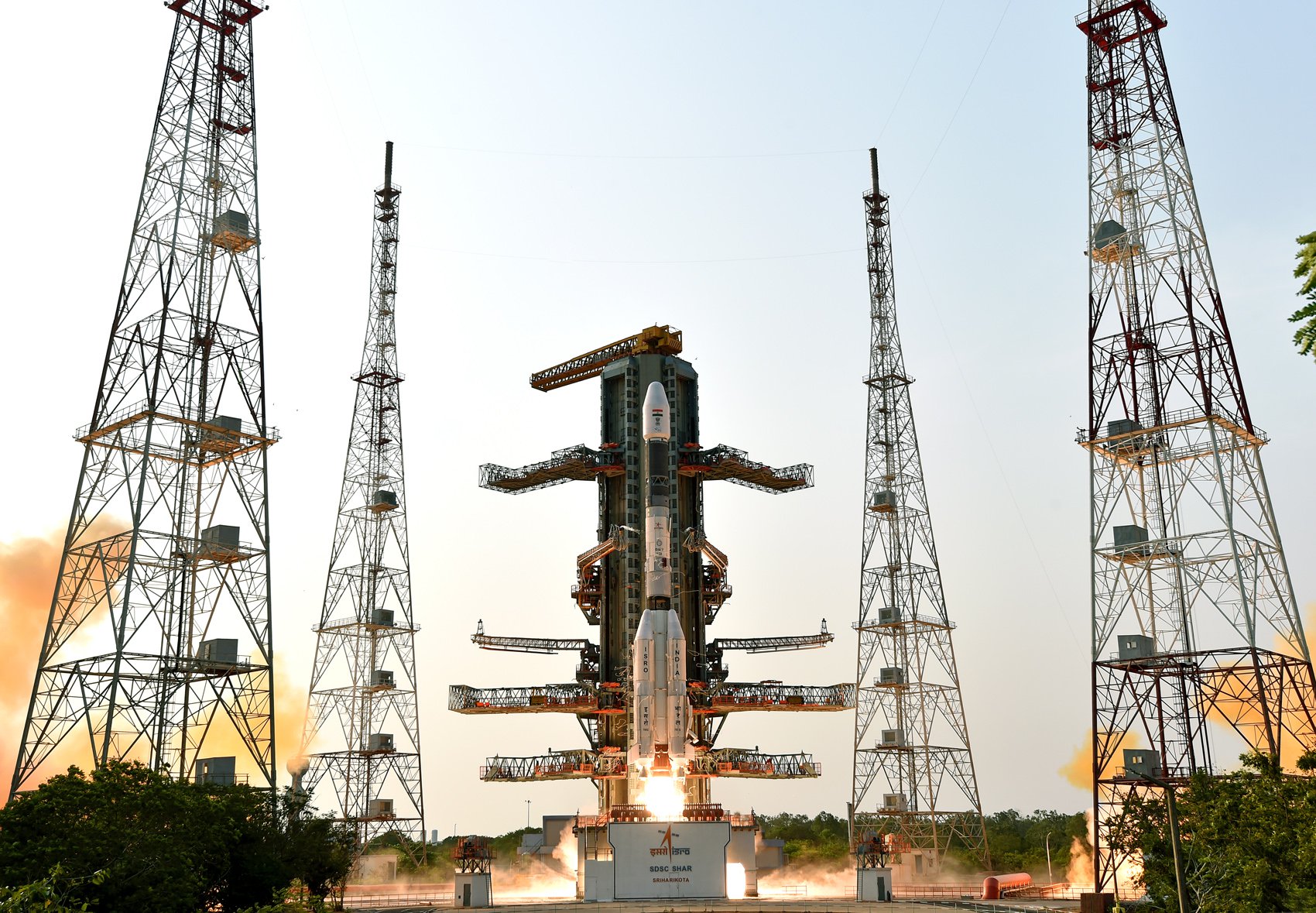
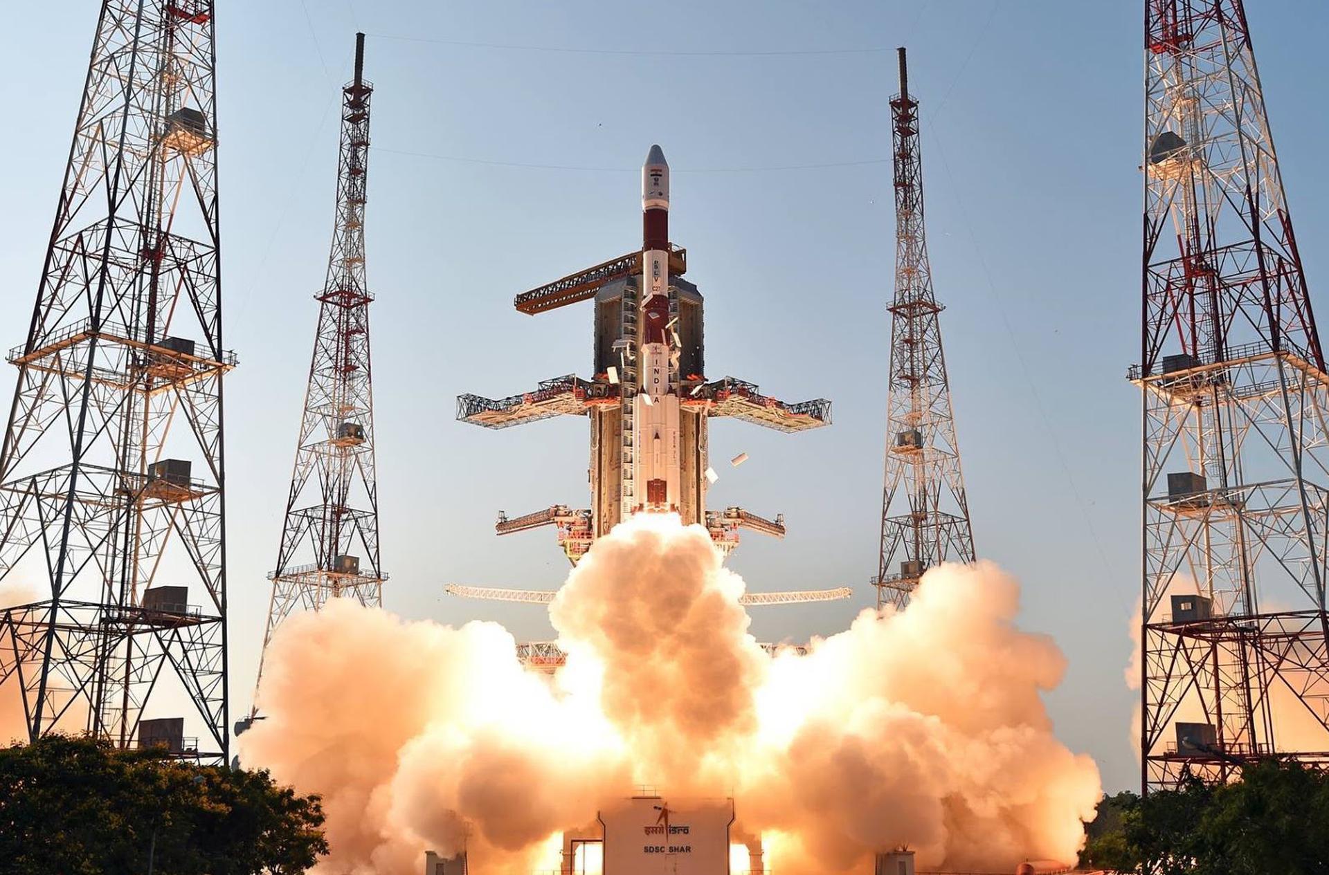
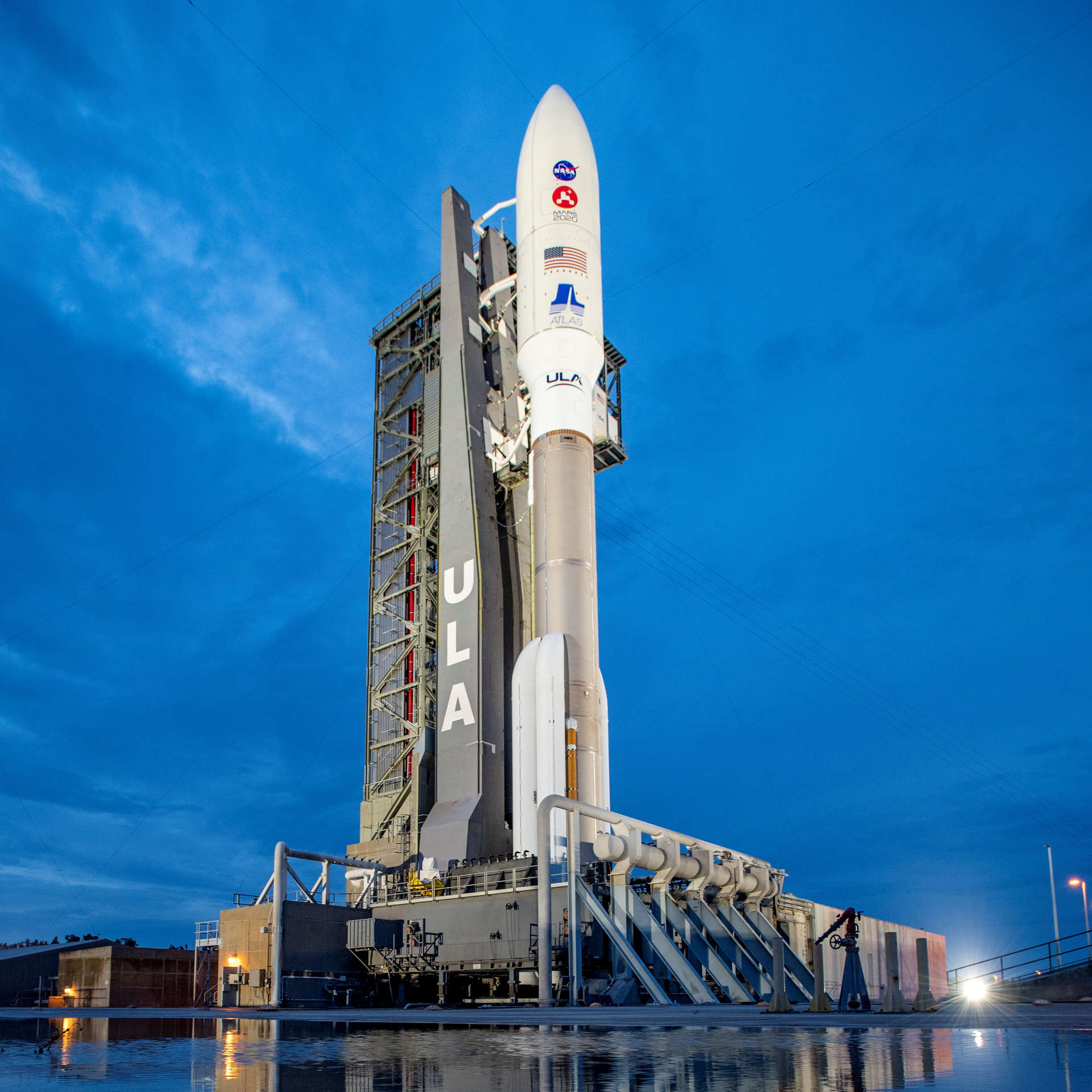
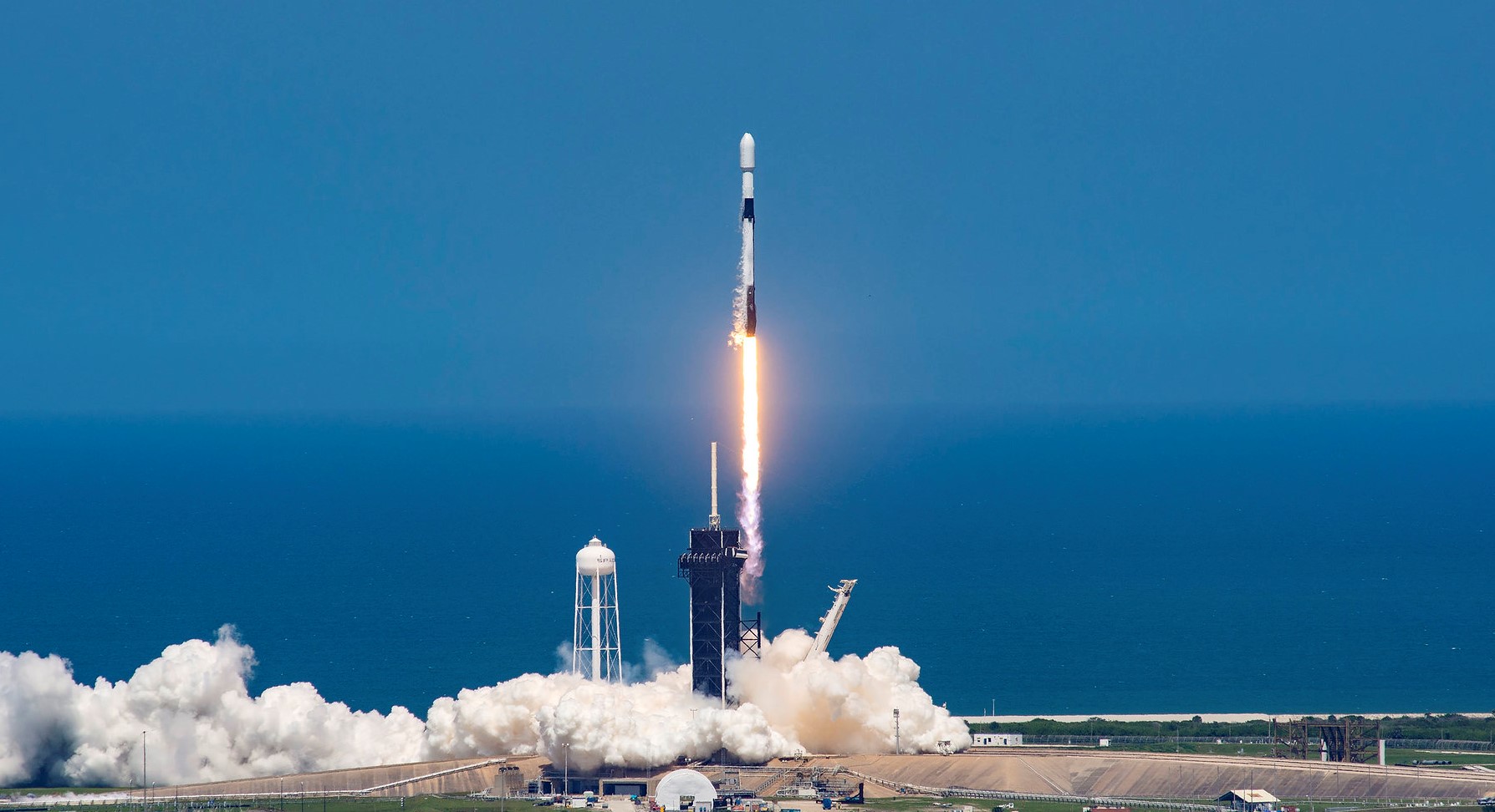
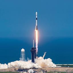
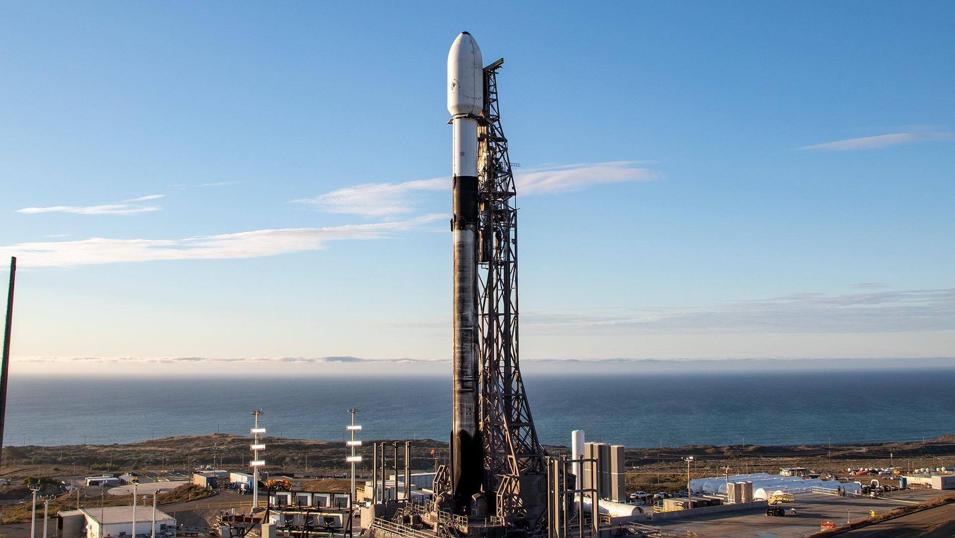
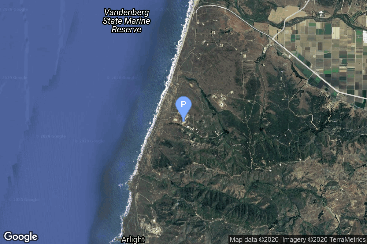
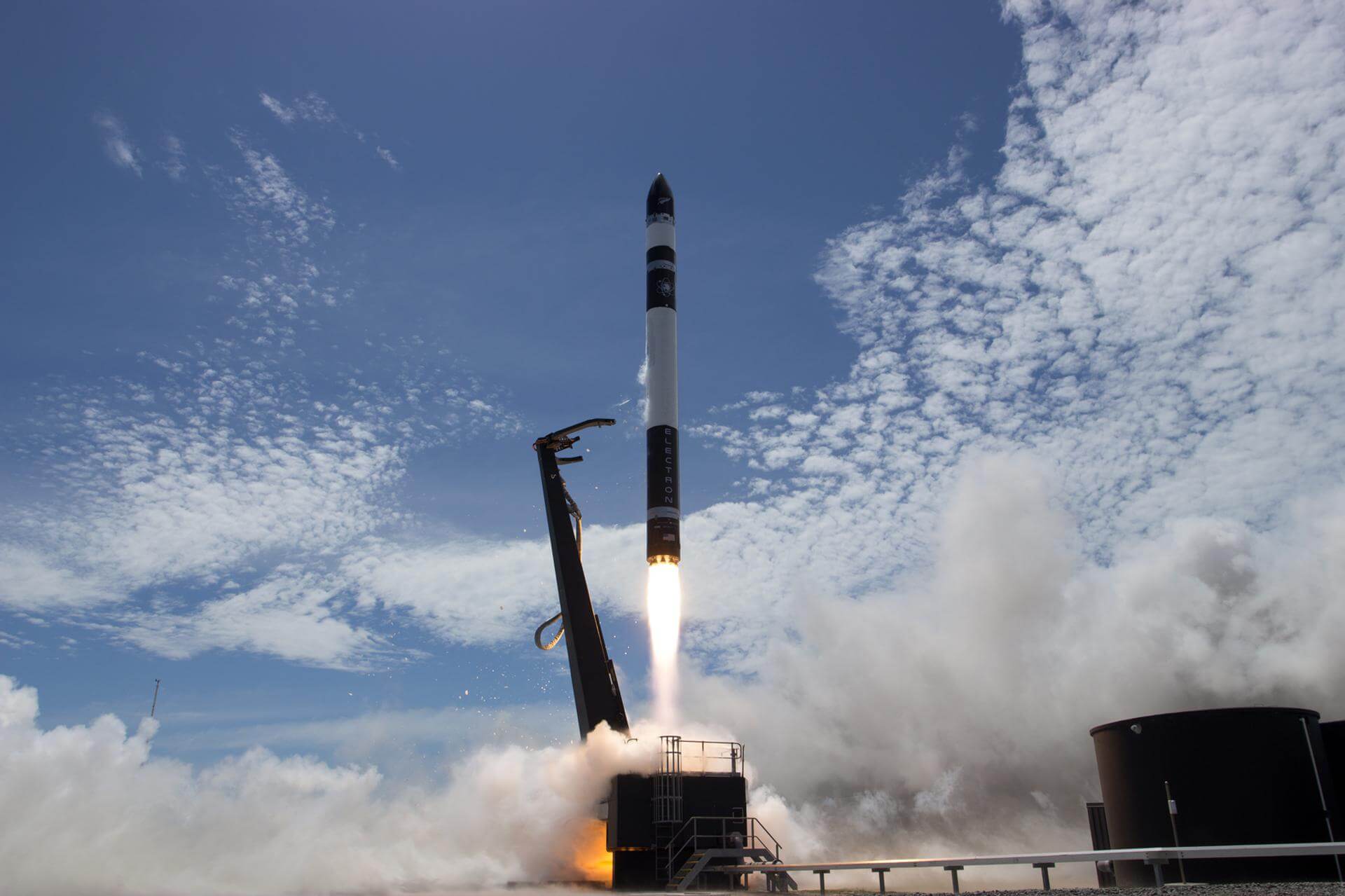
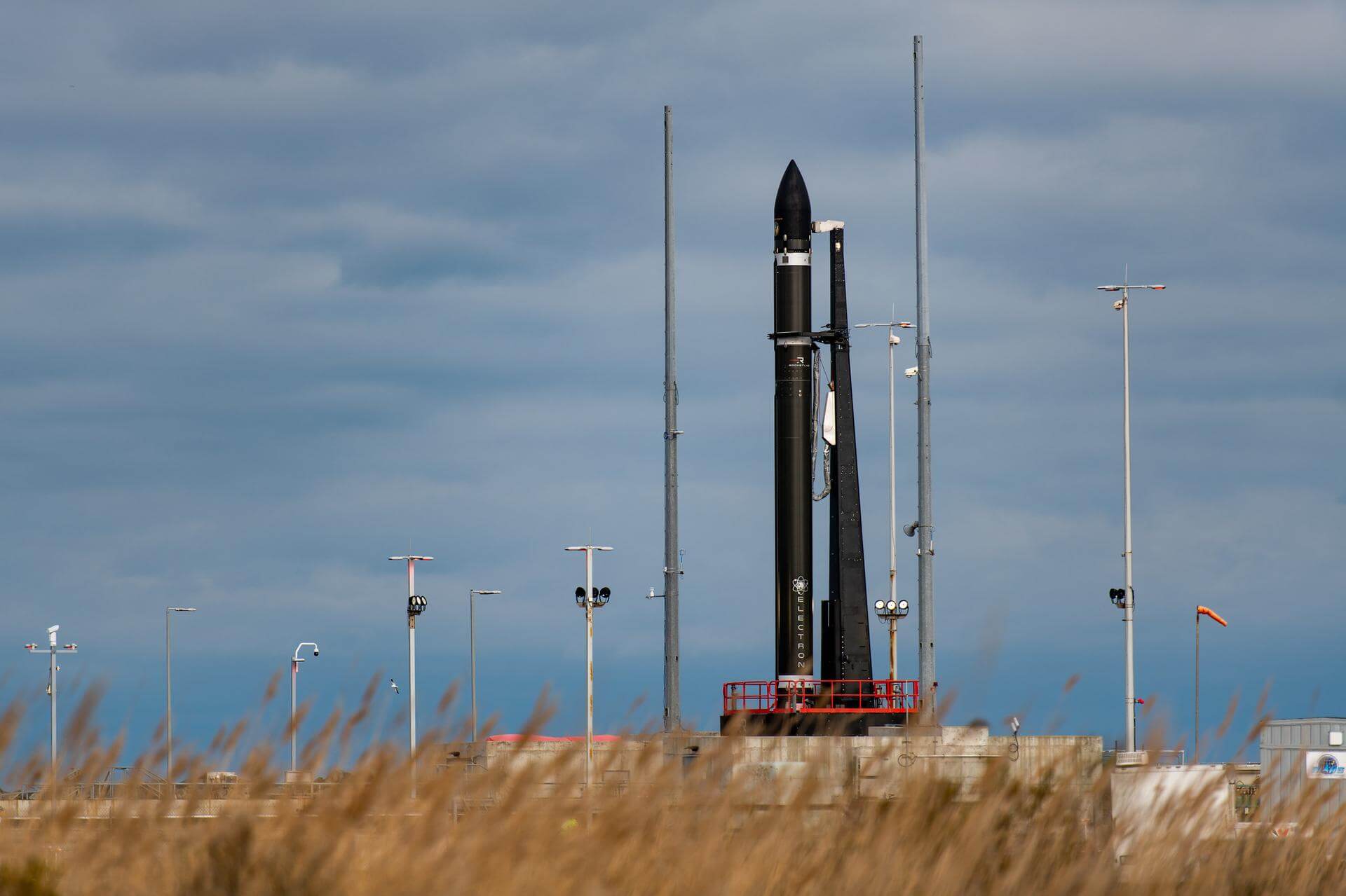
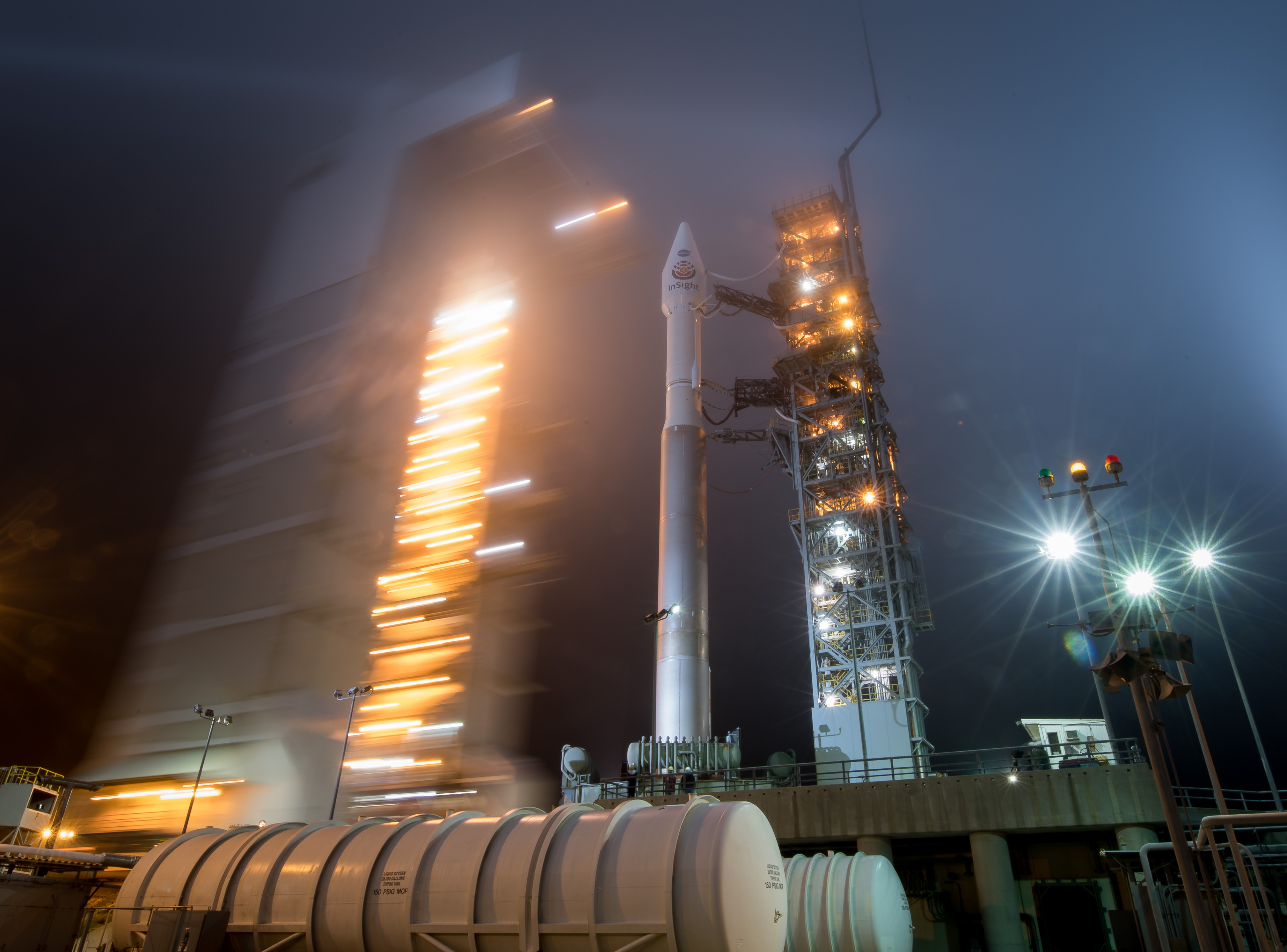