Landing Location List
Number of results
Use limit to control the number of objects in the response (max 100)
Example - /config/landing_locations/?limit=2
Format
Switch to JSON output - /config/landing_locations/?format=json
Help
Find all the FAQs and support links on the documentation homepage - lldev.thespacedevs.com/docs
GET /2.3.0/config/landing_locations/?format=api&offset=10&ordering=longitude
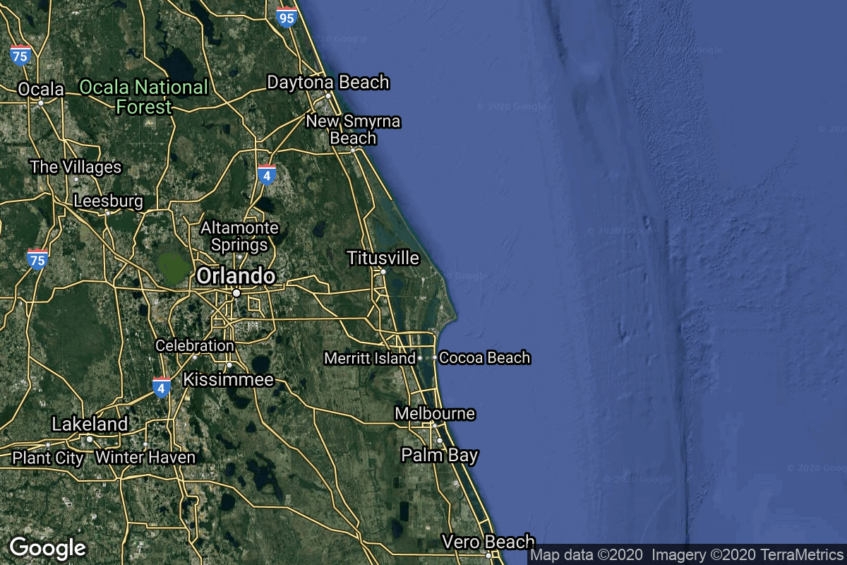
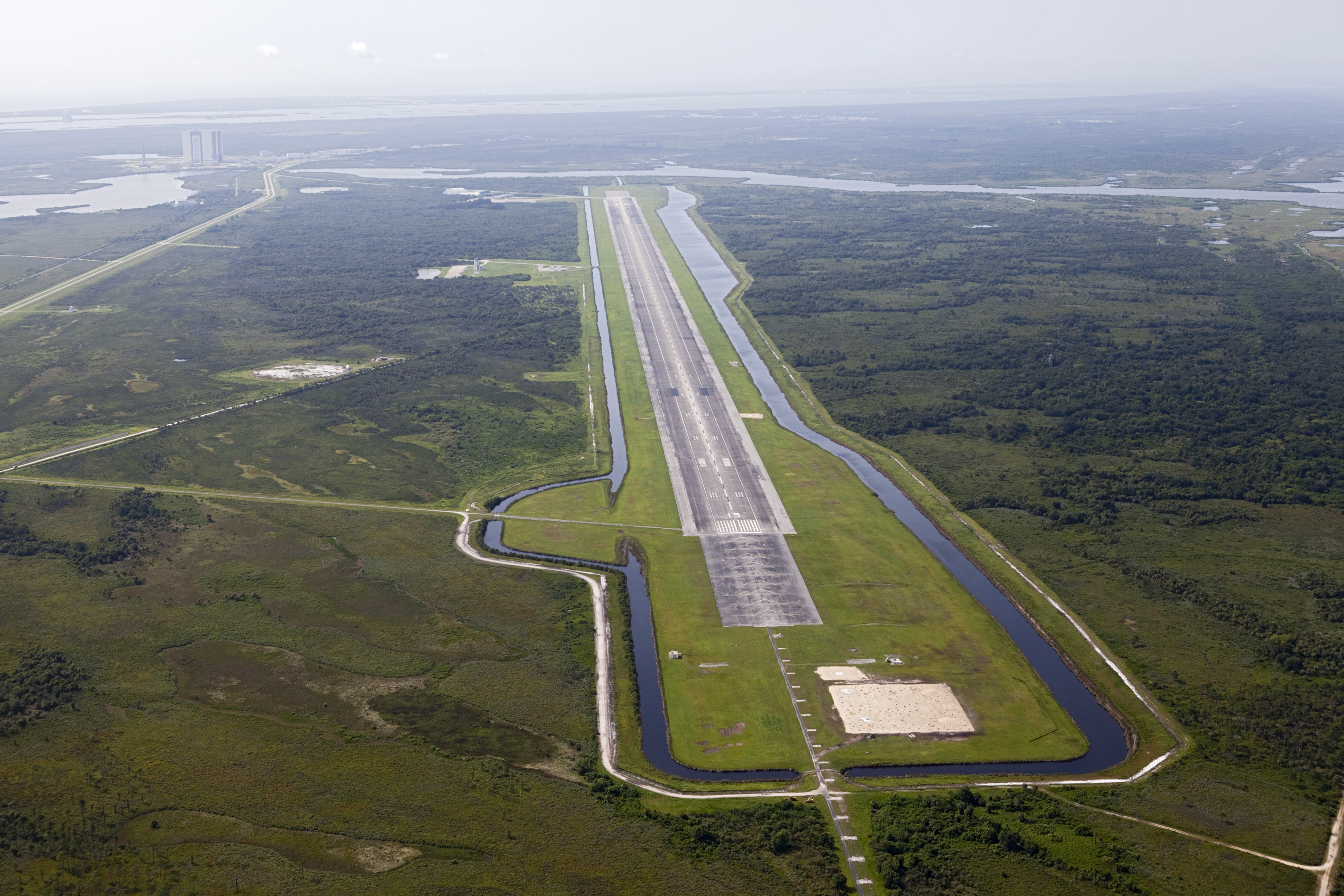
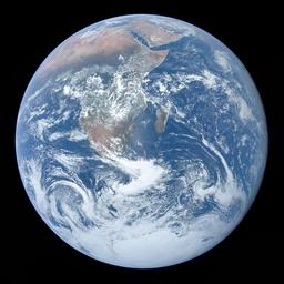
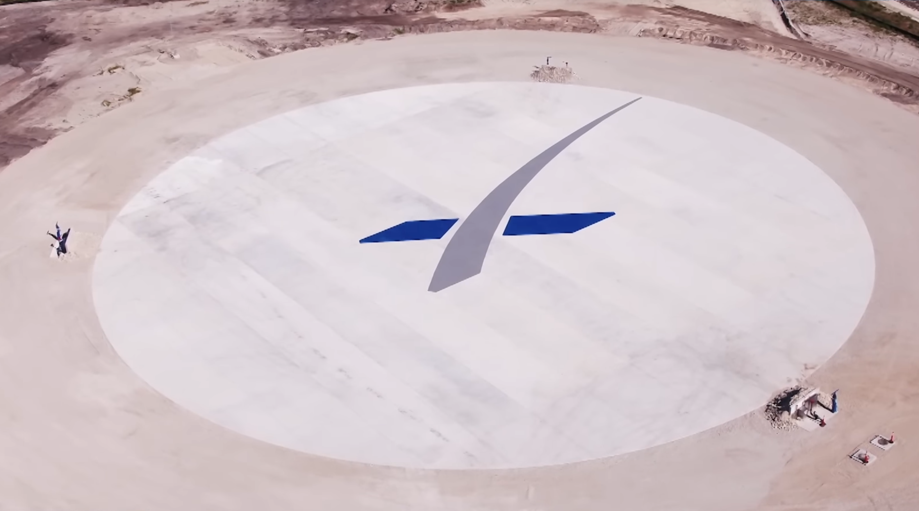
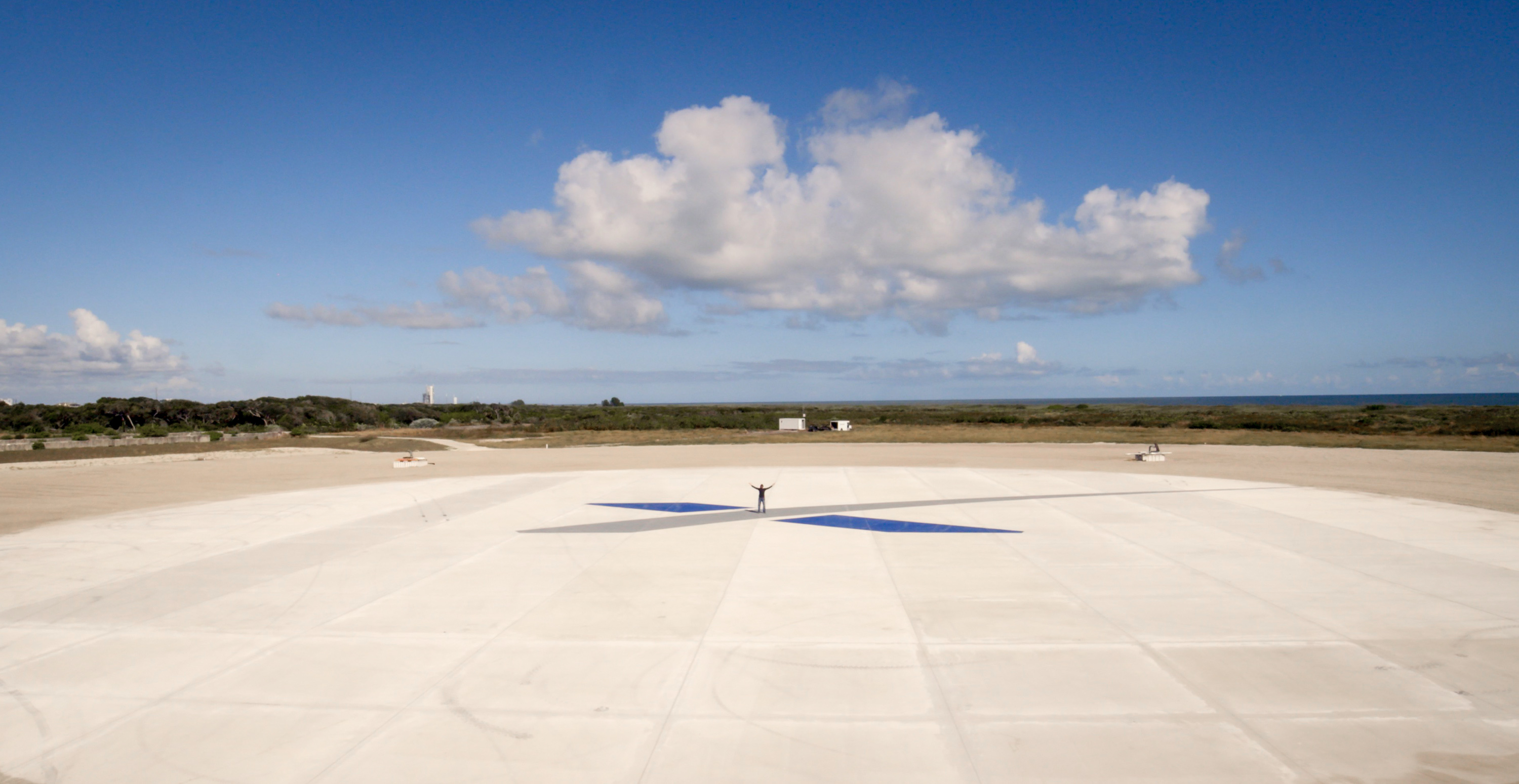
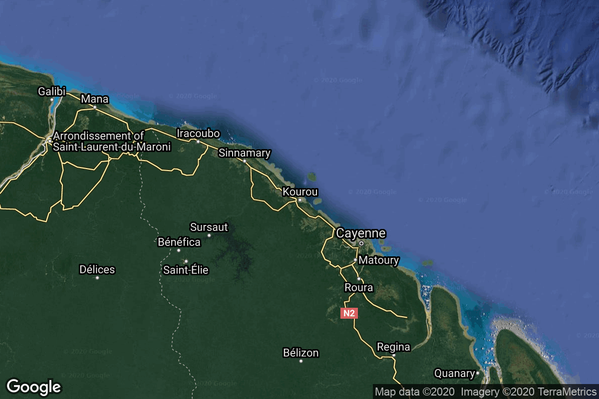
{ "count": 55, "next": "https://lldev.thespacedevs.com/2.3.0/config/landing_locations/?format=api&limit=10&offset=20&ordering=longitude", "previous": "https://lldev.thespacedevs.com/2.3.0/config/landing_locations/?format=api&limit=10&ordering=longitude", "results": [ { "id": 24, "name": "Shuttle Landing Facility", "active": true, "abbrev": "KTTS", "description": "Airport used for Space Shuttle landings, part of the Kennedy Space Center.", "location": { "response_mode": "normal", "id": 27, "url": "https://lldev.thespacedevs.com/2.3.0/locations/27/?format=api", "name": "Kennedy Space Center, FL, USA", "active": true, "country": { "id": 2, "name": "United States of America", "alpha_2_code": "US", "alpha_3_code": "USA", "nationality_name": "American", "nationality_name_composed": "Americano" }, "description": "The John F. Kennedy Space Center, located on Merritt Island, Florida, is one of NASA's ten field centers. Since 1968, KSC has been NASA's primary launch center of American spaceflight, research, and technology. Launch operations for the Apollo, Skylab and Space Shuttle programs were carried out from Kennedy Space Center Launch Complex 39 and managed by KSC. Located on the east coast of Florida, KSC is adjacent to Cape Canaveral Space Force Station (CCSFS).", "image": { "id": 2200, "name": "Cape Canaveral & KSC seen from orbit (STS-43)", "image_url": "https://thespacedevs-dev.nyc3.digitaloceanspaces.com/media/images/cape_canaveral__image_20240918151615.jpg", "thumbnail_url": "https://thespacedevs-dev.nyc3.digitaloceanspaces.com/media/images/cape_canaveral__image_thumbnail_20240918151616.jpeg", "credit": "NASA", "license": { "id": 4, "name": "NASA Image and Media Guidelines", "priority": 0, "link": "https://www.nasa.gov/nasa-brand-center/images-and-media/" }, "single_use": true, "variants": [] }, "map_image": "https://thespacedevs-dev.nyc3.digitaloceanspaces.com/media/map_images/location_27_20200803142447.jpg", "longitude": -80.650833, "latitude": 28.524167, "timezone_name": "America/New_York", "total_launch_count": 277, "total_landing_count": 0 }, "longitude": -80.6945, "latitude": 28.615, "image": { "id": 1974, "name": "Shuttle Landing Facility", "image_url": "https://thespacedevs-dev.nyc3.digitaloceanspaces.com/media/images/shuttle_landing_image_20240310170702.jpg", "thumbnail_url": "https://thespacedevs-dev.nyc3.digitaloceanspaces.com/media/images/shuttle_landing_image_thumbnail_20240310170703.jpeg", "credit": "NASA/Kim Shiflett", "license": { "id": 4, "name": "NASA Image and Media Guidelines", "priority": 0, "link": "https://www.nasa.gov/nasa-brand-center/images-and-media/" }, "single_use": true, "variants": [] }, "successful_landings": 81, "attempted_landings": 82, "failed_landings": 1, "celestial_body": { "response_mode": "normal", "id": 1, "name": "Earth", "type": { "id": 1, "name": "Planet" }, "diameter": 12742000.0, "mass": 5.972168e+24, "gravity": 9.80655, "length_of_day": "1 00:00:00", "atmosphere": true, "image": { "id": 2040, "name": "Earth (Apollo 17)", "image_url": "https://thespacedevs-dev.nyc3.digitaloceanspaces.com/media/images/earth_2528apol_image_20240402194304.jpeg", "thumbnail_url": "https://thespacedevs-dev.nyc3.digitaloceanspaces.com/media/images/earth_2528apol_image_thumbnail_20240402194305.jpeg", "credit": "NASA", "license": { "id": 4, "name": "NASA Image and Media Guidelines", "priority": 0, "link": "https://www.nasa.gov/nasa-brand-center/images-and-media/" }, "single_use": true, "variants": [] }, "description": "Earth is the third planet from the Sun and the only astronomical object known to harbor life.", "wiki_url": "https://en.wikipedia.org/wiki/Earth" } }, { "id": 50, "name": "Launch Complex 34", "active": false, "abbrev": "LC-34", "description": "", "location": { "response_mode": "normal", "id": 12, "url": "https://lldev.thespacedevs.com/2.3.0/locations/12/?format=api", "name": "Cape Canaveral SFS, FL, USA", "active": true, "country": { "id": 2, "name": "United States of America", "alpha_2_code": "US", "alpha_3_code": "USA", "nationality_name": "American", "nationality_name_composed": "Americano" }, "description": "Cape Canaveral Space Force Station (CCSFS) is an installation of the United States Space Force's Space Launch Delta 45, located on Cape Canaveral in Brevard County, Florida.", "image": { "id": 2200, "name": "Cape Canaveral & KSC seen from orbit (STS-43)", "image_url": "https://thespacedevs-dev.nyc3.digitaloceanspaces.com/media/images/cape_canaveral__image_20240918151615.jpg", "thumbnail_url": "https://thespacedevs-dev.nyc3.digitaloceanspaces.com/media/images/cape_canaveral__image_thumbnail_20240918151616.jpeg", "credit": "NASA", "license": { "id": 4, "name": "NASA Image and Media Guidelines", "priority": 0, "link": "https://www.nasa.gov/nasa-brand-center/images-and-media/" }, "single_use": true, "variants": [] }, "map_image": "https://thespacedevs-dev.nyc3.digitaloceanspaces.com/media/map_images/location_12_20200803142519.jpg", "longitude": -80.577778, "latitude": 28.488889, "timezone_name": "America/New_York", "total_launch_count": 1072, "total_landing_count": 69 }, "longitude": -80.561389, "latitude": 28.521944, "image": { "id": 2236, "name": "LC-34 in 1963", "image_url": "https://thespacedevs-dev.nyc3.digitaloceanspaces.com/media/images/lc-34_in_1963_image_20240920091635.jpg", "thumbnail_url": "https://thespacedevs-dev.nyc3.digitaloceanspaces.com/media/images/lc-34_in_1963_image_thumbnail_20240920091635.jpeg", "credit": "NASA", "license": { "id": 4, "name": "NASA Image and Media Guidelines", "priority": 0, "link": "https://www.nasa.gov/nasa-brand-center/images-and-media/" }, "single_use": true, "variants": [] }, "successful_landings": 0, "attempted_landings": 0, "failed_landings": 0, "celestial_body": { "response_mode": "normal", "id": 1, "name": "Earth", "type": { "id": 1, "name": "Planet" }, "diameter": 12742000.0, "mass": 5.972168e+24, "gravity": 9.80655, "length_of_day": "1 00:00:00", "atmosphere": true, "image": { "id": 2040, "name": "Earth (Apollo 17)", "image_url": "https://thespacedevs-dev.nyc3.digitaloceanspaces.com/media/images/earth_2528apol_image_20240402194304.jpeg", "thumbnail_url": "https://thespacedevs-dev.nyc3.digitaloceanspaces.com/media/images/earth_2528apol_image_thumbnail_20240402194305.jpeg", "credit": "NASA", "license": { "id": 4, "name": "NASA Image and Media Guidelines", "priority": 0, "link": "https://www.nasa.gov/nasa-brand-center/images-and-media/" }, "single_use": true, "variants": [] }, "description": "Earth is the third planet from the Sun and the only astronomical object known to harbor life.", "wiki_url": "https://en.wikipedia.org/wiki/Earth" } }, { "id": 5, "name": "Landing Zone 2", "active": true, "abbrev": "LZ-2", "description": "LZ-2 Pad located at Cape Canaveral Space Force Station at the previous LC-13. Directly next to LZ-1", "location": { "response_mode": "normal", "id": 12, "url": "https://lldev.thespacedevs.com/2.3.0/locations/12/?format=api", "name": "Cape Canaveral SFS, FL, USA", "active": true, "country": { "id": 2, "name": "United States of America", "alpha_2_code": "US", "alpha_3_code": "USA", "nationality_name": "American", "nationality_name_composed": "Americano" }, "description": "Cape Canaveral Space Force Station (CCSFS) is an installation of the United States Space Force's Space Launch Delta 45, located on Cape Canaveral in Brevard County, Florida.", "image": { "id": 2200, "name": "Cape Canaveral & KSC seen from orbit (STS-43)", "image_url": "https://thespacedevs-dev.nyc3.digitaloceanspaces.com/media/images/cape_canaveral__image_20240918151615.jpg", "thumbnail_url": "https://thespacedevs-dev.nyc3.digitaloceanspaces.com/media/images/cape_canaveral__image_thumbnail_20240918151616.jpeg", "credit": "NASA", "license": { "id": 4, "name": "NASA Image and Media Guidelines", "priority": 0, "link": "https://www.nasa.gov/nasa-brand-center/images-and-media/" }, "single_use": true, "variants": [] }, "map_image": "https://thespacedevs-dev.nyc3.digitaloceanspaces.com/media/map_images/location_12_20200803142519.jpg", "longitude": -80.577778, "latitude": 28.488889, "timezone_name": "America/New_York", "total_launch_count": 1072, "total_landing_count": 69 }, "longitude": -80.544964, "latitude": 28.48775, "image": { "id": 1976, "name": "LZ-2", "image_url": "https://thespacedevs-dev.nyc3.digitaloceanspaces.com/media/images/lz-2_image_20240310172018.png", "thumbnail_url": "https://thespacedevs-dev.nyc3.digitaloceanspaces.com/media/images/lz-2_image_thumbnail_20240310172019.png", "credit": "SpaceX", "license": { "id": 5, "name": "CC BY-NC 2.0", "priority": 1, "link": "https://creativecommons.org/licenses/by-nc/2.0/" }, "single_use": true, "variants": [] }, "successful_landings": 15, "attempted_landings": 15, "failed_landings": 0, "celestial_body": { "response_mode": "normal", "id": 1, "name": "Earth", "type": { "id": 1, "name": "Planet" }, "diameter": 12742000.0, "mass": 5.972168e+24, "gravity": 9.80655, "length_of_day": "1 00:00:00", "atmosphere": true, "image": { "id": 2040, "name": "Earth (Apollo 17)", "image_url": "https://thespacedevs-dev.nyc3.digitaloceanspaces.com/media/images/earth_2528apol_image_20240402194304.jpeg", "thumbnail_url": "https://thespacedevs-dev.nyc3.digitaloceanspaces.com/media/images/earth_2528apol_image_thumbnail_20240402194305.jpeg", "credit": "NASA", "license": { "id": 4, "name": "NASA Image and Media Guidelines", "priority": 0, "link": "https://www.nasa.gov/nasa-brand-center/images-and-media/" }, "single_use": true, "variants": [] }, "description": "Earth is the third planet from the Sun and the only astronomical object known to harbor life.", "wiki_url": "https://en.wikipedia.org/wiki/Earth" } }, { "id": 4, "name": "Landing Zone 1", "active": false, "abbrev": "LZ-1", "description": "LZ-1 Pad located at Cape Canaveral Space Force Station at the previous LC-13.", "location": { "response_mode": "normal", "id": 12, "url": "https://lldev.thespacedevs.com/2.3.0/locations/12/?format=api", "name": "Cape Canaveral SFS, FL, USA", "active": true, "country": { "id": 2, "name": "United States of America", "alpha_2_code": "US", "alpha_3_code": "USA", "nationality_name": "American", "nationality_name_composed": "Americano" }, "description": "Cape Canaveral Space Force Station (CCSFS) is an installation of the United States Space Force's Space Launch Delta 45, located on Cape Canaveral in Brevard County, Florida.", "image": { "id": 2200, "name": "Cape Canaveral & KSC seen from orbit (STS-43)", "image_url": "https://thespacedevs-dev.nyc3.digitaloceanspaces.com/media/images/cape_canaveral__image_20240918151615.jpg", "thumbnail_url": "https://thespacedevs-dev.nyc3.digitaloceanspaces.com/media/images/cape_canaveral__image_thumbnail_20240918151616.jpeg", "credit": "NASA", "license": { "id": 4, "name": "NASA Image and Media Guidelines", "priority": 0, "link": "https://www.nasa.gov/nasa-brand-center/images-and-media/" }, "single_use": true, "variants": [] }, "map_image": "https://thespacedevs-dev.nyc3.digitaloceanspaces.com/media/map_images/location_12_20200803142519.jpg", "longitude": -80.577778, "latitude": 28.488889, "timezone_name": "America/New_York", "total_launch_count": 1072, "total_landing_count": 69 }, "longitude": -80.542963, "latitude": 28.485712, "image": { "id": 1968, "name": "LZ-1 empty", "image_url": "https://thespacedevs-dev.nyc3.digitaloceanspaces.com/media/images/lz-1_empty_image_20240310163411.jpg", "thumbnail_url": "https://thespacedevs-dev.nyc3.digitaloceanspaces.com/media/images/lz-1_empty_image_thumbnail_20240310163411.jpeg", "credit": "SpaceX", "license": { "id": 5, "name": "CC BY-NC 2.0", "priority": 1, "link": "https://creativecommons.org/licenses/by-nc/2.0/" }, "single_use": true, "variants": [] }, "successful_landings": 53, "attempted_landings": 54, "failed_landings": 1, "celestial_body": { "response_mode": "normal", "id": 1, "name": "Earth", "type": { "id": 1, "name": "Planet" }, "diameter": 12742000.0, "mass": 5.972168e+24, "gravity": 9.80655, "length_of_day": "1 00:00:00", "atmosphere": true, "image": { "id": 2040, "name": "Earth (Apollo 17)", "image_url": "https://thespacedevs-dev.nyc3.digitaloceanspaces.com/media/images/earth_2528apol_image_20240402194304.jpeg", "thumbnail_url": "https://thespacedevs-dev.nyc3.digitaloceanspaces.com/media/images/earth_2528apol_image_thumbnail_20240402194305.jpeg", "credit": "NASA", "license": { "id": 4, "name": "NASA Image and Media Guidelines", "priority": 0, "link": "https://www.nasa.gov/nasa-brand-center/images-and-media/" }, "single_use": true, "variants": [] }, "description": "Earth is the third planet from the Sun and the only astronomical object known to harbor life.", "wiki_url": "https://en.wikipedia.org/wiki/Earth" } }, { "id": 59, "name": "Diamant Launch Area Landing Pad", "active": true, "abbrev": "DLALP", "description": "Landing pad for reusable first stages launched from the Diamant Launch Area.", "location": { "response_mode": "normal", "id": 13, "url": "https://lldev.thespacedevs.com/2.3.0/locations/13/?format=api", "name": "Guiana Space Centre, French Guiana", "active": true, "country": { "id": 50, "name": "French Guiana", "alpha_2_code": "GF", "alpha_3_code": "GUF", "nationality_name": "French Guianan", "nationality_name_composed": "Franco-Guiano" }, "description": "The Guiana Space Centre is a European spaceport to the northwest of Kourou in French Guiana, a region of France in South America. Kourou is located at a latitude of 5°. In operation since 1968, it is a suitable location for a spaceport because of its equatorial location and open sea to the east.", "image": { "id": 2203, "name": "Vega & Ariane 5 pads at the Guiana Space Centre", "image_url": "https://thespacedevs-dev.nyc3.digitaloceanspaces.com/media/images/vega_2526_aria_image_20240918154413.jpg", "thumbnail_url": "https://thespacedevs-dev.nyc3.digitaloceanspaces.com/media/images/vega_2526_aria_image_thumbnail_20240918154414.jpeg", "credit": "ESA/S. Corvaja", "license": { "id": 2, "name": "ESA Standard Licence", "priority": 2, "link": "https://www.esa.int/ESA_Multimedia/Terms_and_conditions_of_use_of_images_and_videos_available_on_the_esa_website" }, "single_use": true, "variants": [] }, "map_image": "https://thespacedevs-dev.nyc3.digitaloceanspaces.com/media/map_images/location_13_20200803142412.jpg", "longitude": -52.6903, "latitude": 5.169, "timezone_name": "America/Cayenne", "total_launch_count": 329, "total_landing_count": 0 }, "longitude": -52.7758051, "latitude": 5.2222222, "image": { "id": 2477, "name": "ELM Diamant render", "image_url": "https://thespacedevs-dev.nyc3.digitaloceanspaces.com/media/images/elm_diamant_ren_image_20250916111400.webp", "thumbnail_url": "https://thespacedevs-dev.nyc3.digitaloceanspaces.com/media/images/elm_diamant_ren_image_thumbnail_20250916111400.jpeg", "credit": "CNES/L'Œil du Chat", "license": { "id": 26, "name": "CNES Image Use Policy", "priority": 2, "link": "https://phototheque.cnes.fr/cnes/info2.do" }, "single_use": false, "variants": [] }, "successful_landings": 0, "attempted_landings": 0, "failed_landings": 0, "celestial_body": { "response_mode": "normal", "id": 1, "name": "Earth", "type": { "id": 1, "name": "Planet" }, "diameter": 12742000.0, "mass": 5.972168e+24, "gravity": 9.80655, "length_of_day": "1 00:00:00", "atmosphere": true, "image": { "id": 2040, "name": "Earth (Apollo 17)", "image_url": "https://thespacedevs-dev.nyc3.digitaloceanspaces.com/media/images/earth_2528apol_image_20240402194304.jpeg", "thumbnail_url": "https://thespacedevs-dev.nyc3.digitaloceanspaces.com/media/images/earth_2528apol_image_thumbnail_20240402194305.jpeg", "credit": "NASA", "license": { "id": 4, "name": "NASA Image and Media Guidelines", "priority": 0, "link": "https://www.nasa.gov/nasa-brand-center/images-and-media/" }, "single_use": true, "variants": [] }, "description": "Earth is the third planet from the Sun and the only astronomical object known to harbor life.", "wiki_url": "https://en.wikipedia.org/wiki/Earth" } }, { "id": 49, "name": "Chang’e 5 landing site", "active": false, "abbrev": "CE5", "description": "Landing site of the Chinese lunar sample return mission Chang’e 5 on 1 December 2020.", "location": { "response_mode": "normal", "id": 176, "url": "https://lldev.thespacedevs.com/2.3.0/locations/176/?format=api", "name": "Mons Rümker, Moon", "active": false, "country": null, "description": "Mons Rümker is an isolated volcanic formation that is located in the northwest part of the Moon's near side. The feature forms a large, elevated mound in the northern part of the Oceanus Procellarum.", "image": { "id": 2171, "name": "Mons Rümker seen from Apollo 15", "image_url": "https://thespacedevs-dev.nyc3.digitaloceanspaces.com/media/images/mons_r25c325b_image_20240813081840.jpg", "thumbnail_url": "https://thespacedevs-dev.nyc3.digitaloceanspaces.com/media/images/mons_r25c325b_image_thumbnail_20240813081841.jpeg", "credit": "NASA", "license": { "id": 4, "name": "NASA Image and Media Guidelines", "priority": 0, "link": "https://www.nasa.gov/nasa-brand-center/images-and-media/" }, "single_use": true, "variants": [] }, "map_image": "https://thespacedevs-dev.nyc3.digitaloceanspaces.com/media/map_images/location_chang25e225802599e_5_landing_site252c_mons_r25c325bcmker252c_moon_20240813035032.jpg", "longitude": null, "latitude": 40.8, "timezone_name": "", "total_launch_count": 1, "total_landing_count": 0 }, "longitude": -51.9161, "latitude": 43.0576, "image": { "id": 2172, "name": "Chang'e 5 on the lunar surface", "image_url": "https://thespacedevs-dev.nyc3.digitaloceanspaces.com/media/images/chang2527e_5_o_image_20240813082022.png", "thumbnail_url": "https://thespacedevs-dev.nyc3.digitaloceanspaces.com/media/images/chang2527e_5_o_image_thumbnail_20240813082023.png", "credit": "CNSA", "license": { "id": 1, "name": "Unknown", "priority": 9, "link": null }, "single_use": false, "variants": [] }, "successful_landings": 1, "attempted_landings": 1, "failed_landings": 0, "celestial_body": { "response_mode": "normal", "id": 2, "name": "Moon", "type": { "id": 2, "name": "Moon" }, "diameter": 3474800.0, "mass": 7.342e+22, "gravity": 1.622, "length_of_day": "27 07:43:12", "atmosphere": false, "image": { "id": 2041, "name": "Moon (Apollo 11)", "image_url": "https://thespacedevs-dev.nyc3.digitaloceanspaces.com/media/images/moon_2528apoll_image_20240402195408.jpg", "thumbnail_url": "https://thespacedevs-dev.nyc3.digitaloceanspaces.com/media/images/moon_2528apoll_image_thumbnail_20240402195408.jpeg", "credit": "NASA", "license": { "id": 4, "name": "NASA Image and Media Guidelines", "priority": 0, "link": "https://www.nasa.gov/nasa-brand-center/images-and-media/" }, "single_use": false, "variants": [] }, "description": "The Moon is Earth's only natural satellite.", "wiki_url": "https://en.wikipedia.org/wiki/Moon" } }, { "id": 52, "name": "Santa Maria", "active": true, "abbrev": "SM", "description": "Santa Maria is an island in the eastern group of the Azores archipelago (south of the island of São Miguel) and the southernmost island in the Azores.", "location": null, "longitude": -25.13588, "latitude": 36.99769, "image": { "id": 2269, "name": "Santa Maria ground station", "image_url": "https://thespacedevs-dev.nyc3.digitaloceanspaces.com/media/images/santa_maria_gro_image_20241109150149.jpeg", "thumbnail_url": "https://thespacedevs-dev.nyc3.digitaloceanspaces.com/media/images/santa_maria_gro_image_thumbnail_20241109150150.jpeg", "credit": "Portuguese Space Agency", "license": { "id": 34, "name": "Portuguese Space Agency Image Use Policy", "priority": 2, "link": "https://ptspace.pt/privacy-policy/" }, "single_use": true, "variants": [] }, "successful_landings": 0, "attempted_landings": 0, "failed_landings": 0, "celestial_body": { "response_mode": "normal", "id": 1, "name": "Earth", "type": { "id": 1, "name": "Planet" }, "diameter": 12742000.0, "mass": 5.972168e+24, "gravity": 9.80655, "length_of_day": "1 00:00:00", "atmosphere": true, "image": { "id": 2040, "name": "Earth (Apollo 17)", "image_url": "https://thespacedevs-dev.nyc3.digitaloceanspaces.com/media/images/earth_2528apol_image_20240402194304.jpeg", "thumbnail_url": "https://thespacedevs-dev.nyc3.digitaloceanspaces.com/media/images/earth_2528apol_image_thumbnail_20240402194305.jpeg", "credit": "NASA", "license": { "id": 4, "name": "NASA Image and Media Guidelines", "priority": 0, "link": "https://www.nasa.gov/nasa-brand-center/images-and-media/" }, "single_use": true, "variants": [] }, "description": "Earth is the third planet from the Sun and the only astronomical object known to harbor life.", "wiki_url": "https://en.wikipedia.org/wiki/Earth" } }, { "id": 41, "name": "Apollo 12 landing site", "active": false, "abbrev": "A12", "description": "Landing site of Apollo 12’s lunar module Intrepid on 19 November 1969.", "location": { "response_mode": "normal", "id": 168, "url": "https://lldev.thespacedevs.com/2.3.0/locations/168/?format=api", "name": "Oceanus Procellarum, Moon", "active": false, "country": null, "description": "Oceanus Procellarum is a vast lunar mare on the western edge of the near side of the Moon.", "image": { "id": 2141, "name": "Oceanus Procellarum", "image_url": "https://thespacedevs-dev.nyc3.digitaloceanspaces.com/media/images/mosaic_of_the_m_image_20240812093743.png", "thumbnail_url": "https://thespacedevs-dev.nyc3.digitaloceanspaces.com/media/images/mosaic_of_the_m_image_thumbnail_20240812093744.png", "credit": "NASA", "license": { "id": 4, "name": "NASA Image and Media Guidelines", "priority": 0, "link": "https://www.nasa.gov/nasa-brand-center/images-and-media/" }, "single_use": true, "variants": [] }, "map_image": "https://thespacedevs-dev.nyc3.digitaloceanspaces.com/media/map_images/location_apollo_12_landing_site252c_oceanus_procellarum252c_moon_20240813032914.jpg", "longitude": -57.4, "latitude": 18.4, "timezone_name": "", "total_launch_count": 1, "total_landing_count": 0 }, "longitude": -23.42157, "latitude": -3.01239, "image": { "id": 2159, "name": "Apollo 12 LM, Pete Conrad, and Surveyor III on the lunar surface", "image_url": "https://thespacedevs-dev.nyc3.digitaloceanspaces.com/media/images/apollo_12_lm_an_image_20240813071938.jpg", "thumbnail_url": "https://thespacedevs-dev.nyc3.digitaloceanspaces.com/media/images/apollo_12_lm_an_image_thumbnail_20240813071938.jpeg", "credit": "NASA/Alan L. Bean", "license": { "id": 4, "name": "NASA Image and Media Guidelines", "priority": 0, "link": "https://www.nasa.gov/nasa-brand-center/images-and-media/" }, "single_use": false, "variants": [] }, "successful_landings": 1, "attempted_landings": 1, "failed_landings": 0, "celestial_body": { "response_mode": "normal", "id": 2, "name": "Moon", "type": { "id": 2, "name": "Moon" }, "diameter": 3474800.0, "mass": 7.342e+22, "gravity": 1.622, "length_of_day": "27 07:43:12", "atmosphere": false, "image": { "id": 2041, "name": "Moon (Apollo 11)", "image_url": "https://thespacedevs-dev.nyc3.digitaloceanspaces.com/media/images/moon_2528apoll_image_20240402195408.jpg", "thumbnail_url": "https://thespacedevs-dev.nyc3.digitaloceanspaces.com/media/images/moon_2528apoll_image_thumbnail_20240402195408.jpeg", "credit": "NASA", "license": { "id": 4, "name": "NASA Image and Media Guidelines", "priority": 0, "link": "https://www.nasa.gov/nasa-brand-center/images-and-media/" }, "single_use": false, "variants": [] }, "description": "The Moon is Earth's only natural satellite.", "wiki_url": "https://en.wikipedia.org/wiki/Moon" } }, { "id": 42, "name": "Apollo 14 landing site", "active": false, "abbrev": "A14", "description": "Landing site of Apollo 14’s lunar module Antares on 5 February 1971.", "location": { "response_mode": "normal", "id": 169, "url": "https://lldev.thespacedevs.com/2.3.0/locations/169/?format=api", "name": "Fra Mauro Formation, Moon", "active": false, "country": null, "description": "The Fra Mauro formation (or Fra Mauro Highlands) is a formation on the near side of Earth's Moon that served as the landing site for the American Apollo 14 mission in 1971. It is named after the 80-kilometer-diameter crater Fra Mauro, located within it. The formation, as well as Fra Mauro crater, take their names from a 15th-century Italian monk and mapmaker of the same name.", "image": { "id": 2142, "name": "Fra Mauro from lunar orbit (Apollo 12)", "image_url": "https://thespacedevs-dev.nyc3.digitaloceanspaces.com/media/images/fra_mauro_from__image_20240812111040.jpg", "thumbnail_url": "https://thespacedevs-dev.nyc3.digitaloceanspaces.com/media/images/fra_mauro_from__image_thumbnail_20240812111041.jpeg", "credit": "NASA", "license": { "id": 4, "name": "NASA Image and Media Guidelines", "priority": 0, "link": "https://www.nasa.gov/nasa-brand-center/images-and-media/" }, "single_use": true, "variants": [] }, "map_image": "https://thespacedevs-dev.nyc3.digitaloceanspaces.com/media/map_images/location_apollo_14_landing_site252c_fra_mauro252c_moon_20240813033131.jpg", "longitude": -17.0, "latitude": -6.0, "timezone_name": "", "total_launch_count": 1, "total_landing_count": 0 }, "longitude": -17.47136, "latitude": -3.6453, "image": { "id": 2161, "name": "Apollo 14 LM on the lunar surface", "image_url": "https://thespacedevs-dev.nyc3.digitaloceanspaces.com/media/images/apollo_14_lm_on_image_20240813073933.jpg", "thumbnail_url": "https://thespacedevs-dev.nyc3.digitaloceanspaces.com/media/images/apollo_14_lm_on_image_thumbnail_20240813073933.jpeg", "credit": "NASA", "license": { "id": 4, "name": "NASA Image and Media Guidelines", "priority": 0, "link": "https://www.nasa.gov/nasa-brand-center/images-and-media/" }, "single_use": false, "variants": [] }, "successful_landings": 1, "attempted_landings": 1, "failed_landings": 0, "celestial_body": { "response_mode": "normal", "id": 2, "name": "Moon", "type": { "id": 2, "name": "Moon" }, "diameter": 3474800.0, "mass": 7.342e+22, "gravity": 1.622, "length_of_day": "27 07:43:12", "atmosphere": false, "image": { "id": 2041, "name": "Moon (Apollo 11)", "image_url": "https://thespacedevs-dev.nyc3.digitaloceanspaces.com/media/images/moon_2528apoll_image_20240402195408.jpg", "thumbnail_url": "https://thespacedevs-dev.nyc3.digitaloceanspaces.com/media/images/moon_2528apoll_image_thumbnail_20240402195408.jpeg", "credit": "NASA", "license": { "id": 4, "name": "NASA Image and Media Guidelines", "priority": 0, "link": "https://www.nasa.gov/nasa-brand-center/images-and-media/" }, "single_use": false, "variants": [] }, "description": "The Moon is Earth's only natural satellite.", "wiki_url": "https://en.wikipedia.org/wiki/Moon" } }, { "id": 36, "name": "Nova-C IM-1 landing site", "active": false, "abbrev": "IM1", "description": "Landing site of Intuitive Machine's Nova-C IM-1 lunar lander.", "location": { "response_mode": "normal", "id": 182, "url": "https://lldev.thespacedevs.com/2.3.0/locations/182/?format=api", "name": "Malapert-A", "active": true, "country": null, "description": "Malapert is a lunar impact crater that lies near the south pole of the Moon, named for 17th century astronomer Charles Malapert.", "image": { "id": 2238, "name": "Malapert-A imaged by the LRO", "image_url": "https://thespacedevs-dev.nyc3.digitaloceanspaces.com/media/images/malapert-a_imag_image_20240920092256.png", "thumbnail_url": "https://thespacedevs-dev.nyc3.digitaloceanspaces.com/media/images/malapert-a_imag_image_thumbnail_20240920092256.png", "credit": "NASA", "license": { "id": 4, "name": "NASA Image and Media Guidelines", "priority": 0, "link": "https://www.nasa.gov/nasa-brand-center/images-and-media/" }, "single_use": true, "variants": [] }, "map_image": null, "longitude": 12.9, "latitude": -84.9, "timezone_name": "", "total_launch_count": 0, "total_landing_count": 0 }, "longitude": 1.44, "latitude": -80.13, "image": { "id": 2238, "name": "Malapert-A imaged by the LRO", "image_url": "https://thespacedevs-dev.nyc3.digitaloceanspaces.com/media/images/malapert-a_imag_image_20240920092256.png", "thumbnail_url": "https://thespacedevs-dev.nyc3.digitaloceanspaces.com/media/images/malapert-a_imag_image_thumbnail_20240920092256.png", "credit": "NASA", "license": { "id": 4, "name": "NASA Image and Media Guidelines", "priority": 0, "link": "https://www.nasa.gov/nasa-brand-center/images-and-media/" }, "single_use": true, "variants": [] }, "successful_landings": 1, "attempted_landings": 1, "failed_landings": 0, "celestial_body": { "response_mode": "normal", "id": 2, "name": "Moon", "type": { "id": 2, "name": "Moon" }, "diameter": 3474800.0, "mass": 7.342e+22, "gravity": 1.622, "length_of_day": "27 07:43:12", "atmosphere": false, "image": { "id": 2041, "name": "Moon (Apollo 11)", "image_url": "https://thespacedevs-dev.nyc3.digitaloceanspaces.com/media/images/moon_2528apoll_image_20240402195408.jpg", "thumbnail_url": "https://thespacedevs-dev.nyc3.digitaloceanspaces.com/media/images/moon_2528apoll_image_thumbnail_20240402195408.jpeg", "credit": "NASA", "license": { "id": 4, "name": "NASA Image and Media Guidelines", "priority": 0, "link": "https://www.nasa.gov/nasa-brand-center/images-and-media/" }, "single_use": false, "variants": [] }, "description": "The Moon is Earth's only natural satellite.", "wiki_url": "https://en.wikipedia.org/wiki/Moon" } } ] }