Landing Location List
Number of results
Use limit to control the number of objects in the response (max 100)
Example - /config/landing_locations/?limit=2
Format
Switch to JSON output - /config/landing_locations/?format=json
Help
Find all the FAQs and support links on the documentation homepage - lldev.thespacedevs.com/docs
GET /2.3.0/config/landing_locations/?format=api&offset=10&ordering=-celestial_body
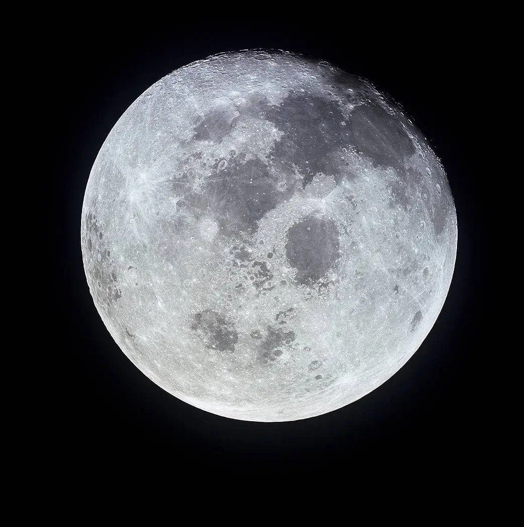
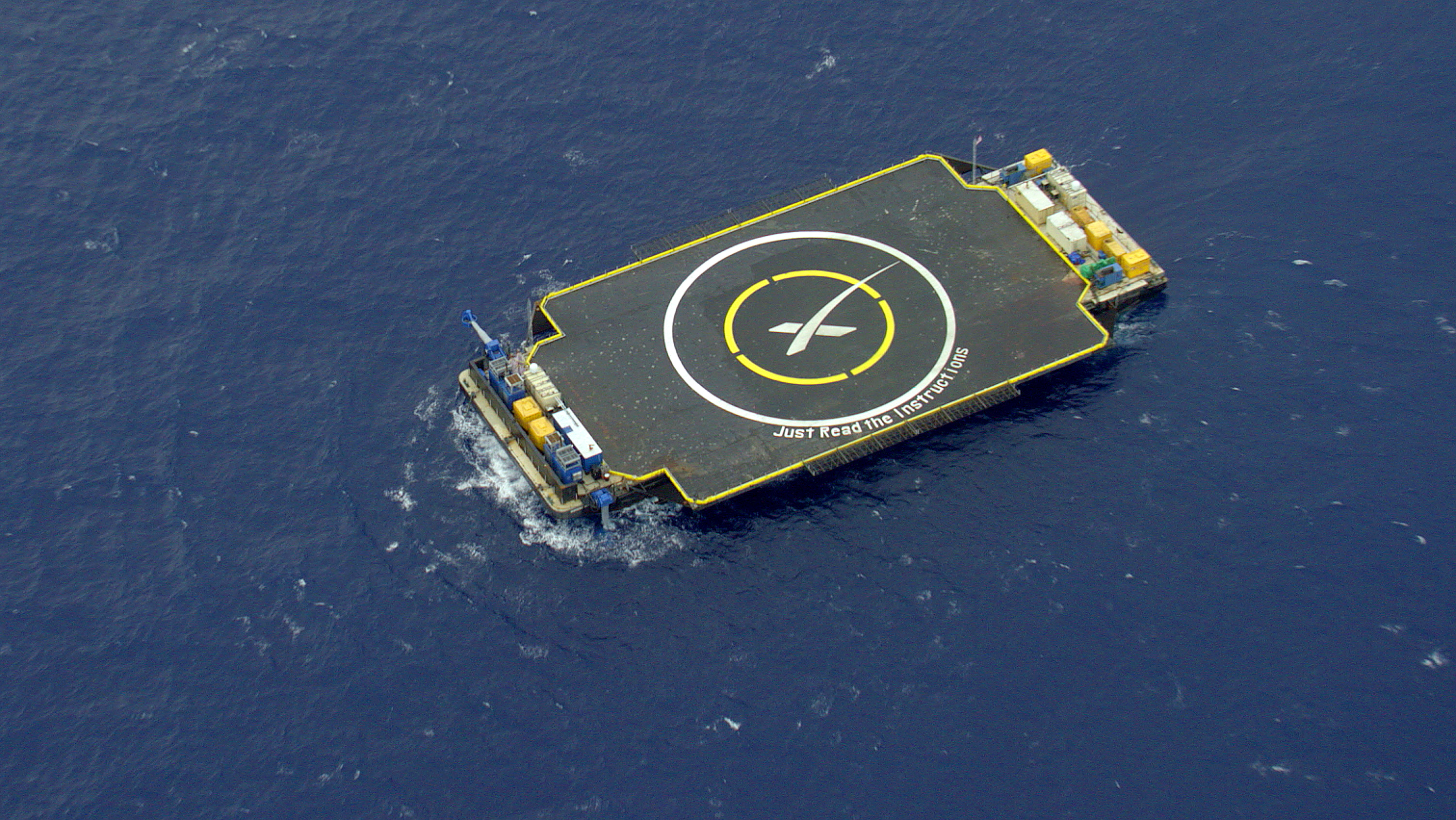
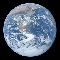
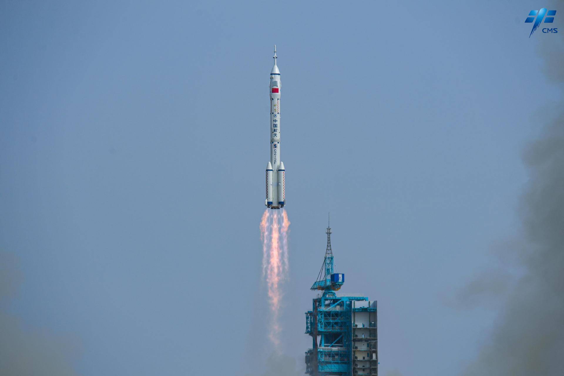
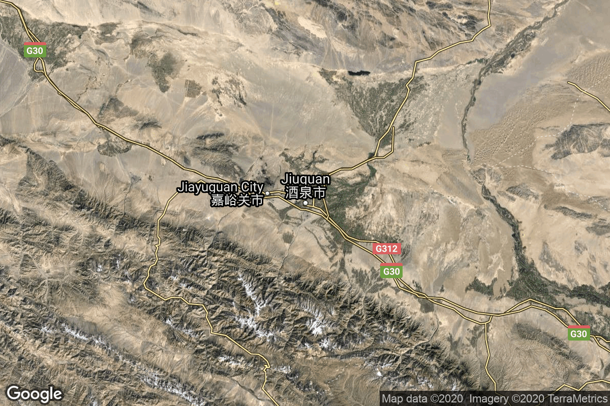
{ "count": 55, "next": "https://lldev.thespacedevs.com/2.3.0/config/landing_locations/?format=api&limit=10&offset=20&ordering=-celestial_body", "previous": "https://lldev.thespacedevs.com/2.3.0/config/landing_locations/?format=api&limit=10&ordering=-celestial_body", "results": [ { "id": 45, "name": "Apollo 17 landing site", "active": false, "abbrev": "A17", "description": "Landing site of Apollo 17’s lunar module Challenger on 11 December 1972.", "location": { "response_mode": "normal", "id": 172, "url": "https://lldev.thespacedevs.com/2.3.0/locations/172/?format=api", "name": "Taurus–Littrow, Moon", "active": false, "country": null, "description": "Taurus–Littrow is a lunar valley located on the near side at the coordinates 20.0°N 31.0°E. It served as the landing site for the American Apollo 17 mission in December 1972, the last crewed mission to the Moon. The valley is located on the southeastern edge of Mare Serenitatis along a ring of mountains formed between 3.8 and 3.9 billion years ago when a large object impacted the Moon, forming the Serenitatis basin and pushing rock outward and upward.", "image": { "id": 2146, "name": "Apollo 17 landing site at Taurus–Littrow valley", "image_url": "https://thespacedevs-dev.nyc3.digitaloceanspaces.com/media/images/apollo_17_landi_image_20240812113539.jpg", "thumbnail_url": "https://thespacedevs-dev.nyc3.digitaloceanspaces.com/media/images/apollo_17_landi_image_thumbnail_20240812113540.jpeg", "credit": "NASA", "license": { "id": 4, "name": "NASA Image and Media Guidelines", "priority": 0, "link": "https://www.nasa.gov/nasa-brand-center/images-and-media/" }, "single_use": true, "variants": [] }, "map_image": "https://thespacedevs-dev.nyc3.digitaloceanspaces.com/media/map_images/location_apollo_17_landing_site252c_taurus25e225802593littrow_valley252c_moo_20240813033827.jpg", "longitude": 31.0, "latitude": 20.0, "timezone_name": "", "total_launch_count": 1, "total_landing_count": 0 }, "longitude": 30.7717, "latitude": 20.1908, "image": { "id": 2163, "name": "Apollo 17 LM and Gene Cernan on the lunar surface", "image_url": "https://thespacedevs-dev.nyc3.digitaloceanspaces.com/media/images/apollo_17_lm_an_image_20240813074717.jpg", "thumbnail_url": "https://thespacedevs-dev.nyc3.digitaloceanspaces.com/media/images/apollo_17_lm_an_image_thumbnail_20240813074717.jpeg", "credit": "NASA/Harrison H. Schmitt", "license": { "id": 4, "name": "NASA Image and Media Guidelines", "priority": 0, "link": "https://www.nasa.gov/nasa-brand-center/images-and-media/" }, "single_use": false, "variants": [] }, "successful_landings": 1, "attempted_landings": 1, "failed_landings": 0, "celestial_body": { "response_mode": "normal", "id": 2, "name": "Moon", "type": { "id": 2, "name": "Moon" }, "diameter": 3474800.0, "mass": 7.342e+22, "gravity": 1.622, "length_of_day": "27 07:43:12", "atmosphere": false, "image": { "id": 2041, "name": "Moon (Apollo 11)", "image_url": "https://thespacedevs-dev.nyc3.digitaloceanspaces.com/media/images/moon_2528apoll_image_20240402195408.jpg", "thumbnail_url": "https://thespacedevs-dev.nyc3.digitaloceanspaces.com/media/images/moon_2528apoll_image_thumbnail_20240402195408.jpeg", "credit": "NASA", "license": { "id": 4, "name": "NASA Image and Media Guidelines", "priority": 0, "link": "https://www.nasa.gov/nasa-brand-center/images-and-media/" }, "single_use": false, "variants": [] }, "description": "The Moon is Earth's only natural satellite.", "wiki_url": "https://en.wikipedia.org/wiki/Moon" } }, { "id": 47, "name": "Luna 20 landing site", "active": false, "abbrev": "L20", "description": "Landing site of the successful Soviet lunar sample return mission Luna 20 on 21 February 1972.", "location": { "response_mode": "normal", "id": 174, "url": "https://lldev.thespacedevs.com/2.3.0/locations/174/?format=api", "name": "Terra Apollonius, Moon", "active": false, "country": null, "description": "Mountainous area near Mare Fecunditatis (Sea of Fertility).", "image": { "id": 2166, "name": "Luna 20 landing site at Terra Apollonius seen from LRO", "image_url": "https://thespacedevs-dev.nyc3.digitaloceanspaces.com/media/images/luna_20_landing_image_20240813080158.png", "thumbnail_url": "https://thespacedevs-dev.nyc3.digitaloceanspaces.com/media/images/luna_20_landing_image_thumbnail_20240813080159.png", "credit": "NASA", "license": { "id": 4, "name": "NASA Image and Media Guidelines", "priority": 0, "link": "https://www.nasa.gov/nasa-brand-center/images-and-media/" }, "single_use": false, "variants": [] }, "map_image": "https://thespacedevs-dev.nyc3.digitaloceanspaces.com/media/map_images/location_luna_20_landing_site252c_terra_apollonius252c_moon_20240813034436.jpg", "longitude": 56.6242, "latitude": 3.7863, "timezone_name": "", "total_launch_count": 1, "total_landing_count": 0 }, "longitude": 56.6242, "latitude": 3.7863, "image": { "id": 2166, "name": "Luna 20 landing site at Terra Apollonius seen from LRO", "image_url": "https://thespacedevs-dev.nyc3.digitaloceanspaces.com/media/images/luna_20_landing_image_20240813080158.png", "thumbnail_url": "https://thespacedevs-dev.nyc3.digitaloceanspaces.com/media/images/luna_20_landing_image_thumbnail_20240813080159.png", "credit": "NASA", "license": { "id": 4, "name": "NASA Image and Media Guidelines", "priority": 0, "link": "https://www.nasa.gov/nasa-brand-center/images-and-media/" }, "single_use": false, "variants": [] }, "successful_landings": 1, "attempted_landings": 1, "failed_landings": 0, "celestial_body": { "response_mode": "normal", "id": 2, "name": "Moon", "type": { "id": 2, "name": "Moon" }, "diameter": 3474800.0, "mass": 7.342e+22, "gravity": 1.622, "length_of_day": "27 07:43:12", "atmosphere": false, "image": { "id": 2041, "name": "Moon (Apollo 11)", "image_url": "https://thespacedevs-dev.nyc3.digitaloceanspaces.com/media/images/moon_2528apoll_image_20240402195408.jpg", "thumbnail_url": "https://thespacedevs-dev.nyc3.digitaloceanspaces.com/media/images/moon_2528apoll_image_thumbnail_20240402195408.jpeg", "credit": "NASA", "license": { "id": 4, "name": "NASA Image and Media Guidelines", "priority": 0, "link": "https://www.nasa.gov/nasa-brand-center/images-and-media/" }, "single_use": false, "variants": [] }, "description": "The Moon is Earth's only natural satellite.", "wiki_url": "https://en.wikipedia.org/wiki/Moon" } }, { "id": 55, "name": "Blue Ghost Mission 1 landing site", "active": true, "abbrev": "BGM1", "description": "Landing location for Firefly's Blue Ghost Mission 1 lunar lander, near Mons Latreille in Mare Crisium.", "location": { "response_mode": "normal", "id": 175, "url": "https://lldev.thespacedevs.com/2.3.0/locations/175/?format=api", "name": "Mare Crisium, Moon", "active": false, "country": null, "description": "Mare Crisium is a lunar mare located in the Moon's Crisium basin, just northeast of Mare Tranquillitatis. Mare Crisium is a basin of Nectarian age.", "image": { "id": 2167, "name": "Mare Crisium seen from LRO", "image_url": "https://thespacedevs-dev.nyc3.digitaloceanspaces.com/media/images/mare_crisium_se_image_20240813080640.png", "thumbnail_url": "https://thespacedevs-dev.nyc3.digitaloceanspaces.com/media/images/mare_crisium_se_image_thumbnail_20240813080640.png", "credit": "NASA", "license": { "id": 4, "name": "NASA Image and Media Guidelines", "priority": 0, "link": "https://www.nasa.gov/nasa-brand-center/images-and-media/" }, "single_use": true, "variants": [] }, "map_image": "https://thespacedevs-dev.nyc3.digitaloceanspaces.com/media/map_images/location_luna_24_landing_site252c_mare_crisium252c_moon_20240813034626.jpg", "longitude": 59.1, "latitude": 17.0, "timezone_name": "", "total_launch_count": 1, "total_landing_count": 0 }, "longitude": 61.92, "latitude": 18.47, "image": { "id": 2167, "name": "Mare Crisium seen from LRO", "image_url": "https://thespacedevs-dev.nyc3.digitaloceanspaces.com/media/images/mare_crisium_se_image_20240813080640.png", "thumbnail_url": "https://thespacedevs-dev.nyc3.digitaloceanspaces.com/media/images/mare_crisium_se_image_thumbnail_20240813080640.png", "credit": "NASA", "license": { "id": 4, "name": "NASA Image and Media Guidelines", "priority": 0, "link": "https://www.nasa.gov/nasa-brand-center/images-and-media/" }, "single_use": true, "variants": [] }, "successful_landings": 1, "attempted_landings": 1, "failed_landings": 0, "celestial_body": { "response_mode": "normal", "id": 2, "name": "Moon", "type": { "id": 2, "name": "Moon" }, "diameter": 3474800.0, "mass": 7.342e+22, "gravity": 1.622, "length_of_day": "27 07:43:12", "atmosphere": false, "image": { "id": 2041, "name": "Moon (Apollo 11)", "image_url": "https://thespacedevs-dev.nyc3.digitaloceanspaces.com/media/images/moon_2528apoll_image_20240402195408.jpg", "thumbnail_url": "https://thespacedevs-dev.nyc3.digitaloceanspaces.com/media/images/moon_2528apoll_image_thumbnail_20240402195408.jpeg", "credit": "NASA", "license": { "id": 4, "name": "NASA Image and Media Guidelines", "priority": 0, "link": "https://www.nasa.gov/nasa-brand-center/images-and-media/" }, "single_use": false, "variants": [] }, "description": "The Moon is Earth's only natural satellite.", "wiki_url": "https://en.wikipedia.org/wiki/Moon" } }, { "id": 56, "name": "Hakuto-R M2 landing site", "active": true, "abbrev": "HRM2", "description": "Landing site of ispace's Hakuto-R Mission 2 lunar lander.", "location": { "response_mode": "normal", "id": 180, "url": "https://lldev.thespacedevs.com/2.3.0/locations/180/?format=api", "name": "Mare Frigoris", "active": false, "country": null, "description": "Mare Frigoris is a lunar mare in the far north of the Moon. It is located in the outer rings of the Procellarum basin, just north of Mare Imbrium, and stretches east to north of Mare Serenitatis. It is just north of the dark crater Plato.", "image": { "id": 2312, "name": "Mare Frigoris seen from Lunar Orbiter 4", "image_url": "https://thespacedevs-dev.nyc3.digitaloceanspaces.com/media/images/mare_frigoris_s_image_20250115090515.jpg", "thumbnail_url": "https://thespacedevs-dev.nyc3.digitaloceanspaces.com/media/images/mare_frigoris_s_image_thumbnail_20250115090515.jpeg", "credit": "James Stuby based on NASA imagery", "license": { "id": 25, "name": "CC0 1.0", "priority": 3, "link": "https://creativecommons.org/publicdomain/zero/1.0/deed.en" }, "single_use": false, "variants": [] }, "map_image": null, "longitude": 1.4, "latitude": 56.0, "timezone_name": "", "total_launch_count": 0, "total_landing_count": 0 }, "longitude": null, "latitude": null, "image": { "id": 2312, "name": "Mare Frigoris seen from Lunar Orbiter 4", "image_url": "https://thespacedevs-dev.nyc3.digitaloceanspaces.com/media/images/mare_frigoris_s_image_20250115090515.jpg", "thumbnail_url": "https://thespacedevs-dev.nyc3.digitaloceanspaces.com/media/images/mare_frigoris_s_image_thumbnail_20250115090515.jpeg", "credit": "James Stuby based on NASA imagery", "license": { "id": 25, "name": "CC0 1.0", "priority": 3, "link": "https://creativecommons.org/publicdomain/zero/1.0/deed.en" }, "single_use": false, "variants": [] }, "successful_landings": 0, "attempted_landings": 1, "failed_landings": 1, "celestial_body": { "response_mode": "normal", "id": 2, "name": "Moon", "type": { "id": 2, "name": "Moon" }, "diameter": 3474800.0, "mass": 7.342e+22, "gravity": 1.622, "length_of_day": "27 07:43:12", "atmosphere": false, "image": { "id": 2041, "name": "Moon (Apollo 11)", "image_url": "https://thespacedevs-dev.nyc3.digitaloceanspaces.com/media/images/moon_2528apoll_image_20240402195408.jpg", "thumbnail_url": "https://thespacedevs-dev.nyc3.digitaloceanspaces.com/media/images/moon_2528apoll_image_thumbnail_20240402195408.jpeg", "credit": "NASA", "license": { "id": 4, "name": "NASA Image and Media Guidelines", "priority": 0, "link": "https://www.nasa.gov/nasa-brand-center/images-and-media/" }, "single_use": false, "variants": [] }, "description": "The Moon is Earth's only natural satellite.", "wiki_url": "https://en.wikipedia.org/wiki/Moon" } }, { "id": 46, "name": "Luna 16 landing site", "active": false, "abbrev": "L16", "description": "Landing site of the successful Soviet lunar sample return mission Luna 16 on 20 September 1970.", "location": { "response_mode": "normal", "id": 173, "url": "https://lldev.thespacedevs.com/2.3.0/locations/173/?format=api", "name": "Mare Fecunditatis, Moon", "active": false, "country": null, "description": "Mare Fecunditatis is a lunar mare in the eastern half of the visible Moon. The mare has a maximum diameter of 840 km.", "image": { "id": 2164, "name": "Mare Fecunditatis", "image_url": "https://thespacedevs-dev.nyc3.digitaloceanspaces.com/media/images/mare_fecunditat_image_20240813075141.jpg", "thumbnail_url": "https://thespacedevs-dev.nyc3.digitaloceanspaces.com/media/images/mare_fecunditat_image_thumbnail_20240813075141.jpeg", "credit": "NASA", "license": { "id": 4, "name": "NASA Image and Media Guidelines", "priority": 0, "link": "https://www.nasa.gov/nasa-brand-center/images-and-media/" }, "single_use": true, "variants": [] }, "map_image": "https://thespacedevs-dev.nyc3.digitaloceanspaces.com/media/map_images/location_luna_16_landing_site252c_mare_fecunditatis252c_moon_20240813034222.jpg", "longitude": 51.3, "latitude": -7.8, "timezone_name": "", "total_launch_count": 1, "total_landing_count": 0 }, "longitude": 56.3638, "latitude": -0.5137, "image": { "id": 2165, "name": "Luna 16 model", "image_url": "https://thespacedevs-dev.nyc3.digitaloceanspaces.com/media/images/luna_16_model_image_20240813075746.jpg", "thumbnail_url": "https://thespacedevs-dev.nyc3.digitaloceanspaces.com/media/images/luna_16_model_image_thumbnail_20240813075746.jpeg", "credit": "Bembmv", "license": { "id": 21, "name": "CC BY-SA 3.0", "priority": 4, "link": "https://creativecommons.org/licenses/by-sa/3.0/deed.en" }, "single_use": false, "variants": [] }, "successful_landings": 1, "attempted_landings": 1, "failed_landings": 0, "celestial_body": { "response_mode": "normal", "id": 2, "name": "Moon", "type": { "id": 2, "name": "Moon" }, "diameter": 3474800.0, "mass": 7.342e+22, "gravity": 1.622, "length_of_day": "27 07:43:12", "atmosphere": false, "image": { "id": 2041, "name": "Moon (Apollo 11)", "image_url": "https://thespacedevs-dev.nyc3.digitaloceanspaces.com/media/images/moon_2528apoll_image_20240402195408.jpg", "thumbnail_url": "https://thespacedevs-dev.nyc3.digitaloceanspaces.com/media/images/moon_2528apoll_image_thumbnail_20240402195408.jpeg", "credit": "NASA", "license": { "id": 4, "name": "NASA Image and Media Guidelines", "priority": 0, "link": "https://www.nasa.gov/nasa-brand-center/images-and-media/" }, "single_use": false, "variants": [] }, "description": "The Moon is Earth's only natural satellite.", "wiki_url": "https://en.wikipedia.org/wiki/Moon" } }, { "id": 48, "name": "Luna 24 landing site", "active": false, "abbrev": "L24", "description": "Landing site of the successful Soviet lunar sample return mission Luna 24 on 18 August 1976.", "location": { "response_mode": "normal", "id": 175, "url": "https://lldev.thespacedevs.com/2.3.0/locations/175/?format=api", "name": "Mare Crisium, Moon", "active": false, "country": null, "description": "Mare Crisium is a lunar mare located in the Moon's Crisium basin, just northeast of Mare Tranquillitatis. Mare Crisium is a basin of Nectarian age.", "image": { "id": 2167, "name": "Mare Crisium seen from LRO", "image_url": "https://thespacedevs-dev.nyc3.digitaloceanspaces.com/media/images/mare_crisium_se_image_20240813080640.png", "thumbnail_url": "https://thespacedevs-dev.nyc3.digitaloceanspaces.com/media/images/mare_crisium_se_image_thumbnail_20240813080640.png", "credit": "NASA", "license": { "id": 4, "name": "NASA Image and Media Guidelines", "priority": 0, "link": "https://www.nasa.gov/nasa-brand-center/images-and-media/" }, "single_use": true, "variants": [] }, "map_image": "https://thespacedevs-dev.nyc3.digitaloceanspaces.com/media/map_images/location_luna_24_landing_site252c_mare_crisium252c_moon_20240813034626.jpg", "longitude": 59.1, "latitude": 17.0, "timezone_name": "", "total_launch_count": 1, "total_landing_count": 0 }, "longitude": 62.2097, "latitude": 12.7145, "image": { "id": 2168, "name": "Luna 24 model", "image_url": "https://thespacedevs-dev.nyc3.digitaloceanspaces.com/media/images/luna_24_model_image_20240813080836.jpg", "thumbnail_url": "https://thespacedevs-dev.nyc3.digitaloceanspaces.com/media/images/luna_24_model_image_thumbnail_20240813080836.jpeg", "credit": "Музей Космонавтики from Россия", "license": { "id": 25, "name": "CC0 1.0", "priority": 3, "link": "https://creativecommons.org/publicdomain/zero/1.0/deed.en" }, "single_use": false, "variants": [] }, "successful_landings": 1, "attempted_landings": 1, "failed_landings": 0, "celestial_body": { "response_mode": "normal", "id": 2, "name": "Moon", "type": { "id": 2, "name": "Moon" }, "diameter": 3474800.0, "mass": 7.342e+22, "gravity": 1.622, "length_of_day": "27 07:43:12", "atmosphere": false, "image": { "id": 2041, "name": "Moon (Apollo 11)", "image_url": "https://thespacedevs-dev.nyc3.digitaloceanspaces.com/media/images/moon_2528apoll_image_20240402195408.jpg", "thumbnail_url": "https://thespacedevs-dev.nyc3.digitaloceanspaces.com/media/images/moon_2528apoll_image_thumbnail_20240402195408.jpeg", "credit": "NASA", "license": { "id": 4, "name": "NASA Image and Media Guidelines", "priority": 0, "link": "https://www.nasa.gov/nasa-brand-center/images-and-media/" }, "single_use": false, "variants": [] }, "description": "The Moon is Earth's only natural satellite.", "wiki_url": "https://en.wikipedia.org/wiki/Moon" } }, { "id": 54, "name": "Hakuto-R M1 crash site", "active": false, "abbrev": "HRM1", "description": "Crash site of the Japanese Hakuto-R M1 lunar lander.", "location": { "response_mode": "normal", "id": 179, "url": "https://lldev.thespacedevs.com/2.3.0/locations/179/?format=api", "name": "Atlas crater, Moon", "active": false, "country": null, "description": "Atlas is a prominent lunar impact crater that is located in the northeast part of the Moon, to the southeast of Mare Frigoris. Just to the west is the slightly smaller but still prominent crater Hercules. Northeast of Atlas is the large crater Endymion.", "image": { "id": 2309, "name": "Atlas crater seen by the LRO (mosaic)", "image_url": "https://thespacedevs-dev.nyc3.digitaloceanspaces.com/media/images/atlas_crater_se_image_20250115074600.jpg", "thumbnail_url": "https://thespacedevs-dev.nyc3.digitaloceanspaces.com/media/images/atlas_crater_se_image_thumbnail_20250115074600.jpeg", "credit": "James Stuby based on NASA imagery", "license": { "id": 25, "name": "CC0 1.0", "priority": 3, "link": "https://creativecommons.org/publicdomain/zero/1.0/deed.en" }, "single_use": false, "variants": [] }, "map_image": null, "longitude": 44.4, "latitude": 46.7, "timezone_name": "", "total_launch_count": 0, "total_landing_count": 0 }, "longitude": 44.094, "latitude": 47.581, "image": { "id": 2309, "name": "Atlas crater seen by the LRO (mosaic)", "image_url": "https://thespacedevs-dev.nyc3.digitaloceanspaces.com/media/images/atlas_crater_se_image_20250115074600.jpg", "thumbnail_url": "https://thespacedevs-dev.nyc3.digitaloceanspaces.com/media/images/atlas_crater_se_image_thumbnail_20250115074600.jpeg", "credit": "James Stuby based on NASA imagery", "license": { "id": 25, "name": "CC0 1.0", "priority": 3, "link": "https://creativecommons.org/publicdomain/zero/1.0/deed.en" }, "single_use": false, "variants": [] }, "successful_landings": 0, "attempted_landings": 1, "failed_landings": 1, "celestial_body": { "response_mode": "normal", "id": 2, "name": "Moon", "type": { "id": 2, "name": "Moon" }, "diameter": 3474800.0, "mass": 7.342e+22, "gravity": 1.622, "length_of_day": "27 07:43:12", "atmosphere": false, "image": { "id": 2041, "name": "Moon (Apollo 11)", "image_url": "https://thespacedevs-dev.nyc3.digitaloceanspaces.com/media/images/moon_2528apoll_image_20240402195408.jpg", "thumbnail_url": "https://thespacedevs-dev.nyc3.digitaloceanspaces.com/media/images/moon_2528apoll_image_thumbnail_20240402195408.jpeg", "credit": "NASA", "license": { "id": 4, "name": "NASA Image and Media Guidelines", "priority": 0, "link": "https://www.nasa.gov/nasa-brand-center/images-and-media/" }, "single_use": false, "variants": [] }, "description": "The Moon is Earth's only natural satellite.", "wiki_url": "https://en.wikipedia.org/wiki/Moon" } }, { "id": 35, "name": "Just Read the Instructions (Original)", "active": false, "abbrev": "JRTI", "description": "1st (Marmac 300) ASDS barge, Just Read the Instructions (JRTI) was used for 2 Falcon 9 landing attempts in the Altantic Ocean.", "location": null, "longitude": null, "latitude": null, "image": { "id": 1970, "name": "JRTI (Marmac 300) empty", "image_url": "https://thespacedevs-dev.nyc3.digitaloceanspaces.com/media/images/jrti_2528marma_image_20240310164519.jpg", "thumbnail_url": "https://thespacedevs-dev.nyc3.digitaloceanspaces.com/media/images/jrti_2528marma_image_thumbnail_20240310164520.jpeg", "credit": "SpaceX", "license": { "id": 5, "name": "CC BY-NC 2.0", "priority": 1, "link": "https://creativecommons.org/licenses/by-nc/2.0/" }, "single_use": true, "variants": [] }, "successful_landings": 0, "attempted_landings": 2, "failed_landings": 2, "celestial_body": { "response_mode": "normal", "id": 1, "name": "Earth", "type": { "id": 1, "name": "Planet" }, "diameter": 12742000.0, "mass": 5.972168e+24, "gravity": 9.80655, "length_of_day": "1 00:00:00", "atmosphere": true, "image": { "id": 2040, "name": "Earth (Apollo 17)", "image_url": "https://thespacedevs-dev.nyc3.digitaloceanspaces.com/media/images/earth_2528apol_image_20240402194304.jpeg", "thumbnail_url": "https://thespacedevs-dev.nyc3.digitaloceanspaces.com/media/images/earth_2528apol_image_thumbnail_20240402194305.jpeg", "credit": "NASA", "license": { "id": 4, "name": "NASA Image and Media Guidelines", "priority": 0, "link": "https://www.nasa.gov/nasa-brand-center/images-and-media/" }, "single_use": true, "variants": [] }, "description": "Earth is the third planet from the Sun and the only astronomical object known to harbor life.", "wiki_url": "https://en.wikipedia.org/wiki/Earth" } }, { "id": 12, "name": "Unknown", "active": true, "abbrev": "N/A", "description": null, "location": null, "longitude": null, "latitude": null, "image": null, "successful_landings": 0, "attempted_landings": 0, "failed_landings": 0, "celestial_body": { "response_mode": "normal", "id": 1, "name": "Earth", "type": { "id": 1, "name": "Planet" }, "diameter": 12742000.0, "mass": 5.972168e+24, "gravity": 9.80655, "length_of_day": "1 00:00:00", "atmosphere": true, "image": { "id": 2040, "name": "Earth (Apollo 17)", "image_url": "https://thespacedevs-dev.nyc3.digitaloceanspaces.com/media/images/earth_2528apol_image_20240402194304.jpeg", "thumbnail_url": "https://thespacedevs-dev.nyc3.digitaloceanspaces.com/media/images/earth_2528apol_image_thumbnail_20240402194305.jpeg", "credit": "NASA", "license": { "id": 4, "name": "NASA Image and Media Guidelines", "priority": 0, "link": "https://www.nasa.gov/nasa-brand-center/images-and-media/" }, "single_use": true, "variants": [] }, "description": "Earth is the third planet from the Sun and the only astronomical object known to harbor life.", "wiki_url": "https://en.wikipedia.org/wiki/Earth" } }, { "id": 60, "name": "Zhuque-3 Landing Site", "active": true, "abbrev": "ZQ-3 LZ", "description": "Landing site for first stage boosters of LandSpace’s Zhuque-3 rocket at Minqin County, Gansu Province, China.", "location": { "response_mode": "normal", "id": 17, "url": "https://lldev.thespacedevs.com/2.3.0/locations/17/?format=api", "name": "Jiuquan Satellite Launch Center, People's Republic of China", "active": true, "country": { "id": 6, "name": "China", "alpha_2_code": "CN", "alpha_3_code": "CHN", "nationality_name": "Chinese", "nationality_name_composed": "Sino" }, "description": "Jiuquan Satellite Launch Center is a Chinese spaceport located between the Ejin, Alxa, Inner Mongolia and Hangtian Town, Jinta County, Jiuquan, Gansu Province. It is part of the Dongfeng Aerospace City (Base 10).", "image": { "id": 1374, "name": "Long March 2F/G liftoff (Shenzhou 16)", "image_url": "https://thespacedevs-dev.nyc3.digitaloceanspaces.com/media/images/long2520march_image_20240101085213.jpeg", "thumbnail_url": "https://thespacedevs-dev.nyc3.digitaloceanspaces.com/media/images/255bauto255d__image_thumbnail_20240305192548.jpeg", "credit": "CMS", "license": { "id": 1, "name": "Unknown", "priority": 9, "link": null }, "single_use": false, "variants": [] }, "map_image": "https://thespacedevs-dev.nyc3.digitaloceanspaces.com/media/map_images/location_17_20200803142429.jpg", "longitude": 100.291111, "latitude": 40.958056, "timezone_name": "Asia/Shanghai", "total_launch_count": 268, "total_landing_count": 1 }, "longitude": 103.480704, "latitude": 38.445068, "image": null, "successful_landings": 0, "attempted_landings": 1, "failed_landings": 1, "celestial_body": { "response_mode": "normal", "id": 1, "name": "Earth", "type": { "id": 1, "name": "Planet" }, "diameter": 12742000.0, "mass": 5.972168e+24, "gravity": 9.80655, "length_of_day": "1 00:00:00", "atmosphere": true, "image": { "id": 2040, "name": "Earth (Apollo 17)", "image_url": "https://thespacedevs-dev.nyc3.digitaloceanspaces.com/media/images/earth_2528apol_image_20240402194304.jpeg", "thumbnail_url": "https://thespacedevs-dev.nyc3.digitaloceanspaces.com/media/images/earth_2528apol_image_thumbnail_20240402194305.jpeg", "credit": "NASA", "license": { "id": 4, "name": "NASA Image and Media Guidelines", "priority": 0, "link": "https://www.nasa.gov/nasa-brand-center/images-and-media/" }, "single_use": true, "variants": [] }, "description": "Earth is the third planet from the Sun and the only astronomical object known to harbor life.", "wiki_url": "https://en.wikipedia.org/wiki/Earth" } } ] }