Pad List
API endpoint that allows Location instances to be viewed.
GET: Return a list of all the existing location instances.
FILTERS: Parameters - 'id', 'agency_id', 'name', 'name__contains', 'latitude', 'latitude__contains', 'longitude', 'longitude__contains', 'location__name', 'location__name__contains', 'location__id', 'orbital_launch_attempt_count', 'total_launch_count'
ORDERING: Fields - 'id', 'name', 'location__id', 'location__name', 'orbital_launch_attempt_count', 'total_launch_count'
Example - /2.2.0/pad/?ordering=location__name
GET /2.2.0/pad/?format=api&offset=80
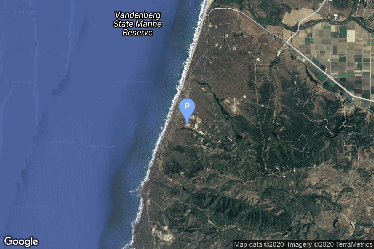
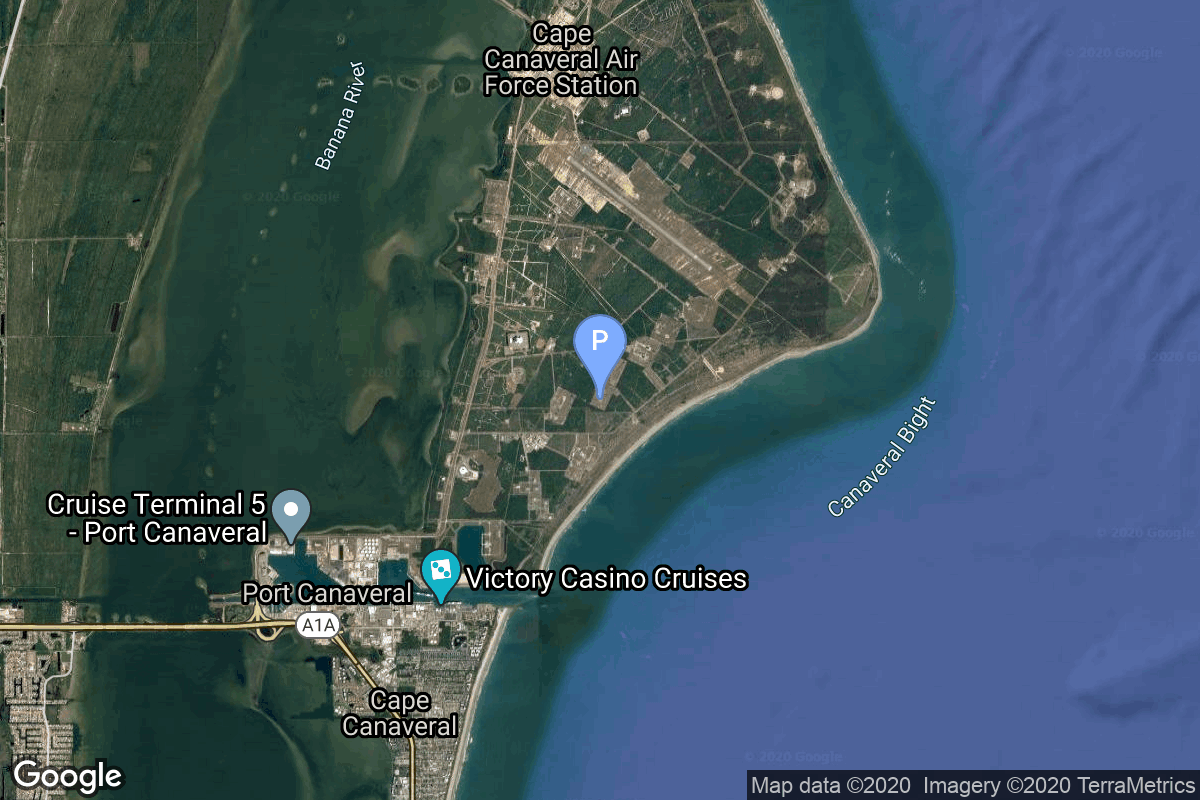
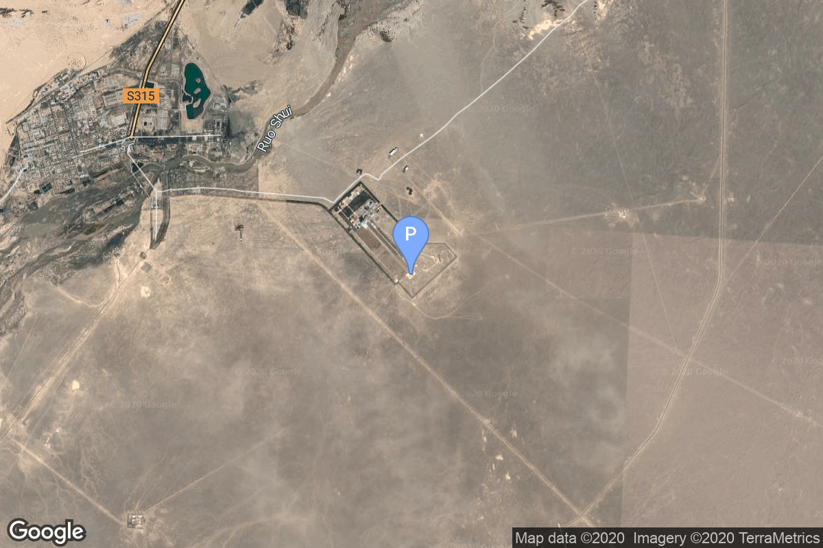
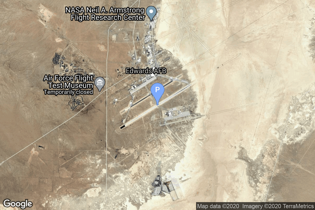
{ "count": 220, "next": "https://lldev.thespacedevs.com/2.2.0/pad/?format=api&limit=10&offset=90", "previous": "https://lldev.thespacedevs.com/2.2.0/pad/?format=api&limit=10&offset=70", "results": [ { "id": 157, "url": "https://lldev.thespacedevs.com/2.2.0/pad/157/?format=api", "agency_id": null, "name": "Mobile Launcher Pad", "description": null, "info_url": null, "wiki_url": "https://en.wikipedia.org/wiki/Xichang_Satellite_Launch_Center", "map_url": "https://www.google.com/maps?q=28.242774,102.032944", "latitude": "28.242774", "longitude": "102.032944", "location": { "id": 16, "url": "https://lldev.thespacedevs.com/2.2.0/location/16/?format=api", "name": "Xichang Satellite Launch Center, People's Republic of China", "country_code": "CHN", "description": "The Xichang Satellite Launch Center is a spaceport in China. It is located in Zeyuan Town, northwest of Xichang, Liangshan Yi Autonomous Prefecture in Sichuan.", "map_image": "https://thespacedevs-prod.nyc3.digitaloceanspaces.com/media/map_images/location_16_20200803142513.jpg", "timezone_name": "Asia/Shanghai", "total_launch_count": 227, "total_landing_count": 0 }, "country_code": "CHN", "map_image": "https://thespacedevs-prod.nyc3.digitaloceanspaces.com/media/map_images/pad_157_20200803143359.jpg", "total_launch_count": 7, "orbital_launch_attempt_count": 7 }, { "id": 136, "url": "https://lldev.thespacedevs.com/2.2.0/pad/136/?format=api", "agency_id": null, "name": "107", "description": null, "info_url": null, "wiki_url": "https://en.wikipedia.org/wiki/Kapustin_Yar", "map_url": "https://www.google.com/maps?q=48.540716,46.296826", "latitude": "48.540716", "longitude": "46.296826", "location": { "id": 30, "url": "https://lldev.thespacedevs.com/2.2.0/location/30/?format=api", "name": "Kapustin Yar, Russian Federation", "country_code": "RUS", "description": "Kapustin Yar is a Russian military training area and a rocket launch complex in Astrakhan Oblast, about 100 km east of Volgograd. It was established by the Soviet Union on 13 May 1946. In the beginning, Kapustin Yar used technology, material, and scientific support gained from the defeat of Germany in World War II. Numerous launches of test rockets for the Russian military were carried out at the site, as well as satellite and sounding rocket launches.", "map_image": "https://thespacedevs-prod.nyc3.digitaloceanspaces.com/media/map_images/location_30_20200803142515.jpg", "timezone_name": "Europe/Volgograd", "total_launch_count": 101, "total_landing_count": 0 }, "country_code": "RUS", "map_image": "https://thespacedevs-prod.nyc3.digitaloceanspaces.com/media/map_images/pad_136_20200803143342.jpg", "total_launch_count": 3, "orbital_launch_attempt_count": 3 }, { "id": 36, "url": "https://lldev.thespacedevs.com/2.2.0/pad/36/?format=api", "agency_id": 163, "name": "43/3 (43L)", "description": "", "info_url": null, "wiki_url": null, "map_url": "https://www.google.com/maps?q=62.9273,40.45", "latitude": "62.9273", "longitude": "40.45", "location": { "id": 6, "url": "https://lldev.thespacedevs.com/2.2.0/location/6/?format=api", "name": "Plesetsk Cosmodrome, Russian Federation", "country_code": "RUS", "description": "Plesetsk Cosmodrome is a Russian spaceport located in Mirny, Arkhangelsk Oblast, about 800 km north of Moscow and approximately 200 km south of Arkhangelsk. Originally developed as an ICBM site for the R-7 missile, it also served for numerous satellite launches using the R-7 and other rockets. Its high latitude makes it useful only for certain types of launches, especially the Molniya orbits, so for much of the site's history it functioned as a secondary location, with most orbital launches taking place from Baikonur, in the Kazakh SSR. With the end of the Soviet Union, Baikonur became a foreign territory, and Kazakhstan charged $115 million usage fees annually. Consequently, Plesetsk has seen considerably more activity since the 2000s.", "map_image": "https://thespacedevs-prod.nyc3.digitaloceanspaces.com/media/map_images/location_6_20200803142434.jpg", "timezone_name": "Europe/Moscow", "total_launch_count": 1676, "total_landing_count": 0 }, "country_code": "RUS", "map_image": "https://thespacedevs-prod.nyc3.digitaloceanspaces.com/media/map_images/pad_36_20200803143534.jpg", "total_launch_count": 230, "orbital_launch_attempt_count": 230 }, { "id": 89, "url": "https://lldev.thespacedevs.com/2.2.0/pad/89/?format=api", "agency_id": 88, "name": "DeFu-15002 mobile launch platform", "description": "", "info_url": null, "wiki_url": null, "map_url": "https://www.google.com/maps?q=36.631333,121.198361", "latitude": "36.631333", "longitude": "121.198361", "location": { "id": 3, "url": "https://lldev.thespacedevs.com/2.2.0/location/3/?format=api", "name": "Sea Launch", "country_code": "???", "description": "", "map_image": "https://thespacedevs-prod.nyc3.digitaloceanspaces.com/media/map_images/location_3_20200803142448.jpg", "timezone_name": "", "total_launch_count": 56, "total_landing_count": 0 }, "country_code": "CHN", "map_image": "https://thespacedevs-prod.nyc3.digitaloceanspaces.com/media/map_images/pad_89_20200803143242.jpg", "total_launch_count": 2, "orbital_launch_attempt_count": 2 }, { "id": 71, "url": "https://lldev.thespacedevs.com/2.2.0/pad/71/?format=api", "agency_id": null, "name": "Unknown Pad", "description": null, "info_url": null, "wiki_url": "", "map_url": "https://www.google.com/maps?q=40.958,100.291", "latitude": "40.958", "longitude": "100.291", "location": { "id": 17, "url": "https://lldev.thespacedevs.com/2.2.0/location/17/?format=api", "name": "Jiuquan Satellite Launch Center, People's Republic of China", "country_code": "CHN", "description": "Jiuquan Satellite Launch Center is a Chinese spaceport located between the Ejin, Alxa, Inner Mongolia and Hangtian Town, Jinta County, Jiuquan, Gansu Province. It is part of the Dongfeng Aerospace City (Base 10).", "map_image": "https://thespacedevs-prod.nyc3.digitaloceanspaces.com/media/map_images/location_17_20200803142429.jpg", "timezone_name": "Asia/Shanghai", "total_launch_count": 253, "total_landing_count": 0 }, "country_code": "CHN", "map_image": "https://thespacedevs-prod.nyc3.digitaloceanspaces.com/media/map_images/pad_71_20200803143610.jpg", "total_launch_count": 0, "orbital_launch_attempt_count": 0 }, { "id": 70, "url": "https://lldev.thespacedevs.com/2.2.0/pad/70/?format=api", "agency_id": 100, "name": "Edwards Air Force Base", "description": null, "info_url": null, "wiki_url": "https://en.wikipedia.org/wiki/Edwards_Air_Force_Base", "map_url": "https://www.google.com/maps?q=34.905556,-117.883611", "latitude": "34.905556", "longitude": "-117.883611", "location": { "id": 20, "url": "https://lldev.thespacedevs.com/2.2.0/location/20/?format=api", "name": "Air launch to orbit", "country_code": "???", "description": "", "map_image": "https://thespacedevs-prod.nyc3.digitaloceanspaces.com/media/map_images/location_20_20200803142433.jpg", "timezone_name": "", "total_launch_count": 51, "total_landing_count": 0 }, "country_code": "USA", "map_image": "https://thespacedevs-prod.nyc3.digitaloceanspaces.com/media/map_images/pad_70_20200803143352.jpg", "total_launch_count": 5, "orbital_launch_attempt_count": 5 }, { "id": 15, "url": "https://lldev.thespacedevs.com/2.2.0/pad/15/?format=api", "agency_id": null, "name": "200/39 (200L)", "description": null, "info_url": null, "wiki_url": "", "map_url": "https://www.google.com/maps?q=46.039984,63.032093", "latitude": "46.039984", "longitude": "63.032093", "location": { "id": 15, "url": "https://lldev.thespacedevs.com/2.2.0/location/15/?format=api", "name": "Baikonur Cosmodrome, Republic of Kazakhstan", "country_code": "KAZ", "description": "The Baikonur Cosmodrome is a spaceport operated by Russia within Kazakhstan. Located in the Kazakh city of Baikonur, it is the largest operational space launch facility in terms of area. All Russian crewed spaceflights are launched from Baikonur.", "map_image": "https://thespacedevs-prod.nyc3.digitaloceanspaces.com/media/map_images/location_15_20200803142517.jpg", "timezone_name": "Asia/Qyzylorda", "total_launch_count": 1555, "total_landing_count": 0 }, "country_code": "KAZ", "map_image": "https://thespacedevs-prod.nyc3.digitaloceanspaces.com/media/map_images/pad_15_20200803143530.jpg", "total_launch_count": 167, "orbital_launch_attempt_count": 167 }, { "id": 168, "url": "https://lldev.thespacedevs.com/2.2.0/pad/168/?format=api", "agency_id": null, "name": "41/1", "description": null, "info_url": null, "wiki_url": "https://en.wikipedia.org/wiki/Plesetsk_Cosmodrome", "map_url": "https://www.google.com/maps?q=62.941,40.526806", "latitude": "62.941", "longitude": "40.526806", "location": { "id": 6, "url": "https://lldev.thespacedevs.com/2.2.0/location/6/?format=api", "name": "Plesetsk Cosmodrome, Russian Federation", "country_code": "RUS", "description": "Plesetsk Cosmodrome is a Russian spaceport located in Mirny, Arkhangelsk Oblast, about 800 km north of Moscow and approximately 200 km south of Arkhangelsk. Originally developed as an ICBM site for the R-7 missile, it also served for numerous satellite launches using the R-7 and other rockets. Its high latitude makes it useful only for certain types of launches, especially the Molniya orbits, so for much of the site's history it functioned as a secondary location, with most orbital launches taking place from Baikonur, in the Kazakh SSR. With the end of the Soviet Union, Baikonur became a foreign territory, and Kazakhstan charged $115 million usage fees annually. Consequently, Plesetsk has seen considerably more activity since the 2000s.", "map_image": "https://thespacedevs-prod.nyc3.digitaloceanspaces.com/media/map_images/location_6_20200803142434.jpg", "timezone_name": "Europe/Moscow", "total_launch_count": 1676, "total_landing_count": 0 }, "country_code": "RUS", "map_image": "https://thespacedevs-prod.nyc3.digitaloceanspaces.com/media/map_images/pad_168_20200803143446.jpg", "total_launch_count": 310, "orbital_launch_attempt_count": 310 }, { "id": 141, "url": "https://lldev.thespacedevs.com/2.2.0/pad/141/?format=api", "agency_id": null, "name": "Brigitte", "description": null, "info_url": null, "wiki_url": "https://en.wikipedia.org/wiki/Hammaguir", "map_url": "https://www.google.com/maps?q=30.7787318,-3.0669721", "latitude": "30.7787318", "longitude": "-3.0669721", "location": { "id": 147, "url": "https://lldev.thespacedevs.com/2.2.0/location/147/?format=api", "name": "Interarmy Special Vehicles Test Centre, French Algeria", "country_code": "FRA", "description": "The Centre Interarmées d'Essais d'Engins Spéciaux was France's first space launch and ballistic missile testing facility. Outside France, the facility is often referred to by the name of the nearest town, Hammaguir. It was established on 24 April 1947, by ministerial decree as the Special Weapons Test Center (CEES, Centre d'essais d'engins spéciaux) for use by the French Army. In 1948, it was turned over to the French Air Force, who renamed it CIEES. Its remote location in the middle of the Saharan Desert and its relative closeness to the Equator (compared with Metropolitan France) made it an attractive launch site for missiles and orbital rockets.", "map_image": "https://thespacedevs-prod.nyc3.digitaloceanspaces.com/media/map_images/location_147_20240808092142.jpg", "timezone_name": "Africa/Algiers", "total_launch_count": 4, "total_landing_count": 0 }, "country_code": "FRA", "map_image": "https://thespacedevs-prod.nyc3.digitaloceanspaces.com/media/map_images/pad_141_20200803143211.jpg", "total_launch_count": 4, "orbital_launch_attempt_count": 4 }, { "id": 139, "url": "https://lldev.thespacedevs.com/2.2.0/pad/139/?format=api", "agency_id": null, "name": "86/1", "description": null, "info_url": null, "wiki_url": "https://en.wikipedia.org/wiki/Kapustin_Yar", "map_url": "https://www.google.com/maps?q=48.56935,46.293219", "latitude": "48.56935", "longitude": "46.293219", "location": { "id": 30, "url": "https://lldev.thespacedevs.com/2.2.0/location/30/?format=api", "name": "Kapustin Yar, Russian Federation", "country_code": "RUS", "description": "Kapustin Yar is a Russian military training area and a rocket launch complex in Astrakhan Oblast, about 100 km east of Volgograd. It was established by the Soviet Union on 13 May 1946. In the beginning, Kapustin Yar used technology, material, and scientific support gained from the defeat of Germany in World War II. Numerous launches of test rockets for the Russian military were carried out at the site, as well as satellite and sounding rocket launches.", "map_image": "https://thespacedevs-prod.nyc3.digitaloceanspaces.com/media/map_images/location_30_20200803142515.jpg", "timezone_name": "Europe/Volgograd", "total_launch_count": 101, "total_landing_count": 0 }, "country_code": "RUS", "map_image": "https://thespacedevs-prod.nyc3.digitaloceanspaces.com/media/map_images/pad_139_20200803143345.jpg", "total_launch_count": 26, "orbital_launch_attempt_count": 26 } ] }