Pad List
API endpoint that allows Location instances to be viewed.
GET: Return a list of all the existing location instances.
FILTERS: Parameters - 'id', 'agency_id', 'name', 'name__contains', 'latitude', 'latitude__contains', 'longitude', 'longitude__contains', 'location__name', 'location__name__contains', 'location__id', 'orbital_launch_attempt_count', 'total_launch_count'
ORDERING: Fields - 'id', 'name', 'location__id', 'location__name', 'orbital_launch_attempt_count', 'total_launch_count'
Example - /2.2.0/pad/?ordering=location__name
GET /2.2.0/pad/?format=api&offset=40&ordering=-id
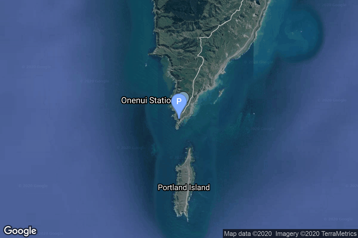
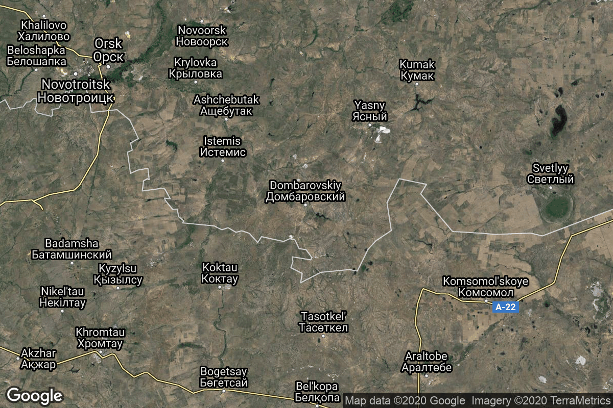
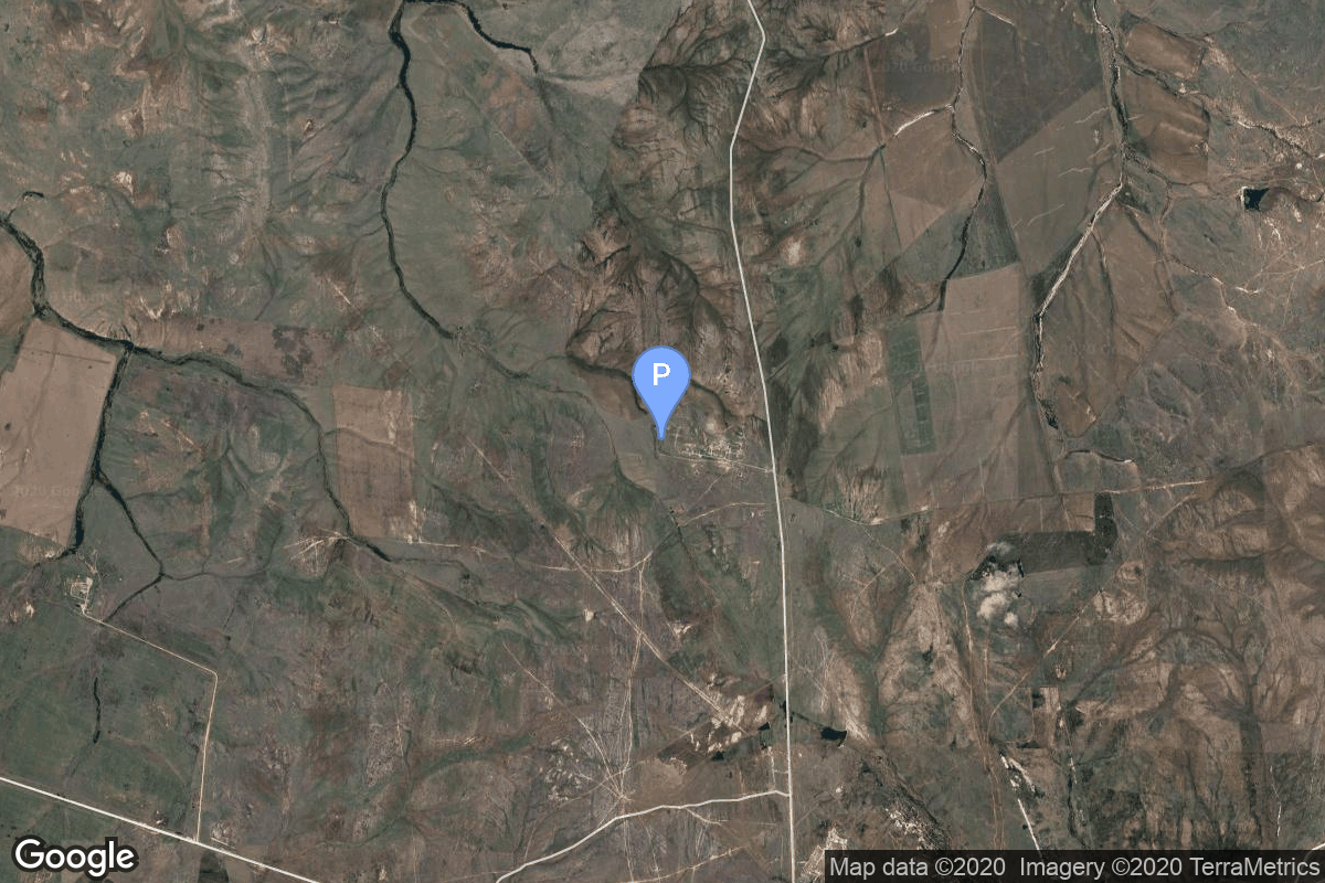
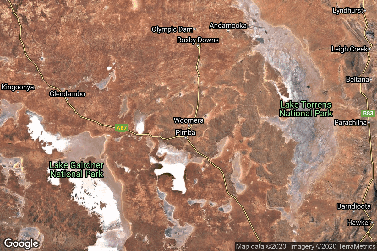
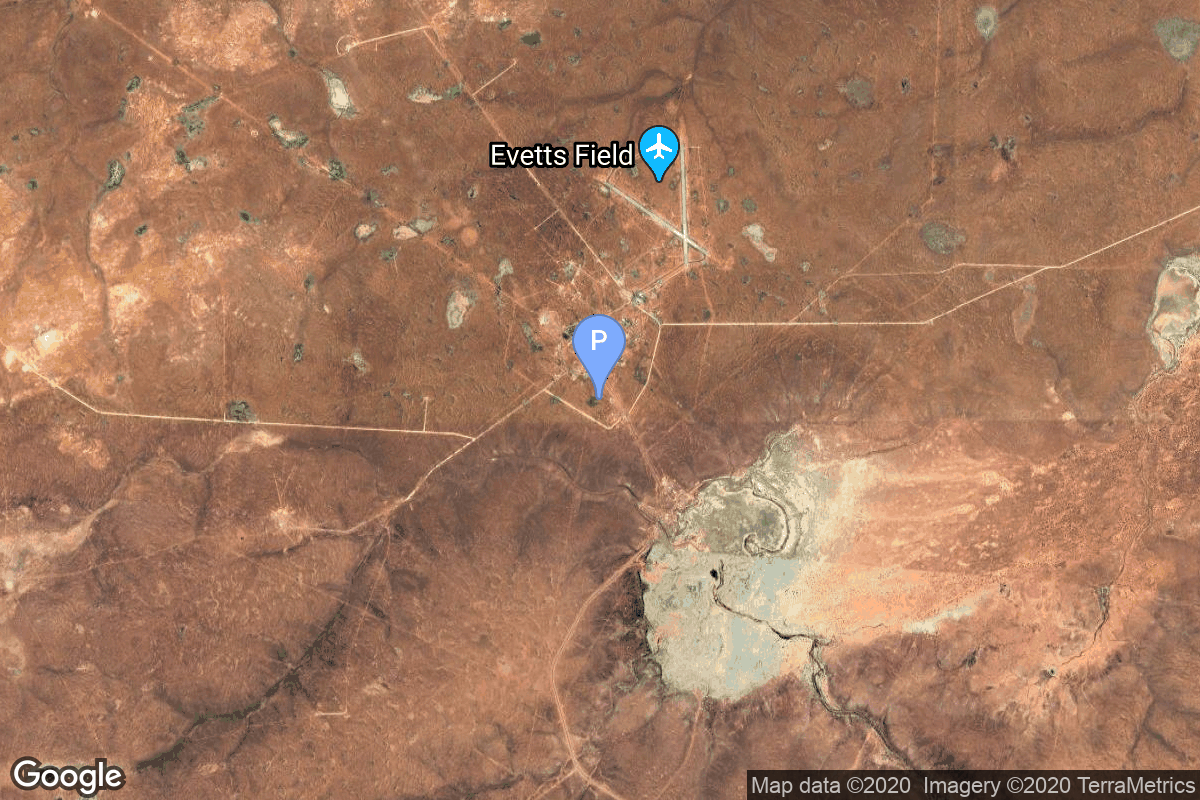
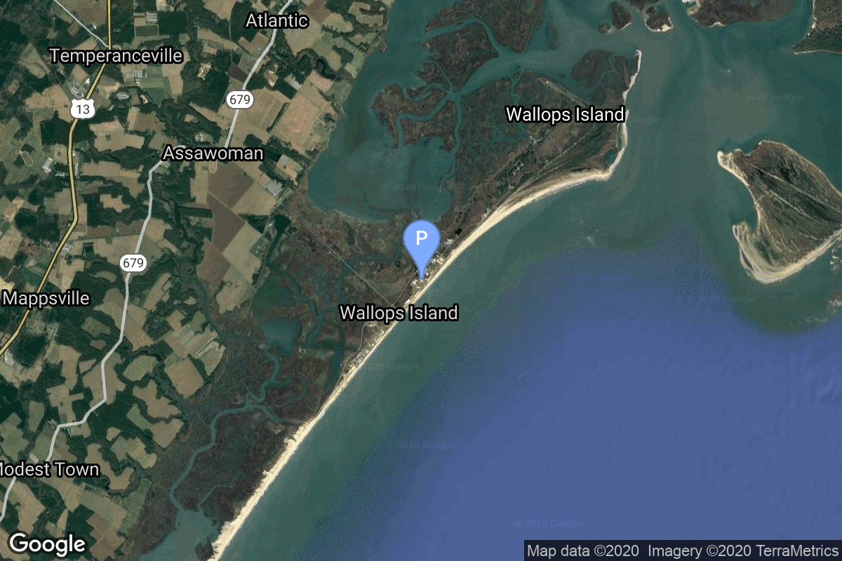
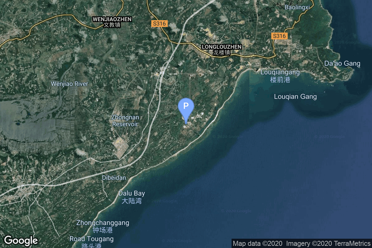
{ "count": 220, "next": "https://lldev.thespacedevs.com/2.2.0/pad/?format=api&limit=10&offset=50&ordering=-id", "previous": "https://lldev.thespacedevs.com/2.2.0/pad/?format=api&limit=10&offset=30&ordering=-id", "results": [ { "id": 185, "url": "https://lldev.thespacedevs.com/2.2.0/pad/185/?format=api", "agency_id": 147, "name": "Rocket Lab Launch Complex 1B", "description": "", "info_url": null, "wiki_url": "https://en.wikipedia.org/wiki/Rocket_Lab_Launch_Complex_1", "map_url": "https://www.google.com/maps?q=-39.262833,177.864469", "latitude": "-39.262833", "longitude": "177.864469", "location": { "id": 10, "url": "https://lldev.thespacedevs.com/2.2.0/location/10/?format=api", "name": "Rocket Lab Launch Complex 1, Mahia Peninsula, New Zealand", "country_code": "NZL", "description": "Rocket Lab Launch Complex 1 is a commercial spaceport located close to Ahuriri Point at the southern tip of Māhia Peninsula, on the east coast of New Zealand's North Island. It is owned and operated by private spaceflight company Rocket Lab and supports launches of the company's Electron rocket for small satellites. With the launch of Electron on 25 May 2017, it became the first private spaceport to host an orbital launch attempt, and the first site in New Zealand to host an orbital launch attempt. With the Electron launch of 21 January 2018, it became the first private spaceport to host a successful orbital launch.", "map_image": "https://thespacedevs-prod.nyc3.digitaloceanspaces.com/media/map_images/location_10_20200803142509.jpg", "timezone_name": "Pacific/Auckland", "total_launch_count": 60, "total_landing_count": 17 }, "country_code": "NZL", "map_image": "https://thespacedevs-prod.nyc3.digitaloceanspaces.com/media/map_images/pad_185_20200803143540.jpg", "total_launch_count": 29, "orbital_launch_attempt_count": 29 }, { "id": 184, "url": "https://lldev.thespacedevs.com/2.2.0/pad/184/?format=api", "agency_id": null, "name": "Satellite Launch Pad", "description": null, "info_url": null, "wiki_url": "https://en.wikipedia.org/wiki/Tonghae_Satellite_Launching_Ground", "map_url": "https://www.google.com/maps?q=40.855799,129.665895", "latitude": "40.855799", "longitude": "129.665895", "location": { "id": 153, "url": "https://lldev.thespacedevs.com/2.2.0/location/153/?format=api", "name": "Tonghae Satellite Launching Ground", "country_code": "PRK", "description": "The Tonghae Satellite Launching Ground is a rocket launching site in North Korea.", "map_image": "https://thespacedevs-prod.nyc3.digitaloceanspaces.com/media/map_images/location_153_20200803142503.jpg", "timezone_name": "Asia/Pyongyang", "total_launch_count": 2, "total_landing_count": 0 }, "country_code": "PRK", "map_image": "https://thespacedevs-prod.nyc3.digitaloceanspaces.com/media/map_images/pad_184_20200803143423.jpg", "total_launch_count": 2, "orbital_launch_attempt_count": 2 }, { "id": 183, "url": "https://lldev.thespacedevs.com/2.2.0/pad/183/?format=api", "agency_id": null, "name": "370/13", "description": null, "info_url": null, "wiki_url": "https://en.wikipedia.org/wiki/Dombarovsky_Air_Base", "map_url": "https://www.google.com/maps?q=51.0938889,59.8400282", "latitude": "51.0938889", "longitude": "59.8400282", "location": { "id": 5, "url": "https://lldev.thespacedevs.com/2.2.0/location/5/?format=api", "name": "Dombarovskiy, Russian Federation", "country_code": "RUS", "description": "Dombarovsky is a military airbase near Yasny in Russia's Orenburg Oblast. Operated by the Soviet Air Defence Forces and later by the Russian Air Force, it hosted fighter interceptor squadrons and hosts an ICBM base (which has been adapted for commercial satellite launches) with a supporting helicopter base.", "map_image": "https://thespacedevs-prod.nyc3.digitaloceanspaces.com/media/map_images/location_5_20200803142425.jpg", "timezone_name": "Asia/Yekaterinburg", "total_launch_count": 10, "total_landing_count": 0 }, "country_code": "RUS", "map_image": "https://thespacedevs-prod.nyc3.digitaloceanspaces.com/media/map_images/pad_183_20200803143512.jpg", "total_launch_count": 8, "orbital_launch_attempt_count": 8 }, { "id": 182, "url": "https://lldev.thespacedevs.com/2.2.0/pad/182/?format=api", "agency_id": null, "name": "370/11", "description": null, "info_url": null, "wiki_url": "https://en.wikipedia.org/wiki/Dombarovsky_Air_Base", "map_url": "https://www.google.com/maps?q=51.0938889,59.8400282", "latitude": "51.0938889", "longitude": "59.8400282", "location": { "id": 5, "url": "https://lldev.thespacedevs.com/2.2.0/location/5/?format=api", "name": "Dombarovskiy, Russian Federation", "country_code": "RUS", "description": "Dombarovsky is a military airbase near Yasny in Russia's Orenburg Oblast. Operated by the Soviet Air Defence Forces and later by the Russian Air Force, it hosted fighter interceptor squadrons and hosts an ICBM base (which has been adapted for commercial satellite launches) with a supporting helicopter base.", "map_image": "https://thespacedevs-prod.nyc3.digitaloceanspaces.com/media/map_images/location_5_20200803142425.jpg", "timezone_name": "Asia/Yekaterinburg", "total_launch_count": 10, "total_landing_count": 0 }, "country_code": "RUS", "map_image": "https://thespacedevs-prod.nyc3.digitaloceanspaces.com/media/map_images/pad_182_20200803143504.jpg", "total_launch_count": 2, "orbital_launch_attempt_count": 2 }, { "id": 181, "url": "https://lldev.thespacedevs.com/2.2.0/pad/181/?format=api", "agency_id": null, "name": "Launch Area 8", "description": null, "info_url": null, "wiki_url": "https://en.wikipedia.org/wiki/RAAF_Woomera_Range_Complex", "map_url": "https://www.google.com/maps?q=-30.9552778,136.5300282", "latitude": "-30.9552778", "longitude": "136.5300282", "location": { "id": 152, "url": "https://lldev.thespacedevs.com/2.2.0/location/152/?format=api", "name": "RAAF Woomera Range Complex", "country_code": "AUS", "description": "The RAAF Woomera Range Complex (WRC) is a major Australian military and civil aerospace facility and operation located in South Australia, approximately 450 km (280 mi) north-west of Adelaide. The WRC is operated by the Royal Australian Air Force (RAAF), a Service of the Australian Defence Force (ADF). The complex has a land area of 122,188 km2 (47,177 sq mi) or roughly the size of North Korea or Pennsylvania. The airspace above the area is restricted and controlled by the RAAF for safety and security. The WRC is a highly specialised ADF test and evaluation capability operated by the RAAF for the purposes of testing defence materiel.", "map_image": "https://thespacedevs-prod.nyc3.digitaloceanspaces.com/media/map_images/location_152_20200803142502.jpg", "timezone_name": "Australia/Adelaide", "total_launch_count": 6, "total_landing_count": 0 }, "country_code": "AUS", "map_image": "https://thespacedevs-prod.nyc3.digitaloceanspaces.com/media/map_images/pad_181_20200803143447.jpg", "total_launch_count": 1, "orbital_launch_attempt_count": 1 }, { "id": 180, "url": "https://lldev.thespacedevs.com/2.2.0/pad/180/?format=api", "agency_id": null, "name": "Launch Area 6A", "description": null, "info_url": null, "wiki_url": "https://en.wikipedia.org/wiki/RAAF_Woomera_Range_Complex", "map_url": "https://www.google.com/maps?q=-30.9552778,136.5300282", "latitude": "-30.9552778", "longitude": "136.5300282", "location": { "id": 152, "url": "https://lldev.thespacedevs.com/2.2.0/location/152/?format=api", "name": "RAAF Woomera Range Complex", "country_code": "AUS", "description": "The RAAF Woomera Range Complex (WRC) is a major Australian military and civil aerospace facility and operation located in South Australia, approximately 450 km (280 mi) north-west of Adelaide. The WRC is operated by the Royal Australian Air Force (RAAF), a Service of the Australian Defence Force (ADF). The complex has a land area of 122,188 km2 (47,177 sq mi) or roughly the size of North Korea or Pennsylvania. The airspace above the area is restricted and controlled by the RAAF for safety and security. The WRC is a highly specialised ADF test and evaluation capability operated by the RAAF for the purposes of testing defence materiel.", "map_image": "https://thespacedevs-prod.nyc3.digitaloceanspaces.com/media/map_images/location_152_20200803142502.jpg", "timezone_name": "Australia/Adelaide", "total_launch_count": 6, "total_landing_count": 0 }, "country_code": "AUS", "map_image": "https://thespacedevs-prod.nyc3.digitaloceanspaces.com/media/map_images/pad_180_20200803143508.jpg", "total_launch_count": 3, "orbital_launch_attempt_count": 3 }, { "id": 179, "url": "https://lldev.thespacedevs.com/2.2.0/pad/179/?format=api", "agency_id": null, "name": "Launch Area 5B", "description": null, "info_url": null, "wiki_url": "https://en.wikipedia.org/wiki/RAAF_Woomera_Range_Complex", "map_url": "https://www.google.com/maps?q=-30.9552778,136.5300282", "latitude": "-30.9552778", "longitude": "136.5300282", "location": { "id": 152, "url": "https://lldev.thespacedevs.com/2.2.0/location/152/?format=api", "name": "RAAF Woomera Range Complex", "country_code": "AUS", "description": "The RAAF Woomera Range Complex (WRC) is a major Australian military and civil aerospace facility and operation located in South Australia, approximately 450 km (280 mi) north-west of Adelaide. The WRC is operated by the Royal Australian Air Force (RAAF), a Service of the Australian Defence Force (ADF). The complex has a land area of 122,188 km2 (47,177 sq mi) or roughly the size of North Korea or Pennsylvania. The airspace above the area is restricted and controlled by the RAAF for safety and security. The WRC is a highly specialised ADF test and evaluation capability operated by the RAAF for the purposes of testing defence materiel.", "map_image": "https://thespacedevs-prod.nyc3.digitaloceanspaces.com/media/map_images/location_152_20200803142502.jpg", "timezone_name": "Australia/Adelaide", "total_launch_count": 6, "total_landing_count": 0 }, "country_code": "AUS", "map_image": "https://thespacedevs-prod.nyc3.digitaloceanspaces.com/media/map_images/pad_179_20200803143455.jpg", "total_launch_count": 2, "orbital_launch_attempt_count": 2 }, { "id": 178, "url": "https://lldev.thespacedevs.com/2.2.0/pad/178/?format=api", "agency_id": null, "name": "Launch Area 3A", "description": null, "info_url": null, "wiki_url": null, "map_url": "https://www.google.com/maps?q=37.8495,-75.4725", "latitude": "37.8495", "longitude": "-75.4725", "location": { "id": 21, "url": "https://lldev.thespacedevs.com/2.2.0/location/21/?format=api", "name": "Wallops Flight Facility, Virginia, USA", "country_code": "USA", "description": "Wallops Flight Facility is a rocket launch site on Wallops Island on the Eastern Shore of Virginia, United States, just east of the Delmarva Peninsula and north-northeast of Norfolk. The facility is operated by the Goddard Space Flight Center in Greenbelt, Maryland, and primarily serves to support science and exploration missions for NASA and other federal agencies. WFF includes an extensively instrumented range to support launches of more than a dozen types of sounding rockets; small expendable suborbital and orbital rockets; high-altitude balloon flights carrying scientific instruments for atmospheric and astronomical research; and, using its Research Airport, flight tests of aeronautical research aircraft, including uncrewed aerial vehicles.", "map_image": "https://thespacedevs-prod.nyc3.digitaloceanspaces.com/media/map_images/location_21_20200803142423.jpg", "timezone_name": "America/New_York", "total_launch_count": 80, "total_landing_count": 0 }, "country_code": "USA", "map_image": "https://thespacedevs-prod.nyc3.digitaloceanspaces.com/media/map_images/pad_178_20200803143407.jpg", "total_launch_count": 18, "orbital_launch_attempt_count": 13 }, { "id": 177, "url": "https://lldev.thespacedevs.com/2.2.0/pad/177/?format=api", "agency_id": null, "name": "Unknown Pad", "description": null, "info_url": null, "wiki_url": "https://en.wikipedia.org/wiki/Wallops_Flight_Facility", "map_url": "https://www.google.com/maps?q=37.9386111,-75.4594162", "latitude": "37.9386111", "longitude": "-75.4594162", "location": { "id": 21, "url": "https://lldev.thespacedevs.com/2.2.0/location/21/?format=api", "name": "Wallops Flight Facility, Virginia, USA", "country_code": "USA", "description": "Wallops Flight Facility is a rocket launch site on Wallops Island on the Eastern Shore of Virginia, United States, just east of the Delmarva Peninsula and north-northeast of Norfolk. The facility is operated by the Goddard Space Flight Center in Greenbelt, Maryland, and primarily serves to support science and exploration missions for NASA and other federal agencies. WFF includes an extensively instrumented range to support launches of more than a dozen types of sounding rockets; small expendable suborbital and orbital rockets; high-altitude balloon flights carrying scientific instruments for atmospheric and astronomical research; and, using its Research Airport, flight tests of aeronautical research aircraft, including uncrewed aerial vehicles.", "map_image": "https://thespacedevs-prod.nyc3.digitaloceanspaces.com/media/map_images/location_21_20200803142423.jpg", "timezone_name": "America/New_York", "total_launch_count": 80, "total_landing_count": 0 }, "country_code": "USA", "map_image": "https://thespacedevs-prod.nyc3.digitaloceanspaces.com/media/map_images/pad_177_20200803143406.jpg", "total_launch_count": 8, "orbital_launch_attempt_count": 0 }, { "id": 176, "url": "https://lldev.thespacedevs.com/2.2.0/pad/176/?format=api", "agency_id": null, "name": "201", "description": "", "info_url": null, "wiki_url": "https://en.wikipedia.org/wiki/Wenchang_Spacecraft_Launch_Site", "map_url": "https://www.google.com/maps?q=19.618452,110.955356", "latitude": "19.618452", "longitude": "110.955356", "location": { "id": 8, "url": "https://lldev.thespacedevs.com/2.2.0/location/8/?format=api", "name": "Wenchang Space Launch Site, People's Republic of China", "country_code": "CHN", "description": "The Wenchang Space Launch Site is a rocket launch site located in Wenchang on the island of Hainan, in China.\r\n\r\nFormally a suborbital test center, it currently serves as China's southernmost spaceport. The site was selected for its low latitude, 19° north of the equator, allowing for larger payloads to be launched. It is capable of launching the Long March 5, the heaviest Chinese rocket. Unlike launch facilities on the mainland, Wenchang uses its seaport for deliveries.", "map_image": "https://thespacedevs-prod.nyc3.digitaloceanspaces.com/media/map_images/location_8_20200803142445.jpg", "timezone_name": "Asia/Shanghai", "total_launch_count": 39, "total_landing_count": 0 }, "country_code": "CHN", "map_image": "https://thespacedevs-prod.nyc3.digitaloceanspaces.com/media/map_images/pad_176_20200803143412.jpg", "total_launch_count": 23, "orbital_launch_attempt_count": 23 } ] }