Pad List
API endpoint that allows Location instances to be viewed.
GET: Return a list of all the existing location instances.
FILTERS: Parameters - 'id', 'agency_id', 'name', 'name__contains', 'latitude', 'latitude__contains', 'longitude', 'longitude__contains', 'location__name', 'location__name__contains', 'location__id', 'orbital_launch_attempt_count', 'total_launch_count'
ORDERING: Fields - 'id', 'name', 'location__id', 'location__name', 'orbital_launch_attempt_count', 'total_launch_count'
Example - /2.2.0/pad/?ordering=location__name
GET /2.2.0/pad/?format=api&offset=220&ordering=-orbital_launch_attempt_count
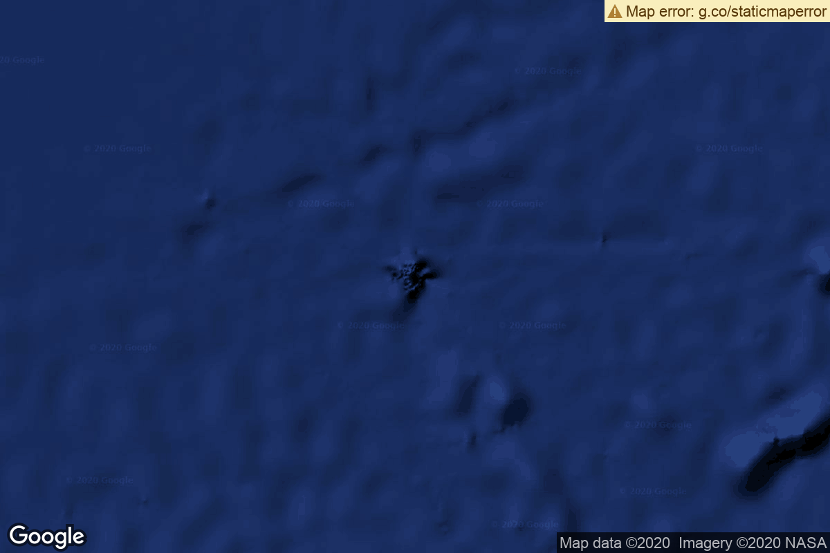
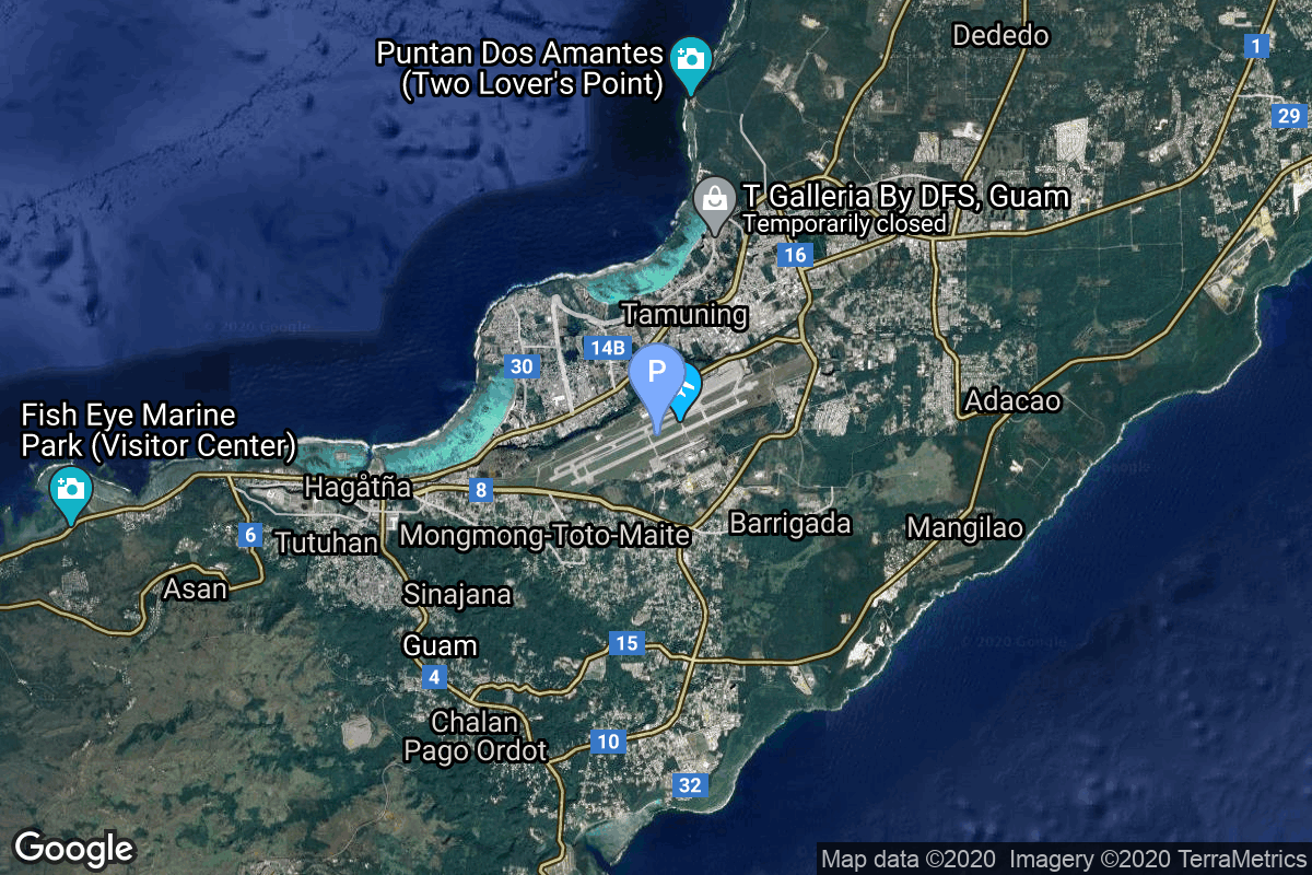
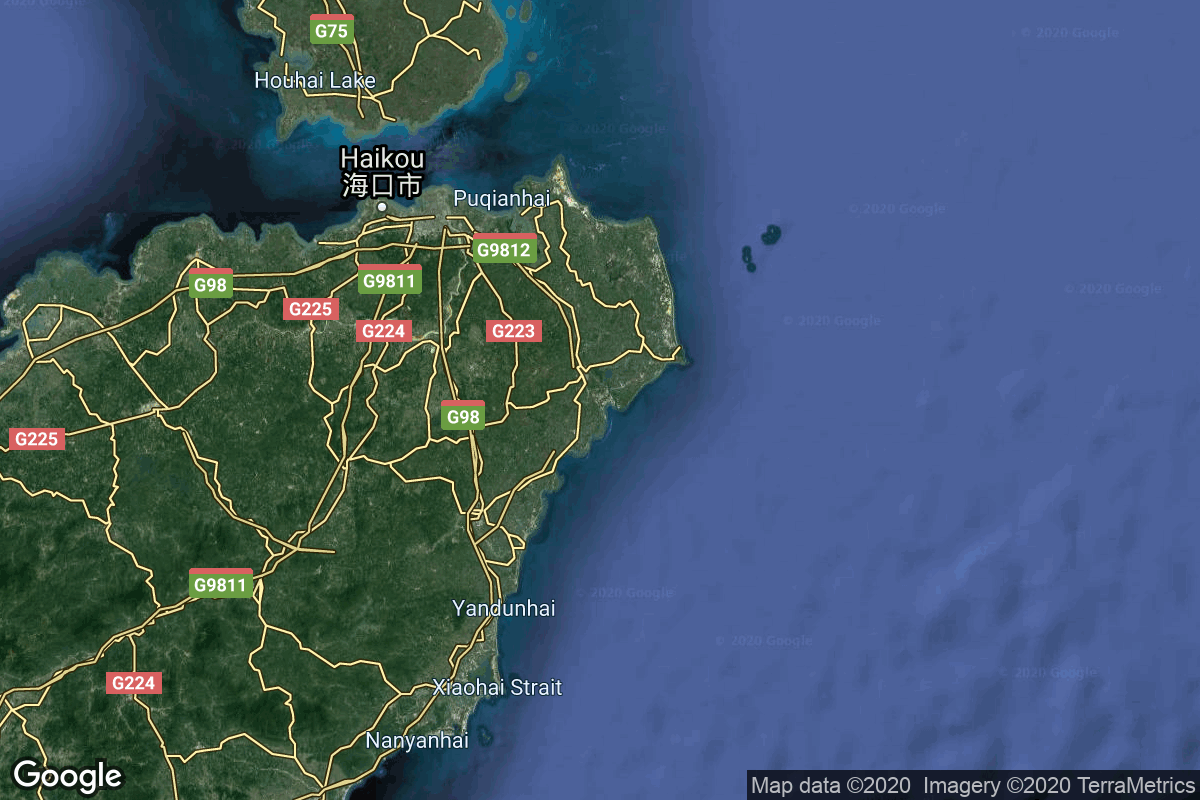
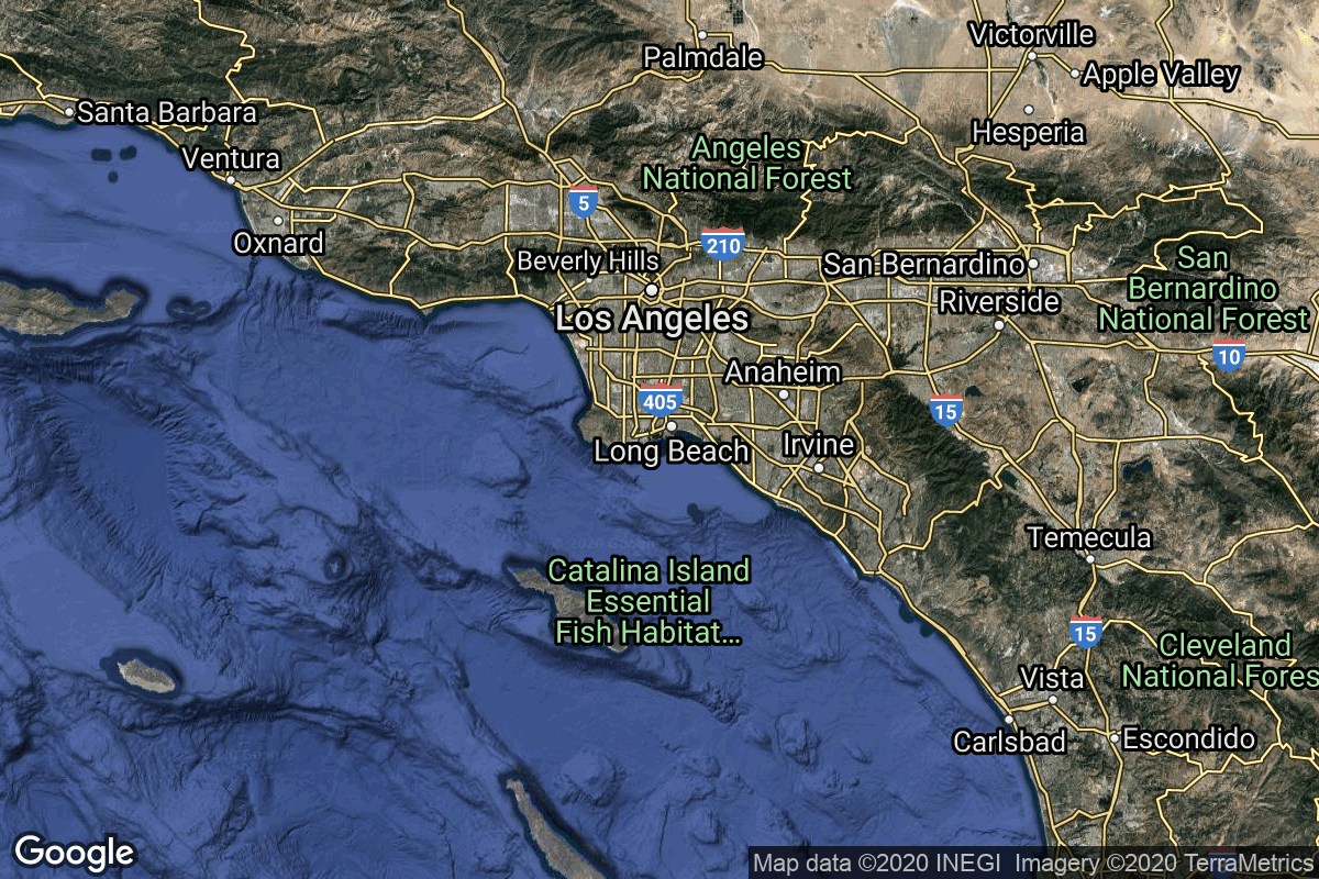
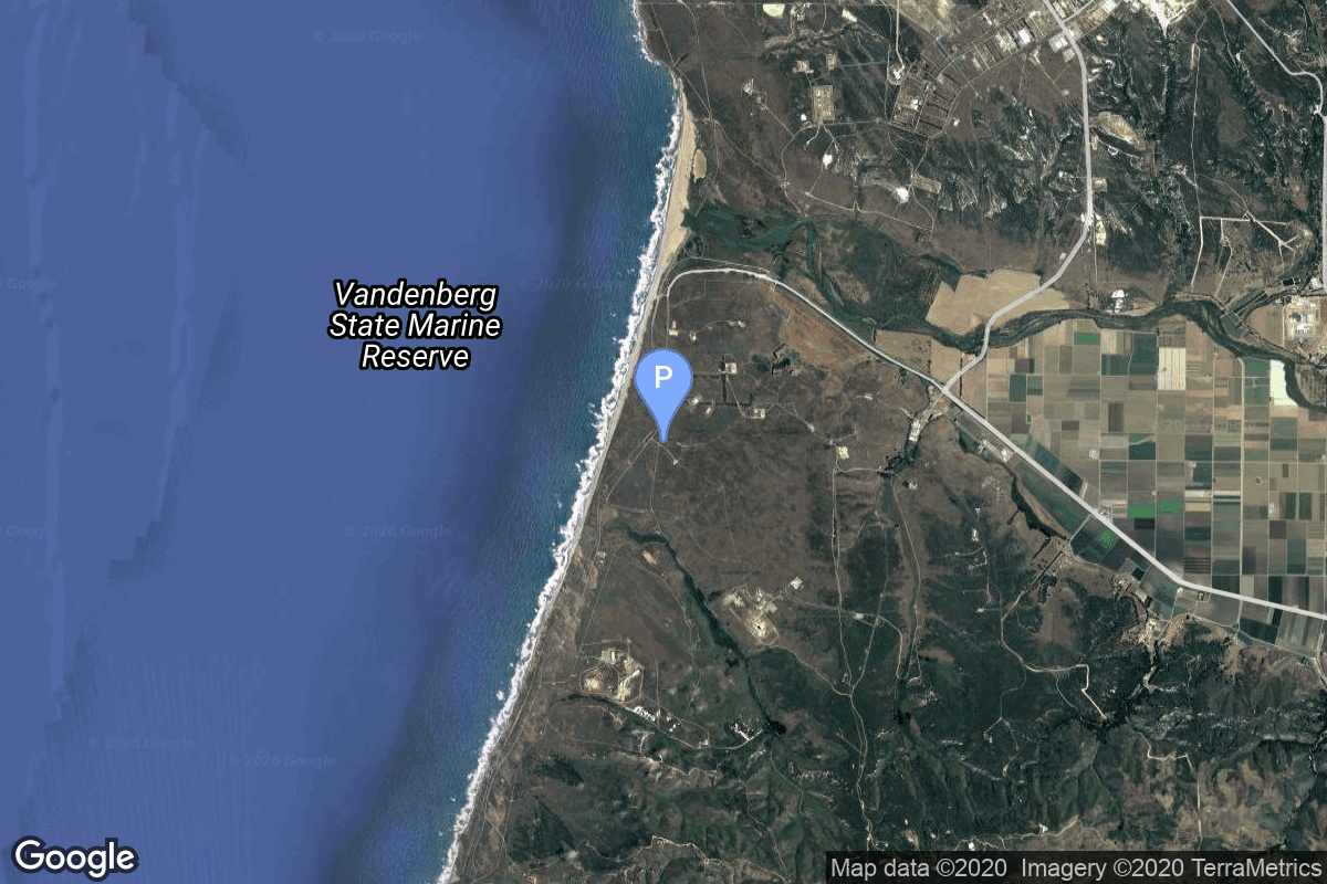
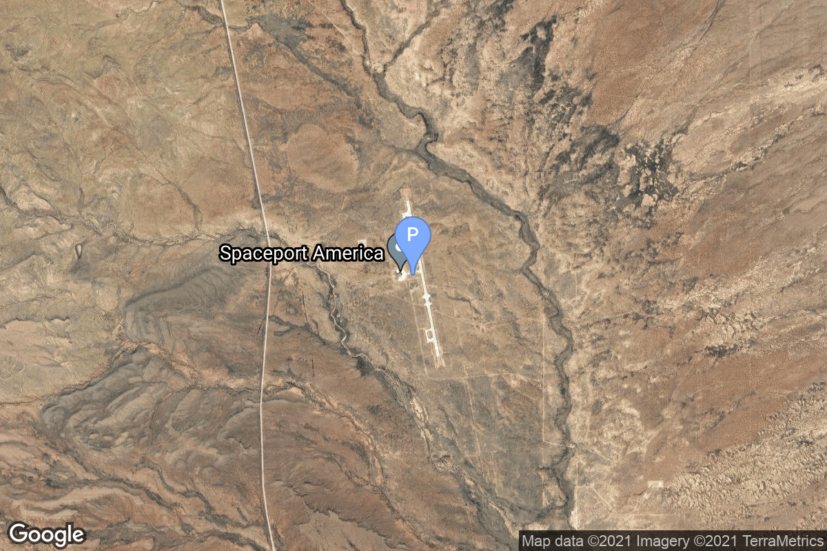
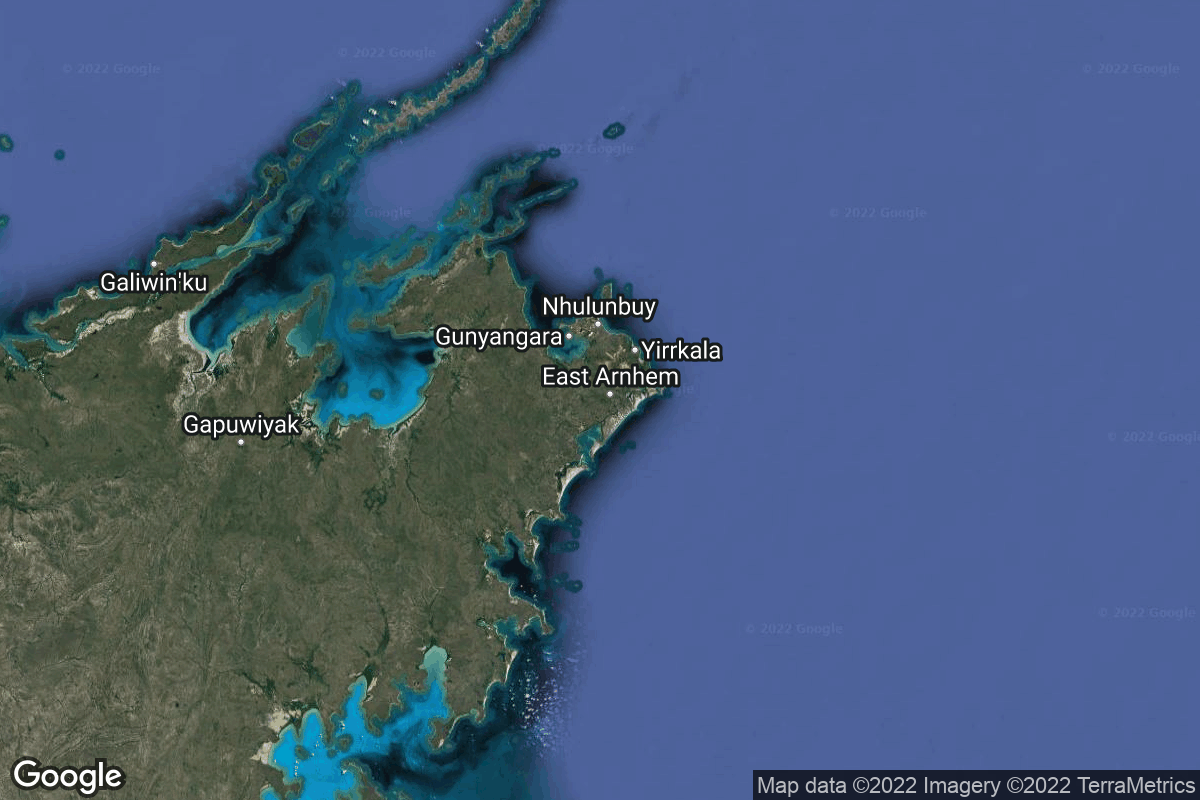
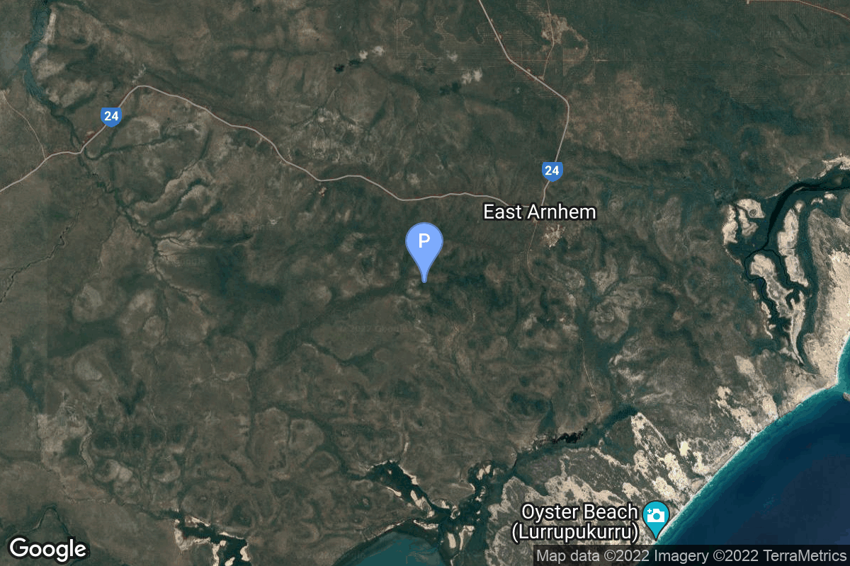
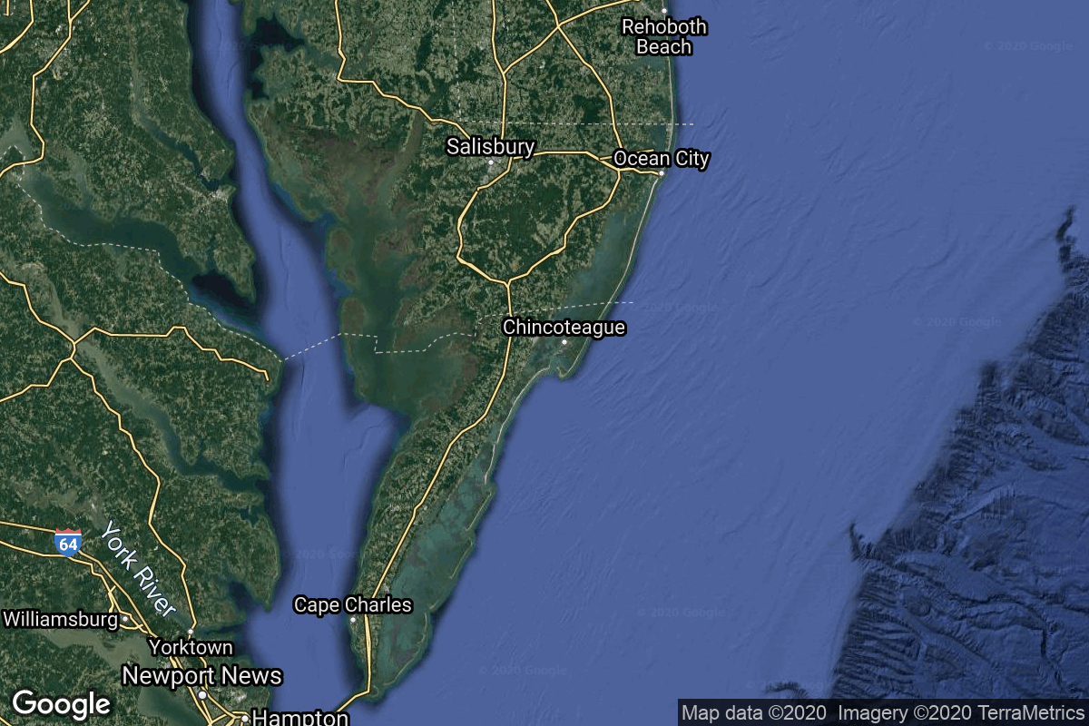
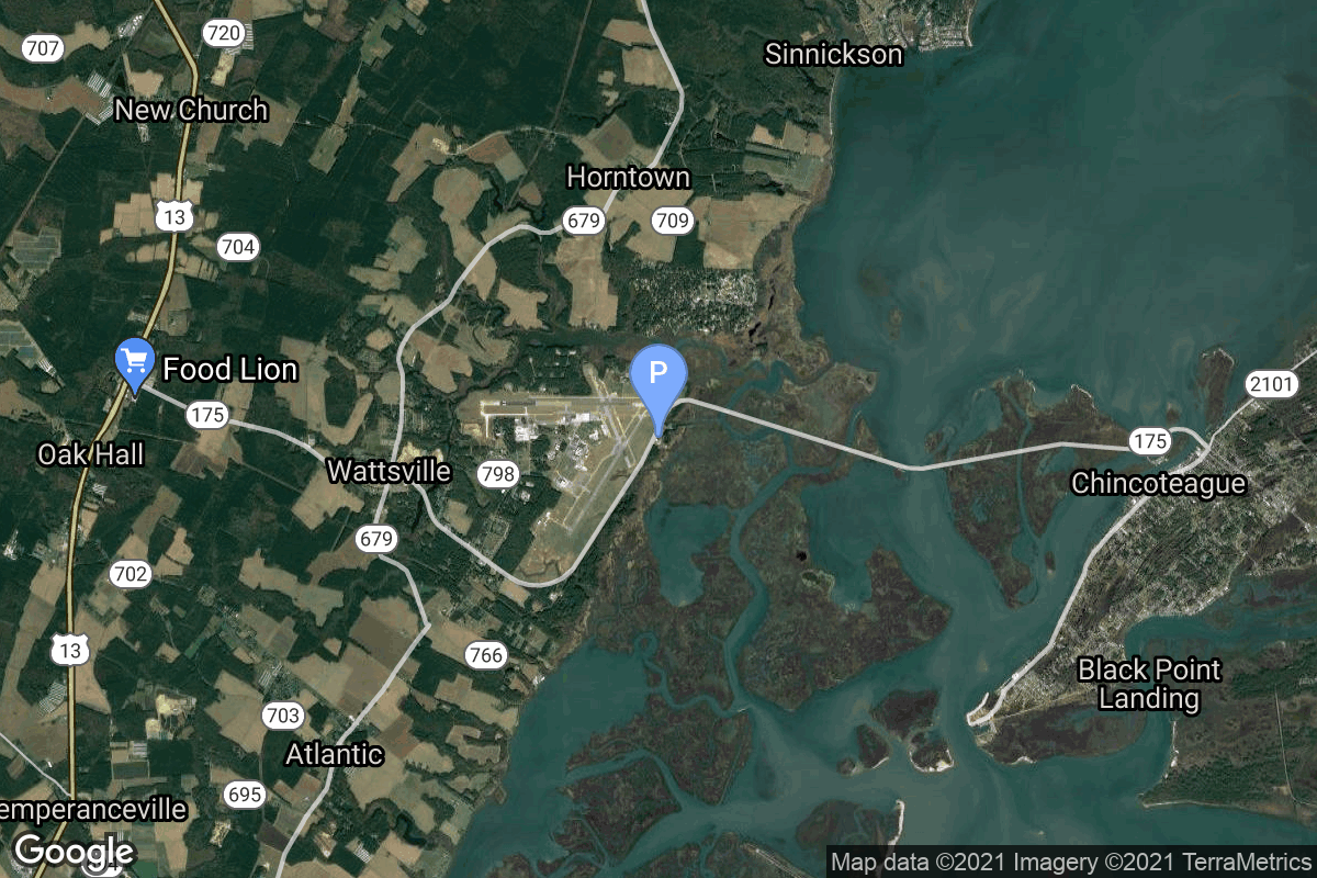
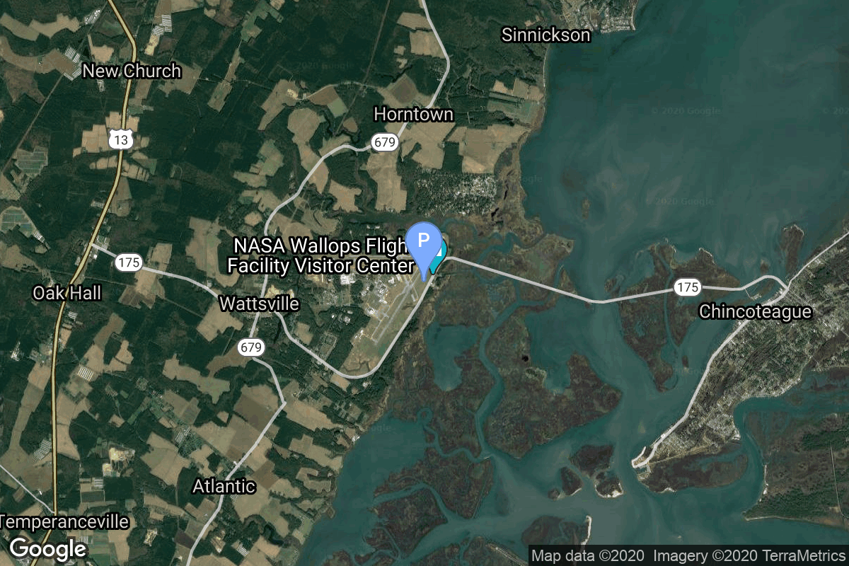
{ "count": 229, "next": null, "previous": "https://lldev.thespacedevs.com/2.2.0/pad/?format=api&limit=10&offset=210&ordering=-orbital_launch_attempt_count", "results": [ { "id": 104, "url": "https://lldev.thespacedevs.com/2.2.0/pad/104/?format=api", "agency_id": null, "name": "Guam International Airport", "description": null, "info_url": null, "wiki_url": "https://en.wikipedia.org/wiki/Antonio_B._Won_Pat_International_Airport", "map_url": "https://www.google.com/maps?q=13.483889,144.797222", "latitude": "13.483889", "longitude": "144.797222", "location": { "id": 20, "url": "https://lldev.thespacedevs.com/2.2.0/location/20/?format=api", "name": "Air launch to orbit", "country_code": "???", "description": "", "map_image": "https://thespacedevs-dev.nyc3.digitaloceanspaces.com/media/map_images/location_20_20200803142433.jpg", "timezone_name": "", "total_launch_count": 51, "total_landing_count": 0 }, "country_code": "USA", "map_image": "https://thespacedevs-dev.nyc3.digitaloceanspaces.com/media/map_images/pad_104_20200803143546.jpg", "total_launch_count": 0, "orbital_launch_attempt_count": 0 }, { "id": 242, "url": "https://lldev.thespacedevs.com/2.2.0/pad/242/?format=api", "agency_id": null, "name": "Commercial LC-4", "description": "", "info_url": null, "wiki_url": "https://en.wikipedia.org/wiki/Wenchang_Commercial_Space_Launch_Site", "map_url": "https://www.google.com/maps?q=19.58394,110.91531", "latitude": "19.58394", "longitude": "110.91531", "location": { "id": 8, "url": "https://lldev.thespacedevs.com/2.2.0/location/8/?format=api", "name": "Wenchang Space Launch Site, People's Republic of China", "country_code": "CHN", "description": "The Wenchang Space Launch Site is a rocket launch site located in Wenchang on the island of Hainan, in China.\r\n\r\nFormally a suborbital test center, it currently serves as China's southernmost spaceport. The site was selected for its low latitude, 19° north of the equator, allowing for larger payloads to be launched. It is capable of launching the Long March 5, the heaviest Chinese rocket. Unlike launch facilities on the mainland, Wenchang uses its seaport for deliveries.", "map_image": "https://thespacedevs-dev.nyc3.digitaloceanspaces.com/media/map_images/location_8_20200803142445.jpg", "timezone_name": "Asia/Shanghai", "total_launch_count": 51, "total_landing_count": 0 }, "country_code": "CHN", "map_image": "https://thespacedevs-dev.nyc3.digitaloceanspaces.com/media/map_images/pad_commercial_lc-4_20251128182247.jpg", "total_launch_count": 0, "orbital_launch_attempt_count": 0 }, { "id": 101, "url": "https://lldev.thespacedevs.com/2.2.0/pad/101/?format=api", "agency_id": null, "name": "Unknown Pad", "description": "", "info_url": null, "wiki_url": null, "map_url": "https://www.google.com/maps?q=0.0,0.0", "latitude": null, "longitude": null, "location": { "id": 3, "url": "https://lldev.thespacedevs.com/2.2.0/location/3/?format=api", "name": "Sea Launch", "country_code": "???", "description": "", "map_image": "https://thespacedevs-dev.nyc3.digitaloceanspaces.com/media/map_images/location_3_20200803142448.jpg", "timezone_name": "", "total_launch_count": 40, "total_landing_count": 0 }, "country_code": "", "map_image": "https://thespacedevs-dev.nyc3.digitaloceanspaces.com/media/map_images/pad_101_20200803143204.jpg", "total_launch_count": 0, "orbital_launch_attempt_count": 0 }, { "id": 241, "url": "https://lldev.thespacedevs.com/2.2.0/pad/241/?format=api", "agency_id": null, "name": "301", "description": "Launch pad for the Long March 10 and 10A rockets for future Chinese crew missions to the lunar surface and Low Earth Orbit space station.", "info_url": null, "wiki_url": "https://en.wikipedia.org/wiki/Wenchang_Space_Launch_Site", "map_url": "https://www.google.com/maps?q=19.610019,110.944443", "latitude": "19.610019", "longitude": "110.944443", "location": { "id": 8, "url": "https://lldev.thespacedevs.com/2.2.0/location/8/?format=api", "name": "Wenchang Space Launch Site, People's Republic of China", "country_code": "CHN", "description": "The Wenchang Space Launch Site is a rocket launch site located in Wenchang on the island of Hainan, in China.\r\n\r\nFormally a suborbital test center, it currently serves as China's southernmost spaceport. The site was selected for its low latitude, 19° north of the equator, allowing for larger payloads to be launched. It is capable of launching the Long March 5, the heaviest Chinese rocket. Unlike launch facilities on the mainland, Wenchang uses its seaport for deliveries.", "map_image": "https://thespacedevs-dev.nyc3.digitaloceanspaces.com/media/map_images/location_8_20200803142445.jpg", "timezone_name": "Asia/Shanghai", "total_launch_count": 51, "total_landing_count": 0 }, "country_code": "CHN", "map_image": "https://thespacedevs-dev.nyc3.digitaloceanspaces.com/media/map_images/pad_301_20251128182017.jpg", "total_launch_count": 0, "orbital_launch_attempt_count": 0 }, { "id": 169, "url": "https://lldev.thespacedevs.com/2.2.0/pad/169/?format=api", "agency_id": null, "name": "Launch Complex A", "description": "PALC-A at the Vandenberg Air Force Base, is a launch complex that was used for a number of sounding rocket launches between 1959 and 1966.", "info_url": null, "wiki_url": "https://en.wikipedia.org/wiki/List_of_Vandenberg_Air_Force_Base_launch_facilities", "map_url": "https://www.google.com/maps?q=34.663800,-120.602200", "latitude": "34.6638", "longitude": "-120.6022", "location": { "id": 11, "url": "https://lldev.thespacedevs.com/2.2.0/location/11/?format=api", "name": "Vandenberg SFB, CA, USA", "country_code": "USA", "description": "Vandenberg Space Force Base is a United States Space Force Base in Santa Barbara County, California. Established in 1941, Vandenberg Space Force Base is a space launch base, launching spacecraft from the Western Range, and also performs missile testing. The United States Space Force's Space Launch Delta 30 serves as the host delta for the base, equivalent to an Air Force air base wing. In addition to its military space launch mission, Vandenberg Space Force Base also hosts space launches for civil and commercial space entities, such as NASA and SpaceX.", "map_image": "https://thespacedevs-dev.nyc3.digitaloceanspaces.com/media/map_images/location_11_20200803142416.jpg", "timezone_name": "America/Los_Angeles", "total_launch_count": 849, "total_landing_count": 30 }, "country_code": "USA", "map_image": "https://thespacedevs-dev.nyc3.digitaloceanspaces.com/media/map_images/pad_169_20200803143430.jpg", "total_launch_count": 1, "orbital_launch_attempt_count": 0 }, { "id": 191, "url": "https://lldev.thespacedevs.com/2.2.0/pad/191/?format=api", "agency_id": 1024, "name": "Spaceport America", "description": null, "info_url": "https://www.spaceportamerica.com/", "wiki_url": "https://en.wikipedia.org/wiki/Spaceport_America", "map_url": "https://www.google.com/maps?q=32.9902778,-106.9719162", "latitude": "32.9902778", "longitude": "-106.9719162", "location": { "id": 144, "url": "https://lldev.thespacedevs.com/2.2.0/location/144/?format=api", "name": "Air launch to Suborbital flight", "country_code": "???", "description": "", "map_image": "https://thespacedevs-dev.nyc3.digitaloceanspaces.com/media/map_images/location_144_20200803142439.jpg", "timezone_name": "", "total_launch_count": 86, "total_landing_count": 0 }, "country_code": "USA", "map_image": "https://thespacedevs-dev.nyc3.digitaloceanspaces.com/media/map_images/pad_spaceport_america_20210522162030.jpg", "total_launch_count": 14, "orbital_launch_attempt_count": 0 }, { "id": 202, "url": "https://lldev.thespacedevs.com/2.2.0/pad/202/?format=api", "agency_id": 1038, "name": "Suborbital Launch Ramp", "description": null, "info_url": "https://ela.space/arnhem-space-centre/", "wiki_url": "https://en.wikipedia.org/wiki/Arnhem_Land#Economy", "map_url": "https://www.google.com/maps?q=-12.3892948,136.7903215", "latitude": "-12.3892948", "longitude": "136.7903215", "location": { "id": 160, "url": "https://lldev.thespacedevs.com/2.2.0/location/160/?format=api", "name": "Arnhem Space Centre", "country_code": "AUS", "description": "The Arnhem Space Centre was Australia's first commercial spaceport, located near Nhulunbuy, in Arnhem Land, Australia. It was owned and operated by Equatorial Launch Australia (ELA), and was the site of NASA's first non-orbital sounding rocket launch from a commercial port outside the United States on 27 June 2022.", "map_image": "https://thespacedevs-dev.nyc3.digitaloceanspaces.com/media/map_images/location_arnhem_space_centre_20220622160552.jpg", "timezone_name": "Australia/Darwin", "total_launch_count": 3, "total_landing_count": 0 }, "country_code": "AUS", "map_image": "https://thespacedevs-dev.nyc3.digitaloceanspaces.com/media/map_images/pad_suborbital_launch_ramp_20220625184504.jpg", "total_launch_count": 3, "orbital_launch_attempt_count": 0 }, { "id": 195, "url": "https://lldev.thespacedevs.com/2.2.0/pad/195/?format=api", "agency_id": 44, "name": "Launch Area 1", "description": null, "info_url": null, "wiki_url": "https://en.wikipedia.org/wiki/Wallops_Flight_Facility", "map_url": "https://www.google.com/maps?q=37.938611,-75.457222", "latitude": "37.938611", "longitude": "-75.457222", "location": { "id": 21, "url": "https://lldev.thespacedevs.com/2.2.0/location/21/?format=api", "name": "Wallops Flight Facility, Virginia, USA", "country_code": "USA", "description": "Wallops Flight Facility is a rocket launch site on Wallops Island on the Eastern Shore of Virginia, United States, just east of the Delmarva Peninsula and north-northeast of Norfolk. The facility is operated by the Goddard Space Flight Center in Greenbelt, Maryland, and primarily serves to support science and exploration missions for NASA and other federal agencies. WFF includes an extensively instrumented range to support launches of more than a dozen types of sounding rockets; small expendable suborbital and orbital rockets; high-altitude balloon flights carrying scientific instruments for atmospheric and astronomical research; and, using its Research Airport, flight tests of aeronautical research aircraft, including uncrewed aerial vehicles.", "map_image": "https://thespacedevs-dev.nyc3.digitaloceanspaces.com/media/map_images/location_21_20200803142423.jpg", "timezone_name": "America/New_York", "total_launch_count": 83, "total_landing_count": 0 }, "country_code": "USA", "map_image": "https://thespacedevs-dev.nyc3.digitaloceanspaces.com/media/map_images/pad_launch_area_1_20210901085625.jpg", "total_launch_count": 7, "orbital_launch_attempt_count": 0 }, { "id": 177, "url": "https://lldev.thespacedevs.com/2.2.0/pad/177/?format=api", "agency_id": null, "name": "Unknown Pad", "description": null, "info_url": null, "wiki_url": "https://en.wikipedia.org/wiki/Wallops_Flight_Facility", "map_url": "https://www.google.com/maps?q=37.9386111,-75.4594162", "latitude": "37.9386111", "longitude": "-75.4594162", "location": { "id": 21, "url": "https://lldev.thespacedevs.com/2.2.0/location/21/?format=api", "name": "Wallops Flight Facility, Virginia, USA", "country_code": "USA", "description": "Wallops Flight Facility is a rocket launch site on Wallops Island on the Eastern Shore of Virginia, United States, just east of the Delmarva Peninsula and north-northeast of Norfolk. The facility is operated by the Goddard Space Flight Center in Greenbelt, Maryland, and primarily serves to support science and exploration missions for NASA and other federal agencies. WFF includes an extensively instrumented range to support launches of more than a dozen types of sounding rockets; small expendable suborbital and orbital rockets; high-altitude balloon flights carrying scientific instruments for atmospheric and astronomical research; and, using its Research Airport, flight tests of aeronautical research aircraft, including uncrewed aerial vehicles.", "map_image": "https://thespacedevs-dev.nyc3.digitaloceanspaces.com/media/map_images/location_21_20200803142423.jpg", "timezone_name": "America/New_York", "total_launch_count": 83, "total_landing_count": 0 }, "country_code": "USA", "map_image": "https://thespacedevs-dev.nyc3.digitaloceanspaces.com/media/map_images/pad_177_20200803143406.jpg", "total_launch_count": 8, "orbital_launch_attempt_count": 0 } ] }