Pad List
API endpoint that allows Location instances to be viewed.
GET: Return a list of all the existing location instances.
FILTERS: Parameters - 'id', 'agency_id', 'name', 'name__contains', 'latitude', 'latitude__contains', 'longitude', 'longitude__contains', 'location__name', 'location__name__contains', 'location__id', 'orbital_launch_attempt_count', 'total_launch_count'
ORDERING: Fields - 'id', 'name', 'location__id', 'location__name', 'orbital_launch_attempt_count', 'total_launch_count'
Example - /2.2.0/pad/?ordering=location__name
GET /2.2.0/pad/?format=api&offset=20&ordering=-id
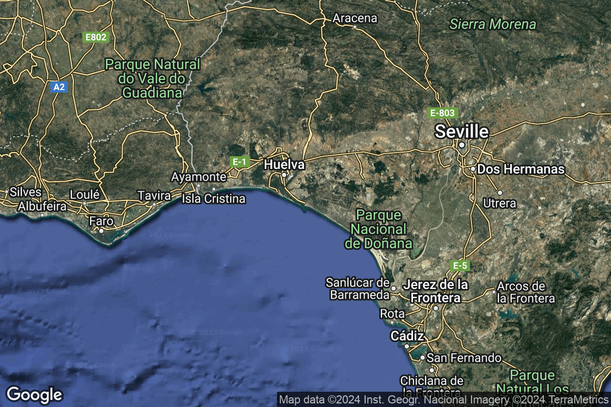
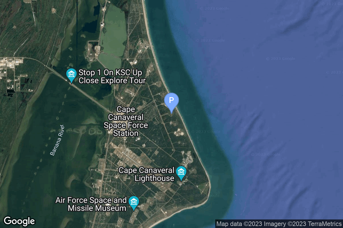
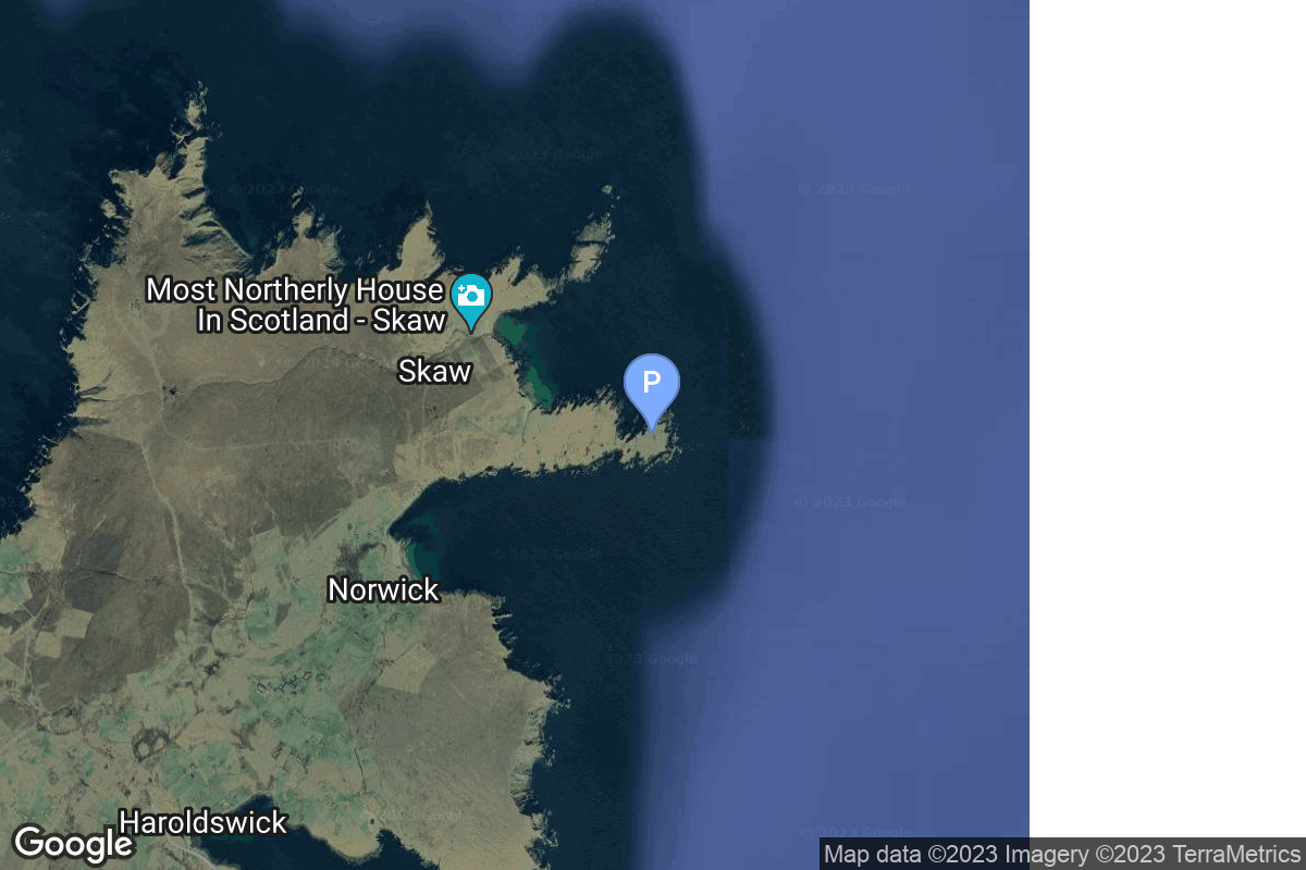
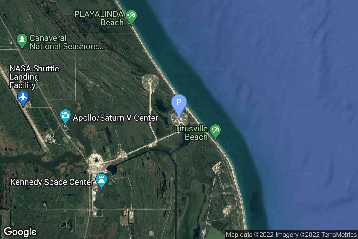
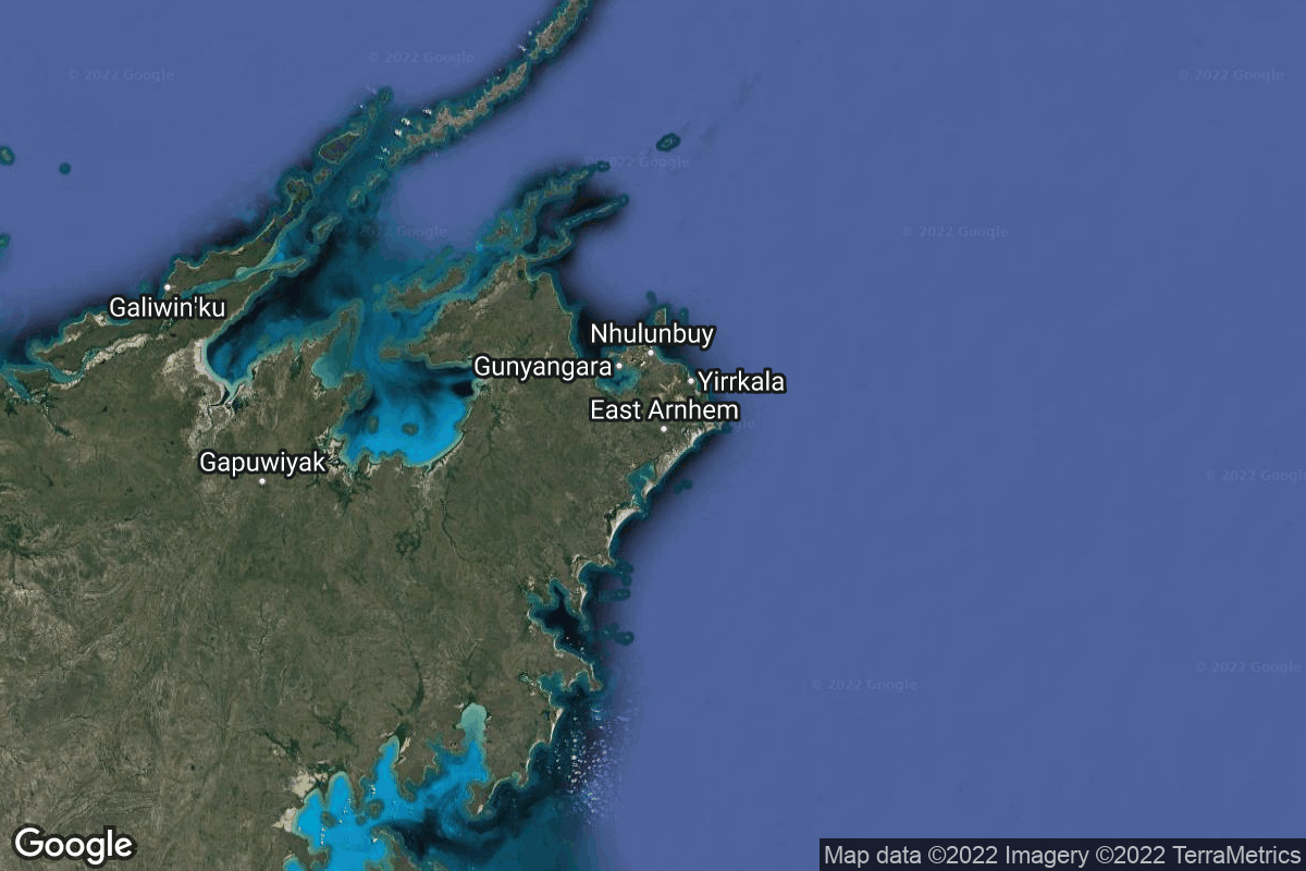
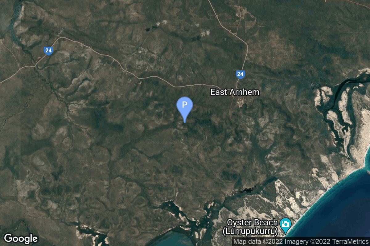
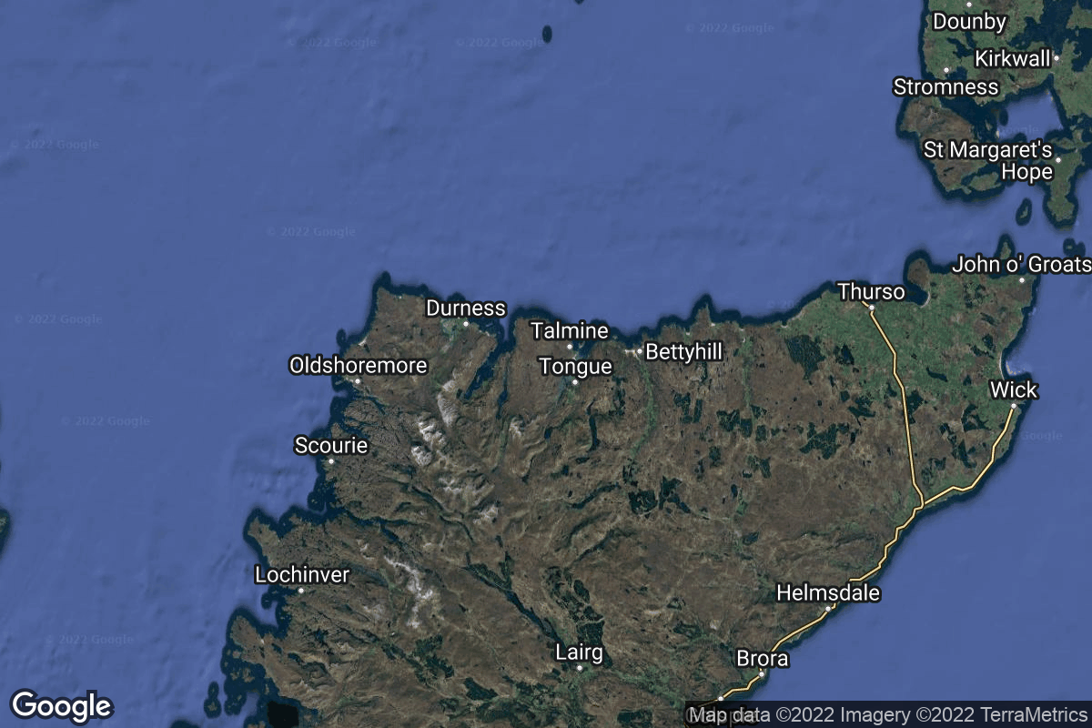
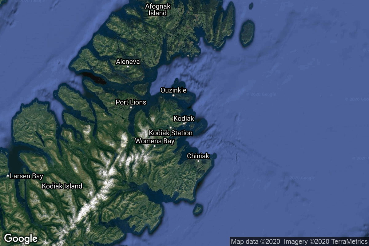
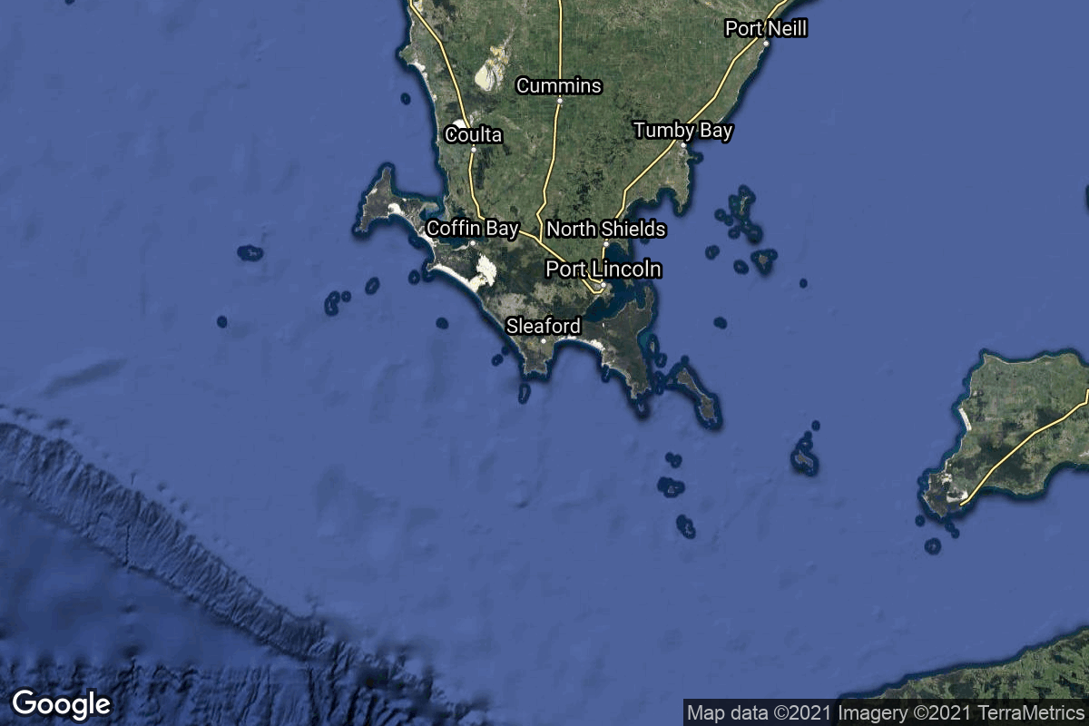
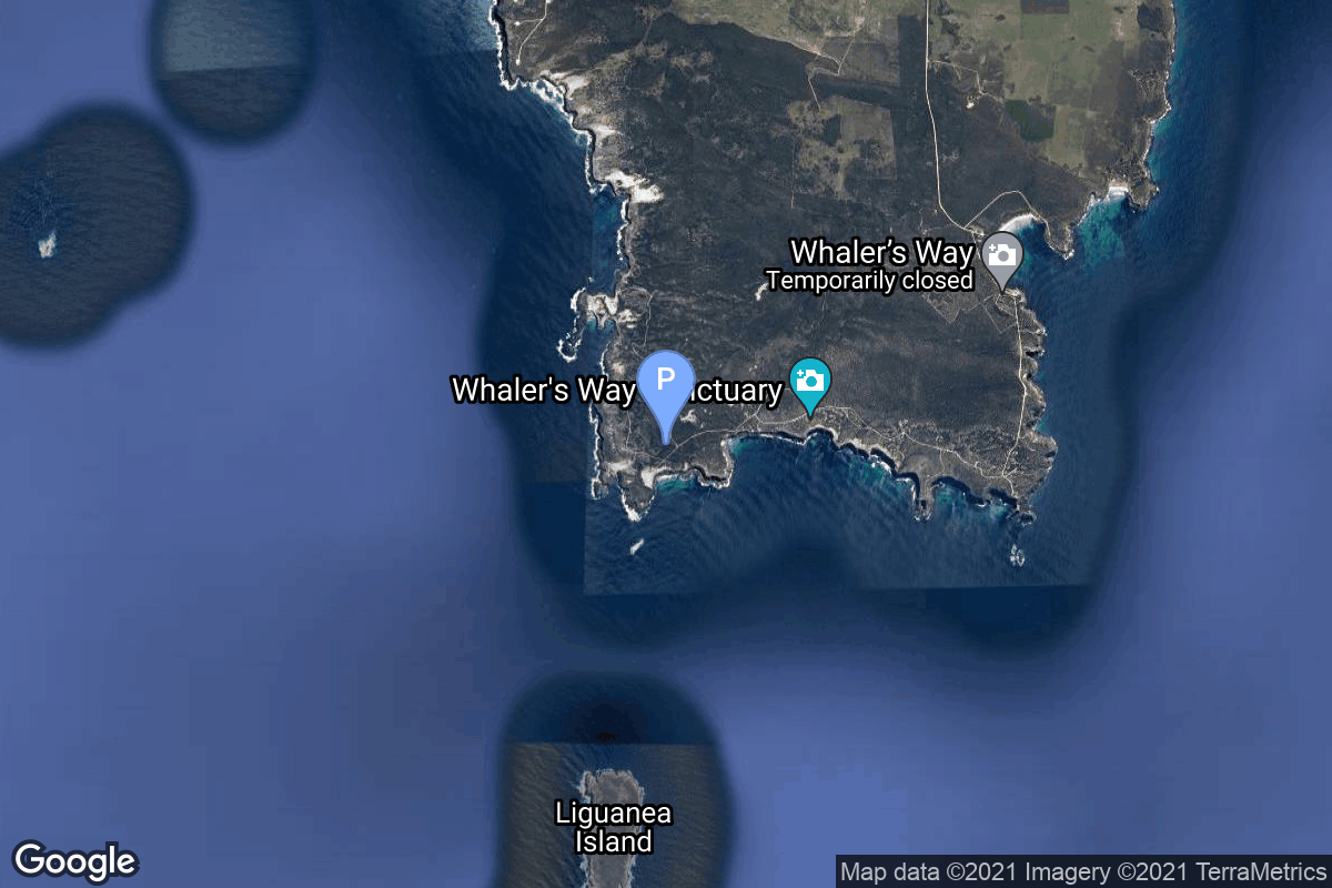
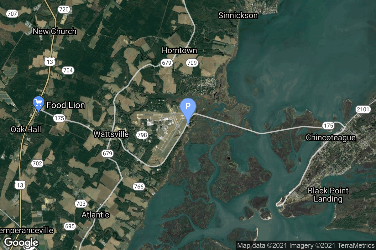
{ "count": 220, "next": "https://lldev.thespacedevs.com/2.2.0/pad/?format=api&limit=10&offset=30&ordering=-id", "previous": "https://lldev.thespacedevs.com/2.2.0/pad/?format=api&limit=10&offset=10&ordering=-id", "results": [ { "id": 207, "url": "https://lldev.thespacedevs.com/2.2.0/pad/207/?format=api", "agency_id": null, "name": "Médano del Loro", "description": null, "info_url": null, "wiki_url": "https://en.wikipedia.org/wiki/El_Arenosillo", "map_url": null, "latitude": "37.09687", "longitude": "-6.73863", "location": { "id": 163, "url": "https://lldev.thespacedevs.com/2.2.0/location/163/?format=api", "name": "El Arenosillo Test Centre", "country_code": "ESP", "description": "El Arenosillo Test Centre is the name of a rocket launch site managed by INTA, located in Moguer, Spain. It is located in the province of Huelva, Andalucía, on the southwest coast of Spain.", "map_image": "https://thespacedevs-prod.nyc3.digitaloceanspaces.com/media/map_images/location_163_20240111100612.jpg", "timezone_name": "Europe/Madrid", "total_launch_count": 1, "total_landing_count": 0 }, "country_code": "ESP", "map_image": "https://thespacedevs-prod.nyc3.digitaloceanspaces.com/media/map_images/pad_miura_1_pad_20230530101735.jpg", "total_launch_count": 1, "orbital_launch_attempt_count": 0 }, { "id": 206, "url": "https://lldev.thespacedevs.com/2.2.0/pad/206/?format=api", "agency_id": 1030, "name": "Space Launch Complex 15", "description": null, "info_url": null, "wiki_url": "https://en.wikipedia.org/wiki/Cape_Canaveral_Launch_Complex_15", "map_url": "https://www.google.com/maps?q=28.4963,-80.5493", "latitude": "28.4963", "longitude": "-80.5493", "location": { "id": 12, "url": "https://lldev.thespacedevs.com/2.2.0/location/12/?format=api", "name": "Cape Canaveral SFS, FL, USA", "country_code": "USA", "description": "Cape Canaveral Space Force Station (CCSFS) is an installation of the United States Space Force's Space Launch Delta 45, located on Cape Canaveral in Brevard County, Florida.", "map_image": "https://thespacedevs-prod.nyc3.digitaloceanspaces.com/media/map_images/location_12_20200803142519.jpg", "timezone_name": "America/New_York", "total_launch_count": 1031, "total_landing_count": 64 }, "country_code": "USA", "map_image": "https://thespacedevs-prod.nyc3.digitaloceanspaces.com/media/map_images/pad_space_launch_complex_15_20230308080759.jpg", "total_launch_count": 0, "orbital_launch_attempt_count": 0 }, { "id": 205, "url": "https://lldev.thespacedevs.com/2.2.0/pad/205/?format=api", "agency_id": 1045, "name": "Launch Pad Fredo", "description": null, "info_url": "https://saxavord.com/", "wiki_url": "https://en.wikipedia.org/wiki/SaxaVord_Spaceport", "map_url": "https://www.google.com/maps?q=60.81736038715111,-0.7626391593025057", "latitude": "60.81736038715111", "longitude": "-0.7626391593025057", "location": { "id": 157, "url": "https://lldev.thespacedevs.com/2.2.0/location/157/?format=api", "name": "SaxaVord Spaceport", "country_code": "GBR", "description": "SaxaVord Spaceport is a UK spaceport located on the Lamba Ness peninsula on Unst, the most northerly of the inhabited Shetland Islands off the coast of Scotland. The site is near the RAF Saxa Vord radar station and the settlement of Skaw, adjacent to the Saxa Vord distillery.", "map_image": "https://thespacedevs-prod.nyc3.digitaloceanspaces.com/media/map_images/location_saxavord_spaceport_20211102161146.jpg", "timezone_name": "Europe/London", "total_launch_count": 0, "total_landing_count": 0 }, "country_code": "GBR", "map_image": "https://thespacedevs-prod.nyc3.digitaloceanspaces.com/media/map_images/pad_launch_pad_fredo_20230112225206.jpg", "total_launch_count": 0, "orbital_launch_attempt_count": 0 }, { "id": 203, "url": "https://lldev.thespacedevs.com/2.2.0/pad/203/?format=api", "agency_id": 121, "name": "Launch Complex 39A Starship Pad", "description": "", "info_url": null, "wiki_url": "https://en.wikipedia.org/wiki/Kennedy_Space_Center_Launch_Complex_39A", "map_url": "https://www.google.com/maps?q=28.60822681,-80.60428186", "latitude": "28.60822681", "longitude": "-80.60428186", "location": { "id": 27, "url": "https://lldev.thespacedevs.com/2.2.0/location/27/?format=api", "name": "Kennedy Space Center, FL, USA", "country_code": "USA", "description": "The John F. Kennedy Space Center, located on Merritt Island, Florida, is one of NASA's ten field centers. Since 1968, KSC has been NASA's primary launch center of American spaceflight, research, and technology. Launch operations for the Apollo, Skylab and Space Shuttle programs were carried out from Kennedy Space Center Launch Complex 39 and managed by KSC. Located on the east coast of Florida, KSC is adjacent to Cape Canaveral Space Force Station (CCSFS).", "map_image": "https://thespacedevs-prod.nyc3.digitaloceanspaces.com/media/map_images/location_27_20200803142447.jpg", "timezone_name": "America/New_York", "total_launch_count": 266, "total_landing_count": 0 }, "country_code": "USA", "map_image": "https://thespacedevs-prod.nyc3.digitaloceanspaces.com/media/map_images/pad_launch_complex_39a_20220818090654.jpg", "total_launch_count": 0, "orbital_launch_attempt_count": 0 }, { "id": 202, "url": "https://lldev.thespacedevs.com/2.2.0/pad/202/?format=api", "agency_id": 1038, "name": "Suborbital Launch Ramp", "description": null, "info_url": "https://ela.space/arnhem-space-centre/", "wiki_url": "https://en.wikipedia.org/wiki/Arnhem_Land#Economy", "map_url": "https://www.google.com/maps?q=-12.3892948,136.7903215", "latitude": "-12.3892948", "longitude": "136.7903215", "location": { "id": 160, "url": "https://lldev.thespacedevs.com/2.2.0/location/160/?format=api", "name": "Arnhem Space Centre", "country_code": "AUS", "description": "The Arnhem Space Centre was Australia's first commercial spaceport, located near Nhulunbuy, in Arnhem Land, Australia. It was owned and operated by Equatorial Launch Australia (ELA), and was the site of NASA's first non-orbital sounding rocket launch from a commercial port outside the United States on 27 June 2022.", "map_image": "https://thespacedevs-prod.nyc3.digitaloceanspaces.com/media/map_images/location_arnhem_space_centre_20220622160552.jpg", "timezone_name": "Australia/Darwin", "total_launch_count": 3, "total_landing_count": 0 }, "country_code": "AUS", "map_image": "https://thespacedevs-prod.nyc3.digitaloceanspaces.com/media/map_images/pad_suborbital_launch_ramp_20220625184504.jpg", "total_launch_count": 3, "orbital_launch_attempt_count": 0 }, { "id": 201, "url": "https://lldev.thespacedevs.com/2.2.0/pad/201/?format=api", "agency_id": null, "name": "Launch Complex", "description": null, "info_url": null, "wiki_url": "https://en.wikipedia.org/wiki/Sutherland_spaceport", "map_url": "https://www.google.com/maps?q=58.022058,-4.402414", "latitude": "58.022058", "longitude": "-4.402414", "location": { "id": 159, "url": "https://lldev.thespacedevs.com/2.2.0/location/159/?format=api", "name": "Sutherland Spaceport", "country_code": "GBR", "description": "The Sutherland spaceport is a spaceport to be located in Sutherland in Scotland.", "map_image": "https://thespacedevs-prod.nyc3.digitaloceanspaces.com/media/map_images/location_sutherland_spaceport_20220511180155.jpg", "timezone_name": "Europe/London", "total_launch_count": 0, "total_landing_count": 0 }, "country_code": "GBR", "map_image": "https://thespacedevs-prod.nyc3.digitaloceanspaces.com/media/map_images/pad_201_20220511181044.jpg", "total_launch_count": 0, "orbital_launch_attempt_count": 0 }, { "id": 200, "url": "https://lldev.thespacedevs.com/2.2.0/pad/200/?format=api", "agency_id": null, "name": "Launch Complex 9A", "description": "", "info_url": null, "wiki_url": null, "map_url": "https://www.google.com/maps?q=38.8583,111.5802", "latitude": "38.8583", "longitude": "111.5802", "location": { "id": 19, "url": "https://lldev.thespacedevs.com/2.2.0/location/19/?format=api", "name": "Taiyuan Satellite Launch Center, People's Republic of China", "country_code": "CHN", "description": "The Taiyuan Satellite Launch Center is a People's Republic of China space and defense launch facility. It is situated in Kelan County, Xinzhou, Shanxi Province and is the second of four launch sites having been founded in March 1966 and coming into full operation in 1968.", "map_image": "https://thespacedevs-prod.nyc3.digitaloceanspaces.com/media/map_images/location_19_20200803142421.jpg", "timezone_name": "Asia/Shanghai", "total_launch_count": 142, "total_landing_count": 0 }, "country_code": "CHN", "map_image": "https://thespacedevs-prod.nyc3.digitaloceanspaces.com/media/map_images/pad_launch_complex_9a_20220330003717.jpg", "total_launch_count": 14, "orbital_launch_attempt_count": 14 }, { "id": 199, "url": "https://lldev.thespacedevs.com/2.2.0/pad/199/?format=api", "agency_id": null, "name": "Launch Pad 3C", "description": "", "info_url": null, "wiki_url": "https://en.wikipedia.org/wiki/Pacific_Spaceport_Complex_%E2%80%93_Alaska", "map_url": "https://www.google.com/maps?q=57.431239,-152.350749", "latitude": "57.431239", "longitude": "-152.350749", "location": { "id": 25, "url": "https://lldev.thespacedevs.com/2.2.0/location/25/?format=api", "name": "Pacific Spaceport Complex, Alaska, USA", "country_code": "USA", "description": "The Pacific Spaceport Complex – Alaska (PSCA), formerly known as the Kodiak Launch Complex (KLC), is a dual-use commercial and military spaceport for sub-orbital and orbital launch vehicles. The facility is owned and operated by the Alaska Aerospace Corporation, a corporation owned by the Government of Alaska, and is located on Kodiak Island in Alaska.", "map_image": "https://thespacedevs-prod.nyc3.digitaloceanspaces.com/media/map_images/location_25_20200803142500.jpg", "timezone_name": "America/Anchorage", "total_launch_count": 9, "total_landing_count": 0 }, "country_code": "USA", "map_image": "https://thespacedevs-prod.nyc3.digitaloceanspaces.com/media/map_images/pad_199_20220904142623.jpg", "total_launch_count": 1, "orbital_launch_attempt_count": 1 }, { "id": 197, "url": "https://lldev.thespacedevs.com/2.2.0/pad/197/?format=api", "agency_id": 1028, "name": "Pad 1", "description": null, "info_url": "https://www.southernlaunch.space/whalers-way-orbital-launch-complex", "wiki_url": "https://en.wikipedia.org/wiki/Whalers_Way_Orbital_Launch_Complex", "map_url": "https://www.google.com/maps?q=-34.937822,135.630035", "latitude": "-34.937822", "longitude": "135.630035", "location": { "id": 156, "url": "https://lldev.thespacedevs.com/2.2.0/location/156/?format=api", "name": "Whalers Way Orbital Launch Complex, South Australia", "country_code": "AUS", "description": "Whalers Way Orbital Launch Complex is a rocket-launching facility operated by Southern Launch at Whalers Way, in the locality of Sleaford near Port Lincoln on South Australia's Eyre Peninsula.", "map_image": "https://thespacedevs-prod.nyc3.digitaloceanspaces.com/media/map_images/location_whalers_way_orbital_launch_complex_20210910042508.jpg", "timezone_name": "Australia/Adelaide", "total_launch_count": 1, "total_landing_count": 0 }, "country_code": "AUS", "map_image": "https://thespacedevs-prod.nyc3.digitaloceanspaces.com/media/map_images/pad_whalers_way_orbital_launch_complex_20210910042853.jpg", "total_launch_count": 1, "orbital_launch_attempt_count": 0 }, { "id": 196, "url": "https://lldev.thespacedevs.com/2.2.0/pad/196/?format=api", "agency_id": 44, "name": "Launch Area 4", "description": null, "info_url": null, "wiki_url": "https://en.wikipedia.org/wiki/Wallops_Flight_Facility", "map_url": "https://www.google.com/maps?q=37.938611,-75.457222", "latitude": "37.938611", "longitude": "-75.457222", "location": { "id": 21, "url": "https://lldev.thespacedevs.com/2.2.0/location/21/?format=api", "name": "Wallops Flight Facility, Virginia, USA", "country_code": "USA", "description": "Wallops Flight Facility is a rocket launch site on Wallops Island on the Eastern Shore of Virginia, United States, just east of the Delmarva Peninsula and north-northeast of Norfolk. The facility is operated by the Goddard Space Flight Center in Greenbelt, Maryland, and primarily serves to support science and exploration missions for NASA and other federal agencies. WFF includes an extensively instrumented range to support launches of more than a dozen types of sounding rockets; small expendable suborbital and orbital rockets; high-altitude balloon flights carrying scientific instruments for atmospheric and astronomical research; and, using its Research Airport, flight tests of aeronautical research aircraft, including uncrewed aerial vehicles.", "map_image": "https://thespacedevs-prod.nyc3.digitaloceanspaces.com/media/map_images/location_21_20200803142423.jpg", "timezone_name": "America/New_York", "total_launch_count": 80, "total_landing_count": 0 }, "country_code": "USA", "map_image": "https://thespacedevs-prod.nyc3.digitaloceanspaces.com/media/map_images/pad_launch_area_4_20210901092808.jpg", "total_launch_count": 1, "orbital_launch_attempt_count": 0 } ] }