Pad List
API endpoint that allows Location instances to be viewed.
GET: Return a list of all the existing location instances.
FILTERS: Parameters - 'id', 'agency_id', 'name', 'name__contains', 'latitude', 'latitude__contains', 'longitude', 'longitude__contains', 'location__name', 'location__name__contains', 'location__id', 'orbital_launch_attempt_count', 'total_launch_count'
ORDERING: Fields - 'id', 'name', 'location__id', 'location__name', 'orbital_launch_attempt_count', 'total_launch_count'
Example - /2.2.0/pad/?ordering=location__name
GET /2.2.0/pad/?format=api&offset=180&ordering=-orbital_launch_attempt_count
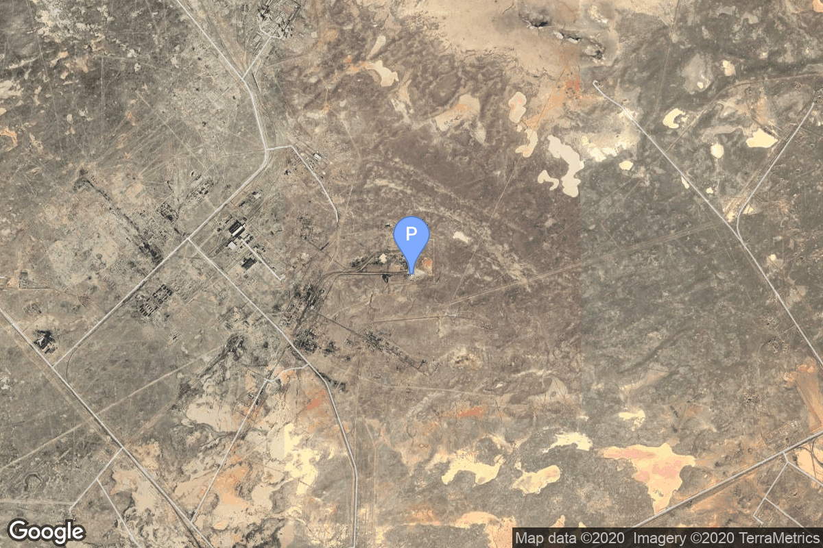
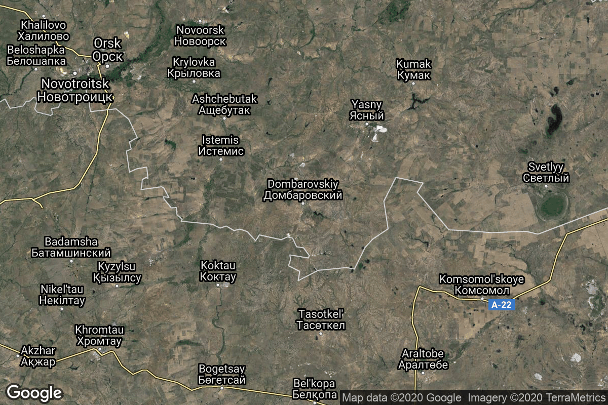
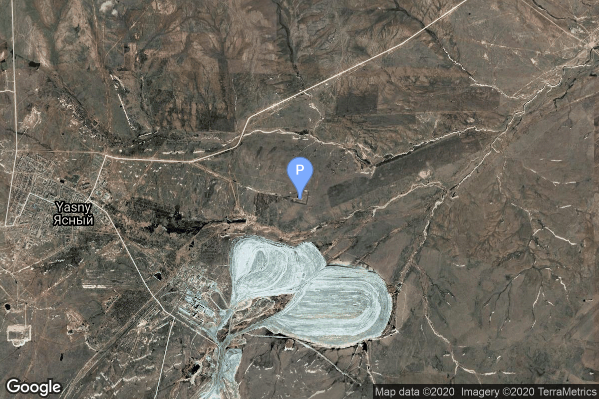
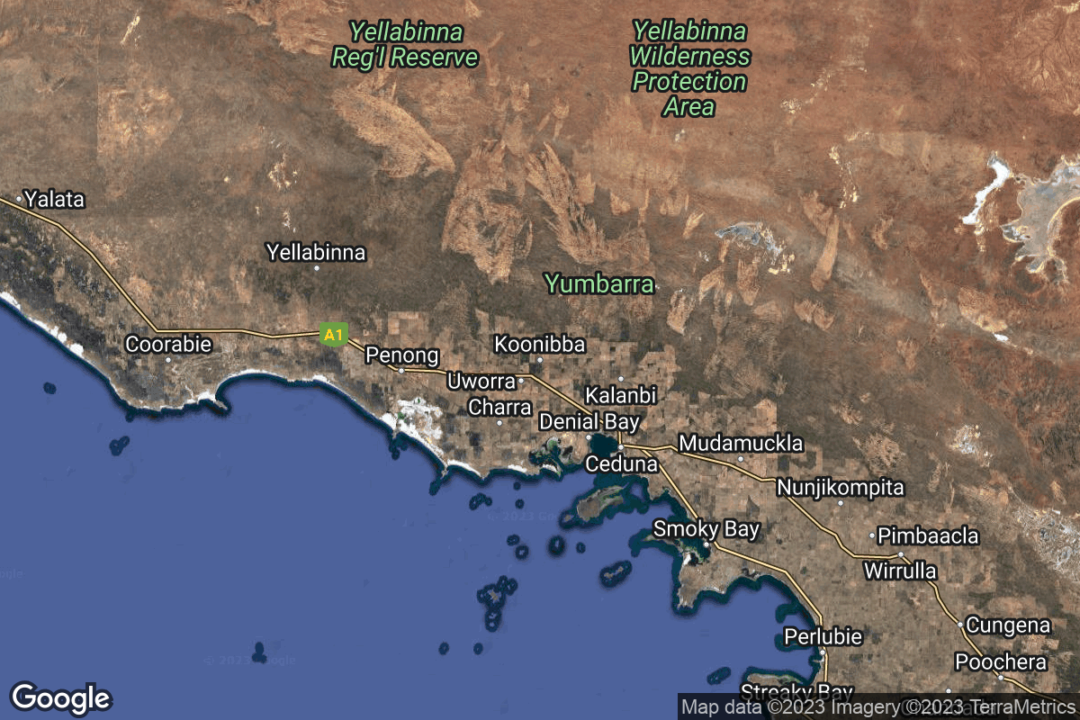
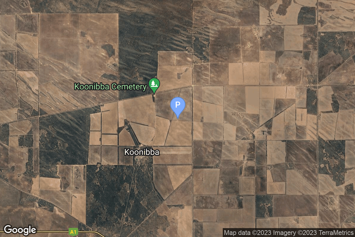
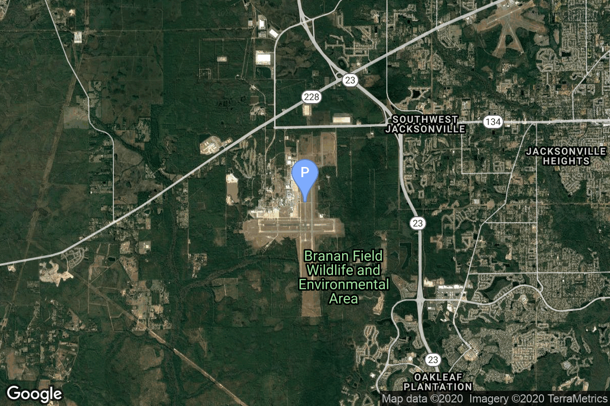
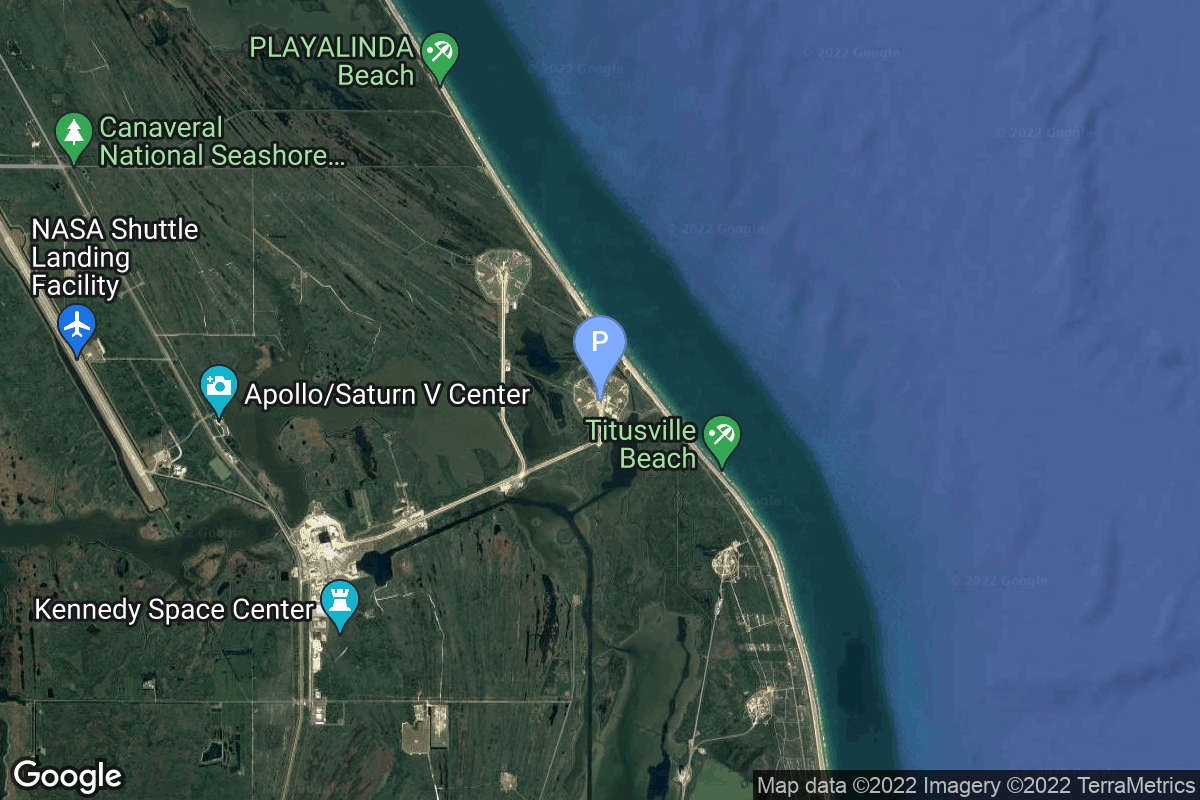
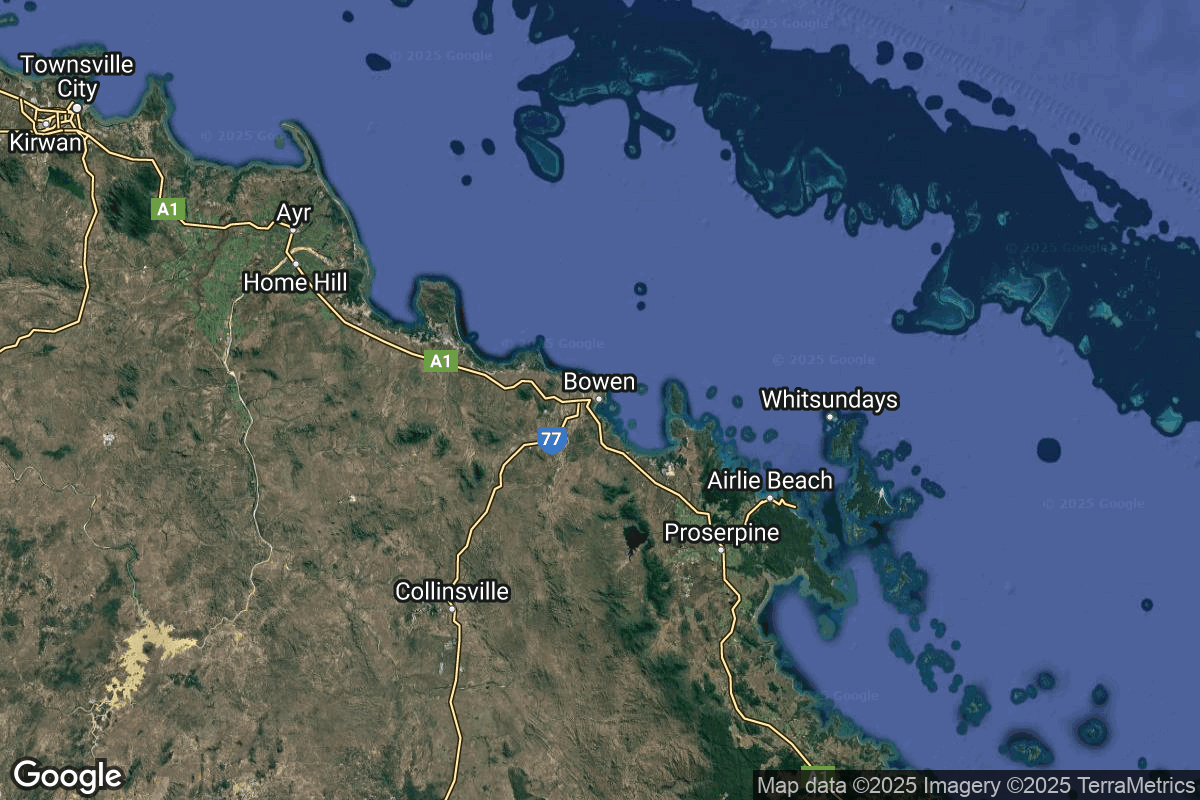
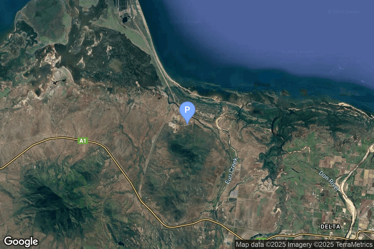
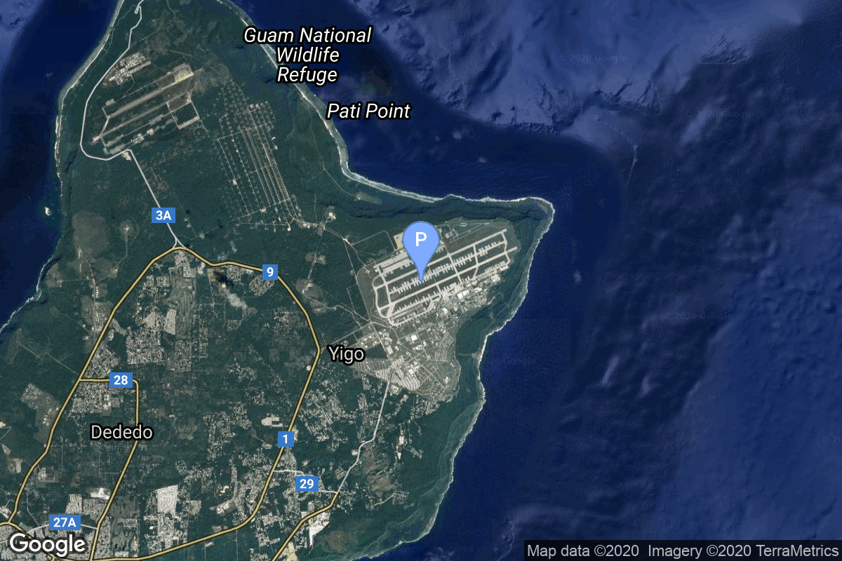
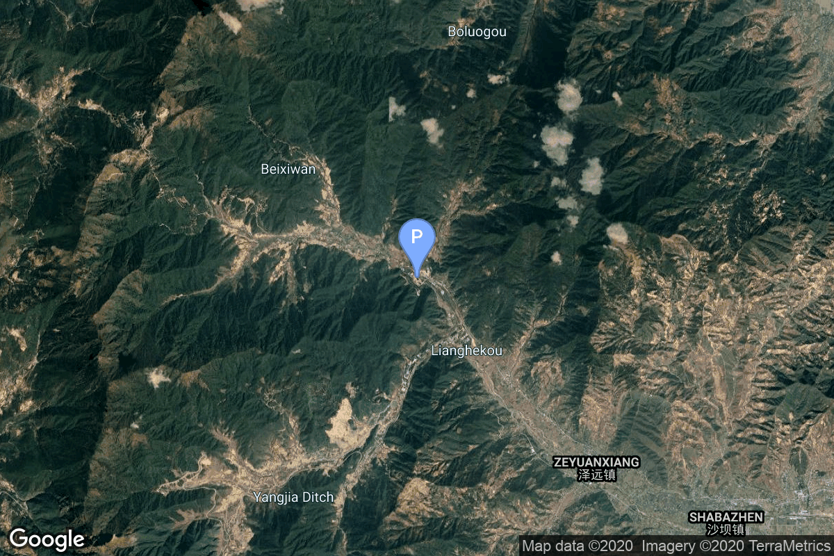
{ "count": 220, "next": "https://lldev.thespacedevs.com/2.2.0/pad/?format=api&limit=10&offset=190&ordering=-orbital_launch_attempt_count", "previous": "https://lldev.thespacedevs.com/2.2.0/pad/?format=api&limit=10&offset=170&ordering=-orbital_launch_attempt_count", "results": [ { "id": 101, "url": "https://lldev.thespacedevs.com/2.2.0/pad/101/?format=api", "agency_id": null, "name": "Unknown Pad", "description": "", "info_url": null, "wiki_url": null, "map_url": "https://www.google.com/maps?q=0.0,0.0", "latitude": null, "longitude": null, "location": { "id": 3, "url": "https://lldev.thespacedevs.com/2.2.0/location/3/?format=api", "name": "Sea Launch", "country_code": "???", "description": "", "map_image": "https://thespacedevs-prod.nyc3.digitaloceanspaces.com/media/map_images/location_3_20200803142448.jpg", "timezone_name": "", "total_launch_count": 56, "total_landing_count": 0 }, "country_code": "", "map_image": "https://thespacedevs-prod.nyc3.digitaloceanspaces.com/media/map_images/pad_101_20200803143204.jpg", "total_launch_count": 0, "orbital_launch_attempt_count": 0 }, { "id": 68, "url": "https://lldev.thespacedevs.com/2.2.0/pad/68/?format=api", "agency_id": null, "name": "Unknown Pad", "description": null, "info_url": null, "wiki_url": "", "map_url": "https://www.google.com/maps?q=45.92,63.342", "latitude": "45.92", "longitude": "63.342", "location": { "id": 15, "url": "https://lldev.thespacedevs.com/2.2.0/location/15/?format=api", "name": "Baikonur Cosmodrome, Republic of Kazakhstan", "country_code": "KAZ", "description": "The Baikonur Cosmodrome is a spaceport operated by Russia within Kazakhstan. Located in the Kazakh city of Baikonur, it is the largest operational space launch facility in terms of area. All Russian crewed spaceflights are launched from Baikonur.", "map_image": "https://thespacedevs-prod.nyc3.digitaloceanspaces.com/media/map_images/location_15_20200803142517.jpg", "timezone_name": "Asia/Qyzylorda", "total_launch_count": 1555, "total_landing_count": 0 }, "country_code": "KAZ", "map_image": "https://thespacedevs-prod.nyc3.digitaloceanspaces.com/media/map_images/pad_68_20200803143521.jpg", "total_launch_count": 0, "orbital_launch_attempt_count": 0 }, { "id": 44, "url": "https://lldev.thespacedevs.com/2.2.0/pad/44/?format=api", "agency_id": null, "name": "Unknown Pad", "description": null, "info_url": null, "wiki_url": "", "map_url": "https://www.google.com/maps?q=51.036,59.958", "latitude": "51.036", "longitude": "59.958", "location": { "id": 5, "url": "https://lldev.thespacedevs.com/2.2.0/location/5/?format=api", "name": "Dombarovskiy, Russian Federation", "country_code": "RUS", "description": "Dombarovsky is a military airbase near Yasny in Russia's Orenburg Oblast. Operated by the Soviet Air Defence Forces and later by the Russian Air Force, it hosted fighter interceptor squadrons and hosts an ICBM base (which has been adapted for commercial satellite launches) with a supporting helicopter base.", "map_image": "https://thespacedevs-prod.nyc3.digitaloceanspaces.com/media/map_images/location_5_20200803142425.jpg", "timezone_name": "Asia/Yekaterinburg", "total_launch_count": 10, "total_landing_count": 0 }, "country_code": "RUS", "map_image": "https://thespacedevs-prod.nyc3.digitaloceanspaces.com/media/map_images/pad_44_20200803143327.jpg", "total_launch_count": 0, "orbital_launch_attempt_count": 0 }, { "id": 215, "url": "https://lldev.thespacedevs.com/2.2.0/pad/215/?format=api", "agency_id": 1028, "name": "Pad 1", "description": "", "info_url": "https://www.southernlaunch.space/koonibba-test-range", "wiki_url": "https://en.wikipedia.org/wiki/Koonibba_Test_Range", "map_url": "https://www.google.com/maps?q=-31.885558,133.448686", "latitude": "-31.885558", "longitude": "133.448686", "location": { "id": 164, "url": "https://lldev.thespacedevs.com/2.2.0/location/164/?format=api", "name": "Koonibba Test Range, South Australia", "country_code": "AUS", "description": "The Koonibba Test Range is a rocket test range site near the township of Koonibba in the far west of South Australia. Rockets are launched to the north over a clear area – the Yumbarra Conservation Park and Yellabinna Wilderness Protection Area – for 145 kilometres (90 mi).", "map_image": "https://thespacedevs-prod.nyc3.digitaloceanspaces.com/media/map_images/location_koonibba_test_range252c_south_australia_20231114184328.jpg", "timezone_name": "Australia/Adelaide", "total_launch_count": 1, "total_landing_count": 0 }, "country_code": "AUS", "map_image": "https://thespacedevs-prod.nyc3.digitaloceanspaces.com/media/map_images/pad_pad_1_20231114184452.jpg", "total_launch_count": 1, "orbital_launch_attempt_count": 0 }, { "id": 109, "url": "https://lldev.thespacedevs.com/2.2.0/pad/109/?format=api", "agency_id": null, "name": "Cecil Air and Space Port", "description": null, "info_url": null, "wiki_url": "https://en.wikipedia.org/wiki/Cecil_Airport", "map_url": "https://www.google.com/maps?q=30.224166,-81.876236", "latitude": "30.224166", "longitude": "-81.876236", "location": { "id": 20, "url": "https://lldev.thespacedevs.com/2.2.0/location/20/?format=api", "name": "Air launch to orbit", "country_code": "???", "description": "", "map_image": "https://thespacedevs-prod.nyc3.digitaloceanspaces.com/media/map_images/location_20_20200803142433.jpg", "timezone_name": "", "total_launch_count": 51, "total_landing_count": 0 }, "country_code": "USA", "map_image": "https://thespacedevs-prod.nyc3.digitaloceanspaces.com/media/map_images/pad_109_20200803143535.jpg", "total_launch_count": 0, "orbital_launch_attempt_count": 0 }, { "id": 112, "url": "https://lldev.thespacedevs.com/2.2.0/pad/112/?format=api", "agency_id": null, "name": "Edwards Air Force Base", "description": null, "info_url": null, "wiki_url": "https://en.wikipedia.org/wiki/Edwards_Air_Force_Base", "map_url": "https://www.google.com/maps?q=34.905556,-117.883611", "latitude": "34.905556", "longitude": "-117.883611", "location": { "id": 144, "url": "https://lldev.thespacedevs.com/2.2.0/location/144/?format=api", "name": "Air launch to Suborbital flight", "country_code": "???", "description": "", "map_image": "https://thespacedevs-prod.nyc3.digitaloceanspaces.com/media/map_images/location_144_20200803142439.jpg", "timezone_name": "", "total_launch_count": 86, "total_landing_count": 0 }, "country_code": "USA", "map_image": "https://thespacedevs-prod.nyc3.digitaloceanspaces.com/media/map_images/pad_112_20200803143214.jpg", "total_launch_count": 13, "orbital_launch_attempt_count": 0 }, { "id": 203, "url": "https://lldev.thespacedevs.com/2.2.0/pad/203/?format=api", "agency_id": 121, "name": "Launch Complex 39A Starship Pad", "description": "", "info_url": null, "wiki_url": "https://en.wikipedia.org/wiki/Kennedy_Space_Center_Launch_Complex_39A", "map_url": "https://www.google.com/maps?q=28.60822681,-80.60428186", "latitude": "28.60822681", "longitude": "-80.60428186", "location": { "id": 27, "url": "https://lldev.thespacedevs.com/2.2.0/location/27/?format=api", "name": "Kennedy Space Center, FL, USA", "country_code": "USA", "description": "The John F. Kennedy Space Center, located on Merritt Island, Florida, is one of NASA's ten field centers. Since 1968, KSC has been NASA's primary launch center of American spaceflight, research, and technology. Launch operations for the Apollo, Skylab and Space Shuttle programs were carried out from Kennedy Space Center Launch Complex 39 and managed by KSC. Located on the east coast of Florida, KSC is adjacent to Cape Canaveral Space Force Station (CCSFS).", "map_image": "https://thespacedevs-prod.nyc3.digitaloceanspaces.com/media/map_images/location_27_20200803142447.jpg", "timezone_name": "America/New_York", "total_launch_count": 266, "total_landing_count": 0 }, "country_code": "USA", "map_image": "https://thespacedevs-prod.nyc3.digitaloceanspaces.com/media/map_images/pad_launch_complex_39a_20220818090654.jpg", "total_launch_count": 0, "orbital_launch_attempt_count": 0 }, { "id": 238, "url": "https://lldev.thespacedevs.com/2.2.0/pad/238/?format=api", "agency_id": 188, "name": "Eris Pad", "description": "Launch pad for Gilmour Space's orbital rocket Eris.", "info_url": null, "wiki_url": "https://en.wikipedia.org/wiki/Gilmour_Space_Technologies#Bowen_Orbital_Spaceport_(BOS)", "map_url": null, "latitude": "-19.958151", "longitude": "148.1129553", "location": { "id": 181, "url": "https://lldev.thespacedevs.com/2.2.0/location/181/?format=api", "name": "Bowen Orbital Spaceport", "country_code": "AUS", "description": "Private orbital launch facility owned and operated by Gilmour Space.", "map_image": "https://thespacedevs-prod.nyc3.digitaloceanspaces.com/media/map_images/location_bowen_orbital_spaceport_20250227073649.jpg", "timezone_name": "Australia/Brisbane", "total_launch_count": 0, "total_landing_count": 0 }, "country_code": "AUS", "map_image": "https://thespacedevs-prod.nyc3.digitaloceanspaces.com/media/map_images/pad_eris_pad_20250227074117.jpg", "total_launch_count": 0, "orbital_launch_attempt_count": 0 }, { "id": 110, "url": "https://lldev.thespacedevs.com/2.2.0/pad/110/?format=api", "agency_id": null, "name": "Andersen Air Force Base", "description": null, "info_url": null, "wiki_url": "https://en.wikipedia.org/wiki/Andersen_Air_Force_Base", "map_url": "https://www.google.com/maps?q=13.581111,144.924444", "latitude": "13.581111", "longitude": "144.924444", "location": { "id": 20, "url": "https://lldev.thespacedevs.com/2.2.0/location/20/?format=api", "name": "Air launch to orbit", "country_code": "???", "description": "", "map_image": "https://thespacedevs-prod.nyc3.digitaloceanspaces.com/media/map_images/location_20_20200803142433.jpg", "timezone_name": "", "total_launch_count": 51, "total_landing_count": 0 }, "country_code": "USA", "map_image": "https://thespacedevs-prod.nyc3.digitaloceanspaces.com/media/map_images/pad_110_20200803143558.jpg", "total_launch_count": 0, "orbital_launch_attempt_count": 0 }, { "id": 86, "url": "https://lldev.thespacedevs.com/2.2.0/pad/86/?format=api", "agency_id": 17, "name": "Unknown Pad", "description": null, "info_url": null, "wiki_url": "https://en.wikipedia.org/wiki/Xichang_Satellite_Launch_Center", "map_url": "https://www.google.com/maps?q=28.246017,102.026556", "latitude": "28.246017", "longitude": "102.026556", "location": { "id": 16, "url": "https://lldev.thespacedevs.com/2.2.0/location/16/?format=api", "name": "Xichang Satellite Launch Center, People's Republic of China", "country_code": "CHN", "description": "The Xichang Satellite Launch Center is a spaceport in China. It is located in Zeyuan Town, northwest of Xichang, Liangshan Yi Autonomous Prefecture in Sichuan.", "map_image": "https://thespacedevs-prod.nyc3.digitaloceanspaces.com/media/map_images/location_16_20200803142513.jpg", "timezone_name": "Asia/Shanghai", "total_launch_count": 227, "total_landing_count": 0 }, "country_code": "CHN", "map_image": "https://thespacedevs-prod.nyc3.digitaloceanspaces.com/media/map_images/pad_86_20200803143555.jpg", "total_launch_count": 0, "orbital_launch_attempt_count": 0 } ] }