Pad List
API endpoint that allows Location instances to be viewed.
GET: Return a list of all the existing location instances.
FILTERS: Parameters - 'id', 'agency_id', 'name', 'name__contains', 'latitude', 'latitude__contains', 'longitude', 'longitude__contains', 'location__name', 'location__name__contains', 'location__id', 'orbital_launch_attempt_count', 'total_launch_count'
ORDERING: Fields - 'id', 'name', 'location__id', 'location__name', 'orbital_launch_attempt_count', 'total_launch_count'
Example - /2.2.0/pad/?ordering=location__name
GET /2.2.0/pad/?format=api&offset=150
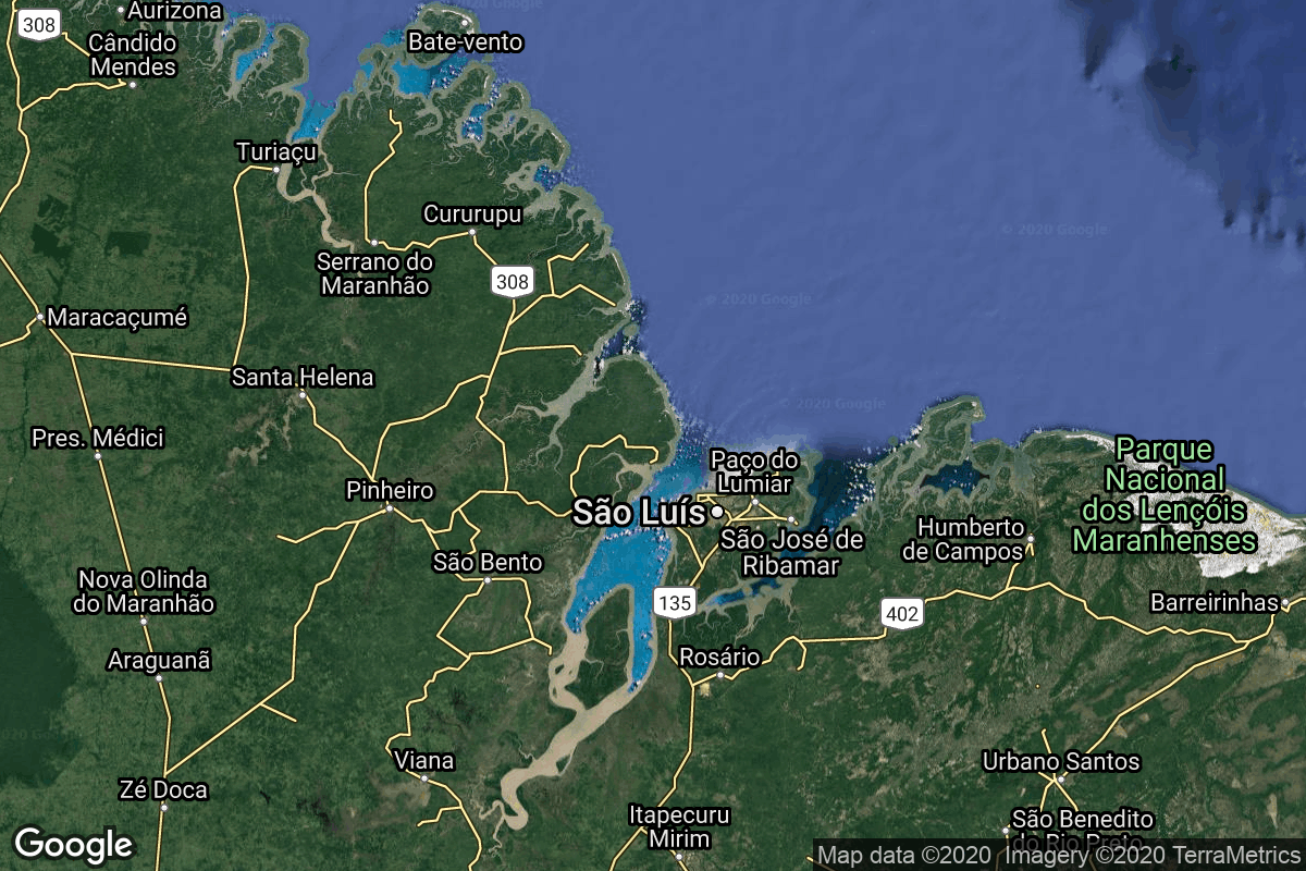
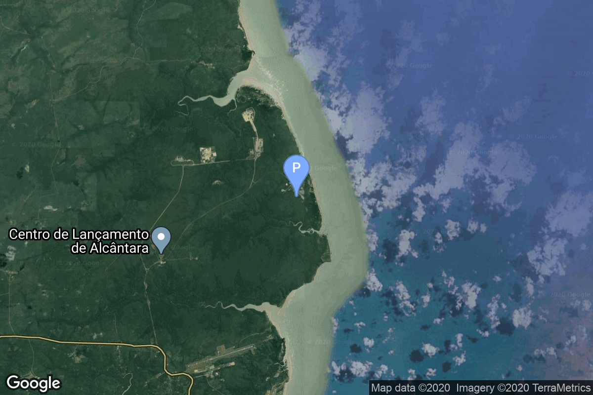
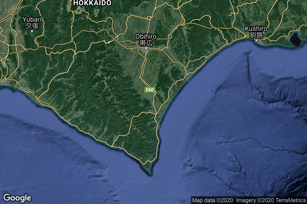
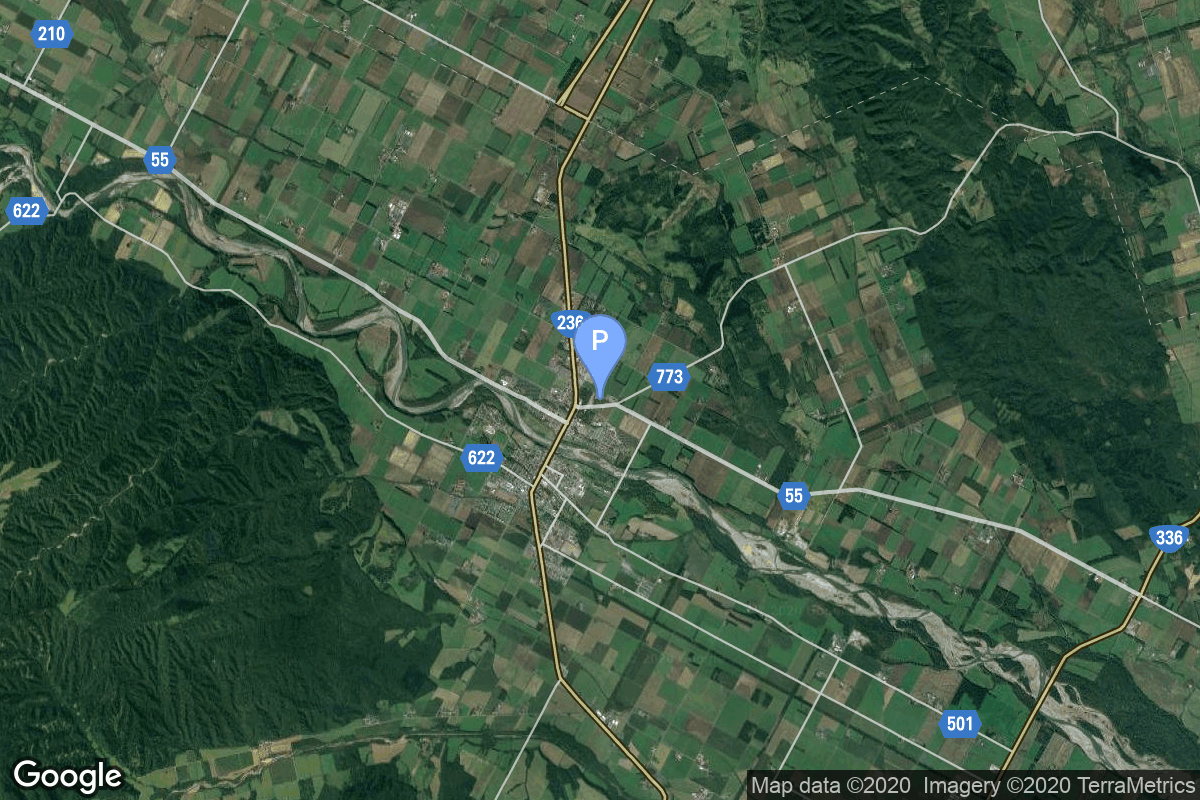
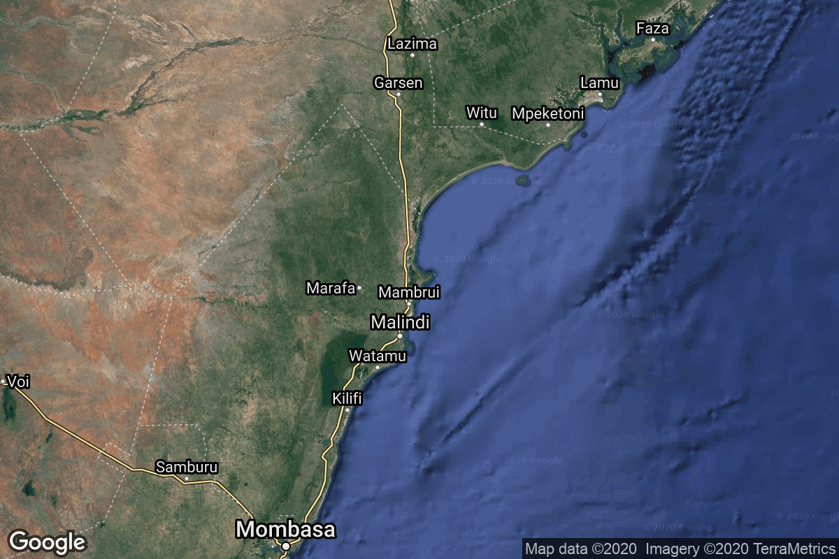
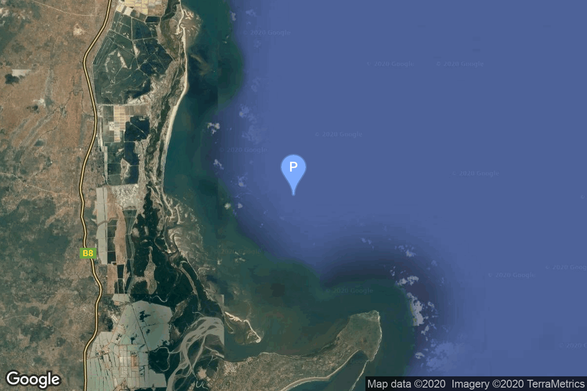
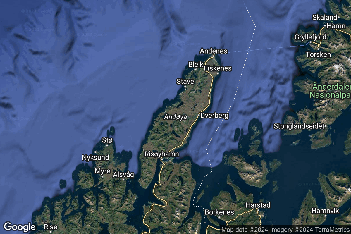
{ "count": 220, "next": "https://lldev.thespacedevs.com/2.2.0/pad/?format=api&limit=10&offset=160", "previous": "https://lldev.thespacedevs.com/2.2.0/pad/?format=api&limit=10&offset=140", "results": [ { "id": 86, "url": "https://lldev.thespacedevs.com/2.2.0/pad/86/?format=api", "agency_id": 17, "name": "Unknown Pad", "description": null, "info_url": null, "wiki_url": "https://en.wikipedia.org/wiki/Xichang_Satellite_Launch_Center", "map_url": "https://www.google.com/maps?q=28.246017,102.026556", "latitude": "28.246017", "longitude": "102.026556", "location": { "id": 16, "url": "https://lldev.thespacedevs.com/2.2.0/location/16/?format=api", "name": "Xichang Satellite Launch Center, People's Republic of China", "country_code": "CHN", "description": "The Xichang Satellite Launch Center is a spaceport in China. It is located in Zeyuan Town, northwest of Xichang, Liangshan Yi Autonomous Prefecture in Sichuan.", "map_image": "https://thespacedevs-prod.nyc3.digitaloceanspaces.com/media/map_images/location_16_20200803142513.jpg", "timezone_name": "Asia/Shanghai", "total_launch_count": 227, "total_landing_count": 0 }, "country_code": "CHN", "map_image": "https://thespacedevs-prod.nyc3.digitaloceanspaces.com/media/map_images/pad_86_20200803143555.jpg", "total_launch_count": 0, "orbital_launch_attempt_count": 0 }, { "id": 26, "url": "https://lldev.thespacedevs.com/2.2.0/pad/26/?format=api", "agency_id": null, "name": "Launch Area 95B", "description": null, "info_url": null, "wiki_url": "https://en.wikipedia.org/wiki/Jiuquan_Satellite_Launch_Center", "map_url": "https://www.google.com/maps?q=40.972407,100.363691", "latitude": "40.972407", "longitude": "100.363691", "location": { "id": 17, "url": "https://lldev.thespacedevs.com/2.2.0/location/17/?format=api", "name": "Jiuquan Satellite Launch Center, People's Republic of China", "country_code": "CHN", "description": "Jiuquan Satellite Launch Center is a Chinese spaceport located between the Ejin, Alxa, Inner Mongolia and Hangtian Town, Jinta County, Jiuquan, Gansu Province. It is part of the Dongfeng Aerospace City (Base 10).", "map_image": "https://thespacedevs-prod.nyc3.digitaloceanspaces.com/media/map_images/location_17_20200803142429.jpg", "timezone_name": "Asia/Shanghai", "total_launch_count": 253, "total_landing_count": 0 }, "country_code": "CHN", "map_image": "https://thespacedevs-prod.nyc3.digitaloceanspaces.com/media/map_images/pad_26_20200803143355.jpg", "total_launch_count": 2, "orbital_launch_attempt_count": 2 }, { "id": 146, "url": "https://lldev.thespacedevs.com/2.2.0/pad/146/?format=api", "agency_id": null, "name": "VLS Pad", "description": null, "info_url": null, "wiki_url": "https://en.wikipedia.org/wiki/Alc%C3%A2ntara_Launch_Center", "map_url": "https://www.google.com/maps?q=-2.3177,-44.369984", "latitude": "-2.3177", "longitude": "-44.369984", "location": { "id": 150, "url": "https://lldev.thespacedevs.com/2.2.0/location/150/?format=api", "name": "Alcântara Space Center, Federative Republic of Brazil", "country_code": "BRA", "description": "The Alcântara Space Center, formerly known as Alcântara Launch Center is a space center and launching facility of the Brazilian Space Agency in the city of Alcântara, located on Brazil's northern Atlantic coast, in the state of Maranhão.", "map_image": "https://thespacedevs-prod.nyc3.digitaloceanspaces.com/media/map_images/location_150_20200803142405.jpg", "timezone_name": "America/Fortaleza", "total_launch_count": 2, "total_landing_count": 0 }, "country_code": "BRA", "map_image": "https://thespacedevs-prod.nyc3.digitaloceanspaces.com/media/map_images/pad_146_20200803143337.jpg", "total_launch_count": 2, "orbital_launch_attempt_count": 2 }, { "id": 106, "url": "https://lldev.thespacedevs.com/2.2.0/pad/106/?format=api", "agency_id": 1002, "name": "Launch Complex 0", "description": null, "info_url": null, "wiki_url": "https://en.wikipedia.org/wiki/Taiki_Aerospace_Research_Field", "map_url": "https://www.google.com/maps?q=42.50000000,143.441389", "latitude": "42.5", "longitude": "143.441389", "location": { "id": 32, "url": "https://lldev.thespacedevs.com/2.2.0/location/32/?format=api", "name": "Hokkaido Spaceport, Japan", "country_code": "JPN", "description": "Rocket launch pad of Interstellar Technologies, located next to the Taiki Aerospace Research Field.", "map_image": "https://thespacedevs-prod.nyc3.digitaloceanspaces.com/media/map_images/location_32_20200803142407.jpg", "timezone_name": "Asia/Tokyo", "total_launch_count": 7, "total_landing_count": 0 }, "country_code": "JPN", "map_image": "https://thespacedevs-prod.nyc3.digitaloceanspaces.com/media/map_images/pad_106_20200803143453.jpg", "total_launch_count": 7, "orbital_launch_attempt_count": 0 }, { "id": 155, "url": "https://lldev.thespacedevs.com/2.2.0/pad/155/?format=api", "agency_id": null, "name": "San Marco platform", "description": null, "info_url": null, "wiki_url": "https://en.wikipedia.org/wiki/Broglio_Space_Center", "map_url": "https://www.google.com/maps?q=-2.9383333,40.210306", "latitude": "-2.9383333", "longitude": "40.210306", "location": { "id": 151, "url": "https://lldev.thespacedevs.com/2.2.0/location/151/?format=api", "name": "Broglio Space Center, Kenya", "country_code": "ITA", "description": "The Luigi Broglio Space Center (BSC) located near Malindi, Kenya, is an Italian Space Agency (ASI) Spaceport. It served as a spaceport for the launch of both Italian and international satellites, but is currently only used for satellite communications.", "map_image": "https://thespacedevs-prod.nyc3.digitaloceanspaces.com/media/map_images/location_151_20200803142409.jpg", "timezone_name": "Africa/Nairobi", "total_launch_count": 9, "total_landing_count": 0 }, "country_code": "ITA", "map_image": "https://thespacedevs-prod.nyc3.digitaloceanspaces.com/media/map_images/pad_155_20200803143349.jpg", "total_launch_count": 9, "orbital_launch_attempt_count": 9 }, { "id": 34, "url": "https://lldev.thespacedevs.com/2.2.0/pad/34/?format=api", "agency_id": 115, "name": "Ariane Launch Area 1 (ELV)", "description": "ELA-1, now named Ensemble de Lancement Vega (short ELV), is a launch pad at the Centre Spatial Guyanais in French Guiana. It has been used to support launches of the Europa rocket, Ariane 1, Ariane 3, and is currently used to launch Vega rockets.", "info_url": null, "wiki_url": "https://en.wikipedia.org/wiki/ELA-1", "map_url": "https://www.google.com/maps?q=5.236,-52.775", "latitude": "5.236", "longitude": "-52.775", "location": { "id": 13, "url": "https://lldev.thespacedevs.com/2.2.0/location/13/?format=api", "name": "Guiana Space Centre, French Guiana", "country_code": "GUF", "description": "The Guiana Space Centre is a European spaceport to the northwest of Kourou in French Guiana, a region of France in South America. Kourou is located at a latitude of 5°. In operation since 1968, it is a suitable location for a spaceport because of its equatorial location and open sea to the east.", "map_image": "https://thespacedevs-prod.nyc3.digitaloceanspaces.com/media/map_images/location_13_20200803142412.jpg", "timezone_name": "America/Cayenne", "total_launch_count": 325, "total_landing_count": 0 }, "country_code": "GUF", "map_image": "https://thespacedevs-prod.nyc3.digitaloceanspaces.com/media/map_images/pad_34_20200803143527.jpg", "total_launch_count": 52, "orbital_launch_attempt_count": 52 }, { "id": 51, "url": "https://lldev.thespacedevs.com/2.2.0/pad/51/?format=api", "agency_id": null, "name": "Orbital Launch Pad", "description": null, "info_url": null, "wiki_url": "https://en.wikipedia.org/wiki/And%C3%B8ya_Space", "map_url": "https://www.google.com/maps?q=69.1084,15.5895", "latitude": "69.1084", "longitude": "15.5895", "location": { "id": 161, "url": "https://lldev.thespacedevs.com/2.2.0/location/161/?format=api", "name": "Andøya Spaceport", "country_code": "NOR", "description": "Andøya Space, also named Andøya Space Center and formerly Andøya Rocket Range, is a rocket launch site, rocket range, and spaceport on Andøya island (the northernmost in the Vesterålen archipelago) in Andøy Municipality in Nordland county, Norway.", "map_image": "https://thespacedevs-prod.nyc3.digitaloceanspaces.com/media/map_images/location_161_20240109072235.jpg", "timezone_name": "Europe/Oslo", "total_launch_count": 1, "total_landing_count": 0 }, "country_code": "NOR", "map_image": "https://thespacedevs-prod.nyc3.digitaloceanspaces.com/media/map_images/pad_51_20200803143605.jpg", "total_launch_count": 1, "orbital_launch_attempt_count": 1 }, { "id": 214, "url": "https://lldev.thespacedevs.com/2.2.0/pad/214/?format=api", "agency_id": null, "name": "Launch Pad Elizabeth", "description": "Named after the late Queen Elizabeth II, the pad will support launch operations of US-based launchers.\r\n\r\nIt is located at the most northern tip of the UK, allowing for extra security control to meet ITAR regulations.", "info_url": null, "wiki_url": null, "map_url": null, "latitude": null, "longitude": null, "location": { "id": 157, "url": "https://lldev.thespacedevs.com/2.2.0/location/157/?format=api", "name": "SaxaVord Spaceport", "country_code": "GBR", "description": "SaxaVord Spaceport is a UK spaceport located on the Lamba Ness peninsula on Unst, the most northerly of the inhabited Shetland Islands off the coast of Scotland. The site is near the RAF Saxa Vord radar station and the settlement of Skaw, adjacent to the Saxa Vord distillery.", "map_image": "https://thespacedevs-prod.nyc3.digitaloceanspaces.com/media/map_images/location_saxavord_spaceport_20211102161146.jpg", "timezone_name": "Europe/London", "total_launch_count": 0, "total_landing_count": 0 }, "country_code": "GBR", "map_image": "https://thespacedevs-prod.nyc3.digitaloceanspaces.com/media/map_images/pad_launch_pad_elizabeth_20231013025957.jpg", "total_launch_count": 0, "orbital_launch_attempt_count": 0 }, { "id": 66, "url": "https://lldev.thespacedevs.com/2.2.0/pad/66/?format=api", "agency_id": 17, "name": "Launch Complex 3 (LC-3/LA-1)", "description": "", "info_url": null, "wiki_url": "https://en.wikipedia.org/wiki/Xichang_Satellite_Launch_Center", "map_url": "https://www.google.com/maps?q=28.247209,102.02917", "latitude": "28.247209", "longitude": "102.02917", "location": { "id": 16, "url": "https://lldev.thespacedevs.com/2.2.0/location/16/?format=api", "name": "Xichang Satellite Launch Center, People's Republic of China", "country_code": "CHN", "description": "The Xichang Satellite Launch Center is a spaceport in China. It is located in Zeyuan Town, northwest of Xichang, Liangshan Yi Autonomous Prefecture in Sichuan.", "map_image": "https://thespacedevs-prod.nyc3.digitaloceanspaces.com/media/map_images/location_16_20200803142513.jpg", "timezone_name": "Asia/Shanghai", "total_launch_count": 227, "total_landing_count": 0 }, "country_code": "CHN", "map_image": "https://thespacedevs-prod.nyc3.digitaloceanspaces.com/media/map_images/pad_66_20200803143611.jpg", "total_launch_count": 100, "orbital_launch_attempt_count": 100 }, { "id": 163, "url": "https://lldev.thespacedevs.com/2.2.0/pad/163/?format=api", "agency_id": null, "name": "250", "description": null, "info_url": null, "wiki_url": "https://en.wikipedia.org/wiki/Baikonur_Cosmodrome", "map_url": "https://www.google.com/maps?q=46.008,63.302806", "latitude": "46.008", "longitude": "63.302806", "location": { "id": 15, "url": "https://lldev.thespacedevs.com/2.2.0/location/15/?format=api", "name": "Baikonur Cosmodrome, Republic of Kazakhstan", "country_code": "KAZ", "description": "The Baikonur Cosmodrome is a spaceport operated by Russia within Kazakhstan. Located in the Kazakh city of Baikonur, it is the largest operational space launch facility in terms of area. All Russian crewed spaceflights are launched from Baikonur.", "map_image": "https://thespacedevs-prod.nyc3.digitaloceanspaces.com/media/map_images/location_15_20200803142517.jpg", "timezone_name": "Asia/Qyzylorda", "total_launch_count": 1555, "total_landing_count": 0 }, "country_code": "KAZ", "map_image": "https://thespacedevs-prod.nyc3.digitaloceanspaces.com/media/map_images/pad_163_20200803143510.jpg", "total_launch_count": 1, "orbital_launch_attempt_count": 1 } ] }