Pad List
API endpoint that allows Location instances to be viewed.
GET: Return a list of all the existing location instances.
FILTERS: Parameters - 'id', 'agency_id', 'name', 'name__contains', 'latitude', 'latitude__contains', 'longitude', 'longitude__contains', 'location__name', 'location__name__contains', 'location__id', 'orbital_launch_attempt_count', 'total_launch_count'
ORDERING: Fields - 'id', 'name', 'location__id', 'location__name', 'orbital_launch_attempt_count', 'total_launch_count'
Example - /2.2.0/pad/?ordering=location__name
GET /2.2.0/pad/?format=api&offset=130&ordering=-total_launch_count
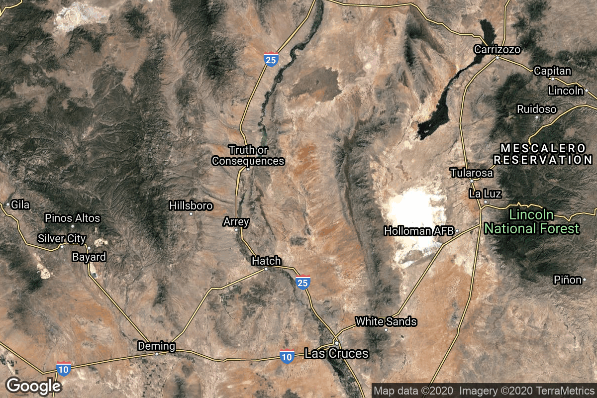
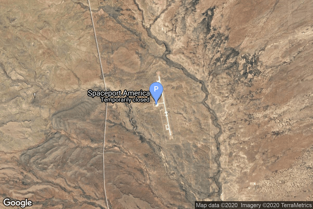
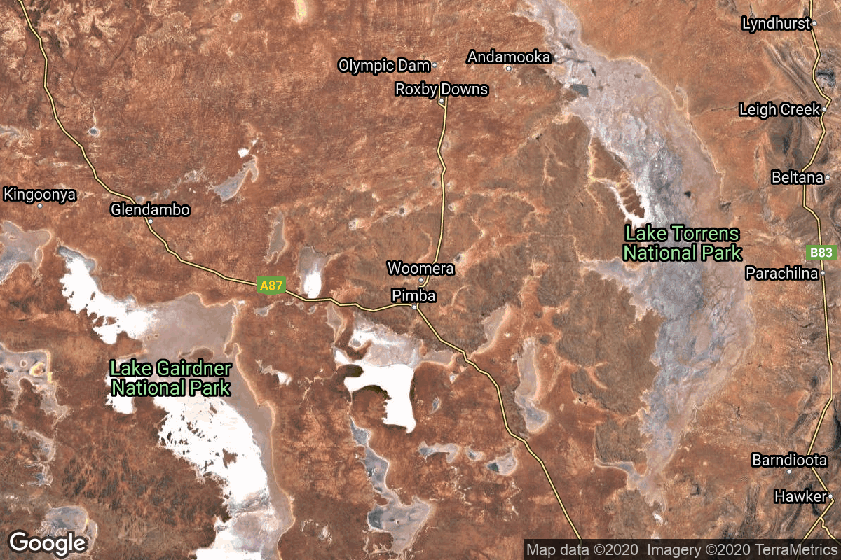
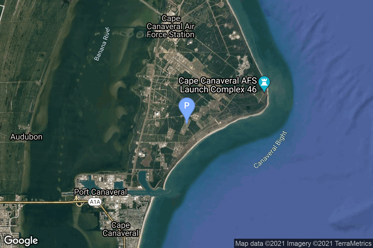
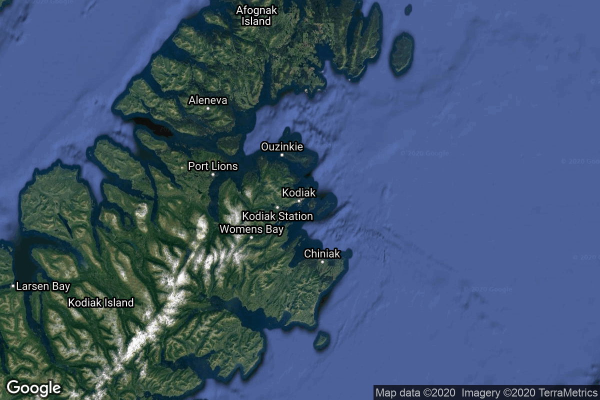
{ "count": 220, "next": "https://lldev.thespacedevs.com/2.2.0/pad/?format=api&limit=10&offset=140&ordering=-total_launch_count", "previous": "https://lldev.thespacedevs.com/2.2.0/pad/?format=api&limit=10&offset=120&ordering=-total_launch_count", "results": [ { "id": 59, "url": "https://lldev.thespacedevs.com/2.2.0/pad/59/?format=api", "agency_id": null, "name": "Kwajalein Atoll", "description": null, "info_url": null, "wiki_url": "https://en.wikipedia.org/wiki/Kwajalein_Atoll", "map_url": "https://www.google.com/maps?q=8.716667,167.733333", "latitude": "8.716667", "longitude": "167.733333", "location": { "id": 20, "url": "https://lldev.thespacedevs.com/2.2.0/location/20/?format=api", "name": "Air launch to orbit", "country_code": "???", "description": "", "map_image": "https://thespacedevs-prod.nyc3.digitaloceanspaces.com/media/map_images/location_20_20200803142433.jpg", "timezone_name": "", "total_launch_count": 51, "total_landing_count": 0 }, "country_code": "MHL", "map_image": "https://thespacedevs-prod.nyc3.digitaloceanspaces.com/media/map_images/pad_59_20200803143427.jpg", "total_launch_count": 4, "orbital_launch_attempt_count": 4 }, { "id": 105, "url": "https://lldev.thespacedevs.com/2.2.0/pad/105/?format=api", "agency_id": 1001, "name": "Vertical Launch Area", "description": null, "info_url": null, "wiki_url": null, "map_url": "https://www.google.com/maps?q=32.9901856,-106.9750602", "latitude": "32.9901856", "longitude": "-106.9750602", "location": { "id": 31, "url": "https://lldev.thespacedevs.com/2.2.0/location/31/?format=api", "name": "Spaceport America, NM, USA", "country_code": "USA", "description": "Spaceport America is an FAA-licensed spaceport located in the Jornada del Muerto desert basin north of Las Cruces, New Mexico, and southeast of Truth or Consequences. With Virgin Galactic's launch of the VSS Unity, with three people aboard, on May 22, 2021, New Mexico became the third US state to launch humans into space after California and Florida.", "map_image": "https://thespacedevs-prod.nyc3.digitaloceanspaces.com/media/map_images/location_31_20200803142505.jpg", "timezone_name": "America/Denver", "total_launch_count": 4, "total_landing_count": 4 }, "country_code": "USA", "map_image": "https://thespacedevs-prod.nyc3.digitaloceanspaces.com/media/map_images/pad_105_20200803143432.jpg", "total_launch_count": 4, "orbital_launch_attempt_count": 0 }, { "id": 186, "url": "https://lldev.thespacedevs.com/2.2.0/pad/186/?format=api", "agency_id": 88, "name": "Tai Rui mobile launch platform", "description": null, "info_url": null, "wiki_url": null, "map_url": "https://www.google.com/maps?q=34.899444,121.190278", "latitude": "34.899444", "longitude": "121.190278", "location": { "id": 3, "url": "https://lldev.thespacedevs.com/2.2.0/location/3/?format=api", "name": "Sea Launch", "country_code": "???", "description": "", "map_image": "https://thespacedevs-prod.nyc3.digitaloceanspaces.com/media/map_images/location_3_20200803142448.jpg", "timezone_name": "", "total_launch_count": 56, "total_landing_count": 0 }, "country_code": "CHN", "map_image": "https://thespacedevs-prod.nyc3.digitaloceanspaces.com/media/map_images/pad_long_march_11_launch_platform_20200901183938.jpg", "total_launch_count": 3, "orbital_launch_attempt_count": 3 }, { "id": 221, "url": "https://lldev.thespacedevs.com/2.2.0/pad/221/?format=api", "agency_id": 88, "name": "Oriental Spaceport mobile launch ship", "description": "", "info_url": null, "wiki_url": null, "map_url": "https://www.google.com/maps?q=35.391667%2C119.598667", "latitude": "35.391667", "longitude": "119.598667", "location": { "id": 3, "url": "https://lldev.thespacedevs.com/2.2.0/location/3/?format=api", "name": "Sea Launch", "country_code": "???", "description": "", "map_image": "https://thespacedevs-prod.nyc3.digitaloceanspaces.com/media/map_images/location_3_20200803142448.jpg", "timezone_name": "", "total_launch_count": 56, "total_landing_count": 0 }, "country_code": "CHN", "map_image": "https://thespacedevs-prod.nyc3.digitaloceanspaces.com/media/map_images/pad_oriental_spaceport_mobile_launch_ship_20240529085416.jpg", "total_launch_count": 3, "orbital_launch_attempt_count": 3 }, { "id": 180, "url": "https://lldev.thespacedevs.com/2.2.0/pad/180/?format=api", "agency_id": null, "name": "Launch Area 6A", "description": null, "info_url": null, "wiki_url": "https://en.wikipedia.org/wiki/RAAF_Woomera_Range_Complex", "map_url": "https://www.google.com/maps?q=-30.9552778,136.5300282", "latitude": "-30.9552778", "longitude": "136.5300282", "location": { "id": 152, "url": "https://lldev.thespacedevs.com/2.2.0/location/152/?format=api", "name": "RAAF Woomera Range Complex", "country_code": "AUS", "description": "The RAAF Woomera Range Complex (WRC) is a major Australian military and civil aerospace facility and operation located in South Australia, approximately 450 km (280 mi) north-west of Adelaide. The WRC is operated by the Royal Australian Air Force (RAAF), a Service of the Australian Defence Force (ADF). The complex has a land area of 122,188 km2 (47,177 sq mi) or roughly the size of North Korea or Pennsylvania. The airspace above the area is restricted and controlled by the RAAF for safety and security. The WRC is a highly specialised ADF test and evaluation capability operated by the RAAF for the purposes of testing defence materiel.", "map_image": "https://thespacedevs-prod.nyc3.digitaloceanspaces.com/media/map_images/location_152_20200803142502.jpg", "timezone_name": "Australia/Adelaide", "total_launch_count": 6, "total_landing_count": 0 }, "country_code": "AUS", "map_image": "https://thespacedevs-prod.nyc3.digitaloceanspaces.com/media/map_images/pad_180_20200803143508.jpg", "total_launch_count": 3, "orbital_launch_attempt_count": 3 }, { "id": 142, "url": "https://lldev.thespacedevs.com/2.2.0/pad/142/?format=api", "agency_id": null, "name": "Kaituozhe Launch Pad", "description": null, "info_url": null, "wiki_url": "https://en.wikipedia.org/wiki/Taiyuan_Satellite_Launch_Center", "map_url": "https://www.google.com/maps?q=38.835756,111.606406", "latitude": "38.835756", "longitude": "111.606406", "location": { "id": 19, "url": "https://lldev.thespacedevs.com/2.2.0/location/19/?format=api", "name": "Taiyuan Satellite Launch Center, People's Republic of China", "country_code": "CHN", "description": "The Taiyuan Satellite Launch Center is a People's Republic of China space and defense launch facility. It is situated in Kelan County, Xinzhou, Shanxi Province and is the second of four launch sites having been founded in March 1966 and coming into full operation in 1968.", "map_image": "https://thespacedevs-prod.nyc3.digitaloceanspaces.com/media/map_images/location_19_20200803142421.jpg", "timezone_name": "Asia/Shanghai", "total_launch_count": 142, "total_landing_count": 0 }, "country_code": "CHN", "map_image": "https://thespacedevs-prod.nyc3.digitaloceanspaces.com/media/map_images/pad_142_20200803143244.jpg", "total_launch_count": 3, "orbital_launch_attempt_count": 3 }, { "id": 217, "url": "https://lldev.thespacedevs.com/2.2.0/pad/217/?format=api", "agency_id": null, "name": "Bo Run Jiu Zhou mobile launch platform", "description": "", "info_url": null, "wiki_url": null, "map_url": "https://www.google.com/maps?q=21.283333,112.0", "latitude": "21.283333", "longitude": "112.0", "location": { "id": 3, "url": "https://lldev.thespacedevs.com/2.2.0/location/3/?format=api", "name": "Sea Launch", "country_code": "???", "description": "", "map_image": "https://thespacedevs-prod.nyc3.digitaloceanspaces.com/media/map_images/location_3_20200803142448.jpg", "timezone_name": "", "total_launch_count": 56, "total_landing_count": 0 }, "country_code": "CHN", "map_image": "https://thespacedevs-prod.nyc3.digitaloceanspaces.com/media/map_images/pad_bo_run_jiu_zhou_mobile_launch_platform_20231206001303.jpg", "total_launch_count": 3, "orbital_launch_attempt_count": 3 }, { "id": 5, "url": "https://lldev.thespacedevs.com/2.2.0/pad/5/?format=api", "agency_id": null, "name": "175/59", "description": null, "info_url": null, "wiki_url": "", "map_url": "https://www.google.com/maps?q=46.052,62.986", "latitude": "46.052", "longitude": "62.986", "location": { "id": 15, "url": "https://lldev.thespacedevs.com/2.2.0/location/15/?format=api", "name": "Baikonur Cosmodrome, Republic of Kazakhstan", "country_code": "KAZ", "description": "The Baikonur Cosmodrome is a spaceport operated by Russia within Kazakhstan. Located in the Kazakh city of Baikonur, it is the largest operational space launch facility in terms of area. All Russian crewed spaceflights are launched from Baikonur.", "map_image": "https://thespacedevs-prod.nyc3.digitaloceanspaces.com/media/map_images/location_15_20200803142517.jpg", "timezone_name": "Asia/Qyzylorda", "total_launch_count": 1555, "total_landing_count": 0 }, "country_code": "KAZ", "map_image": "https://thespacedevs-prod.nyc3.digitaloceanspaces.com/media/map_images/pad_5_20200803143217.jpg", "total_launch_count": 3, "orbital_launch_attempt_count": 3 }, { "id": 193, "url": "https://lldev.thespacedevs.com/2.2.0/pad/193/?format=api", "agency_id": 161, "name": "Launch Complex 26A", "description": null, "info_url": null, "wiki_url": "https://en.wikipedia.org/wiki/Cape_Canaveral_Air_Force_Station_Launch_Complex_26", "map_url": "https://www.google.com/maps?q=28.4433,-80.5712", "latitude": "28.4433", "longitude": "-80.5712", "location": { "id": 12, "url": "https://lldev.thespacedevs.com/2.2.0/location/12/?format=api", "name": "Cape Canaveral SFS, FL, USA", "country_code": "USA", "description": "Cape Canaveral Space Force Station (CCSFS) is an installation of the United States Space Force's Space Launch Delta 45, located on Cape Canaveral in Brevard County, Florida.", "map_image": "https://thespacedevs-prod.nyc3.digitaloceanspaces.com/media/map_images/location_12_20200803142519.jpg", "timezone_name": "America/New_York", "total_launch_count": 1031, "total_landing_count": 64 }, "country_code": "USA", "map_image": "https://thespacedevs-prod.nyc3.digitaloceanspaces.com/media/map_images/pad_space_launch_complex_26a_20210830170946.jpg", "total_launch_count": 3, "orbital_launch_attempt_count": 3 }, { "id": 57, "url": "https://lldev.thespacedevs.com/2.2.0/pad/57/?format=api", "agency_id": null, "name": "Launch Pad 1", "description": null, "info_url": null, "wiki_url": "https://en.wikipedia.org/wiki/Pacific_Spaceport_Complex_%E2%80%93_Alaska", "map_url": "https://www.google.com/maps?q=57.435833,-152.337778", "latitude": "57.435833", "longitude": "-152.337778", "location": { "id": 25, "url": "https://lldev.thespacedevs.com/2.2.0/location/25/?format=api", "name": "Pacific Spaceport Complex, Alaska, USA", "country_code": "USA", "description": "The Pacific Spaceport Complex – Alaska (PSCA), formerly known as the Kodiak Launch Complex (KLC), is a dual-use commercial and military spaceport for sub-orbital and orbital launch vehicles. The facility is owned and operated by the Alaska Aerospace Corporation, a corporation owned by the Government of Alaska, and is located on Kodiak Island in Alaska.", "map_image": "https://thespacedevs-prod.nyc3.digitaloceanspaces.com/media/map_images/location_25_20200803142500.jpg", "timezone_name": "America/Anchorage", "total_launch_count": 9, "total_landing_count": 0 }, "country_code": "USA", "map_image": "https://thespacedevs-prod.nyc3.digitaloceanspaces.com/media/map_images/pad_57_20200803143509.jpg", "total_launch_count": 3, "orbital_launch_attempt_count": 3 } ] }