Pad List
API endpoint that allows Location instances to be viewed.
GET: Return a list of all the existing location instances.
FILTERS: Parameters - 'id', 'agency_id', 'name', 'name__contains', 'latitude', 'latitude__contains', 'longitude', 'longitude__contains', 'location__name', 'location__name__contains', 'location__id', 'orbital_launch_attempt_count', 'total_launch_count'
ORDERING: Fields - 'id', 'name', 'location__id', 'location__name', 'orbital_launch_attempt_count', 'total_launch_count'
Example - /2.2.0/pad/?ordering=location__name
GET /2.2.0/pad/?format=api&offset=120&ordering=total_launch_count
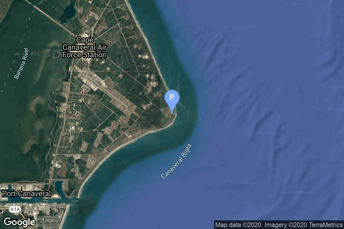
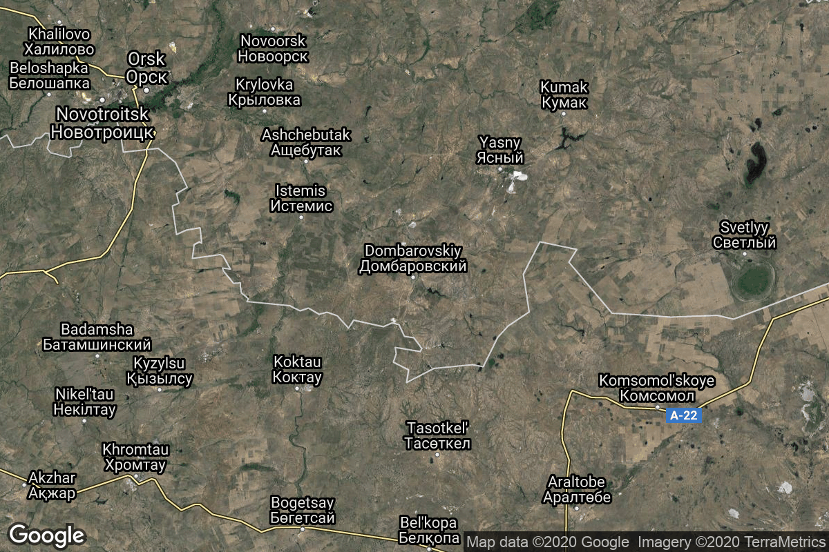
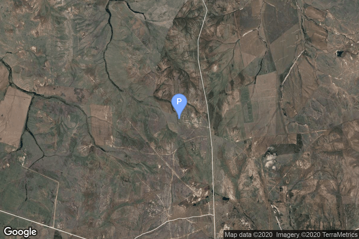
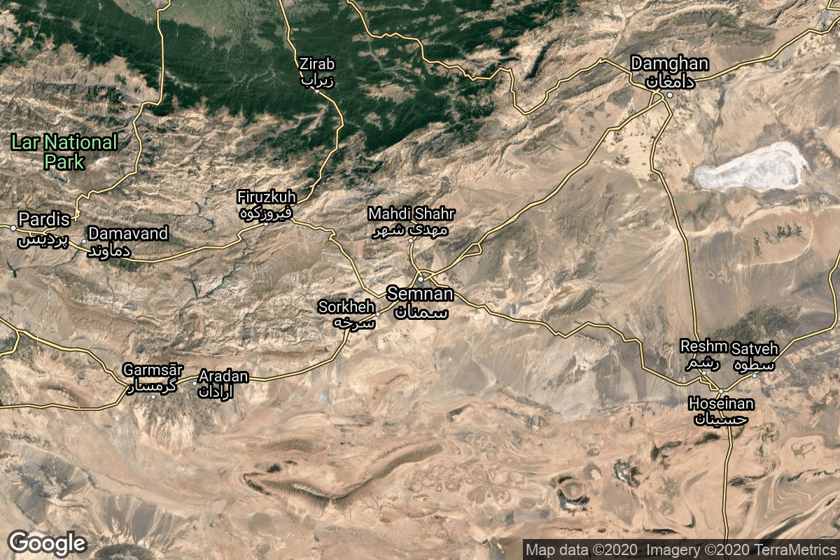
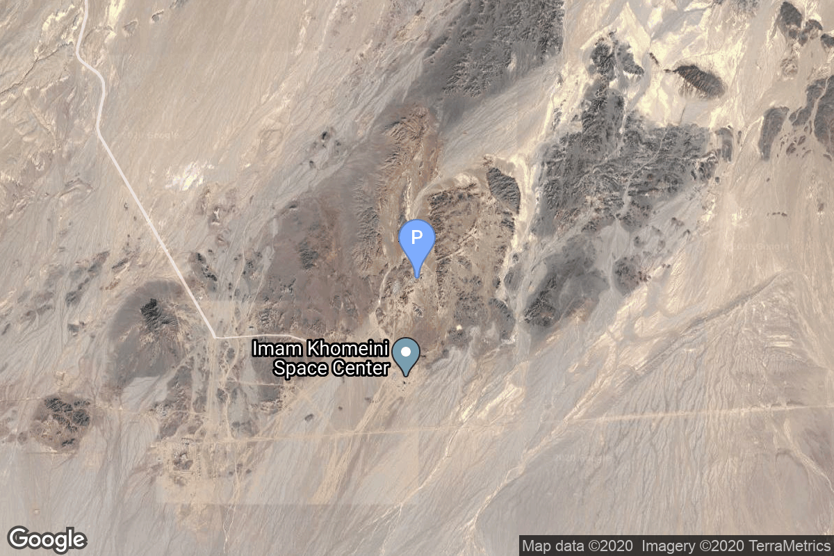
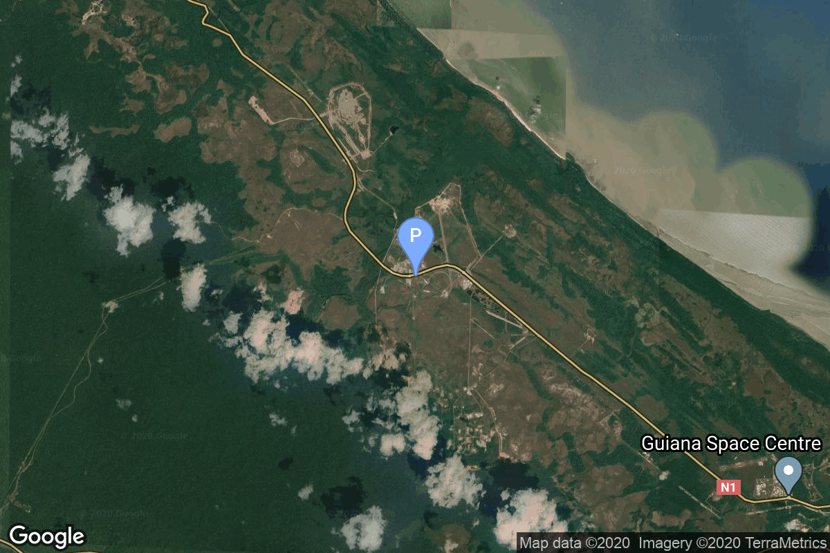
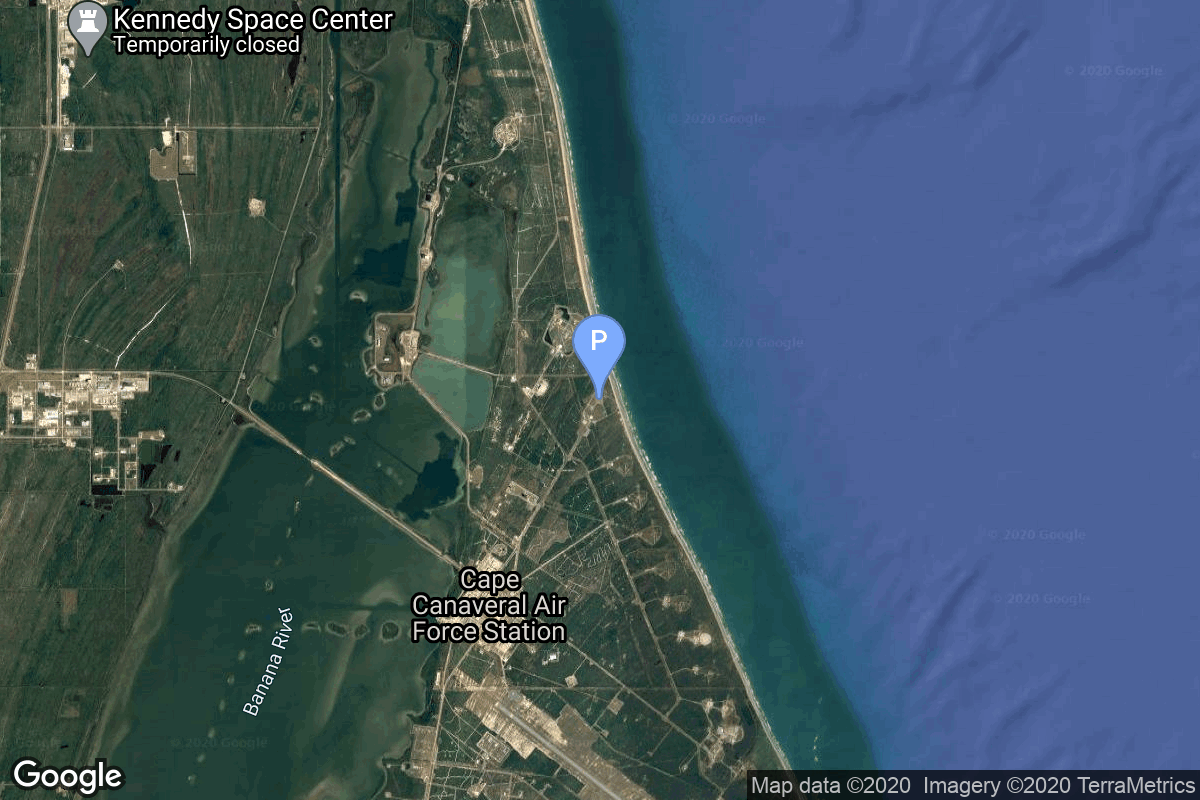
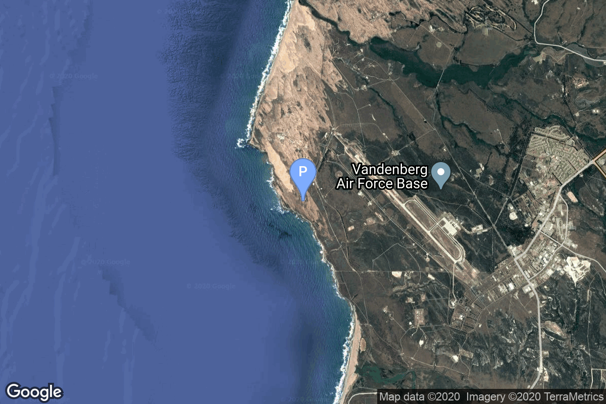
{ "count": 220, "next": "https://lldev.thespacedevs.com/2.2.0/pad/?format=api&limit=10&offset=130&ordering=total_launch_count", "previous": "https://lldev.thespacedevs.com/2.2.0/pad/?format=api&limit=10&offset=110&ordering=total_launch_count", "results": [ { "id": 84, "url": "https://lldev.thespacedevs.com/2.2.0/pad/84/?format=api", "agency_id": null, "name": "Cape Canaveral", "description": null, "info_url": null, "wiki_url": "https://en.wikipedia.org/wiki/Cape_Canaveral", "map_url": "https://www.google.com/maps?q=28.455556,-80.527778", "latitude": "28.455556", "longitude": "-80.527778", "location": { "id": 20, "url": "https://lldev.thespacedevs.com/2.2.0/location/20/?format=api", "name": "Air launch to orbit", "country_code": "???", "description": "", "map_image": "https://thespacedevs-prod.nyc3.digitaloceanspaces.com/media/map_images/location_20_20200803142433.jpg", "timezone_name": "", "total_launch_count": 51, "total_landing_count": 0 }, "country_code": "USA", "map_image": "https://thespacedevs-prod.nyc3.digitaloceanspaces.com/media/map_images/pad_84_20200803143436.jpg", "total_launch_count": 7, "orbital_launch_attempt_count": 7 }, { "id": 183, "url": "https://lldev.thespacedevs.com/2.2.0/pad/183/?format=api", "agency_id": null, "name": "370/13", "description": null, "info_url": null, "wiki_url": "https://en.wikipedia.org/wiki/Dombarovsky_Air_Base", "map_url": "https://www.google.com/maps?q=51.0938889,59.8400282", "latitude": "51.0938889", "longitude": "59.8400282", "location": { "id": 5, "url": "https://lldev.thespacedevs.com/2.2.0/location/5/?format=api", "name": "Dombarovskiy, Russian Federation", "country_code": "RUS", "description": "Dombarovsky is a military airbase near Yasny in Russia's Orenburg Oblast. Operated by the Soviet Air Defence Forces and later by the Russian Air Force, it hosted fighter interceptor squadrons and hosts an ICBM base (which has been adapted for commercial satellite launches) with a supporting helicopter base.", "map_image": "https://thespacedevs-prod.nyc3.digitaloceanspaces.com/media/map_images/location_5_20200803142425.jpg", "timezone_name": "Asia/Yekaterinburg", "total_launch_count": 10, "total_landing_count": 0 }, "country_code": "RUS", "map_image": "https://thespacedevs-prod.nyc3.digitaloceanspaces.com/media/map_images/pad_183_20200803143512.jpg", "total_launch_count": 8, "orbital_launch_attempt_count": 8 }, { "id": 56, "url": "https://lldev.thespacedevs.com/2.2.0/pad/56/?format=api", "agency_id": 44, "name": "Launch Area 0 B", "description": "LP-0B became operational in 1999,and was subsequently upgraded in 2003 with the construction of a mobile service tower, which was completed in 2004. It is active, and is currently used by Northrop Grumman Minotaur rockets. The first launch from LP-0B was of a Minotaur I in December 2006, and was the first launch from the Mid-Atlantic Regional Spaceport.", "info_url": null, "wiki_url": "https://en.wikipedia.org/wiki/Mid-Atlantic_Regional_Spaceport_Launch_Pad_0#Pad-0B", "map_url": "https://www.google.com/maps?q=37.831,-75.4911", "latitude": "37.831", "longitude": "-75.4911", "location": { "id": 21, "url": "https://lldev.thespacedevs.com/2.2.0/location/21/?format=api", "name": "Wallops Flight Facility, Virginia, USA", "country_code": "USA", "description": "Wallops Flight Facility is a rocket launch site on Wallops Island on the Eastern Shore of Virginia, United States, just east of the Delmarva Peninsula and north-northeast of Norfolk. The facility is operated by the Goddard Space Flight Center in Greenbelt, Maryland, and primarily serves to support science and exploration missions for NASA and other federal agencies. WFF includes an extensively instrumented range to support launches of more than a dozen types of sounding rockets; small expendable suborbital and orbital rockets; high-altitude balloon flights carrying scientific instruments for atmospheric and astronomical research; and, using its Research Airport, flight tests of aeronautical research aircraft, including uncrewed aerial vehicles.", "map_image": "https://thespacedevs-prod.nyc3.digitaloceanspaces.com/media/map_images/location_21_20200803142423.jpg", "timezone_name": "America/New_York", "total_launch_count": 80, "total_landing_count": 0 }, "country_code": "USA", "map_image": "https://thespacedevs-prod.nyc3.digitaloceanspaces.com/media/map_images/pad_56_20200803143541.jpg", "total_launch_count": 8, "orbital_launch_attempt_count": 8 }, { "id": 177, "url": "https://lldev.thespacedevs.com/2.2.0/pad/177/?format=api", "agency_id": null, "name": "Unknown Pad", "description": null, "info_url": null, "wiki_url": "https://en.wikipedia.org/wiki/Wallops_Flight_Facility", "map_url": "https://www.google.com/maps?q=37.9386111,-75.4594162", "latitude": "37.9386111", "longitude": "-75.4594162", "location": { "id": 21, "url": "https://lldev.thespacedevs.com/2.2.0/location/21/?format=api", "name": "Wallops Flight Facility, Virginia, USA", "country_code": "USA", "description": "Wallops Flight Facility is a rocket launch site on Wallops Island on the Eastern Shore of Virginia, United States, just east of the Delmarva Peninsula and north-northeast of Norfolk. The facility is operated by the Goddard Space Flight Center in Greenbelt, Maryland, and primarily serves to support science and exploration missions for NASA and other federal agencies. WFF includes an extensively instrumented range to support launches of more than a dozen types of sounding rockets; small expendable suborbital and orbital rockets; high-altitude balloon flights carrying scientific instruments for atmospheric and astronomical research; and, using its Research Airport, flight tests of aeronautical research aircraft, including uncrewed aerial vehicles.", "map_image": "https://thespacedevs-prod.nyc3.digitaloceanspaces.com/media/map_images/location_21_20200803142423.jpg", "timezone_name": "America/New_York", "total_launch_count": 80, "total_landing_count": 0 }, "country_code": "USA", "map_image": "https://thespacedevs-prod.nyc3.digitaloceanspaces.com/media/map_images/pad_177_20200803143406.jpg", "total_launch_count": 8, "orbital_launch_attempt_count": 0 }, { "id": 58, "url": "https://lldev.thespacedevs.com/2.2.0/pad/58/?format=api", "agency_id": null, "name": "Safir Launch Pad", "description": null, "info_url": null, "wiki_url": "https://en.wikipedia.org/wiki/Semnan_Space_Center#Circular_launch_platform", "map_url": "https://www.google.com/maps?q=35.23462,53.920936", "latitude": "35.23462", "longitude": "53.920936", "location": { "id": 2, "url": "https://lldev.thespacedevs.com/2.2.0/location/2/?format=api", "name": "Semnan Space Center, Islamic Republic of Iran", "country_code": "IRN", "description": "Semnan Space Center is the primary Iranian spaceport, located 50 km southeast of the city of Semnan in the north of the country.", "map_image": "https://thespacedevs-prod.nyc3.digitaloceanspaces.com/media/map_images/location_2_20200803142458.jpg", "timezone_name": "Asia/Tehran", "total_launch_count": 15, "total_landing_count": 0 }, "country_code": "IRN", "map_image": "https://thespacedevs-prod.nyc3.digitaloceanspaces.com/media/map_images/pad_58_20200803143301.jpg", "total_launch_count": 8, "orbital_launch_attempt_count": 8 }, { "id": 40, "url": "https://lldev.thespacedevs.com/2.2.0/pad/40/?format=api", "agency_id": 31, "name": "SLV-3 Launch Pad", "description": "The SLV3 Launch Pad, began operation in 1979 and was decommissioned in 1994. It was used by two launch vehicles of the ISRO: the Satellite Launch Vehicle (SLV) and the Augmented Satellite Launch Vehicle (ASLV) Initially it was built for launching SLV-3s but was later also used as an ASLV launch complex.", "info_url": null, "wiki_url": "https://en.wikipedia.org/wiki/Satish_Dhawan_Space_Centre_SLV_Launch_Pad", "map_url": "https://www.google.com/maps?q=13.666193,80.227231", "latitude": "13.666193", "longitude": "80.227231", "location": { "id": 14, "url": "https://lldev.thespacedevs.com/2.2.0/location/14/?format=api", "name": "Satish Dhawan Space Centre, India", "country_code": "IND", "description": "Satish Dhawan Space Centre – SDSC (formerly Sriharikota Range – SHAR),[1] is the primary spaceport of the Indian Space Research Organisation (ISRO), located in Sriharikota, Andhra Pradesh.", "map_image": "https://thespacedevs-prod.nyc3.digitaloceanspaces.com/media/map_images/location_14_20200803142403.jpg", "timezone_name": "Asia/Kolkata", "total_launch_count": 99, "total_landing_count": 0 }, "country_code": "IND", "map_image": "https://thespacedevs-prod.nyc3.digitaloceanspaces.com/media/map_images/pad_40_20200803143325.jpg", "total_launch_count": 8, "orbital_launch_attempt_count": 8 }, { "id": 125, "url": "https://lldev.thespacedevs.com/2.2.0/pad/125/?format=api", "agency_id": 115, "name": "Diamant Launch Area", "description": "", "info_url": null, "wiki_url": null, "map_url": "https://www.google.com/maps?q=5.2222222,-52.7758051", "latitude": "5.2222222", "longitude": "-52.7758051", "location": { "id": 13, "url": "https://lldev.thespacedevs.com/2.2.0/location/13/?format=api", "name": "Guiana Space Centre, French Guiana", "country_code": "GUF", "description": "The Guiana Space Centre is a European spaceport to the northwest of Kourou in French Guiana, a region of France in South America. Kourou is located at a latitude of 5°. In operation since 1968, it is a suitable location for a spaceport because of its equatorial location and open sea to the east.", "map_image": "https://thespacedevs-prod.nyc3.digitaloceanspaces.com/media/map_images/location_13_20200803142412.jpg", "timezone_name": "America/Cayenne", "total_launch_count": 325, "total_landing_count": 0 }, "country_code": "GUF", "map_image": "https://thespacedevs-prod.nyc3.digitaloceanspaces.com/media/map_images/pad_125_20200803143236.jpg", "total_launch_count": 8, "orbital_launch_attempt_count": 8 }, { "id": 19, "url": "https://lldev.thespacedevs.com/2.2.0/pad/19/?format=api", "agency_id": null, "name": "Launch Complex 34", "description": null, "info_url": null, "wiki_url": "https://en.wikipedia.org/wiki/Cape_Canaveral_Air_Force_Station_Launch_Complex_34", "map_url": "https://www.google.com/maps?q=28.521811,-80.56113", "latitude": "28.521811", "longitude": "-80.56113", "location": { "id": 12, "url": "https://lldev.thespacedevs.com/2.2.0/location/12/?format=api", "name": "Cape Canaveral SFS, FL, USA", "country_code": "USA", "description": "Cape Canaveral Space Force Station (CCSFS) is an installation of the United States Space Force's Space Launch Delta 45, located on Cape Canaveral in Brevard County, Florida.", "map_image": "https://thespacedevs-prod.nyc3.digitaloceanspaces.com/media/map_images/location_12_20200803142519.jpg", "timezone_name": "America/New_York", "total_launch_count": 1031, "total_landing_count": 64 }, "country_code": "USA", "map_image": "https://thespacedevs-prod.nyc3.digitaloceanspaces.com/media/map_images/pad_19_20200803143428.jpg", "total_launch_count": 9, "orbital_launch_attempt_count": 3 }, { "id": 55, "url": "https://lldev.thespacedevs.com/2.2.0/pad/55/?format=api", "agency_id": 161, "name": "Space Launch Complex 576E", "description": "Launch Complex 576 is a group of rocket launch pads at Vandenberg Space Force Base. The pads were used from 1959 until 1971 to launch SM-65 Atlas missiles. The site was also known as Complex ABRES. Pads in Area 576 include 576A-1, 576A-2 and 576A-3, 576B-1, 576B-2 and 576B-3, 576-C, 576-D, 576-E, OSTF-1 and OSTF-2.", "info_url": null, "wiki_url": "https://en.wikipedia.org/wiki/Vandenberg_Launch_Complex_576", "map_url": "https://www.google.com/maps?q=34.739444,-120.619167", "latitude": "34.739444", "longitude": "-120.619167", "location": { "id": 11, "url": "https://lldev.thespacedevs.com/2.2.0/location/11/?format=api", "name": "Vandenberg SFB, CA, USA", "country_code": "USA", "description": "Vandenberg Space Force Base is a United States Space Force Base in Santa Barbara County, California. Established in 1941, Vandenberg Space Force Base is a space launch base, launching spacecraft from the Western Range, and also performs missile testing. The United States Space Force's Space Launch Delta 30 serves as the host delta for the base, equivalent to an Air Force air base wing. In addition to its military space launch mission, Vandenberg Space Force Base also hosts space launches for civil and commercial space entities, such as NASA and SpaceX.", "map_image": "https://thespacedevs-prod.nyc3.digitaloceanspaces.com/media/map_images/location_11_20200803142416.jpg", "timezone_name": "America/Los_Angeles", "total_launch_count": 814, "total_landing_count": 26 }, "country_code": "USA", "map_image": "https://thespacedevs-prod.nyc3.digitaloceanspaces.com/media/map_images/pad_55_20200803143429.jpg", "total_launch_count": 9, "orbital_launch_attempt_count": 9 }, { "id": 8, "url": "https://lldev.thespacedevs.com/2.2.0/pad/8/?format=api", "agency_id": 161, "name": "Space Launch Complex 8", "description": "Space Launch Complex 8 (SLC-8), is a launch pad at Vandenberg Space Force Base in California, United States. It is used by Minotaur rockets. It was originally part of the California Spaceport, and was known as the Commercial Launch Facility (CLF) or Space Launch Facility (SLF).", "info_url": null, "wiki_url": "https://en.wikipedia.org/wiki/Vandenberg_Space_Launch_Complex_8", "map_url": "https://www.google.com/maps?q=34.57635,-120.63245", "latitude": "34.57635", "longitude": "-120.63245", "location": { "id": 11, "url": "https://lldev.thespacedevs.com/2.2.0/location/11/?format=api", "name": "Vandenberg SFB, CA, USA", "country_code": "USA", "description": "Vandenberg Space Force Base is a United States Space Force Base in Santa Barbara County, California. Established in 1941, Vandenberg Space Force Base is a space launch base, launching spacecraft from the Western Range, and also performs missile testing. The United States Space Force's Space Launch Delta 30 serves as the host delta for the base, equivalent to an Air Force air base wing. In addition to its military space launch mission, Vandenberg Space Force Base also hosts space launches for civil and commercial space entities, such as NASA and SpaceX.", "map_image": "https://thespacedevs-prod.nyc3.digitaloceanspaces.com/media/map_images/location_11_20200803142416.jpg", "timezone_name": "America/Los_Angeles", "total_launch_count": 814, "total_landing_count": 26 }, "country_code": "USA", "map_image": "https://thespacedevs-prod.nyc3.digitaloceanspaces.com/media/map_images/pad_8_20200803143300.jpg", "total_launch_count": 9, "orbital_launch_attempt_count": 9 } ] }