Pad List
API endpoint that allows Location instances to be viewed.
GET: Return a list of all the existing location instances.
FILTERS: Parameters - 'id', 'agency_id', 'name', 'name__contains', 'latitude', 'latitude__contains', 'longitude', 'longitude__contains', 'location__name', 'location__name__contains', 'location__id', 'orbital_launch_attempt_count', 'total_launch_count'
ORDERING: Fields - 'id', 'name', 'location__id', 'location__name', 'orbital_launch_attempt_count', 'total_launch_count'
Example - /2.2.0/pad/?ordering=location__name
GET /2.2.0/pad/?format=api&offset=10
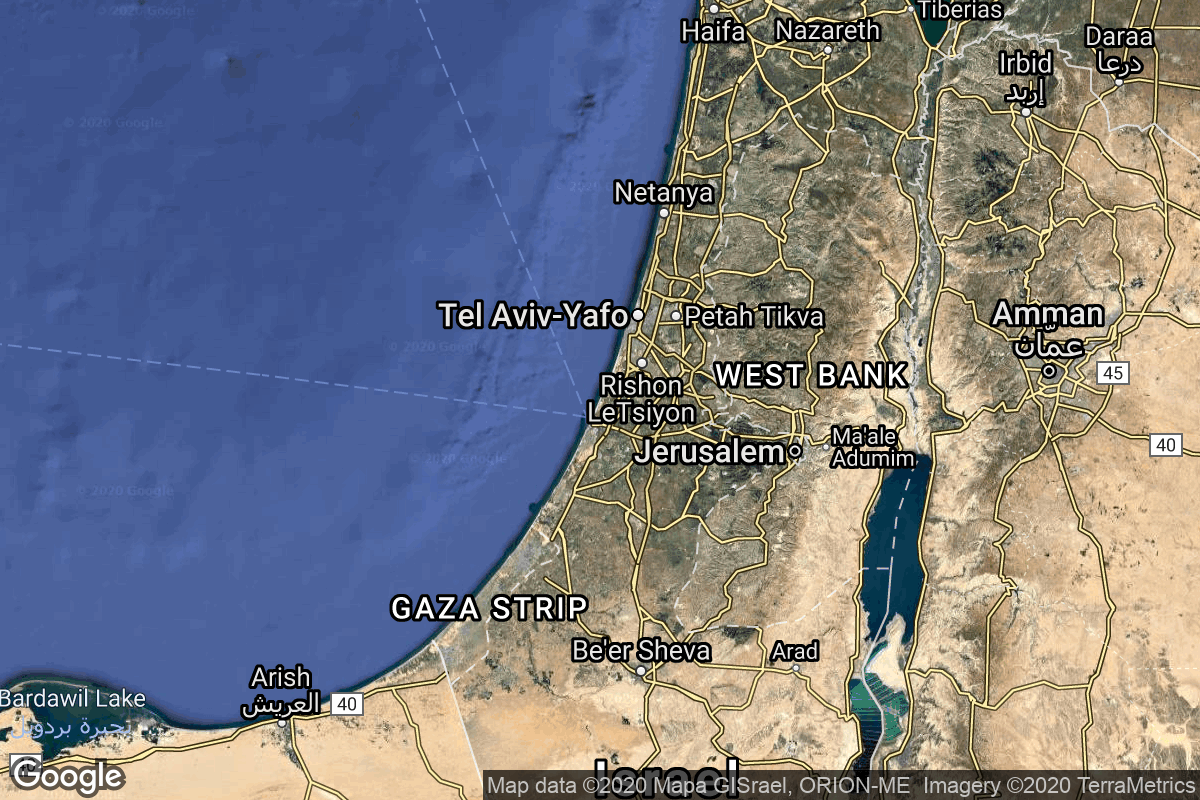
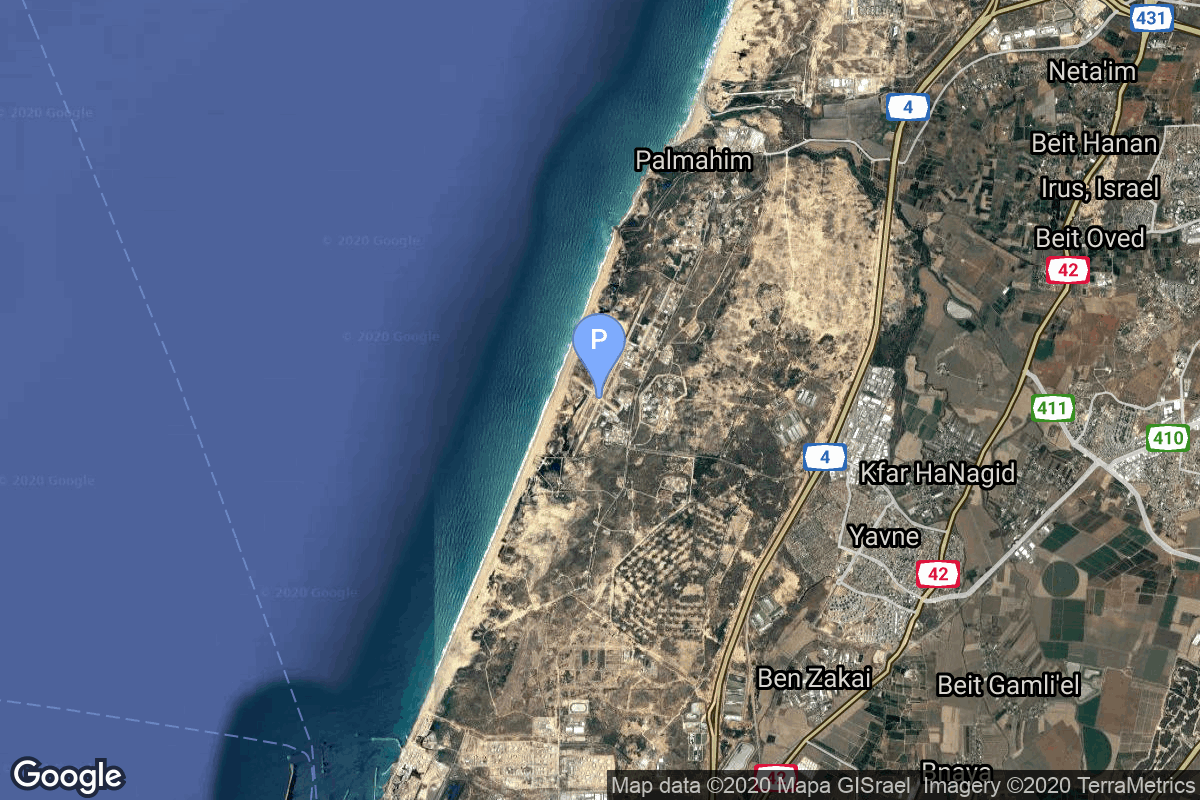
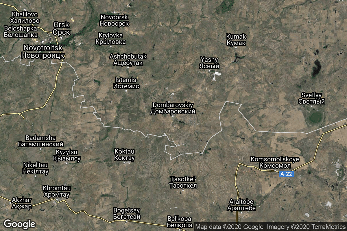
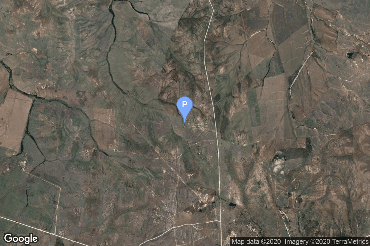
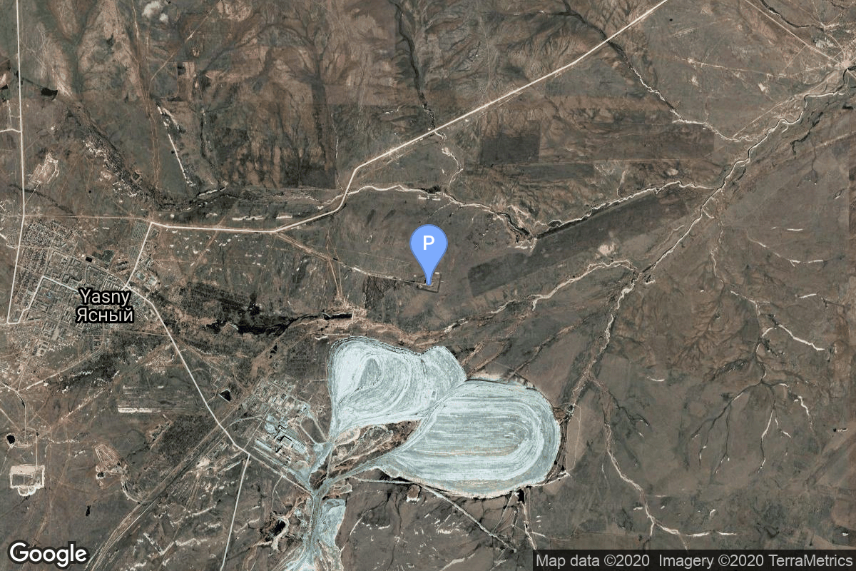
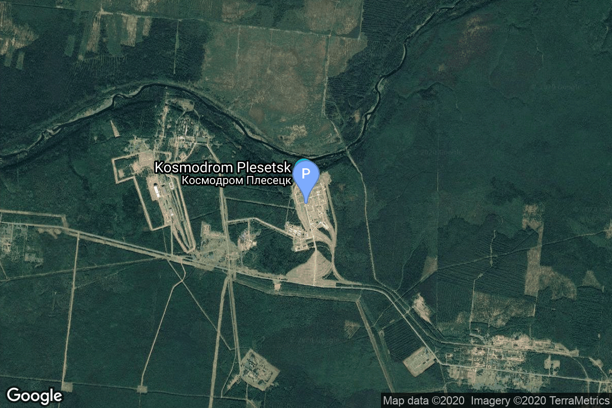
{ "count": 220, "next": "https://lldev.thespacedevs.com/2.2.0/pad/?format=api&limit=10&offset=20", "previous": "https://lldev.thespacedevs.com/2.2.0/pad/?format=api&limit=10", "results": [ { "id": 186, "url": "https://lldev.thespacedevs.com/2.2.0/pad/186/?format=api", "agency_id": 88, "name": "Tai Rui mobile launch platform", "description": null, "info_url": null, "wiki_url": null, "map_url": "https://www.google.com/maps?q=34.899444,121.190278", "latitude": "34.899444", "longitude": "121.190278", "location": { "id": 3, "url": "https://lldev.thespacedevs.com/2.2.0/location/3/?format=api", "name": "Sea Launch", "country_code": "???", "description": "", "map_image": "https://thespacedevs-prod.nyc3.digitaloceanspaces.com/media/map_images/location_3_20200803142448.jpg", "timezone_name": "", "total_launch_count": 56, "total_landing_count": 0 }, "country_code": "CHN", "map_image": "https://thespacedevs-prod.nyc3.digitaloceanspaces.com/media/map_images/pad_long_march_11_launch_platform_20200901183938.jpg", "total_launch_count": 3, "orbital_launch_attempt_count": 3 }, { "id": 13, "url": "https://lldev.thespacedevs.com/2.2.0/pad/13/?format=api", "agency_id": 80, "name": "Launch Platform Odyssey", "description": "", "info_url": null, "wiki_url": "https://en.wikipedia.org/wiki/Odyssey_(launch_platform)", "map_url": "https://www.google.com/maps?q=0.0,-154", "latitude": "0.0", "longitude": "-154.0", "location": { "id": 3, "url": "https://lldev.thespacedevs.com/2.2.0/location/3/?format=api", "name": "Sea Launch", "country_code": "???", "description": "", "map_image": "https://thespacedevs-prod.nyc3.digitaloceanspaces.com/media/map_images/location_3_20200803142448.jpg", "timezone_name": "", "total_launch_count": 56, "total_landing_count": 0 }, "country_code": "", "map_image": "https://thespacedevs-prod.nyc3.digitaloceanspaces.com/media/map_images/pad_13_20200803143257.jpg", "total_launch_count": 36, "orbital_launch_attempt_count": 36 }, { "id": 216, "url": "https://lldev.thespacedevs.com/2.2.0/pad/216/?format=api", "agency_id": null, "name": "ADD Offshore launch platform", "description": "Offshore launch platform for the South Korean military small satellite launch vehicle.", "info_url": null, "wiki_url": null, "map_url": null, "latitude": "33.216667", "longitude": "126.366667", "location": { "id": 3, "url": "https://lldev.thespacedevs.com/2.2.0/location/3/?format=api", "name": "Sea Launch", "country_code": "???", "description": "", "map_image": "https://thespacedevs-prod.nyc3.digitaloceanspaces.com/media/map_images/location_3_20200803142448.jpg", "timezone_name": "", "total_launch_count": 56, "total_landing_count": 0 }, "country_code": "KOR", "map_image": "https://thespacedevs-prod.nyc3.digitaloceanspaces.com/media/map_images/pad_add_offshore_launch_platform_20231204142359.jpg", "total_launch_count": 1, "orbital_launch_attempt_count": 1 }, { "id": 144, "url": "https://lldev.thespacedevs.com/2.2.0/pad/144/?format=api", "agency_id": 88, "name": "DeBo 3 mobile launch platform", "description": null, "info_url": null, "wiki_url": null, "map_url": "https://www.google.com/maps?q=34.311667,123.761111", "latitude": "34.311667", "longitude": "123.761111", "location": { "id": 3, "url": "https://lldev.thespacedevs.com/2.2.0/location/3/?format=api", "name": "Sea Launch", "country_code": "???", "description": "", "map_image": "https://thespacedevs-prod.nyc3.digitaloceanspaces.com/media/map_images/location_3_20200803142448.jpg", "timezone_name": "", "total_launch_count": 56, "total_landing_count": 0 }, "country_code": "CHN", "map_image": "https://thespacedevs-prod.nyc3.digitaloceanspaces.com/media/map_images/pad_144_20200803143251.jpg", "total_launch_count": 1, "orbital_launch_attempt_count": 1 }, { "id": 148, "url": "https://lldev.thespacedevs.com/2.2.0/pad/148/?format=api", "agency_id": null, "name": "Borisoglebsk (K-496)", "description": null, "info_url": null, "wiki_url": "https://en.wikipedia.org/wiki/Russian_submarine_Borisoglebsk_(K-496)", "map_url": "https://www.google.com/maps?q=74.0000,38.0000", "latitude": "74.0", "longitude": "38.0", "location": { "id": 3, "url": "https://lldev.thespacedevs.com/2.2.0/location/3/?format=api", "name": "Sea Launch", "country_code": "???", "description": "", "map_image": "https://thespacedevs-prod.nyc3.digitaloceanspaces.com/media/map_images/location_3_20200803142448.jpg", "timezone_name": "", "total_launch_count": 56, "total_landing_count": 0 }, "country_code": "RUS", "map_image": "https://thespacedevs-prod.nyc3.digitaloceanspaces.com/media/map_images/pad_148_20200803143426.jpg", "total_launch_count": 1, "orbital_launch_attempt_count": 1 }, { "id": 75, "url": "https://lldev.thespacedevs.com/2.2.0/pad/75/?format=api", "agency_id": 95, "name": "Shavit Launch Pad", "description": "", "info_url": null, "wiki_url": "https://en.wikipedia.org/wiki/Palmachim_Airbase", "map_url": "https://www.google.com/maps?q=31.884444,34.680278", "latitude": "31.884444", "longitude": "34.680278", "location": { "id": 4, "url": "https://lldev.thespacedevs.com/2.2.0/location/4/?format=api", "name": "Palmachim Airbase, State of Israel", "country_code": "ISR", "description": "Palmachim Airbase is an Israeli Air Force (IAF) base and spaceport, which the IAF and the Israel Space Agency (ISA) operate jointly. It is located west of the city of Yavne on the Mediterranean coast, 12 km south of the Gush Dan metropolitan area with Tel Aviv, named after the Kibbutz Palmachim north of it.", "map_image": "https://thespacedevs-prod.nyc3.digitaloceanspaces.com/media/map_images/location_4_20200803142418.jpg", "timezone_name": "Asia/Jerusalem", "total_launch_count": 12, "total_landing_count": 0 }, "country_code": "ISR", "map_image": "https://thespacedevs-prod.nyc3.digitaloceanspaces.com/media/map_images/pad_75_20200803143316.jpg", "total_launch_count": 12, "orbital_launch_attempt_count": 12 }, { "id": 182, "url": "https://lldev.thespacedevs.com/2.2.0/pad/182/?format=api", "agency_id": null, "name": "370/11", "description": null, "info_url": null, "wiki_url": "https://en.wikipedia.org/wiki/Dombarovsky_Air_Base", "map_url": "https://www.google.com/maps?q=51.0938889,59.8400282", "latitude": "51.0938889", "longitude": "59.8400282", "location": { "id": 5, "url": "https://lldev.thespacedevs.com/2.2.0/location/5/?format=api", "name": "Dombarovskiy, Russian Federation", "country_code": "RUS", "description": "Dombarovsky is a military airbase near Yasny in Russia's Orenburg Oblast. Operated by the Soviet Air Defence Forces and later by the Russian Air Force, it hosted fighter interceptor squadrons and hosts an ICBM base (which has been adapted for commercial satellite launches) with a supporting helicopter base.", "map_image": "https://thespacedevs-prod.nyc3.digitaloceanspaces.com/media/map_images/location_5_20200803142425.jpg", "timezone_name": "Asia/Yekaterinburg", "total_launch_count": 10, "total_landing_count": 0 }, "country_code": "RUS", "map_image": "https://thespacedevs-prod.nyc3.digitaloceanspaces.com/media/map_images/pad_182_20200803143504.jpg", "total_launch_count": 2, "orbital_launch_attempt_count": 2 }, { "id": 44, "url": "https://lldev.thespacedevs.com/2.2.0/pad/44/?format=api", "agency_id": null, "name": "Unknown Pad", "description": null, "info_url": null, "wiki_url": "", "map_url": "https://www.google.com/maps?q=51.036,59.958", "latitude": "51.036", "longitude": "59.958", "location": { "id": 5, "url": "https://lldev.thespacedevs.com/2.2.0/location/5/?format=api", "name": "Dombarovskiy, Russian Federation", "country_code": "RUS", "description": "Dombarovsky is a military airbase near Yasny in Russia's Orenburg Oblast. Operated by the Soviet Air Defence Forces and later by the Russian Air Force, it hosted fighter interceptor squadrons and hosts an ICBM base (which has been adapted for commercial satellite launches) with a supporting helicopter base.", "map_image": "https://thespacedevs-prod.nyc3.digitaloceanspaces.com/media/map_images/location_5_20200803142425.jpg", "timezone_name": "Asia/Yekaterinburg", "total_launch_count": 10, "total_landing_count": 0 }, "country_code": "RUS", "map_image": "https://thespacedevs-prod.nyc3.digitaloceanspaces.com/media/map_images/pad_44_20200803143327.jpg", "total_launch_count": 0, "orbital_launch_attempt_count": 0 }, { "id": 183, "url": "https://lldev.thespacedevs.com/2.2.0/pad/183/?format=api", "agency_id": null, "name": "370/13", "description": null, "info_url": null, "wiki_url": "https://en.wikipedia.org/wiki/Dombarovsky_Air_Base", "map_url": "https://www.google.com/maps?q=51.0938889,59.8400282", "latitude": "51.0938889", "longitude": "59.8400282", "location": { "id": 5, "url": "https://lldev.thespacedevs.com/2.2.0/location/5/?format=api", "name": "Dombarovskiy, Russian Federation", "country_code": "RUS", "description": "Dombarovsky is a military airbase near Yasny in Russia's Orenburg Oblast. Operated by the Soviet Air Defence Forces and later by the Russian Air Force, it hosted fighter interceptor squadrons and hosts an ICBM base (which has been adapted for commercial satellite launches) with a supporting helicopter base.", "map_image": "https://thespacedevs-prod.nyc3.digitaloceanspaces.com/media/map_images/location_5_20200803142425.jpg", "timezone_name": "Asia/Yekaterinburg", "total_launch_count": 10, "total_landing_count": 0 }, "country_code": "RUS", "map_image": "https://thespacedevs-prod.nyc3.digitaloceanspaces.com/media/map_images/pad_183_20200803143512.jpg", "total_launch_count": 8, "orbital_launch_attempt_count": 8 }, { "id": 135, "url": "https://lldev.thespacedevs.com/2.2.0/pad/135/?format=api", "agency_id": null, "name": "158", "description": null, "info_url": null, "wiki_url": "https://en.wikipedia.org/wiki/Plesetsk_Cosmodrome", "map_url": "https://www.google.com/maps?q=62.9255556,40.5755838", "latitude": "62.9255556", "longitude": "40.5755838", "location": { "id": 6, "url": "https://lldev.thespacedevs.com/2.2.0/location/6/?format=api", "name": "Plesetsk Cosmodrome, Russian Federation", "country_code": "RUS", "description": "Plesetsk Cosmodrome is a Russian spaceport located in Mirny, Arkhangelsk Oblast, about 800 km north of Moscow and approximately 200 km south of Arkhangelsk. Originally developed as an ICBM site for the R-7 missile, it also served for numerous satellite launches using the R-7 and other rockets. Its high latitude makes it useful only for certain types of launches, especially the Molniya orbits, so for much of the site's history it functioned as a secondary location, with most orbital launches taking place from Baikonur, in the Kazakh SSR. With the end of the Soviet Union, Baikonur became a foreign territory, and Kazakhstan charged $115 million usage fees annually. Consequently, Plesetsk has seen considerably more activity since the 2000s.", "map_image": "https://thespacedevs-prod.nyc3.digitaloceanspaces.com/media/map_images/location_6_20200803142434.jpg", "timezone_name": "Europe/Moscow", "total_launch_count": 1676, "total_landing_count": 0 }, "country_code": "RUS", "map_image": "https://thespacedevs-prod.nyc3.digitaloceanspaces.com/media/map_images/pad_135_20200803143333.jpg", "total_launch_count": 2, "orbital_launch_attempt_count": 2 } ] }