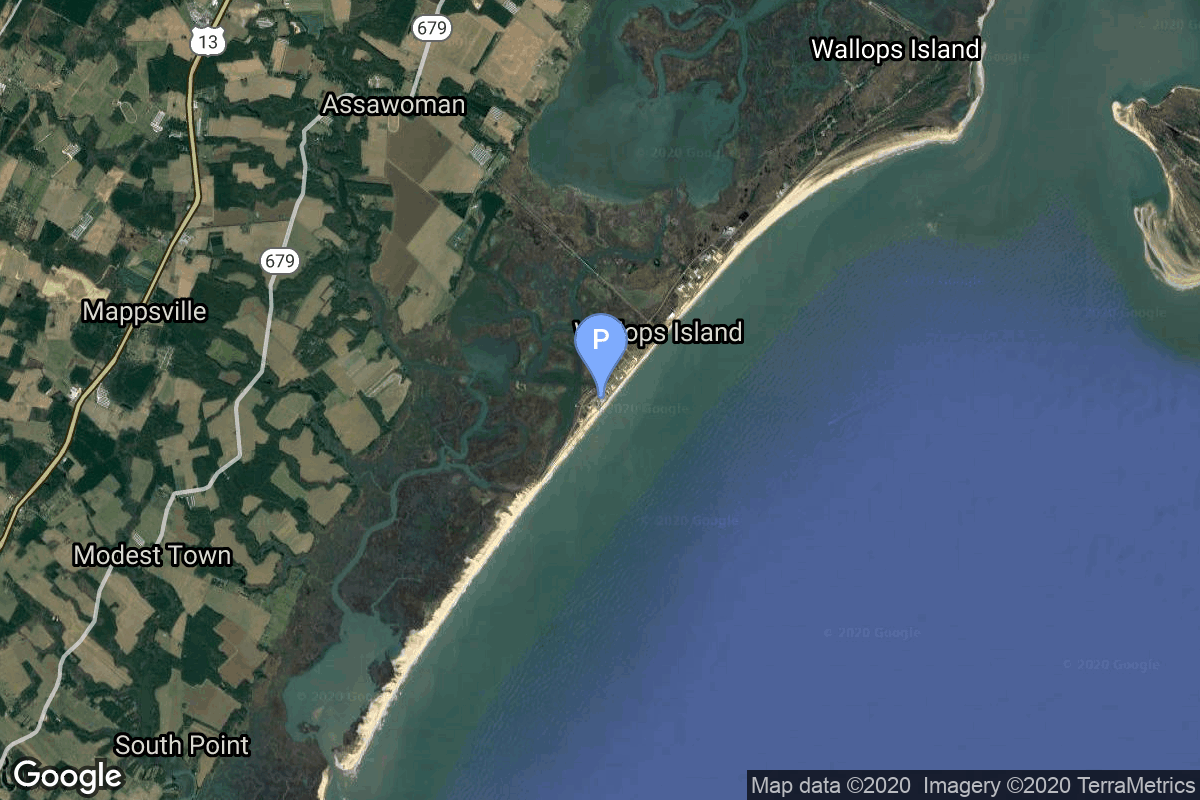
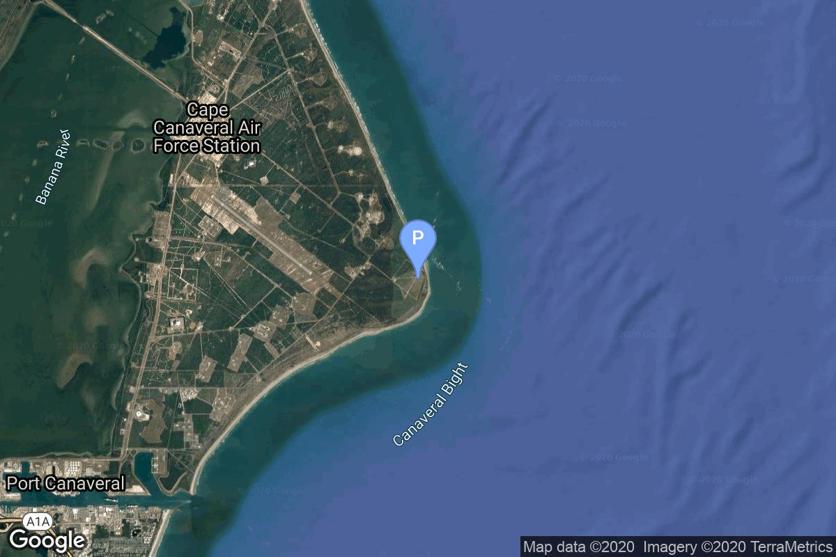
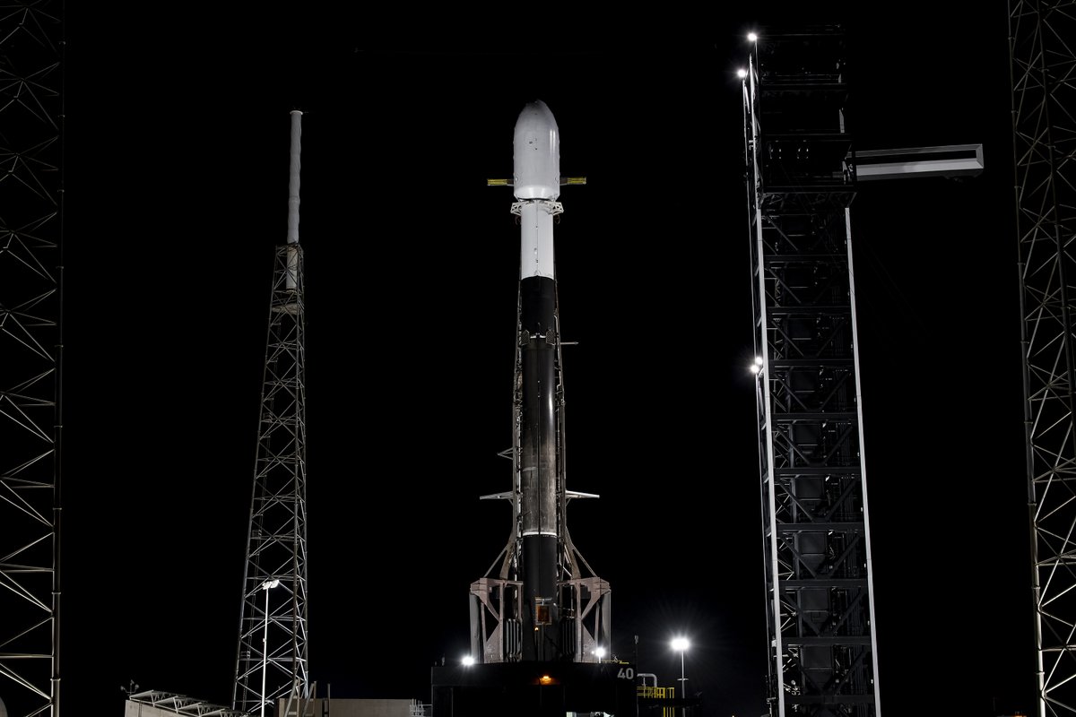
Upcoming Launch List
API endpoint that returns future Launch objects and launches from the last twenty-four hours.
GET Return a list of future Launches
FILTERS Fields - 'name', 'id(s)', 'lsp__id', 'lsp__name', 'serial_number', 'launcher_config__id', 'rocket__spacecraftflight__spacecraft__name', 'is_crewed', 'include_suborbital', 'spacecraft_config__ids', 'related', 'location__ids', 'lsp__ids,'pad__ids', 'status__ids', 'hide_recent_previous'
MODE 'normal', 'list', 'detailed'
EXAMPLE ?mode=list
SEARCH Searches through the launch name, rocket name, launch agency and mission name. EXAMPLE - ?search=SpaceX
GET /2.2.0/launch/upcoming/?format=api&offset=50&ordering=net
{ "count": 169, "next": "https://lldev.thespacedevs.com/2.2.0/launch/upcoming/?format=api&limit=10&offset=60&ordering=net", "previous": "https://lldev.thespacedevs.com/2.2.0/launch/upcoming/?format=api&limit=10&offset=40&ordering=net", "results": [ { "id": "91f5f940-da5a-44de-a10a-b44c59066285", "url": "https://lldev.thespacedevs.com/2.2.0/launch/91f5f940-da5a-44de-a10a-b44c59066285/?format=api", "slug": "vega-c-korean-multi-purpose-satellite-6-kompsat-6", "name": "Vega-C | Korean Multi-purpose Satellite 6 (KOMPSAT-6)", "status": { "id": 2, "name": "To Be Determined", "abbrev": "TBD", "description": "Current date is a placeholder or rough estimation based on unreliable or interpreted sources." }, "last_updated": "2024-09-18T11:08:21Z", "net": "2025-12-31T00:00:00Z", "window_end": "2025-12-31T00:00:00Z", "window_start": "2025-12-31T00:00:00Z", "net_precision": { "id": 14, "name": "Year", "abbrev": "Y", "description": "The T-0 is expected in the given year." }, "probability": null, "weather_concerns": null, "holdreason": "", "failreason": "", "hashtag": null, "launch_service_provider": { "id": 115, "url": "https://lldev.thespacedevs.com/2.2.0/agencies/115/?format=api", "name": "Arianespace", "type": "Commercial" }, "rocket": { "id": 127, "configuration": { "id": 127, "url": "https://lldev.thespacedevs.com/2.2.0/config/launcher/127/?format=api", "name": "Vega-C", "family": "Vega", "full_name": "Vega-C", "variant": "" } }, "mission": { "id": 6163, "name": "Korean Multi-purpose Satellite 6 (KOMPSAT-6)", "description": "Sixth South Korean Earth observation satellite of the KOMPSAT series. It is equipped with a synthetic aperture radar with a ground resolution between 0.5 and 20 meters.", "launch_designator": null, "type": "Earth Science", "orbit": { "id": 17, "name": "Sun-Synchronous Orbit", "abbrev": "SSO" }, "agencies": [ { "id": 41, "url": "https://lldev.thespacedevs.com/2.2.0/agencies/41/?format=api", "name": "Korea Aerospace Research Institute", "featured": false, "type": "Government", "country_code": "KOR", "abbrev": "KARI", "description": "The Korea Aerospace Research Institute (KARI) established in 1989, is the aeronautics and space agency of Republic of Korea. Its main laboratories are located in Daejeon, in the Daedeok Science Town.", "administrator": "Administrator: Lee Sang-Ryool", "founding_year": "1989", "launchers": "Nuri", "spacecraft": "", "launch_library_url": null, "total_launch_count": 7, "consecutive_successful_launches": 2, "successful_launches": 4, "failed_launches": 3, "pending_launches": 1, "consecutive_successful_landings": 0, "successful_landings": 0, "failed_landings": 0, "attempted_landings": 0, "info_url": "https://www.kari.kr/", "wiki_url": "https://en.wikipedia.org/wiki/Korea_Aerospace_Research_Institute", "logo_url": "https://thespacedevs-prod.nyc3.digitaloceanspaces.com/media/images/korea2520aerospace2520research2520institute_logo_20200806032236.png", "image_url": null, "nation_url": "https://thespacedevs-prod.nyc3.digitaloceanspaces.com/media/images/korea2520aerospace2520research2520institute_nation_20230604194037.jpg" } ], "info_urls": [], "vid_urls": [] }, "pad": { "id": 34, "url": "https://lldev.thespacedevs.com/2.2.0/pad/34/?format=api", "agency_id": 115, "name": "Ariane Launch Area 1 (ELV)", "description": "ELA-1, now named Ensemble de Lancement Vega (short ELV), is a launch pad at the Centre Spatial Guyanais in French Guiana. It has been used to support launches of the Europa rocket, Ariane 1, Ariane 3, and is currently used to launch Vega rockets.", "info_url": null, "wiki_url": "https://en.wikipedia.org/wiki/ELA-1", "map_url": "https://www.google.com/maps?q=5.236,-52.775", "latitude": "5.236", "longitude": "-52.775", "location": { "id": 13, "url": "https://lldev.thespacedevs.com/2.2.0/location/13/?format=api", "name": "Guiana Space Centre, French Guiana", "country_code": "GUF", "description": "The Guiana Space Centre is a European spaceport to the northwest of Kourou in French Guiana, a region of France in South America. Kourou is located at a latitude of 5°. In operation since 1968, it is a suitable location for a spaceport because of its equatorial location and open sea to the east.", "map_image": "https://thespacedevs-prod.nyc3.digitaloceanspaces.com/media/map_images/location_13_20200803142412.jpg", "timezone_name": "America/Cayenne", "total_launch_count": 325, "total_landing_count": 0 }, "country_code": "GUF", "map_image": "https://thespacedevs-prod.nyc3.digitaloceanspaces.com/media/map_images/pad_34_20200803143527.jpg", "total_launch_count": 52, "orbital_launch_attempt_count": 52 }, "webcast_live": false, "image": "https://thespacedevs-prod.nyc3.digitaloceanspaces.com/media/images/vega-c_image_20220713154437.jpg", "infographic": null, "program": [], "orbital_launch_attempt_count": 7145, "location_launch_attempt_count": 343, "pad_launch_attempt_count": 59, "agency_launch_attempt_count": 336, "orbital_launch_attempt_count_year": 296, "location_launch_attempt_count_year": 20, "pad_launch_attempt_count_year": 8, "agency_launch_attempt_count_year": 19, "type": "normal" }, { "id": "eaff0f48-04b7-49fc-bee6-9afd9ec8cc5f", "url": "https://lldev.thespacedevs.com/2.2.0/launch/eaff0f48-04b7-49fc-bee6-9afd9ec8cc5f/?format=api", "slug": "vega-c-iride-2", "name": "Vega-C | IRIDE 2", "status": { "id": 2, "name": "To Be Determined", "abbrev": "TBD", "description": "Current date is a placeholder or rough estimation based on unreliable or interpreted sources." }, "last_updated": "2023-06-14T03:49:39Z", "net": "2025-12-31T00:00:00Z", "window_end": "2025-12-31T00:00:00Z", "window_start": "2025-12-31T00:00:00Z", "net_precision": null, "probability": null, "weather_concerns": null, "holdreason": "", "failreason": "", "hashtag": null, "launch_service_provider": { "id": 115, "url": "https://lldev.thespacedevs.com/2.2.0/agencies/115/?format=api", "name": "Arianespace", "type": "Commercial" }, "rocket": { "id": 7821, "configuration": { "id": 127, "url": "https://lldev.thespacedevs.com/2.2.0/config/launcher/127/?format=api", "name": "Vega-C", "family": "Vega", "full_name": "Vega-C", "variant": "" } }, "mission": { "id": 6327, "name": "IRIDE 2", "description": "Second dedicated launch for the European Space Agency's IRIDE Earth observation constellation.", "launch_designator": null, "type": "Earth Science", "orbit": { "id": 17, "name": "Sun-Synchronous Orbit", "abbrev": "SSO" }, "agencies": [], "info_urls": [], "vid_urls": [] }, "pad": { "id": 34, "url": "https://lldev.thespacedevs.com/2.2.0/pad/34/?format=api", "agency_id": 115, "name": "Ariane Launch Area 1 (ELV)", "description": "ELA-1, now named Ensemble de Lancement Vega (short ELV), is a launch pad at the Centre Spatial Guyanais in French Guiana. It has been used to support launches of the Europa rocket, Ariane 1, Ariane 3, and is currently used to launch Vega rockets.", "info_url": null, "wiki_url": "https://en.wikipedia.org/wiki/ELA-1", "map_url": "https://www.google.com/maps?q=5.236,-52.775", "latitude": "5.236", "longitude": "-52.775", "location": { "id": 13, "url": "https://lldev.thespacedevs.com/2.2.0/location/13/?format=api", "name": "Guiana Space Centre, French Guiana", "country_code": "GUF", "description": "The Guiana Space Centre is a European spaceport to the northwest of Kourou in French Guiana, a region of France in South America. Kourou is located at a latitude of 5°. In operation since 1968, it is a suitable location for a spaceport because of its equatorial location and open sea to the east.", "map_image": "https://thespacedevs-prod.nyc3.digitaloceanspaces.com/media/map_images/location_13_20200803142412.jpg", "timezone_name": "America/Cayenne", "total_launch_count": 325, "total_landing_count": 0 }, "country_code": "GUF", "map_image": "https://thespacedevs-prod.nyc3.digitaloceanspaces.com/media/map_images/pad_34_20200803143527.jpg", "total_launch_count": 52, "orbital_launch_attempt_count": 52 }, "webcast_live": false, "image": "https://thespacedevs-prod.nyc3.digitaloceanspaces.com/media/images/vega-c_image_20220713154437.jpg", "infographic": null, "program": [], "orbital_launch_attempt_count": 7145, "location_launch_attempt_count": 343, "pad_launch_attempt_count": 59, "agency_launch_attempt_count": 336, "orbital_launch_attempt_count_year": 296, "location_launch_attempt_count_year": 20, "pad_launch_attempt_count_year": 8, "agency_launch_attempt_count_year": 19, "type": "normal" }, { "id": "da43dc2c-00af-4cc1-8ef1-90a60b2eb9e5", "url": "https://lldev.thespacedevs.com/2.2.0/launch/da43dc2c-00af-4cc1-8ef1-90a60b2eb9e5/?format=api", "slug": "falcon-9-block-5-sda-tranche-1-transport-layer-a", "name": "Falcon 9 Block 5 | SDA Tranche 1 Transport Layer A", "status": { "id": 2, "name": "To Be Determined", "abbrev": "TBD", "description": "Current date is a placeholder or rough estimation based on unreliable or interpreted sources." }, "last_updated": "2025-03-08T03:02:03Z", "net": "2025-12-31T00:00:00Z", "window_end": "2025-12-31T00:00:00Z", "window_start": "2025-12-31T00:00:00Z", "net_precision": { "id": 14, "name": "Year", "abbrev": "Y", "description": "The T-0 is expected in the given year." }, "probability": null, "weather_concerns": null, "holdreason": "", "failreason": "", "hashtag": null, "launch_service_provider": { "id": 121, "url": "https://lldev.thespacedevs.com/2.2.0/agencies/121/?format=api", "name": "SpaceX", "type": "Commercial" }, "rocket": { "id": 7589, "configuration": { "id": 164, "url": "https://lldev.thespacedevs.com/2.2.0/config/launcher/164/?format=api", "name": "Falcon 9", "family": "Falcon", "full_name": "Falcon 9 Block 5", "variant": "Block 5" } }, "mission": { "id": 6031, "name": "SDA Tranche 1 Transport Layer A", "description": "First of six missions launched by the Space Development Agency for the Tranche 1 Transport Layer.", "launch_designator": null, "type": "Government/Top Secret", "orbit": { "id": 13, "name": "Polar Orbit", "abbrev": "PO" }, "agencies": [ { "id": 1056, "url": "https://lldev.thespacedevs.com/2.2.0/agencies/1056/?format=api", "name": "Space Development Agency", "featured": false, "type": "Government", "country_code": "USA", "abbrev": "SDA", "description": "The Space Development Agency (SDA) is a United States Space Force direct-reporting unit tasked with deploying disruptive space technology. A primary focus is space-based missile defense using large global satellite constellations made up of industry-procured low-cost satellites.", "administrator": "Director: Derek Tournear", "founding_year": "2019", "launchers": "", "spacecraft": "", "launch_library_url": null, "total_launch_count": 0, "consecutive_successful_launches": 0, "successful_launches": 0, "failed_launches": 0, "pending_launches": 0, "consecutive_successful_landings": 0, "successful_landings": 0, "failed_landings": 0, "attempted_landings": 0, "info_url": "https://www.sda.mil/", "wiki_url": "https://en.wikipedia.org/wiki/Space_Development_Agency", "logo_url": "https://thespacedevs-prod.nyc3.digitaloceanspaces.com/media/images/space2520development2520agency_logo_20230806170522.jpg", "image_url": null, "nation_url": null } ], "info_urls": [], "vid_urls": [] }, "pad": { "id": 16, "url": "https://lldev.thespacedevs.com/2.2.0/pad/16/?format=api", "agency_id": null, "name": "Space Launch Complex 4E", "description": "Space Launch Complex 4 East (SLC-4E) is a launch site at Vandenberg Space Force Base, California, U.S.\r\n\r\nThe pad was previously used by Atlas and Titan rockets between 1963 and 2005. The pad was built for use by Atlas-Agena rockets, but was later rebuilt to handle Titan rockets.", "info_url": null, "wiki_url": "https://en.wikipedia.org/wiki/Vandenberg_Space_Launch_Complex_4#SLC-4E", "map_url": "https://www.google.com/maps?q=34.632,-120.611", "latitude": "34.632", "longitude": "-120.611", "location": { "id": 11, "url": "https://lldev.thespacedevs.com/2.2.0/location/11/?format=api", "name": "Vandenberg SFB, CA, USA", "country_code": "USA", "description": "Vandenberg Space Force Base is a United States Space Force Base in Santa Barbara County, California. Established in 1941, Vandenberg Space Force Base is a space launch base, launching spacecraft from the Western Range, and also performs missile testing. The United States Space Force's Space Launch Delta 30 serves as the host delta for the base, equivalent to an Air Force air base wing. In addition to its military space launch mission, Vandenberg Space Force Base also hosts space launches for civil and commercial space entities, such as NASA and SpaceX.", "map_image": "https://thespacedevs-prod.nyc3.digitaloceanspaces.com/media/map_images/location_11_20200803142416.jpg", "timezone_name": "America/Los_Angeles", "total_launch_count": 814, "total_landing_count": 26 }, "country_code": "USA", "map_image": "https://thespacedevs-prod.nyc3.digitaloceanspaces.com/media/map_images/pad_16_20200803143532.jpg", "total_launch_count": 200, "orbital_launch_attempt_count": 200 }, "webcast_live": false, "image": "https://thespacedevs-prod.nyc3.digitaloceanspaces.com/media/images/falcon_9_image_20230807133459.jpeg", "infographic": null, "program": [], "orbital_launch_attempt_count": 7145, "location_launch_attempt_count": 841, "pad_launch_attempt_count": 220, "agency_launch_attempt_count": 574, "orbital_launch_attempt_count_year": 296, "location_launch_attempt_count_year": 55, "pad_launch_attempt_count_year": 46, "agency_launch_attempt_count_year": 125, "type": "normal" }, { "id": "ab932c60-d808-4825-ab71-b6fe0a745f15", "url": "https://lldev.thespacedevs.com/2.2.0/launch/ab932c60-d808-4825-ab71-b6fe0a745f15/?format=api", "slug": "falcon-9-block-5-rivada-3", "name": "Falcon 9 Block 5 | Rivada 3", "status": { "id": 2, "name": "To Be Determined", "abbrev": "TBD", "description": "Current date is a placeholder or rough estimation based on unreliable or interpreted sources." }, "last_updated": "2023-09-21T19:59:02Z", "net": "2025-12-31T00:00:00Z", "window_end": "2025-12-31T00:00:00Z", "window_start": "2025-12-31T00:00:00Z", "net_precision": { "id": 13, "name": "Year Half 2", "abbrev": "H2", "description": "The T-0 is expected in the second half of the given year." }, "probability": null, "weather_concerns": null, "holdreason": "", "failreason": "", "hashtag": null, "launch_service_provider": { "id": 121, "url": "https://lldev.thespacedevs.com/2.2.0/agencies/121/?format=api", "name": "SpaceX", "type": "Commercial" }, "rocket": { "id": 7801, "configuration": { "id": 164, "url": "https://lldev.thespacedevs.com/2.2.0/config/launcher/164/?format=api", "name": "Falcon 9", "family": "Falcon", "full_name": "Falcon 9 Block 5", "variant": "Block 5" } }, "mission": { "id": 6569, "name": "Rivada 3", "description": "24 satellites for Rivada's internet constellation.", "launch_designator": null, "type": "Communications", "orbit": { "id": 13, "name": "Polar Orbit", "abbrev": "PO" }, "agencies": [ { "id": 1076, "url": "https://lldev.thespacedevs.com/2.2.0/agencies/1076/?format=api", "name": "Rivada Space Networks", "featured": false, "type": "Commercial", "country_code": "DEU", "abbrev": "RivadaSpace", "description": "In March 2022, Rivada announced the formation of Rivada Space Networks GmbH, a wholly owned subsidiary that was land to launch 600 low earth orbit satellites interconnected with laser links to form a single global mesh network in space.", "administrator": "CEO: Declan Ganley", "founding_year": "2022", "launchers": "", "spacecraft": "", "launch_library_url": null, "total_launch_count": 0, "consecutive_successful_launches": 0, "successful_launches": 0, "failed_launches": 0, "pending_launches": 0, "consecutive_successful_landings": 0, "successful_landings": 0, "failed_landings": 0, "attempted_landings": 0, "info_url": "https://rivadaspace.com/", "wiki_url": "https://en.wikipedia.org/wiki/Rivada_Networks", "logo_url": "https://thespacedevs-prod.nyc3.digitaloceanspaces.com/media/images/rivada2520space2520networks_logo_20230921195723.png", "image_url": null, "nation_url": "https://thespacedevs-prod.nyc3.digitaloceanspaces.com/media/images/rivada2520space2520networks_nation_20230921195724.png" } ], "info_urls": [], "vid_urls": [] }, "pad": { "id": 16, "url": "https://lldev.thespacedevs.com/2.2.0/pad/16/?format=api", "agency_id": null, "name": "Space Launch Complex 4E", "description": "Space Launch Complex 4 East (SLC-4E) is a launch site at Vandenberg Space Force Base, California, U.S.\r\n\r\nThe pad was previously used by Atlas and Titan rockets between 1963 and 2005. The pad was built for use by Atlas-Agena rockets, but was later rebuilt to handle Titan rockets.", "info_url": null, "wiki_url": "https://en.wikipedia.org/wiki/Vandenberg_Space_Launch_Complex_4#SLC-4E", "map_url": "https://www.google.com/maps?q=34.632,-120.611", "latitude": "34.632", "longitude": "-120.611", "location": { "id": 11, "url": "https://lldev.thespacedevs.com/2.2.0/location/11/?format=api", "name": "Vandenberg SFB, CA, USA", "country_code": "USA", "description": "Vandenberg Space Force Base is a United States Space Force Base in Santa Barbara County, California. Established in 1941, Vandenberg Space Force Base is a space launch base, launching spacecraft from the Western Range, and also performs missile testing. The United States Space Force's Space Launch Delta 30 serves as the host delta for the base, equivalent to an Air Force air base wing. In addition to its military space launch mission, Vandenberg Space Force Base also hosts space launches for civil and commercial space entities, such as NASA and SpaceX.", "map_image": "https://thespacedevs-prod.nyc3.digitaloceanspaces.com/media/map_images/location_11_20200803142416.jpg", "timezone_name": "America/Los_Angeles", "total_launch_count": 814, "total_landing_count": 26 }, "country_code": "USA", "map_image": "https://thespacedevs-prod.nyc3.digitaloceanspaces.com/media/map_images/pad_16_20200803143532.jpg", "total_launch_count": 200, "orbital_launch_attempt_count": 200 }, "webcast_live": false, "image": "https://thespacedevs-prod.nyc3.digitaloceanspaces.com/media/images/falcon_9_image_20230807133459.jpeg", "infographic": null, "program": [], "orbital_launch_attempt_count": 7145, "location_launch_attempt_count": 841, "pad_launch_attempt_count": 220, "agency_launch_attempt_count": 574, "orbital_launch_attempt_count_year": 296, "location_launch_attempt_count_year": 55, "pad_launch_attempt_count_year": 46, "agency_launch_attempt_count_year": 125, "type": "normal" }, { "id": "ac92d963-ebfb-4d18-b48c-04102d8dce8e", "url": "https://lldev.thespacedevs.com/2.2.0/launch/ac92d963-ebfb-4d18-b48c-04102d8dce8e/?format=api", "slug": "vulcan-nrol-64", "name": "Vulcan | NROL-64", "status": { "id": 2, "name": "To Be Determined", "abbrev": "TBD", "description": "Current date is a placeholder or rough estimation based on unreliable or interpreted sources." }, "last_updated": "2023-06-14T17:42:26Z", "net": "2025-12-31T00:00:00Z", "window_end": "2025-12-31T00:00:00Z", "window_start": "2025-12-31T00:00:00Z", "net_precision": { "id": 14, "name": "Year", "abbrev": "Y", "description": "The T-0 is expected in the given year." }, "probability": null, "weather_concerns": null, "holdreason": "", "failreason": "", "hashtag": null, "launch_service_provider": { "id": 124, "url": "https://lldev.thespacedevs.com/2.2.0/agencies/124/?format=api", "name": "United Launch Alliance", "type": "Commercial" }, "rocket": { "id": 7897, "configuration": { "id": 200, "url": "https://lldev.thespacedevs.com/2.2.0/config/launcher/200/?format=api", "name": "Vulcan", "family": "Vulcan", "full_name": "Vulcan", "variant": "Vulcan" } }, "mission": { "id": 6406, "name": "NROL-64", "description": "Classified payload for the US National Reconnaissance Office", "launch_designator": null, "type": "Government/Top Secret", "orbit": { "id": 25, "name": "Unknown", "abbrev": "N/A" }, "agencies": [ { "id": 181, "url": "https://lldev.thespacedevs.com/2.2.0/agencies/181/?format=api", "name": "National Reconnaissance Office", "featured": false, "type": "Government", "country_code": "USA", "abbrev": "NRO", "description": "The National Reconnaissance Office (NRO) is a member of the United States Intelligence Community and an agency of the United States Department of Defense which designs, builds, launches, and operates the reconnaissance satellites of the U.S. federal government, and provides satellite intelligence to several government agencies, particularly signals intelligence (SIGINT) to the NSA, imagery intelligence (IMINT) to the NGA, and measurement and signature intelligence (MASINT) to the DIA.", "administrator": "Director: Christopher Scolese", "founding_year": "1961", "launchers": "", "spacecraft": "", "launch_library_url": null, "total_launch_count": 0, "consecutive_successful_launches": 0, "successful_launches": 0, "failed_launches": 0, "pending_launches": 0, "consecutive_successful_landings": 0, "successful_landings": 0, "failed_landings": 0, "attempted_landings": 0, "info_url": "https://www.nro.gov/", "wiki_url": "https://en.wikipedia.org/wiki/National_Reconnaissance_Office", "logo_url": null, "image_url": null, "nation_url": "https://thespacedevs-prod.nyc3.digitaloceanspaces.com/media/images/national2520reconnaissance2520office_nation_20240228092125.png" } ], "info_urls": [], "vid_urls": [] }, "pad": { "id": 29, "url": "https://lldev.thespacedevs.com/2.2.0/pad/29/?format=api", "agency_id": null, "name": "Space Launch Complex 41", "description": "", "info_url": null, "wiki_url": "https://en.wikipedia.org/wiki/Cape_Canaveral_Air_Force_Station_Space_Launch_Complex_41", "map_url": "https://www.google.com/maps?q=28.58341025,-80.58303644", "latitude": "28.58341025", "longitude": "-80.58303644", "location": { "id": 12, "url": "https://lldev.thespacedevs.com/2.2.0/location/12/?format=api", "name": "Cape Canaveral SFS, FL, USA", "country_code": "USA", "description": "Cape Canaveral Space Force Station (CCSFS) is an installation of the United States Space Force's Space Launch Delta 45, located on Cape Canaveral in Brevard County, Florida.", "map_image": "https://thespacedevs-prod.nyc3.digitaloceanspaces.com/media/map_images/location_12_20200803142519.jpg", "timezone_name": "America/New_York", "total_launch_count": 1031, "total_landing_count": 64 }, "country_code": "USA", "map_image": "https://thespacedevs-prod.nyc3.digitaloceanspaces.com/media/map_images/pad_29_20200803143528.jpg", "total_launch_count": 115, "orbital_launch_attempt_count": 115 }, "webcast_live": false, "image": "https://thespacedevs-prod.nyc3.digitaloceanspaces.com/media/images/vulcan_image_20240107162928.jpeg", "infographic": null, "program": [], "orbital_launch_attempt_count": 7145, "location_launch_attempt_count": 1080, "pad_launch_attempt_count": 137, "agency_launch_attempt_count": 190, "orbital_launch_attempt_count_year": 296, "location_launch_attempt_count_year": 86, "pad_launch_attempt_count_year": 23, "agency_launch_attempt_count_year": 26, "type": "normal" }, { "id": "bc939d6c-4f57-44d8-8caf-dd81c0872a9e", "url": "https://lldev.thespacedevs.com/2.2.0/launch/bc939d6c-4f57-44d8-8caf-dd81c0872a9e/?format=api", "slug": "electron-northstar-2", "name": "Electron | NorthStar 2", "status": { "id": 2, "name": "To Be Determined", "abbrev": "TBD", "description": "Current date is a placeholder or rough estimation based on unreliable or interpreted sources." }, "last_updated": "2024-12-06T05:10:24Z", "net": "2025-12-31T00:00:00Z", "window_end": "2025-12-31T00:00:00Z", "window_start": "2025-12-31T00:00:00Z", "net_precision": { "id": 14, "name": "Year", "abbrev": "Y", "description": "The T-0 is expected in the given year." }, "probability": null, "weather_concerns": null, "holdreason": "", "failreason": "", "hashtag": null, "launch_service_provider": { "id": 147, "url": "https://lldev.thespacedevs.com/2.2.0/agencies/147/?format=api", "name": "Rocket Lab", "type": "Commercial" }, "rocket": { "id": 7941, "configuration": { "id": 26, "url": "https://lldev.thespacedevs.com/2.2.0/config/launcher/26/?format=api", "name": "Electron", "family": "", "full_name": "Electron", "variant": "" } }, "mission": { "id": 6450, "name": "NorthStar 2", "description": "Four space situational awareness (SSA) satellites for Canadian company NorthStar Earth and Space.", "launch_designator": null, "type": "Space Situational Awareness", "orbit": { "id": 8, "name": "Low Earth Orbit", "abbrev": "LEO" }, "agencies": [], "info_urls": [], "vid_urls": [] }, "pad": { "id": 210, "url": "https://lldev.thespacedevs.com/2.2.0/pad/210/?format=api", "agency_id": null, "name": "Unknown Pad", "description": null, "info_url": null, "wiki_url": null, "map_url": null, "latitude": "-39.260881", "longitude": "177.865826", "location": { "id": 10, "url": "https://lldev.thespacedevs.com/2.2.0/location/10/?format=api", "name": "Rocket Lab Launch Complex 1, Mahia Peninsula, New Zealand", "country_code": "NZL", "description": "Rocket Lab Launch Complex 1 is a commercial spaceport located close to Ahuriri Point at the southern tip of Māhia Peninsula, on the east coast of New Zealand's North Island. It is owned and operated by private spaceflight company Rocket Lab and supports launches of the company's Electron rocket for small satellites. With the launch of Electron on 25 May 2017, it became the first private spaceport to host an orbital launch attempt, and the first site in New Zealand to host an orbital launch attempt. With the Electron launch of 21 January 2018, it became the first private spaceport to host a successful orbital launch.", "map_image": "https://thespacedevs-prod.nyc3.digitaloceanspaces.com/media/map_images/location_10_20200803142509.jpg", "timezone_name": "Pacific/Auckland", "total_launch_count": 60, "total_landing_count": 17 }, "country_code": "NZL", "map_image": "https://thespacedevs-prod.nyc3.digitaloceanspaces.com/media/map_images/pad_210_20230819165718.jpg", "total_launch_count": 0, "orbital_launch_attempt_count": 0 }, "webcast_live": false, "image": "https://thespacedevs-prod.nyc3.digitaloceanspaces.com/media/images/electron_image_20190705175640.jpeg", "infographic": null, "program": [], "orbital_launch_attempt_count": 7145, "location_launch_attempt_count": 73, "pad_launch_attempt_count": 12, "agency_launch_attempt_count": 87, "orbital_launch_attempt_count_year": 296, "location_launch_attempt_count_year": 21, "pad_launch_attempt_count_year": 12, "agency_launch_attempt_count_year": 29, "type": "normal" }, { "id": "dc1b1aea-7a5f-4b39-9df5-1fd38dd670cf", "url": "https://lldev.thespacedevs.com/2.2.0/launch/dc1b1aea-7a5f-4b39-9df5-1fd38dd670cf/?format=api", "slug": "h3-22-michibiki-5-qzs-5", "name": "H3-22 | Michibiki 5 (QZS-5)", "status": { "id": 2, "name": "To Be Determined", "abbrev": "TBD", "description": "Current date is a placeholder or rough estimation based on unreliable or interpreted sources." }, "last_updated": "2025-02-03T07:04:51Z", "net": "2025-12-31T00:00:00Z", "window_end": "2025-12-31T00:00:00Z", "window_start": "2025-12-31T00:00:00Z", "net_precision": { "id": 14, "name": "Year", "abbrev": "Y", "description": "The T-0 is expected in the given year." }, "probability": null, "weather_concerns": null, "holdreason": "", "failreason": "", "hashtag": null, "launch_service_provider": { "id": 98, "url": "https://lldev.thespacedevs.com/2.2.0/agencies/98/?format=api", "name": "Mitsubishi Heavy Industries", "type": "Commercial" }, "rocket": { "id": 7766, "configuration": { "id": 486, "url": "https://lldev.thespacedevs.com/2.2.0/config/launcher/486/?format=api", "name": "H3-22", "family": "H3", "full_name": "H3-22", "variant": "22" } }, "mission": { "id": 6284, "name": "Michibiki 5 (QZS-5)", "description": "QZSS (Quasi Zenith Satellite System) is a Japanese satellite navigation system operating from inclined, elliptical geosynchronous orbits to achieve optimal high-elevation visibility in urban canyons and mountainous areas. The navigation system objective is to broadcast GPS-interoperable and augmentation signals as well as original Japanese (QZSS) signals from a three-spacecraft constellation.\r\n\r\nThe navigation system objective is to broadcast GPS-interoperable and augmentation signals as well as original Japanese (QZSS) signals from a three-spacecraft constellation in inclined, elliptical geosynchronous orbits.", "launch_designator": null, "type": "Navigation", "orbit": { "id": 4, "name": "Geosynchronous Transfer Orbit", "abbrev": "GSTO" }, "agencies": [ { "id": 37, "url": "https://lldev.thespacedevs.com/2.2.0/agencies/37/?format=api", "name": "Japan Aerospace Exploration Agency", "featured": true, "type": "Government", "country_code": "JPN", "abbrev": "JAXA", "description": "The Japan Aerospace Exploration Agency (JAXA) is Japan's national aero-space agency. Through the merger of three previously independent organizations, JAXA was formed on 1 October 2003. JAXA is responsible for research, technology development and the launch of satellites into orbit, and is involved in many more advanced missions, such as asteroid exploration and possible manned exploration of the Moon. JAXA launch their Epsilon vehicle from the Uchinoura Space Center and their H-II vehicles from the Tanegashima Space Center.", "administrator": "Administrator: Hiroshi Yamakawa", "founding_year": "2003", "launchers": "H-II", "spacecraft": "", "launch_library_url": null, "total_launch_count": 36, "consecutive_successful_launches": 1, "successful_launches": 32, "failed_launches": 4, "pending_launches": 4, "consecutive_successful_landings": 0, "successful_landings": 0, "failed_landings": 0, "attempted_landings": 0, "info_url": "https://www.jaxa.jp/", "wiki_url": "https://en.wikipedia.org/wiki/Japan_Aerospace_Exploration_Agency", "logo_url": "https://thespacedevs-prod.nyc3.digitaloceanspaces.com/media/images/japan2520aerospace2520exploration2520agency_logo_20190207032440.png", "image_url": "https://thespacedevs-prod.nyc3.digitaloceanspaces.com/media/images/japan2520aerospace2520exploration2520agency_image_20190207032440.jpeg", "nation_url": "https://thespacedevs-prod.nyc3.digitaloceanspaces.com/media/images/japan2520aerospace2520exploration2520agency_nation_20230531052930.png" } ], "info_urls": [], "vid_urls": [] }, "pad": { "id": 209, "url": "https://lldev.thespacedevs.com/2.2.0/pad/209/?format=api", "agency_id": 37, "name": "Yoshinobu Launch Complex LP-2", "description": "", "info_url": null, "wiki_url": "https://en.wikipedia.org/wiki/Yoshinobu_Launch_Complex", "map_url": "https://www.google.com/maps?q=30.400938,130.97564", "latitude": "30.400938", "longitude": "130.97564", "location": { "id": 26, "url": "https://lldev.thespacedevs.com/2.2.0/location/26/?format=api", "name": "Tanegashima Space Center, Japan", "country_code": "JPN", "description": "The Tanegashima Space Center is the largest rocket-launch complex in Japan. It is located on the southeastern tip of Tanegashima, an island located south of Kyushu, an island and region and Japan. It was established in 1969 when the National Space Development Agency of Japan (NASDA) was formed, and is now run by JAXA. The activities that take place at TNSC include assembly, testing, launching, and tracking satellites, as well as rocket engine firing tests.", "map_image": "https://thespacedevs-prod.nyc3.digitaloceanspaces.com/media/map_images/location_26_20200803142507.jpg", "timezone_name": "Asia/Tokyo", "total_launch_count": 94, "total_landing_count": 0 }, "country_code": "JPN", "map_image": "https://thespacedevs-prod.nyc3.digitaloceanspaces.com/media/map_images/pad_yoshinobu_launch_complex_lp-2_20230707124715.jpg", "total_launch_count": 14, "orbital_launch_attempt_count": 14 }, "webcast_live": false, "image": "https://thespacedevs-prod.nyc3.digitaloceanspaces.com/media/images/h3-22_image_20230307130808.jpeg", "infographic": null, "program": [], "orbital_launch_attempt_count": 7145, "location_launch_attempt_count": 100, "pad_launch_attempt_count": 19, "agency_launch_attempt_count": 59, "orbital_launch_attempt_count_year": 296, "location_launch_attempt_count_year": 7, "pad_launch_attempt_count_year": 6, "agency_launch_attempt_count_year": 6, "type": "normal" }, { "id": "f9e4852a-fba8-4937-9a86-5a05b3244fb1", "url": "https://lldev.thespacedevs.com/2.2.0/launch/f9e4852a-fba8-4937-9a86-5a05b3244fb1/?format=api", "slug": "electron-blacksky-gen-3-3", "name": "Electron | BlackSky Gen-3 3", "status": { "id": 2, "name": "To Be Determined", "abbrev": "TBD", "description": "Current date is a placeholder or rough estimation based on unreliable or interpreted sources." }, "last_updated": "2024-12-06T05:05:10Z", "net": "2025-12-31T00:00:00Z", "window_end": "2025-12-31T00:00:00Z", "window_start": "2025-12-31T00:00:00Z", "net_precision": { "id": 14, "name": "Year", "abbrev": "Y", "description": "The T-0 is expected in the given year." }, "probability": null, "weather_concerns": null, "holdreason": "", "failreason": "", "hashtag": null, "launch_service_provider": { "id": 147, "url": "https://lldev.thespacedevs.com/2.2.0/agencies/147/?format=api", "name": "Rocket Lab", "type": "Commercial" }, "rocket": { "id": 7980, "configuration": { "id": 26, "url": "https://lldev.thespacedevs.com/2.2.0/config/launcher/26/?format=api", "name": "Electron", "family": "", "full_name": "Electron", "variant": "" } }, "mission": { "id": 6503, "name": "BlackSky Gen-3 3", "description": "BlackSky Gen-3 Earth-imaging satellites", "launch_designator": null, "type": "Earth Science", "orbit": { "id": 8, "name": "Low Earth Orbit", "abbrev": "LEO" }, "agencies": [ { "id": 1064, "url": "https://lldev.thespacedevs.com/2.2.0/agencies/1064/?format=api", "name": "BlackSky", "featured": false, "type": "Private", "country_code": "USA", "abbrev": "BS", "description": "BlackSky is an American private aerospace company specializing in geospatial intelligence services. It operates the BlackSky constellation of Earth-imaging small satellites.", "administrator": "CEO: Brian O’Toole", "founding_year": "2013", "launchers": "", "spacecraft": "", "launch_library_url": null, "total_launch_count": 0, "consecutive_successful_launches": 0, "successful_launches": 0, "failed_launches": 0, "pending_launches": 0, "consecutive_successful_landings": 0, "successful_landings": 0, "failed_landings": 0, "attempted_landings": 0, "info_url": "https://www.blacksky.com/", "wiki_url": "https://en.wikipedia.org/wiki/Spaceflight_Industries#BlackSky", "logo_url": "https://thespacedevs-prod.nyc3.digitaloceanspaces.com/media/images/blacksky_logo_20230810081114.png", "image_url": null, "nation_url": "https://thespacedevs-prod.nyc3.digitaloceanspaces.com/media/images/blacksky_nation_20230810082744.jpg" } ], "info_urls": [], "vid_urls": [] }, "pad": { "id": 210, "url": "https://lldev.thespacedevs.com/2.2.0/pad/210/?format=api", "agency_id": null, "name": "Unknown Pad", "description": null, "info_url": null, "wiki_url": null, "map_url": null, "latitude": "-39.260881", "longitude": "177.865826", "location": { "id": 10, "url": "https://lldev.thespacedevs.com/2.2.0/location/10/?format=api", "name": "Rocket Lab Launch Complex 1, Mahia Peninsula, New Zealand", "country_code": "NZL", "description": "Rocket Lab Launch Complex 1 is a commercial spaceport located close to Ahuriri Point at the southern tip of Māhia Peninsula, on the east coast of New Zealand's North Island. It is owned and operated by private spaceflight company Rocket Lab and supports launches of the company's Electron rocket for small satellites. With the launch of Electron on 25 May 2017, it became the first private spaceport to host an orbital launch attempt, and the first site in New Zealand to host an orbital launch attempt. With the Electron launch of 21 January 2018, it became the first private spaceport to host a successful orbital launch.", "map_image": "https://thespacedevs-prod.nyc3.digitaloceanspaces.com/media/map_images/location_10_20200803142509.jpg", "timezone_name": "Pacific/Auckland", "total_launch_count": 60, "total_landing_count": 17 }, "country_code": "NZL", "map_image": "https://thespacedevs-prod.nyc3.digitaloceanspaces.com/media/map_images/pad_210_20230819165718.jpg", "total_launch_count": 0, "orbital_launch_attempt_count": 0 }, "webcast_live": false, "image": "https://thespacedevs-prod.nyc3.digitaloceanspaces.com/media/images/electron_image_20190705175640.jpeg", "infographic": null, "program": [], "orbital_launch_attempt_count": 7145, "location_launch_attempt_count": 73, "pad_launch_attempt_count": 12, "agency_launch_attempt_count": 87, "orbital_launch_attempt_count_year": 296, "location_launch_attempt_count_year": 21, "pad_launch_attempt_count_year": 12, "agency_launch_attempt_count_year": 29, "type": "normal" }, { "id": "0196fba7-dd6c-4ba0-bf71-e1460930ffde", "url": "https://lldev.thespacedevs.com/2.2.0/launch/0196fba7-dd6c-4ba0-bf71-e1460930ffde/?format=api", "slug": "haste-leidos-4", "name": "HASTE | Leidos-4", "status": { "id": 2, "name": "To Be Determined", "abbrev": "TBD", "description": "Current date is a placeholder or rough estimation based on unreliable or interpreted sources." }, "last_updated": "2023-09-13T07:28:38Z", "net": "2025-12-31T00:00:00Z", "window_end": "2025-12-31T00:00:00Z", "window_start": "2025-12-31T00:00:00Z", "net_precision": { "id": 14, "name": "Year", "abbrev": "Y", "description": "The T-0 is expected in the given year." }, "probability": null, "weather_concerns": null, "holdreason": "", "failreason": "", "hashtag": null, "launch_service_provider": { "id": 147, "url": "https://lldev.thespacedevs.com/2.2.0/agencies/147/?format=api", "name": "Rocket Lab", "type": "Commercial" }, "rocket": { "id": 8024, "configuration": { "id": 26, "url": "https://lldev.thespacedevs.com/2.2.0/config/launcher/26/?format=api", "name": "Electron", "family": "", "full_name": "Electron", "variant": "" } }, "mission": null, "pad": { "id": 79, "url": "https://lldev.thespacedevs.com/2.2.0/pad/79/?format=api", "agency_id": 147, "name": "Rocket Lab Launch Complex 2 (Launch Area 0 C)", "description": "", "info_url": null, "wiki_url": null, "map_url": "https://www.google.com/maps?q=37.833262,-75.488235", "latitude": "37.833262", "longitude": "-75.488235", "location": { "id": 21, "url": "https://lldev.thespacedevs.com/2.2.0/location/21/?format=api", "name": "Wallops Flight Facility, Virginia, USA", "country_code": "USA", "description": "Wallops Flight Facility is a rocket launch site on Wallops Island on the Eastern Shore of Virginia, United States, just east of the Delmarva Peninsula and north-northeast of Norfolk. The facility is operated by the Goddard Space Flight Center in Greenbelt, Maryland, and primarily serves to support science and exploration missions for NASA and other federal agencies. WFF includes an extensively instrumented range to support launches of more than a dozen types of sounding rockets; small expendable suborbital and orbital rockets; high-altitude balloon flights carrying scientific instruments for atmospheric and astronomical research; and, using its Research Airport, flight tests of aeronautical research aircraft, including uncrewed aerial vehicles.", "map_image": "https://thespacedevs-prod.nyc3.digitaloceanspaces.com/media/map_images/location_21_20200803142423.jpg", "timezone_name": "America/New_York", "total_launch_count": 80, "total_landing_count": 0 }, "country_code": "USA", "map_image": "https://thespacedevs-prod.nyc3.digitaloceanspaces.com/media/map_images/pad_79_20200803143607.jpg", "total_launch_count": 6, "orbital_launch_attempt_count": 3 }, "webcast_live": false, "image": "https://thespacedevs-prod.nyc3.digitaloceanspaces.com/media/images/electron_image_20190705175640.jpeg", "infographic": null, "program": [], "orbital_launch_attempt_count": 7145, "location_launch_attempt_count": 89, "pad_launch_attempt_count": 13, "agency_launch_attempt_count": 87, "orbital_launch_attempt_count_year": 7145, "location_launch_attempt_count_year": 9, "pad_launch_attempt_count_year": 7, "agency_launch_attempt_count_year": 29, "type": "normal" }, { "id": "c3f48f48-0e0a-4bca-917e-de494cfca35b", "url": "https://lldev.thespacedevs.com/2.2.0/launch/c3f48f48-0e0a-4bca-917e-de494cfca35b/?format=api", "slug": "falcon-9-block-5-bluebird-block-2-3", "name": "Falcon 9 Block 5 | BlueBird Block 2 #3", "status": { "id": 2, "name": "To Be Determined", "abbrev": "TBD", "description": "Current date is a placeholder or rough estimation based on unreliable or interpreted sources." }, "last_updated": "2024-11-15T07:25:25Z", "net": "2025-12-31T00:00:00Z", "window_end": "2025-12-31T00:00:00Z", "window_start": "2025-12-31T00:00:00Z", "net_precision": { "id": 14, "name": "Year", "abbrev": "Y", "description": "The T-0 is expected in the given year." }, "probability": null, "weather_concerns": null, "holdreason": "", "failreason": "", "hashtag": null, "launch_service_provider": { "id": 121, "url": "https://lldev.thespacedevs.com/2.2.0/agencies/121/?format=api", "name": "SpaceX", "type": "Commercial" }, "rocket": { "id": 8410, "configuration": { "id": 164, "url": "https://lldev.thespacedevs.com/2.2.0/config/launcher/164/?format=api", "name": "Falcon 9", "family": "Falcon", "full_name": "Falcon 9 Block 5", "variant": "Block 5" } }, "mission": { "id": 6998, "name": "BlueBird Block 2 #3", "description": "AST SpaceMobile’s Block 2 BlueBird satellites are designed to deliver up to 10 times the bandwidth capacity of the BlueBird Block 1 satellites, required to achieve 24/7 continuous cellular broadband service coverage in the United States, with beams designed to support a capacity of up to 40 MHz, enabling peak data transmission speeds up to 120 Mbps, supporting voice, full data and video applications. The Block 2 BlueBirds, featuring as large as 2400 square foot communications arrays, will be the largest satellites ever commercially deployed in Low Earth orbit once launched.\r\n\r\nThis launch will feature 4 satellites.", "launch_designator": null, "type": "Communications", "orbit": { "id": 8, "name": "Low Earth Orbit", "abbrev": "LEO" }, "agencies": [], "info_urls": [], "vid_urls": [] }, "pad": { "id": 72, "url": "https://lldev.thespacedevs.com/2.2.0/pad/72/?format=api", "agency_id": null, "name": "Unknown Pad", "description": null, "info_url": null, "wiki_url": "", "map_url": "https://www.google.com/maps?q=28.458,-80.528", "latitude": "28.458", "longitude": "-80.528", "location": { "id": 12, "url": "https://lldev.thespacedevs.com/2.2.0/location/12/?format=api", "name": "Cape Canaveral SFS, FL, USA", "country_code": "USA", "description": "Cape Canaveral Space Force Station (CCSFS) is an installation of the United States Space Force's Space Launch Delta 45, located on Cape Canaveral in Brevard County, Florida.", "map_image": "https://thespacedevs-prod.nyc3.digitaloceanspaces.com/media/map_images/location_12_20200803142519.jpg", "timezone_name": "America/New_York", "total_launch_count": 1031, "total_landing_count": 64 }, "country_code": "USA", "map_image": "https://thespacedevs-prod.nyc3.digitaloceanspaces.com/media/map_images/pad_72_20200803143403.jpg", "total_launch_count": 0, "orbital_launch_attempt_count": 0 }, "webcast_live": false, "image": "https://thespacedevs-prod.nyc3.digitaloceanspaces.com/media/images/f9_on_slc-40_2_image_20240919072420.jpg", "infographic": null, "program": [], "orbital_launch_attempt_count": 7145, "location_launch_attempt_count": 1080, "pad_launch_attempt_count": 21, "agency_launch_attempt_count": 574, "orbital_launch_attempt_count_year": 296, "location_launch_attempt_count_year": 86, "pad_launch_attempt_count_year": 21, "agency_launch_attempt_count_year": 125, "type": "normal" } ] }