Launch List
AN API endpoint that returns all Launch objects or a single launch.
EXAMPLE - /launch/[id]/ or /launch/?mode=list&search=SpaceX
GET Return a list of all Launch objects.
FILTERS Fields - 'name', 'id(s)', 'lsp__id', 'lsp__name', 'serial_number', 'launcher_config__id', 'rocket__spacecraftflight__spacecraft__name', 'is_crewed', 'include_suborbital', 'spacecraft_config__ids', 'related', 'location__ids', 'lsp__ids', 'pad__ids', 'status__ids'
MODE 'normal', 'list', 'detailed'
EXAMPLE ?mode=list
SEARCH Searches through the launch name, rocket name, launch agency, mission name & spacecraft name.
EXAMPLE - ?search=SpaceX
GET /2.2.0/launch/?format=api&ordering=name
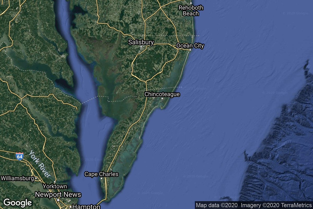
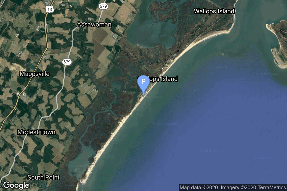
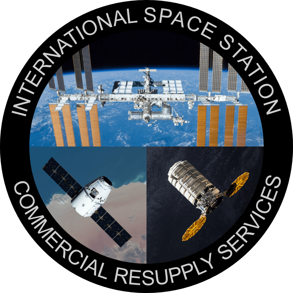
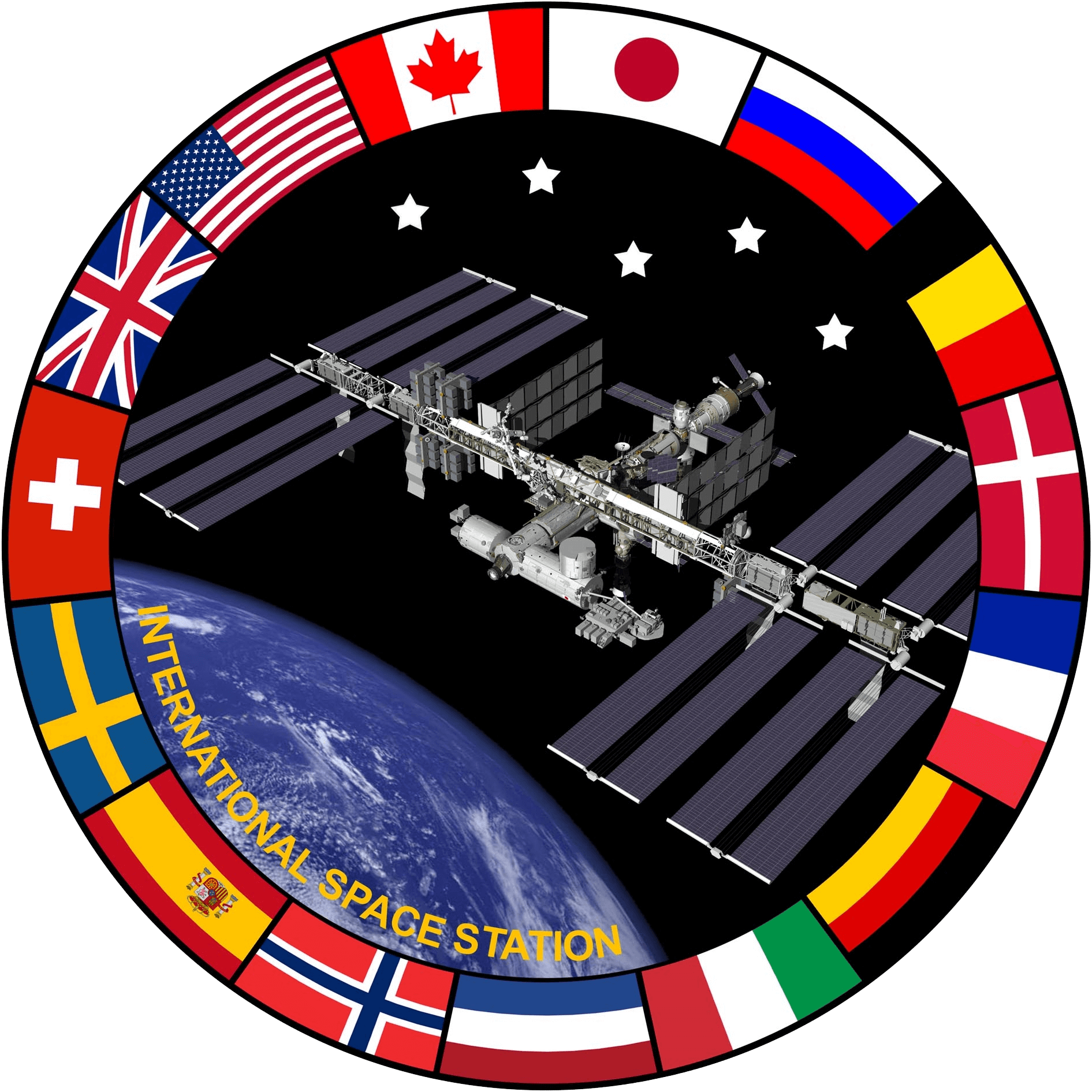
{ "count": 550, "next": "https://lldev.thespacedevs.com/2.2.0/launch/?format=api&limit=10&offset=10&ordering=name", "previous": null, "results": [ { "id": "547f1a96-0539-4fd3-b13c-2a781f02cfd5", "url": "https://lldev.thespacedevs.com/2.2.0/launch/547f1a96-0539-4fd3-b13c-2a781f02cfd5/?format=api", "slug": "angara-12-3-x-rodnik-kosmos-2597-2598-2599", "name": "Angara 1.2 | 3 x Rodnik (Kosmos 2597, 2598, 2599)", "status": { "id": 3, "name": "Launch Successful", "abbrev": "Success", "description": "The launch vehicle successfully inserted its payload(s) into the target orbit(s)." }, "last_updated": "2025-11-30T14:40:45Z", "net": "2025-11-25T13:42:00Z", "window_end": "2025-11-25T14:35:00Z", "window_start": "2025-11-25T13:00:00Z", "net_precision": { "id": 1, "name": "Minute", "abbrev": "MIN", "description": "The T-0 is accurate to the minute." }, "probability": null, "weather_concerns": null, "holdreason": "", "failreason": "", "hashtag": null, "launch_service_provider": { "id": 96, "url": "https://lldev.thespacedevs.com/2.2.0/agencies/96/?format=api", "name": "Khrunichev State Research and Production Space Center", "type": "Government" }, "rocket": { "id": 8801, "configuration": { "id": 136, "url": "https://lldev.thespacedevs.com/2.2.0/config/launcher/136/?format=api", "name": "Angara 1.2", "family": "Angara", "full_name": "Angara 1.2", "variant": "1.2" } }, "mission": { "id": 7392, "name": "3 x Rodnik (Kosmos 2597, 2598, 2599)", "description": "Note: Payload identity and Cosmos series numbering not confirmed.\r\n\r\nThe Strela (Russian: Стрела) are Soviet, then Russian, military space telecommunication satellites, in use since 1964.\r\n\r\nThese satellites operate as mailboxes (\"store-and-forward\"): they remember the received messages and then resend them after the scheduled time, or by a command from the Earth. They can serve for up to five years. The satellites are used for transmission of encrypted messages and images.\r\n\r\nThe operational constellation consists of 12 satellites in two orbital planes, spaced 90° apart. The spacecraft had a cylindrical body with a gravity-gradient boom, which was extended on-orbit to provide passive attitude stabilization. On-board storage was 12 Mbits of data, with a transmission rate of 2.4 kbit/s.\r\n\r\nThe first three satellites were launched in 1964 by a Cosmos launcher. After one year of service, new and improved satellites were launched, called Strela-2. In 1970, these satellites were modernized, and became the Strela-1M and Strela-2M satellites. From 1985, these satellites will be gradually replaced by Strela-3, and then by Strela-3M from 2005. A civilian version of these satellites was created, called Goniets.\r\n\r\nInitially they were launched in groups of six on Tsyklon; when the launcher was retired, they were only launched by two on Cosmos, before Rokot was put into service and allowed the sending of triplets of Strela satellites.", "launch_designator": null, "type": "Government/Top Secret", "orbit": { "id": 8, "name": "Low Earth Orbit", "abbrev": "LEO" }, "agencies": [], "info_urls": [], "vid_urls": [] }, "pad": { "id": 42, "url": "https://lldev.thespacedevs.com/2.2.0/pad/42/?format=api", "agency_id": 163, "name": "35/1", "description": null, "info_url": null, "wiki_url": "https://en.wikipedia.org/wiki/Plesetsk_Cosmodrome_Site_35", "map_url": "https://www.google.com/maps?q=62.927319,40.574897", "latitude": "62.927319", "longitude": "40.574897", "location": { "id": 6, "url": "https://lldev.thespacedevs.com/2.2.0/location/6/?format=api", "name": "Plesetsk Cosmodrome, Russian Federation", "country_code": "RUS", "description": "Plesetsk Cosmodrome is a Russian spaceport located in Mirny, Arkhangelsk Oblast, about 800 km north of Moscow and approximately 200 km south of Arkhangelsk. Originally developed as an ICBM site for the R-7 missile, it also served for numerous satellite launches using the R-7 and other rockets. Its high latitude makes it useful only for certain types of launches, especially the Molniya orbits, so for much of the site's history it functioned as a secondary location, with most orbital launches taking place from Baikonur, in the Kazakh SSR. With the end of the Soviet Union, Baikonur became a foreign territory, and Kazakhstan charged $115 million usage fees annually. Consequently, Plesetsk has seen considerably more activity since the 2000s.", "map_image": "https://thespacedevs-dev.nyc3.digitaloceanspaces.com/media/map_images/location_6_20200803142434.jpg", "timezone_name": "Europe/Moscow", "total_launch_count": 1683, "total_landing_count": 0 }, "country_code": "RUS", "map_image": "https://thespacedevs-dev.nyc3.digitaloceanspaces.com/media/map_images/pad_42_20200803143543.jpg", "total_launch_count": 11, "orbital_launch_attempt_count": 11 }, "webcast_live": false, "image": "https://thespacedevs-dev.nyc3.digitaloceanspaces.com/media/images/angara25201.2_image_20190224012254.jpeg", "infographic": null, "program": [], "orbital_launch_attempt_count": 7129, "location_launch_attempt_count": 1679, "pad_launch_attempt_count": 11, "agency_launch_attempt_count": 197, "orbital_launch_attempt_count_year": 280, "location_launch_attempt_count_year": 8, "pad_launch_attempt_count_year": 4, "agency_launch_attempt_count_year": 2, "type": "normal" }, { "id": "709a1d9f-a0aa-4fd0-b108-1015393f49e1", "url": "https://lldev.thespacedevs.com/2.2.0/launch/709a1d9f-a0aa-4fd0-b108-1015393f49e1/?format=api", "slug": "angara-12-kosmos-2591-2594", "name": "Angara 1.2 | Kosmos 2591-2594", "status": { "id": 3, "name": "Launch Successful", "abbrev": "Success", "description": "The launch vehicle successfully inserted its payload(s) into the target orbit(s)." }, "last_updated": "2025-09-13T12:26:45Z", "net": "2025-08-21T09:32:00Z", "window_end": "2025-08-21T10:30:00Z", "window_start": "2025-08-21T08:30:00Z", "net_precision": { "id": 1, "name": "Minute", "abbrev": "MIN", "description": "The T-0 is accurate to the minute." }, "probability": null, "weather_concerns": null, "holdreason": "", "failreason": "", "hashtag": null, "launch_service_provider": { "id": 193, "url": "https://lldev.thespacedevs.com/2.2.0/agencies/193/?format=api", "name": "Russian Space Forces", "type": "Government" }, "rocket": { "id": 8683, "configuration": { "id": 136, "url": "https://lldev.thespacedevs.com/2.2.0/config/launcher/136/?format=api", "name": "Angara 1.2", "family": "Angara", "full_name": "Angara 1.2", "variant": "1.2" } }, "mission": { "id": 7275, "name": "Kosmos 2591-2594", "description": "4 classified satellites for the Russian military.", "launch_designator": null, "type": "Government/Top Secret", "orbit": { "id": 13, "name": "Polar Orbit", "abbrev": "PO" }, "agencies": [], "info_urls": [], "vid_urls": [] }, "pad": { "id": 42, "url": "https://lldev.thespacedevs.com/2.2.0/pad/42/?format=api", "agency_id": 163, "name": "35/1", "description": null, "info_url": null, "wiki_url": "https://en.wikipedia.org/wiki/Plesetsk_Cosmodrome_Site_35", "map_url": "https://www.google.com/maps?q=62.927319,40.574897", "latitude": "62.927319", "longitude": "40.574897", "location": { "id": 6, "url": "https://lldev.thespacedevs.com/2.2.0/location/6/?format=api", "name": "Plesetsk Cosmodrome, Russian Federation", "country_code": "RUS", "description": "Plesetsk Cosmodrome is a Russian spaceport located in Mirny, Arkhangelsk Oblast, about 800 km north of Moscow and approximately 200 km south of Arkhangelsk. Originally developed as an ICBM site for the R-7 missile, it also served for numerous satellite launches using the R-7 and other rockets. Its high latitude makes it useful only for certain types of launches, especially the Molniya orbits, so for much of the site's history it functioned as a secondary location, with most orbital launches taking place from Baikonur, in the Kazakh SSR. With the end of the Soviet Union, Baikonur became a foreign territory, and Kazakhstan charged $115 million usage fees annually. Consequently, Plesetsk has seen considerably more activity since the 2000s.", "map_image": "https://thespacedevs-dev.nyc3.digitaloceanspaces.com/media/map_images/location_6_20200803142434.jpg", "timezone_name": "Europe/Moscow", "total_launch_count": 1683, "total_landing_count": 0 }, "country_code": "RUS", "map_image": "https://thespacedevs-dev.nyc3.digitaloceanspaces.com/media/map_images/pad_42_20200803143543.jpg", "total_launch_count": 11, "orbital_launch_attempt_count": 11 }, "webcast_live": false, "image": "https://thespacedevs-dev.nyc3.digitaloceanspaces.com/media/images/angara25201.2_image_20190224012254.jpeg", "infographic": null, "program": [], "orbital_launch_attempt_count": 7037, "location_launch_attempt_count": 1677, "pad_launch_attempt_count": 10, "agency_launch_attempt_count": 146, "orbital_launch_attempt_count_year": 188, "location_launch_attempt_count_year": 6, "pad_launch_attempt_count_year": 3, "agency_launch_attempt_count_year": 5, "type": "normal" }, { "id": "4e6e74a5-6ffb-4dc3-8f39-90545067bf12", "url": "https://lldev.thespacedevs.com/2.2.0/launch/4e6e74a5-6ffb-4dc3-8f39-90545067bf12/?format=api", "slug": "angara-a5briz-m-kosmos-2589-2590", "name": "Angara A5/Briz-M | Kosmos 2589 & 2590", "status": { "id": 3, "name": "Launch Successful", "abbrev": "Success", "description": "The launch vehicle successfully inserted its payload(s) into the target orbit(s)." }, "last_updated": "2025-09-13T12:26:27Z", "net": "2025-06-19T03:01:20Z", "window_end": "2025-06-19T04:00:00Z", "window_start": "2025-06-19T02:30:00Z", "net_precision": { "id": 0, "name": "Second", "abbrev": "SEC", "description": "The T-0 is accurate to the second." }, "probability": null, "weather_concerns": null, "holdreason": "", "failreason": "", "hashtag": null, "launch_service_provider": { "id": 193, "url": "https://lldev.thespacedevs.com/2.2.0/agencies/193/?format=api", "name": "Russian Space Forces", "type": "Government" }, "rocket": { "id": 8636, "configuration": { "id": 504, "url": "https://lldev.thespacedevs.com/2.2.0/config/launcher/504/?format=api", "name": "Angara A5/Briz-M", "family": "Angara", "full_name": "Angara A5/Briz-M", "variant": "A5/Briz-M" } }, "mission": { "id": 7228, "name": "Kosmos 2589 & 2590", "description": "Unidentified payload for the Russian military. Kosmos 2590 was separated from Kosmos 2589 after launch.", "launch_designator": null, "type": "Government/Top Secret", "orbit": { "id": 18, "name": "Supersynchronous Transfer Orbit", "abbrev": "Super-GTO" }, "agencies": [], "info_urls": [], "vid_urls": [] }, "pad": { "id": 42, "url": "https://lldev.thespacedevs.com/2.2.0/pad/42/?format=api", "agency_id": 163, "name": "35/1", "description": null, "info_url": null, "wiki_url": "https://en.wikipedia.org/wiki/Plesetsk_Cosmodrome_Site_35", "map_url": "https://www.google.com/maps?q=62.927319,40.574897", "latitude": "62.927319", "longitude": "40.574897", "location": { "id": 6, "url": "https://lldev.thespacedevs.com/2.2.0/location/6/?format=api", "name": "Plesetsk Cosmodrome, Russian Federation", "country_code": "RUS", "description": "Plesetsk Cosmodrome is a Russian spaceport located in Mirny, Arkhangelsk Oblast, about 800 km north of Moscow and approximately 200 km south of Arkhangelsk. Originally developed as an ICBM site for the R-7 missile, it also served for numerous satellite launches using the R-7 and other rockets. Its high latitude makes it useful only for certain types of launches, especially the Molniya orbits, so for much of the site's history it functioned as a secondary location, with most orbital launches taking place from Baikonur, in the Kazakh SSR. With the end of the Soviet Union, Baikonur became a foreign territory, and Kazakhstan charged $115 million usage fees annually. Consequently, Plesetsk has seen considerably more activity since the 2000s.", "map_image": "https://thespacedevs-dev.nyc3.digitaloceanspaces.com/media/map_images/location_6_20200803142434.jpg", "timezone_name": "Europe/Moscow", "total_launch_count": 1683, "total_landing_count": 0 }, "country_code": "RUS", "map_image": "https://thespacedevs-dev.nyc3.digitaloceanspaces.com/media/map_images/pad_42_20200803143543.jpg", "total_launch_count": 11, "orbital_launch_attempt_count": 11 }, "webcast_live": false, "image": "https://thespacedevs-dev.nyc3.digitaloceanspaces.com/media/images/angara_a52fbri_image_20240102171438.jpg", "infographic": null, "program": [], "orbital_launch_attempt_count": 6984, "location_launch_attempt_count": 1676, "pad_launch_attempt_count": 9, "agency_launch_attempt_count": 145, "orbital_launch_attempt_count_year": 135, "location_launch_attempt_count_year": 5, "pad_launch_attempt_count_year": 2, "agency_launch_attempt_count_year": 4, "type": "normal" }, { "id": "d74afbc7-0de5-491c-be05-4e9c31f736ac", "url": "https://lldev.thespacedevs.com/2.2.0/launch/d74afbc7-0de5-491c-be05-4e9c31f736ac/?format=api", "slug": "antares-330-cygnus-crs-2-ng-25", "name": "Antares 330 | Cygnus CRS-2 NG-25", "status": { "id": 2, "name": "To Be Determined", "abbrev": "TBD", "description": "Current date is a placeholder or rough estimation based on unreliable or interpreted sources." }, "last_updated": "2025-09-12T16:37:20Z", "net": "2026-12-31T00:00:00Z", "window_end": "2026-12-31T00:00:00Z", "window_start": "2026-12-31T00:00:00Z", "net_precision": { "id": 14, "name": "Year", "abbrev": "Y", "description": "The T-0 is expected in the given year." }, "probability": null, "weather_concerns": null, "holdreason": "", "failreason": "", "hashtag": null, "launch_service_provider": { "id": 257, "url": "https://lldev.thespacedevs.com/2.2.0/agencies/257/?format=api", "name": "Northrop Grumman Space Systems", "type": "Commercial" }, "rocket": { "id": 7754, "configuration": { "id": 487, "url": "https://lldev.thespacedevs.com/2.2.0/config/launcher/487/?format=api", "name": "Antares 330", "family": "Antares", "full_name": "Antares 330", "variant": "330" } }, "mission": { "id": 6272, "name": "Cygnus CRS-2 NG-25", "description": "This is the 25th flight of the Orbital ATK's uncrewed resupply spacecraft Cygnus and its 24th flight to the International Space Station under the Commercial Resupply Services contract with NASA.", "launch_designator": null, "type": "Resupply", "orbit": { "id": 8, "name": "Low Earth Orbit", "abbrev": "LEO" }, "agencies": [], "info_urls": [], "vid_urls": [] }, "pad": { "id": 76, "url": "https://lldev.thespacedevs.com/2.2.0/pad/76/?format=api", "agency_id": 44, "name": "Launch Area 0 A", "description": "LP-0A was first built for the failed Conestoga rocket program. The original launch tower was subsequently demolished in September 2008. A new pad facility was built from 2009 to 2011 for Orbital Sciences Taurus II, now renamed Antares.", "info_url": null, "wiki_url": "https://en.wikipedia.org/wiki/Mid-Atlantic_Regional_Spaceport_Launch_Pad_0#Pad_0A", "map_url": "https://www.google.com/maps?q=37.8337,-75.4881", "latitude": "37.8337", "longitude": "-75.4881", "location": { "id": 21, "url": "https://lldev.thespacedevs.com/2.2.0/location/21/?format=api", "name": "Wallops Flight Facility, Virginia, USA", "country_code": "USA", "description": "Wallops Flight Facility is a rocket launch site on Wallops Island on the Eastern Shore of Virginia, United States, just east of the Delmarva Peninsula and north-northeast of Norfolk. The facility is operated by the Goddard Space Flight Center in Greenbelt, Maryland, and primarily serves to support science and exploration missions for NASA and other federal agencies. WFF includes an extensively instrumented range to support launches of more than a dozen types of sounding rockets; small expendable suborbital and orbital rockets; high-altitude balloon flights carrying scientific instruments for atmospheric and astronomical research; and, using its Research Airport, flight tests of aeronautical research aircraft, including uncrewed aerial vehicles.", "map_image": "https://thespacedevs-dev.nyc3.digitaloceanspaces.com/media/map_images/location_21_20200803142423.jpg", "timezone_name": "America/New_York", "total_launch_count": 85, "total_landing_count": 0 }, "country_code": "USA", "map_image": "https://thespacedevs-dev.nyc3.digitaloceanspaces.com/media/map_images/pad_76_20200803143538.jpg", "total_launch_count": 19, "orbital_launch_attempt_count": 19 }, "webcast_live": false, "image": null, "infographic": null, "program": [ { "id": 11, "url": "https://lldev.thespacedevs.com/2.2.0/program/11/?format=api", "name": "Commercial Resupply Services", "description": "Commercial Resupply Services (CRS) are a series of flights awarded by NASA for the delivery of cargo and supplies to the International Space Station.The first CRS contracts were signed in 2008 and awarded $1.6 billion to SpaceX for twelve cargo Dragon and $1.9 billion to Orbital Sciences for eight Cygnus flights, covering deliveries to 2016. The Falcon 9 and Antares rockets were also developed under the CRS program to deliver cargo spacecraft to the ISS.", "agencies": [ { "id": 44, "url": "https://lldev.thespacedevs.com/2.2.0/agencies/44/?format=api", "name": "National Aeronautics and Space Administration", "type": "Government" }, { "id": 257, "url": "https://lldev.thespacedevs.com/2.2.0/agencies/257/?format=api", "name": "Northrop Grumman Space Systems", "type": "Commercial" }, { "id": 1020, "url": "https://lldev.thespacedevs.com/2.2.0/agencies/1020/?format=api", "name": "Sierra Nevada Corporation", "type": "Commercial" }, { "id": 121, "url": "https://lldev.thespacedevs.com/2.2.0/agencies/121/?format=api", "name": "SpaceX", "type": "Commercial" } ], "image_url": "https://thespacedevs-dev.nyc3.digitaloceanspaces.com/media/images/commercial2520_program_20201129212219.png", "start_date": "2008-12-23T00:00:00Z", "end_date": null, "info_url": null, "wiki_url": "https://en.wikipedia.org/wiki/Commercial_Resupply_Services#Commercial_Resupply_Services", "mission_patches": [], "type": { "id": 2, "name": "Human Spaceflight" } }, { "id": 17, "url": "https://lldev.thespacedevs.com/2.2.0/program/17/?format=api", "name": "International Space Station", "description": "The International Space Station programme is tied together by a complex set of legal, political and financial agreements between the sixteen nations involved in the project, governing ownership of the various components, rights to crewing and utilization, and responsibilities for crew rotation and resupply of the International Space Station. It was conceived in 1984 by President Ronald Reagan, during the Space Station Freedom project as it was originally called.", "agencies": [ { "id": 16, "url": "https://lldev.thespacedevs.com/2.2.0/agencies/16/?format=api", "name": "Canadian Space Agency", "type": "Government" }, { "id": 27, "url": "https://lldev.thespacedevs.com/2.2.0/agencies/27/?format=api", "name": "European Space Agency", "type": "Multinational" }, { "id": 37, "url": "https://lldev.thespacedevs.com/2.2.0/agencies/37/?format=api", "name": "Japan Aerospace Exploration Agency", "type": "Government" }, { "id": 44, "url": "https://lldev.thespacedevs.com/2.2.0/agencies/44/?format=api", "name": "National Aeronautics and Space Administration", "type": "Government" }, { "id": 63, "url": "https://lldev.thespacedevs.com/2.2.0/agencies/63/?format=api", "name": "Russian Federal Space Agency (ROSCOSMOS)", "type": "Government" } ], "image_url": "https://thespacedevs-dev.nyc3.digitaloceanspaces.com/media/images/international2_program_20201129184745.png", "start_date": "1998-11-20T06:40:00Z", "end_date": null, "info_url": "https://www.nasa.gov/mission_pages/station/main/index.html", "wiki_url": "https://en.wikipedia.org/wiki/International_Space_Station_programme", "mission_patches": [], "type": { "id": 2, "name": "Human Spaceflight" } } ], "orbital_launch_attempt_count": 7441, "location_launch_attempt_count": 92, "pad_launch_attempt_count": 21, "agency_launch_attempt_count": 19, "orbital_launch_attempt_count_year": 268, "location_launch_attempt_count_year": 8, "pad_launch_attempt_count_year": 2, "agency_launch_attempt_count_year": 4, "type": "normal" }, { "id": "526b4a0f-f0c9-4a20-9066-e9fc8c79307b", "url": "https://lldev.thespacedevs.com/2.2.0/launch/526b4a0f-f0c9-4a20-9066-e9fc8c79307b/?format=api", "slug": "ariane-62-block-2-plato", "name": "Ariane 62 Block 2 | PLATO", "status": { "id": 2, "name": "To Be Determined", "abbrev": "TBD", "description": "Current date is a placeholder or rough estimation based on unreliable or interpreted sources." }, "last_updated": "2026-02-13T10:07:17Z", "net": "2027-01-31T00:00:00Z", "window_end": "2027-01-31T00:00:00Z", "window_start": "2027-01-31T00:00:00Z", "net_precision": { "id": 7, "name": "Month", "abbrev": "M", "description": "The T-0 is expected in the given month." }, "probability": null, "weather_concerns": null, "holdreason": "", "failreason": "", "hashtag": null, "launch_service_provider": { "id": 115, "url": "https://lldev.thespacedevs.com/2.2.0/agencies/115/?format=api", "name": "Arianespace", "type": "Commercial" }, "rocket": { "id": 8508, "configuration": { "id": 553, "url": "https://lldev.thespacedevs.com/2.2.0/config/launcher/553/?format=api", "name": "Ariane 62", "family": "Ariane", "full_name": "Ariane 62 Block 2", "variant": "62 Block 2" } }, "mission": { "id": 7098, "name": "PLATO", "description": "Plato, for PLAnetary Transits and Oscillations of stars, is a European Space Agency (ESA) mission with 26 cameras to study terrestrial exoplanets in orbits up to the habitable zone of Sun-like stars. Its goal is to measure the sizes of exoplanets and discover exomoons and rings around them, as well as characterise planets' host stars by studying tiny light variations in the starlight it receives.", "launch_designator": null, "type": "Astrophysics", "orbit": { "id": 16, "name": "Sun-Earth L2", "abbrev": "L2" }, "agencies": [ { "id": 27, "url": "https://lldev.thespacedevs.com/2.2.0/agencies/27/?format=api", "name": "European Space Agency", "featured": false, "type": "Multinational", "country_code": "FRA,ITA,DEU,ESP,CHE,GBR,AUT,SWE,PRT,NLD,HUN,POL,DNK,CZE,ROU,NOR,FIN,GRC,EST,IRL,LUX,BEL,SVN", "abbrev": "ESA", "description": "The European Space Agency is an intergovernmental organisation of 22 member states. Established in 1975 and headquartered in Paris, France, ESA has a worldwide staff of about 2,000 employees.\r\n\r\nESA's space flight programme includes human spaceflight (mainly through participation in the International Space Station program); the launch and operation of unmanned exploration missions to other planets and the Moon; Earth observation, science and telecommunication; designing launch vehicles; and maintaining a major spaceport, the Guiana Space Centre at Kourou, French Guiana.", "administrator": "Director General: Josef Aschbacher", "founding_year": "1975", "launchers": "Ariane | Vega", "spacecraft": "Space Rider", "launch_library_url": null, "total_launch_count": 7, "consecutive_successful_launches": 5, "successful_launches": 6, "failed_launches": 1, "pending_launches": 1, "consecutive_successful_landings": 0, "successful_landings": 0, "failed_landings": 0, "attempted_landings": 0, "info_url": "https://www.esa.int/", "wiki_url": "https://en.wikipedia.org/wiki/European_Space_Agency", "logo_url": "https://thespacedevs-dev.nyc3.digitaloceanspaces.com/media/images/european2520space2520agency_logo_20221130101442.png", "image_url": "https://thespacedevs-dev.nyc3.digitaloceanspaces.com/media/images/esa_patch_float_image_20250211192109.png", "nation_url": "https://thespacedevs-dev.nyc3.digitaloceanspaces.com/media/images/european2520space2520agency_logo_20221130101442.png" } ], "info_urls": [ { "priority": 10, "source": "www.esa.int", "title": "Plato", "description": "ESA’s mission Plato, PLAnetary Transits and Oscillations of stars, will use its 26 cameras to study terrestrial exoplanets in orbits up to the habitable zone of Sun-like stars. The mission will measure the sizes of exoplanets and discover exomoons and rings around them. Plato will also characterise ...", "feature_image": null, "url": "https://www.esa.int/Science_Exploration/Space_Science/Plato", "type": { "id": 1, "name": "Official Page" }, "language": { "id": 1, "name": "English", "code": "en" } } ], "vid_urls": [] }, "pad": { "id": 67, "url": "https://lldev.thespacedevs.com/2.2.0/pad/67/?format=api", "agency_id": 115, "name": "Ariane Launch Area 4", "description": "ELA-4, is a launch pad and associated facilities at the Centre Spatial Guyanais in French Guiana. The complex is composed of a launch pad with mobile gantry, an horizontal assembly building and a dedicated launch operations building. ELA-4 is operated by Arianespace as part of the Ariane 6 program.", "info_url": null, "wiki_url": "https://en.wikipedia.org/wiki/Guiana_Space_Centre", "map_url": "https://www.google.com/maps?q=5.256319,-52.786838", "latitude": "5.256319", "longitude": "-52.786838", "location": { "id": 13, "url": "https://lldev.thespacedevs.com/2.2.0/location/13/?format=api", "name": "Guiana Space Centre, French Guiana", "country_code": "GUF", "description": "The Guiana Space Centre is a European spaceport to the northwest of Kourou in French Guiana, a region of France in South America. Kourou is located at a latitude of 5°. In operation since 1968, it is a suitable location for a spaceport because of its equatorial location and open sea to the east.", "map_image": "https://thespacedevs-dev.nyc3.digitaloceanspaces.com/media/map_images/location_13_20200803142412.jpg", "timezone_name": "America/Cayenne", "total_launch_count": 331, "total_landing_count": 0 }, "country_code": "GUF", "map_image": "https://thespacedevs-dev.nyc3.digitaloceanspaces.com/media/map_images/pad_67_20200803143559.jpg", "total_launch_count": 6, "orbital_launch_attempt_count": 6 }, "webcast_live": false, "image": "https://thespacedevs-dev.nyc3.digitaloceanspaces.com/media/images/ariane_62_lifto_image_20240711132056.jpeg", "infographic": null, "program": [], "orbital_launch_attempt_count": 7445, "location_launch_attempt_count": 346, "pad_launch_attempt_count": 14, "agency_launch_attempt_count": 334, "orbital_launch_attempt_count_year": 4, "location_launch_attempt_count_year": 1, "pad_launch_attempt_count_year": 1, "agency_launch_attempt_count_year": 1, "type": "normal" }, { "id": "8e7d57b1-b5c0-4d0d-a575-fe23606bdeee", "url": "https://lldev.thespacedevs.com/2.2.0/launch/8e7d57b1-b5c0-4d0d-a575-fe23606bdeee/?format=api", "slug": "ariane-62-galileo-l14-foc-fm33-fm34", "name": "Ariane 62 | Galileo L14 (FOC FM33 & FM34)", "status": { "id": 3, "name": "Launch Successful", "abbrev": "Success", "description": "The launch vehicle successfully inserted its payload(s) into the target orbit(s)." }, "last_updated": "2025-12-17T15:39:58Z", "net": "2025-12-17T05:01:58Z", "window_end": "2025-12-17T05:01:58Z", "window_start": "2025-12-17T05:01:58Z", "net_precision": { "id": 0, "name": "Second", "abbrev": "SEC", "description": "The T-0 is accurate to the second." }, "probability": null, "weather_concerns": null, "holdreason": "", "failreason": "", "hashtag": "VA266", "launch_service_provider": { "id": 115, "url": "https://lldev.thespacedevs.com/2.2.0/agencies/115/?format=api", "name": "Arianespace", "type": "Commercial" }, "rocket": { "id": 7509, "configuration": { "id": 121, "url": "https://lldev.thespacedevs.com/2.2.0/config/launcher/121/?format=api", "name": "Ariane 62", "family": "Ariane", "full_name": "Ariane 62", "variant": "62" } }, "mission": { "id": 5918, "name": "Galileo L14 (FOC FM33 & FM34)", "description": "Payload consists of two satellites for Europe's Galileo navigation system.", "launch_designator": null, "type": "Navigation", "orbit": { "id": 12, "name": "Medium Earth Orbit", "abbrev": "MEO" }, "agencies": [ { "id": 27, "url": "https://lldev.thespacedevs.com/2.2.0/agencies/27/?format=api", "name": "European Space Agency", "featured": false, "type": "Multinational", "country_code": "FRA,ITA,DEU,ESP,CHE,GBR,AUT,SWE,PRT,NLD,HUN,POL,DNK,CZE,ROU,NOR,FIN,GRC,EST,IRL,LUX,BEL,SVN", "abbrev": "ESA", "description": "The European Space Agency is an intergovernmental organisation of 22 member states. Established in 1975 and headquartered in Paris, France, ESA has a worldwide staff of about 2,000 employees.\r\n\r\nESA's space flight programme includes human spaceflight (mainly through participation in the International Space Station program); the launch and operation of unmanned exploration missions to other planets and the Moon; Earth observation, science and telecommunication; designing launch vehicles; and maintaining a major spaceport, the Guiana Space Centre at Kourou, French Guiana.", "administrator": "Director General: Josef Aschbacher", "founding_year": "1975", "launchers": "Ariane | Vega", "spacecraft": "Space Rider", "launch_library_url": null, "total_launch_count": 7, "consecutive_successful_launches": 5, "successful_launches": 6, "failed_launches": 1, "pending_launches": 1, "consecutive_successful_landings": 0, "successful_landings": 0, "failed_landings": 0, "attempted_landings": 0, "info_url": "https://www.esa.int/", "wiki_url": "https://en.wikipedia.org/wiki/European_Space_Agency", "logo_url": "https://thespacedevs-dev.nyc3.digitaloceanspaces.com/media/images/european2520space2520agency_logo_20221130101442.png", "image_url": "https://thespacedevs-dev.nyc3.digitaloceanspaces.com/media/images/esa_patch_float_image_20250211192109.png", "nation_url": "https://thespacedevs-dev.nyc3.digitaloceanspaces.com/media/images/european2520space2520agency_logo_20221130101442.png" } ], "info_urls": [], "vid_urls": [] }, "pad": { "id": 67, "url": "https://lldev.thespacedevs.com/2.2.0/pad/67/?format=api", "agency_id": 115, "name": "Ariane Launch Area 4", "description": "ELA-4, is a launch pad and associated facilities at the Centre Spatial Guyanais in French Guiana. The complex is composed of a launch pad with mobile gantry, an horizontal assembly building and a dedicated launch operations building. ELA-4 is operated by Arianespace as part of the Ariane 6 program.", "info_url": null, "wiki_url": "https://en.wikipedia.org/wiki/Guiana_Space_Centre", "map_url": "https://www.google.com/maps?q=5.256319,-52.786838", "latitude": "5.256319", "longitude": "-52.786838", "location": { "id": 13, "url": "https://lldev.thespacedevs.com/2.2.0/location/13/?format=api", "name": "Guiana Space Centre, French Guiana", "country_code": "GUF", "description": "The Guiana Space Centre is a European spaceport to the northwest of Kourou in French Guiana, a region of France in South America. Kourou is located at a latitude of 5°. In operation since 1968, it is a suitable location for a spaceport because of its equatorial location and open sea to the east.", "map_image": "https://thespacedevs-dev.nyc3.digitaloceanspaces.com/media/map_images/location_13_20200803142412.jpg", "timezone_name": "America/Cayenne", "total_launch_count": 331, "total_landing_count": 0 }, "country_code": "GUF", "map_image": "https://thespacedevs-dev.nyc3.digitaloceanspaces.com/media/map_images/pad_67_20200803143559.jpg", "total_launch_count": 6, "orbital_launch_attempt_count": 6 }, "webcast_live": false, "image": "https://thespacedevs-dev.nyc3.digitaloceanspaces.com/media/images/ariane_62_lifto_image_20240711132056.jpeg", "infographic": null, "program": [ { "id": 30, "url": "https://lldev.thespacedevs.com/2.2.0/program/30/?format=api", "name": "Galileo", "description": "Galileo is a global navigation satellite system (GNSS) that went live in 2016, created by the European Union through the European Space Agency (ESA), operated by the European Union Agency for the Space Programme (EUSPA).", "agencies": [ { "id": 27, "url": "https://lldev.thespacedevs.com/2.2.0/agencies/27/?format=api", "name": "European Space Agency", "type": "Multinational" } ], "image_url": "https://thespacedevs-dev.nyc3.digitaloceanspaces.com/media/images/galileo_program_20231230110547.png", "start_date": "2011-10-21T10:30:00Z", "end_date": null, "info_url": "https://www.gsc-europa.eu/", "wiki_url": "https://en.wikipedia.org/wiki/Galileo_(satellite_navigation)", "mission_patches": [], "type": { "id": 4, "name": "Navigation Constellation" } } ], "orbital_launch_attempt_count": 7158, "location_launch_attempt_count": 330, "pad_launch_attempt_count": 5, "agency_launch_attempt_count": 324, "orbital_launch_attempt_count_year": 309, "location_launch_attempt_count_year": 7, "pad_launch_attempt_count_year": 4, "agency_launch_attempt_count_year": 7, "type": "normal" }, { "id": "0b85fcca-5252-48d7-9ccb-c10b1da9d183", "url": "https://lldev.thespacedevs.com/2.2.0/launch/0b85fcca-5252-48d7-9ccb-c10b1da9d183/?format=api", "slug": "ariane-62-galileo-l15-foc-fm28-fm31", "name": "Ariane 62 | Galileo L15 (FOC FM28 & FM31)", "status": { "id": 2, "name": "To Be Determined", "abbrev": "TBD", "description": "Current date is a placeholder or rough estimation based on unreliable or interpreted sources." }, "last_updated": "2025-12-10T18:28:10Z", "net": "2026-12-31T00:00:00Z", "window_end": "2026-12-31T00:00:00Z", "window_start": "2026-12-31T00:00:00Z", "net_precision": { "id": 11, "name": "Quarter 4", "abbrev": "Q4", "description": "The T-0 is expected in the fourth quarter of the given year." }, "probability": null, "weather_concerns": null, "holdreason": "", "failreason": "", "hashtag": null, "launch_service_provider": { "id": 115, "url": "https://lldev.thespacedevs.com/2.2.0/agencies/115/?format=api", "name": "Arianespace", "type": "Commercial" }, "rocket": { "id": 7510, "configuration": { "id": 121, "url": "https://lldev.thespacedevs.com/2.2.0/config/launcher/121/?format=api", "name": "Ariane 62", "family": "Ariane", "full_name": "Ariane 62", "variant": "62" } }, "mission": { "id": 5919, "name": "Galileo L15 (FOC FM28 & FM31)", "description": "Payload consists of two satellites for Europe's Galileo navigation system.", "launch_designator": null, "type": "Navigation", "orbit": { "id": 12, "name": "Medium Earth Orbit", "abbrev": "MEO" }, "agencies": [ { "id": 27, "url": "https://lldev.thespacedevs.com/2.2.0/agencies/27/?format=api", "name": "European Space Agency", "featured": false, "type": "Multinational", "country_code": "FRA,ITA,DEU,ESP,CHE,GBR,AUT,SWE,PRT,NLD,HUN,POL,DNK,CZE,ROU,NOR,FIN,GRC,EST,IRL,LUX,BEL,SVN", "abbrev": "ESA", "description": "The European Space Agency is an intergovernmental organisation of 22 member states. Established in 1975 and headquartered in Paris, France, ESA has a worldwide staff of about 2,000 employees.\r\n\r\nESA's space flight programme includes human spaceflight (mainly through participation in the International Space Station program); the launch and operation of unmanned exploration missions to other planets and the Moon; Earth observation, science and telecommunication; designing launch vehicles; and maintaining a major spaceport, the Guiana Space Centre at Kourou, French Guiana.", "administrator": "Director General: Josef Aschbacher", "founding_year": "1975", "launchers": "Ariane | Vega", "spacecraft": "Space Rider", "launch_library_url": null, "total_launch_count": 7, "consecutive_successful_launches": 5, "successful_launches": 6, "failed_launches": 1, "pending_launches": 1, "consecutive_successful_landings": 0, "successful_landings": 0, "failed_landings": 0, "attempted_landings": 0, "info_url": "https://www.esa.int/", "wiki_url": "https://en.wikipedia.org/wiki/European_Space_Agency", "logo_url": "https://thespacedevs-dev.nyc3.digitaloceanspaces.com/media/images/european2520space2520agency_logo_20221130101442.png", "image_url": "https://thespacedevs-dev.nyc3.digitaloceanspaces.com/media/images/esa_patch_float_image_20250211192109.png", "nation_url": "https://thespacedevs-dev.nyc3.digitaloceanspaces.com/media/images/european2520space2520agency_logo_20221130101442.png" } ], "info_urls": [], "vid_urls": [] }, "pad": { "id": 67, "url": "https://lldev.thespacedevs.com/2.2.0/pad/67/?format=api", "agency_id": 115, "name": "Ariane Launch Area 4", "description": "ELA-4, is a launch pad and associated facilities at the Centre Spatial Guyanais in French Guiana. The complex is composed of a launch pad with mobile gantry, an horizontal assembly building and a dedicated launch operations building. ELA-4 is operated by Arianespace as part of the Ariane 6 program.", "info_url": null, "wiki_url": "https://en.wikipedia.org/wiki/Guiana_Space_Centre", "map_url": "https://www.google.com/maps?q=5.256319,-52.786838", "latitude": "5.256319", "longitude": "-52.786838", "location": { "id": 13, "url": "https://lldev.thespacedevs.com/2.2.0/location/13/?format=api", "name": "Guiana Space Centre, French Guiana", "country_code": "GUF", "description": "The Guiana Space Centre is a European spaceport to the northwest of Kourou in French Guiana, a region of France in South America. Kourou is located at a latitude of 5°. In operation since 1968, it is a suitable location for a spaceport because of its equatorial location and open sea to the east.", "map_image": "https://thespacedevs-dev.nyc3.digitaloceanspaces.com/media/map_images/location_13_20200803142412.jpg", "timezone_name": "America/Cayenne", "total_launch_count": 331, "total_landing_count": 0 }, "country_code": "GUF", "map_image": "https://thespacedevs-dev.nyc3.digitaloceanspaces.com/media/map_images/pad_67_20200803143559.jpg", "total_launch_count": 6, "orbital_launch_attempt_count": 6 }, "webcast_live": false, "image": "https://thespacedevs-dev.nyc3.digitaloceanspaces.com/media/images/ariane_62_lifto_image_20240711132056.jpeg", "infographic": null, "program": [ { "id": 30, "url": "https://lldev.thespacedevs.com/2.2.0/program/30/?format=api", "name": "Galileo", "description": "Galileo is a global navigation satellite system (GNSS) that went live in 2016, created by the European Union through the European Space Agency (ESA), operated by the European Union Agency for the Space Programme (EUSPA).", "agencies": [ { "id": 27, "url": "https://lldev.thespacedevs.com/2.2.0/agencies/27/?format=api", "name": "European Space Agency", "type": "Multinational" } ], "image_url": "https://thespacedevs-dev.nyc3.digitaloceanspaces.com/media/images/galileo_program_20231230110547.png", "start_date": "2011-10-21T10:30:00Z", "end_date": null, "info_url": "https://www.gsc-europa.eu/", "wiki_url": "https://en.wikipedia.org/wiki/Galileo_(satellite_navigation)", "mission_patches": [], "type": { "id": 4, "name": "Navigation Constellation" } } ], "orbital_launch_attempt_count": 7441, "location_launch_attempt_count": 345, "pad_launch_attempt_count": 13, "agency_launch_attempt_count": 333, "orbital_launch_attempt_count_year": 268, "location_launch_attempt_count_year": 15, "pad_launch_attempt_count_year": 8, "agency_launch_attempt_count_year": 9, "type": "normal" }, { "id": "c73425e7-d668-4b80-b123-39cff09b31d7", "url": "https://lldev.thespacedevs.com/2.2.0/launch/c73425e7-d668-4b80-b123-39cff09b31d7/?format=api", "slug": "ariane-62-galileo-l16-foc-fm29-fm30", "name": "Ariane 62 | Galileo L16 (FOC FM29 & FM30)", "status": { "id": 2, "name": "To Be Determined", "abbrev": "TBD", "description": "Current date is a placeholder or rough estimation based on unreliable or interpreted sources." }, "last_updated": "2025-12-10T18:29:21Z", "net": "2027-03-31T00:00:00Z", "window_end": "2027-03-31T00:00:00Z", "window_start": "2027-03-31T00:00:00Z", "net_precision": { "id": 8, "name": "Quarter 1", "abbrev": "Q1", "description": "The T-0 is expected in the first quarter of the given year." }, "probability": null, "weather_concerns": null, "holdreason": "", "failreason": "", "hashtag": null, "launch_service_provider": { "id": 115, "url": "https://lldev.thespacedevs.com/2.2.0/agencies/115/?format=api", "name": "Arianespace", "type": "Commercial" }, "rocket": { "id": 8661, "configuration": { "id": 121, "url": "https://lldev.thespacedevs.com/2.2.0/config/launcher/121/?format=api", "name": "Ariane 62", "family": "Ariane", "full_name": "Ariane 62", "variant": "62" } }, "mission": { "id": 7253, "name": "Galileo L16 (FOC FM29 & FM30)", "description": "Payload consists of two satellites for Europe's Galileo navigation system.", "launch_designator": null, "type": "Navigation", "orbit": { "id": 12, "name": "Medium Earth Orbit", "abbrev": "MEO" }, "agencies": [ { "id": 27, "url": "https://lldev.thespacedevs.com/2.2.0/agencies/27/?format=api", "name": "European Space Agency", "featured": false, "type": "Multinational", "country_code": "FRA,ITA,DEU,ESP,CHE,GBR,AUT,SWE,PRT,NLD,HUN,POL,DNK,CZE,ROU,NOR,FIN,GRC,EST,IRL,LUX,BEL,SVN", "abbrev": "ESA", "description": "The European Space Agency is an intergovernmental organisation of 22 member states. Established in 1975 and headquartered in Paris, France, ESA has a worldwide staff of about 2,000 employees.\r\n\r\nESA's space flight programme includes human spaceflight (mainly through participation in the International Space Station program); the launch and operation of unmanned exploration missions to other planets and the Moon; Earth observation, science and telecommunication; designing launch vehicles; and maintaining a major spaceport, the Guiana Space Centre at Kourou, French Guiana.", "administrator": "Director General: Josef Aschbacher", "founding_year": "1975", "launchers": "Ariane | Vega", "spacecraft": "Space Rider", "launch_library_url": null, "total_launch_count": 7, "consecutive_successful_launches": 5, "successful_launches": 6, "failed_launches": 1, "pending_launches": 1, "consecutive_successful_landings": 0, "successful_landings": 0, "failed_landings": 0, "attempted_landings": 0, "info_url": "https://www.esa.int/", "wiki_url": "https://en.wikipedia.org/wiki/European_Space_Agency", "logo_url": "https://thespacedevs-dev.nyc3.digitaloceanspaces.com/media/images/european2520space2520agency_logo_20221130101442.png", "image_url": "https://thespacedevs-dev.nyc3.digitaloceanspaces.com/media/images/esa_patch_float_image_20250211192109.png", "nation_url": "https://thespacedevs-dev.nyc3.digitaloceanspaces.com/media/images/european2520space2520agency_logo_20221130101442.png" } ], "info_urls": [], "vid_urls": [] }, "pad": { "id": 67, "url": "https://lldev.thespacedevs.com/2.2.0/pad/67/?format=api", "agency_id": 115, "name": "Ariane Launch Area 4", "description": "ELA-4, is a launch pad and associated facilities at the Centre Spatial Guyanais in French Guiana. The complex is composed of a launch pad with mobile gantry, an horizontal assembly building and a dedicated launch operations building. ELA-4 is operated by Arianespace as part of the Ariane 6 program.", "info_url": null, "wiki_url": "https://en.wikipedia.org/wiki/Guiana_Space_Centre", "map_url": "https://www.google.com/maps?q=5.256319,-52.786838", "latitude": "5.256319", "longitude": "-52.786838", "location": { "id": 13, "url": "https://lldev.thespacedevs.com/2.2.0/location/13/?format=api", "name": "Guiana Space Centre, French Guiana", "country_code": "GUF", "description": "The Guiana Space Centre is a European spaceport to the northwest of Kourou in French Guiana, a region of France in South America. Kourou is located at a latitude of 5°. In operation since 1968, it is a suitable location for a spaceport because of its equatorial location and open sea to the east.", "map_image": "https://thespacedevs-dev.nyc3.digitaloceanspaces.com/media/map_images/location_13_20200803142412.jpg", "timezone_name": "America/Cayenne", "total_launch_count": 331, "total_landing_count": 0 }, "country_code": "GUF", "map_image": "https://thespacedevs-dev.nyc3.digitaloceanspaces.com/media/map_images/pad_67_20200803143559.jpg", "total_launch_count": 6, "orbital_launch_attempt_count": 6 }, "webcast_live": false, "image": "https://thespacedevs-dev.nyc3.digitaloceanspaces.com/media/images/ariane_62_lifto_image_20240711132056.jpeg", "infographic": null, "program": [ { "id": 30, "url": "https://lldev.thespacedevs.com/2.2.0/program/30/?format=api", "name": "Galileo", "description": "Galileo is a global navigation satellite system (GNSS) that went live in 2016, created by the European Union through the European Space Agency (ESA), operated by the European Union Agency for the Space Programme (EUSPA).", "agencies": [ { "id": 27, "url": "https://lldev.thespacedevs.com/2.2.0/agencies/27/?format=api", "name": "European Space Agency", "type": "Multinational" } ], "image_url": "https://thespacedevs-dev.nyc3.digitaloceanspaces.com/media/images/galileo_program_20231230110547.png", "start_date": "2011-10-21T10:30:00Z", "end_date": null, "info_url": "https://www.gsc-europa.eu/", "wiki_url": "https://en.wikipedia.org/wiki/Galileo_(satellite_navigation)", "mission_patches": [], "type": { "id": 4, "name": "Navigation Constellation" } } ], "orbital_launch_attempt_count": 7453, "location_launch_attempt_count": 348, "pad_launch_attempt_count": 16, "agency_launch_attempt_count": 336, "orbital_launch_attempt_count_year": 12, "location_launch_attempt_count_year": 3, "pad_launch_attempt_count_year": 3, "agency_launch_attempt_count_year": 3, "type": "normal" }, { "id": "1b9bed2f-7e00-4d95-b5d1-7b71c36a4ab1", "url": "https://lldev.thespacedevs.com/2.2.0/launch/1b9bed2f-7e00-4d95-b5d1-7b71c36a4ab1/?format=api", "slug": "ariane-62-metop-sg-a1", "name": "Ariane 62 | Metop-SG A1", "status": { "id": 3, "name": "Launch Successful", "abbrev": "Success", "description": "The launch vehicle successfully inserted its payload(s) into the target orbit(s)." }, "last_updated": "2025-08-26T11:31:52Z", "net": "2025-08-13T00:37:50Z", "window_end": "2025-08-13T00:37:50Z", "window_start": "2025-08-13T00:37:50Z", "net_precision": { "id": 0, "name": "Second", "abbrev": "SEC", "description": "The T-0 is accurate to the second." }, "probability": null, "weather_concerns": null, "holdreason": "", "failreason": "", "hashtag": null, "launch_service_provider": { "id": 115, "url": "https://lldev.thespacedevs.com/2.2.0/agencies/115/?format=api", "name": "Arianespace", "type": "Commercial" }, "rocket": { "id": 169, "configuration": { "id": 121, "url": "https://lldev.thespacedevs.com/2.2.0/config/launcher/121/?format=api", "name": "Ariane 62", "family": "Ariane", "full_name": "Ariane 62", "variant": "62" } }, "mission": { "id": 5920, "name": "Metop-SG A1", "description": "First of EUMETSAT's second generation of Metop weather satellites.", "launch_designator": null, "type": "Earth Science", "orbit": { "id": 17, "name": "Sun-Synchronous Orbit", "abbrev": "SSO" }, "agencies": [ { "id": 232, "url": "https://lldev.thespacedevs.com/2.2.0/agencies/232/?format=api", "name": "European Organisation for the Exploitation of Meteorological Satellites", "featured": false, "type": "Multinational", "country_code": "AUT,BEL,BGR,HRV,CZE,DNK,EST,FIN,FRA,DEU,GRC,HUN,IRL,ISL,ITA,LVA,LTU,LUX,NLD,NOR,POL,PRT,ROU,SVK,SVN,ESP,SWE,CHE,TUR,GBR", "abbrev": "EUMETSAT", "description": "The European Organisation for the Exploitation of Meteorological Satellites (EUMETSAT) is an intergovernmental organisation created through an international convention agreed by a current total of 30 European Member States.\r\n\r\nEUMETSAT's primary objective is to establish, maintain and exploit European systems of operational meteorological satellites. EUMETSAT is responsible for the launch and operation of the satellites and for delivering satellite data to end-users as well as contributing to the operational monitoring of climate and the detection of global climate changes.", "administrator": null, "founding_year": "1986", "launchers": "", "spacecraft": "", "launch_library_url": null, "total_launch_count": 0, "consecutive_successful_launches": 0, "successful_launches": 0, "failed_launches": 0, "pending_launches": 0, "consecutive_successful_landings": 0, "successful_landings": 0, "failed_landings": 0, "attempted_landings": 0, "info_url": "https://www.eumetsat.int/", "wiki_url": "https://en.wikipedia.org/wiki/EUMETSAT", "logo_url": "https://thespacedevs-dev.nyc3.digitaloceanspaces.com/media/images/eumetsat_logo_image_20250723121030.png", "image_url": "https://thespacedevs-dev.nyc3.digitaloceanspaces.com/media/images/eumetsat_hq_image_20250723121241.jpg", "nation_url": "https://thespacedevs-dev.nyc3.digitaloceanspaces.com/media/images/eumetsat_social_image_20250723121041.jpg" } ], "info_urls": [], "vid_urls": [] }, "pad": { "id": 67, "url": "https://lldev.thespacedevs.com/2.2.0/pad/67/?format=api", "agency_id": 115, "name": "Ariane Launch Area 4", "description": "ELA-4, is a launch pad and associated facilities at the Centre Spatial Guyanais in French Guiana. The complex is composed of a launch pad with mobile gantry, an horizontal assembly building and a dedicated launch operations building. ELA-4 is operated by Arianespace as part of the Ariane 6 program.", "info_url": null, "wiki_url": "https://en.wikipedia.org/wiki/Guiana_Space_Centre", "map_url": "https://www.google.com/maps?q=5.256319,-52.786838", "latitude": "5.256319", "longitude": "-52.786838", "location": { "id": 13, "url": "https://lldev.thespacedevs.com/2.2.0/location/13/?format=api", "name": "Guiana Space Centre, French Guiana", "country_code": "GUF", "description": "The Guiana Space Centre is a European spaceport to the northwest of Kourou in French Guiana, a region of France in South America. Kourou is located at a latitude of 5°. In operation since 1968, it is a suitable location for a spaceport because of its equatorial location and open sea to the east.", "map_image": "https://thespacedevs-dev.nyc3.digitaloceanspaces.com/media/map_images/location_13_20200803142412.jpg", "timezone_name": "America/Cayenne", "total_launch_count": 331, "total_landing_count": 0 }, "country_code": "GUF", "map_image": "https://thespacedevs-dev.nyc3.digitaloceanspaces.com/media/map_images/pad_67_20200803143559.jpg", "total_launch_count": 6, "orbital_launch_attempt_count": 6 }, "webcast_live": false, "image": "https://thespacedevs-dev.nyc3.digitaloceanspaces.com/media/images/ariane_62_lifto_image_20240711132056.jpeg", "infographic": null, "program": [ { "id": 22, "url": "https://lldev.thespacedevs.com/2.2.0/program/22/?format=api", "name": "Copernicus", "description": "Copernicus is the European Union's Earth observation programme coordinated and managed for the European Commission by the European Union Agency for the Space Programme in partnership with the European Space Agency (ESA), the EU Member States. It aims at achieving a global, continuous, autonomous, high quality, wide range Earth observation capacity. Providing accurate, timely and easily accessible information to, among other things, improve the management of the environment, understand and mitigate the effects of climate change, and ensure civil security.", "agencies": [ { "id": 27, "url": "https://lldev.thespacedevs.com/2.2.0/agencies/27/?format=api", "name": "European Space Agency", "type": "Multinational" }, { "id": 1043, "url": "https://lldev.thespacedevs.com/2.2.0/agencies/1043/?format=api", "name": "European Union Agency for the Space Programme", "type": "Multinational" } ], "image_url": "https://thespacedevs-dev.nyc3.digitaloceanspaces.com/media/images/copernicus_program_20221129162831.png", "start_date": "2014-04-03T00:00:00Z", "end_date": null, "info_url": "https://www.copernicus.eu", "wiki_url": "https://en.wikipedia.org/wiki/Copernicus_Programme", "mission_patches": [], "type": { "id": 8, "name": "Earth Observation" } } ], "orbital_launch_attempt_count": 7026, "location_launch_attempt_count": 327, "pad_launch_attempt_count": 3, "agency_launch_attempt_count": 321, "orbital_launch_attempt_count_year": 177, "location_launch_attempt_count_year": 4, "pad_launch_attempt_count_year": 2, "agency_launch_attempt_count_year": 4, "type": "normal" }, { "id": "22e117bf-041c-49d5-9d09-7b180036e143", "url": "https://lldev.thespacedevs.com/2.2.0/launch/22e117bf-041c-49d5-9d09-7b180036e143/?format=api", "slug": "ariane-62-metop-sg-b1", "name": "Ariane 62 | Metop-SG B1", "status": { "id": 2, "name": "To Be Determined", "abbrev": "TBD", "description": "Current date is a placeholder or rough estimation based on unreliable or interpreted sources." }, "last_updated": "2026-03-29T21:47:24Z", "net": "2026-10-06T00:00:00Z", "window_end": "2026-10-06T00:00:00Z", "window_start": "2026-10-06T00:00:00Z", "net_precision": { "id": 5, "name": "Day", "abbrev": "DAY", "description": "The T-0 is expected on the given day." }, "probability": null, "weather_concerns": null, "holdreason": "", "failreason": "", "hashtag": null, "launch_service_provider": { "id": 115, "url": "https://lldev.thespacedevs.com/2.2.0/agencies/115/?format=api", "name": "Arianespace", "type": "Commercial" }, "rocket": { "id": 170, "configuration": { "id": 121, "url": "https://lldev.thespacedevs.com/2.2.0/config/launcher/121/?format=api", "name": "Ariane 62", "family": "Ariane", "full_name": "Ariane 62", "variant": "62" } }, "mission": { "id": 5921, "name": "Metop-SG B1", "description": "Second of EUMETSAT's second generation of Metop weather satellites.", "launch_designator": null, "type": "Earth Science", "orbit": { "id": 17, "name": "Sun-Synchronous Orbit", "abbrev": "SSO" }, "agencies": [], "info_urls": [], "vid_urls": [] }, "pad": { "id": 67, "url": "https://lldev.thespacedevs.com/2.2.0/pad/67/?format=api", "agency_id": 115, "name": "Ariane Launch Area 4", "description": "ELA-4, is a launch pad and associated facilities at the Centre Spatial Guyanais in French Guiana. The complex is composed of a launch pad with mobile gantry, an horizontal assembly building and a dedicated launch operations building. ELA-4 is operated by Arianespace as part of the Ariane 6 program.", "info_url": null, "wiki_url": "https://en.wikipedia.org/wiki/Guiana_Space_Centre", "map_url": "https://www.google.com/maps?q=5.256319,-52.786838", "latitude": "5.256319", "longitude": "-52.786838", "location": { "id": 13, "url": "https://lldev.thespacedevs.com/2.2.0/location/13/?format=api", "name": "Guiana Space Centre, French Guiana", "country_code": "GUF", "description": "The Guiana Space Centre is a European spaceport to the northwest of Kourou in French Guiana, a region of France in South America. Kourou is located at a latitude of 5°. In operation since 1968, it is a suitable location for a spaceport because of its equatorial location and open sea to the east.", "map_image": "https://thespacedevs-dev.nyc3.digitaloceanspaces.com/media/map_images/location_13_20200803142412.jpg", "timezone_name": "America/Cayenne", "total_launch_count": 331, "total_landing_count": 0 }, "country_code": "GUF", "map_image": "https://thespacedevs-dev.nyc3.digitaloceanspaces.com/media/map_images/pad_67_20200803143559.jpg", "total_launch_count": 6, "orbital_launch_attempt_count": 6 }, "webcast_live": false, "image": "https://thespacedevs-dev.nyc3.digitaloceanspaces.com/media/images/ariane_62_lifto_image_20240711132056.jpeg", "infographic": null, "program": [], "orbital_launch_attempt_count": 7321, "location_launch_attempt_count": 337, "pad_launch_attempt_count": 10, "agency_launch_attempt_count": 329, "orbital_launch_attempt_count_year": 148, "location_launch_attempt_count_year": 7, "pad_launch_attempt_count_year": 5, "agency_launch_attempt_count_year": 5, "type": "normal" } ] }