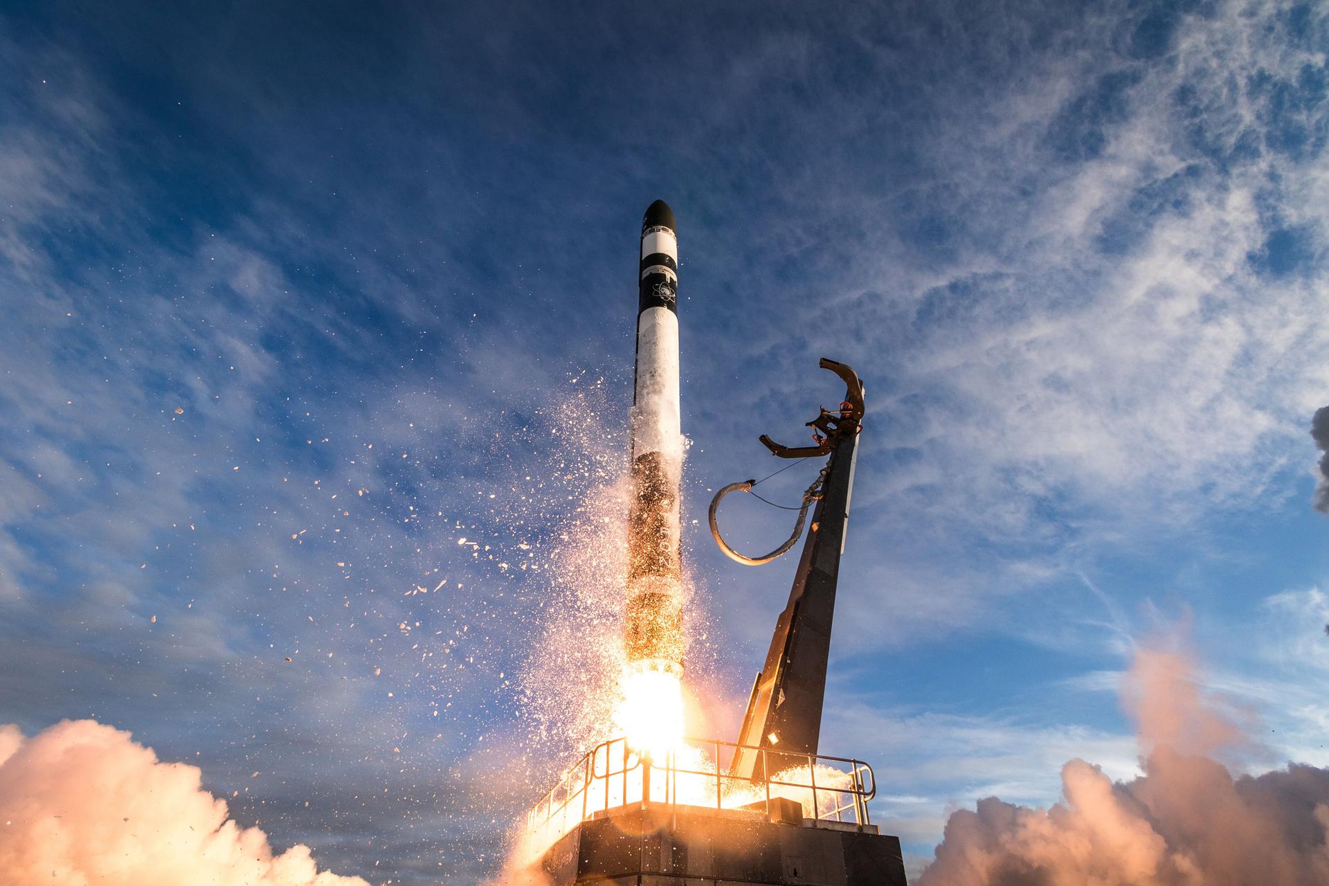
Launch List
AN API endpoint that returns all Launch objects or a single launch.
EXAMPLE - /launch/[id]/ or /launch/?mode=list&search=SpaceX
GET Return a list of all Launch objects.
FILTERS Fields - 'name', 'id(s)', 'lsp__id', 'lsp__name', 'serial_number', 'launcher_config__id', 'rocket__spacecraftflight__spacecraft__name', 'is_crewed', 'include_suborbital', 'spacecraft_config__ids', 'related', 'location__ids', 'lsp__ids', 'pad__ids', 'status__ids'
MODE 'normal', 'list', 'detailed'
EXAMPLE ?mode=list
SEARCH Searches through the launch name, rocket name, launch agency, mission name & spacecraft name.
EXAMPLE - ?search=SpaceX
GET /2.2.0/launch/?format=api&offset=400
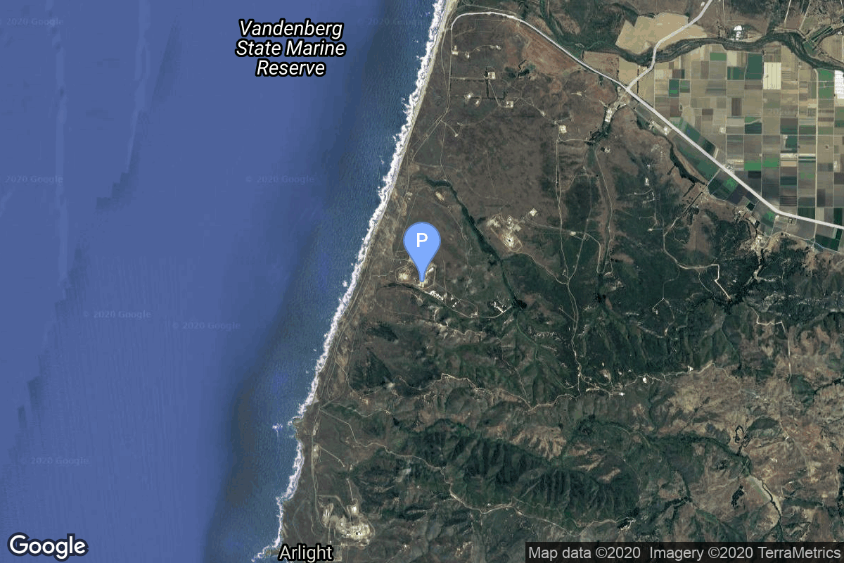
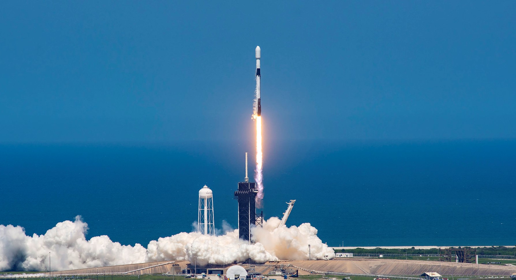
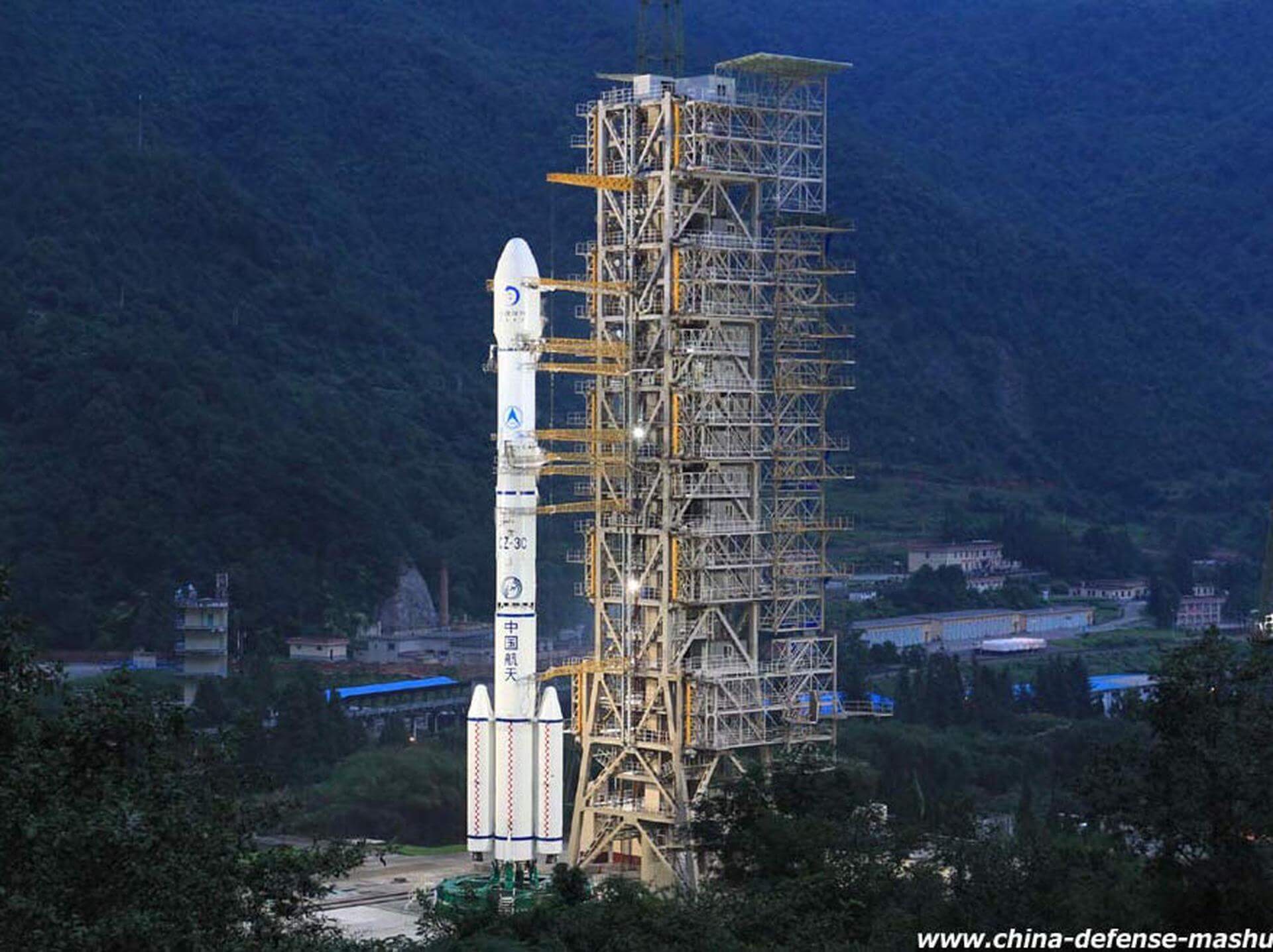
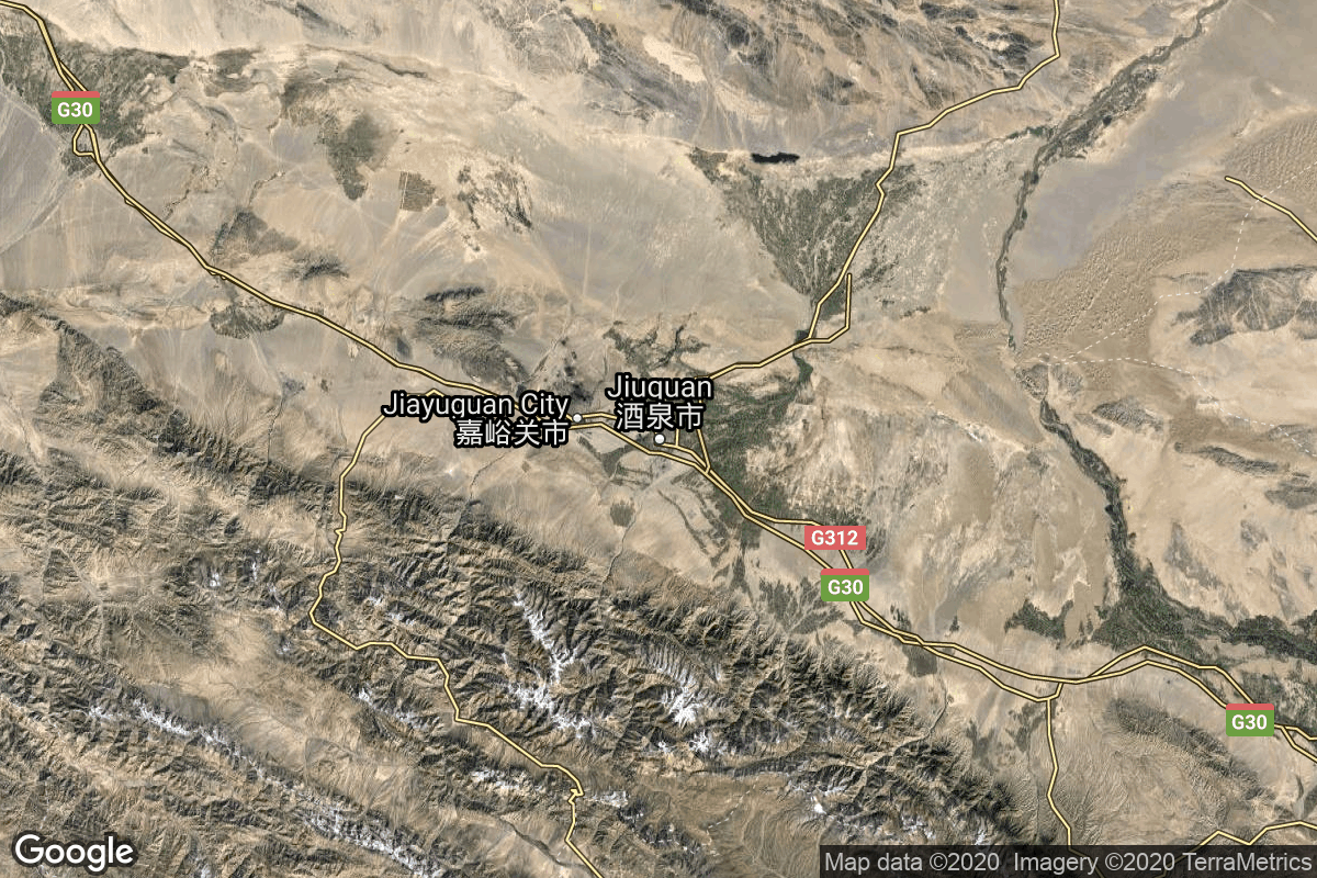
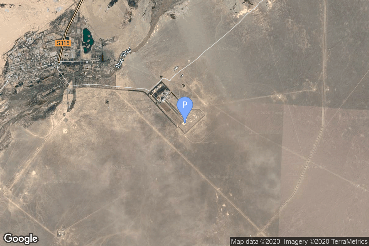
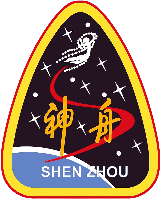
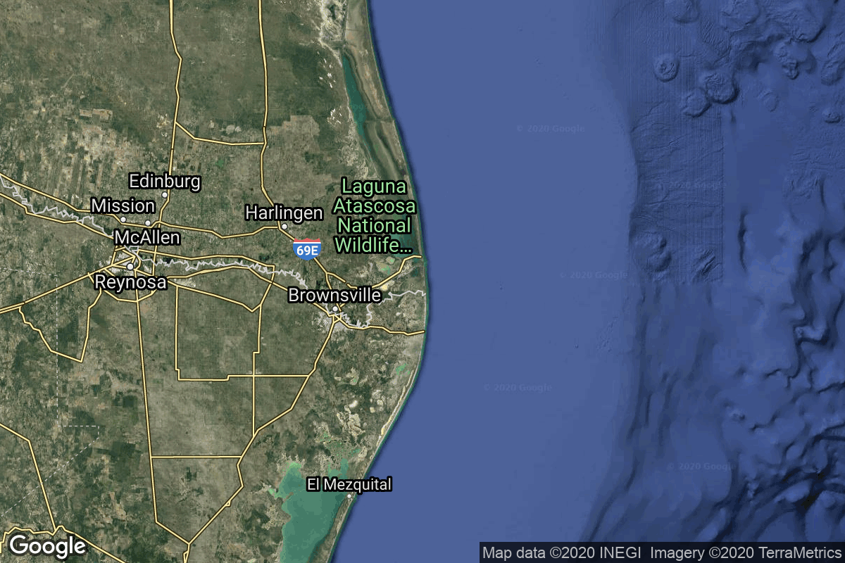
{ "count": 553, "next": "https://lldev.thespacedevs.com/2.2.0/launch/?format=api&limit=10&offset=410", "previous": "https://lldev.thespacedevs.com/2.2.0/launch/?format=api&limit=10&offset=390", "results": [ { "id": "7d77bd89-af23-4a5a-b632-de0034003a64", "url": "https://lldev.thespacedevs.com/2.2.0/launch/7d77bd89-af23-4a5a-b632-de0034003a64/?format=api", "slug": "falcon-9-block-5-rivada-8", "name": "Falcon 9 Block 5 | Rivada 8", "status": { "id": 2, "name": "To Be Determined", "abbrev": "TBD", "description": "Current date is a placeholder or rough estimation based on unreliable or interpreted sources." }, "last_updated": "2023-09-21T20:02:03Z", "net": "2026-06-30T00:00:00Z", "window_end": "2026-06-30T00:00:00Z", "window_start": "2026-06-30T00:00:00Z", "net_precision": { "id": 12, "name": "Year Half 1", "abbrev": "H1", "description": "The T-0 is expected in the first half of the given year." }, "probability": null, "weather_concerns": null, "holdreason": "", "failreason": "", "hashtag": null, "launch_service_provider": { "id": 121, "url": "https://lldev.thespacedevs.com/2.2.0/agencies/121/?format=api", "name": "SpaceX", "type": "Commercial" }, "rocket": { "id": 7806, "configuration": { "id": 164, "url": "https://lldev.thespacedevs.com/2.2.0/config/launcher/164/?format=api", "name": "Falcon 9", "family": "Falcon", "full_name": "Falcon 9 Block 5", "variant": "Block 5" } }, "mission": { "id": 6574, "name": "Rivada 8", "description": "24 satellites for Rivada's internet constellation.", "launch_designator": null, "type": "Communications", "orbit": { "id": 13, "name": "Polar Orbit", "abbrev": "PO" }, "agencies": [ { "id": 1076, "url": "https://lldev.thespacedevs.com/2.2.0/agencies/1076/?format=api", "name": "Rivada Space Networks", "featured": false, "type": "Commercial", "country_code": "DEU", "abbrev": "RivadaSpace", "description": "In March 2022, Rivada announced the formation of Rivada Space Networks GmbH, a wholly owned subsidiary that was land to launch 600 low earth orbit satellites interconnected with laser links to form a single global mesh network in space.", "administrator": "CEO: Declan Ganley", "founding_year": "2022", "launchers": "", "spacecraft": "", "launch_library_url": null, "total_launch_count": 0, "consecutive_successful_launches": 0, "successful_launches": 0, "failed_launches": 0, "pending_launches": 0, "consecutive_successful_landings": 0, "successful_landings": 0, "failed_landings": 0, "attempted_landings": 0, "info_url": "https://rivadaspace.com/", "wiki_url": "https://en.wikipedia.org/wiki/Rivada_Networks", "logo_url": "https://thespacedevs-dev.nyc3.digitaloceanspaces.com/media/images/rivada2520space2520networks_logo_20230921195723.png", "image_url": null, "nation_url": "https://thespacedevs-dev.nyc3.digitaloceanspaces.com/media/images/rivada2520space2520networks_nation_20230921195724.png" } ], "info_urls": [], "vid_urls": [] }, "pad": { "id": 16, "url": "https://lldev.thespacedevs.com/2.2.0/pad/16/?format=api", "agency_id": null, "name": "Space Launch Complex 4E", "description": "Space Launch Complex 4 East (SLC-4E) is a launch site at Vandenberg Space Force Base, California, U.S.\r\n\r\nThe pad was previously used by Atlas and Titan rockets between 1963 and 2005. The pad was built for use by Atlas-Agena rockets, but was later rebuilt to handle Titan rockets.", "info_url": null, "wiki_url": "https://en.wikipedia.org/wiki/Vandenberg_Space_Launch_Complex_4#SLC-4E", "map_url": "https://www.google.com/maps?q=34.632,-120.611", "latitude": "34.632", "longitude": "-120.611", "location": { "id": 11, "url": "https://lldev.thespacedevs.com/2.2.0/location/11/?format=api", "name": "Vandenberg SFB, CA, USA", "country_code": "USA", "description": "Vandenberg Space Force Base is a United States Space Force Base in Santa Barbara County, California. Established in 1941, Vandenberg Space Force Base is a space launch base, launching spacecraft from the Western Range, and also performs missile testing. The United States Space Force's Space Launch Delta 30 serves as the host delta for the base, equivalent to an Air Force air base wing. In addition to its military space launch mission, Vandenberg Space Force Base also hosts space launches for civil and commercial space entities, such as NASA and SpaceX.", "map_image": "https://thespacedevs-dev.nyc3.digitaloceanspaces.com/media/map_images/location_11_20200803142416.jpg", "timezone_name": "America/Los_Angeles", "total_launch_count": 875, "total_landing_count": 33 }, "country_code": "USA", "map_image": "https://thespacedevs-dev.nyc3.digitaloceanspaces.com/media/map_images/pad_16_20200803143532.jpg", "total_launch_count": 259, "orbital_launch_attempt_count": 259 }, "webcast_live": false, "image": "https://thespacedevs-dev.nyc3.digitaloceanspaces.com/media/images/falcon_9_image_20230807133459.jpeg", "infographic": null, "program": [], "orbital_launch_attempt_count": 7313, "location_launch_attempt_count": 894, "pad_launch_attempt_count": 277, "agency_launch_attempt_count": 689, "orbital_launch_attempt_count_year": 140, "location_launch_attempt_count_year": 42, "pad_launch_attempt_count_year": 39, "agency_launch_attempt_count_year": 70, "type": "normal" }, { "id": "5ce7e9b6-b471-4a88-891f-2a6f21cb369f", "url": "https://lldev.thespacedevs.com/2.2.0/launch/5ce7e9b6-b471-4a88-891f-2a6f21cb369f/?format=api", "slug": "falcon-9-block-5-rivada-9", "name": "Falcon 9 Block 5 | Rivada 9", "status": { "id": 2, "name": "To Be Determined", "abbrev": "TBD", "description": "Current date is a placeholder or rough estimation based on unreliable or interpreted sources." }, "last_updated": "2023-09-21T20:02:38Z", "net": "2026-06-30T00:00:00Z", "window_end": "2026-06-30T00:00:00Z", "window_start": "2026-06-30T00:00:00Z", "net_precision": { "id": 12, "name": "Year Half 1", "abbrev": "H1", "description": "The T-0 is expected in the first half of the given year." }, "probability": null, "weather_concerns": null, "holdreason": "", "failreason": "", "hashtag": null, "launch_service_provider": { "id": 121, "url": "https://lldev.thespacedevs.com/2.2.0/agencies/121/?format=api", "name": "SpaceX", "type": "Commercial" }, "rocket": { "id": 7807, "configuration": { "id": 164, "url": "https://lldev.thespacedevs.com/2.2.0/config/launcher/164/?format=api", "name": "Falcon 9", "family": "Falcon", "full_name": "Falcon 9 Block 5", "variant": "Block 5" } }, "mission": { "id": 6575, "name": "Rivada 9", "description": "24 satellites for Rivada's internet constellation.", "launch_designator": null, "type": "Communications", "orbit": { "id": 13, "name": "Polar Orbit", "abbrev": "PO" }, "agencies": [ { "id": 1076, "url": "https://lldev.thespacedevs.com/2.2.0/agencies/1076/?format=api", "name": "Rivada Space Networks", "featured": false, "type": "Commercial", "country_code": "DEU", "abbrev": "RivadaSpace", "description": "In March 2022, Rivada announced the formation of Rivada Space Networks GmbH, a wholly owned subsidiary that was land to launch 600 low earth orbit satellites interconnected with laser links to form a single global mesh network in space.", "administrator": "CEO: Declan Ganley", "founding_year": "2022", "launchers": "", "spacecraft": "", "launch_library_url": null, "total_launch_count": 0, "consecutive_successful_launches": 0, "successful_launches": 0, "failed_launches": 0, "pending_launches": 0, "consecutive_successful_landings": 0, "successful_landings": 0, "failed_landings": 0, "attempted_landings": 0, "info_url": "https://rivadaspace.com/", "wiki_url": "https://en.wikipedia.org/wiki/Rivada_Networks", "logo_url": "https://thespacedevs-dev.nyc3.digitaloceanspaces.com/media/images/rivada2520space2520networks_logo_20230921195723.png", "image_url": null, "nation_url": "https://thespacedevs-dev.nyc3.digitaloceanspaces.com/media/images/rivada2520space2520networks_nation_20230921195724.png" } ], "info_urls": [], "vid_urls": [] }, "pad": { "id": 16, "url": "https://lldev.thespacedevs.com/2.2.0/pad/16/?format=api", "agency_id": null, "name": "Space Launch Complex 4E", "description": "Space Launch Complex 4 East (SLC-4E) is a launch site at Vandenberg Space Force Base, California, U.S.\r\n\r\nThe pad was previously used by Atlas and Titan rockets between 1963 and 2005. The pad was built for use by Atlas-Agena rockets, but was later rebuilt to handle Titan rockets.", "info_url": null, "wiki_url": "https://en.wikipedia.org/wiki/Vandenberg_Space_Launch_Complex_4#SLC-4E", "map_url": "https://www.google.com/maps?q=34.632,-120.611", "latitude": "34.632", "longitude": "-120.611", "location": { "id": 11, "url": "https://lldev.thespacedevs.com/2.2.0/location/11/?format=api", "name": "Vandenberg SFB, CA, USA", "country_code": "USA", "description": "Vandenberg Space Force Base is a United States Space Force Base in Santa Barbara County, California. Established in 1941, Vandenberg Space Force Base is a space launch base, launching spacecraft from the Western Range, and also performs missile testing. The United States Space Force's Space Launch Delta 30 serves as the host delta for the base, equivalent to an Air Force air base wing. In addition to its military space launch mission, Vandenberg Space Force Base also hosts space launches for civil and commercial space entities, such as NASA and SpaceX.", "map_image": "https://thespacedevs-dev.nyc3.digitaloceanspaces.com/media/map_images/location_11_20200803142416.jpg", "timezone_name": "America/Los_Angeles", "total_launch_count": 875, "total_landing_count": 33 }, "country_code": "USA", "map_image": "https://thespacedevs-dev.nyc3.digitaloceanspaces.com/media/map_images/pad_16_20200803143532.jpg", "total_launch_count": 259, "orbital_launch_attempt_count": 259 }, "webcast_live": false, "image": "https://thespacedevs-dev.nyc3.digitaloceanspaces.com/media/images/falcon_9_image_20230807133459.jpeg", "infographic": null, "program": [], "orbital_launch_attempt_count": 7313, "location_launch_attempt_count": 894, "pad_launch_attempt_count": 277, "agency_launch_attempt_count": 689, "orbital_launch_attempt_count_year": 140, "location_launch_attempt_count_year": 42, "pad_launch_attempt_count_year": 39, "agency_launch_attempt_count_year": 70, "type": "normal" }, { "id": "a0e0f590-1cb4-4b6b-845c-0087633af132", "url": "https://lldev.thespacedevs.com/2.2.0/launch/a0e0f590-1cb4-4b6b-845c-0087633af132/?format=api", "slug": "long-march-2fg-shenzhou-23", "name": "Long March 2F/G | Shenzhou 23", "status": { "id": 2, "name": "To Be Determined", "abbrev": "TBD", "description": "Current date is a placeholder or rough estimation based on unreliable or interpreted sources." }, "last_updated": "2026-01-23T08:15:24Z", "net": "2026-06-30T00:00:00Z", "window_end": "2026-06-30T00:00:00Z", "window_start": "2026-06-30T00:00:00Z", "net_precision": { "id": 12, "name": "Year Half 1", "abbrev": "H1", "description": "The T-0 is expected in the first half of the given year." }, "probability": null, "weather_concerns": null, "holdreason": "", "failreason": "", "hashtag": null, "launch_service_provider": { "id": 88, "url": "https://lldev.thespacedevs.com/2.2.0/agencies/88/?format=api", "name": "China Aerospace Science and Technology Corporation", "type": "Government" }, "rocket": { "id": 8900, "configuration": { "id": 84, "url": "https://lldev.thespacedevs.com/2.2.0/config/launcher/84/?format=api", "name": "Long March 2F/G", "family": "Long March", "full_name": "Long March 2F/G", "variant": "F/G" } }, "mission": { "id": 7491, "name": "Shenzhou 23", "description": "Shenzhou 23 will be the 23rd flight of the Shenzhou program.", "launch_designator": null, "type": "Human Exploration", "orbit": { "id": 8, "name": "Low Earth Orbit", "abbrev": "LEO" }, "agencies": [ { "id": 17, "url": "https://lldev.thespacedevs.com/2.2.0/agencies/17/?format=api", "name": "China National Space Administration", "featured": true, "type": "Government", "country_code": "CHN", "abbrev": "CNSA", "description": "The China National Space Administration (CNSA) is the national space agency of the People's Republic of China. It is responsible for the national space program and for planning and development of space activities. CNSA and China Aerospace Corporation (CASC) assumed the authority over space development efforts previously held by the Ministry of Aerospace Industry. The CNSA has many launch sites around China with their orbital sites located in Jiuquan, Xichang, Taiyuan and Wenchang.", "administrator": "Administrator: Tang Dengjie", "founding_year": "1993", "launchers": "", "spacecraft": "Shenzhou", "launch_library_url": null, "total_launch_count": 2, "consecutive_successful_launches": 2, "successful_launches": 2, "failed_launches": 0, "pending_launches": 0, "consecutive_successful_landings": 0, "successful_landings": 0, "failed_landings": 0, "attempted_landings": 0, "info_url": "https://www.cnsa.gov.cn/", "wiki_url": "https://en.wikipedia.org/wiki/China_National_Space_Administration", "logo_url": "https://thespacedevs-dev.nyc3.digitaloceanspaces.com/media/images/china2520national2520space2520administration_logo_20190207032431.png", "image_url": "https://thespacedevs-dev.nyc3.digitaloceanspaces.com/media/images/china2520national2520space2520administration_image_20190207032431.jpeg", "nation_url": "https://thespacedevs-dev.nyc3.digitaloceanspaces.com/media/images/china2520national2520space2520administration_nation_20190602114400.png" } ], "info_urls": [], "vid_urls": [] }, "pad": { "id": 37, "url": "https://lldev.thespacedevs.com/2.2.0/pad/37/?format=api", "agency_id": null, "name": "Launch Area 91 (SLS-1 / 921)", "description": "", "info_url": null, "wiki_url": "https://en.wikipedia.org/wiki/Jiuquan_Launch_Area_4", "map_url": "https://www.google.com/maps?q=40.957893,100.290944", "latitude": "40.957893", "longitude": "100.290944", "location": { "id": 17, "url": "https://lldev.thespacedevs.com/2.2.0/location/17/?format=api", "name": "Jiuquan Satellite Launch Center, People's Republic of China", "country_code": "CHN", "description": "Jiuquan Satellite Launch Center is a Chinese spaceport located between the Ejin, Alxa, Inner Mongolia and Hangtian Town, Jinta County, Jiuquan, Gansu Province. It is part of the Dongfeng Aerospace City (Base 10).", "map_image": "https://thespacedevs-dev.nyc3.digitaloceanspaces.com/media/map_images/location_17_20200803142429.jpg", "timezone_name": "Asia/Shanghai", "total_launch_count": 281, "total_landing_count": 2 }, "country_code": "CHN", "map_image": "https://thespacedevs-dev.nyc3.digitaloceanspaces.com/media/map_images/pad_37_20200803143603.jpg", "total_launch_count": 28, "orbital_launch_attempt_count": 28 }, "webcast_live": false, "image": "https://thespacedevs-dev.nyc3.digitaloceanspaces.com/media/images/shenzhou_22_lau_image_20251129175823.jpg", "infographic": null, "program": [ { "id": 7, "url": "https://lldev.thespacedevs.com/2.2.0/program/7/?format=api", "name": "Shenzhou", "description": "The Shenzhou program is a crewed spaceflight initiative by China. The program put the first Chinese citizen, Yang Liwei, into orbit on 15 October 2003.", "agencies": [ { "id": 17, "url": "https://lldev.thespacedevs.com/2.2.0/agencies/17/?format=api", "name": "China National Space Administration", "type": "Government" } ], "image_url": "https://thespacedevs-dev.nyc3.digitaloceanspaces.com/media/images/shenzhou_program_20200820204745.PNG", "start_date": "1993-01-01T00:00:00Z", "end_date": null, "info_url": null, "wiki_url": "https://en.wikipedia.org/wiki/Shenzhou_program", "mission_patches": [], "type": { "id": 2, "name": "Human Spaceflight" } }, { "id": 19, "url": "https://lldev.thespacedevs.com/2.2.0/program/19/?format=api", "name": "Tiangong space station", "description": "The Tiangong space station is a space station placed in Low Earth orbit between 340 and 450 km above the surface.", "agencies": [ { "id": 88, "url": "https://lldev.thespacedevs.com/2.2.0/agencies/88/?format=api", "name": "China Aerospace Science and Technology Corporation", "type": "Government" } ], "image_url": "https://thespacedevs-dev.nyc3.digitaloceanspaces.com/media/images/chinese2520spa_program_20210608105528.png", "start_date": "2021-04-29T03:23:00Z", "end_date": null, "info_url": null, "wiki_url": "https://en.wikipedia.org/wiki/Tiangong_space_station", "mission_patches": [], "type": { "id": 2, "name": "Human Spaceflight" } } ], "orbital_launch_attempt_count": 7313, "location_launch_attempt_count": 286, "pad_launch_attempt_count": 29, "agency_launch_attempt_count": 589, "orbital_launch_attempt_count_year": 140, "location_launch_attempt_count_year": 13, "pad_launch_attempt_count_year": 2, "agency_launch_attempt_count_year": 19, "type": "normal" }, { "id": "a8d8d683-3ab0-40ab-beb0-e66bb55afd91", "url": "https://lldev.thespacedevs.com/2.2.0/launch/a8d8d683-3ab0-40ab-beb0-e66bb55afd91/?format=api", "slug": "nebula-1-demo-flight", "name": "Nebula-1 | Demo Flight", "status": { "id": 2, "name": "To Be Determined", "abbrev": "TBD", "description": "Current date is a placeholder or rough estimation based on unreliable or interpreted sources." }, "last_updated": "2026-04-05T19:35:40Z", "net": "2026-06-30T00:00:00Z", "window_end": "2026-06-30T00:00:00Z", "window_start": "2026-06-30T00:00:00Z", "net_precision": { "id": 12, "name": "Year Half 1", "abbrev": "H1", "description": "The T-0 is expected in the first half of the given year." }, "probability": null, "weather_concerns": null, "holdreason": "", "failreason": "", "hashtag": null, "launch_service_provider": { "id": 1102, "url": "https://lldev.thespacedevs.com/2.2.0/agencies/1102/?format=api", "name": "Deep Blue Aerospace", "type": "Commercial" }, "rocket": { "id": 8827, "configuration": { "id": 545, "url": "https://lldev.thespacedevs.com/2.2.0/config/launcher/545/?format=api", "name": "Nebula-1", "family": "", "full_name": "Nebula-1", "variant": "" } }, "mission": { "id": 7418, "name": "Demo Flight", "description": "First test launch of Deep Blue Aerospace’s Nebula-1 rocket.\r\n\r\nThe test flight profile is reported to be sub-orbital.", "launch_designator": null, "type": "Test Flight", "orbit": { "id": 15, "name": "Suborbital", "abbrev": "Sub" }, "agencies": [], "info_urls": [], "vid_urls": [] }, "pad": { "id": 252, "url": "https://lldev.thespacedevs.com/2.2.0/pad/252/?format=api", "agency_id": 88, "name": "Land Launch Pad 1", "description": "First land launch pad at the Haiyang Oriental Spaceport, built on the former tourist attraction site of the reclaimed-island Lianli Island. It is described as a \"sea-launch and booster recovery testing launch site\".", "info_url": null, "wiki_url": null, "map_url": "https://www.google.com/maps?q=36.664312,121.188333", "latitude": "36.664312", "longitude": "121.188333", "location": { "id": 185, "url": "https://lldev.thespacedevs.com/2.2.0/location/185/?format=api", "name": "Haiyang Oriental Spaceport", "country_code": "CHN", "description": "Chinese orbital launch vehicle launches supporting sea port located at Haiyang, Shandong Province, with dedicated piers and rocket/payload processing facilities for Chinese launch vehicles’ sea launches, and (as part of its expansion project) land based launch pads on artificial islands for various test vehicles and launch vehicles of private and government launch services providers.\r\n\r\nIn operation as a remote base of Taiyuan Satellite Launch Center since 2019.", "map_image": "https://thespacedevs-dev.nyc3.digitaloceanspaces.com/media/map_images/location_haiyang_oriental_spaceport_20251128181322.jpg", "timezone_name": "Asia/Shanghai", "total_launch_count": 25, "total_landing_count": 0 }, "country_code": "CHN", "map_image": "https://thespacedevs-dev.nyc3.digitaloceanspaces.com/media/map_images/pad_land_launch_pad_1_20260405193202.jpg", "total_launch_count": 0, "orbital_launch_attempt_count": 0 }, "webcast_live": false, "image": null, "infographic": null, "program": [], "orbital_launch_attempt_count": null, "location_launch_attempt_count": 26, "pad_launch_attempt_count": 1, "agency_launch_attempt_count": 1, "orbital_launch_attempt_count_year": null, "location_launch_attempt_count_year": 5, "pad_launch_attempt_count_year": 1, "agency_launch_attempt_count_year": 1, "type": "normal" }, { "id": "ac897b9f-44d2-4ff4-8416-1a0a076e98a2", "url": "https://lldev.thespacedevs.com/2.2.0/launch/ac897b9f-44d2-4ff4-8416-1a0a076e98a2/?format=api", "slug": "starship-flight-13", "name": "Starship | Flight 13", "status": { "id": 2, "name": "To Be Determined", "abbrev": "TBD", "description": "Current date is a placeholder or rough estimation based on unreliable or interpreted sources." }, "last_updated": "2026-01-09T09:59:47Z", "net": "2026-06-30T00:00:00Z", "window_end": "2026-06-30T00:00:00Z", "window_start": "2026-06-30T00:00:00Z", "net_precision": { "id": 12, "name": "Year Half 1", "abbrev": "H1", "description": "The T-0 is expected in the first half of the given year." }, "probability": null, "weather_concerns": null, "holdreason": "", "failreason": "", "hashtag": null, "launch_service_provider": { "id": 121, "url": "https://lldev.thespacedevs.com/2.2.0/agencies/121/?format=api", "name": "SpaceX", "type": "Commercial" }, "rocket": { "id": 8879, "configuration": { "id": 522, "url": "https://lldev.thespacedevs.com/2.2.0/config/launcher/522/?format=api", "name": "Starship", "family": "Starship", "full_name": "Starship V3", "variant": "V3" } }, "mission": { "id": 7470, "name": "Flight 13", "description": "13th test flight of the two-stage Starship launch vehicle. Second flight of Starship V3", "launch_designator": null, "type": "Test Flight", "orbit": { "id": 15, "name": "Suborbital", "abbrev": "Sub" }, "agencies": [ { "id": 121, "url": "https://lldev.thespacedevs.com/2.2.0/agencies/121/?format=api", "name": "SpaceX", "featured": true, "type": "Commercial", "country_code": "USA", "abbrev": "SpX", "description": "Space Exploration Technologies Corp., known as SpaceX, is an American aerospace manufacturer and space transport services company headquartered in Hawthorne, California. It was founded in 2002 by entrepreneur Elon Musk with the goal of reducing space transportation costs and enabling the colonization of Mars. SpaceX operates from many pads, on the East Coast of the US they operate from SLC-40 at Cape Canaveral Space Force Station and historic LC-39A at Kennedy Space Center. They also operate from SLC-4E at Vandenberg Space Force Base, California, usually for polar launches. Another launch site is being developed at Boca Chica, Texas.", "administrator": "CEO: Elon Musk", "founding_year": "2002", "launchers": "Falcon | Starship", "spacecraft": "Dragon", "launch_library_url": null, "total_launch_count": 663, "consecutive_successful_launches": 148, "successful_launches": 648, "failed_launches": 15, "pending_launches": 122, "consecutive_successful_landings": 147, "successful_landings": 608, "failed_landings": 27, "attempted_landings": 634, "info_url": "https://www.spacex.com/", "wiki_url": "https://en.wikipedia.org/wiki/SpaceX", "logo_url": "https://thespacedevs-dev.nyc3.digitaloceanspaces.com/media/images/spacex_logo_20220826094919.png", "image_url": "https://thespacedevs-dev.nyc3.digitaloceanspaces.com/media/images/falcon_9_image_20230807133459.jpeg", "nation_url": "https://thespacedevs-dev.nyc3.digitaloceanspaces.com/media/images/spacex_social_l_image_20260407054626.jpg" } ], "info_urls": [], "vid_urls": [] }, "pad": { "id": 235, "url": "https://lldev.thespacedevs.com/2.2.0/pad/235/?format=api", "agency_id": 121, "name": "Orbital Launch Pad 2", "description": "The second launch and landing pad of the full version of the combined SpaceX Starship and Superheavy booster. To be first used for launch in 2025 with version 3 of Starship and the Superheavy booster.\r\n\r\nThe launch mount itself is named Orbital Launch Mount B.", "info_url": null, "wiki_url": "https://en.wikipedia.org/wiki/SpaceX_Starbase#Launch_site_(Orbital_Launch_Mount_(Pad_1_and_2))", "map_url": "https://www.google.com/maps?q=25.996603,-97.158251", "latitude": "25.996603", "longitude": "-97.158251", "location": { "id": 143, "url": "https://lldev.thespacedevs.com/2.2.0/location/143/?format=api", "name": "SpaceX Starbase, TX, USA", "country_code": "USA", "description": "Starbase is an industrial complex for Starship rockets and the headquarters of the American aerospace manufacturer company SpaceX. Located near Brownsville, Texas, United States, it has been under construction since the late 2010s by SpaceX. Starbase is composed of a spaceport near the Gulf of Mexico, a production facility at the Boca Chica village, and a small structure test site along the Texas State Highway 4.", "map_image": "https://thespacedevs-dev.nyc3.digitaloceanspaces.com/media/map_images/location_143_20200803142438.jpg", "timezone_name": "America/Chicago", "total_launch_count": 20, "total_landing_count": 13 }, "country_code": "USA", "map_image": "https://thespacedevs-dev.nyc3.digitaloceanspaces.com/media/map_images/pad_orbital_launch_mount_b_20241126031254.jpg", "total_launch_count": 0, "orbital_launch_attempt_count": 0 }, "webcast_live": false, "image": "https://thespacedevs-dev.nyc3.digitaloceanspaces.com/media/images/starship_on_the_image_20250111100520.jpg", "infographic": null, "program": [ { "id": 1, "url": "https://lldev.thespacedevs.com/2.2.0/program/1/?format=api", "name": "SpaceX Starship", "description": "The SpaceX Starship is a fully reusable super heavy-lift launch vehicle under development by SpaceX since 2012, as a self-funded private spaceflight project. The second stage of the Starship — is designed as a long-duration cargo and passenger-carrying spacecraft. It is expected to be initially used without any booster stage at all, as part of an extensive development program to prove out launch-and-landing and iterate on a variety of design details, particularly with respect to the vehicle's atmospheric reentry.", "agencies": [ { "id": 121, "url": "https://lldev.thespacedevs.com/2.2.0/agencies/121/?format=api", "name": "SpaceX", "type": "Commercial" } ], "image_url": "https://thespacedevs-dev.nyc3.digitaloceanspaces.com/media/images/starship_on_the_image_20250111100520.jpg", "start_date": "2019-03-01T05:00:00Z", "end_date": null, "info_url": "https://www.spacex.com/vehicles/starship/", "wiki_url": "https://en.wikipedia.org/wiki/SpaceX_Starship", "mission_patches": [], "type": { "id": 7, "name": "Technology" } } ], "orbital_launch_attempt_count": null, "location_launch_attempt_count": 22, "pad_launch_attempt_count": 2, "agency_launch_attempt_count": 689, "orbital_launch_attempt_count_year": null, "location_launch_attempt_count_year": 2, "pad_launch_attempt_count_year": 2, "agency_launch_attempt_count_year": 70, "type": "normal" }, { "id": "a556b963-0f36-4660-95a8-fdffdba653e2", "url": "https://lldev.thespacedevs.com/2.2.0/launch/a556b963-0f36-4660-95a8-fdffdba653e2/?format=api", "slug": "soyuz-21a-soyuz-ms-29", "name": "Soyuz 2.1a | Soyuz MS-29", "status": { "id": 8, "name": "To Be Confirmed", "abbrev": "TBC", "description": "Awaiting official confirmation - current date is known with some certainty." }, "last_updated": "2025-12-20T03:43:12Z", "net": "2026-07-14T14:43:00Z", "window_end": "2026-07-14T14:43:00Z", "window_start": "2026-07-14T14:43:00Z", "net_precision": { "id": 1, "name": "Minute", "abbrev": "MIN", "description": "The T-0 is accurate to the minute." }, "probability": null, "weather_concerns": null, "holdreason": "", "failreason": "", "hashtag": null, "launch_service_provider": { "id": 63, "url": "https://lldev.thespacedevs.com/2.2.0/agencies/63/?format=api", "name": "Russian Federal Space Agency (ROSCOSMOS)", "type": "Government" }, "rocket": { "id": 8653, "configuration": { "id": 24, "url": "https://lldev.thespacedevs.com/2.2.0/config/launcher/24/?format=api", "name": "Soyuz 2.1a", "family": "Soyuz", "full_name": "Soyuz 2.1a", "variant": "" } }, "mission": { "id": 7245, "name": "Soyuz MS-29", "description": "Soyuz MS-29 will carry three cosmonauts and one astronaut to the International Space Station aboard the Soyuz spacecraft from the Baikonur Cosmodrome in Kazakhstan. The crew consists of Roscosmos cosmonauts Pyotr Dubrov and Anna Kikina, as well as NASA astronaut Anil Menon.", "launch_designator": null, "type": "Human Exploration", "orbit": { "id": 8, "name": "Low Earth Orbit", "abbrev": "LEO" }, "agencies": [ { "id": 44, "url": "https://lldev.thespacedevs.com/2.2.0/agencies/44/?format=api", "name": "National Aeronautics and Space Administration", "featured": true, "type": "Government", "country_code": "USA", "abbrev": "NASA", "description": "The National Aeronautics and Space Administration is an independent agency of the executive branch of the United States federal government responsible for the civilian space program, as well as aeronautics and aerospace research. NASA have many launch facilities but most are inactive. The most commonly used pad will be LC-39B at Kennedy Space Center in Florida.", "administrator": "Administrator: Jared Isaacman", "founding_year": "1958", "launchers": "Space Shuttle | SLS", "spacecraft": "Orion", "launch_library_url": null, "total_launch_count": 142, "consecutive_successful_launches": 12, "successful_launches": 122, "failed_launches": 20, "pending_launches": 5, "consecutive_successful_landings": 0, "successful_landings": 0, "failed_landings": 0, "attempted_landings": 0, "info_url": "https://www.nasa.gov", "wiki_url": "https://en.wikipedia.org/wiki/National_Aeronautics_and_Space_Administration", "logo_url": "https://thespacedevs-dev.nyc3.digitaloceanspaces.com/media/images/national2520aeronautics2520and2520space2520administration_logo_20190207032448.png", "image_url": "https://thespacedevs-dev.nyc3.digitaloceanspaces.com/media/images/national2520aeronautics2520and2520space2520administration_image_20190207032448.jpeg", "nation_url": "https://thespacedevs-dev.nyc3.digitaloceanspaces.com/media/images/national2520aeronautics2520and2520space2520administration_nation_20230803040809.jpg" }, { "id": 63, "url": "https://lldev.thespacedevs.com/2.2.0/agencies/63/?format=api", "name": "Russian Federal Space Agency (ROSCOSMOS)", "featured": true, "type": "Government", "country_code": "RUS", "abbrev": "RFSA", "description": "The Roscosmos State Corporation for Space Activities, commonly known as Roscosmos, is the governmental body responsible for the space science program of the Russian Federation and general aerospace research. Soyuz has many launch locations the Russian sites are Baikonur, Plesetsk and Vostochny however Ariane also purchases the vehicle and launches it from French Guiana.", "administrator": "Administrator: Yuri Borisov", "founding_year": "1992", "launchers": "Soyuz", "spacecraft": "Soyuz", "launch_library_url": null, "total_launch_count": 340, "consecutive_successful_launches": 64, "successful_launches": 329, "failed_launches": 11, "pending_launches": 3, "consecutive_successful_landings": 0, "successful_landings": 0, "failed_landings": 0, "attempted_landings": 0, "info_url": "https://en.roscosmos.ru/", "wiki_url": "https://en.wikipedia.org/wiki/Russian_Federal_Space_Agency", "logo_url": "https://thespacedevs-dev.nyc3.digitaloceanspaces.com/media/images/russian2520federal2520space2520agency25202528roscosmos2529_logo_20190207032459.png", "image_url": "https://thespacedevs-dev.nyc3.digitaloceanspaces.com/media/images/russian2520federal2520space2520agency25202528roscosmos2529_image_20190207032459.jpeg", "nation_url": "https://thespacedevs-dev.nyc3.digitaloceanspaces.com/media/images/russian2520federal2520space2520agency25202528roscosmos2529_nation_20230531052758.jpg" } ], "info_urls": [], "vid_urls": [] }, "pad": { "id": 20, "url": "https://lldev.thespacedevs.com/2.2.0/pad/20/?format=api", "agency_id": null, "name": "31/6", "description": "", "info_url": null, "wiki_url": "https://en.wikipedia.org/wiki/Baikonur_Cosmodrome_Site_31", "map_url": "https://www.google.com/maps?q=45.996034,63.564003", "latitude": "45.996034", "longitude": "63.564003", "location": { "id": 15, "url": "https://lldev.thespacedevs.com/2.2.0/location/15/?format=api", "name": "Baikonur Cosmodrome, Republic of Kazakhstan", "country_code": "KAZ", "description": "The Baikonur Cosmodrome is a spaceport operated by Russia within Kazakhstan. Located in the Kazakh city of Baikonur, it is the largest operational space launch facility in terms of area. All Russian crewed spaceflights are launched from Baikonur.", "map_image": "https://thespacedevs-dev.nyc3.digitaloceanspaces.com/media/map_images/location_15_20200803142517.jpg", "timezone_name": "Asia/Qyzylorda", "total_launch_count": 1561, "total_landing_count": 0 }, "country_code": "KAZ", "map_image": "https://thespacedevs-dev.nyc3.digitaloceanspaces.com/media/map_images/pad_20_20200803143516.jpg", "total_launch_count": 427, "orbital_launch_attempt_count": 427 }, "webcast_live": false, "image": "https://thespacedevs-dev.nyc3.digitaloceanspaces.com/media/images/soyuz_2.1a_image_20230805184309.jpg", "infographic": null, "program": [ { "id": 8, "url": "https://lldev.thespacedevs.com/2.2.0/program/8/?format=api", "name": "Soyuz", "description": "The Soyuz programme is a human spaceflight programme initiated by the Soviet Union in the early 1960s. The Soyuz spacecraft was originally part of a Moon landing project intended to put a Soviet cosmonaut on the Moon. It was the third Soviet human spaceflight programme after the Vostok and Voskhod programmes.", "agencies": [ { "id": 63, "url": "https://lldev.thespacedevs.com/2.2.0/agencies/63/?format=api", "name": "Russian Federal Space Agency (ROSCOSMOS)", "type": "Government" }, { "id": 66, "url": "https://lldev.thespacedevs.com/2.2.0/agencies/66/?format=api", "name": "Soviet Space Program", "type": "Government" } ], "image_url": "https://thespacedevs-dev.nyc3.digitaloceanspaces.com/media/images/soyuz_program_20201129185543.png", "start_date": "1966-11-28T11:02:00Z", "end_date": null, "info_url": null, "wiki_url": "https://en.wikipedia.org/wiki/Soyuz_programme", "mission_patches": [], "type": { "id": 2, "name": "Human Spaceflight" } }, { "id": 17, "url": "https://lldev.thespacedevs.com/2.2.0/program/17/?format=api", "name": "International Space Station", "description": "The International Space Station programme is tied together by a complex set of legal, political and financial agreements between the sixteen nations involved in the project, governing ownership of the various components, rights to crewing and utilization, and responsibilities for crew rotation and resupply of the International Space Station. It was conceived in 1984 by President Ronald Reagan, during the Space Station Freedom project as it was originally called.", "agencies": [ { "id": 16, "url": "https://lldev.thespacedevs.com/2.2.0/agencies/16/?format=api", "name": "Canadian Space Agency", "type": "Government" }, { "id": 27, "url": "https://lldev.thespacedevs.com/2.2.0/agencies/27/?format=api", "name": "European Space Agency", "type": "Multinational" }, { "id": 37, "url": "https://lldev.thespacedevs.com/2.2.0/agencies/37/?format=api", "name": "Japan Aerospace Exploration Agency", "type": "Government" }, { "id": 44, "url": "https://lldev.thespacedevs.com/2.2.0/agencies/44/?format=api", "name": "National Aeronautics and Space Administration", "type": "Government" }, { "id": 63, "url": "https://lldev.thespacedevs.com/2.2.0/agencies/63/?format=api", "name": "Russian Federal Space Agency (ROSCOSMOS)", "type": "Government" } ], "image_url": "https://thespacedevs-dev.nyc3.digitaloceanspaces.com/media/images/international2_program_20201129184745.png", "start_date": "1998-11-20T06:40:00Z", "end_date": null, "info_url": "https://www.nasa.gov/mission_pages/station/main/index.html", "wiki_url": "https://en.wikipedia.org/wiki/International_Space_Station_programme", "mission_patches": [], "type": { "id": 2, "name": "Human Spaceflight" } } ], "orbital_launch_attempt_count": 7314, "location_launch_attempt_count": 1565, "pad_launch_attempt_count": 430, "agency_launch_attempt_count": 344, "orbital_launch_attempt_count_year": 141, "location_launch_attempt_count_year": 6, "pad_launch_attempt_count_year": 4, "agency_launch_attempt_count_year": 6, "type": "normal" }, { "id": "add0a5be-1cf0-49cb-975a-e8c8e18d37ec", "url": "https://lldev.thespacedevs.com/2.2.0/launch/add0a5be-1cf0-49cb-975a-e8c8e18d37ec/?format=api", "slug": "electron-strix-launch-10", "name": "Electron | StriX Launch 10", "status": { "id": 2, "name": "To Be Determined", "abbrev": "TBD", "description": "Current date is a placeholder or rough estimation based on unreliable or interpreted sources." }, "last_updated": "2026-03-27T00:30:51Z", "net": "2026-07-31T00:00:00Z", "window_end": "2026-07-31T00:00:00Z", "window_start": "2026-07-31T00:00:00Z", "net_precision": { "id": 7, "name": "Month", "abbrev": "M", "description": "The T-0 is expected in the given month." }, "probability": null, "weather_concerns": null, "holdreason": "", "failreason": "", "hashtag": null, "launch_service_provider": { "id": 147, "url": "https://lldev.thespacedevs.com/2.2.0/agencies/147/?format=api", "name": "Rocket Lab", "type": "Commercial" }, "rocket": { "id": 8266, "configuration": { "id": 26, "url": "https://lldev.thespacedevs.com/2.2.0/config/launcher/26/?format=api", "name": "Electron", "family": "", "full_name": "Electron", "variant": "" } }, "mission": { "id": 6847, "name": "StriX Launch 10", "description": "Synthetic aperture radar satellite for Japanese Earth imaging company Synspective.", "launch_designator": null, "type": "Earth Science", "orbit": { "id": 17, "name": "Sun-Synchronous Orbit", "abbrev": "SSO" }, "agencies": [ { "id": 1071, "url": "https://lldev.thespacedevs.com/2.2.0/agencies/1071/?format=api", "name": "Synspective", "featured": false, "type": "Private", "country_code": "JPN", "abbrev": "", "description": "Synspective was established with the aim to integrate SAR satellite technology in society through the agility of a start-up company. Synspective derives its name from the company concept of “Synthetic Data for Perspective on Sustainable Development.", "administrator": "CEO: Dr. Motoyuki Arai", "founding_year": "2018", "launchers": "", "spacecraft": "", "launch_library_url": null, "total_launch_count": 0, "consecutive_successful_launches": 0, "successful_launches": 0, "failed_launches": 0, "pending_launches": 0, "consecutive_successful_landings": 0, "successful_landings": 0, "failed_landings": 0, "attempted_landings": 0, "info_url": "https://synspective.com/", "wiki_url": null, "logo_url": "https://thespacedevs-dev.nyc3.digitaloceanspaces.com/media/images/synspective_log_image_20240325082018.png", "image_url": null, "nation_url": "https://thespacedevs-dev.nyc3.digitaloceanspaces.com/media/images/synspective_nation_20240228091738.jpg" } ], "info_urls": [], "vid_urls": [] }, "pad": { "id": 210, "url": "https://lldev.thespacedevs.com/2.2.0/pad/210/?format=api", "agency_id": null, "name": "Unknown Pad", "description": null, "info_url": null, "wiki_url": null, "map_url": null, "latitude": "-39.260881", "longitude": "177.865826", "location": { "id": 10, "url": "https://lldev.thespacedevs.com/2.2.0/location/10/?format=api", "name": "Rocket Lab Launch Complex 1, Mahia Peninsula, New Zealand", "country_code": "NZL", "description": "Rocket Lab Launch Complex 1 is a commercial spaceport located close to Ahuriri Point at the southern tip of Māhia Peninsula, on the east coast of New Zealand's North Island. It is owned and operated by private spaceflight company Rocket Lab and supports launches of the company's Electron rocket for small satellites. With the launch of Electron on 25 May 2017, it became the first private spaceport to host an orbital launch attempt, and the first site in New Zealand to host an orbital launch attempt. With the Electron launch of 21 January 2018, it became the first private spaceport to host a successful orbital launch.", "map_image": "https://thespacedevs-dev.nyc3.digitaloceanspaces.com/media/map_images/location_10_20200803142509.jpg", "timezone_name": "Pacific/Auckland", "total_launch_count": 74, "total_landing_count": 17 }, "country_code": "NZL", "map_image": "https://thespacedevs-dev.nyc3.digitaloceanspaces.com/media/map_images/pad_210_20230819165718.jpg", "total_launch_count": 0, "orbital_launch_attempt_count": 0 }, "webcast_live": false, "image": "https://thespacedevs-dev.nyc3.digitaloceanspaces.com/media/images/electron_image_20190705175640.jpeg", "infographic": null, "program": [], "orbital_launch_attempt_count": 7316, "location_launch_attempt_count": 80, "pad_launch_attempt_count": 6, "agency_launch_attempt_count": 91, "orbital_launch_attempt_count_year": 143, "location_launch_attempt_count_year": 11, "pad_launch_attempt_count_year": 6, "agency_launch_attempt_count_year": 12, "type": "normal" }, { "id": "a2234679-5efe-4a00-9aff-cf82dbac22b0", "url": "https://lldev.thespacedevs.com/2.2.0/launch/a2234679-5efe-4a00-9aff-cf82dbac22b0/?format=api", "slug": "h3-24-htv-x2", "name": "H3-24 | HTV-X2", "status": { "id": 2, "name": "To Be Determined", "abbrev": "TBD", "description": "Current date is a placeholder or rough estimation based on unreliable or interpreted sources." }, "last_updated": "2026-02-24T21:52:06Z", "net": "2026-07-31T00:00:00Z", "window_end": "2026-07-31T00:00:00Z", "window_start": "2026-07-31T00:00:00Z", "net_precision": { "id": 7, "name": "Month", "abbrev": "M", "description": "The T-0 is expected in the given month." }, "probability": null, "weather_concerns": null, "holdreason": "", "failreason": "", "hashtag": null, "launch_service_provider": { "id": 98, "url": "https://lldev.thespacedevs.com/2.2.0/agencies/98/?format=api", "name": "Mitsubishi Heavy Industries", "type": "Commercial" }, "rocket": { "id": 7771, "configuration": { "id": 204, "url": "https://lldev.thespacedevs.com/2.2.0/config/launcher/204/?format=api", "name": "H3-24", "family": "H3", "full_name": "H3-24", "variant": "24" } }, "mission": { "id": 6289, "name": "HTV-X2", "description": "Second flight of the upgraded Japanese HTV-X spacecraft designed to resupply the International Space Station.", "launch_designator": null, "type": "Resupply", "orbit": { "id": 8, "name": "Low Earth Orbit", "abbrev": "LEO" }, "agencies": [], "info_urls": [], "vid_urls": [] }, "pad": { "id": 209, "url": "https://lldev.thespacedevs.com/2.2.0/pad/209/?format=api", "agency_id": 37, "name": "Yoshinobu Launch Complex LP-2", "description": "", "info_url": null, "wiki_url": "https://en.wikipedia.org/wiki/Yoshinobu_Launch_Complex", "map_url": "https://www.google.com/maps?q=30.400938,130.97564", "latitude": "30.400938", "longitude": "130.97564", "location": { "id": 26, "url": "https://lldev.thespacedevs.com/2.2.0/location/26/?format=api", "name": "Tanegashima Space Center, Japan", "country_code": "JPN", "description": "The Tanegashima Space Center is the largest rocket-launch complex in Japan. It is located on the southeastern tip of Tanegashima, an island located south of Kyushu, an island and region and Japan. It was established in 1969 when the National Space Development Agency of Japan (NASDA) was formed, and is now run by JAXA. The activities that take place at TNSC include assembly, testing, launching, and tracking satellites, as well as rocket engine firing tests.", "map_image": "https://thespacedevs-dev.nyc3.digitaloceanspaces.com/media/map_images/location_26_20200803142507.jpg", "timezone_name": "Asia/Tokyo", "total_launch_count": 97, "total_landing_count": 0 }, "country_code": "JPN", "map_image": "https://thespacedevs-dev.nyc3.digitaloceanspaces.com/media/map_images/pad_yoshinobu_launch_complex_lp-2_20230707124715.jpg", "total_launch_count": 16, "orbital_launch_attempt_count": 16 }, "webcast_live": false, "image": "https://thespacedevs-dev.nyc3.digitaloceanspaces.com/media/images/h3-24_liftoff__image_20251028184029.jpeg", "infographic": null, "program": [ { "id": 17, "url": "https://lldev.thespacedevs.com/2.2.0/program/17/?format=api", "name": "International Space Station", "description": "The International Space Station programme is tied together by a complex set of legal, political and financial agreements between the sixteen nations involved in the project, governing ownership of the various components, rights to crewing and utilization, and responsibilities for crew rotation and resupply of the International Space Station. It was conceived in 1984 by President Ronald Reagan, during the Space Station Freedom project as it was originally called.", "agencies": [ { "id": 16, "url": "https://lldev.thespacedevs.com/2.2.0/agencies/16/?format=api", "name": "Canadian Space Agency", "type": "Government" }, { "id": 27, "url": "https://lldev.thespacedevs.com/2.2.0/agencies/27/?format=api", "name": "European Space Agency", "type": "Multinational" }, { "id": 37, "url": "https://lldev.thespacedevs.com/2.2.0/agencies/37/?format=api", "name": "Japan Aerospace Exploration Agency", "type": "Government" }, { "id": 44, "url": "https://lldev.thespacedevs.com/2.2.0/agencies/44/?format=api", "name": "National Aeronautics and Space Administration", "type": "Government" }, { "id": 63, "url": "https://lldev.thespacedevs.com/2.2.0/agencies/63/?format=api", "name": "Russian Federal Space Agency (ROSCOSMOS)", "type": "Government" } ], "image_url": "https://thespacedevs-dev.nyc3.digitaloceanspaces.com/media/images/international2_program_20201129184745.png", "start_date": "1998-11-20T06:40:00Z", "end_date": null, "info_url": "https://www.nasa.gov/mission_pages/station/main/index.html", "wiki_url": "https://en.wikipedia.org/wiki/International_Space_Station_programme", "mission_patches": [], "type": { "id": 2, "name": "Human Spaceflight" } } ], "orbital_launch_attempt_count": 7316, "location_launch_attempt_count": 99, "pad_launch_attempt_count": 18, "agency_launch_attempt_count": 58, "orbital_launch_attempt_count_year": 143, "location_launch_attempt_count_year": 2, "pad_launch_attempt_count_year": 2, "agency_launch_attempt_count_year": 2, "type": "normal" }, { "id": "0d6ad64c-3aed-4041-b095-e1d951bc6d29", "url": "https://lldev.thespacedevs.com/2.2.0/launch/0d6ad64c-3aed-4041-b095-e1d951bc6d29/?format=api", "slug": "electron-aspera", "name": "Electron | Aspera", "status": { "id": 2, "name": "To Be Determined", "abbrev": "TBD", "description": "Current date is a placeholder or rough estimation based on unreliable or interpreted sources." }, "last_updated": "2025-11-06T12:21:40Z", "net": "2026-08-15T00:00:00Z", "window_end": "2026-08-15T00:00:00Z", "window_start": "2026-08-15T00:00:00Z", "net_precision": { "id": 5, "name": "Day", "abbrev": "DAY", "description": "The T-0 is expected on the given day." }, "probability": null, "weather_concerns": null, "holdreason": "", "failreason": "", "hashtag": null, "launch_service_provider": { "id": 147, "url": "https://lldev.thespacedevs.com/2.2.0/agencies/147/?format=api", "name": "Rocket Lab", "type": "Commercial" }, "rocket": { "id": 8615, "configuration": { "id": 26, "url": "https://lldev.thespacedevs.com/2.2.0/config/launcher/26/?format=api", "name": "Electron", "family": "", "full_name": "Electron", "variant": "" } }, "mission": { "id": 7207, "name": "Aspera", "description": "Aspera houses an ultraviolet telescope and will examine hot gas in the intergalactic medium, thought to be contributing to the birth of stars and planets. Aspera will be the first NASA astrophysics mission to gather and map these ultraviolet light signatures, potentially unlocking a deeper understanding of the origins of stars, planets, and life in the universe.", "launch_designator": null, "type": "Astrophysics", "orbit": { "id": 8, "name": "Low Earth Orbit", "abbrev": "LEO" }, "agencies": [ { "id": 44, "url": "https://lldev.thespacedevs.com/2.2.0/agencies/44/?format=api", "name": "National Aeronautics and Space Administration", "featured": true, "type": "Government", "country_code": "USA", "abbrev": "NASA", "description": "The National Aeronautics and Space Administration is an independent agency of the executive branch of the United States federal government responsible for the civilian space program, as well as aeronautics and aerospace research. NASA have many launch facilities but most are inactive. The most commonly used pad will be LC-39B at Kennedy Space Center in Florida.", "administrator": "Administrator: Jared Isaacman", "founding_year": "1958", "launchers": "Space Shuttle | SLS", "spacecraft": "Orion", "launch_library_url": null, "total_launch_count": 142, "consecutive_successful_launches": 12, "successful_launches": 122, "failed_launches": 20, "pending_launches": 5, "consecutive_successful_landings": 0, "successful_landings": 0, "failed_landings": 0, "attempted_landings": 0, "info_url": "https://www.nasa.gov", "wiki_url": "https://en.wikipedia.org/wiki/National_Aeronautics_and_Space_Administration", "logo_url": "https://thespacedevs-dev.nyc3.digitaloceanspaces.com/media/images/national2520aeronautics2520and2520space2520administration_logo_20190207032448.png", "image_url": "https://thespacedevs-dev.nyc3.digitaloceanspaces.com/media/images/national2520aeronautics2520and2520space2520administration_image_20190207032448.jpeg", "nation_url": "https://thespacedevs-dev.nyc3.digitaloceanspaces.com/media/images/national2520aeronautics2520and2520space2520administration_nation_20230803040809.jpg" } ], "info_urls": [], "vid_urls": [] }, "pad": { "id": 210, "url": "https://lldev.thespacedevs.com/2.2.0/pad/210/?format=api", "agency_id": null, "name": "Unknown Pad", "description": null, "info_url": null, "wiki_url": null, "map_url": null, "latitude": "-39.260881", "longitude": "177.865826", "location": { "id": 10, "url": "https://lldev.thespacedevs.com/2.2.0/location/10/?format=api", "name": "Rocket Lab Launch Complex 1, Mahia Peninsula, New Zealand", "country_code": "NZL", "description": "Rocket Lab Launch Complex 1 is a commercial spaceport located close to Ahuriri Point at the southern tip of Māhia Peninsula, on the east coast of New Zealand's North Island. It is owned and operated by private spaceflight company Rocket Lab and supports launches of the company's Electron rocket for small satellites. With the launch of Electron on 25 May 2017, it became the first private spaceport to host an orbital launch attempt, and the first site in New Zealand to host an orbital launch attempt. With the Electron launch of 21 January 2018, it became the first private spaceport to host a successful orbital launch.", "map_image": "https://thespacedevs-dev.nyc3.digitaloceanspaces.com/media/map_images/location_10_20200803142509.jpg", "timezone_name": "Pacific/Auckland", "total_launch_count": 74, "total_landing_count": 17 }, "country_code": "NZL", "map_image": "https://thespacedevs-dev.nyc3.digitaloceanspaces.com/media/map_images/pad_210_20230819165718.jpg", "total_launch_count": 0, "orbital_launch_attempt_count": 0 }, "webcast_live": false, "image": "https://thespacedevs-dev.nyc3.digitaloceanspaces.com/media/images/electron_image_20190705175640.jpeg", "infographic": null, "program": [], "orbital_launch_attempt_count": 7317, "location_launch_attempt_count": 81, "pad_launch_attempt_count": 7, "agency_launch_attempt_count": 92, "orbital_launch_attempt_count_year": 144, "location_launch_attempt_count_year": 12, "pad_launch_attempt_count_year": 7, "agency_launch_attempt_count_year": 13, "type": "normal" }, { "id": "9f5a4cb6-63f9-47e1-9512-b468bae2a8e6", "url": "https://lldev.thespacedevs.com/2.2.0/launch/9f5a4cb6-63f9-47e1-9512-b468bae2a8e6/?format=api", "slug": "electron-strix-launch-11", "name": "Electron | StriX Launch 11", "status": { "id": 2, "name": "To Be Determined", "abbrev": "TBD", "description": "Current date is a placeholder or rough estimation based on unreliable or interpreted sources." }, "last_updated": "2026-03-27T00:31:50Z", "net": "2026-08-31T00:00:00Z", "window_end": "2026-08-31T00:00:00Z", "window_start": "2026-08-31T00:00:00Z", "net_precision": { "id": 7, "name": "Month", "abbrev": "M", "description": "The T-0 is expected in the given month." }, "probability": null, "weather_concerns": null, "holdreason": "", "failreason": "", "hashtag": null, "launch_service_provider": { "id": 147, "url": "https://lldev.thespacedevs.com/2.2.0/agencies/147/?format=api", "name": "Rocket Lab", "type": "Commercial" }, "rocket": { "id": 8267, "configuration": { "id": 26, "url": "https://lldev.thespacedevs.com/2.2.0/config/launcher/26/?format=api", "name": "Electron", "family": "", "full_name": "Electron", "variant": "" } }, "mission": { "id": 6848, "name": "StriX Launch 11", "description": "Synthetic aperture radar satellite for Japanese Earth imaging company Synspective.", "launch_designator": null, "type": "Earth Science", "orbit": { "id": 17, "name": "Sun-Synchronous Orbit", "abbrev": "SSO" }, "agencies": [ { "id": 1071, "url": "https://lldev.thespacedevs.com/2.2.0/agencies/1071/?format=api", "name": "Synspective", "featured": false, "type": "Private", "country_code": "JPN", "abbrev": "", "description": "Synspective was established with the aim to integrate SAR satellite technology in society through the agility of a start-up company. Synspective derives its name from the company concept of “Synthetic Data for Perspective on Sustainable Development.", "administrator": "CEO: Dr. Motoyuki Arai", "founding_year": "2018", "launchers": "", "spacecraft": "", "launch_library_url": null, "total_launch_count": 0, "consecutive_successful_launches": 0, "successful_launches": 0, "failed_launches": 0, "pending_launches": 0, "consecutive_successful_landings": 0, "successful_landings": 0, "failed_landings": 0, "attempted_landings": 0, "info_url": "https://synspective.com/", "wiki_url": null, "logo_url": "https://thespacedevs-dev.nyc3.digitaloceanspaces.com/media/images/synspective_log_image_20240325082018.png", "image_url": null, "nation_url": "https://thespacedevs-dev.nyc3.digitaloceanspaces.com/media/images/synspective_nation_20240228091738.jpg" } ], "info_urls": [], "vid_urls": [] }, "pad": { "id": 210, "url": "https://lldev.thespacedevs.com/2.2.0/pad/210/?format=api", "agency_id": null, "name": "Unknown Pad", "description": null, "info_url": null, "wiki_url": null, "map_url": null, "latitude": "-39.260881", "longitude": "177.865826", "location": { "id": 10, "url": "https://lldev.thespacedevs.com/2.2.0/location/10/?format=api", "name": "Rocket Lab Launch Complex 1, Mahia Peninsula, New Zealand", "country_code": "NZL", "description": "Rocket Lab Launch Complex 1 is a commercial spaceport located close to Ahuriri Point at the southern tip of Māhia Peninsula, on the east coast of New Zealand's North Island. It is owned and operated by private spaceflight company Rocket Lab and supports launches of the company's Electron rocket for small satellites. With the launch of Electron on 25 May 2017, it became the first private spaceport to host an orbital launch attempt, and the first site in New Zealand to host an orbital launch attempt. With the Electron launch of 21 January 2018, it became the first private spaceport to host a successful orbital launch.", "map_image": "https://thespacedevs-dev.nyc3.digitaloceanspaces.com/media/map_images/location_10_20200803142509.jpg", "timezone_name": "Pacific/Auckland", "total_launch_count": 74, "total_landing_count": 17 }, "country_code": "NZL", "map_image": "https://thespacedevs-dev.nyc3.digitaloceanspaces.com/media/map_images/pad_210_20230819165718.jpg", "total_launch_count": 0, "orbital_launch_attempt_count": 0 }, "webcast_live": false, "image": "https://thespacedevs-dev.nyc3.digitaloceanspaces.com/media/images/electron_image_20190705175640.jpeg", "infographic": null, "program": [], "orbital_launch_attempt_count": 7320, "location_launch_attempt_count": 82, "pad_launch_attempt_count": 8, "agency_launch_attempt_count": 93, "orbital_launch_attempt_count_year": 147, "location_launch_attempt_count_year": 13, "pad_launch_attempt_count_year": 8, "agency_launch_attempt_count_year": 14, "type": "normal" } ] }