Launch List
AN API endpoint that returns all Launch objects or a single launch.
EXAMPLE - /launch/[id]/ or /launch/?mode=list&search=SpaceX
GET Return a list of all Launch objects.
FILTERS Fields - 'name', 'id(s)', 'lsp__id', 'lsp__name', 'serial_number', 'launcher_config__id', 'rocket__spacecraftflight__spacecraft__name', 'is_crewed', 'include_suborbital', 'spacecraft_config__ids', 'related', 'location__ids', 'lsp__ids', 'pad__ids', 'status__ids'
MODE 'normal', 'list', 'detailed'
EXAMPLE ?mode=list
SEARCH Searches through the launch name, rocket name, launch agency, mission name & spacecraft name.
EXAMPLE - ?search=SpaceX
GET /2.2.0/launch/?format=api&offset=370&ordering=net
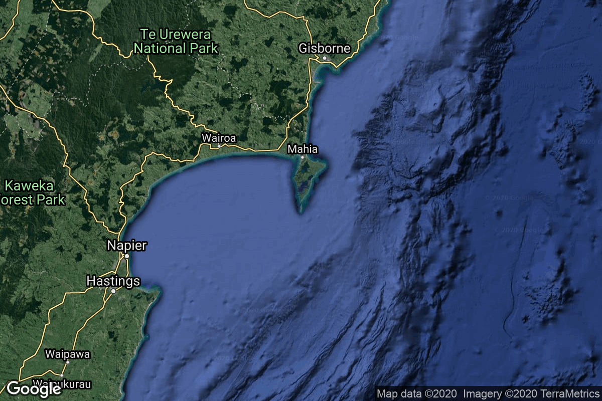
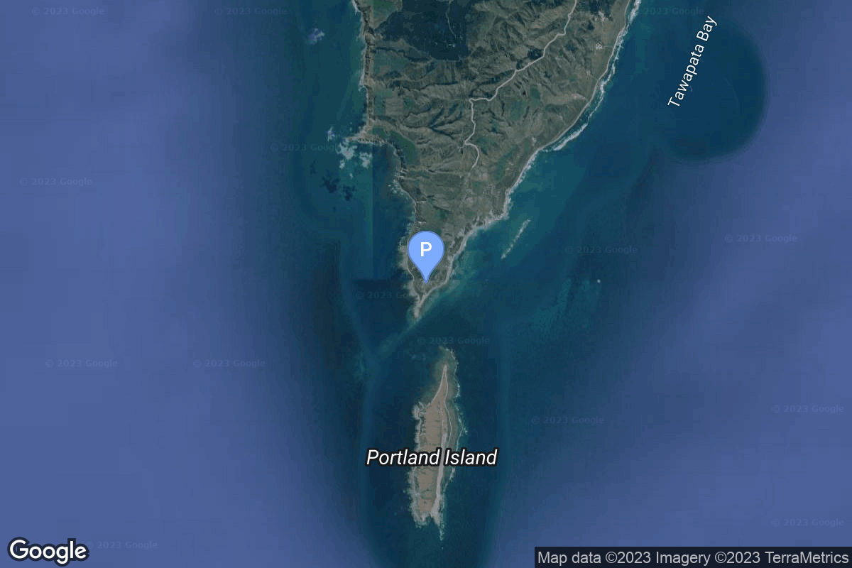
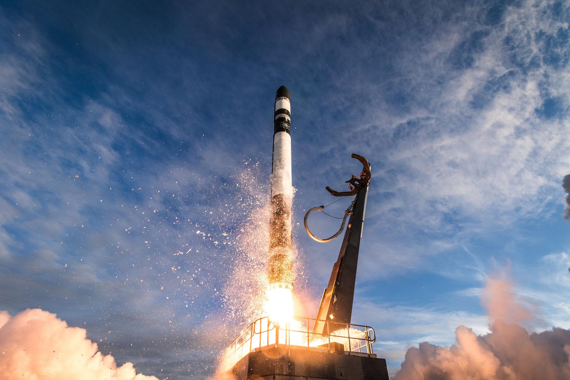
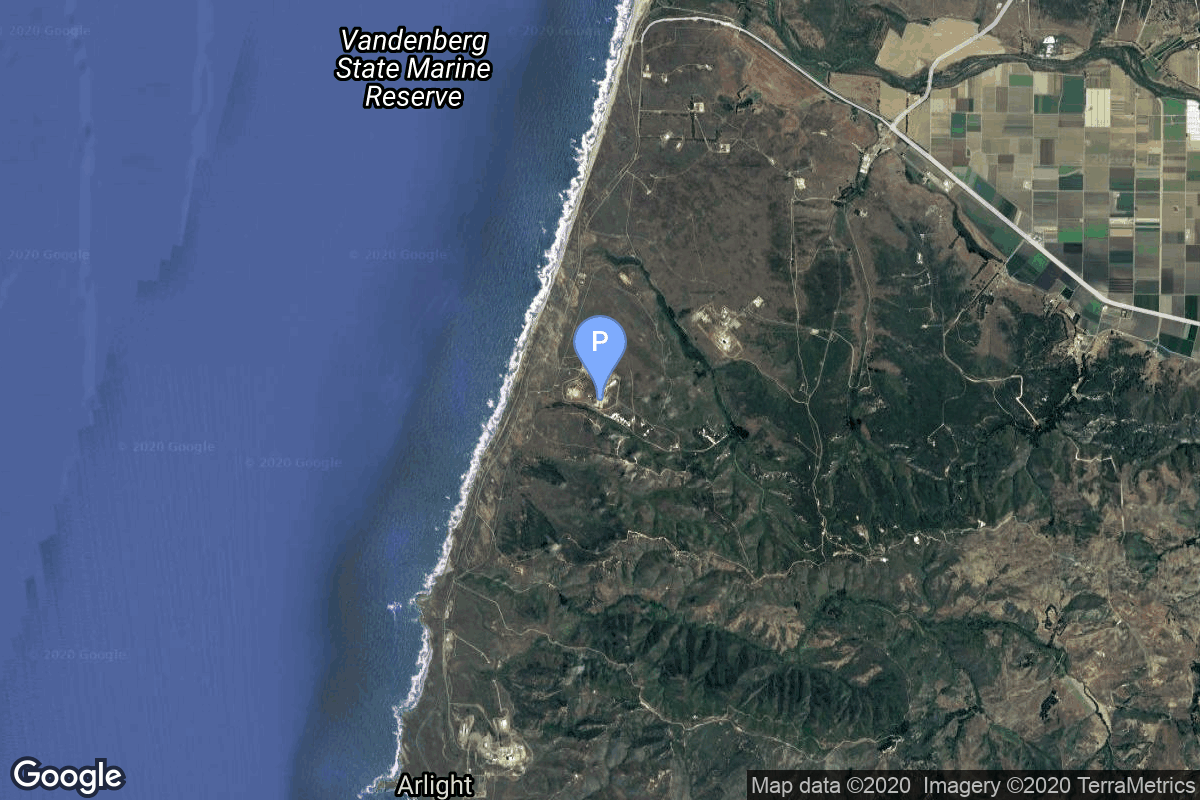
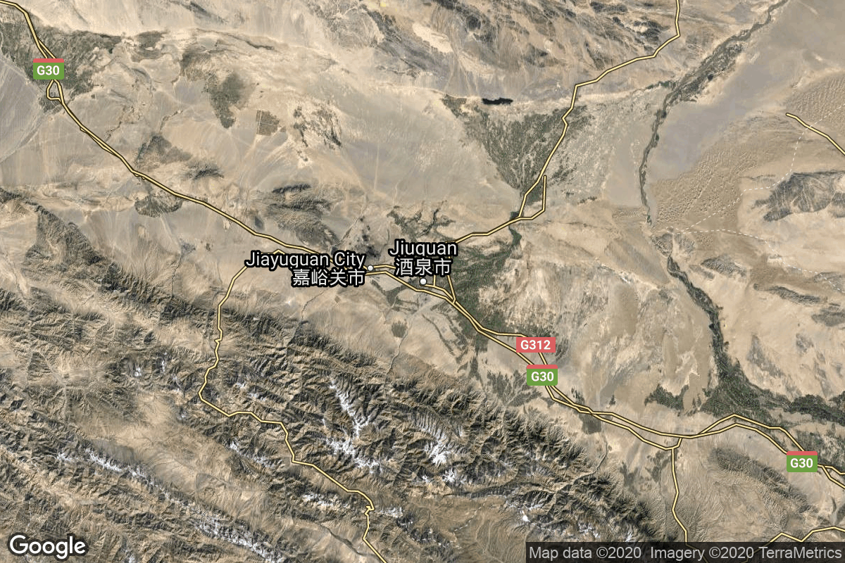
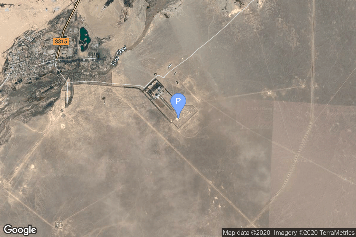
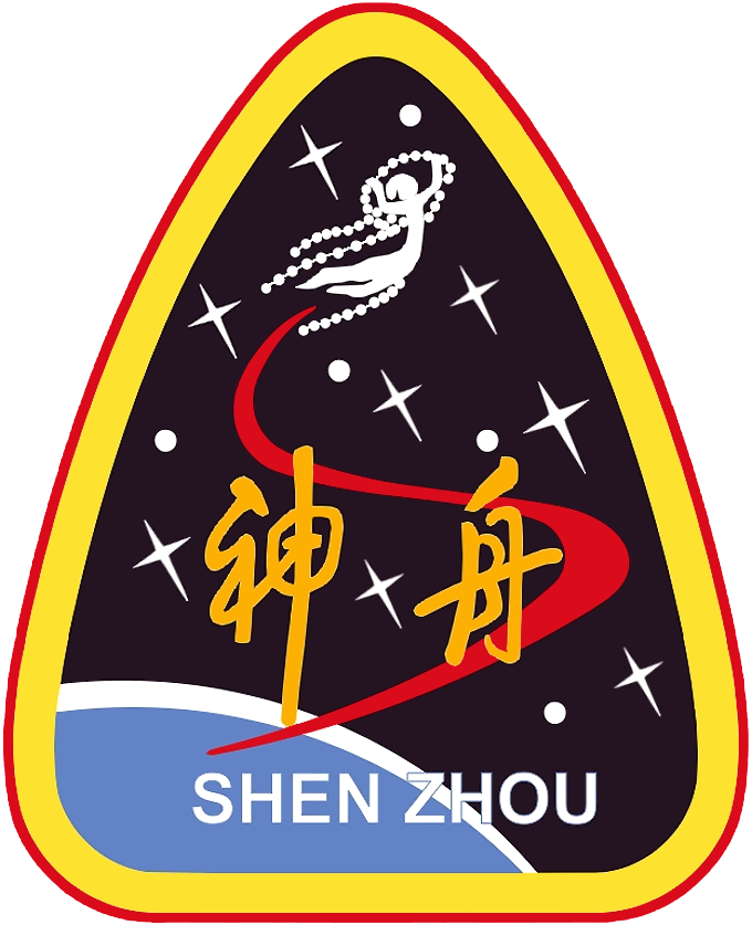
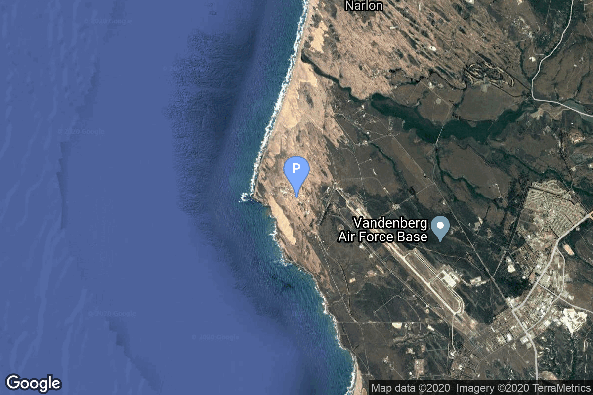
{ "count": 549, "next": "https://lldev.thespacedevs.com/2.2.0/launch/?format=api&limit=10&offset=380&ordering=net", "previous": "https://lldev.thespacedevs.com/2.2.0/launch/?format=api&limit=10&offset=360&ordering=net", "results": [ { "id": "04154b70-045b-4e3a-bb5a-e5436091ba37", "url": "https://lldev.thespacedevs.com/2.2.0/launch/04154b70-045b-4e3a-bb5a-e5436091ba37/?format=api", "slug": "electron-victus-haze-puma", "name": "Electron | VICTUS HAZE Puma", "status": { "id": 2, "name": "To Be Determined", "abbrev": "TBD", "description": "Current date is a placeholder or rough estimation based on unreliable or interpreted sources." }, "last_updated": "2026-01-28T18:55:37Z", "net": "2026-06-30T00:00:00Z", "window_end": "2026-06-30T00:00:00Z", "window_start": "2026-06-30T00:00:00Z", "net_precision": { "id": 12, "name": "Year Half 1", "abbrev": "H1", "description": "The T-0 is expected in the first half of the given year." }, "probability": null, "weather_concerns": null, "holdreason": "", "failreason": "", "hashtag": null, "launch_service_provider": { "id": 147, "url": "https://lldev.thespacedevs.com/2.2.0/agencies/147/?format=api", "name": "Rocket Lab", "type": "Commercial" }, "rocket": { "id": 8384, "configuration": { "id": 26, "url": "https://lldev.thespacedevs.com/2.2.0/config/launcher/26/?format=api", "name": "Electron", "family": "", "full_name": "Electron", "variant": "" } }, "mission": { "id": 6965, "name": "VICTUS HAZE Puma", "description": "VICTUS HAZE will see Rocket Lab design, build, launch, and operate a rendezvous proximity operation (RPO) capable spacecraft. U.S. Space Force Space Systems Command (SSC)’s Space Safari’s VICTUS HAZE mission will be an exercise of a realistic threat-response scenario and on-orbit space domain awareness (SDA) demonstration. Once the spacecraft build is complete, Rocket Lab will be entered into a Hot Standby Phase awaiting further direction. Once the exercise begins, Rocket Lab will be given notice to launch the spacecraft into a target orbit. After reaching orbit, the spacecraft will be rapidly commissioned and readied for operations. Rocket Lab will configure a Pioneer class spacecraft bus to meet the unique requirements of the VICTUS HAZE mission.\r\n\r\nThe mission will improve Tactically Responsive Space (TacRS) processes and timelines, demonstrating the ability to respond to on-orbit threats on very short timelines and validating techniques for space domain awareness (SDA) and on-orbit characterization. Rocket Lab’s constellation-class production capability and discriminating technical capabilities in the areas of in-space propulsion, precision attitude control, low latency communications, and autonomous operations are key enablers for this mission.", "launch_designator": null, "type": "Government/Top Secret", "orbit": { "id": 8, "name": "Low Earth Orbit", "abbrev": "LEO" }, "agencies": [], "info_urls": [], "vid_urls": [] }, "pad": { "id": 210, "url": "https://lldev.thespacedevs.com/2.2.0/pad/210/?format=api", "agency_id": null, "name": "Unknown Pad", "description": null, "info_url": null, "wiki_url": null, "map_url": null, "latitude": "-39.260881", "longitude": "177.865826", "location": { "id": 10, "url": "https://lldev.thespacedevs.com/2.2.0/location/10/?format=api", "name": "Rocket Lab Launch Complex 1, Mahia Peninsula, New Zealand", "country_code": "NZL", "description": "Rocket Lab Launch Complex 1 is a commercial spaceport located close to Ahuriri Point at the southern tip of Māhia Peninsula, on the east coast of New Zealand's North Island. It is owned and operated by private spaceflight company Rocket Lab and supports launches of the company's Electron rocket for small satellites. With the launch of Electron on 25 May 2017, it became the first private spaceport to host an orbital launch attempt, and the first site in New Zealand to host an orbital launch attempt. With the Electron launch of 21 January 2018, it became the first private spaceport to host a successful orbital launch.", "map_image": "https://thespacedevs-dev.nyc3.digitaloceanspaces.com/media/map_images/location_10_20200803142509.jpg", "timezone_name": "Pacific/Auckland", "total_launch_count": 74, "total_landing_count": 17 }, "country_code": "NZL", "map_image": "https://thespacedevs-dev.nyc3.digitaloceanspaces.com/media/map_images/pad_210_20230819165718.jpg", "total_launch_count": 0, "orbital_launch_attempt_count": 0 }, "webcast_live": false, "image": "https://thespacedevs-dev.nyc3.digitaloceanspaces.com/media/images/electron_image_20190705175640.jpeg", "infographic": null, "program": [], "orbital_launch_attempt_count": 7303, "location_launch_attempt_count": 78, "pad_launch_attempt_count": 4, "agency_launch_attempt_count": 89, "orbital_launch_attempt_count_year": 130, "location_launch_attempt_count_year": 9, "pad_launch_attempt_count_year": 4, "agency_launch_attempt_count_year": 10, "type": "normal" }, { "id": "d9adedc4-8fa1-4a36-84f9-43b8893a6865", "url": "https://lldev.thespacedevs.com/2.2.0/launch/d9adedc4-8fa1-4a36-84f9-43b8893a6865/?format=api", "slug": "falcon-9-block-5-sda-tranche-1-transport-layer-e", "name": "Falcon 9 Block 5 | SDA Tranche 1 Transport Layer E", "status": { "id": 2, "name": "To Be Determined", "abbrev": "TBD", "description": "Current date is a placeholder or rough estimation based on unreliable or interpreted sources." }, "last_updated": "2026-03-17T13:53:51Z", "net": "2026-06-30T00:00:00Z", "window_end": "2026-06-30T00:00:00Z", "window_start": "2026-06-30T00:00:00Z", "net_precision": { "id": 9, "name": "Quarter 2", "abbrev": "Q2", "description": "The T-0 is expected in the second quarter of the given year." }, "probability": null, "weather_concerns": null, "holdreason": "", "failreason": "", "hashtag": null, "launch_service_provider": { "id": 121, "url": "https://lldev.thespacedevs.com/2.2.0/agencies/121/?format=api", "name": "SpaceX", "type": "Commercial" }, "rocket": { "id": 7895, "configuration": { "id": 164, "url": "https://lldev.thespacedevs.com/2.2.0/config/launcher/164/?format=api", "name": "Falcon 9", "family": "Falcon", "full_name": "Falcon 9 Block 5", "variant": "Block 5" } }, "mission": { "id": 6404, "name": "SDA Tranche 1 Transport Layer E", "description": "Tranche 1 Transport Layer E is one of six missions by the United States Space Force Space Development Agency (SDA) for the Proliferated Warfighter Space Architecture (PWSA) Tranche 1 Transport Layer constellation, which will provide assured, resilient, low-latency military data and connectivity worldwide to the full range of warfighter platforms from Low Earth Orbit satellites.\r\n\r\nThe constellation will be interconnected with Optical Inter-Satellite Links (OISLs) which have significantly increased performance over existing radio frequency crosslinks. It is expected to operate over Ka band, have stereo coverage and be dynamically networked for simpler hand-offs, greater bandwidth and fault tolerance.", "launch_designator": null, "type": "Government/Top Secret", "orbit": { "id": 13, "name": "Polar Orbit", "abbrev": "PO" }, "agencies": [ { "id": 1056, "url": "https://lldev.thespacedevs.com/2.2.0/agencies/1056/?format=api", "name": "Space Development Agency", "featured": false, "type": "Government", "country_code": "USA", "abbrev": "SDA", "description": "The Space Development Agency (SDA) is a United States Space Force direct-reporting unit tasked with deploying disruptive space technology. A primary focus is space-based missile defense using large global satellite constellations made up of industry-procured low-cost satellites.", "administrator": "Director: Derek Tournear", "founding_year": "2019", "launchers": "", "spacecraft": "", "launch_library_url": null, "total_launch_count": 0, "consecutive_successful_launches": 0, "successful_launches": 0, "failed_launches": 0, "pending_launches": 0, "consecutive_successful_landings": 0, "successful_landings": 0, "failed_landings": 0, "attempted_landings": 0, "info_url": "https://www.sda.mil/", "wiki_url": "https://en.wikipedia.org/wiki/Space_Development_Agency", "logo_url": "https://thespacedevs-dev.nyc3.digitaloceanspaces.com/media/images/space2520development2520agency_logo_20230806170522.jpg", "image_url": null, "nation_url": null } ], "info_urls": [], "vid_urls": [] }, "pad": { "id": 16, "url": "https://lldev.thespacedevs.com/2.2.0/pad/16/?format=api", "agency_id": null, "name": "Space Launch Complex 4E", "description": "Space Launch Complex 4 East (SLC-4E) is a launch site at Vandenberg Space Force Base, California, U.S.\r\n\r\nThe pad was previously used by Atlas and Titan rockets between 1963 and 2005. The pad was built for use by Atlas-Agena rockets, but was later rebuilt to handle Titan rockets.", "info_url": null, "wiki_url": "https://en.wikipedia.org/wiki/Vandenberg_Space_Launch_Complex_4#SLC-4E", "map_url": "https://www.google.com/maps?q=34.632,-120.611", "latitude": "34.632", "longitude": "-120.611", "location": { "id": 11, "url": "https://lldev.thespacedevs.com/2.2.0/location/11/?format=api", "name": "Vandenberg SFB, CA, USA", "country_code": "USA", "description": "Vandenberg Space Force Base is a United States Space Force Base in Santa Barbara County, California. Established in 1941, Vandenberg Space Force Base is a space launch base, launching spacecraft from the Western Range, and also performs missile testing. The United States Space Force's Space Launch Delta 30 serves as the host delta for the base, equivalent to an Air Force air base wing. In addition to its military space launch mission, Vandenberg Space Force Base also hosts space launches for civil and commercial space entities, such as NASA and SpaceX.", "map_image": "https://thespacedevs-dev.nyc3.digitaloceanspaces.com/media/map_images/location_11_20200803142416.jpg", "timezone_name": "America/Los_Angeles", "total_launch_count": 872, "total_landing_count": 33 }, "country_code": "USA", "map_image": "https://thespacedevs-dev.nyc3.digitaloceanspaces.com/media/map_images/pad_16_20200803143532.jpg", "total_launch_count": 257, "orbital_launch_attempt_count": 257 }, "webcast_live": false, "image": "https://thespacedevs-dev.nyc3.digitaloceanspaces.com/media/images/falcon_9_image_20230807133459.jpeg", "infographic": null, "program": [], "orbital_launch_attempt_count": 7303, "location_launch_attempt_count": 891, "pad_launch_attempt_count": 274, "agency_launch_attempt_count": 686, "orbital_launch_attempt_count_year": 130, "location_launch_attempt_count_year": 39, "pad_launch_attempt_count_year": 36, "agency_launch_attempt_count_year": 67, "type": "normal" }, { "id": "be8b4b0d-1989-48a5-a96d-e8e4d59ed8b3", "url": "https://lldev.thespacedevs.com/2.2.0/launch/be8b4b0d-1989-48a5-a96d-e8e4d59ed8b3/?format=api", "slug": "falcon-9-block-5-9-x-globalstar-3", "name": "Falcon 9 Block 5 | 9 x Globalstar-3", "status": { "id": 2, "name": "To Be Determined", "abbrev": "TBD", "description": "Current date is a placeholder or rough estimation based on unreliable or interpreted sources." }, "last_updated": "2026-02-26T06:45:19Z", "net": "2026-06-30T00:00:00Z", "window_end": "2026-06-30T00:00:00Z", "window_start": "2026-06-30T00:00:00Z", "net_precision": { "id": 12, "name": "Year Half 1", "abbrev": "H1", "description": "The T-0 is expected in the first half of the given year." }, "probability": null, "weather_concerns": null, "holdreason": "", "failreason": "", "hashtag": null, "launch_service_provider": { "id": 121, "url": "https://lldev.thespacedevs.com/2.2.0/agencies/121/?format=api", "name": "SpaceX", "type": "Commercial" }, "rocket": { "id": 8654, "configuration": { "id": 164, "url": "https://lldev.thespacedevs.com/2.2.0/config/launcher/164/?format=api", "name": "Falcon 9", "family": "Falcon", "full_name": "Falcon 9 Block 5", "variant": "Block 5" } }, "mission": { "id": 7246, "name": "9 x Globalstar-3", "description": "The Globalstar global mobile communications network offers global, digital real time voice, data and fax services via its Low Earth Orbit satellite constellation. The constellation operates in a 1410 km orbit inclined at 52 degrees.\r\n\r\nIn early 2022, Globalstar contracted with MDA for the construction of 17 new 3rd generation satellites to replenish the existing constellation. Rocket Lab is sub-contracted to build the satellites' buses and the launch dispensers.", "launch_designator": null, "type": "Communications", "orbit": { "id": 8, "name": "Low Earth Orbit", "abbrev": "LEO" }, "agencies": [ { "id": 204, "url": "https://lldev.thespacedevs.com/2.2.0/agencies/204/?format=api", "name": "Globalstar", "featured": false, "type": "Commercial", "country_code": "USA", "abbrev": "GSAT", "description": null, "administrator": null, "founding_year": null, "launchers": "", "spacecraft": "", "launch_library_url": null, "total_launch_count": 0, "consecutive_successful_launches": 0, "successful_launches": 0, "failed_launches": 0, "pending_launches": 0, "consecutive_successful_landings": 0, "successful_landings": 0, "failed_landings": 0, "attempted_landings": 0, "info_url": null, "wiki_url": "https://en.wikipedia.org/wiki/Globalstar", "logo_url": null, "image_url": null, "nation_url": null } ], "info_urls": [], "vid_urls": [] }, "pad": { "id": 72, "url": "https://lldev.thespacedevs.com/2.2.0/pad/72/?format=api", "agency_id": null, "name": "Unknown Pad", "description": null, "info_url": null, "wiki_url": "", "map_url": "https://www.google.com/maps?q=28.458,-80.528", "latitude": "28.458", "longitude": "-80.528", "location": { "id": 12, "url": "https://lldev.thespacedevs.com/2.2.0/location/12/?format=api", "name": "Cape Canaveral SFS, FL, USA", "country_code": "USA", "description": "Cape Canaveral Space Force Station (CCSFS) is an installation of the United States Space Force's Space Launch Delta 45, located on Cape Canaveral in Brevard County, Florida.", "map_image": "https://thespacedevs-dev.nyc3.digitaloceanspaces.com/media/map_images/location_12_20200803142519.jpg", "timezone_name": "America/New_York", "total_launch_count": 1100, "total_landing_count": 71 }, "country_code": "USA", "map_image": "https://thespacedevs-dev.nyc3.digitaloceanspaces.com/media/map_images/pad_72_20200803143403.jpg", "total_launch_count": 0, "orbital_launch_attempt_count": 0 }, "webcast_live": false, "image": "https://thespacedevs-dev.nyc3.digitaloceanspaces.com/media/images/falcon_9_image_20230807133459.jpeg", "infographic": null, "program": [], "orbital_launch_attempt_count": 7303, "location_launch_attempt_count": 1110, "pad_launch_attempt_count": 3, "agency_launch_attempt_count": 686, "orbital_launch_attempt_count_year": 130, "location_launch_attempt_count_year": 34, "pad_launch_attempt_count_year": 3, "agency_launch_attempt_count_year": 67, "type": "normal" }, { "id": "a8d8d683-3ab0-40ab-beb0-e66bb55afd91", "url": "https://lldev.thespacedevs.com/2.2.0/launch/a8d8d683-3ab0-40ab-beb0-e66bb55afd91/?format=api", "slug": "nebula-1-demo-flight", "name": "Nebula-1 | Demo Flight", "status": { "id": 2, "name": "To Be Determined", "abbrev": "TBD", "description": "Current date is a placeholder or rough estimation based on unreliable or interpreted sources." }, "last_updated": "2026-04-05T19:35:40Z", "net": "2026-06-30T00:00:00Z", "window_end": "2026-06-30T00:00:00Z", "window_start": "2026-06-30T00:00:00Z", "net_precision": { "id": 12, "name": "Year Half 1", "abbrev": "H1", "description": "The T-0 is expected in the first half of the given year." }, "probability": null, "weather_concerns": null, "holdreason": "", "failreason": "", "hashtag": null, "launch_service_provider": { "id": 1102, "url": "https://lldev.thespacedevs.com/2.2.0/agencies/1102/?format=api", "name": "Deep Blue Aerospace", "type": "Commercial" }, "rocket": { "id": 8827, "configuration": { "id": 545, "url": "https://lldev.thespacedevs.com/2.2.0/config/launcher/545/?format=api", "name": "Nebula-1", "family": "", "full_name": "Nebula-1", "variant": "" } }, "mission": { "id": 7418, "name": "Demo Flight", "description": "First test launch of Deep Blue Aerospace’s Nebula-1 rocket.\r\n\r\nThe test flight profile is reported to be sub-orbital.", "launch_designator": null, "type": "Test Flight", "orbit": { "id": 15, "name": "Suborbital", "abbrev": "Sub" }, "agencies": [], "info_urls": [], "vid_urls": [] }, "pad": { "id": 252, "url": "https://lldev.thespacedevs.com/2.2.0/pad/252/?format=api", "agency_id": 88, "name": "Land Launch Pad 1", "description": "First land launch pad at the Haiyang Oriental Spaceport, built on the former tourist attraction site of the reclaimed-island Lianli Island. It is described as a \"sea-launch and booster recovery testing launch site\".", "info_url": null, "wiki_url": null, "map_url": "https://www.google.com/maps?q=36.664312,121.188333", "latitude": "36.664312", "longitude": "121.188333", "location": { "id": 185, "url": "https://lldev.thespacedevs.com/2.2.0/location/185/?format=api", "name": "Haiyang Oriental Spaceport", "country_code": "CHN", "description": "Chinese orbital launch vehicle launches supporting sea port located at Haiyang, Shandong Province, with dedicated piers and rocket/payload processing facilities for Chinese launch vehicles’ sea launches, and (as part of its expansion project) land based launch pads on artificial islands for various test vehicles and launch vehicles of private and government launch services providers.\r\n\r\nIn operation as a remote base of Taiyuan Satellite Launch Center since 2019.", "map_image": "https://thespacedevs-dev.nyc3.digitaloceanspaces.com/media/map_images/location_haiyang_oriental_spaceport_20251128181322.jpg", "timezone_name": "Asia/Shanghai", "total_launch_count": 24, "total_landing_count": 0 }, "country_code": "CHN", "map_image": "https://thespacedevs-dev.nyc3.digitaloceanspaces.com/media/map_images/pad_land_launch_pad_1_20260405193202.jpg", "total_launch_count": 0, "orbital_launch_attempt_count": 0 }, "webcast_live": false, "image": null, "infographic": null, "program": [], "orbital_launch_attempt_count": null, "location_launch_attempt_count": 26, "pad_launch_attempt_count": 1, "agency_launch_attempt_count": 1, "orbital_launch_attempt_count_year": null, "location_launch_attempt_count_year": 5, "pad_launch_attempt_count_year": 1, "agency_launch_attempt_count_year": 1, "type": "normal" }, { "id": "bf5c6fa2-3add-49ff-aad6-c6450148cd89", "url": "https://lldev.thespacedevs.com/2.2.0/launch/bf5c6fa2-3add-49ff-aad6-c6450148cd89/?format=api", "slug": "falcon-9-block-5-rivada-12", "name": "Falcon 9 Block 5 | Rivada 12", "status": { "id": 2, "name": "To Be Determined", "abbrev": "TBD", "description": "Current date is a placeholder or rough estimation based on unreliable or interpreted sources." }, "last_updated": "2023-09-21T20:04:03Z", "net": "2026-06-30T00:00:00Z", "window_end": "2026-06-30T00:00:00Z", "window_start": "2026-06-30T00:00:00Z", "net_precision": { "id": 12, "name": "Year Half 1", "abbrev": "H1", "description": "The T-0 is expected in the first half of the given year." }, "probability": null, "weather_concerns": null, "holdreason": "", "failreason": "", "hashtag": null, "launch_service_provider": { "id": 121, "url": "https://lldev.thespacedevs.com/2.2.0/agencies/121/?format=api", "name": "SpaceX", "type": "Commercial" }, "rocket": { "id": 7810, "configuration": { "id": 164, "url": "https://lldev.thespacedevs.com/2.2.0/config/launcher/164/?format=api", "name": "Falcon 9", "family": "Falcon", "full_name": "Falcon 9 Block 5", "variant": "Block 5" } }, "mission": { "id": 6578, "name": "Rivada 12", "description": "24 satellites for Rivada's internet constellation.", "launch_designator": null, "type": "Communications", "orbit": { "id": 13, "name": "Polar Orbit", "abbrev": "PO" }, "agencies": [ { "id": 1076, "url": "https://lldev.thespacedevs.com/2.2.0/agencies/1076/?format=api", "name": "Rivada Space Networks", "featured": false, "type": "Commercial", "country_code": "DEU", "abbrev": "RivadaSpace", "description": "In March 2022, Rivada announced the formation of Rivada Space Networks GmbH, a wholly owned subsidiary that was land to launch 600 low earth orbit satellites interconnected with laser links to form a single global mesh network in space.", "administrator": "CEO: Declan Ganley", "founding_year": "2022", "launchers": "", "spacecraft": "", "launch_library_url": null, "total_launch_count": 0, "consecutive_successful_launches": 0, "successful_launches": 0, "failed_launches": 0, "pending_launches": 0, "consecutive_successful_landings": 0, "successful_landings": 0, "failed_landings": 0, "attempted_landings": 0, "info_url": "https://rivadaspace.com/", "wiki_url": "https://en.wikipedia.org/wiki/Rivada_Networks", "logo_url": "https://thespacedevs-dev.nyc3.digitaloceanspaces.com/media/images/rivada2520space2520networks_logo_20230921195723.png", "image_url": null, "nation_url": "https://thespacedevs-dev.nyc3.digitaloceanspaces.com/media/images/rivada2520space2520networks_nation_20230921195724.png" } ], "info_urls": [], "vid_urls": [] }, "pad": { "id": 16, "url": "https://lldev.thespacedevs.com/2.2.0/pad/16/?format=api", "agency_id": null, "name": "Space Launch Complex 4E", "description": "Space Launch Complex 4 East (SLC-4E) is a launch site at Vandenberg Space Force Base, California, U.S.\r\n\r\nThe pad was previously used by Atlas and Titan rockets between 1963 and 2005. The pad was built for use by Atlas-Agena rockets, but was later rebuilt to handle Titan rockets.", "info_url": null, "wiki_url": "https://en.wikipedia.org/wiki/Vandenberg_Space_Launch_Complex_4#SLC-4E", "map_url": "https://www.google.com/maps?q=34.632,-120.611", "latitude": "34.632", "longitude": "-120.611", "location": { "id": 11, "url": "https://lldev.thespacedevs.com/2.2.0/location/11/?format=api", "name": "Vandenberg SFB, CA, USA", "country_code": "USA", "description": "Vandenberg Space Force Base is a United States Space Force Base in Santa Barbara County, California. Established in 1941, Vandenberg Space Force Base is a space launch base, launching spacecraft from the Western Range, and also performs missile testing. The United States Space Force's Space Launch Delta 30 serves as the host delta for the base, equivalent to an Air Force air base wing. In addition to its military space launch mission, Vandenberg Space Force Base also hosts space launches for civil and commercial space entities, such as NASA and SpaceX.", "map_image": "https://thespacedevs-dev.nyc3.digitaloceanspaces.com/media/map_images/location_11_20200803142416.jpg", "timezone_name": "America/Los_Angeles", "total_launch_count": 872, "total_landing_count": 33 }, "country_code": "USA", "map_image": "https://thespacedevs-dev.nyc3.digitaloceanspaces.com/media/map_images/pad_16_20200803143532.jpg", "total_launch_count": 257, "orbital_launch_attempt_count": 257 }, "webcast_live": false, "image": "https://thespacedevs-dev.nyc3.digitaloceanspaces.com/media/images/falcon_9_image_20230807133459.jpeg", "infographic": null, "program": [], "orbital_launch_attempt_count": 7303, "location_launch_attempt_count": 891, "pad_launch_attempt_count": 274, "agency_launch_attempt_count": 686, "orbital_launch_attempt_count_year": 130, "location_launch_attempt_count_year": 39, "pad_launch_attempt_count_year": 36, "agency_launch_attempt_count_year": 67, "type": "normal" }, { "id": "d08d8b46-353b-4eee-ab5e-e1385b329008", "url": "https://lldev.thespacedevs.com/2.2.0/launch/d08d8b46-353b-4eee-ab5e-e1385b329008/?format=api", "slug": "falcon-9-block-5-rivada-11", "name": "Falcon 9 Block 5 | Rivada 11", "status": { "id": 2, "name": "To Be Determined", "abbrev": "TBD", "description": "Current date is a placeholder or rough estimation based on unreliable or interpreted sources." }, "last_updated": "2023-09-21T20:03:39Z", "net": "2026-06-30T00:00:00Z", "window_end": "2026-06-30T00:00:00Z", "window_start": "2026-06-30T00:00:00Z", "net_precision": { "id": 12, "name": "Year Half 1", "abbrev": "H1", "description": "The T-0 is expected in the first half of the given year." }, "probability": null, "weather_concerns": null, "holdreason": "", "failreason": "", "hashtag": null, "launch_service_provider": { "id": 121, "url": "https://lldev.thespacedevs.com/2.2.0/agencies/121/?format=api", "name": "SpaceX", "type": "Commercial" }, "rocket": { "id": 7809, "configuration": { "id": 164, "url": "https://lldev.thespacedevs.com/2.2.0/config/launcher/164/?format=api", "name": "Falcon 9", "family": "Falcon", "full_name": "Falcon 9 Block 5", "variant": "Block 5" } }, "mission": { "id": 6577, "name": "Rivada 11", "description": "24 satellites for Rivada's internet constellation.", "launch_designator": null, "type": "Communications", "orbit": { "id": 13, "name": "Polar Orbit", "abbrev": "PO" }, "agencies": [ { "id": 1076, "url": "https://lldev.thespacedevs.com/2.2.0/agencies/1076/?format=api", "name": "Rivada Space Networks", "featured": false, "type": "Commercial", "country_code": "DEU", "abbrev": "RivadaSpace", "description": "In March 2022, Rivada announced the formation of Rivada Space Networks GmbH, a wholly owned subsidiary that was land to launch 600 low earth orbit satellites interconnected with laser links to form a single global mesh network in space.", "administrator": "CEO: Declan Ganley", "founding_year": "2022", "launchers": "", "spacecraft": "", "launch_library_url": null, "total_launch_count": 0, "consecutive_successful_launches": 0, "successful_launches": 0, "failed_launches": 0, "pending_launches": 0, "consecutive_successful_landings": 0, "successful_landings": 0, "failed_landings": 0, "attempted_landings": 0, "info_url": "https://rivadaspace.com/", "wiki_url": "https://en.wikipedia.org/wiki/Rivada_Networks", "logo_url": "https://thespacedevs-dev.nyc3.digitaloceanspaces.com/media/images/rivada2520space2520networks_logo_20230921195723.png", "image_url": null, "nation_url": "https://thespacedevs-dev.nyc3.digitaloceanspaces.com/media/images/rivada2520space2520networks_nation_20230921195724.png" } ], "info_urls": [], "vid_urls": [] }, "pad": { "id": 16, "url": "https://lldev.thespacedevs.com/2.2.0/pad/16/?format=api", "agency_id": null, "name": "Space Launch Complex 4E", "description": "Space Launch Complex 4 East (SLC-4E) is a launch site at Vandenberg Space Force Base, California, U.S.\r\n\r\nThe pad was previously used by Atlas and Titan rockets between 1963 and 2005. The pad was built for use by Atlas-Agena rockets, but was later rebuilt to handle Titan rockets.", "info_url": null, "wiki_url": "https://en.wikipedia.org/wiki/Vandenberg_Space_Launch_Complex_4#SLC-4E", "map_url": "https://www.google.com/maps?q=34.632,-120.611", "latitude": "34.632", "longitude": "-120.611", "location": { "id": 11, "url": "https://lldev.thespacedevs.com/2.2.0/location/11/?format=api", "name": "Vandenberg SFB, CA, USA", "country_code": "USA", "description": "Vandenberg Space Force Base is a United States Space Force Base in Santa Barbara County, California. Established in 1941, Vandenberg Space Force Base is a space launch base, launching spacecraft from the Western Range, and also performs missile testing. The United States Space Force's Space Launch Delta 30 serves as the host delta for the base, equivalent to an Air Force air base wing. In addition to its military space launch mission, Vandenberg Space Force Base also hosts space launches for civil and commercial space entities, such as NASA and SpaceX.", "map_image": "https://thespacedevs-dev.nyc3.digitaloceanspaces.com/media/map_images/location_11_20200803142416.jpg", "timezone_name": "America/Los_Angeles", "total_launch_count": 872, "total_landing_count": 33 }, "country_code": "USA", "map_image": "https://thespacedevs-dev.nyc3.digitaloceanspaces.com/media/map_images/pad_16_20200803143532.jpg", "total_launch_count": 257, "orbital_launch_attempt_count": 257 }, "webcast_live": false, "image": "https://thespacedevs-dev.nyc3.digitaloceanspaces.com/media/images/falcon_9_image_20230807133459.jpeg", "infographic": null, "program": [], "orbital_launch_attempt_count": 7303, "location_launch_attempt_count": 891, "pad_launch_attempt_count": 274, "agency_launch_attempt_count": 686, "orbital_launch_attempt_count_year": 130, "location_launch_attempt_count_year": 39, "pad_launch_attempt_count_year": 36, "agency_launch_attempt_count_year": 67, "type": "normal" }, { "id": "fcbc4550-e69e-4458-a9e6-4a5b6b6b15a5", "url": "https://lldev.thespacedevs.com/2.2.0/launch/fcbc4550-e69e-4458-a9e6-4a5b6b6b15a5/?format=api", "slug": "falcon-9-block-5-sda-tranche-1-tracking-layer-e", "name": "Falcon 9 Block 5 | SDA Tranche 1 Tracking Layer E", "status": { "id": 2, "name": "To Be Determined", "abbrev": "TBD", "description": "Current date is a placeholder or rough estimation based on unreliable or interpreted sources." }, "last_updated": "2026-01-28T18:43:00Z", "net": "2026-06-30T00:00:00Z", "window_end": "2026-06-30T00:00:00Z", "window_start": "2026-06-30T00:00:00Z", "net_precision": { "id": 9, "name": "Quarter 2", "abbrev": "Q2", "description": "The T-0 is expected in the second quarter of the given year." }, "probability": null, "weather_concerns": null, "holdreason": "", "failreason": "", "hashtag": null, "launch_service_provider": { "id": 121, "url": "https://lldev.thespacedevs.com/2.2.0/agencies/121/?format=api", "name": "SpaceX", "type": "Commercial" }, "rocket": { "id": 8075, "configuration": { "id": 164, "url": "https://lldev.thespacedevs.com/2.2.0/config/launcher/164/?format=api", "name": "Falcon 9", "family": "Falcon", "full_name": "Falcon 9 Block 5", "variant": "Block 5" } }, "mission": { "id": 6628, "name": "SDA Tranche 1 Tracking Layer E", "description": "Tranche 1 Tracking Layer E is one of five missions by the United States Space Force Space Development Agency (SDA) for the Proliferated Warfighter Space Architecture (PWSA) Tranche 1 Tracking Layer constellation, which will provide global indications, warning, tracking, and targeting of advanced missile threats, including hypersonic missile systems.", "launch_designator": null, "type": "Government/Top Secret", "orbit": { "id": 13, "name": "Polar Orbit", "abbrev": "PO" }, "agencies": [ { "id": 1056, "url": "https://lldev.thespacedevs.com/2.2.0/agencies/1056/?format=api", "name": "Space Development Agency", "featured": false, "type": "Government", "country_code": "USA", "abbrev": "SDA", "description": "The Space Development Agency (SDA) is a United States Space Force direct-reporting unit tasked with deploying disruptive space technology. A primary focus is space-based missile defense using large global satellite constellations made up of industry-procured low-cost satellites.", "administrator": "Director: Derek Tournear", "founding_year": "2019", "launchers": "", "spacecraft": "", "launch_library_url": null, "total_launch_count": 0, "consecutive_successful_launches": 0, "successful_launches": 0, "failed_launches": 0, "pending_launches": 0, "consecutive_successful_landings": 0, "successful_landings": 0, "failed_landings": 0, "attempted_landings": 0, "info_url": "https://www.sda.mil/", "wiki_url": "https://en.wikipedia.org/wiki/Space_Development_Agency", "logo_url": "https://thespacedevs-dev.nyc3.digitaloceanspaces.com/media/images/space2520development2520agency_logo_20230806170522.jpg", "image_url": null, "nation_url": null } ], "info_urls": [], "vid_urls": [] }, "pad": { "id": 16, "url": "https://lldev.thespacedevs.com/2.2.0/pad/16/?format=api", "agency_id": null, "name": "Space Launch Complex 4E", "description": "Space Launch Complex 4 East (SLC-4E) is a launch site at Vandenberg Space Force Base, California, U.S.\r\n\r\nThe pad was previously used by Atlas and Titan rockets between 1963 and 2005. The pad was built for use by Atlas-Agena rockets, but was later rebuilt to handle Titan rockets.", "info_url": null, "wiki_url": "https://en.wikipedia.org/wiki/Vandenberg_Space_Launch_Complex_4#SLC-4E", "map_url": "https://www.google.com/maps?q=34.632,-120.611", "latitude": "34.632", "longitude": "-120.611", "location": { "id": 11, "url": "https://lldev.thespacedevs.com/2.2.0/location/11/?format=api", "name": "Vandenberg SFB, CA, USA", "country_code": "USA", "description": "Vandenberg Space Force Base is a United States Space Force Base in Santa Barbara County, California. Established in 1941, Vandenberg Space Force Base is a space launch base, launching spacecraft from the Western Range, and also performs missile testing. The United States Space Force's Space Launch Delta 30 serves as the host delta for the base, equivalent to an Air Force air base wing. In addition to its military space launch mission, Vandenberg Space Force Base also hosts space launches for civil and commercial space entities, such as NASA and SpaceX.", "map_image": "https://thespacedevs-dev.nyc3.digitaloceanspaces.com/media/map_images/location_11_20200803142416.jpg", "timezone_name": "America/Los_Angeles", "total_launch_count": 872, "total_landing_count": 33 }, "country_code": "USA", "map_image": "https://thespacedevs-dev.nyc3.digitaloceanspaces.com/media/map_images/pad_16_20200803143532.jpg", "total_launch_count": 257, "orbital_launch_attempt_count": 257 }, "webcast_live": false, "image": "https://thespacedevs-dev.nyc3.digitaloceanspaces.com/media/images/falcon_9_image_20230807133459.jpeg", "infographic": null, "program": [], "orbital_launch_attempt_count": 7303, "location_launch_attempt_count": 891, "pad_launch_attempt_count": 274, "agency_launch_attempt_count": 686, "orbital_launch_attempt_count_year": 130, "location_launch_attempt_count_year": 39, "pad_launch_attempt_count_year": 36, "agency_launch_attempt_count_year": 67, "type": "normal" }, { "id": "a6db1e67-5860-47c9-a674-adc0f35b62e0", "url": "https://lldev.thespacedevs.com/2.2.0/launch/a6db1e67-5860-47c9-a674-adc0f35b62e0/?format=api", "slug": "falcon-9-block-5-transporter-17-dedicated-sso-ride", "name": "Falcon 9 Block 5 | Transporter 17 (Dedicated SSO Rideshare)", "status": { "id": 2, "name": "To Be Determined", "abbrev": "TBD", "description": "Current date is a placeholder or rough estimation based on unreliable or interpreted sources." }, "last_updated": "2025-06-03T23:38:27Z", "net": "2026-06-30T00:00:00Z", "window_end": "2026-06-30T00:00:00Z", "window_start": "2026-06-30T00:00:00Z", "net_precision": { "id": 7, "name": "Month", "abbrev": "M", "description": "The T-0 is expected in the given month." }, "probability": null, "weather_concerns": null, "holdreason": "", "failreason": "", "hashtag": null, "launch_service_provider": { "id": 121, "url": "https://lldev.thespacedevs.com/2.2.0/agencies/121/?format=api", "name": "SpaceX", "type": "Commercial" }, "rocket": { "id": 8631, "configuration": { "id": 164, "url": "https://lldev.thespacedevs.com/2.2.0/config/launcher/164/?format=api", "name": "Falcon 9", "family": "Falcon", "full_name": "Falcon 9 Block 5", "variant": "Block 5" } }, "mission": { "id": 7223, "name": "Transporter 17 (Dedicated SSO Rideshare)", "description": "Dedicated rideshare flight to a sun-synchronous orbit with dozens of small microsatellites and nanosatellites for commercial and government customers.", "launch_designator": null, "type": "Dedicated Rideshare", "orbit": { "id": 17, "name": "Sun-Synchronous Orbit", "abbrev": "SSO" }, "agencies": [ { "id": 121, "url": "https://lldev.thespacedevs.com/2.2.0/agencies/121/?format=api", "name": "SpaceX", "featured": true, "type": "Commercial", "country_code": "USA", "abbrev": "SpX", "description": "Space Exploration Technologies Corp., known as SpaceX, is an American aerospace manufacturer and space transport services company headquartered in Hawthorne, California. It was founded in 2002 by entrepreneur Elon Musk with the goal of reducing space transportation costs and enabling the colonization of Mars. SpaceX operates from many pads, on the East Coast of the US they operate from SLC-40 at Cape Canaveral Space Force Station and historic LC-39A at Kennedy Space Center. They also operate from SLC-4E at Vandenberg Space Force Base, California, usually for polar launches. Another launch site is being developed at Boca Chica, Texas.", "administrator": "CEO: Elon Musk", "founding_year": "2002", "launchers": "Falcon | Starship", "spacecraft": "Dragon", "launch_library_url": null, "total_launch_count": 660, "consecutive_successful_launches": 145, "successful_launches": 645, "failed_launches": 15, "pending_launches": 122, "consecutive_successful_landings": 144, "successful_landings": 605, "failed_landings": 27, "attempted_landings": 631, "info_url": "https://www.spacex.com/", "wiki_url": "https://en.wikipedia.org/wiki/SpaceX", "logo_url": "https://thespacedevs-dev.nyc3.digitaloceanspaces.com/media/images/spacex_logo_20220826094919.png", "image_url": "https://thespacedevs-dev.nyc3.digitaloceanspaces.com/media/images/spacex_image_20190207032501.jpeg", "nation_url": "https://thespacedevs-dev.nyc3.digitaloceanspaces.com/media/images/spacex_nation_20230531064544.jpg" } ], "info_urls": [], "vid_urls": [] }, "pad": { "id": 16, "url": "https://lldev.thespacedevs.com/2.2.0/pad/16/?format=api", "agency_id": null, "name": "Space Launch Complex 4E", "description": "Space Launch Complex 4 East (SLC-4E) is a launch site at Vandenberg Space Force Base, California, U.S.\r\n\r\nThe pad was previously used by Atlas and Titan rockets between 1963 and 2005. The pad was built for use by Atlas-Agena rockets, but was later rebuilt to handle Titan rockets.", "info_url": null, "wiki_url": "https://en.wikipedia.org/wiki/Vandenberg_Space_Launch_Complex_4#SLC-4E", "map_url": "https://www.google.com/maps?q=34.632,-120.611", "latitude": "34.632", "longitude": "-120.611", "location": { "id": 11, "url": "https://lldev.thespacedevs.com/2.2.0/location/11/?format=api", "name": "Vandenberg SFB, CA, USA", "country_code": "USA", "description": "Vandenberg Space Force Base is a United States Space Force Base in Santa Barbara County, California. Established in 1941, Vandenberg Space Force Base is a space launch base, launching spacecraft from the Western Range, and also performs missile testing. The United States Space Force's Space Launch Delta 30 serves as the host delta for the base, equivalent to an Air Force air base wing. In addition to its military space launch mission, Vandenberg Space Force Base also hosts space launches for civil and commercial space entities, such as NASA and SpaceX.", "map_image": "https://thespacedevs-dev.nyc3.digitaloceanspaces.com/media/map_images/location_11_20200803142416.jpg", "timezone_name": "America/Los_Angeles", "total_launch_count": 872, "total_landing_count": 33 }, "country_code": "USA", "map_image": "https://thespacedevs-dev.nyc3.digitaloceanspaces.com/media/map_images/pad_16_20200803143532.jpg", "total_launch_count": 257, "orbital_launch_attempt_count": 257 }, "webcast_live": false, "image": "https://thespacedevs-dev.nyc3.digitaloceanspaces.com/media/images/falcon_9_image_20230807133459.jpeg", "infographic": null, "program": [], "orbital_launch_attempt_count": 7303, "location_launch_attempt_count": 891, "pad_launch_attempt_count": 274, "agency_launch_attempt_count": 686, "orbital_launch_attempt_count_year": 130, "location_launch_attempt_count_year": 39, "pad_launch_attempt_count_year": 36, "agency_launch_attempt_count_year": 67, "type": "normal" }, { "id": "a0e0f590-1cb4-4b6b-845c-0087633af132", "url": "https://lldev.thespacedevs.com/2.2.0/launch/a0e0f590-1cb4-4b6b-845c-0087633af132/?format=api", "slug": "long-march-2fg-shenzhou-23", "name": "Long March 2F/G | Shenzhou 23", "status": { "id": 2, "name": "To Be Determined", "abbrev": "TBD", "description": "Current date is a placeholder or rough estimation based on unreliable or interpreted sources." }, "last_updated": "2026-01-23T08:15:24Z", "net": "2026-06-30T00:00:00Z", "window_end": "2026-06-30T00:00:00Z", "window_start": "2026-06-30T00:00:00Z", "net_precision": { "id": 12, "name": "Year Half 1", "abbrev": "H1", "description": "The T-0 is expected in the first half of the given year." }, "probability": null, "weather_concerns": null, "holdreason": "", "failreason": "", "hashtag": null, "launch_service_provider": { "id": 88, "url": "https://lldev.thespacedevs.com/2.2.0/agencies/88/?format=api", "name": "China Aerospace Science and Technology Corporation", "type": "Government" }, "rocket": { "id": 8900, "configuration": { "id": 84, "url": "https://lldev.thespacedevs.com/2.2.0/config/launcher/84/?format=api", "name": "Long March 2F/G", "family": "Long March", "full_name": "Long March 2F/G", "variant": "F/G" } }, "mission": { "id": 7491, "name": "Shenzhou 23", "description": "Shenzhou 23 will be the 23rd flight of the Shenzhou program.", "launch_designator": null, "type": "Human Exploration", "orbit": { "id": 8, "name": "Low Earth Orbit", "abbrev": "LEO" }, "agencies": [ { "id": 17, "url": "https://lldev.thespacedevs.com/2.2.0/agencies/17/?format=api", "name": "China National Space Administration", "featured": true, "type": "Government", "country_code": "CHN", "abbrev": "CNSA", "description": "The China National Space Administration (CNSA) is the national space agency of the People's Republic of China. It is responsible for the national space program and for planning and development of space activities. CNSA and China Aerospace Corporation (CASC) assumed the authority over space development efforts previously held by the Ministry of Aerospace Industry. The CNSA has many launch sites around China with their orbital sites located in Jiuquan, Xichang, Taiyuan and Wenchang.", "administrator": "Administrator: Tang Dengjie", "founding_year": "1993", "launchers": "", "spacecraft": "Shenzhou", "launch_library_url": null, "total_launch_count": 2, "consecutive_successful_launches": 2, "successful_launches": 2, "failed_launches": 0, "pending_launches": 0, "consecutive_successful_landings": 0, "successful_landings": 0, "failed_landings": 0, "attempted_landings": 0, "info_url": "https://www.cnsa.gov.cn/", "wiki_url": "https://en.wikipedia.org/wiki/China_National_Space_Administration", "logo_url": "https://thespacedevs-dev.nyc3.digitaloceanspaces.com/media/images/china2520national2520space2520administration_logo_20190207032431.png", "image_url": "https://thespacedevs-dev.nyc3.digitaloceanspaces.com/media/images/china2520national2520space2520administration_image_20190207032431.jpeg", "nation_url": "https://thespacedevs-dev.nyc3.digitaloceanspaces.com/media/images/china2520national2520space2520administration_nation_20190602114400.png" } ], "info_urls": [], "vid_urls": [] }, "pad": { "id": 37, "url": "https://lldev.thespacedevs.com/2.2.0/pad/37/?format=api", "agency_id": null, "name": "Launch Area 91 (SLS-1 / 921)", "description": "", "info_url": null, "wiki_url": "https://en.wikipedia.org/wiki/Jiuquan_Launch_Area_4", "map_url": "https://www.google.com/maps?q=40.957893,100.290944", "latitude": "40.957893", "longitude": "100.290944", "location": { "id": 17, "url": "https://lldev.thespacedevs.com/2.2.0/location/17/?format=api", "name": "Jiuquan Satellite Launch Center, People's Republic of China", "country_code": "CHN", "description": "Jiuquan Satellite Launch Center is a Chinese spaceport located between the Ejin, Alxa, Inner Mongolia and Hangtian Town, Jinta County, Jiuquan, Gansu Province. It is part of the Dongfeng Aerospace City (Base 10).", "map_image": "https://thespacedevs-dev.nyc3.digitaloceanspaces.com/media/map_images/location_17_20200803142429.jpg", "timezone_name": "Asia/Shanghai", "total_launch_count": 281, "total_landing_count": 2 }, "country_code": "CHN", "map_image": "https://thespacedevs-dev.nyc3.digitaloceanspaces.com/media/map_images/pad_37_20200803143603.jpg", "total_launch_count": 28, "orbital_launch_attempt_count": 28 }, "webcast_live": false, "image": "https://thespacedevs-dev.nyc3.digitaloceanspaces.com/media/images/shenzhou_22_lau_image_20251129175823.jpg", "infographic": null, "program": [ { "id": 7, "url": "https://lldev.thespacedevs.com/2.2.0/program/7/?format=api", "name": "Shenzhou", "description": "The Shenzhou program is a crewed spaceflight initiative by China. The program put the first Chinese citizen, Yang Liwei, into orbit on 15 October 2003.", "agencies": [ { "id": 17, "url": "https://lldev.thespacedevs.com/2.2.0/agencies/17/?format=api", "name": "China National Space Administration", "type": "Government" } ], "image_url": "https://thespacedevs-dev.nyc3.digitaloceanspaces.com/media/images/shenzhou_program_20200820204745.PNG", "start_date": "1993-01-01T00:00:00Z", "end_date": null, "info_url": null, "wiki_url": "https://en.wikipedia.org/wiki/Shenzhou_program", "mission_patches": [], "type": { "id": 2, "name": "Human Spaceflight" } }, { "id": 19, "url": "https://lldev.thespacedevs.com/2.2.0/program/19/?format=api", "name": "Tiangong space station", "description": "The Tiangong space station is a space station placed in Low Earth orbit between 340 and 450 km above the surface.", "agencies": [ { "id": 88, "url": "https://lldev.thespacedevs.com/2.2.0/agencies/88/?format=api", "name": "China Aerospace Science and Technology Corporation", "type": "Government" } ], "image_url": "https://thespacedevs-dev.nyc3.digitaloceanspaces.com/media/images/chinese2520spa_program_20210608105528.png", "start_date": "2021-04-29T03:23:00Z", "end_date": null, "info_url": null, "wiki_url": "https://en.wikipedia.org/wiki/Tiangong_space_station", "mission_patches": [], "type": { "id": 2, "name": "Human Spaceflight" } } ], "orbital_launch_attempt_count": 7303, "location_launch_attempt_count": 284, "pad_launch_attempt_count": 29, "agency_launch_attempt_count": 588, "orbital_launch_attempt_count_year": 130, "location_launch_attempt_count_year": 11, "pad_launch_attempt_count_year": 2, "agency_launch_attempt_count_year": 18, "type": "normal" }, { "id": "875ba957-be5f-42bd-8a6e-ed98254f572a", "url": "https://lldev.thespacedevs.com/2.2.0/launch/875ba957-be5f-42bd-8a6e-ed98254f572a/?format=api", "slug": "firefly-alpha-block-2-victus-haze-jackal", "name": "Firefly Alpha Block 2 | VICTUS HAZE Jackal", "status": { "id": 2, "name": "To Be Determined", "abbrev": "TBD", "description": "Current date is a placeholder or rough estimation based on unreliable or interpreted sources." }, "last_updated": "2026-01-28T18:56:13Z", "net": "2026-06-30T00:00:00Z", "window_end": "2026-06-30T00:00:00Z", "window_start": "2026-06-30T00:00:00Z", "net_precision": { "id": 9, "name": "Quarter 2", "abbrev": "Q2", "description": "The T-0 is expected in the second quarter of the given year." }, "probability": null, "weather_concerns": null, "holdreason": "", "failreason": "", "hashtag": null, "launch_service_provider": { "id": 265, "url": "https://lldev.thespacedevs.com/2.2.0/agencies/265/?format=api", "name": "Firefly Aerospace", "type": "Commercial" }, "rocket": { "id": 8383, "configuration": { "id": 551, "url": "https://lldev.thespacedevs.com/2.2.0/config/launcher/551/?format=api", "name": "Firefly Alpha Block 2", "family": "Firefly Alpha", "full_name": "Firefly Alpha Block 2", "variant": "Block 2" } }, "mission": { "id": 6964, "name": "VICTUS HAZE Jackal", "description": "True Anomaly’s Jackal Autonomous Orbital Vehicle (AOV) will support U.S. Space Force Space Systems Command’s VICTUS HAZE Tactically Responsive Space (TacRS) mission with operations in orbit proximity with another spacecraft built by Rocket Lab National Security. \r\n\r\nThe spacecraft, once completed, will remain on call until the U.S. Space Force provides the notice to launch. The Firefly team will then have 24 hours to transport the payload fairing to the pad, mate the fairing to the Alpha rocket, fuel the rocket, and launch within the first available window.", "launch_designator": null, "type": "Government/Top Secret", "orbit": { "id": 8, "name": "Low Earth Orbit", "abbrev": "LEO" }, "agencies": [], "info_urls": [], "vid_urls": [] }, "pad": { "id": 39, "url": "https://lldev.thespacedevs.com/2.2.0/pad/39/?format=api", "agency_id": null, "name": "Space Launch Complex 2W", "description": "SLC-2W was originally used for Delta, Thor-Agena and Delta II launches. After the last Delta II flight in 2018, SLC-2W was repurposed to launch Firefly Alpha rockets.", "info_url": null, "wiki_url": "https://en.wikipedia.org/wiki/Vandenberg_Space_Launch_Complex_2", "map_url": "https://www.google.com/maps?q=34.7556,-120.6224", "latitude": "34.7556", "longitude": "-120.6224", "location": { "id": 11, "url": "https://lldev.thespacedevs.com/2.2.0/location/11/?format=api", "name": "Vandenberg SFB, CA, USA", "country_code": "USA", "description": "Vandenberg Space Force Base is a United States Space Force Base in Santa Barbara County, California. Established in 1941, Vandenberg Space Force Base is a space launch base, launching spacecraft from the Western Range, and also performs missile testing. The United States Space Force's Space Launch Delta 30 serves as the host delta for the base, equivalent to an Air Force air base wing. In addition to its military space launch mission, Vandenberg Space Force Base also hosts space launches for civil and commercial space entities, such as NASA and SpaceX.", "map_image": "https://thespacedevs-dev.nyc3.digitaloceanspaces.com/media/map_images/location_11_20200803142416.jpg", "timezone_name": "America/Los_Angeles", "total_launch_count": 872, "total_landing_count": 33 }, "country_code": "USA", "map_image": "https://thespacedevs-dev.nyc3.digitaloceanspaces.com/media/map_images/pad_39_20200803143542.jpg", "total_launch_count": 99, "orbital_launch_attempt_count": 99 }, "webcast_live": false, "image": "https://thespacedevs-dev.nyc3.digitaloceanspaces.com/media/images/firefly_alpha_l_image_20240605174156.jpeg", "infographic": null, "program": [], "orbital_launch_attempt_count": 7303, "location_launch_attempt_count": 891, "pad_launch_attempt_count": 100, "agency_launch_attempt_count": 8, "orbital_launch_attempt_count_year": 130, "location_launch_attempt_count_year": 39, "pad_launch_attempt_count_year": 2, "agency_launch_attempt_count_year": 2, "type": "normal" } ] }