Launch List
AN API endpoint that returns all Launch objects or a single launch.
EXAMPLE - /launch/[id]/ or /launch/?mode=list&search=SpaceX
GET Return a list of all Launch objects.
FILTERS Fields - 'name', 'id(s)', 'lsp__id', 'lsp__name', 'serial_number', 'launcher_config__id', 'rocket__spacecraftflight__spacecraft__name', 'is_crewed', 'include_suborbital', 'spacecraft_config__ids', 'related', 'location__ids', 'lsp__ids', 'pad__ids', 'status__ids'
MODE 'normal', 'list', 'detailed'
EXAMPLE ?mode=list
SEARCH Searches through the launch name, rocket name, launch agency, mission name & spacecraft name.
EXAMPLE - ?search=SpaceX
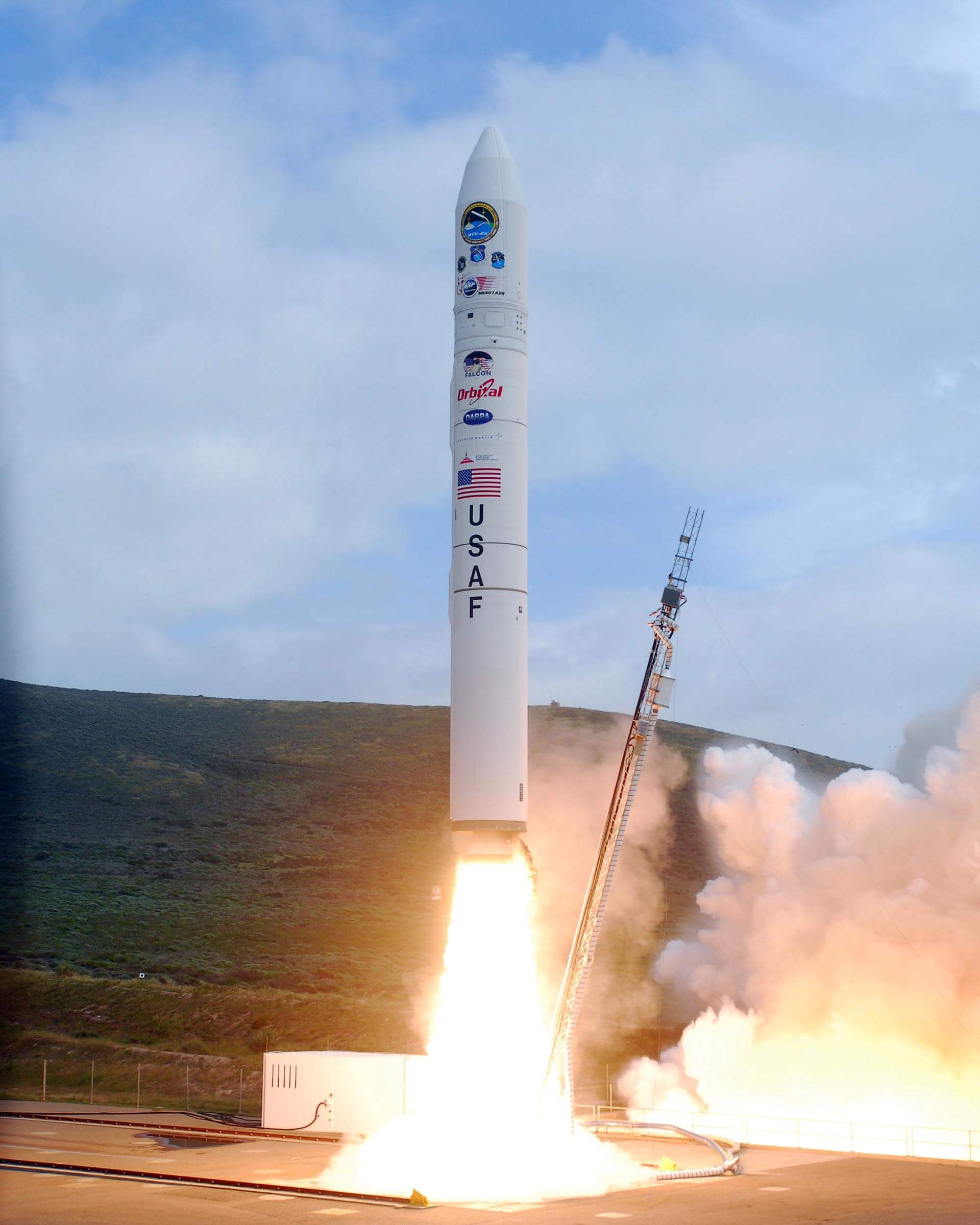
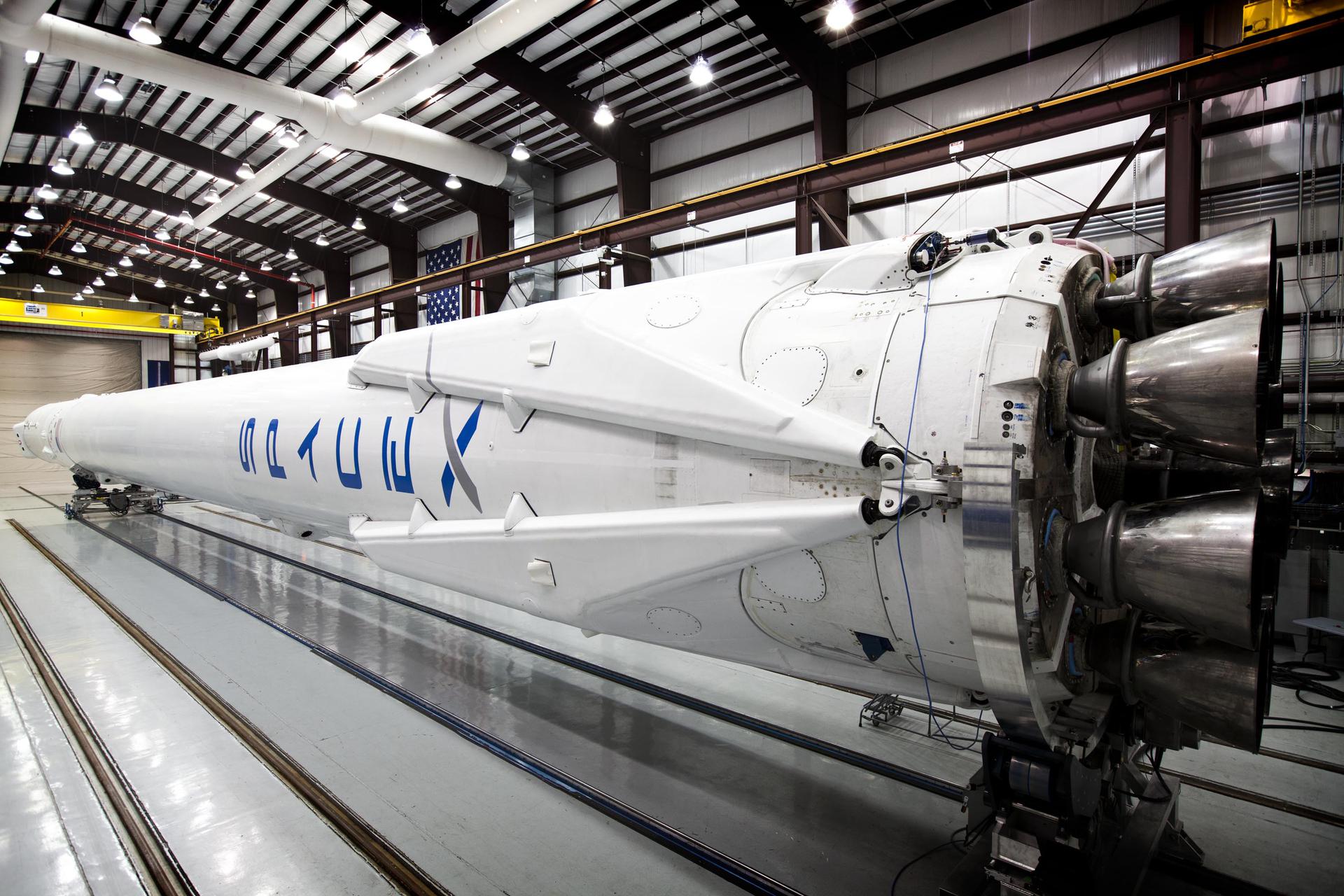
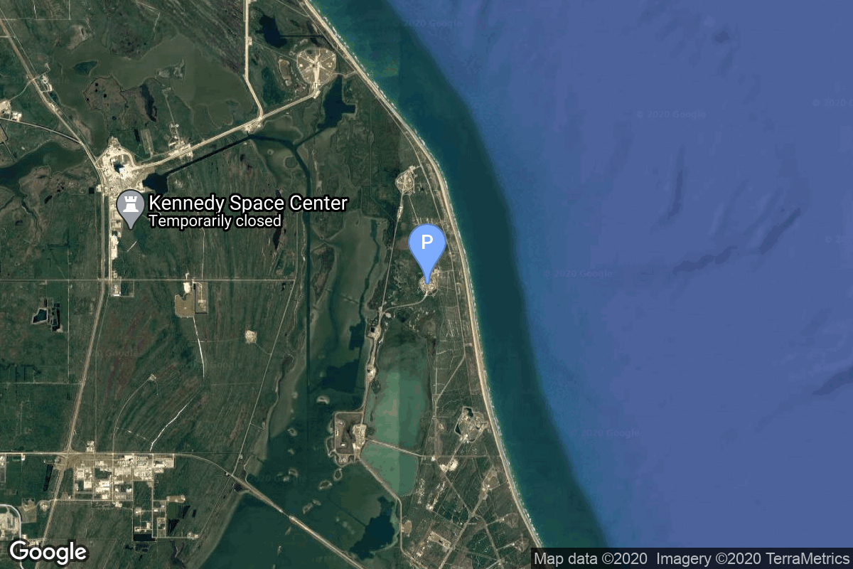
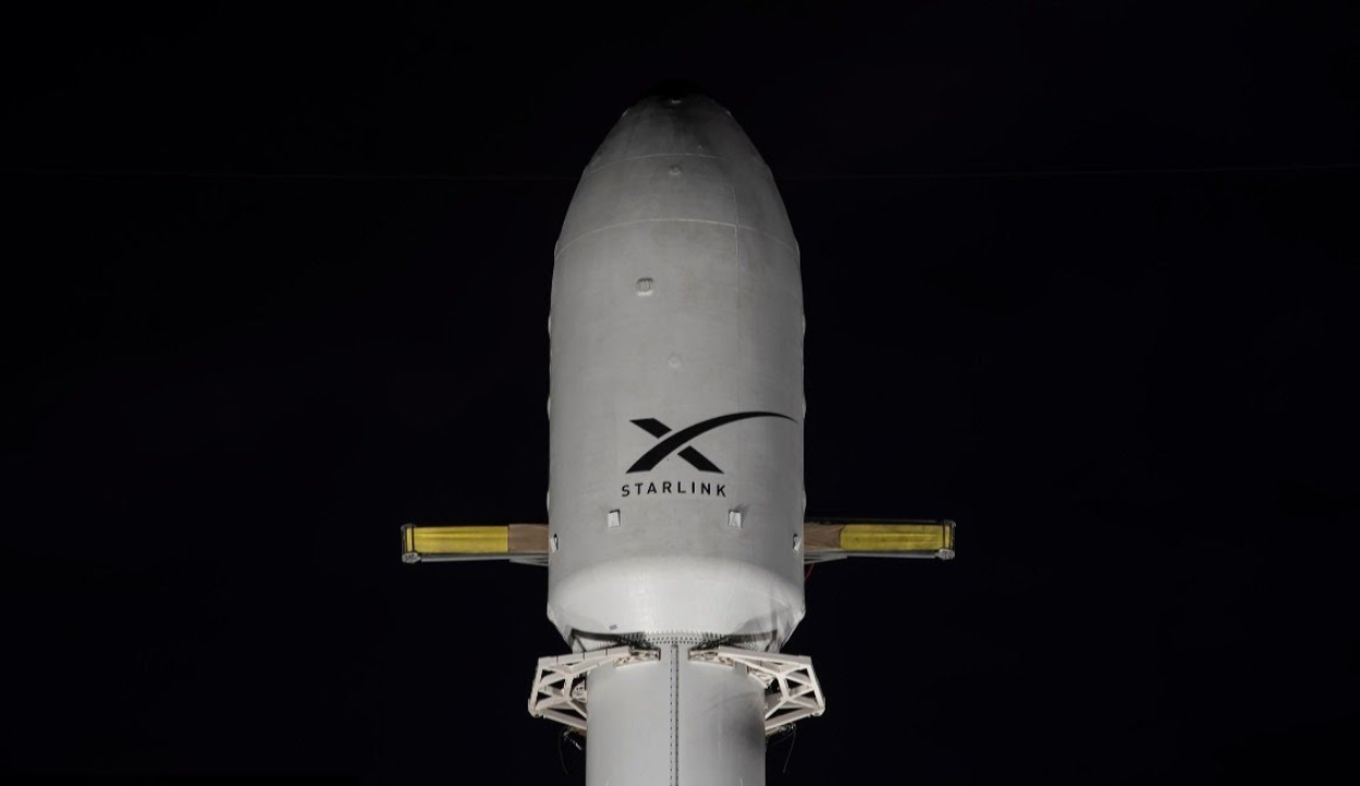
GET /2.2.0/launch/?format=api&offset=10&ordering=-last_updated
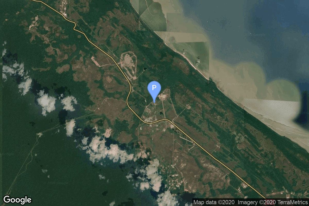
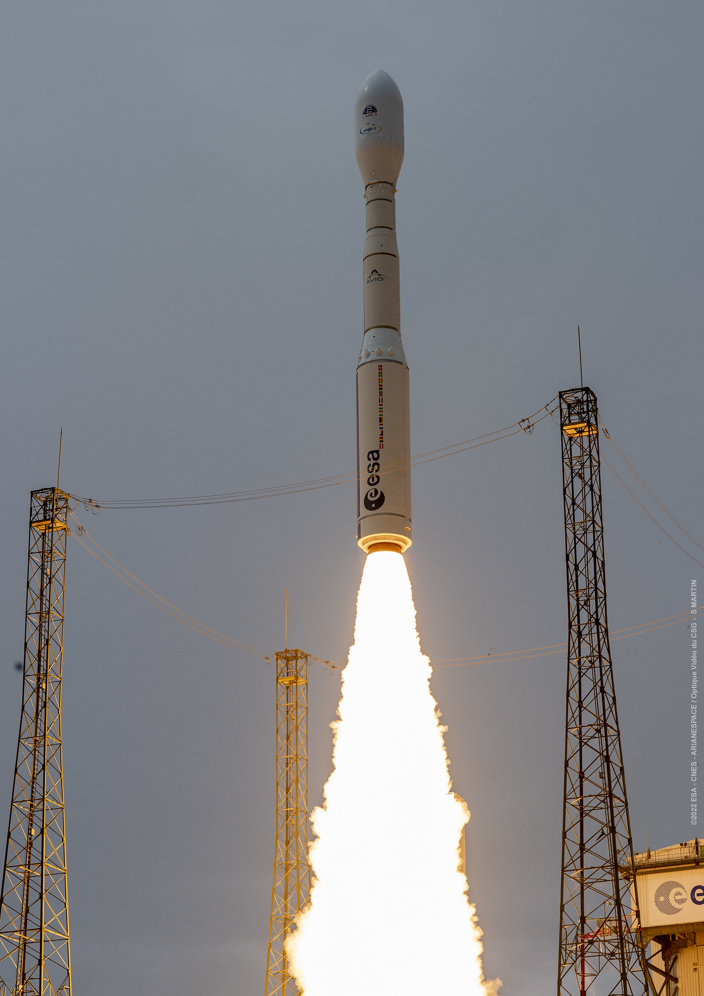
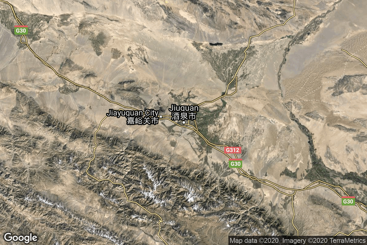
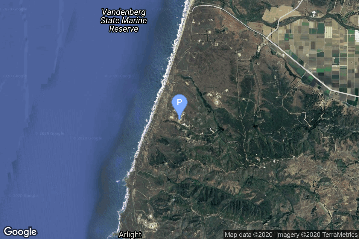
{ "count": 549, "next": "https://lldev.thespacedevs.com/2.2.0/launch/?format=api&limit=10&offset=20&ordering=-last_updated", "previous": "https://lldev.thespacedevs.com/2.2.0/launch/?format=api&limit=10&ordering=-last_updated", "results": [ { "id": "9eb09815-c237-4fdd-9057-5b161131240c", "url": "https://lldev.thespacedevs.com/2.2.0/launch/9eb09815-c237-4fdd-9057-5b161131240c/?format=api", "slug": "atlas-v-551-amazon-leo-la-08", "name": "Atlas V 551 | Amazon Leo (LA-08)", "status": { "id": 2, "name": "To Be Determined", "abbrev": "TBD", "description": "Current date is a placeholder or rough estimation based on unreliable or interpreted sources." }, "last_updated": "2026-04-03T23:46:10Z", "net": "2026-06-30T00:00:00Z", "window_end": "2026-06-30T00:00:00Z", "window_start": "2026-06-30T00:00:00Z", "net_precision": { "id": 9, "name": "Quarter 2", "abbrev": "Q2", "description": "The T-0 is expected in the second quarter of the given year." }, "probability": null, "weather_concerns": null, "holdreason": "", "failreason": "", "hashtag": null, "launch_service_provider": { "id": 124, "url": "https://lldev.thespacedevs.com/2.2.0/agencies/124/?format=api", "name": "United Launch Alliance", "type": "Commercial" }, "rocket": { "id": 184, "configuration": { "id": 27, "url": "https://lldev.thespacedevs.com/2.2.0/config/launcher/27/?format=api", "name": "Atlas V 551", "family": "Atlas", "full_name": "Atlas V 551", "variant": "551" } }, "mission": { "id": 6000, "name": "Amazon Leo (LA-08)", "description": "Amazon Leo, formerly known as Project Kuiper, is a mega constellation of satellites in Low Earth Orbit that will offer broadband internet access, this constellation will be managed by Kuiper Systems LLC, a subsidiary of Amazon. This constellation is planned to be composed of 3,276 satellites. The satellites are projected to be placed in 98 orbital planes in three orbital layers, one at 590 km, 610 km and 630 km altitude.\r\n\r\n29 satellites are carried on this launch.", "launch_designator": null, "type": "Communications", "orbit": { "id": 8, "name": "Low Earth Orbit", "abbrev": "LEO" }, "agencies": [ { "id": 1058, "url": "https://lldev.thespacedevs.com/2.2.0/agencies/1058/?format=api", "name": "Amazon Leo", "featured": false, "type": "Private", "country_code": "USA", "abbrev": "Amazon", "description": "Amazon Leo, formerly known as Kuiper Systems LLC and Project Kuiper, is a subsidiary of Amazon that was established in 2019 to deploy a large satellite internet constellation to provide low-latency broadband internet connectivity.", "administrator": "President: Rajeev Badyal", "founding_year": "2019", "launchers": "", "spacecraft": "", "launch_library_url": null, "total_launch_count": 0, "consecutive_successful_launches": 0, "successful_launches": 0, "failed_launches": 0, "pending_launches": 0, "consecutive_successful_landings": 0, "successful_landings": 0, "failed_landings": 0, "attempted_landings": 0, "info_url": "https://leo.amazon.com/", "wiki_url": "https://en.wikipedia.org/wiki/Kuiper_Systems", "logo_url": null, "image_url": null, "nation_url": "https://thespacedevs-dev.nyc3.digitaloceanspaces.com/media/images/amazon_leo_soci_image_20251117075814.png" } ], "info_urls": [], "vid_urls": [] }, "pad": { "id": 29, "url": "https://lldev.thespacedevs.com/2.2.0/pad/29/?format=api", "agency_id": null, "name": "Space Launch Complex 41", "description": "", "info_url": null, "wiki_url": "https://en.wikipedia.org/wiki/Cape_Canaveral_Air_Force_Station_Space_Launch_Complex_41", "map_url": "https://www.google.com/maps?q=28.58341025,-80.58303644", "latitude": "28.58341025", "longitude": "-80.58303644", "location": { "id": 12, "url": "https://lldev.thespacedevs.com/2.2.0/location/12/?format=api", "name": "Cape Canaveral SFS, FL, USA", "country_code": "USA", "description": "Cape Canaveral Space Force Station (CCSFS) is an installation of the United States Space Force's Space Launch Delta 45, located on Cape Canaveral in Brevard County, Florida.", "map_image": "https://thespacedevs-dev.nyc3.digitaloceanspaces.com/media/map_images/location_12_20200803142519.jpg", "timezone_name": "America/New_York", "total_launch_count": 1100, "total_landing_count": 71 }, "country_code": "USA", "map_image": "https://thespacedevs-dev.nyc3.digitaloceanspaces.com/media/map_images/pad_29_20200803143528.jpg", "total_launch_count": 122, "orbital_launch_attempt_count": 122 }, "webcast_live": false, "image": "https://thespacedevs-dev.nyc3.digitaloceanspaces.com/media/images/atlas2520v2520551_image_20190224012316.jpeg", "infographic": null, "program": [ { "id": 27, "url": "https://lldev.thespacedevs.com/2.2.0/program/27/?format=api", "name": "Amazon Leo", "description": "Amazon Leo is a satellite internet constellation aimed at providing high-speed, low-latency broadband connectivity to underserved and remote areas globally. The project involves deploying a constellation of low Earth orbit (LEO) satellites to create a satellite internet network capable of delivering reliable internet access.", "agencies": [ { "id": 1058, "url": "https://lldev.thespacedevs.com/2.2.0/agencies/1058/?format=api", "name": "Amazon Leo", "type": "Private" } ], "image_url": "https://thespacedevs-dev.nyc3.digitaloceanspaces.com/media/images/project2520kui_program_20231228165031.jpeg", "start_date": "2023-10-16T18:06:00Z", "end_date": null, "info_url": "https://en.wikipedia.org/wiki/Kuiper_Systems", "wiki_url": "https://aboutamazon.com/what-we-do/devices-services/project-kuiper", "mission_patches": [], "type": { "id": 3, "name": "Communication Constellation" } } ], "orbital_launch_attempt_count": 7303, "location_launch_attempt_count": 1110, "pad_launch_attempt_count": 125, "agency_launch_attempt_count": 175, "orbital_launch_attempt_count_year": 130, "location_launch_attempt_count_year": 34, "pad_launch_attempt_count_year": 5, "agency_launch_attempt_count_year": 5, "type": "normal" }, { "id": "ff0a6a32-6513-4e85-9fd8-a2d022add74d", "url": "https://lldev.thespacedevs.com/2.2.0/launch/ff0a6a32-6513-4e85-9fd8-a2d022add74d/?format=api", "slug": "atlas-v-551-amazon-leo-la-07", "name": "Atlas V 551 | Amazon Leo (LA-07)", "status": { "id": 2, "name": "To Be Determined", "abbrev": "TBD", "description": "Current date is a placeholder or rough estimation based on unreliable or interpreted sources." }, "last_updated": "2026-04-03T23:45:38Z", "net": "2026-06-30T00:00:00Z", "window_end": "2026-06-30T00:00:00Z", "window_start": "2026-06-30T00:00:00Z", "net_precision": { "id": 9, "name": "Quarter 2", "abbrev": "Q2", "description": "The T-0 is expected in the second quarter of the given year." }, "probability": null, "weather_concerns": null, "holdreason": "", "failreason": "", "hashtag": null, "launch_service_provider": { "id": 124, "url": "https://lldev.thespacedevs.com/2.2.0/agencies/124/?format=api", "name": "United Launch Alliance", "type": "Commercial" }, "rocket": { "id": 180, "configuration": { "id": 27, "url": "https://lldev.thespacedevs.com/2.2.0/config/launcher/27/?format=api", "name": "Atlas V 551", "family": "Atlas", "full_name": "Atlas V 551", "variant": "551" } }, "mission": { "id": 5999, "name": "Amazon Leo (LA-07)", "description": "Amazon Leo, formerly known as Project Kuiper, is a mega constellation of satellites in Low Earth Orbit that will offer broadband internet access, this constellation will be managed by Kuiper Systems LLC, a subsidiary of Amazon. This constellation is planned to be composed of 3,276 satellites. The satellites are projected to be placed in 98 orbital planes in three orbital layers, one at 590 km, 610 km and 630 km altitude.\r\n\r\n29 satellites are carried on this launch.", "launch_designator": null, "type": "Communications", "orbit": { "id": 8, "name": "Low Earth Orbit", "abbrev": "LEO" }, "agencies": [ { "id": 1058, "url": "https://lldev.thespacedevs.com/2.2.0/agencies/1058/?format=api", "name": "Amazon Leo", "featured": false, "type": "Private", "country_code": "USA", "abbrev": "Amazon", "description": "Amazon Leo, formerly known as Kuiper Systems LLC and Project Kuiper, is a subsidiary of Amazon that was established in 2019 to deploy a large satellite internet constellation to provide low-latency broadband internet connectivity.", "administrator": "President: Rajeev Badyal", "founding_year": "2019", "launchers": "", "spacecraft": "", "launch_library_url": null, "total_launch_count": 0, "consecutive_successful_launches": 0, "successful_launches": 0, "failed_launches": 0, "pending_launches": 0, "consecutive_successful_landings": 0, "successful_landings": 0, "failed_landings": 0, "attempted_landings": 0, "info_url": "https://leo.amazon.com/", "wiki_url": "https://en.wikipedia.org/wiki/Kuiper_Systems", "logo_url": null, "image_url": null, "nation_url": "https://thespacedevs-dev.nyc3.digitaloceanspaces.com/media/images/amazon_leo_soci_image_20251117075814.png" } ], "info_urls": [], "vid_urls": [] }, "pad": { "id": 29, "url": "https://lldev.thespacedevs.com/2.2.0/pad/29/?format=api", "agency_id": null, "name": "Space Launch Complex 41", "description": "", "info_url": null, "wiki_url": "https://en.wikipedia.org/wiki/Cape_Canaveral_Air_Force_Station_Space_Launch_Complex_41", "map_url": "https://www.google.com/maps?q=28.58341025,-80.58303644", "latitude": "28.58341025", "longitude": "-80.58303644", "location": { "id": 12, "url": "https://lldev.thespacedevs.com/2.2.0/location/12/?format=api", "name": "Cape Canaveral SFS, FL, USA", "country_code": "USA", "description": "Cape Canaveral Space Force Station (CCSFS) is an installation of the United States Space Force's Space Launch Delta 45, located on Cape Canaveral in Brevard County, Florida.", "map_image": "https://thespacedevs-dev.nyc3.digitaloceanspaces.com/media/map_images/location_12_20200803142519.jpg", "timezone_name": "America/New_York", "total_launch_count": 1100, "total_landing_count": 71 }, "country_code": "USA", "map_image": "https://thespacedevs-dev.nyc3.digitaloceanspaces.com/media/map_images/pad_29_20200803143528.jpg", "total_launch_count": 122, "orbital_launch_attempt_count": 122 }, "webcast_live": false, "image": "https://thespacedevs-dev.nyc3.digitaloceanspaces.com/media/images/atlas2520v2520551_image_20190224012316.jpeg", "infographic": null, "program": [ { "id": 27, "url": "https://lldev.thespacedevs.com/2.2.0/program/27/?format=api", "name": "Amazon Leo", "description": "Amazon Leo is a satellite internet constellation aimed at providing high-speed, low-latency broadband connectivity to underserved and remote areas globally. The project involves deploying a constellation of low Earth orbit (LEO) satellites to create a satellite internet network capable of delivering reliable internet access.", "agencies": [ { "id": 1058, "url": "https://lldev.thespacedevs.com/2.2.0/agencies/1058/?format=api", "name": "Amazon Leo", "type": "Private" } ], "image_url": "https://thespacedevs-dev.nyc3.digitaloceanspaces.com/media/images/project2520kui_program_20231228165031.jpeg", "start_date": "2023-10-16T18:06:00Z", "end_date": null, "info_url": "https://en.wikipedia.org/wiki/Kuiper_Systems", "wiki_url": "https://aboutamazon.com/what-we-do/devices-services/project-kuiper", "mission_patches": [], "type": { "id": 3, "name": "Communication Constellation" } } ], "orbital_launch_attempt_count": 7303, "location_launch_attempt_count": 1110, "pad_launch_attempt_count": 125, "agency_launch_attempt_count": 175, "orbital_launch_attempt_count_year": 130, "location_launch_attempt_count_year": 34, "pad_launch_attempt_count_year": 5, "agency_launch_attempt_count_year": 5, "type": "normal" }, { "id": "53769468-bfd3-45c7-a52b-46a68ed7510f", "url": "https://lldev.thespacedevs.com/2.2.0/launch/53769468-bfd3-45c7-a52b-46a68ed7510f/?format=api", "slug": "new-glenn-bluebird-block-2-2", "name": "New Glenn | BlueBird Block 2 #2", "status": { "id": 8, "name": "To Be Confirmed", "abbrev": "TBC", "description": "Awaiting official confirmation - current date is known with some certainty." }, "last_updated": "2026-04-03T21:46:56Z", "net": "2026-04-14T10:45:00Z", "window_end": "2026-04-14T13:43:00Z", "window_start": "2026-04-14T10:45:00Z", "net_precision": { "id": 1, "name": "Minute", "abbrev": "MIN", "description": "The T-0 is accurate to the minute." }, "probability": null, "weather_concerns": null, "holdreason": "", "failreason": "", "hashtag": null, "launch_service_provider": { "id": 141, "url": "https://lldev.thespacedevs.com/2.2.0/agencies/141/?format=api", "name": "Blue Origin", "type": "Commercial" }, "rocket": { "id": 8408, "configuration": { "id": 138, "url": "https://lldev.thespacedevs.com/2.2.0/config/launcher/138/?format=api", "name": "New Glenn", "family": "New Glenn", "full_name": "New Glenn", "variant": "" } }, "mission": { "id": 6996, "name": "BlueBird Block 2 #2", "description": "AST SpaceMobile’s Block 2 BlueBird satellites are designed to deliver up to 10 times the bandwidth capacity of the BlueBird Block 1 satellites, required to achieve 24/7 continuous cellular broadband service coverage in the United States, with beams designed to support a capacity of up to 40 MHz, enabling peak data transmission speeds up to 120 Mbps, supporting voice, full data and video applications. The Block 2 BlueBirds, featuring as large as 2400 square foot communications arrays, will be the largest satellites ever commercially deployed in Low Earth orbit once launched.\r\n\r\nThis launch will feature 1 satellite, BlueBird 7/BlueBird Block 2 FM2.", "launch_designator": null, "type": "Communications", "orbit": { "id": 8, "name": "Low Earth Orbit", "abbrev": "LEO" }, "agencies": [], "info_urls": [], "vid_urls": [] }, "pad": { "id": 121, "url": "https://lldev.thespacedevs.com/2.2.0/pad/121/?format=api", "agency_id": 161, "name": "Launch Complex 36A", "description": null, "info_url": null, "wiki_url": "https://en.wikipedia.org/wiki/Cape_Canaveral_Launch_Complex_36", "map_url": "https://www.google.com/maps?q=28.4705556,-80.542194", "latitude": "28.4705556", "longitude": "-80.542194", "location": { "id": 12, "url": "https://lldev.thespacedevs.com/2.2.0/location/12/?format=api", "name": "Cape Canaveral SFS, FL, USA", "country_code": "USA", "description": "Cape Canaveral Space Force Station (CCSFS) is an installation of the United States Space Force's Space Launch Delta 45, located on Cape Canaveral in Brevard County, Florida.", "map_image": "https://thespacedevs-dev.nyc3.digitaloceanspaces.com/media/map_images/location_12_20200803142519.jpg", "timezone_name": "America/New_York", "total_launch_count": 1100, "total_landing_count": 71 }, "country_code": "USA", "map_image": "https://thespacedevs-dev.nyc3.digitaloceanspaces.com/media/map_images/pad_121_20200803143231.jpg", "total_launch_count": 70, "orbital_launch_attempt_count": 70 }, "webcast_live": false, "image": "https://thespacedevs-dev.nyc3.digitaloceanspaces.com/media/images/new_glenn_on_th_image_20251113164507.jpg", "infographic": null, "program": [], "orbital_launch_attempt_count": 7261, "location_launch_attempt_count": 1103, "pad_launch_attempt_count": 71, "agency_launch_attempt_count": 41, "orbital_launch_attempt_count_year": 88, "location_launch_attempt_count_year": 27, "pad_launch_attempt_count_year": 1, "agency_launch_attempt_count_year": 2, "type": "normal" }, { "id": "bc0cca05-0fb5-43ca-b648-a852d20ceaf3", "url": "https://lldev.thespacedevs.com/2.2.0/launch/bc0cca05-0fb5-43ca-b648-a852d20ceaf3/?format=api", "slug": "soyuz-21afregat-m-meridian-m-no21l", "name": "Soyuz 2.1a/Fregat-M | Meridian-M No.21L", "status": { "id": 3, "name": "Launch Successful", "abbrev": "Success", "description": "The launch vehicle successfully inserted its payload(s) into the target orbit(s)." }, "last_updated": "2026-04-03T18:25:45Z", "net": "2026-04-03T06:28:00Z", "window_end": "2026-04-03T12:00:00Z", "window_start": "2026-04-03T02:00:00Z", "net_precision": { "id": 1, "name": "Minute", "abbrev": "MIN", "description": "The T-0 is accurate to the minute." }, "probability": null, "weather_concerns": null, "holdreason": "", "failreason": "", "hashtag": null, "launch_service_provider": { "id": 193, "url": "https://lldev.thespacedevs.com/2.2.0/agencies/193/?format=api", "name": "Russian Space Forces", "type": "Government" }, "rocket": { "id": 8956, "configuration": { "id": 45, "url": "https://lldev.thespacedevs.com/2.2.0/config/launcher/45/?format=api", "name": "Soyuz 2.1a/Fregat-M", "family": "Soyuz", "full_name": "Soyuz 2.1a Fregat-M", "variant": "Fregat-M" } }, "mission": { "id": 7551, "name": "Meridian-M No.21L", "description": "Note: Payload identity uncertain.\r\n\r\nMeridian is a series of communications satellite for military and civilian use.", "launch_designator": null, "type": "Communications", "orbit": { "id": 0, "name": "Elliptical Orbit", "abbrev": "Elliptical" }, "agencies": [], "info_urls": [], "vid_urls": [] }, "pad": { "id": 36, "url": "https://lldev.thespacedevs.com/2.2.0/pad/36/?format=api", "agency_id": 163, "name": "43/3 (43L)", "description": "", "info_url": null, "wiki_url": null, "map_url": "https://www.google.com/maps?q=62.9273,40.45", "latitude": "62.9273", "longitude": "40.45", "location": { "id": 6, "url": "https://lldev.thespacedevs.com/2.2.0/location/6/?format=api", "name": "Plesetsk Cosmodrome, Russian Federation", "country_code": "RUS", "description": "Plesetsk Cosmodrome is a Russian spaceport located in Mirny, Arkhangelsk Oblast, about 800 km north of Moscow and approximately 200 km south of Arkhangelsk. Originally developed as an ICBM site for the R-7 missile, it also served for numerous satellite launches using the R-7 and other rockets. Its high latitude makes it useful only for certain types of launches, especially the Molniya orbits, so for much of the site's history it functioned as a secondary location, with most orbital launches taking place from Baikonur, in the Kazakh SSR. With the end of the Soviet Union, Baikonur became a foreign territory, and Kazakhstan charged $115 million usage fees annually. Consequently, Plesetsk has seen considerably more activity since the 2000s.", "map_image": "https://thespacedevs-dev.nyc3.digitaloceanspaces.com/media/map_images/location_6_20200803142434.jpg", "timezone_name": "Europe/Moscow", "total_launch_count": 1683, "total_landing_count": 0 }, "country_code": "RUS", "map_image": "https://thespacedevs-dev.nyc3.digitaloceanspaces.com/media/map_images/pad_36_20200803143534.jpg", "total_launch_count": 232, "orbital_launch_attempt_count": 232 }, "webcast_live": false, "image": "https://thespacedevs-dev.nyc3.digitaloceanspaces.com/media/images/soyuz25202.1a_image_20190726062341.png", "infographic": null, "program": [], "orbital_launch_attempt_count": 7249, "location_launch_attempt_count": 1683, "pad_launch_attempt_count": 232, "agency_launch_attempt_count": 149, "orbital_launch_attempt_count_year": 76, "location_launch_attempt_count_year": 3, "pad_launch_attempt_count_year": 1, "agency_launch_attempt_count_year": 2, "type": "normal" }, { "id": "ca4fc7a6-fa84-47f7-89f7-dcf299665817", "url": "https://lldev.thespacedevs.com/2.2.0/launch/ca4fc7a6-fa84-47f7-89f7-dcf299665817/?format=api", "slug": "minotaur-iv-stp-s29a", "name": "Minotaur IV | STP-S29A", "status": { "id": 1, "name": "Go for Launch", "abbrev": "Go", "description": "Current T-0 confirmed by official or reliable sources." }, "last_updated": "2026-04-03T18:23:45Z", "net": "2026-04-07T11:30:00Z", "window_end": "2026-04-07T16:30:00Z", "window_start": "2026-04-07T11:30:00Z", "net_precision": { "id": 1, "name": "Minute", "abbrev": "MIN", "description": "The T-0 is accurate to the minute." }, "probability": null, "weather_concerns": null, "holdreason": "", "failreason": "", "hashtag": null, "launch_service_provider": { "id": 257, "url": "https://lldev.thespacedevs.com/2.2.0/agencies/257/?format=api", "name": "Northrop Grumman Space Systems", "type": "Commercial" }, "rocket": { "id": 8375, "configuration": { "id": 52, "url": "https://lldev.thespacedevs.com/2.2.0/config/launcher/52/?format=api", "name": "Minotaur IV", "family": "Minotaur", "full_name": "Minotaur IV", "variant": "" } }, "mission": { "id": 6956, "name": "STP-S29A", "description": "STP-S29A is a mission under the U.S. Department of Defense's Space Test Program (STP) that will deliver technology demonstrations to orbit and contribute to future space system development, with this launch delivering up to 200 kg of STP cubesats to Low Earth Orbit.\r\n\r\nThe main payload will be STPSat-7, an ESPA class satellite based on the Aegis Aerospace M-1 satellite bus used on the STPSat-4 mission for hosting research and technology demonstration payloads for the Department of Defense (DoD). One of the payload is U.S. Naval Research Laboratory's (NRL) Lightsheet Anomaly Resolution and Debris Observation (LARADO) instrument, used to detect and characterize lethal non-trackable orbital debris with lasers in orbit.", "launch_designator": null, "type": "Technology", "orbit": { "id": 8, "name": "Low Earth Orbit", "abbrev": "LEO" }, "agencies": [], "info_urls": [], "vid_urls": [] }, "pad": { "id": 8, "url": "https://lldev.thespacedevs.com/2.2.0/pad/8/?format=api", "agency_id": 161, "name": "Space Launch Complex 8", "description": "Space Launch Complex 8 (SLC-8), is a launch pad at Vandenberg Space Force Base in California, United States. It is used by Minotaur rockets. It was originally part of the California Spaceport, and was known as the Commercial Launch Facility (CLF) or Space Launch Facility (SLF).", "info_url": null, "wiki_url": "https://en.wikipedia.org/wiki/Vandenberg_Space_Launch_Complex_8", "map_url": "https://www.google.com/maps?q=34.57635,-120.63245", "latitude": "34.57635", "longitude": "-120.63245", "location": { "id": 11, "url": "https://lldev.thespacedevs.com/2.2.0/location/11/?format=api", "name": "Vandenberg SFB, CA, USA", "country_code": "USA", "description": "Vandenberg Space Force Base is a United States Space Force Base in Santa Barbara County, California. Established in 1941, Vandenberg Space Force Base is a space launch base, launching spacecraft from the Western Range, and also performs missile testing. The United States Space Force's Space Launch Delta 30 serves as the host delta for the base, equivalent to an Air Force air base wing. In addition to its military space launch mission, Vandenberg Space Force Base also hosts space launches for civil and commercial space entities, such as NASA and SpaceX.", "map_image": "https://thespacedevs-dev.nyc3.digitaloceanspaces.com/media/map_images/location_11_20200803142416.jpg", "timezone_name": "America/Los_Angeles", "total_launch_count": 872, "total_landing_count": 33 }, "country_code": "USA", "map_image": "https://thespacedevs-dev.nyc3.digitaloceanspaces.com/media/map_images/pad_8_20200803143300.jpg", "total_launch_count": 9, "orbital_launch_attempt_count": 9 }, "webcast_live": false, "image": "https://thespacedevs-dev.nyc3.digitaloceanspaces.com/media/images/minotaur_iv_lau_image_20240307170209.jpeg", "infographic": null, "program": [], "orbital_launch_attempt_count": 7252, "location_launch_attempt_count": 874, "pad_launch_attempt_count": 10, "agency_launch_attempt_count": 16, "orbital_launch_attempt_count_year": 79, "location_launch_attempt_count_year": 22, "pad_launch_attempt_count_year": 1, "agency_launch_attempt_count_year": 1, "type": "normal" }, { "id": "63aa7636-d2b7-457f-a3e6-27e564e42941", "url": "https://lldev.thespacedevs.com/2.2.0/launch/63aa7636-d2b7-457f-a3e6-27e564e42941/?format=api", "slug": "falcon-9-block-5-starlink-group-10-58", "name": "Falcon 9 Block 5 | Starlink Group 10-58", "status": { "id": 3, "name": "Launch Successful", "abbrev": "Success", "description": "The launch vehicle successfully inserted its payload(s) into the target orbit(s)." }, "last_updated": "2026-04-03T17:23:18Z", "net": "2026-04-02T11:55:10Z", "window_end": "2026-04-02T15:52:00Z", "window_start": "2026-04-02T11:52:00Z", "net_precision": { "id": 0, "name": "Second", "abbrev": "SEC", "description": "The T-0 is accurate to the second." }, "probability": 60, "weather_concerns": "Cumulus Cloud Rule, Surface Electric Fields Rule", "holdreason": "", "failreason": "", "hashtag": null, "launch_service_provider": { "id": 121, "url": "https://lldev.thespacedevs.com/2.2.0/agencies/121/?format=api", "name": "SpaceX", "type": "Commercial" }, "rocket": { "id": 8951, "configuration": { "id": 164, "url": "https://lldev.thespacedevs.com/2.2.0/config/launcher/164/?format=api", "name": "Falcon 9", "family": "Falcon", "full_name": "Falcon 9 Block 5", "variant": "Block 5" } }, "mission": { "id": 7546, "name": "Starlink Group 10-58", "description": "A batch of 29 satellites for the Starlink mega-constellation - SpaceX's project for space-based Internet communication system.", "launch_designator": null, "type": "Communications", "orbit": { "id": 8, "name": "Low Earth Orbit", "abbrev": "LEO" }, "agencies": [ { "id": 121, "url": "https://lldev.thespacedevs.com/2.2.0/agencies/121/?format=api", "name": "SpaceX", "featured": true, "type": "Commercial", "country_code": "USA", "abbrev": "SpX", "description": "Space Exploration Technologies Corp., known as SpaceX, is an American aerospace manufacturer and space transport services company headquartered in Hawthorne, California. It was founded in 2002 by entrepreneur Elon Musk with the goal of reducing space transportation costs and enabling the colonization of Mars. SpaceX operates from many pads, on the East Coast of the US they operate from SLC-40 at Cape Canaveral Space Force Station and historic LC-39A at Kennedy Space Center. They also operate from SLC-4E at Vandenberg Space Force Base, California, usually for polar launches. Another launch site is being developed at Boca Chica, Texas.", "administrator": "CEO: Elon Musk", "founding_year": "2002", "launchers": "Falcon | Starship", "spacecraft": "Dragon", "launch_library_url": null, "total_launch_count": 660, "consecutive_successful_launches": 145, "successful_launches": 645, "failed_launches": 15, "pending_launches": 122, "consecutive_successful_landings": 144, "successful_landings": 605, "failed_landings": 27, "attempted_landings": 631, "info_url": "https://www.spacex.com/", "wiki_url": "https://en.wikipedia.org/wiki/SpaceX", "logo_url": "https://thespacedevs-dev.nyc3.digitaloceanspaces.com/media/images/spacex_logo_20220826094919.png", "image_url": "https://thespacedevs-dev.nyc3.digitaloceanspaces.com/media/images/spacex_image_20190207032501.jpeg", "nation_url": "https://thespacedevs-dev.nyc3.digitaloceanspaces.com/media/images/spacex_nation_20230531064544.jpg" } ], "info_urls": [], "vid_urls": [] }, "pad": { "id": 80, "url": "https://lldev.thespacedevs.com/2.2.0/pad/80/?format=api", "agency_id": 121, "name": "Space Launch Complex 40", "description": "", "info_url": null, "wiki_url": "https://en.wikipedia.org/wiki/Cape_Canaveral_Air_Force_Station_Space_Launch_Complex_40", "map_url": "https://www.google.com/maps?q=28.56194122,-80.57735736", "latitude": "28.56194122", "longitude": "-80.57735736", "location": { "id": 12, "url": "https://lldev.thespacedevs.com/2.2.0/location/12/?format=api", "name": "Cape Canaveral SFS, FL, USA", "country_code": "USA", "description": "Cape Canaveral Space Force Station (CCSFS) is an installation of the United States Space Force's Space Launch Delta 45, located on Cape Canaveral in Brevard County, Florida.", "map_image": "https://thespacedevs-dev.nyc3.digitaloceanspaces.com/media/map_images/location_12_20200803142519.jpg", "timezone_name": "America/New_York", "total_launch_count": 1100, "total_landing_count": 71 }, "country_code": "USA", "map_image": "https://thespacedevs-dev.nyc3.digitaloceanspaces.com/media/map_images/pad_80_20200803143323.jpg", "total_launch_count": 376, "orbital_launch_attempt_count": 376 }, "webcast_live": false, "image": "https://thespacedevs-dev.nyc3.digitaloceanspaces.com/media/images/falcon2520925_image_20221009234147.png", "infographic": null, "program": [ { "id": 25, "url": "https://lldev.thespacedevs.com/2.2.0/program/25/?format=api", "name": "Starlink", "description": "Starlink is a satellite internet constellation operated by American aerospace company SpaceX", "agencies": [ { "id": 121, "url": "https://lldev.thespacedevs.com/2.2.0/agencies/121/?format=api", "name": "SpaceX", "type": "Commercial" } ], "image_url": "https://thespacedevs-dev.nyc3.digitaloceanspaces.com/media/images/starlink_program_20231228154508.jpeg", "start_date": "2018-02-22T14:17:00Z", "end_date": null, "info_url": "https://starlink.com", "wiki_url": "https://en.wikipedia.org/wiki/Starlink", "mission_patches": [ { "id": 7, "name": "Space X Starlink Mission Patch", "priority": 10, "image_url": "https://thespacedevs-dev.nyc3.digitaloceanspaces.com/media/mission_patch_images/space2520x252_mission_patch_20221011205756.png", "agency": { "id": 121, "url": "https://lldev.thespacedevs.com/2.2.0/agencies/121/?format=api", "name": "SpaceX", "type": "Commercial" } } ], "type": { "id": 3, "name": "Communication Constellation" } } ], "orbital_launch_attempt_count": 7247, "location_launch_attempt_count": 1099, "pad_launch_attempt_count": 376, "agency_launch_attempt_count": 660, "orbital_launch_attempt_count_year": 74, "location_launch_attempt_count_year": 23, "pad_launch_attempt_count_year": 22, "agency_launch_attempt_count_year": 41, "type": "normal" }, { "id": "b31313da-ee5d-42b2-9a27-20cc18105276", "url": "https://lldev.thespacedevs.com/2.2.0/launch/b31313da-ee5d-42b2-9a27-20cc18105276/?format=api", "slug": "vega-c-solar-wind-magnetosphere-ionosphere-link-ex", "name": "Vega-C | Solar wind Magnetosphere Ionosphere Link Explorer (SMILE)", "status": { "id": 1, "name": "Go for Launch", "abbrev": "Go", "description": "Current T-0 confirmed by official or reliable sources." }, "last_updated": "2026-04-03T06:34:03Z", "net": "2026-04-09T06:29:00Z", "window_end": "2026-04-09T06:29:00Z", "window_start": "2026-04-09T06:29:00Z", "net_precision": { "id": 1, "name": "Minute", "abbrev": "MIN", "description": "The T-0 is accurate to the minute." }, "probability": null, "weather_concerns": null, "holdreason": "", "failreason": "", "hashtag": "VV29", "launch_service_provider": { "id": 159, "url": "https://lldev.thespacedevs.com/2.2.0/agencies/159/?format=api", "name": "Avio S.p.A", "type": "Commercial" }, "rocket": { "id": 7792, "configuration": { "id": 127, "url": "https://lldev.thespacedevs.com/2.2.0/config/launcher/127/?format=api", "name": "Vega-C", "family": "Vega", "full_name": "Vega-C", "variant": "" } }, "mission": { "id": 6309, "name": "Solar wind Magnetosphere Ionosphere Link Explorer (SMILE)", "description": "Joint mission between the European Space Agency and the Chinese Academy of Sciences to investigate the interaction between Earth’s protective shield – the magnetosphere – and the supersonic solar wind.", "launch_designator": null, "type": "Astrophysics", "orbit": { "id": 0, "name": "Elliptical Orbit", "abbrev": "Elliptical" }, "agencies": [ { "id": 1106, "url": "https://lldev.thespacedevs.com/2.2.0/agencies/1106/?format=api", "name": "Chinese Academy of Sciences", "featured": false, "type": "Government", "country_code": "CHN", "abbrev": "CAS", "description": "The Chinese Academy of Sciences (CAS; Chinese: 中国科学院) is the national academy for natural sciences and the highest consultancy for science and technology of the People's Republic of China.", "administrator": "President: Hou Jianguo", "founding_year": "1949", "launchers": "", "spacecraft": "", "launch_library_url": null, "total_launch_count": 0, "consecutive_successful_launches": 0, "successful_launches": 0, "failed_launches": 0, "pending_launches": 0, "consecutive_successful_landings": 0, "successful_landings": 0, "failed_landings": 0, "attempted_landings": 0, "info_url": "https://www.cas.cn/", "wiki_url": "https://en.wikipedia.org/wiki/Chinese_Academy_of_Sciences", "logo_url": "https://thespacedevs-dev.nyc3.digitaloceanspaces.com/media/images/china_academy_o_image_20260403063134.png", "image_url": null, "nation_url": "https://thespacedevs-dev.nyc3.digitaloceanspaces.com/media/images/china_academy_o_image_20260403063203.png" }, { "id": 27, "url": "https://lldev.thespacedevs.com/2.2.0/agencies/27/?format=api", "name": "European Space Agency", "featured": false, "type": "Multinational", "country_code": "FRA,ITA,DEU,ESP,CHE,GBR,AUT,SWE,PRT,NLD,HUN,POL,DNK,CZE,ROU,NOR,FIN,GRC,EST,IRL,LUX,BEL,SVN", "abbrev": "ESA", "description": "The European Space Agency is an intergovernmental organisation of 22 member states. Established in 1975 and headquartered in Paris, France, ESA has a worldwide staff of about 2,000 employees.\r\n\r\nESA's space flight programme includes human spaceflight (mainly through participation in the International Space Station program); the launch and operation of unmanned exploration missions to other planets and the Moon; Earth observation, science and telecommunication; designing launch vehicles; and maintaining a major spaceport, the Guiana Space Centre at Kourou, French Guiana.", "administrator": "Director General: Josef Aschbacher", "founding_year": "1975", "launchers": "Ariane | Vega", "spacecraft": "Space Rider", "launch_library_url": null, "total_launch_count": 7, "consecutive_successful_launches": 5, "successful_launches": 6, "failed_launches": 1, "pending_launches": 1, "consecutive_successful_landings": 0, "successful_landings": 0, "failed_landings": 0, "attempted_landings": 0, "info_url": "https://www.esa.int/", "wiki_url": "https://en.wikipedia.org/wiki/European_Space_Agency", "logo_url": "https://thespacedevs-dev.nyc3.digitaloceanspaces.com/media/images/european2520space2520agency_logo_20221130101442.png", "image_url": "https://thespacedevs-dev.nyc3.digitaloceanspaces.com/media/images/esa_patch_float_image_20250211192109.png", "nation_url": "https://thespacedevs-dev.nyc3.digitaloceanspaces.com/media/images/european2520space2520agency_logo_20221130101442.png" } ], "info_urls": [], "vid_urls": [] }, "pad": { "id": 34, "url": "https://lldev.thespacedevs.com/2.2.0/pad/34/?format=api", "agency_id": 115, "name": "Ariane Launch Area 1 (ELV)", "description": "ELA-1, now named Ensemble de Lancement Vega (short ELV), is a launch pad at the Centre Spatial Guyanais in French Guiana. It has been used to support launches of the Europa rocket, Ariane 1, Ariane 3, and is currently used to launch Vega rockets.", "info_url": null, "wiki_url": "https://en.wikipedia.org/wiki/ELA-1", "map_url": "https://www.google.com/maps?q=5.236,-52.775", "latitude": "5.236", "longitude": "-52.775", "location": { "id": 13, "url": "https://lldev.thespacedevs.com/2.2.0/location/13/?format=api", "name": "Guiana Space Centre, French Guiana", "country_code": "GUF", "description": "The Guiana Space Centre is a European spaceport to the northwest of Kourou in French Guiana, a region of France in South America. Kourou is located at a latitude of 5°. In operation since 1968, it is a suitable location for a spaceport because of its equatorial location and open sea to the east.", "map_image": "https://thespacedevs-dev.nyc3.digitaloceanspaces.com/media/map_images/location_13_20200803142412.jpg", "timezone_name": "America/Cayenne", "total_launch_count": 331, "total_landing_count": 0 }, "country_code": "GUF", "map_image": "https://thespacedevs-dev.nyc3.digitaloceanspaces.com/media/map_images/pad_34_20200803143527.jpg", "total_launch_count": 54, "orbital_launch_attempt_count": 54 }, "webcast_live": false, "image": "https://thespacedevs-dev.nyc3.digitaloceanspaces.com/media/images/vega-c_image_20220713154437.jpg", "infographic": null, "program": [], "orbital_launch_attempt_count": 7256, "location_launch_attempt_count": 332, "pad_launch_attempt_count": 55, "agency_launch_attempt_count": 1, "orbital_launch_attempt_count_year": 83, "location_launch_attempt_count_year": 2, "pad_launch_attempt_count_year": 1, "agency_launch_attempt_count_year": 1, "type": "normal" }, { "id": "98451321-cd10-4ca7-a0d1-4076db5fa73d", "url": "https://lldev.thespacedevs.com/2.2.0/launch/98451321-cd10-4ca7-a0d1-4076db5fa73d/?format=api", "slug": "tianlong-3-demo-flight", "name": "Tianlong-3 | Demo Flight", "status": { "id": 4, "name": "Launch Failure", "abbrev": "Failure", "description": "Either the launch vehicle did not reach orbit, or the payload(s) failed to separate." }, "last_updated": "2026-04-03T06:29:50Z", "net": "2026-04-03T04:17:00Z", "window_end": "2026-04-03T06:09:00Z", "window_start": "2026-04-03T03:52:00Z", "net_precision": { "id": 1, "name": "Minute", "abbrev": "MIN", "description": "The T-0 is accurate to the minute." }, "probability": null, "weather_concerns": null, "holdreason": "", "failreason": "Apparently failed around stage separation.", "hashtag": null, "launch_service_provider": { "id": 1049, "url": "https://lldev.thespacedevs.com/2.2.0/agencies/1049/?format=api", "name": "Space Pioneer", "type": "Commercial" }, "rocket": { "id": 8822, "configuration": { "id": 540, "url": "https://lldev.thespacedevs.com/2.2.0/config/launcher/540/?format=api", "name": "Tianlong-3", "family": "", "full_name": "Tianlong-3", "variant": "" } }, "mission": { "id": 7413, "name": "Demo Flight", "description": "First test launch of Space Pioneer’s Tianlong-3 rocket.", "launch_designator": null, "type": "Test Flight", "orbit": { "id": 13, "name": "Polar Orbit", "abbrev": "PO" }, "agencies": [], "info_urls": [], "vid_urls": [] }, "pad": { "id": 245, "url": "https://lldev.thespacedevs.com/2.2.0/pad/245/?format=api", "agency_id": 1049, "name": "Tianlong-3 Launch Pad", "description": "", "info_url": null, "wiki_url": "https://en.wikipedia.org/wiki/Tianlong-3", "map_url": "https://www.google.com/maps?q=40.80720,100.13644", "latitude": "40.8072", "longitude": "100.13644", "location": { "id": 17, "url": "https://lldev.thespacedevs.com/2.2.0/location/17/?format=api", "name": "Jiuquan Satellite Launch Center, People's Republic of China", "country_code": "CHN", "description": "Jiuquan Satellite Launch Center is a Chinese spaceport located between the Ejin, Alxa, Inner Mongolia and Hangtian Town, Jinta County, Jiuquan, Gansu Province. It is part of the Dongfeng Aerospace City (Base 10).", "map_image": "https://thespacedevs-dev.nyc3.digitaloceanspaces.com/media/map_images/location_17_20200803142429.jpg", "timezone_name": "Asia/Shanghai", "total_launch_count": 281, "total_landing_count": 2 }, "country_code": "CHN", "map_image": "https://thespacedevs-dev.nyc3.digitaloceanspaces.com/media/map_images/pad_tianlong-3_launch_pad_20251128223349.jpg", "total_launch_count": 1, "orbital_launch_attempt_count": 1 }, "webcast_live": false, "image": "https://thespacedevs-dev.nyc3.digitaloceanspaces.com/media/images/tianlong-3_full_image_20260330045730.jpg", "infographic": null, "program": [], "orbital_launch_attempt_count": 7248, "location_launch_attempt_count": 281, "pad_launch_attempt_count": 1, "agency_launch_attempt_count": 2, "orbital_launch_attempt_count_year": 75, "location_launch_attempt_count_year": 8, "pad_launch_attempt_count_year": 1, "agency_launch_attempt_count_year": 1, "type": "normal" }, { "id": "f6c9396f-5f02-49e6-a847-83e4c774e0e9", "url": "https://lldev.thespacedevs.com/2.2.0/launch/f6c9396f-5f02-49e6-a847-83e4c774e0e9/?format=api", "slug": "falcon-9-block-5-starlink-group-17-21", "name": "Falcon 9 Block 5 | Starlink Group 17-21", "status": { "id": 1, "name": "Go for Launch", "abbrev": "Go", "description": "Current T-0 confirmed by official or reliable sources." }, "last_updated": "2026-04-02T20:45:21Z", "net": "2026-04-10T02:39:00Z", "window_end": "2026-04-10T06:39:00Z", "window_start": "2026-04-10T02:39:00Z", "net_precision": { "id": 1, "name": "Minute", "abbrev": "MIN", "description": "The T-0 is accurate to the minute." }, "probability": null, "weather_concerns": null, "holdreason": "", "failreason": "", "hashtag": null, "launch_service_provider": { "id": 121, "url": "https://lldev.thespacedevs.com/2.2.0/agencies/121/?format=api", "name": "SpaceX", "type": "Commercial" }, "rocket": { "id": 8954, "configuration": { "id": 164, "url": "https://lldev.thespacedevs.com/2.2.0/config/launcher/164/?format=api", "name": "Falcon 9", "family": "Falcon", "full_name": "Falcon 9 Block 5", "variant": "Block 5" } }, "mission": { "id": 7549, "name": "Starlink Group 17-21", "description": "A batch of 25 satellites for the Starlink mega-constellation - SpaceX's project for space-based Internet communication system.", "launch_designator": null, "type": "Communications", "orbit": { "id": 8, "name": "Low Earth Orbit", "abbrev": "LEO" }, "agencies": [ { "id": 121, "url": "https://lldev.thespacedevs.com/2.2.0/agencies/121/?format=api", "name": "SpaceX", "featured": true, "type": "Commercial", "country_code": "USA", "abbrev": "SpX", "description": "Space Exploration Technologies Corp., known as SpaceX, is an American aerospace manufacturer and space transport services company headquartered in Hawthorne, California. It was founded in 2002 by entrepreneur Elon Musk with the goal of reducing space transportation costs and enabling the colonization of Mars. SpaceX operates from many pads, on the East Coast of the US they operate from SLC-40 at Cape Canaveral Space Force Station and historic LC-39A at Kennedy Space Center. They also operate from SLC-4E at Vandenberg Space Force Base, California, usually for polar launches. Another launch site is being developed at Boca Chica, Texas.", "administrator": "CEO: Elon Musk", "founding_year": "2002", "launchers": "Falcon | Starship", "spacecraft": "Dragon", "launch_library_url": null, "total_launch_count": 660, "consecutive_successful_launches": 145, "successful_launches": 645, "failed_launches": 15, "pending_launches": 122, "consecutive_successful_landings": 144, "successful_landings": 605, "failed_landings": 27, "attempted_landings": 631, "info_url": "https://www.spacex.com/", "wiki_url": "https://en.wikipedia.org/wiki/SpaceX", "logo_url": "https://thespacedevs-dev.nyc3.digitaloceanspaces.com/media/images/spacex_logo_20220826094919.png", "image_url": "https://thespacedevs-dev.nyc3.digitaloceanspaces.com/media/images/spacex_image_20190207032501.jpeg", "nation_url": "https://thespacedevs-dev.nyc3.digitaloceanspaces.com/media/images/spacex_nation_20230531064544.jpg" } ], "info_urls": [], "vid_urls": [] }, "pad": { "id": 16, "url": "https://lldev.thespacedevs.com/2.2.0/pad/16/?format=api", "agency_id": null, "name": "Space Launch Complex 4E", "description": "Space Launch Complex 4 East (SLC-4E) is a launch site at Vandenberg Space Force Base, California, U.S.\r\n\r\nThe pad was previously used by Atlas and Titan rockets between 1963 and 2005. The pad was built for use by Atlas-Agena rockets, but was later rebuilt to handle Titan rockets.", "info_url": null, "wiki_url": "https://en.wikipedia.org/wiki/Vandenberg_Space_Launch_Complex_4#SLC-4E", "map_url": "https://www.google.com/maps?q=34.632,-120.611", "latitude": "34.632", "longitude": "-120.611", "location": { "id": 11, "url": "https://lldev.thespacedevs.com/2.2.0/location/11/?format=api", "name": "Vandenberg SFB, CA, USA", "country_code": "USA", "description": "Vandenberg Space Force Base is a United States Space Force Base in Santa Barbara County, California. Established in 1941, Vandenberg Space Force Base is a space launch base, launching spacecraft from the Western Range, and also performs missile testing. The United States Space Force's Space Launch Delta 30 serves as the host delta for the base, equivalent to an Air Force air base wing. In addition to its military space launch mission, Vandenberg Space Force Base also hosts space launches for civil and commercial space entities, such as NASA and SpaceX.", "map_image": "https://thespacedevs-dev.nyc3.digitaloceanspaces.com/media/map_images/location_11_20200803142416.jpg", "timezone_name": "America/Los_Angeles", "total_launch_count": 872, "total_landing_count": 33 }, "country_code": "USA", "map_image": "https://thespacedevs-dev.nyc3.digitaloceanspaces.com/media/map_images/pad_16_20200803143532.jpg", "total_launch_count": 257, "orbital_launch_attempt_count": 257 }, "webcast_live": false, "image": "https://thespacedevs-dev.nyc3.digitaloceanspaces.com/media/images/falcon2520925_image_20221009234147.png", "infographic": null, "program": [ { "id": 25, "url": "https://lldev.thespacedevs.com/2.2.0/program/25/?format=api", "name": "Starlink", "description": "Starlink is a satellite internet constellation operated by American aerospace company SpaceX", "agencies": [ { "id": 121, "url": "https://lldev.thespacedevs.com/2.2.0/agencies/121/?format=api", "name": "SpaceX", "type": "Commercial" } ], "image_url": "https://thespacedevs-dev.nyc3.digitaloceanspaces.com/media/images/starlink_program_20231228154508.jpeg", "start_date": "2018-02-22T14:17:00Z", "end_date": null, "info_url": "https://starlink.com", "wiki_url": "https://en.wikipedia.org/wiki/Starlink", "mission_patches": [ { "id": 7, "name": "Space X Starlink Mission Patch", "priority": 10, "image_url": "https://thespacedevs-dev.nyc3.digitaloceanspaces.com/media/mission_patch_images/space2520x252_mission_patch_20221011205756.png", "agency": { "id": 121, "url": "https://lldev.thespacedevs.com/2.2.0/agencies/121/?format=api", "name": "SpaceX", "type": "Commercial" } } ], "type": { "id": 3, "name": "Communication Constellation" } } ], "orbital_launch_attempt_count": 7257, "location_launch_attempt_count": 875, "pad_launch_attempt_count": 259, "agency_launch_attempt_count": 663, "orbital_launch_attempt_count_year": 84, "location_launch_attempt_count_year": 23, "pad_launch_attempt_count_year": 21, "agency_launch_attempt_count_year": 44, "type": "normal" }, { "id": "41699701-2ef4-4b0c-ac9d-6757820cde87", "url": "https://lldev.thespacedevs.com/2.2.0/launch/41699701-2ef4-4b0c-ac9d-6757820cde87/?format=api", "slug": "sls-block-1-artemis-ii", "name": "SLS Block 1 | Artemis II", "status": { "id": 3, "name": "Launch Successful", "abbrev": "Success", "description": "The launch vehicle successfully inserted its payload(s) into the target orbit(s)." }, "last_updated": "2026-04-02T06:17:44Z", "net": "2026-04-01T22:35:12Z", "window_end": "2026-04-02T00:24:00Z", "window_start": "2026-04-01T22:24:00Z", "net_precision": { "id": 0, "name": "Second", "abbrev": "SEC", "description": "The T-0 is accurate to the second." }, "probability": 90, "weather_concerns": "Cumulus Cloud Rule, Ground Winds", "holdreason": "", "failreason": "", "hashtag": null, "launch_service_provider": { "id": 44, "url": "https://lldev.thespacedevs.com/2.2.0/agencies/44/?format=api", "name": "National Aeronautics and Space Administration", "type": "Government" }, "rocket": { "id": 187, "configuration": { "id": 143, "url": "https://lldev.thespacedevs.com/2.2.0/config/launcher/143/?format=api", "name": "Space Launch System (SLS)", "family": "Space Launch System", "full_name": "Space Launch System Block 1", "variant": "Block 1" } }, "mission": { "id": 6343, "name": "Artemis II", "description": "Artemis II is the first crewed mission as part of the Artemis program. Artemis II will send a crew of 4 - 3 Americans and 1 Canadian around the moon and return them back to Earth.\r\n\r\nThe mission will test the core systems of NASA's Orion spacecraft including the critical life support system, among other systems which could not be tested during Artemis I due to the lack of crew onboard.", "launch_designator": null, "type": "Human Exploration", "orbit": { "id": 9, "name": "Lunar flyby", "abbrev": "Lunar flyby" }, "agencies": [ { "id": 16, "url": "https://lldev.thespacedevs.com/2.2.0/agencies/16/?format=api", "name": "Canadian Space Agency", "featured": false, "type": "Government", "country_code": "CAN", "abbrev": "CSA", "description": "The Canadian Space Agency was established by the Canadian Space Agency Act which received Royal Assent on May 10, 1990. \r\n\r\nThe Canadian space program is administered by the Canadian Space Agency. Canada has contributed technology, expertise and personnel to the world space effort, especially in collaboration with ESA and NASA. In addition to its astronauts and satellites, some of the most notable Canadian technological contributions to space exploration include the Canadarm on the Space Shuttle and Canadarm2 on the International Space Station.", "administrator": "President: Lisa Campbell", "founding_year": "1990", "launchers": "", "spacecraft": "", "launch_library_url": null, "total_launch_count": 0, "consecutive_successful_launches": 0, "successful_launches": 0, "failed_launches": 0, "pending_launches": 0, "consecutive_successful_landings": 0, "successful_landings": 0, "failed_landings": 0, "attempted_landings": 0, "info_url": "https://asc-csa.gc.ca/eng/", "wiki_url": "https://en.wikipedia.org/wiki/Canadian_Space_Agency", "logo_url": "https://thespacedevs-dev.nyc3.digitaloceanspaces.com/media/images/canadian_space__image_20260402074720.png", "image_url": null, "nation_url": "https://thespacedevs-dev.nyc3.digitaloceanspaces.com/media/images/canadian_space__image_20260402074642.jpg" }, { "id": 44, "url": "https://lldev.thespacedevs.com/2.2.0/agencies/44/?format=api", "name": "National Aeronautics and Space Administration", "featured": true, "type": "Government", "country_code": "USA", "abbrev": "NASA", "description": "The National Aeronautics and Space Administration is an independent agency of the executive branch of the United States federal government responsible for the civilian space program, as well as aeronautics and aerospace research. NASA have many launch facilities but most are inactive. The most commonly used pad will be LC-39B at Kennedy Space Center in Florida.", "administrator": "Administrator: Jared Isaacman", "founding_year": "1958", "launchers": "Space Shuttle | SLS", "spacecraft": "Orion", "launch_library_url": null, "total_launch_count": 142, "consecutive_successful_launches": 12, "successful_launches": 122, "failed_launches": 20, "pending_launches": 5, "consecutive_successful_landings": 0, "successful_landings": 0, "failed_landings": 0, "attempted_landings": 0, "info_url": "https://www.nasa.gov", "wiki_url": "https://en.wikipedia.org/wiki/National_Aeronautics_and_Space_Administration", "logo_url": "https://thespacedevs-dev.nyc3.digitaloceanspaces.com/media/images/national2520aeronautics2520and2520space2520administration_logo_20190207032448.png", "image_url": "https://thespacedevs-dev.nyc3.digitaloceanspaces.com/media/images/national2520aeronautics2520and2520space2520administration_image_20190207032448.jpeg", "nation_url": "https://thespacedevs-dev.nyc3.digitaloceanspaces.com/media/images/national2520aeronautics2520and2520space2520administration_nation_20230803040809.jpg" } ], "info_urls": [], "vid_urls": [] }, "pad": { "id": 4, "url": "https://lldev.thespacedevs.com/2.2.0/pad/4/?format=api", "agency_id": 44, "name": "Launch Complex 39B", "description": null, "info_url": null, "wiki_url": "https://en.wikipedia.org/wiki/Kennedy_Space_Center_Launch_Complex_39#Launch_Pad_39B", "map_url": "https://www.google.com/maps?q=28.62711233,-80.62101503", "latitude": "28.62711233", "longitude": "-80.62101503", "location": { "id": 27, "url": "https://lldev.thespacedevs.com/2.2.0/location/27/?format=api", "name": "Kennedy Space Center, FL, USA", "country_code": "USA", "description": "The John F. Kennedy Space Center, located on Merritt Island, Florida, is one of NASA's ten field centers. Since 1968, KSC has been NASA's primary launch center of American spaceflight, research, and technology. Launch operations for the Apollo, Skylab and Space Shuttle programs were carried out from Kennedy Space Center Launch Complex 39 and managed by KSC. Located on the east coast of Florida, KSC is adjacent to Cape Canaveral Space Force Station (CCSFS).", "map_image": "https://thespacedevs-dev.nyc3.digitaloceanspaces.com/media/map_images/location_27_20200803142447.jpg", "timezone_name": "America/New_York", "total_launch_count": 280, "total_landing_count": 0 }, "country_code": "USA", "map_image": "https://thespacedevs-dev.nyc3.digitaloceanspaces.com/media/map_images/pad_4_20200803143518.jpg", "total_launch_count": 59, "orbital_launch_attempt_count": 58 }, "webcast_live": false, "image": "https://thespacedevs-dev.nyc3.digitaloceanspaces.com/media/images/space_launch_sy_image_20260405204639.jpg", "infographic": "https://thespacedevs-dev.nyc3.digitaloceanspaces.com/media/infographic_images/sls2520block2_infographic_20260329082241.jpeg", "program": [ { "id": 15, "url": "https://lldev.thespacedevs.com/2.2.0/program/15/?format=api", "name": "Artemis", "description": "The Artemis program is a US government-funded crewed spaceflight program that has the goal of landing \"the first woman and the next man\" on the Moon, specifically at the lunar south pole region.", "agencies": [ { "id": 44, "url": "https://lldev.thespacedevs.com/2.2.0/agencies/44/?format=api", "name": "National Aeronautics and Space Administration", "type": "Government" } ], "image_url": "https://thespacedevs-dev.nyc3.digitaloceanspaces.com/media/images/artemis_program_20220827100930.png", "start_date": "2017-12-11T00:00:00Z", "end_date": null, "info_url": "https://www.nasa.gov/specials/artemis/", "wiki_url": "https://en.wikipedia.org/wiki/Artemis_program", "mission_patches": [], "type": { "id": 2, "name": "Human Spaceflight" } } ], "orbital_launch_attempt_count": 7246, "location_launch_attempt_count": 280, "pad_launch_attempt_count": 59, "agency_launch_attempt_count": 142, "orbital_launch_attempt_count_year": 73, "location_launch_attempt_count_year": 1, "pad_launch_attempt_count_year": 1, "agency_launch_attempt_count_year": 1, "type": "normal" } ] }