Previous Launch List
API endpoint that returns previous Launch objects.
GET: Return a list of previous Launches
FILTERS: Fields - 'name', 'id(s)', 'lsp_id', 'lsp_name', 'launcher_config__id',
MODE: 'normal', 'list', 'detailed' EXAMPLE: ?mode=list
SEARCH: Searches through the launch name, rocket name, launch agency and mission name. EXAMPLE - ?search=SpaceX
GET /2.0.0/launch/previous/?format=api&offset=330&ordering=-name
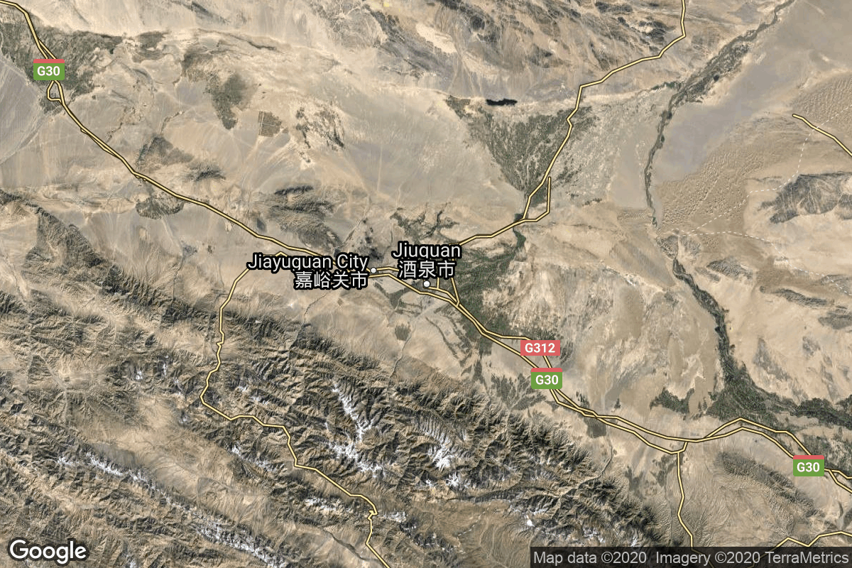
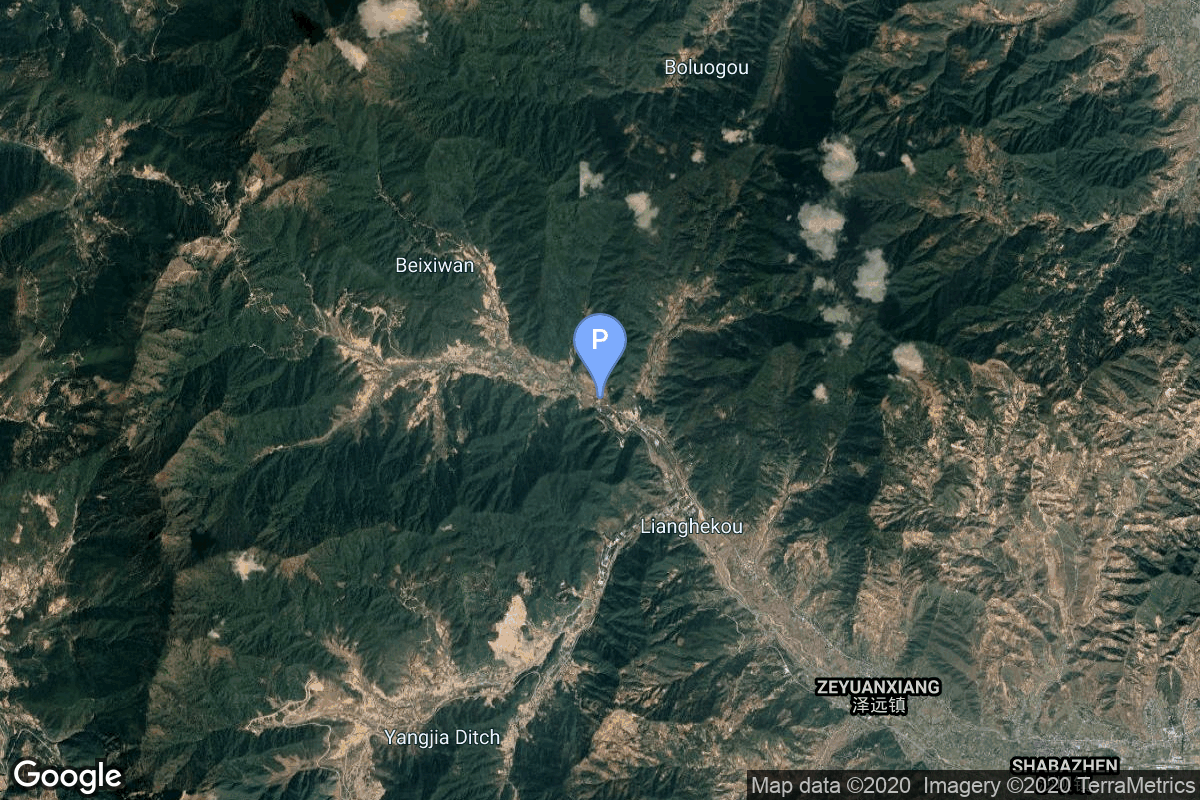
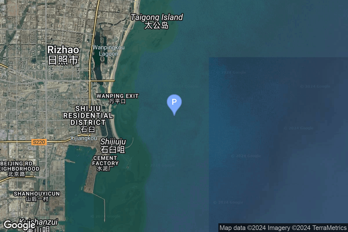
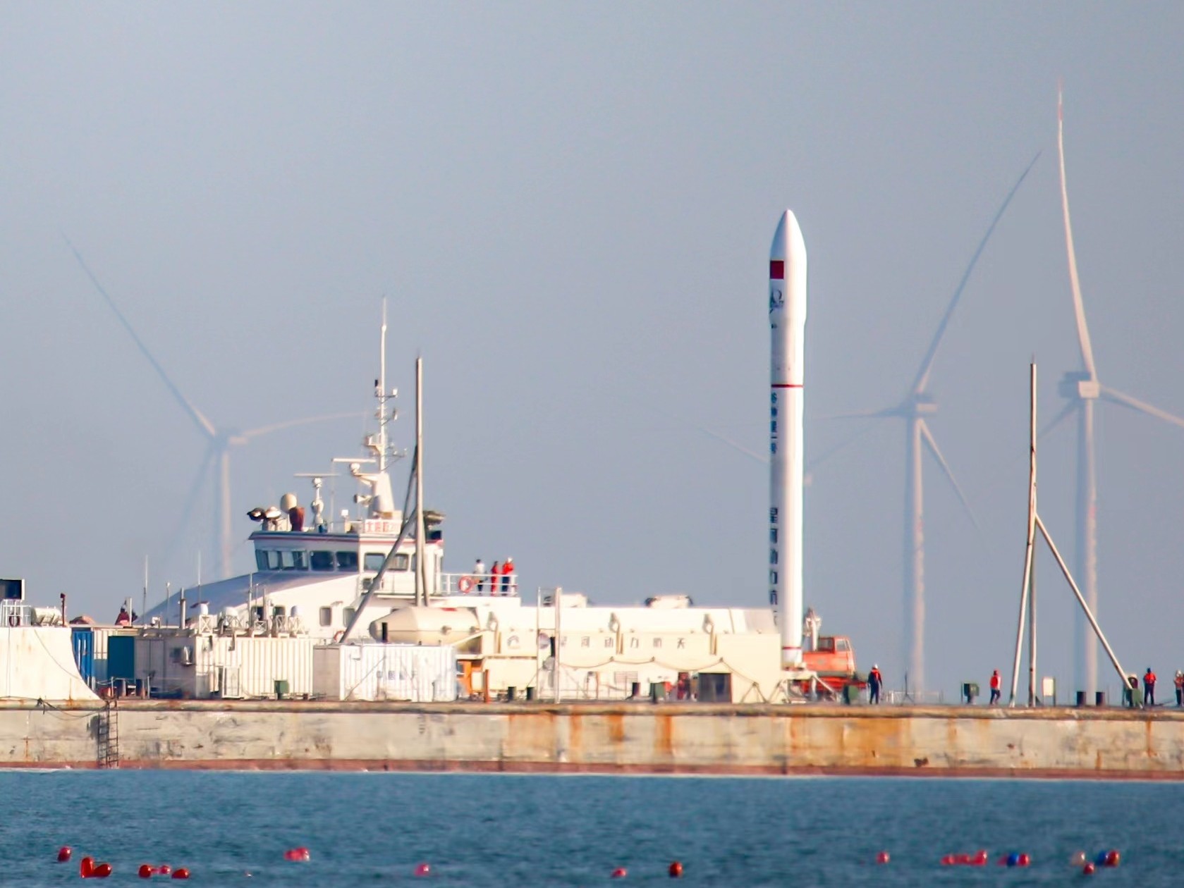
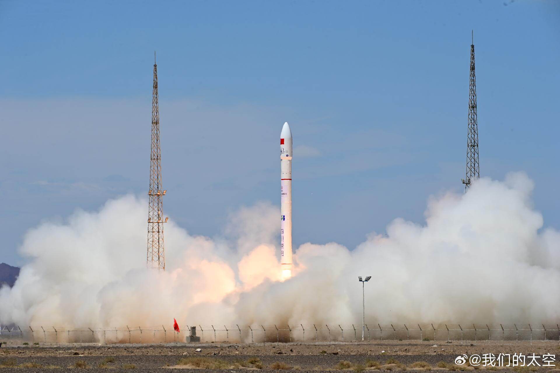
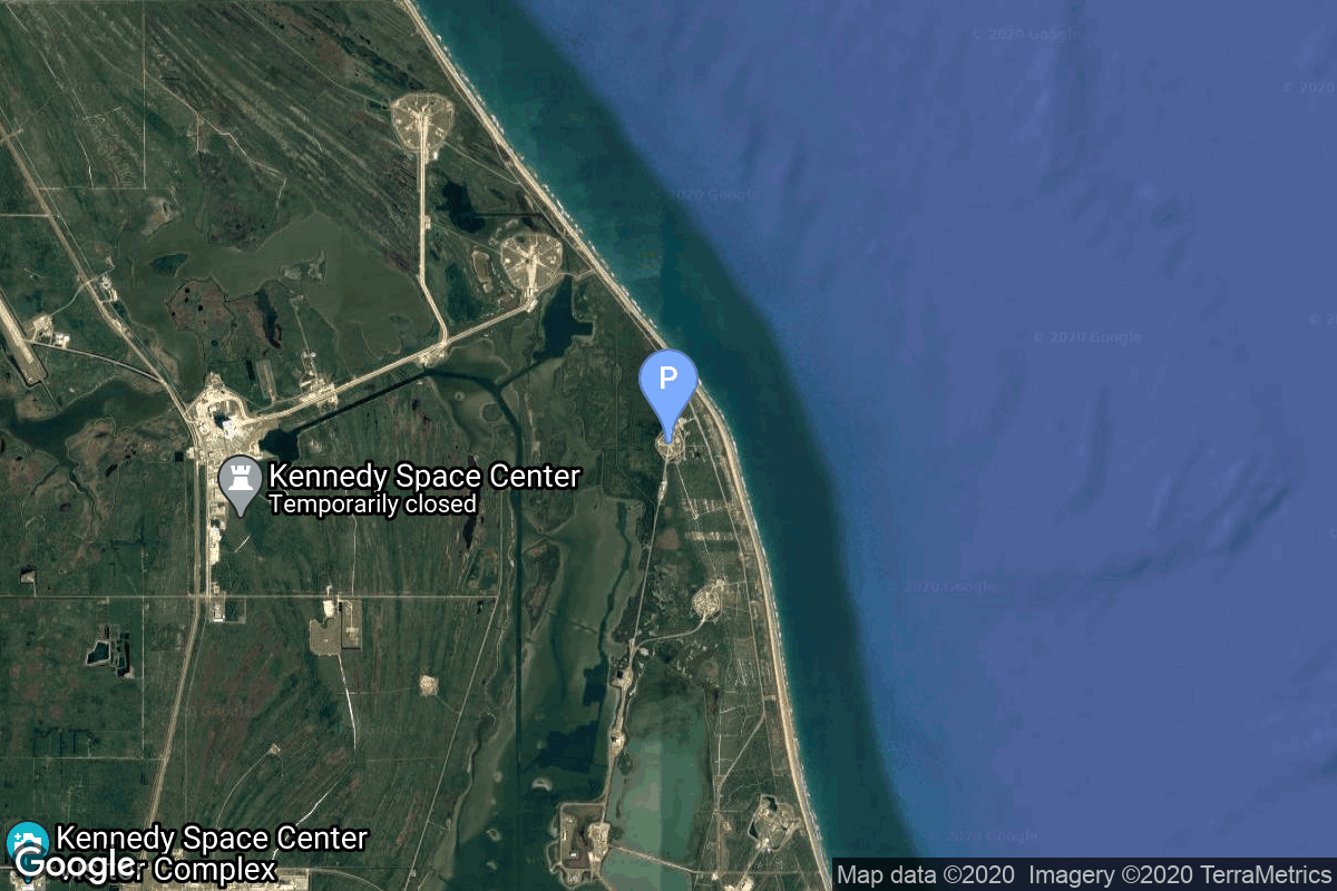
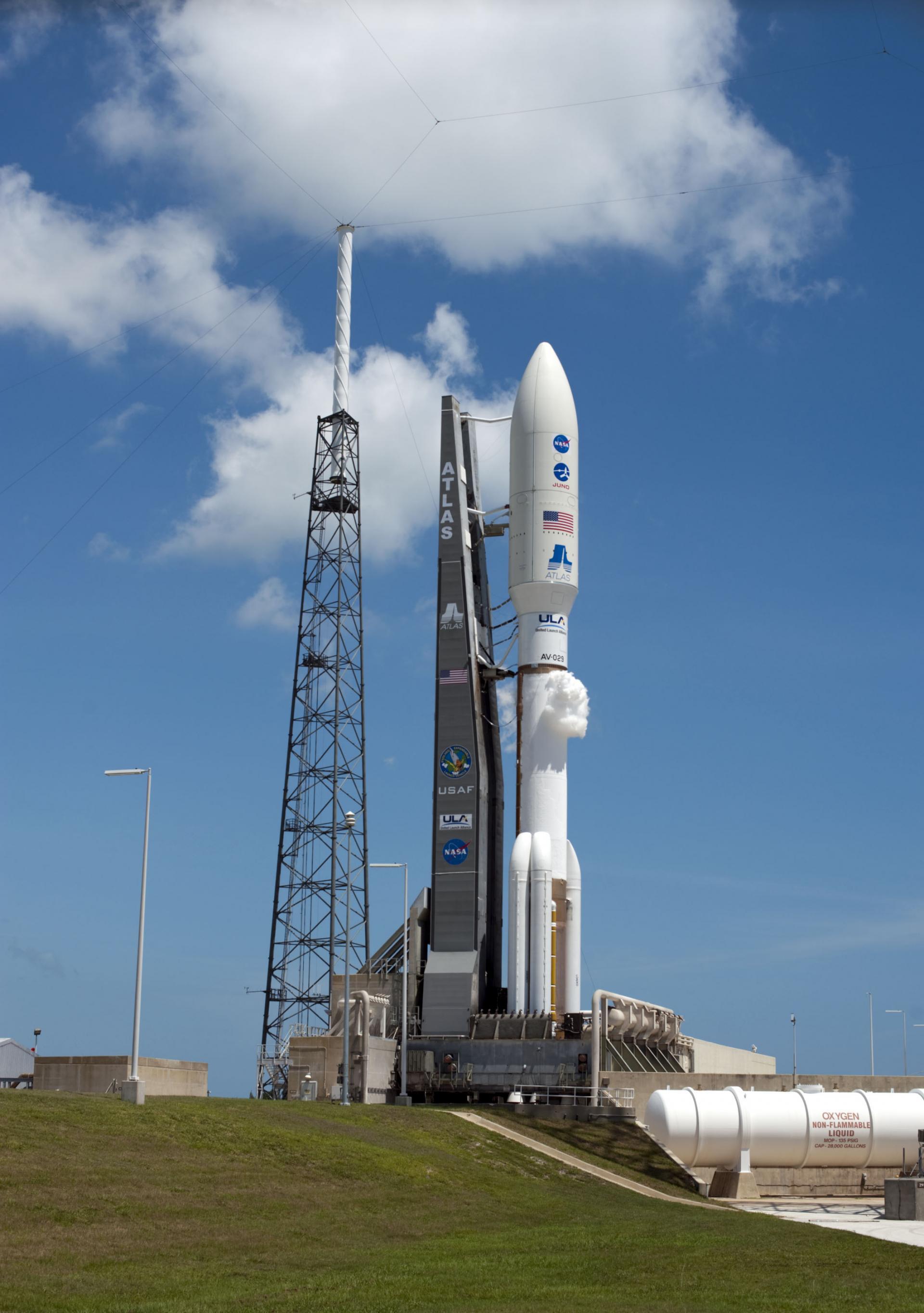
{ "count": 349, "next": "https://lldev.thespacedevs.com/2.0.0/launch/previous/?format=api&limit=10&offset=340&ordering=-name", "previous": "https://lldev.thespacedevs.com/2.0.0/launch/previous/?format=api&limit=10&offset=320&ordering=-name", "results": [ { "id": "7650a17a-cc52-4597-bd1a-0951d7389a95", "url": "https://lldev.thespacedevs.com/2.0.0/launch/7650a17a-cc52-4597-bd1a-0951d7389a95/?format=api", "launch_library_id": null, "slug": "ceres-2-demo-flight", "name": "Ceres-2 | Demo Flight", "status": { "id": 4, "name": "Failure" }, "net": "2026-01-17T04:08:00Z", "window_end": "2026-01-17T04:20:00Z", "window_start": "2026-01-17T03:57:00Z", "inhold": false, "tbdtime": false, "tbddate": false, "probability": null, "holdreason": "", "failreason": "1st stage failure, failed to reach orbit.", "hashtag": null, "launch_service_provider": { "id": 1021, "url": "https://lldev.thespacedevs.com/2.0.0/agencies/1021/?format=api", "name": "Galactic Energy", "type": "Commercial" }, "rocket": { "id": 8828, "configuration": { "id": 546, "launch_library_id": null, "url": "https://lldev.thespacedevs.com/2.0.0/config/launcher/546/?format=api", "name": "Ceres-2", "family": "", "full_name": "Ceres-2", "variant": "" } }, "mission": { "id": 7419, "launch_library_id": null, "name": "Demo Flight", "description": "First test launch of Galactic Energy’s Ceres-2 rocket.", "launch_designator": null, "type": "Test Flight", "orbit": { "id": 25, "name": "Unknown", "abbrev": "N/A" } }, "pad": { "id": 21, "url": "https://lldev.thespacedevs.com/2.0.0/pad/21/?format=api", "agency_id": null, "name": "Launch Area 95A", "info_url": null, "wiki_url": "https://en.wikipedia.org/wiki/Jiuquan_Satellite_Launch_Center", "map_url": "https://www.google.com/maps?q=40.969117,100.343333", "latitude": "40.969117", "longitude": "100.343333", "location": { "id": 17, "url": "https://lldev.thespacedevs.com/2.0.0/location/17/?format=api", "name": "Jiuquan Satellite Launch Center, People's Republic of China", "country_code": "CHN", "map_image": "https://thespacedevs-dev.nyc3.digitaloceanspaces.com/media/map_images/location_17_20200803142429.jpg", "total_launch_count": 290, "total_landing_count": 2 }, "map_image": "https://thespacedevs-dev.nyc3.digitaloceanspaces.com/media/map_images/pad_21_20200803143253.jpg", "total_launch_count": 67 }, "webcast_live": false, "image": "https://thespacedevs-dev.nyc3.digitaloceanspaces.com/media/images/ceres-2_illustr_image_20251210054657.png", "infographic": null, "program": [] }, { "id": "ea2d97bc-a834-4904-b579-6a1e1f7a9c54", "url": "https://lldev.thespacedevs.com/2.0.0/launch/ea2d97bc-a834-4904-b579-6a1e1f7a9c54/?format=api", "launch_library_id": null, "slug": "ceres-1s-tianqi-37-40", "name": "Ceres-1S | Tianqi 37-40", "status": { "id": 3, "name": "Success" }, "net": "2026-01-15T20:10:00Z", "window_end": "2026-01-15T20:26:00Z", "window_start": "2026-01-15T19:58:00Z", "inhold": false, "tbdtime": false, "tbddate": false, "probability": null, "holdreason": "", "failreason": "", "hashtag": null, "launch_service_provider": { "id": 1021, "url": "https://lldev.thespacedevs.com/2.0.0/agencies/1021/?format=api", "name": "Galactic Energy", "type": "Commercial" }, "rocket": { "id": 8880, "configuration": { "id": 500, "launch_library_id": null, "url": "https://lldev.thespacedevs.com/2.0.0/config/launcher/500/?format=api", "name": "Ceres-1S", "family": "Ceres-1", "full_name": "Ceres-1S", "variant": "Ceres-1S" } }, "mission": { "id": 7471, "launch_library_id": null, "name": "Tianqi 37-40", "description": "4 small satellites for LEO Internet of Things (IoT) communication purposes.", "launch_designator": null, "type": "Communications", "orbit": { "id": 8, "name": "Low Earth Orbit", "abbrev": "LEO" } }, "pad": { "id": 221, "url": "https://lldev.thespacedevs.com/2.0.0/pad/221/?format=api", "agency_id": 88, "name": "Rizhao offshore launch location", "info_url": null, "wiki_url": null, "map_url": "https://www.google.com/maps?q=35.391667,119.598667", "latitude": "35.391667", "longitude": "119.598667", "location": { "id": 185, "url": "https://lldev.thespacedevs.com/2.0.0/location/185/?format=api", "name": "Haiyang Oriental Spaceport", "country_code": "CHN", "map_image": "https://thespacedevs-dev.nyc3.digitaloceanspaces.com/media/map_images/location_haiyang_oriental_spaceport_20251128181322.jpg", "total_launch_count": 25, "total_landing_count": 0 }, "map_image": "https://thespacedevs-dev.nyc3.digitaloceanspaces.com/media/map_images/pad_oriental_spaceport_mobile_launch_ship_20240529085416.jpg", "total_launch_count": 7 }, "webcast_live": false, "image": "https://thespacedevs-dev.nyc3.digitaloceanspaces.com/media/images/ceres-1s_image_20230905114324.jpeg", "infographic": null, "program": [] }, { "id": "e208fa2b-169d-4d2d-97fa-8fafbfa09a1e", "url": "https://lldev.thespacedevs.com/2.0.0/launch/e208fa2b-169d-4d2d-97fa-8fafbfa09a1e/?format=api", "launch_library_id": null, "slug": "ceres-1-jilin-1-high-resolution-04c-and-others", "name": "Ceres-1 | Jilin-1 High Resolution-04C and others", "status": { "id": 4, "name": "Failure" }, "net": "2025-11-10T04:02:53Z", "window_end": "2025-11-10T04:33:00Z", "window_start": "2025-11-10T03:56:00Z", "inhold": false, "tbdtime": false, "tbddate": false, "probability": null, "holdreason": "", "failreason": "4th stage shut down prematurely 510 seconds into the burn after engine valve control cable suffered burn through during the engine burn.", "hashtag": null, "launch_service_provider": { "id": 1021, "url": "https://lldev.thespacedevs.com/2.0.0/agencies/1021/?format=api", "name": "Galactic Energy", "type": "Commercial" }, "rocket": { "id": 8792, "configuration": { "id": 461, "launch_library_id": null, "url": "https://lldev.thespacedevs.com/2.0.0/config/launcher/461/?format=api", "name": "Ceres-1", "family": "Ceres-1", "full_name": "Ceres-1", "variant": "Ceres-1" } }, "mission": { "id": 7383, "launch_library_id": null, "name": "Jilin-1 High Resolution-04C and others", "description": "Earth Observation satellite for the Jilin-1 commercial constellation.\r\n\r\nOther payloads:\r\n\r\n* Jilin-1 Platform-02A-04\r\n* Zhongbei University-1", "launch_designator": null, "type": "Earth Science", "orbit": { "id": 17, "name": "Sun-Synchronous Orbit", "abbrev": "SSO" } }, "pad": { "id": 21, "url": "https://lldev.thespacedevs.com/2.0.0/pad/21/?format=api", "agency_id": null, "name": "Launch Area 95A", "info_url": null, "wiki_url": "https://en.wikipedia.org/wiki/Jiuquan_Satellite_Launch_Center", "map_url": "https://www.google.com/maps?q=40.969117,100.343333", "latitude": "40.969117", "longitude": "100.343333", "location": { "id": 17, "url": "https://lldev.thespacedevs.com/2.0.0/location/17/?format=api", "name": "Jiuquan Satellite Launch Center, People's Republic of China", "country_code": "CHN", "map_image": "https://thespacedevs-dev.nyc3.digitaloceanspaces.com/media/map_images/location_17_20200803142429.jpg", "total_launch_count": 290, "total_landing_count": 2 }, "map_image": "https://thespacedevs-dev.nyc3.digitaloceanspaces.com/media/map_images/pad_21_20200803143253.jpg", "total_launch_count": 67 }, "webcast_live": false, "image": "https://thespacedevs-dev.nyc3.digitaloceanspaces.com/media/images/ceres-1_image_20230722081939.jpeg", "infographic": null, "program": [] }, { "id": "b1451c26-c4af-45ee-879e-6d1f6f8eec52", "url": "https://lldev.thespacedevs.com/2.0.0/launch/b1451c26-c4af-45ee-879e-6d1f6f8eec52/?format=api", "launch_library_id": null, "slug": "ceres-1-3-satellites-2", "name": "Ceres-1 | 3 satellites", "status": { "id": 3, "name": "Success" }, "net": "2025-09-05T11:39:00Z", "window_end": "2025-09-05T12:08:00Z", "window_start": "2025-09-05T11:28:00Z", "inhold": false, "tbdtime": false, "tbddate": false, "probability": null, "holdreason": "", "failreason": "", "hashtag": null, "launch_service_provider": { "id": 1021, "url": "https://lldev.thespacedevs.com/2.0.0/agencies/1021/?format=api", "name": "Galactic Energy", "type": "Commercial" }, "rocket": { "id": 8699, "configuration": { "id": 461, "launch_library_id": null, "url": "https://lldev.thespacedevs.com/2.0.0/config/launcher/461/?format=api", "name": "Ceres-1", "family": "Ceres-1", "full_name": "Ceres-1", "variant": "Ceres-1" } }, "mission": { "id": 7291, "launch_library_id": null, "name": "3 satellites", "description": "Carried 3 satellites to Sun-synchronous orbit:\r\n\r\n* Kaiyun-1\r\n* Yuxing-3-08\r\n* Yunyao-27", "launch_designator": null, "type": "Technology", "orbit": { "id": 17, "name": "Sun-Synchronous Orbit", "abbrev": "SSO" } }, "pad": { "id": 21, "url": "https://lldev.thespacedevs.com/2.0.0/pad/21/?format=api", "agency_id": null, "name": "Launch Area 95A", "info_url": null, "wiki_url": "https://en.wikipedia.org/wiki/Jiuquan_Satellite_Launch_Center", "map_url": "https://www.google.com/maps?q=40.969117,100.343333", "latitude": "40.969117", "longitude": "100.343333", "location": { "id": 17, "url": "https://lldev.thespacedevs.com/2.0.0/location/17/?format=api", "name": "Jiuquan Satellite Launch Center, People's Republic of China", "country_code": "CHN", "map_image": "https://thespacedevs-dev.nyc3.digitaloceanspaces.com/media/map_images/location_17_20200803142429.jpg", "total_launch_count": 290, "total_landing_count": 2 }, "map_image": "https://thespacedevs-dev.nyc3.digitaloceanspaces.com/media/map_images/pad_21_20200803143253.jpg", "total_launch_count": 67 }, "webcast_live": false, "image": "https://thespacedevs-dev.nyc3.digitaloceanspaces.com/media/images/ceres-1_image_20230722081939.jpeg", "infographic": null, "program": [] }, { "id": "47deaaf0-40d9-4400-bd92-4cabf1da5791", "url": "https://lldev.thespacedevs.com/2.0.0/launch/47deaaf0-40d9-4400-bd92-4cabf1da5791/?format=api", "launch_library_id": 1621, "slug": "atlas-v-551-viasat-3-f2-viasat-3-emea", "name": "Atlas V 551 | ViaSat-3 F2 (ViaSat-3 EMEA)", "status": { "id": 3, "name": "Success" }, "net": "2025-11-14T03:04:00Z", "window_end": "2025-11-14T03:48:00Z", "window_start": "2025-11-14T03:04:00Z", "inhold": false, "tbdtime": false, "tbddate": false, "probability": 99, "holdreason": "", "failreason": "", "hashtag": null, "launch_service_provider": { "id": 124, "url": "https://lldev.thespacedevs.com/2.0.0/agencies/124/?format=api", "name": "United Launch Alliance", "type": "Commercial" }, "rocket": { "id": 145, "configuration": { "id": 27, "launch_library_id": 37, "url": "https://lldev.thespacedevs.com/2.0.0/config/launcher/27/?format=api", "name": "Atlas V 551", "family": "Atlas", "full_name": "Atlas V 551", "variant": "551" } }, "mission": { "id": 6217, "launch_library_id": null, "name": "ViaSat-3 F2 (ViaSat-3 EMEA)", "description": "The ViaSat-3 is a series of three Ka-band satellites is expected to provide vastly superior capabilities in terms of service speed and flexibility for a satellite platform. Each ViaSat-3 class satellite is expected to deliver more than 1-Terabit per second of network capacity, and to leverage high levels of flexibility to dynamically direct capacity to where customers are located.", "launch_designator": null, "type": "Communications", "orbit": { "id": 2, "name": "Geostationary Transfer Orbit", "abbrev": "GTO" } }, "pad": { "id": 29, "url": "https://lldev.thespacedevs.com/2.0.0/pad/29/?format=api", "agency_id": null, "name": "Space Launch Complex 41", "info_url": null, "wiki_url": "https://en.wikipedia.org/wiki/Cape_Canaveral_Air_Force_Station_Space_Launch_Complex_41", "map_url": "https://www.google.com/maps?q=28.58341025,-80.58303644", "latitude": "28.58341025", "longitude": "-80.58303644", "location": { "id": 12, "url": "https://lldev.thespacedevs.com/2.0.0/location/12/?format=api", "name": "Cape Canaveral SFS, FL, USA", "country_code": "USA", "map_image": "https://thespacedevs-dev.nyc3.digitaloceanspaces.com/media/map_images/location_12_20200803142519.jpg", "total_launch_count": 1115, "total_landing_count": 75 }, "map_image": "https://thespacedevs-dev.nyc3.digitaloceanspaces.com/media/map_images/pad_29_20200803143528.jpg", "total_launch_count": 124 }, "webcast_live": false, "image": "https://thespacedevs-dev.nyc3.digitaloceanspaces.com/media/images/atlas2520v2520551_image_20190224012316.jpeg", "infographic": null, "program": [] }, { "id": "ff0a6a32-6513-4e85-9fd8-a2d022add74d", "url": "https://lldev.thespacedevs.com/2.0.0/launch/ff0a6a32-6513-4e85-9fd8-a2d022add74d/?format=api", "launch_library_id": null, "slug": "atlas-v-551-amazon-leo-la-07", "name": "Atlas V 551 | Amazon Leo (LA-07)", "status": { "id": 3, "name": "Success" }, "net": "2026-05-29T23:53:00Z", "window_end": "2026-05-30T00:02:30Z", "window_start": "2026-05-29T23:33:30Z", "inhold": false, "tbdtime": false, "tbddate": false, "probability": 45, "holdreason": "", "failreason": "", "hashtag": null, "launch_service_provider": { "id": 124, "url": "https://lldev.thespacedevs.com/2.0.0/agencies/124/?format=api", "name": "United Launch Alliance", "type": "Commercial" }, "rocket": { "id": 180, "configuration": { "id": 27, "launch_library_id": 37, "url": "https://lldev.thespacedevs.com/2.0.0/config/launcher/27/?format=api", "name": "Atlas V 551", "family": "Atlas", "full_name": "Atlas V 551", "variant": "551" } }, "mission": { "id": 5999, "launch_library_id": null, "name": "Amazon Leo (LA-07)", "description": "Amazon Leo, formerly known as Project Kuiper, is a mega constellation of satellites in Low Earth Orbit that will offer broadband internet access, this constellation will be managed by Kuiper Systems LLC, a subsidiary of Amazon. This constellation is planned to be composed of 3,276 satellites. The satellites are projected to be placed in 98 orbital planes in three orbital layers, one at 590 km, 610 km and 630 km altitude.\r\n\r\n29 satellites are carried on this launch.", "launch_designator": null, "type": "Communications", "orbit": { "id": 8, "name": "Low Earth Orbit", "abbrev": "LEO" } }, "pad": { "id": 29, "url": "https://lldev.thespacedevs.com/2.0.0/pad/29/?format=api", "agency_id": null, "name": "Space Launch Complex 41", "info_url": null, "wiki_url": "https://en.wikipedia.org/wiki/Cape_Canaveral_Air_Force_Station_Space_Launch_Complex_41", "map_url": "https://www.google.com/maps?q=28.58341025,-80.58303644", "latitude": "28.58341025", "longitude": "-80.58303644", "location": { "id": 12, "url": "https://lldev.thespacedevs.com/2.0.0/location/12/?format=api", "name": "Cape Canaveral SFS, FL, USA", "country_code": "USA", "map_image": "https://thespacedevs-dev.nyc3.digitaloceanspaces.com/media/map_images/location_12_20200803142519.jpg", "total_launch_count": 1115, "total_landing_count": 75 }, "map_image": "https://thespacedevs-dev.nyc3.digitaloceanspaces.com/media/map_images/pad_29_20200803143528.jpg", "total_launch_count": 124 }, "webcast_live": false, "image": "https://thespacedevs-dev.nyc3.digitaloceanspaces.com/media/images/atlas2520v2520551_image_20190224012316.jpeg", "infographic": null, "program": [ { "id": 27, "url": "https://lldev.thespacedevs.com/2.0.0/program/27/?format=api", "name": "Amazon Leo", "description": "Amazon Leo is a satellite internet constellation aimed at providing high-speed, low-latency broadband connectivity to underserved and remote areas globally. The project involves deploying a constellation of low Earth orbit (LEO) satellites to create a satellite internet network capable of delivering reliable internet access.", "agencies": [ { "id": 1058, "url": "https://lldev.thespacedevs.com/2.0.0/agencies/1058/?format=api", "name": "Amazon Leo", "type": "Private" } ], "image_url": "https://thespacedevs-dev.nyc3.digitaloceanspaces.com/media/images/project2520kui_program_20231228165031.jpeg", "start_date": "2023-10-16T18:06:00Z", "end_date": null, "info_url": "https://en.wikipedia.org/wiki/Kuiper_Systems", "wiki_url": "https://aboutamazon.com/what-we-do/devices-services/project-kuiper" } ] }, { "id": "7e89e423-6f47-40a0-b075-c6fc1d9cf228", "url": "https://lldev.thespacedevs.com/2.0.0/launch/7e89e423-6f47-40a0-b075-c6fc1d9cf228/?format=api", "launch_library_id": null, "slug": "atlas-v-551-amazon-leo-la-06", "name": "Atlas V 551 | Amazon Leo (LA-06)", "status": { "id": 3, "name": "Success" }, "net": "2026-04-28T00:53:30Z", "window_end": "2026-04-28T01:21:00Z", "window_start": "2026-04-28T00:52:00Z", "inhold": false, "tbdtime": false, "tbddate": false, "probability": 80, "holdreason": "", "failreason": "", "hashtag": null, "launch_service_provider": { "id": 124, "url": "https://lldev.thespacedevs.com/2.0.0/agencies/124/?format=api", "name": "United Launch Alliance", "type": "Commercial" }, "rocket": { "id": 178, "configuration": { "id": 27, "launch_library_id": 37, "url": "https://lldev.thespacedevs.com/2.0.0/config/launcher/27/?format=api", "name": "Atlas V 551", "family": "Atlas", "full_name": "Atlas V 551", "variant": "551" } }, "mission": { "id": 5998, "launch_library_id": null, "name": "Amazon Leo (LA-06)", "description": "Amazon Leo, formerly known as Project Kuiper, is a mega constellation of satellites in Low Earth Orbit that will offer broadband internet access, this constellation will be managed by Kuiper Systems LLC, a subsidiary of Amazon. This constellation is planned to be composed of 3,276 satellites. The satellites are projected to be placed in 98 orbital planes in three orbital layers, one at 590 km, 610 km and 630 km altitude.\r\n\r\n29 satellites are carried on this launch.", "launch_designator": null, "type": "Communications", "orbit": { "id": 8, "name": "Low Earth Orbit", "abbrev": "LEO" } }, "pad": { "id": 29, "url": "https://lldev.thespacedevs.com/2.0.0/pad/29/?format=api", "agency_id": null, "name": "Space Launch Complex 41", "info_url": null, "wiki_url": "https://en.wikipedia.org/wiki/Cape_Canaveral_Air_Force_Station_Space_Launch_Complex_41", "map_url": "https://www.google.com/maps?q=28.58341025,-80.58303644", "latitude": "28.58341025", "longitude": "-80.58303644", "location": { "id": 12, "url": "https://lldev.thespacedevs.com/2.0.0/location/12/?format=api", "name": "Cape Canaveral SFS, FL, USA", "country_code": "USA", "map_image": "https://thespacedevs-dev.nyc3.digitaloceanspaces.com/media/map_images/location_12_20200803142519.jpg", "total_launch_count": 1115, "total_landing_count": 75 }, "map_image": "https://thespacedevs-dev.nyc3.digitaloceanspaces.com/media/map_images/pad_29_20200803143528.jpg", "total_launch_count": 124 }, "webcast_live": false, "image": "https://thespacedevs-dev.nyc3.digitaloceanspaces.com/media/images/atlas2520v2520551_image_20190224012316.jpeg", "infographic": null, "program": [ { "id": 27, "url": "https://lldev.thespacedevs.com/2.0.0/program/27/?format=api", "name": "Amazon Leo", "description": "Amazon Leo is a satellite internet constellation aimed at providing high-speed, low-latency broadband connectivity to underserved and remote areas globally. The project involves deploying a constellation of low Earth orbit (LEO) satellites to create a satellite internet network capable of delivering reliable internet access.", "agencies": [ { "id": 1058, "url": "https://lldev.thespacedevs.com/2.0.0/agencies/1058/?format=api", "name": "Amazon Leo", "type": "Private" } ], "image_url": "https://thespacedevs-dev.nyc3.digitaloceanspaces.com/media/images/project2520kui_program_20231228165031.jpeg", "start_date": "2023-10-16T18:06:00Z", "end_date": null, "info_url": "https://en.wikipedia.org/wiki/Kuiper_Systems", "wiki_url": "https://aboutamazon.com/what-we-do/devices-services/project-kuiper" } ] }, { "id": "8a9f7ce9-4ab5-4227-95f1-9f328def8828", "url": "https://lldev.thespacedevs.com/2.0.0/launch/8a9f7ce9-4ab5-4227-95f1-9f328def8828/?format=api", "launch_library_id": null, "slug": "atlas-v-551-amazon-leo-la-05", "name": "Atlas V 551 | Amazon Leo (LA-05)", "status": { "id": 3, "name": "Success" }, "net": "2026-04-04T05:46:00Z", "window_end": "2026-04-04T06:14:00Z", "window_start": "2026-04-04T05:45:00Z", "inhold": false, "tbdtime": false, "tbddate": false, "probability": 95, "holdreason": "", "failreason": "", "hashtag": null, "launch_service_provider": { "id": 124, "url": "https://lldev.thespacedevs.com/2.0.0/agencies/124/?format=api", "name": "United Launch Alliance", "type": "Commercial" }, "rocket": { "id": 173, "configuration": { "id": 27, "launch_library_id": 37, "url": "https://lldev.thespacedevs.com/2.0.0/config/launcher/27/?format=api", "name": "Atlas V 551", "family": "Atlas", "full_name": "Atlas V 551", "variant": "551" } }, "mission": { "id": 5997, "launch_library_id": null, "name": "Amazon Leo (LA-05)", "description": "Amazon Leo, formerly known as Project Kuiper, is a mega constellation of satellites in Low Earth Orbit that will offer broadband internet access, this constellation will be managed by Kuiper Systems LLC, a subsidiary of Amazon. This constellation is planned to be composed of 3,276 satellites. The satellites are projected to be placed in 98 orbital planes in three orbital layers, one at 590 km, 610 km and 630 km altitude.\r\n\r\n29 satellites are carried on this launch.", "launch_designator": null, "type": "Communications", "orbit": { "id": 8, "name": "Low Earth Orbit", "abbrev": "LEO" } }, "pad": { "id": 29, "url": "https://lldev.thespacedevs.com/2.0.0/pad/29/?format=api", "agency_id": null, "name": "Space Launch Complex 41", "info_url": null, "wiki_url": "https://en.wikipedia.org/wiki/Cape_Canaveral_Air_Force_Station_Space_Launch_Complex_41", "map_url": "https://www.google.com/maps?q=28.58341025,-80.58303644", "latitude": "28.58341025", "longitude": "-80.58303644", "location": { "id": 12, "url": "https://lldev.thespacedevs.com/2.0.0/location/12/?format=api", "name": "Cape Canaveral SFS, FL, USA", "country_code": "USA", "map_image": "https://thespacedevs-dev.nyc3.digitaloceanspaces.com/media/map_images/location_12_20200803142519.jpg", "total_launch_count": 1115, "total_landing_count": 75 }, "map_image": "https://thespacedevs-dev.nyc3.digitaloceanspaces.com/media/map_images/pad_29_20200803143528.jpg", "total_launch_count": 124 }, "webcast_live": false, "image": "https://thespacedevs-dev.nyc3.digitaloceanspaces.com/media/images/atlas2520v2520551_image_20190224012316.jpeg", "infographic": null, "program": [ { "id": 27, "url": "https://lldev.thespacedevs.com/2.0.0/program/27/?format=api", "name": "Amazon Leo", "description": "Amazon Leo is a satellite internet constellation aimed at providing high-speed, low-latency broadband connectivity to underserved and remote areas globally. The project involves deploying a constellation of low Earth orbit (LEO) satellites to create a satellite internet network capable of delivering reliable internet access.", "agencies": [ { "id": 1058, "url": "https://lldev.thespacedevs.com/2.0.0/agencies/1058/?format=api", "name": "Amazon Leo", "type": "Private" } ], "image_url": "https://thespacedevs-dev.nyc3.digitaloceanspaces.com/media/images/project2520kui_program_20231228165031.jpeg", "start_date": "2023-10-16T18:06:00Z", "end_date": null, "info_url": "https://en.wikipedia.org/wiki/Kuiper_Systems", "wiki_url": "https://aboutamazon.com/what-we-do/devices-services/project-kuiper" } ] }, { "id": "0dcbd5ee-2728-4c79-8dc5-051ea11b888f", "url": "https://lldev.thespacedevs.com/2.0.0/launch/0dcbd5ee-2728-4c79-8dc5-051ea11b888f/?format=api", "launch_library_id": null, "slug": "atlas-v-551-amazon-leo-la-04", "name": "Atlas V 551 | Amazon Leo (LA-04)", "status": { "id": 3, "name": "Success" }, "net": "2025-12-16T08:28:00Z", "window_end": "2025-12-16T08:57:00Z", "window_start": "2025-12-16T08:28:00Z", "inhold": false, "tbdtime": false, "tbddate": false, "probability": 90, "holdreason": "", "failreason": "", "hashtag": null, "launch_service_provider": { "id": 124, "url": "https://lldev.thespacedevs.com/2.0.0/agencies/124/?format=api", "name": "United Launch Alliance", "type": "Commercial" }, "rocket": { "id": 171, "configuration": { "id": 27, "launch_library_id": 37, "url": "https://lldev.thespacedevs.com/2.0.0/config/launcher/27/?format=api", "name": "Atlas V 551", "family": "Atlas", "full_name": "Atlas V 551", "variant": "551" } }, "mission": { "id": 5996, "launch_library_id": null, "name": "Amazon Leo (LA-04)", "description": "Amazon Leo, formerly known as Project Kuiper, is a mega constellation of satellites in Low Earth Orbit that will offer broadband internet access, this constellation will be managed by Kuiper Systems LLC, a subsidiary of Amazon. This constellation is planned to be composed of 3,276 satellites. The satellites are projected to be placed in 98 orbital planes in three orbital layers, one at 590 km, 610 km and 630 km altitude.\r\n\r\n27 satellites are carried on this launch.", "launch_designator": null, "type": "Communications", "orbit": { "id": 8, "name": "Low Earth Orbit", "abbrev": "LEO" } }, "pad": { "id": 29, "url": "https://lldev.thespacedevs.com/2.0.0/pad/29/?format=api", "agency_id": null, "name": "Space Launch Complex 41", "info_url": null, "wiki_url": "https://en.wikipedia.org/wiki/Cape_Canaveral_Air_Force_Station_Space_Launch_Complex_41", "map_url": "https://www.google.com/maps?q=28.58341025,-80.58303644", "latitude": "28.58341025", "longitude": "-80.58303644", "location": { "id": 12, "url": "https://lldev.thespacedevs.com/2.0.0/location/12/?format=api", "name": "Cape Canaveral SFS, FL, USA", "country_code": "USA", "map_image": "https://thespacedevs-dev.nyc3.digitaloceanspaces.com/media/map_images/location_12_20200803142519.jpg", "total_launch_count": 1115, "total_landing_count": 75 }, "map_image": "https://thespacedevs-dev.nyc3.digitaloceanspaces.com/media/map_images/pad_29_20200803143528.jpg", "total_launch_count": 124 }, "webcast_live": false, "image": "https://thespacedevs-dev.nyc3.digitaloceanspaces.com/media/images/atlas_v_on_the__image_20251216072231.jpeg", "infographic": null, "program": [ { "id": 27, "url": "https://lldev.thespacedevs.com/2.0.0/program/27/?format=api", "name": "Amazon Leo", "description": "Amazon Leo is a satellite internet constellation aimed at providing high-speed, low-latency broadband connectivity to underserved and remote areas globally. The project involves deploying a constellation of low Earth orbit (LEO) satellites to create a satellite internet network capable of delivering reliable internet access.", "agencies": [ { "id": 1058, "url": "https://lldev.thespacedevs.com/2.0.0/agencies/1058/?format=api", "name": "Amazon Leo", "type": "Private" } ], "image_url": "https://thespacedevs-dev.nyc3.digitaloceanspaces.com/media/images/project2520kui_program_20231228165031.jpeg", "start_date": "2023-10-16T18:06:00Z", "end_date": null, "info_url": "https://en.wikipedia.org/wiki/Kuiper_Systems", "wiki_url": "https://aboutamazon.com/what-we-do/devices-services/project-kuiper" } ] }, { "id": "9f6d8a5a-f77c-42ff-b377-91628862ae59", "url": "https://lldev.thespacedevs.com/2.0.0/launch/9f6d8a5a-f77c-42ff-b377-91628862ae59/?format=api", "launch_library_id": null, "slug": "atlas-v-551-amazon-leo-ka-03", "name": "Atlas V 551 | Amazon Leo (KA-03)", "status": { "id": 3, "name": "Success" }, "net": "2025-09-25T12:09:30Z", "window_end": "2025-09-25T12:38:00Z", "window_start": "2025-09-25T12:09:00Z", "inhold": false, "tbdtime": false, "tbddate": false, "probability": 95, "holdreason": "", "failreason": "", "hashtag": null, "launch_service_provider": { "id": 124, "url": "https://lldev.thespacedevs.com/2.0.0/agencies/124/?format=api", "name": "United Launch Alliance", "type": "Commercial" }, "rocket": { "id": 163, "configuration": { "id": 27, "launch_library_id": 37, "url": "https://lldev.thespacedevs.com/2.0.0/config/launcher/27/?format=api", "name": "Atlas V 551", "family": "Atlas", "full_name": "Atlas V 551", "variant": "551" } }, "mission": { "id": 5995, "launch_library_id": null, "name": "Amazon Leo (KA-03)", "description": "Amazon Leo, formerly known as Project Kuiper, is a mega constellation of satellites in Low Earth Orbit that will offer broadband internet access, this constellation will be managed by Kuiper Systems LLC, a subsidiary of Amazon. This constellation is planned to be composed of 3,276 satellites. The satellites are projected to be placed in 98 orbital planes in three orbital layers, one at 590 km, 610 km and 630 km altitude.\r\n\r\n27 satellites are carried on this launch.", "launch_designator": null, "type": "Communications", "orbit": { "id": 8, "name": "Low Earth Orbit", "abbrev": "LEO" } }, "pad": { "id": 29, "url": "https://lldev.thespacedevs.com/2.0.0/pad/29/?format=api", "agency_id": null, "name": "Space Launch Complex 41", "info_url": null, "wiki_url": "https://en.wikipedia.org/wiki/Cape_Canaveral_Air_Force_Station_Space_Launch_Complex_41", "map_url": "https://www.google.com/maps?q=28.58341025,-80.58303644", "latitude": "28.58341025", "longitude": "-80.58303644", "location": { "id": 12, "url": "https://lldev.thespacedevs.com/2.0.0/location/12/?format=api", "name": "Cape Canaveral SFS, FL, USA", "country_code": "USA", "map_image": "https://thespacedevs-dev.nyc3.digitaloceanspaces.com/media/map_images/location_12_20200803142519.jpg", "total_launch_count": 1115, "total_landing_count": 75 }, "map_image": "https://thespacedevs-dev.nyc3.digitaloceanspaces.com/media/map_images/pad_29_20200803143528.jpg", "total_launch_count": 124 }, "webcast_live": false, "image": "https://thespacedevs-dev.nyc3.digitaloceanspaces.com/media/images/atlas_v_liftoff_image_20251102102220.jpg", "infographic": null, "program": [ { "id": 27, "url": "https://lldev.thespacedevs.com/2.0.0/program/27/?format=api", "name": "Amazon Leo", "description": "Amazon Leo is a satellite internet constellation aimed at providing high-speed, low-latency broadband connectivity to underserved and remote areas globally. The project involves deploying a constellation of low Earth orbit (LEO) satellites to create a satellite internet network capable of delivering reliable internet access.", "agencies": [ { "id": 1058, "url": "https://lldev.thespacedevs.com/2.0.0/agencies/1058/?format=api", "name": "Amazon Leo", "type": "Private" } ], "image_url": "https://thespacedevs-dev.nyc3.digitaloceanspaces.com/media/images/project2520kui_program_20231228165031.jpeg", "start_date": "2023-10-16T18:06:00Z", "end_date": null, "info_url": "https://en.wikipedia.org/wiki/Kuiper_Systems", "wiki_url": "https://aboutamazon.com/what-we-do/devices-services/project-kuiper" } ] } ] }