Launch List
API endpoint that returns all Launch objects or a single launch.
EXAMPLE - /launch/
GET: Return a list of all Launch objects.
FILTERS: Fields - 'name', 'id(s)', 'lsp_id', 'lsp_name', 'serial_number', 'launcher_config__id', 'rocket__spacecraftflight__spacecraft__name'
MODE: 'normal', 'list', 'detailed' EXAMPLE: ?mode=list
SEARCH: Searches through the launch name, rocket name, launch agency, mission name & spacecraft name. EXAMPLE - ?search=SpaceX
GET /2.0.0/launch/?format=api&offset=7620&ordering=-name
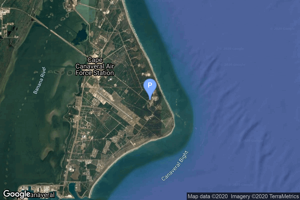
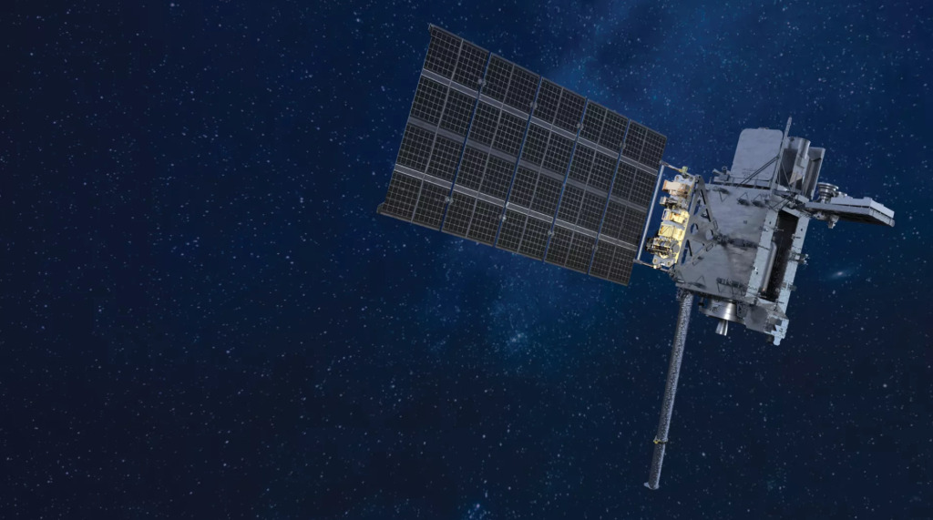
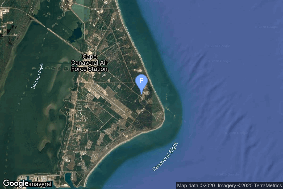
{ "count": 8136, "next": "https://lldev.thespacedevs.com/2.0.0/launch/?format=api&limit=10&offset=7630&ordering=-name", "previous": "https://lldev.thespacedevs.com/2.0.0/launch/?format=api&limit=10&offset=7610&ordering=-name", "results": [ { "id": "715d71ff-a8b7-469b-9621-c61da467ca64", "url": "https://lldev.thespacedevs.com/2.0.0/launch/715d71ff-a8b7-469b-9621-c61da467ca64/?format=api", "launch_library_id": null, "slug": "atlas-iia-goes-12", "name": "Atlas IIA | GOES 12", "status": { "id": 3, "name": "Success" }, "net": "2001-07-23T07:23:01Z", "window_end": "2001-07-23T07:23:01Z", "window_start": "2001-07-23T07:23:01Z", "inhold": false, "tbdtime": false, "tbddate": false, "probability": null, "holdreason": "", "failreason": null, "hashtag": null, "launch_service_provider": { "id": 82, "url": "https://lldev.thespacedevs.com/2.0.0/agencies/82/?format=api", "name": "Lockheed Martin", "type": "Commercial" }, "rocket": { "id": 7049, "configuration": { "id": 254, "launch_library_id": null, "url": "https://lldev.thespacedevs.com/2.0.0/config/launcher/254/?format=api", "name": "Atlas IIA", "family": "Atlas", "full_name": "Atlas IIA", "variant": "IIA" } }, "mission": { "id": 5438, "launch_library_id": null, "name": "GOES 12", "description": "The Geostationary Operational Environmental Satellites were developed by NASA-Goddard and were transferred to the NOAA weather agency when operational. In addition to the usual weather imager/sounder, GOES-M carried a new solar soft X-ray imager.", "launch_designator": null, "type": "Planetary Science", "orbit": { "id": 18, "name": "Supersynchronous Transfer Orbit", "abbrev": "Super-GTO" } }, "pad": { "id": 121, "url": "https://lldev.thespacedevs.com/2.0.0/pad/121/?format=api", "agency_id": 161, "name": "Launch Complex 36A", "info_url": null, "wiki_url": "https://en.wikipedia.org/wiki/Cape_Canaveral_Launch_Complex_36", "map_url": "https://www.google.com/maps?q=28.4705556,-80.542194", "latitude": "28.4705556", "longitude": "-80.542194", "location": { "id": 12, "url": "https://lldev.thespacedevs.com/2.0.0/location/12/?format=api", "name": "Cape Canaveral SFS, FL, USA", "country_code": "USA", "map_image": "https://thespacedevs-dev.nyc3.digitaloceanspaces.com/media/map_images/location_12_20200803142519.jpg", "total_launch_count": 1132, "total_landing_count": 83 }, "map_image": "https://thespacedevs-dev.nyc3.digitaloceanspaces.com/media/map_images/pad_121_20200803143231.jpg", "total_launch_count": 71 }, "webcast_live": false, "image": "https://thespacedevs-dev.nyc3.digitaloceanspaces.com/media/images/launch_of_an_at_image_20251123092831.jpg", "infographic": null, "program": [ { "id": 37, "url": "https://lldev.thespacedevs.com/2.0.0/program/37/?format=api", "name": "Geostationary Operational Environmental Satellite", "description": "The Geostationary Operational Environmental Satellite (GOES), operated by the United States' National Oceanic and Atmospheric Administration (NOAA)'s National Environmental Satellite, Data, and Information Service division, supports weather forecasting, severe storm tracking, and meteorology research", "agencies": [ { "id": 44, "url": "https://lldev.thespacedevs.com/2.0.0/agencies/44/?format=api", "name": "National Aeronautics and Space Administration", "type": "Government" }, { "id": 210, "url": "https://lldev.thespacedevs.com/2.0.0/agencies/210/?format=api", "name": "National Oceanic and Atmospheric Administration", "type": "Government" } ], "image_url": "https://thespacedevs-dev.nyc3.digitaloceanspaces.com/media/images/goes-u_render_image_20240623151909.jpg", "start_date": "1975-10-16T22:40:00Z", "end_date": null, "info_url": null, "wiki_url": "https://en.wikipedia.org/wiki/Geostationary_Operational_Environmental_Satellite" } ] }, { "id": "ad31df64-2932-46f2-a416-b65a47e1b945", "url": "https://lldev.thespacedevs.com/2.0.0/launch/ad31df64-2932-46f2-a416-b65a47e1b945/?format=api", "launch_library_id": null, "slug": "atlas-iia-goes-11", "name": "Atlas IIA | GOES 11", "status": { "id": 3, "name": "Success" }, "net": "2000-05-03T07:07:03Z", "window_end": "2000-05-03T07:07:03Z", "window_start": "2000-05-03T07:07:03Z", "inhold": false, "tbdtime": false, "tbddate": false, "probability": null, "holdreason": "", "failreason": null, "hashtag": null, "launch_service_provider": { "id": 82, "url": "https://lldev.thespacedevs.com/2.0.0/agencies/82/?format=api", "name": "Lockheed Martin", "type": "Commercial" }, "rocket": { "id": 6982, "configuration": { "id": 254, "launch_library_id": null, "url": "https://lldev.thespacedevs.com/2.0.0/config/launcher/254/?format=api", "name": "Atlas IIA", "family": "Atlas", "full_name": "Atlas IIA", "variant": "IIA" } }, "mission": { "id": 5371, "launch_library_id": null, "name": "GOES 11", "description": "American meteorological satellite.", "launch_designator": null, "type": "Earth Science", "orbit": { "id": 1, "name": "Geostationary Orbit", "abbrev": "Direct-GEO" } }, "pad": { "id": 121, "url": "https://lldev.thespacedevs.com/2.0.0/pad/121/?format=api", "agency_id": 161, "name": "Launch Complex 36A", "info_url": null, "wiki_url": "https://en.wikipedia.org/wiki/Cape_Canaveral_Launch_Complex_36", "map_url": "https://www.google.com/maps?q=28.4705556,-80.542194", "latitude": "28.4705556", "longitude": "-80.542194", "location": { "id": 12, "url": "https://lldev.thespacedevs.com/2.0.0/location/12/?format=api", "name": "Cape Canaveral SFS, FL, USA", "country_code": "USA", "map_image": "https://thespacedevs-dev.nyc3.digitaloceanspaces.com/media/map_images/location_12_20200803142519.jpg", "total_launch_count": 1132, "total_landing_count": 83 }, "map_image": "https://thespacedevs-dev.nyc3.digitaloceanspaces.com/media/map_images/pad_121_20200803143231.jpg", "total_launch_count": 71 }, "webcast_live": false, "image": "https://thespacedevs-dev.nyc3.digitaloceanspaces.com/media/images/launch_of_an_at_image_20251123092831.jpg", "infographic": null, "program": [ { "id": 37, "url": "https://lldev.thespacedevs.com/2.0.0/program/37/?format=api", "name": "Geostationary Operational Environmental Satellite", "description": "The Geostationary Operational Environmental Satellite (GOES), operated by the United States' National Oceanic and Atmospheric Administration (NOAA)'s National Environmental Satellite, Data, and Information Service division, supports weather forecasting, severe storm tracking, and meteorology research", "agencies": [ { "id": 44, "url": "https://lldev.thespacedevs.com/2.0.0/agencies/44/?format=api", "name": "National Aeronautics and Space Administration", "type": "Government" }, { "id": 210, "url": "https://lldev.thespacedevs.com/2.0.0/agencies/210/?format=api", "name": "National Oceanic and Atmospheric Administration", "type": "Government" } ], "image_url": "https://thespacedevs-dev.nyc3.digitaloceanspaces.com/media/images/goes-u_render_image_20240623151909.jpg", "start_date": "1975-10-16T22:40:00Z", "end_date": null, "info_url": null, "wiki_url": "https://en.wikipedia.org/wiki/Geostationary_Operational_Environmental_Satellite" } ] }, { "id": "b5d62b51-b59e-413c-9044-098c05811e75", "url": "https://lldev.thespacedevs.com/2.0.0/launch/b5d62b51-b59e-413c-9044-098c05811e75/?format=api", "launch_library_id": null, "slug": "atlas-iia-ge-1", "name": "Atlas IIA | GE 1", "status": { "id": 3, "name": "Success" }, "net": "1996-09-08T21:49:01Z", "window_end": "1996-09-08T21:49:01Z", "window_start": "1996-09-08T21:49:01Z", "inhold": false, "tbdtime": false, "tbddate": false, "probability": null, "holdreason": "", "failreason": null, "hashtag": null, "launch_service_provider": { "id": 82, "url": "https://lldev.thespacedevs.com/2.0.0/agencies/82/?format=api", "name": "Lockheed Martin", "type": "Commercial" }, "rocket": { "id": 6748, "configuration": { "id": 254, "launch_library_id": null, "url": "https://lldev.thespacedevs.com/2.0.0/config/launcher/254/?format=api", "name": "Atlas IIA", "family": "Atlas", "full_name": "Atlas IIA", "variant": "IIA" } }, "mission": { "id": 5138, "launch_library_id": null, "name": "GE 1", "description": "GE-1 is owned by GE Americom and is a continuation of the old RCA/GE Satcom series. GE-1 has 24 C-band and 24 Ku-band transponders, and replaced Satcom K1. GE-1 was placed in a supersynchronous transfer orbit of 191 × 56495 km × 25.0 deg.", "launch_designator": null, "type": "Communications", "orbit": { "id": 1, "name": "Geostationary Orbit", "abbrev": "Direct-GEO" } }, "pad": { "id": 122, "url": "https://lldev.thespacedevs.com/2.0.0/pad/122/?format=api", "agency_id": 161, "name": "Launch Complex 36B", "info_url": null, "wiki_url": "https://en.wikipedia.org/wiki/Cape_Canaveral_Launch_Complex_36", "map_url": "https://www.google.com/maps?q=28.4705556,-80.542194", "latitude": "28.4705556", "longitude": "-80.542194", "location": { "id": 12, "url": "https://lldev.thespacedevs.com/2.0.0/location/12/?format=api", "name": "Cape Canaveral SFS, FL, USA", "country_code": "USA", "map_image": "https://thespacedevs-dev.nyc3.digitaloceanspaces.com/media/map_images/location_12_20200803142519.jpg", "total_launch_count": 1132, "total_landing_count": 83 }, "map_image": "https://thespacedevs-dev.nyc3.digitaloceanspaces.com/media/map_images/pad_122_20200803143232.jpg", "total_launch_count": 76 }, "webcast_live": false, "image": "https://thespacedevs-dev.nyc3.digitaloceanspaces.com/media/images/launch_of_an_at_image_20251123092831.jpg", "infographic": null, "program": [] }, { "id": "4475d8c1-0274-4c26-81a3-f2a966c8ba14", "url": "https://lldev.thespacedevs.com/2.0.0/launch/4475d8c1-0274-4c26-81a3-f2a966c8ba14/?format=api", "launch_library_id": null, "slug": "atlas-iia-galaxy-3r", "name": "Atlas IIA | Galaxy 3R", "status": { "id": 3, "name": "Success" }, "net": "1995-12-15T00:23:01Z", "window_end": "1995-12-15T00:23:01Z", "window_start": "1995-12-15T00:23:01Z", "inhold": false, "tbdtime": false, "tbddate": false, "probability": null, "holdreason": "", "failreason": null, "hashtag": null, "launch_service_provider": { "id": 82, "url": "https://lldev.thespacedevs.com/2.0.0/agencies/82/?format=api", "name": "Lockheed Martin", "type": "Commercial" }, "rocket": { "id": 6700, "configuration": { "id": 254, "launch_library_id": null, "url": "https://lldev.thespacedevs.com/2.0.0/config/launcher/254/?format=api", "name": "Atlas IIA", "family": "Atlas", "full_name": "Atlas IIA", "variant": "IIA" } }, "mission": { "id": 5090, "launch_library_id": null, "name": "Galaxy 3R", "description": "Galaxy 3R, operated by PanAmSat Corporation, is used to provide video and telecommunications services throughout the United States. The satellite's Ku-band capacity can also be switched to provide coverage of Latin America.", "launch_designator": null, "type": "Communications", "orbit": { "id": 1, "name": "Geostationary Orbit", "abbrev": "Direct-GEO" } }, "pad": { "id": 121, "url": "https://lldev.thespacedevs.com/2.0.0/pad/121/?format=api", "agency_id": 161, "name": "Launch Complex 36A", "info_url": null, "wiki_url": "https://en.wikipedia.org/wiki/Cape_Canaveral_Launch_Complex_36", "map_url": "https://www.google.com/maps?q=28.4705556,-80.542194", "latitude": "28.4705556", "longitude": "-80.542194", "location": { "id": 12, "url": "https://lldev.thespacedevs.com/2.0.0/location/12/?format=api", "name": "Cape Canaveral SFS, FL, USA", "country_code": "USA", "map_image": "https://thespacedevs-dev.nyc3.digitaloceanspaces.com/media/map_images/location_12_20200803142519.jpg", "total_launch_count": 1132, "total_landing_count": 83 }, "map_image": "https://thespacedevs-dev.nyc3.digitaloceanspaces.com/media/map_images/pad_121_20200803143231.jpg", "total_launch_count": 71 }, "webcast_live": false, "image": "https://thespacedevs-dev.nyc3.digitaloceanspaces.com/media/images/launch_of_an_at_image_20251123092831.jpg", "infographic": null, "program": [] }, { "id": "b2b39a39-4a4b-4ef0-8db5-384bf40f47da", "url": "https://lldev.thespacedevs.com/2.0.0/launch/b2b39a39-4a4b-4ef0-8db5-384bf40f47da/?format=api", "launch_library_id": null, "slug": "atlas-iia-dscs-3-b8", "name": "Atlas IIA | DSCS-3 B8", "status": { "id": 3, "name": "Success" }, "net": "2000-01-21T01:03:01Z", "window_end": "2000-01-21T01:03:01Z", "window_start": "2000-01-21T01:03:01Z", "inhold": false, "tbdtime": false, "tbddate": false, "probability": null, "holdreason": "", "failreason": null, "hashtag": null, "launch_service_provider": { "id": 82, "url": "https://lldev.thespacedevs.com/2.0.0/agencies/82/?format=api", "name": "Lockheed Martin", "type": "Commercial" }, "rocket": { "id": 6964, "configuration": { "id": 254, "launch_library_id": null, "url": "https://lldev.thespacedevs.com/2.0.0/config/launcher/254/?format=api", "name": "Atlas IIA", "family": "Atlas", "full_name": "Atlas IIA", "variant": "IIA" } }, "mission": { "id": 5353, "launch_library_id": null, "name": "DSCS-3 B8", "description": "DSCS-3 (Defense Satellite Communications System 3) are geostationary communications satellites, which provide a robust anti-jam, nuclear hardened capability that supports Department of Defense (DoD) worldwide requirements, White House and Diplomatic communications. They are the follow-on generation of the DSCS-2 satellites.", "launch_designator": null, "type": "Communications", "orbit": { "id": 1, "name": "Geostationary Orbit", "abbrev": "Direct-GEO" } }, "pad": { "id": 121, "url": "https://lldev.thespacedevs.com/2.0.0/pad/121/?format=api", "agency_id": 161, "name": "Launch Complex 36A", "info_url": null, "wiki_url": "https://en.wikipedia.org/wiki/Cape_Canaveral_Launch_Complex_36", "map_url": "https://www.google.com/maps?q=28.4705556,-80.542194", "latitude": "28.4705556", "longitude": "-80.542194", "location": { "id": 12, "url": "https://lldev.thespacedevs.com/2.0.0/location/12/?format=api", "name": "Cape Canaveral SFS, FL, USA", "country_code": "USA", "map_image": "https://thespacedevs-dev.nyc3.digitaloceanspaces.com/media/map_images/location_12_20200803142519.jpg", "total_launch_count": 1132, "total_landing_count": 83 }, "map_image": "https://thespacedevs-dev.nyc3.digitaloceanspaces.com/media/map_images/pad_121_20200803143231.jpg", "total_launch_count": 71 }, "webcast_live": false, "image": "https://thespacedevs-dev.nyc3.digitaloceanspaces.com/media/images/launch_of_an_at_image_20251123092831.jpg", "infographic": null, "program": [] }, { "id": "dd95d4d2-8762-4f58-95c9-25770c084b3d", "url": "https://lldev.thespacedevs.com/2.0.0/launch/dd95d4d2-8762-4f58-95c9-25770c084b3d/?format=api", "launch_library_id": null, "slug": "atlas-iia-dscs-3-b7", "name": "Atlas IIA | DSCS-3 B7", "status": { "id": 3, "name": "Success" }, "net": "1995-07-31T23:30:02Z", "window_end": "1995-07-31T23:30:02Z", "window_start": "1995-07-31T23:30:02Z", "inhold": false, "tbdtime": false, "tbddate": false, "probability": null, "holdreason": "", "failreason": null, "hashtag": null, "launch_service_provider": { "id": 82, "url": "https://lldev.thespacedevs.com/2.0.0/agencies/82/?format=api", "name": "Lockheed Martin", "type": "Commercial" }, "rocket": { "id": 6672, "configuration": { "id": 254, "launch_library_id": null, "url": "https://lldev.thespacedevs.com/2.0.0/config/launcher/254/?format=api", "name": "Atlas IIA", "family": "Atlas", "full_name": "Atlas IIA", "variant": "IIA" } }, "mission": { "id": 5062, "launch_library_id": null, "name": "DSCS-3 B7", "description": "DSCS-3 (Defense Satellite Communications System 3) are geostationary communications satellites, which provide a robust anti-jam, nuclear hardened capability that supports Department of Defense (DoD) worldwide requirements, White House and Diplomatic communications. They are the follow-on generation of the DSCS-2 satellites.", "launch_designator": null, "type": "Communications", "orbit": { "id": 1, "name": "Geostationary Orbit", "abbrev": "Direct-GEO" } }, "pad": { "id": 121, "url": "https://lldev.thespacedevs.com/2.0.0/pad/121/?format=api", "agency_id": 161, "name": "Launch Complex 36A", "info_url": null, "wiki_url": "https://en.wikipedia.org/wiki/Cape_Canaveral_Launch_Complex_36", "map_url": "https://www.google.com/maps?q=28.4705556,-80.542194", "latitude": "28.4705556", "longitude": "-80.542194", "location": { "id": 12, "url": "https://lldev.thespacedevs.com/2.0.0/location/12/?format=api", "name": "Cape Canaveral SFS, FL, USA", "country_code": "USA", "map_image": "https://thespacedevs-dev.nyc3.digitaloceanspaces.com/media/map_images/location_12_20200803142519.jpg", "total_launch_count": 1132, "total_landing_count": 83 }, "map_image": "https://thespacedevs-dev.nyc3.digitaloceanspaces.com/media/map_images/pad_121_20200803143231.jpg", "total_launch_count": 71 }, "webcast_live": false, "image": "https://thespacedevs-dev.nyc3.digitaloceanspaces.com/media/images/launch_of_an_at_image_20251123092831.jpg", "infographic": null, "program": [] }, { "id": "7b602398-7e73-4d54-9777-f6353c597b57", "url": "https://lldev.thespacedevs.com/2.0.0/launch/7b602398-7e73-4d54-9777-f6353c597b57/?format=api", "launch_library_id": null, "slug": "atlas-iia-dscs-3-b13", "name": "Atlas IIA | DSCS-3 B13", "status": { "id": 3, "name": "Success" }, "net": "1997-10-25T00:46:00Z", "window_end": "1997-10-25T00:46:00Z", "window_start": "1997-10-25T00:46:00Z", "inhold": false, "tbdtime": false, "tbddate": false, "probability": null, "holdreason": "", "failreason": null, "hashtag": null, "launch_service_provider": { "id": 82, "url": "https://lldev.thespacedevs.com/2.0.0/agencies/82/?format=api", "name": "Lockheed Martin", "type": "Commercial" }, "rocket": { "id": 6813, "configuration": { "id": 254, "launch_library_id": null, "url": "https://lldev.thespacedevs.com/2.0.0/config/launcher/254/?format=api", "name": "Atlas IIA", "family": "Atlas", "full_name": "Atlas IIA", "variant": "IIA" } }, "mission": { "id": 5203, "launch_library_id": null, "name": "DSCS-3 B13", "description": "DSCS-3 (Defense Satellite Communications System 3) are geostationary communications satellites, which provide a robust anti-jam, nuclear hardened capability that supports Department of Defense (DoD) worldwide requirements, White House and Diplomatic communications. They are the follow-on generation of the DSCS-2 satellites.", "launch_designator": null, "type": "Communications", "orbit": { "id": 1, "name": "Geostationary Orbit", "abbrev": "Direct-GEO" } }, "pad": { "id": 121, "url": "https://lldev.thespacedevs.com/2.0.0/pad/121/?format=api", "agency_id": 161, "name": "Launch Complex 36A", "info_url": null, "wiki_url": "https://en.wikipedia.org/wiki/Cape_Canaveral_Launch_Complex_36", "map_url": "https://www.google.com/maps?q=28.4705556,-80.542194", "latitude": "28.4705556", "longitude": "-80.542194", "location": { "id": 12, "url": "https://lldev.thespacedevs.com/2.0.0/location/12/?format=api", "name": "Cape Canaveral SFS, FL, USA", "country_code": "USA", "map_image": "https://thespacedevs-dev.nyc3.digitaloceanspaces.com/media/map_images/location_12_20200803142519.jpg", "total_launch_count": 1132, "total_landing_count": 83 }, "map_image": "https://thespacedevs-dev.nyc3.digitaloceanspaces.com/media/map_images/pad_121_20200803143231.jpg", "total_launch_count": 71 }, "webcast_live": false, "image": "https://thespacedevs-dev.nyc3.digitaloceanspaces.com/media/images/launch_of_an_at_image_20251123092831.jpg", "infographic": null, "program": [] }, { "id": "1d0a6f7b-3ef4-4596-882c-f488bc1a62db", "url": "https://lldev.thespacedevs.com/2.0.0/launch/1d0a6f7b-3ef4-4596-882c-f488bc1a62db/?format=api", "launch_library_id": null, "slug": "atlas-iia-dscs-3-b11", "name": "Atlas IIA | DSCS-3 B11", "status": { "id": 3, "name": "Success" }, "net": "2000-10-20T00:40:02Z", "window_end": "2000-10-20T00:40:02Z", "window_start": "2000-10-20T00:40:02Z", "inhold": false, "tbdtime": false, "tbddate": false, "probability": null, "holdreason": "", "failreason": null, "hashtag": null, "launch_service_provider": { "id": 82, "url": "https://lldev.thespacedevs.com/2.0.0/agencies/82/?format=api", "name": "Lockheed Martin", "type": "Commercial" }, "rocket": { "id": 7017, "configuration": { "id": 254, "launch_library_id": null, "url": "https://lldev.thespacedevs.com/2.0.0/config/launcher/254/?format=api", "name": "Atlas IIA", "family": "Atlas", "full_name": "Atlas IIA", "variant": "IIA" } }, "mission": { "id": 5406, "launch_library_id": null, "name": "DSCS-3 B11", "description": "DSCS-3 (Defense Satellite Communications System 3) are geostationary communications satellites, which provide a robust anti-jam, nuclear hardened capability that supports Department of Defense (DoD) worldwide requirements, White House and Diplomatic communications. They are the follow-on generation of the DSCS-2 satellites.", "launch_designator": null, "type": "Communications", "orbit": { "id": 1, "name": "Geostationary Orbit", "abbrev": "Direct-GEO" } }, "pad": { "id": 121, "url": "https://lldev.thespacedevs.com/2.0.0/pad/121/?format=api", "agency_id": 161, "name": "Launch Complex 36A", "info_url": null, "wiki_url": "https://en.wikipedia.org/wiki/Cape_Canaveral_Launch_Complex_36", "map_url": "https://www.google.com/maps?q=28.4705556,-80.542194", "latitude": "28.4705556", "longitude": "-80.542194", "location": { "id": 12, "url": "https://lldev.thespacedevs.com/2.0.0/location/12/?format=api", "name": "Cape Canaveral SFS, FL, USA", "country_code": "USA", "map_image": "https://thespacedevs-dev.nyc3.digitaloceanspaces.com/media/map_images/location_12_20200803142519.jpg", "total_launch_count": 1132, "total_landing_count": 83 }, "map_image": "https://thespacedevs-dev.nyc3.digitaloceanspaces.com/media/map_images/pad_121_20200803143231.jpg", "total_launch_count": 71 }, "webcast_live": false, "image": "https://thespacedevs-dev.nyc3.digitaloceanspaces.com/media/images/launch_of_an_at_image_20251123092831.jpg", "infographic": null, "program": [] }, { "id": "4bc642d3-b2e3-4b99-89c6-28ed60ad0bc0", "url": "https://lldev.thespacedevs.com/2.0.0/launch/4bc642d3-b2e3-4b99-89c6-28ed60ad0bc0/?format=api", "launch_library_id": null, "slug": "atlas-iia-directv-2", "name": "Atlas IIA | DirecTV 2", "status": { "id": 3, "name": "Success" }, "net": "1994-08-03T23:57:02Z", "window_end": "1994-08-03T23:57:02Z", "window_start": "1994-08-03T23:57:02Z", "inhold": false, "tbdtime": false, "tbddate": false, "probability": null, "holdreason": "", "failreason": null, "hashtag": null, "launch_service_provider": { "id": 161, "url": "https://lldev.thespacedevs.com/2.0.0/agencies/161/?format=api", "name": "United States Air Force", "type": "Government" }, "rocket": { "id": 6603, "configuration": { "id": 254, "launch_library_id": null, "url": "https://lldev.thespacedevs.com/2.0.0/config/launcher/254/?format=api", "name": "Atlas IIA", "family": "Atlas", "full_name": "Atlas IIA", "variant": "IIA" } }, "mission": { "id": 4993, "launch_library_id": null, "name": "DirecTV 2", "description": "DirecTV 2 is a high-powered satellites built by Hughes Space and Communications Company (HSC) which began bringing true direct broadcast satellite (DBS) service to homes throughout North America in 1994.", "launch_designator": null, "type": "Communications", "orbit": { "id": 1, "name": "Geostationary Orbit", "abbrev": "Direct-GEO" } }, "pad": { "id": 121, "url": "https://lldev.thespacedevs.com/2.0.0/pad/121/?format=api", "agency_id": 161, "name": "Launch Complex 36A", "info_url": null, "wiki_url": "https://en.wikipedia.org/wiki/Cape_Canaveral_Launch_Complex_36", "map_url": "https://www.google.com/maps?q=28.4705556,-80.542194", "latitude": "28.4705556", "longitude": "-80.542194", "location": { "id": 12, "url": "https://lldev.thespacedevs.com/2.0.0/location/12/?format=api", "name": "Cape Canaveral SFS, FL, USA", "country_code": "USA", "map_image": "https://thespacedevs-dev.nyc3.digitaloceanspaces.com/media/map_images/location_12_20200803142519.jpg", "total_launch_count": 1132, "total_landing_count": 83 }, "map_image": "https://thespacedevs-dev.nyc3.digitaloceanspaces.com/media/map_images/pad_121_20200803143231.jpg", "total_launch_count": 71 }, "webcast_live": false, "image": "https://thespacedevs-dev.nyc3.digitaloceanspaces.com/media/images/launch_of_an_at_image_20251123092831.jpg", "infographic": null, "program": [] }, { "id": "e1575d5e-7eba-4fb6-9072-4f18973e9b33", "url": "https://lldev.thespacedevs.com/2.0.0/launch/e1575d5e-7eba-4fb6-9072-4f18973e9b33/?format=api", "launch_library_id": null, "slug": "atlas-iia-amsc-1", "name": "Atlas IIA | AMSC 1", "status": { "id": 3, "name": "Success" }, "net": "1995-04-07T23:47:00Z", "window_end": "1995-04-07T23:47:00Z", "window_start": "1995-04-07T23:47:00Z", "inhold": false, "tbdtime": false, "tbddate": false, "probability": null, "holdreason": "", "failreason": null, "hashtag": null, "launch_service_provider": { "id": 82, "url": "https://lldev.thespacedevs.com/2.0.0/agencies/82/?format=api", "name": "Lockheed Martin", "type": "Commercial" }, "rocket": { "id": 6657, "configuration": { "id": 254, "launch_library_id": null, "url": "https://lldev.thespacedevs.com/2.0.0/config/launcher/254/?format=api", "name": "Atlas IIA", "family": "Atlas", "full_name": "Atlas IIA", "variant": "IIA" } }, "mission": { "id": 5047, "launch_library_id": null, "name": "AMSC 1", "description": "North American communications satellite", "launch_designator": null, "type": "Communications", "orbit": { "id": 1, "name": "Geostationary Orbit", "abbrev": "Direct-GEO" } }, "pad": { "id": 121, "url": "https://lldev.thespacedevs.com/2.0.0/pad/121/?format=api", "agency_id": 161, "name": "Launch Complex 36A", "info_url": null, "wiki_url": "https://en.wikipedia.org/wiki/Cape_Canaveral_Launch_Complex_36", "map_url": "https://www.google.com/maps?q=28.4705556,-80.542194", "latitude": "28.4705556", "longitude": "-80.542194", "location": { "id": 12, "url": "https://lldev.thespacedevs.com/2.0.0/location/12/?format=api", "name": "Cape Canaveral SFS, FL, USA", "country_code": "USA", "map_image": "https://thespacedevs-dev.nyc3.digitaloceanspaces.com/media/map_images/location_12_20200803142519.jpg", "total_launch_count": 1132, "total_landing_count": 83 }, "map_image": "https://thespacedevs-dev.nyc3.digitaloceanspaces.com/media/map_images/pad_121_20200803143231.jpg", "total_launch_count": 71 }, "webcast_live": false, "image": "https://thespacedevs-dev.nyc3.digitaloceanspaces.com/media/images/launch_of_an_at_image_20251123092831.jpg", "infographic": null, "program": [] } ] }