Launch List
API endpoint that returns all Launch objects or a single launch.
EXAMPLE - /launch/
GET: Return a list of all Launch objects.
FILTERS: Fields - 'name', 'id(s)', 'lsp_id', 'lsp_name', 'serial_number', 'launcher_config__id', 'rocket__spacecraftflight__spacecraft__name'
MODE: 'normal', 'list', 'detailed' EXAMPLE: ?mode=list
SEARCH: Searches through the launch name, rocket name, launch agency, mission name & spacecraft name. EXAMPLE - ?search=SpaceX
GET /2.0.0/launch/?format=api&offset=7370&ordering=-name
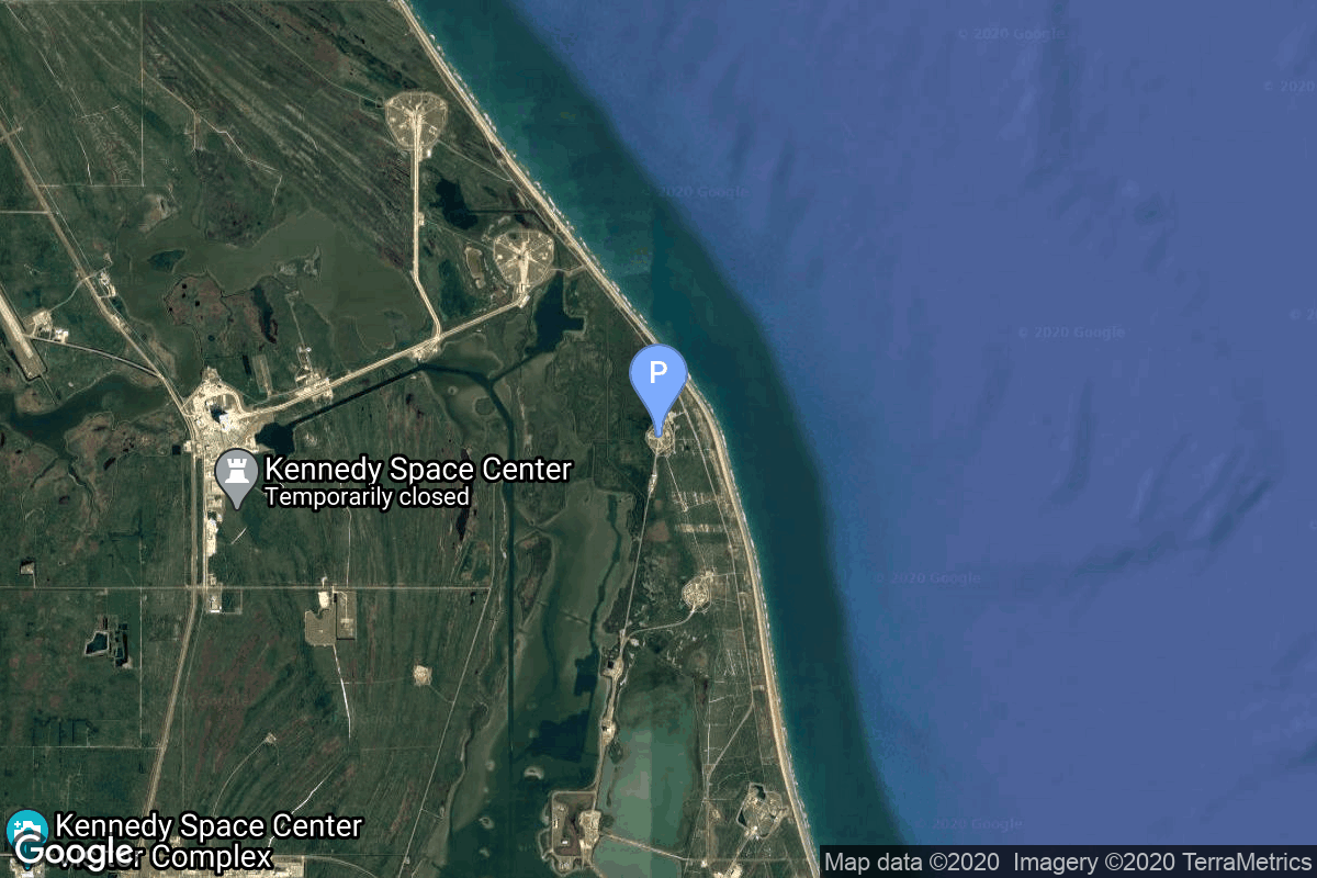
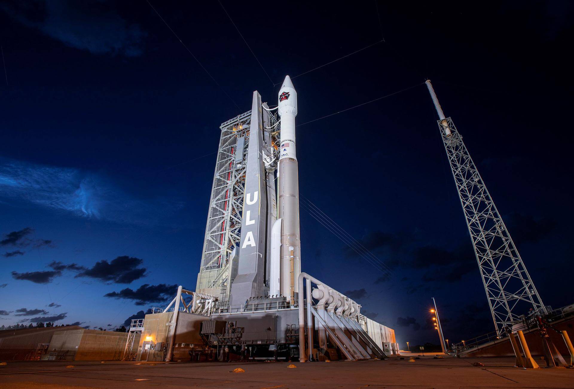
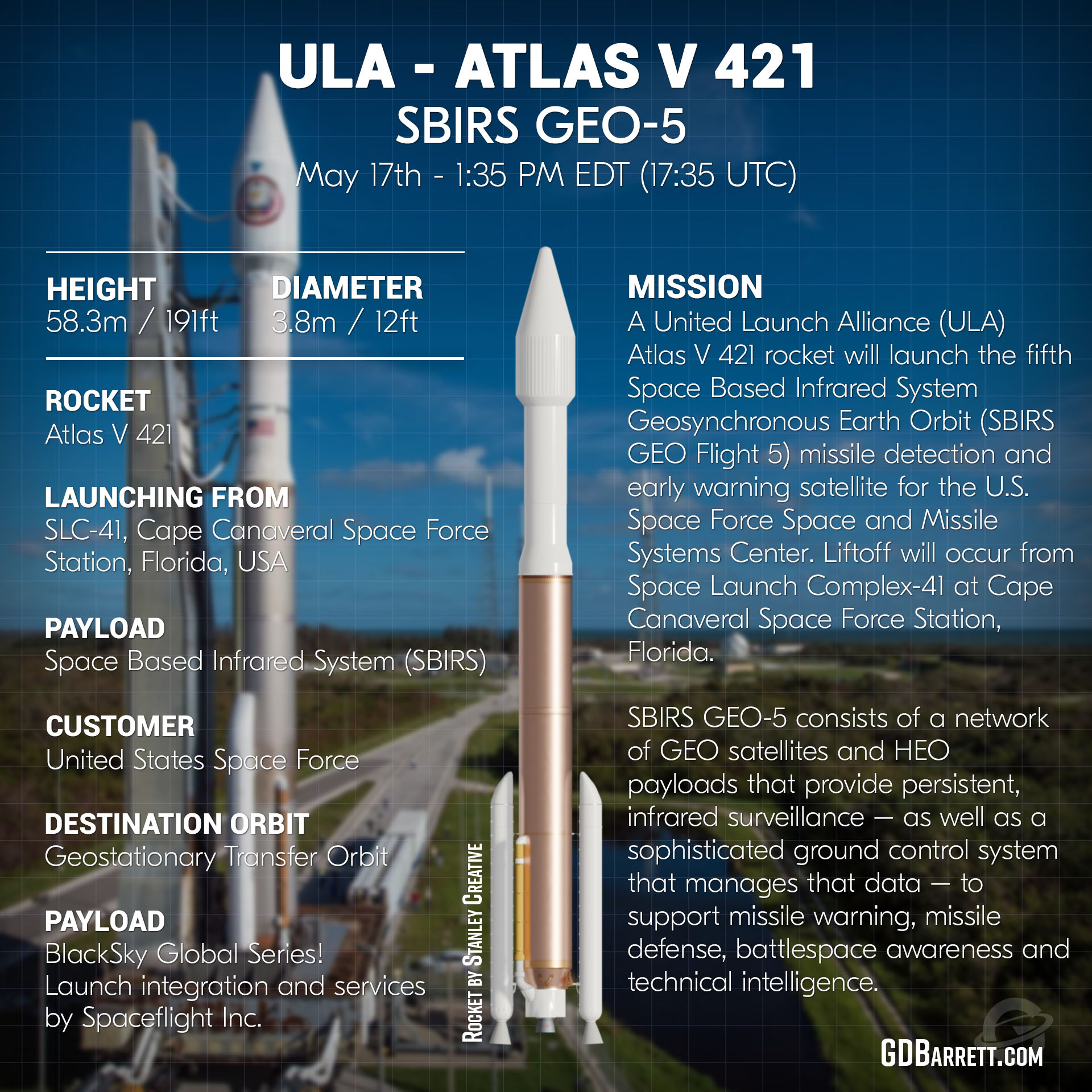
{ "count": 8136, "next": "https://lldev.thespacedevs.com/2.0.0/launch/?format=api&limit=10&offset=7380&ordering=-name", "previous": "https://lldev.thespacedevs.com/2.0.0/launch/?format=api&limit=10&offset=7360&ordering=-name", "results": [ { "id": "9086bd21-5422-41b9-a492-963aababd8fd", "url": "https://lldev.thespacedevs.com/2.0.0/launch/9086bd21-5422-41b9-a492-963aababd8fd/?format=api", "launch_library_id": null, "slug": "atlas-v-501-amazon-leo-project-kuiper-protoflight", "name": "Atlas V 501 | Amazon Leo (Project Kuiper) Protoflight Mission", "status": { "id": 3, "name": "Success" }, "net": "2023-10-06T18:06:00Z", "window_end": "2023-10-06T20:00:00Z", "window_start": "2023-10-06T18:00:00Z", "inhold": false, "tbdtime": false, "tbddate": false, "probability": 85, "holdreason": "", "failreason": "", "hashtag": null, "launch_service_provider": { "id": 124, "url": "https://lldev.thespacedevs.com/2.0.0/agencies/124/?format=api", "name": "United Launch Alliance", "type": "Commercial" }, "rocket": { "id": 135, "configuration": { "id": 4, "launch_library_id": 32, "url": "https://lldev.thespacedevs.com/2.0.0/config/launcher/4/?format=api", "name": "Atlas V 501", "family": "Atlas", "full_name": "Atlas V 501", "variant": "501" } }, "mission": { "id": 5992, "launch_library_id": null, "name": "Amazon Leo (Project Kuiper) Protoflight Mission", "description": "This launch deployed 2 KuiperSat demonstration satellites to 500 km altitude, 30 degree inclination orbit. They were previously scheduled on the 1st Vulcan launch.\r\n\r\nAmazon Leo, formerly known as Project Kuiper, is a mega constellation of satellites in Low Earth Orbit that will offer broadband internet access, this constellation will be managed by Kuiper Systems LLC, a subsidiary of Amazon. This constellation is planned to be composed of 3,276 satellites. The satellites are projected to be placed in 98 orbital planes in three orbital layers, one at 590 km, 610 km and 630 km altitude.", "launch_designator": null, "type": "Communications", "orbit": { "id": 8, "name": "Low Earth Orbit", "abbrev": "LEO" } }, "pad": { "id": 29, "url": "https://lldev.thespacedevs.com/2.0.0/pad/29/?format=api", "agency_id": null, "name": "Space Launch Complex 41", "info_url": null, "wiki_url": "https://en.wikipedia.org/wiki/Cape_Canaveral_Air_Force_Station_Space_Launch_Complex_41", "map_url": "https://www.google.com/maps?q=28.58341025,-80.58303644", "latitude": "28.58341025", "longitude": "-80.58303644", "location": { "id": 12, "url": "https://lldev.thespacedevs.com/2.0.0/location/12/?format=api", "name": "Cape Canaveral SFS, FL, USA", "country_code": "USA", "map_image": "https://thespacedevs-dev.nyc3.digitaloceanspaces.com/media/map_images/location_12_20200803142519.jpg", "total_launch_count": 1132, "total_landing_count": 83 }, "map_image": "https://thespacedevs-dev.nyc3.digitaloceanspaces.com/media/map_images/pad_29_20200803143528.jpg", "total_launch_count": 125 }, "webcast_live": false, "image": "https://thespacedevs-dev.nyc3.digitaloceanspaces.com/media/images/atlas2520v252_image_20231008042449.jpeg", "infographic": null, "program": [ { "id": 27, "url": "https://lldev.thespacedevs.com/2.0.0/program/27/?format=api", "name": "Amazon Leo", "description": "Amazon Leo is a satellite internet constellation aimed at providing high-speed, low-latency broadband connectivity to underserved and remote areas globally. The project involves deploying a constellation of low Earth orbit (LEO) satellites to create a satellite internet network capable of delivering reliable internet access.", "agencies": [ { "id": 1058, "url": "https://lldev.thespacedevs.com/2.0.0/agencies/1058/?format=api", "name": "Amazon Leo", "type": "Private" } ], "image_url": "https://thespacedevs-dev.nyc3.digitaloceanspaces.com/media/images/project2520kui_program_20231228165031.jpeg", "start_date": "2023-10-16T18:06:00Z", "end_date": null, "info_url": "https://en.wikipedia.org/wiki/Kuiper_Systems", "wiki_url": "https://aboutamazon.com/what-we-do/devices-services/project-kuiper" } ] }, { "id": "67e443c9-8209-4167-b54c-9b46dceca275", "url": "https://lldev.thespacedevs.com/2.0.0/launch/67e443c9-8209-4167-b54c-9b46dceca275/?format=api", "launch_library_id": 1568, "slug": "atlas-v-431-intelsat-14", "name": "Atlas V 431 | Intelsat 14", "status": { "id": 3, "name": "Success" }, "net": "2009-11-23T06:55:00Z", "window_end": "2009-11-23T06:55:00Z", "window_start": "2009-11-23T06:55:00Z", "inhold": false, "tbdtime": false, "tbddate": false, "probability": 0, "holdreason": "", "failreason": "", "hashtag": null, "launch_service_provider": { "id": 124, "url": "https://lldev.thespacedevs.com/2.0.0/agencies/124/?format=api", "name": "United Launch Alliance", "type": "Commercial" }, "rocket": { "id": 1434, "configuration": { "id": 111, "launch_library_id": 119, "url": "https://lldev.thespacedevs.com/2.0.0/config/launcher/111/?format=api", "name": "Atlas V 431", "family": "Atlas", "full_name": "Atlas V 431", "variant": "431" } }, "mission": { "id": 556, "launch_library_id": 725, "name": "Intelsat 14", "description": "A commercial communications satellite owned and operated by Intelsat.", "launch_designator": null, "type": "Communications", "orbit": { "id": 2, "name": "Geostationary Transfer Orbit", "abbrev": "GTO" } }, "pad": { "id": 29, "url": "https://lldev.thespacedevs.com/2.0.0/pad/29/?format=api", "agency_id": null, "name": "Space Launch Complex 41", "info_url": null, "wiki_url": "https://en.wikipedia.org/wiki/Cape_Canaveral_Air_Force_Station_Space_Launch_Complex_41", "map_url": "https://www.google.com/maps?q=28.58341025,-80.58303644", "latitude": "28.58341025", "longitude": "-80.58303644", "location": { "id": 12, "url": "https://lldev.thespacedevs.com/2.0.0/location/12/?format=api", "name": "Cape Canaveral SFS, FL, USA", "country_code": "USA", "map_image": "https://thespacedevs-dev.nyc3.digitaloceanspaces.com/media/map_images/location_12_20200803142519.jpg", "total_launch_count": 1132, "total_landing_count": 83 }, "map_image": "https://thespacedevs-dev.nyc3.digitaloceanspaces.com/media/map_images/pad_29_20200803143528.jpg", "total_launch_count": 125 }, "webcast_live": false, "image": "https://thespacedevs-dev.nyc3.digitaloceanspaces.com/media/images/atlas2520v2520431_image_20190222031015.jpeg", "infographic": null, "program": [] }, { "id": "57d8217f-5cc3-476f-b688-9dba65e8f988", "url": "https://lldev.thespacedevs.com/2.0.0/launch/57d8217f-5cc3-476f-b688-9dba65e8f988/?format=api", "launch_library_id": null, "slug": "atlas-v-431-inmarsat-4-f1", "name": "Atlas V 431 | INMARSAT 4 F1", "status": { "id": 3, "name": "Success" }, "net": "2005-03-11T21:42:00Z", "window_end": "2005-03-11T21:42:00Z", "window_start": "2005-03-11T21:42:00Z", "inhold": false, "tbdtime": false, "tbddate": false, "probability": null, "holdreason": "", "failreason": null, "hashtag": null, "launch_service_provider": { "id": 82, "url": "https://lldev.thespacedevs.com/2.0.0/agencies/82/?format=api", "name": "Lockheed Martin", "type": "Commercial" }, "rocket": { "id": 7218, "configuration": { "id": 111, "launch_library_id": 119, "url": "https://lldev.thespacedevs.com/2.0.0/config/launcher/111/?format=api", "name": "Atlas V 431", "family": "Atlas", "full_name": "Atlas V 431", "variant": "431" } }, "mission": { "id": 5607, "launch_library_id": null, "name": "INMARSAT 4 F1", "description": "Heaviest single payload to geosynchronous transfer orbit to that date. The satellite was to provide L-band mobile communications and wideband data transmission for Inmarsat's global network.", "launch_designator": null, "type": "Communications", "orbit": { "id": 4, "name": "Geosynchronous Transfer Orbit", "abbrev": "GSTO" } }, "pad": { "id": 29, "url": "https://lldev.thespacedevs.com/2.0.0/pad/29/?format=api", "agency_id": null, "name": "Space Launch Complex 41", "info_url": null, "wiki_url": "https://en.wikipedia.org/wiki/Cape_Canaveral_Air_Force_Station_Space_Launch_Complex_41", "map_url": "https://www.google.com/maps?q=28.58341025,-80.58303644", "latitude": "28.58341025", "longitude": "-80.58303644", "location": { "id": 12, "url": "https://lldev.thespacedevs.com/2.0.0/location/12/?format=api", "name": "Cape Canaveral SFS, FL, USA", "country_code": "USA", "map_image": "https://thespacedevs-dev.nyc3.digitaloceanspaces.com/media/map_images/location_12_20200803142519.jpg", "total_launch_count": 1132, "total_landing_count": 83 }, "map_image": "https://thespacedevs-dev.nyc3.digitaloceanspaces.com/media/map_images/pad_29_20200803143528.jpg", "total_launch_count": 125 }, "webcast_live": false, "image": "https://thespacedevs-dev.nyc3.digitaloceanspaces.com/media/images/atlas2520v2520431_image_20190222031015.jpeg", "infographic": null, "program": [] }, { "id": "6e7316e1-9e03-411d-a39f-c28e20e18a91", "url": "https://lldev.thespacedevs.com/2.0.0/launch/6e7316e1-9e03-411d-a39f-c28e20e18a91/?format=api", "launch_library_id": 766, "slug": "atlas-v-431-echostar-19-jupiter-2", "name": "Atlas V 431 | Echostar 19 (Jupiter-2)", "status": { "id": 3, "name": "Success" }, "net": "2016-12-18T19:13:00Z", "window_end": "2016-12-18T20:27:00Z", "window_start": "2016-12-18T18:27:00Z", "inhold": false, "tbdtime": false, "tbddate": false, "probability": 70, "holdreason": "", "failreason": null, "hashtag": null, "launch_service_provider": { "id": 124, "url": "https://lldev.thespacedevs.com/2.0.0/agencies/124/?format=api", "name": "United Launch Alliance", "type": "Commercial" }, "rocket": { "id": 1974, "configuration": { "id": 111, "launch_library_id": 119, "url": "https://lldev.thespacedevs.com/2.0.0/config/launcher/111/?format=api", "name": "Atlas V 431", "family": "Atlas", "full_name": "Atlas V 431", "variant": "431" } }, "mission": { "id": 286, "launch_library_id": 389, "name": "Echostar 19 (Jupiter-2)", "description": "Echostar-19, also known as Jupiter-2, is a world’s highest capacity broadband satellite that will help meet the growing demand for HughesNet high-speed satellite internet service in North America. The satellite is designed to provide service for 15 years or more.", "launch_designator": null, "type": "Communications", "orbit": { "id": 2, "name": "Geostationary Transfer Orbit", "abbrev": "GTO" } }, "pad": { "id": 29, "url": "https://lldev.thespacedevs.com/2.0.0/pad/29/?format=api", "agency_id": null, "name": "Space Launch Complex 41", "info_url": null, "wiki_url": "https://en.wikipedia.org/wiki/Cape_Canaveral_Air_Force_Station_Space_Launch_Complex_41", "map_url": "https://www.google.com/maps?q=28.58341025,-80.58303644", "latitude": "28.58341025", "longitude": "-80.58303644", "location": { "id": 12, "url": "https://lldev.thespacedevs.com/2.0.0/location/12/?format=api", "name": "Cape Canaveral SFS, FL, USA", "country_code": "USA", "map_image": "https://thespacedevs-dev.nyc3.digitaloceanspaces.com/media/map_images/location_12_20200803142519.jpg", "total_launch_count": 1132, "total_landing_count": 83 }, "map_image": "https://thespacedevs-dev.nyc3.digitaloceanspaces.com/media/map_images/pad_29_20200803143528.jpg", "total_launch_count": 125 }, "webcast_live": false, "image": "https://thespacedevs-dev.nyc3.digitaloceanspaces.com/media/images/atlas2520v2520431_image_20190222031015.jpeg", "infographic": null, "program": [] }, { "id": "a381436d-c846-4572-9d53-758a1ad01879", "url": "https://lldev.thespacedevs.com/2.0.0/launch/a381436d-c846-4572-9d53-758a1ad01879/?format=api", "launch_library_id": 1564, "slug": "atlas-v-421-wgs-2", "name": "Atlas V 421 | WGS-2", "status": { "id": 3, "name": "Success" }, "net": "2009-04-04T00:31:00Z", "window_end": "2009-04-04T00:31:00Z", "window_start": "2009-04-04T00:31:00Z", "inhold": false, "tbdtime": false, "tbddate": false, "probability": 0, "holdreason": "", "failreason": "", "hashtag": "", "launch_service_provider": { "id": 124, "url": "https://lldev.thespacedevs.com/2.0.0/agencies/124/?format=api", "name": "United Launch Alliance", "type": "Commercial" }, "rocket": { "id": 1413, "configuration": { "id": 28, "launch_library_id": 55, "url": "https://lldev.thespacedevs.com/2.0.0/config/launcher/28/?format=api", "name": "Atlas V 421", "family": "Atlas", "full_name": "Atlas V 421", "variant": "421" } }, "mission": { "id": 550, "launch_library_id": 721, "name": "WGS-2", "description": "The Wideband Global SATCOM system (WGS) is a high capacity satellite communications system for use by US DoD and Australian Department of Defence. Providing communications for warfighters.", "launch_designator": null, "type": "Communications", "orbit": { "id": 2, "name": "Geostationary Transfer Orbit", "abbrev": "GTO" } }, "pad": { "id": 29, "url": "https://lldev.thespacedevs.com/2.0.0/pad/29/?format=api", "agency_id": null, "name": "Space Launch Complex 41", "info_url": null, "wiki_url": "https://en.wikipedia.org/wiki/Cape_Canaveral_Air_Force_Station_Space_Launch_Complex_41", "map_url": "https://www.google.com/maps?q=28.58341025,-80.58303644", "latitude": "28.58341025", "longitude": "-80.58303644", "location": { "id": 12, "url": "https://lldev.thespacedevs.com/2.0.0/location/12/?format=api", "name": "Cape Canaveral SFS, FL, USA", "country_code": "USA", "map_image": "https://thespacedevs-dev.nyc3.digitaloceanspaces.com/media/map_images/location_12_20200803142519.jpg", "total_launch_count": 1132, "total_landing_count": 83 }, "map_image": "https://thespacedevs-dev.nyc3.digitaloceanspaces.com/media/map_images/pad_29_20200803143528.jpg", "total_launch_count": 125 }, "webcast_live": false, "image": "https://thespacedevs-dev.nyc3.digitaloceanspaces.com/media/images/atlas_v_421_image_20210519053741.jpeg", "infographic": null, "program": [] }, { "id": "aaaa4478-ff53-49e3-8dfb-2c74b197a73a", "url": "https://lldev.thespacedevs.com/2.0.0/launch/aaaa4478-ff53-49e3-8dfb-2c74b197a73a/?format=api", "launch_library_id": 1560, "slug": "atlas-v-421-wgs-1", "name": "Atlas V 421 | WGS-1", "status": { "id": 3, "name": "Success" }, "net": "2007-10-11T00:22:00Z", "window_end": "2007-10-11T00:22:00Z", "window_start": "2007-10-11T00:22:00Z", "inhold": false, "tbdtime": false, "tbddate": false, "probability": 0, "holdreason": "", "failreason": "", "hashtag": "", "launch_service_provider": { "id": 124, "url": "https://lldev.thespacedevs.com/2.0.0/agencies/124/?format=api", "name": "United Launch Alliance", "type": "Commercial" }, "rocket": { "id": 550, "configuration": { "id": 28, "launch_library_id": 55, "url": "https://lldev.thespacedevs.com/2.0.0/config/launcher/28/?format=api", "name": "Atlas V 421", "family": "Atlas", "full_name": "Atlas V 421", "variant": "421" } }, "mission": { "id": 546, "launch_library_id": 717, "name": "WGS-1", "description": "The Wideband Global SATCOM system (WGS) is a high capacity satellite communications system for use by US DoD and Australian Department of Defence. Providing communications for warfighters.", "launch_designator": null, "type": "Communications", "orbit": { "id": 2, "name": "Geostationary Transfer Orbit", "abbrev": "GTO" } }, "pad": { "id": 29, "url": "https://lldev.thespacedevs.com/2.0.0/pad/29/?format=api", "agency_id": null, "name": "Space Launch Complex 41", "info_url": null, "wiki_url": "https://en.wikipedia.org/wiki/Cape_Canaveral_Air_Force_Station_Space_Launch_Complex_41", "map_url": "https://www.google.com/maps?q=28.58341025,-80.58303644", "latitude": "28.58341025", "longitude": "-80.58303644", "location": { "id": 12, "url": "https://lldev.thespacedevs.com/2.0.0/location/12/?format=api", "name": "Cape Canaveral SFS, FL, USA", "country_code": "USA", "map_image": "https://thespacedevs-dev.nyc3.digitaloceanspaces.com/media/map_images/location_12_20200803142519.jpg", "total_launch_count": 1132, "total_landing_count": 83 }, "map_image": "https://thespacedevs-dev.nyc3.digitaloceanspaces.com/media/map_images/pad_29_20200803143528.jpg", "total_launch_count": 125 }, "webcast_live": false, "image": "https://thespacedevs-dev.nyc3.digitaloceanspaces.com/media/images/atlas_v_421_image_20210519053741.jpeg", "infographic": null, "program": [] }, { "id": "33bf26a0-818e-4519-a47a-4fe79a07e84e", "url": "https://lldev.thespacedevs.com/2.0.0/launch/33bf26a0-818e-4519-a47a-4fe79a07e84e/?format=api", "launch_library_id": 1691, "slug": "atlas-v-421-sbirs-geo-6", "name": "Atlas V 421 | SBIRS GEO-6", "status": { "id": 3, "name": "Success" }, "net": "2022-08-04T10:29:00Z", "window_end": "2022-08-04T11:09:00Z", "window_start": "2022-08-04T10:29:00Z", "inhold": false, "tbdtime": false, "tbddate": false, "probability": 80, "holdreason": "", "failreason": "", "hashtag": null, "launch_service_provider": { "id": 124, "url": "https://lldev.thespacedevs.com/2.0.0/agencies/124/?format=api", "name": "United Launch Alliance", "type": "Commercial" }, "rocket": { "id": 2229, "configuration": { "id": 28, "launch_library_id": 55, "url": "https://lldev.thespacedevs.com/2.0.0/config/launcher/28/?format=api", "name": "Atlas V 421", "family": "Atlas", "full_name": "Atlas V 421", "variant": "421" } }, "mission": { "id": 6088, "launch_library_id": null, "name": "SBIRS GEO-6", "description": "Sixth geosynchronous satellite of the Space Based Infrared System program (SBIRS), providing capabilities for early missile warning and missile defense. SBIRS GEO-6 is the second satellite using Lockheed Martin's LM2100 combat bus.", "launch_designator": null, "type": "Government/Top Secret", "orbit": { "id": 2, "name": "Geostationary Transfer Orbit", "abbrev": "GTO" } }, "pad": { "id": 29, "url": "https://lldev.thespacedevs.com/2.0.0/pad/29/?format=api", "agency_id": null, "name": "Space Launch Complex 41", "info_url": null, "wiki_url": "https://en.wikipedia.org/wiki/Cape_Canaveral_Air_Force_Station_Space_Launch_Complex_41", "map_url": "https://www.google.com/maps?q=28.58341025,-80.58303644", "latitude": "28.58341025", "longitude": "-80.58303644", "location": { "id": 12, "url": "https://lldev.thespacedevs.com/2.0.0/location/12/?format=api", "name": "Cape Canaveral SFS, FL, USA", "country_code": "USA", "map_image": "https://thespacedevs-dev.nyc3.digitaloceanspaces.com/media/map_images/location_12_20200803142519.jpg", "total_launch_count": 1132, "total_landing_count": 83 }, "map_image": "https://thespacedevs-dev.nyc3.digitaloceanspaces.com/media/map_images/pad_29_20200803143528.jpg", "total_launch_count": 125 }, "webcast_live": false, "image": "https://thespacedevs-dev.nyc3.digitaloceanspaces.com/media/images/atlas2520v252_image_20220804055901.jpeg", "infographic": null, "program": [] }, { "id": "137a0935-a14f-4690-9ce2-02c8c2ebd1c5", "url": "https://lldev.thespacedevs.com/2.0.0/launch/137a0935-a14f-4690-9ce2-02c8c2ebd1c5/?format=api", "launch_library_id": 1690, "slug": "atlas-v-421-sbirs-geo-5", "name": "Atlas V 421 | SBIRS GEO-5", "status": { "id": 3, "name": "Success" }, "net": "2021-05-18T17:37:00Z", "window_end": "2021-05-18T18:11:00Z", "window_start": "2021-05-18T17:31:00Z", "inhold": false, "tbdtime": false, "tbddate": false, "probability": null, "holdreason": "", "failreason": "", "hashtag": null, "launch_service_provider": { "id": 124, "url": "https://lldev.thespacedevs.com/2.0.0/agencies/124/?format=api", "name": "United Launch Alliance", "type": "Commercial" }, "rocket": { "id": 2228, "configuration": { "id": 28, "launch_library_id": 55, "url": "https://lldev.thespacedevs.com/2.0.0/config/launcher/28/?format=api", "name": "Atlas V 421", "family": "Atlas", "full_name": "Atlas V 421", "variant": "421" } }, "mission": { "id": 1293, "launch_library_id": null, "name": "SBIRS GEO-5", "description": "Fifth geosynchronous satellite of the Space Based Infrared System program (SBIRS), providing capabilities for early missile warning and missile defense. SBIRS GEO-5 is the first satellite using Lockheed Martin's LM2100 combat bus.", "launch_designator": null, "type": "Government/Top Secret", "orbit": { "id": 2, "name": "Geostationary Transfer Orbit", "abbrev": "GTO" } }, "pad": { "id": 29, "url": "https://lldev.thespacedevs.com/2.0.0/pad/29/?format=api", "agency_id": null, "name": "Space Launch Complex 41", "info_url": null, "wiki_url": "https://en.wikipedia.org/wiki/Cape_Canaveral_Air_Force_Station_Space_Launch_Complex_41", "map_url": "https://www.google.com/maps?q=28.58341025,-80.58303644", "latitude": "28.58341025", "longitude": "-80.58303644", "location": { "id": 12, "url": "https://lldev.thespacedevs.com/2.0.0/location/12/?format=api", "name": "Cape Canaveral SFS, FL, USA", "country_code": "USA", "map_image": "https://thespacedevs-dev.nyc3.digitaloceanspaces.com/media/map_images/location_12_20200803142519.jpg", "total_launch_count": 1132, "total_landing_count": 83 }, "map_image": "https://thespacedevs-dev.nyc3.digitaloceanspaces.com/media/map_images/pad_29_20200803143528.jpg", "total_launch_count": 125 }, "webcast_live": false, "image": "https://thespacedevs-dev.nyc3.digitaloceanspaces.com/media/images/atlas2520v252_image_20210516172951.jpeg", "infographic": "https://thespacedevs-dev.nyc3.digitaloceanspaces.com/media/infographic_images/atlas2520v252_infographic_20210515005057.jpg", "program": [] }, { "id": "5f59bf95-0c45-418a-a1d4-8a237c6b852b", "url": "https://lldev.thespacedevs.com/2.0.0/launch/5f59bf95-0c45-418a-a1d4-8a237c6b852b/?format=api", "launch_library_id": 760, "slug": "atlas-v-421-nrol-61", "name": "Atlas V 421 | NROL-61", "status": { "id": 3, "name": "Success" }, "net": "2016-07-28T12:37:00Z", "window_end": "2016-07-28T16:00:00Z", "window_start": "2016-07-28T12:00:00Z", "inhold": false, "tbdtime": false, "tbddate": false, "probability": 80, "holdreason": "", "failreason": null, "hashtag": null, "launch_service_provider": { "id": 124, "url": "https://lldev.thespacedevs.com/2.0.0/agencies/124/?format=api", "name": "United Launch Alliance", "type": "Commercial" }, "rocket": { "id": 1943, "configuration": { "id": 28, "launch_library_id": 55, "url": "https://lldev.thespacedevs.com/2.0.0/config/launcher/28/?format=api", "name": "Atlas V 421", "family": "Atlas", "full_name": "Atlas V 421", "variant": "421" } }, "mission": { "id": 120, "launch_library_id": 174, "name": "NROL-61", "description": "Classified payload for the National Reconnaissance Office.", "launch_designator": null, "type": "Government/Top Secret", "orbit": { "id": 2, "name": "Geostationary Transfer Orbit", "abbrev": "GTO" } }, "pad": { "id": 29, "url": "https://lldev.thespacedevs.com/2.0.0/pad/29/?format=api", "agency_id": null, "name": "Space Launch Complex 41", "info_url": null, "wiki_url": "https://en.wikipedia.org/wiki/Cape_Canaveral_Air_Force_Station_Space_Launch_Complex_41", "map_url": "https://www.google.com/maps?q=28.58341025,-80.58303644", "latitude": "28.58341025", "longitude": "-80.58303644", "location": { "id": 12, "url": "https://lldev.thespacedevs.com/2.0.0/location/12/?format=api", "name": "Cape Canaveral SFS, FL, USA", "country_code": "USA", "map_image": "https://thespacedevs-dev.nyc3.digitaloceanspaces.com/media/map_images/location_12_20200803142519.jpg", "total_launch_count": 1132, "total_landing_count": 83 }, "map_image": "https://thespacedevs-dev.nyc3.digitaloceanspaces.com/media/map_images/pad_29_20200803143528.jpg", "total_launch_count": 125 }, "webcast_live": false, "image": "https://thespacedevs-dev.nyc3.digitaloceanspaces.com/media/images/atlas_v_421_image_20210519053741.jpeg", "infographic": null, "program": [] }, { "id": "a444a545-cd97-40c4-90e3-a4b4ab896afa", "url": "https://lldev.thespacedevs.com/2.0.0/launch/a444a545-cd97-40c4-90e3-a4b4ab896afa/?format=api", "launch_library_id": 1287, "slug": "atlas-v-421-nrol-52", "name": "Atlas V 421 | NROL-52", "status": { "id": 3, "name": "Success" }, "net": "2017-10-15T07:28:00Z", "window_end": "2017-10-15T07:28:00Z", "window_start": "2017-10-15T07:28:00Z", "inhold": false, "tbdtime": false, "tbddate": false, "probability": 80, "holdreason": "", "failreason": null, "hashtag": "", "launch_service_provider": { "id": 124, "url": "https://lldev.thespacedevs.com/2.0.0/agencies/124/?format=api", "name": "United Launch Alliance", "type": "Commercial" }, "rocket": { "id": 2040, "configuration": { "id": 28, "launch_library_id": 55, "url": "https://lldev.thespacedevs.com/2.0.0/config/launcher/28/?format=api", "name": "Atlas V 421", "family": "Atlas", "full_name": "Atlas V 421", "variant": "421" } }, "mission": { "id": 133, "launch_library_id": 570, "name": "NROL-52", "description": "Classified payload for the U.S. National Reconnaissance Office.", "launch_designator": null, "type": "Government/Top Secret", "orbit": { "id": 2, "name": "Geostationary Transfer Orbit", "abbrev": "GTO" } }, "pad": { "id": 29, "url": "https://lldev.thespacedevs.com/2.0.0/pad/29/?format=api", "agency_id": null, "name": "Space Launch Complex 41", "info_url": null, "wiki_url": "https://en.wikipedia.org/wiki/Cape_Canaveral_Air_Force_Station_Space_Launch_Complex_41", "map_url": "https://www.google.com/maps?q=28.58341025,-80.58303644", "latitude": "28.58341025", "longitude": "-80.58303644", "location": { "id": 12, "url": "https://lldev.thespacedevs.com/2.0.0/location/12/?format=api", "name": "Cape Canaveral SFS, FL, USA", "country_code": "USA", "map_image": "https://thespacedevs-dev.nyc3.digitaloceanspaces.com/media/map_images/location_12_20200803142519.jpg", "total_launch_count": 1132, "total_landing_count": 83 }, "map_image": "https://thespacedevs-dev.nyc3.digitaloceanspaces.com/media/map_images/pad_29_20200803143528.jpg", "total_launch_count": 125 }, "webcast_live": false, "image": "https://thespacedevs-dev.nyc3.digitaloceanspaces.com/media/images/atlas_v_421_image_20210519053741.jpeg", "infographic": null, "program": [] } ] }