Launch List
API endpoint that returns all Launch objects or a single launch.
EXAMPLE - /launch/
GET: Return a list of all Launch objects.
FILTERS: Fields - 'name', 'id(s)', 'lsp_id', 'lsp_name', 'serial_number', 'launcher_config__id', 'rocket__spacecraftflight__spacecraft__name'
MODE: 'normal', 'list', 'detailed' EXAMPLE: ?mode=list
SEARCH: Searches through the launch name, rocket name, launch agency, mission name & spacecraft name. EXAMPLE - ?search=SpaceX
GET /2.0.0/launch/?format=api&offset=6970&ordering=-name
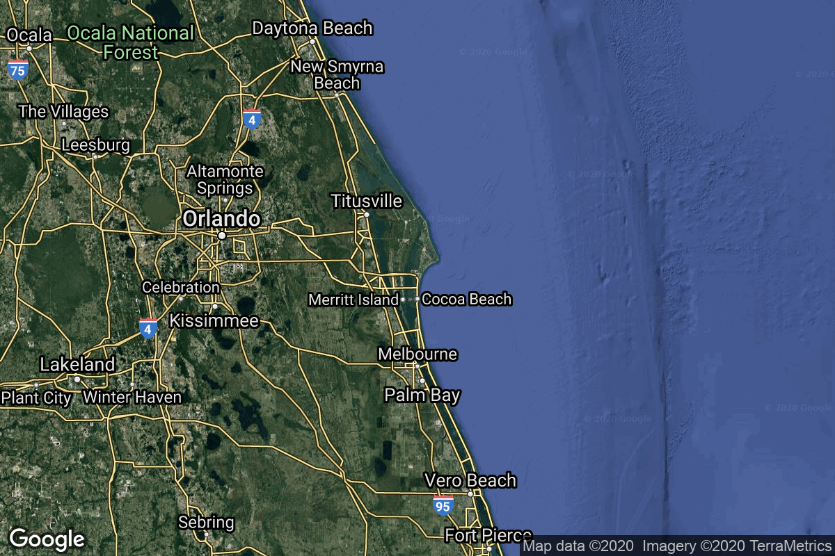
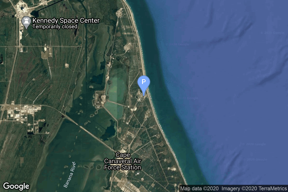
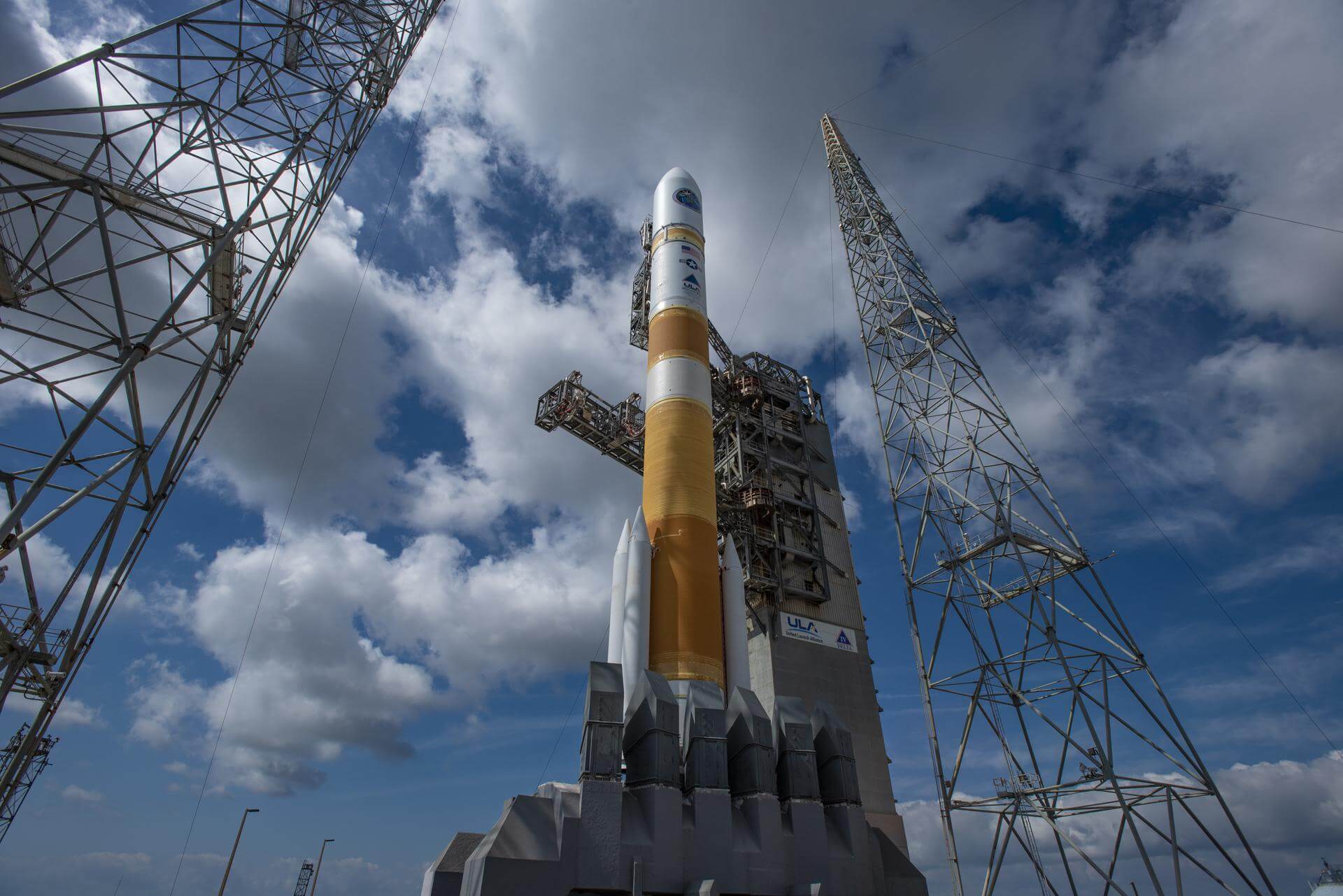
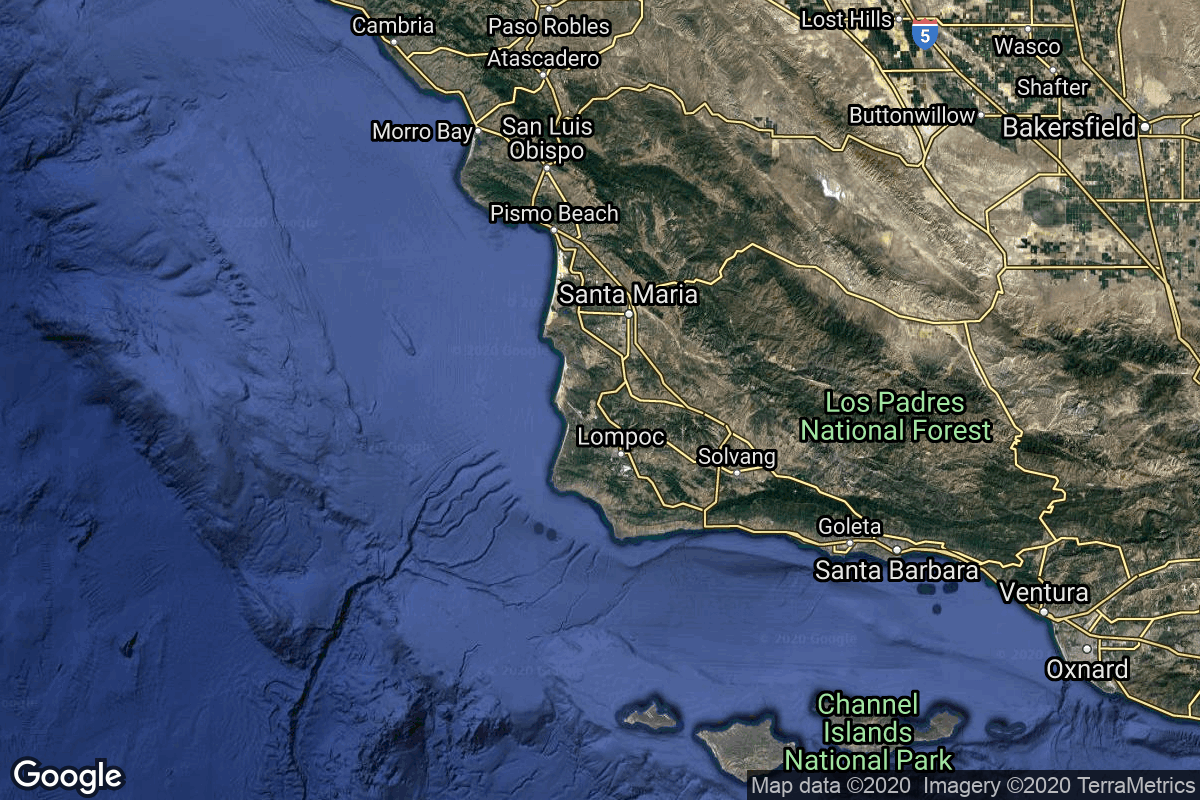
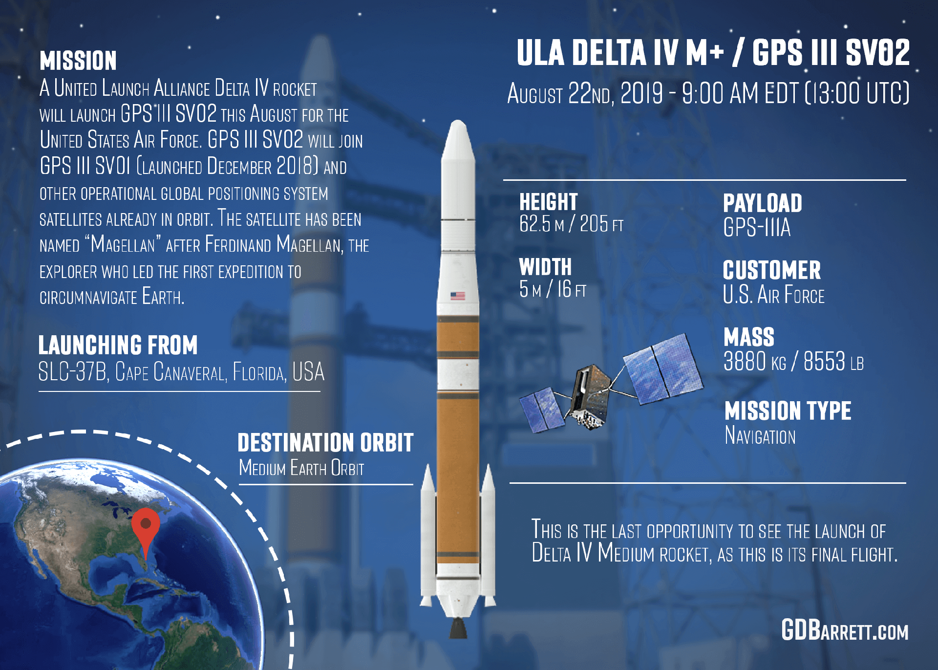
{ "count": 8136, "next": "https://lldev.thespacedevs.com/2.0.0/launch/?format=api&limit=10&offset=6980&ordering=-name", "previous": "https://lldev.thespacedevs.com/2.0.0/launch/?format=api&limit=10&offset=6960&ordering=-name", "results": [ { "id": "b4a603e1-4fa0-4702-b324-24e745ab82df", "url": "https://lldev.thespacedevs.com/2.0.0/launch/b4a603e1-4fa0-4702-b324-24e745ab82df/?format=api", "launch_library_id": 1334, "slug": "delta-iv-m54-wgs-10", "name": "Delta IV M+(5,4) | WGS-10", "status": { "id": 3, "name": "Success" }, "net": "2019-03-16T00:26:00Z", "window_end": "2019-03-16T01:05:00Z", "window_start": "2019-03-15T22:56:00Z", "inhold": false, "tbdtime": false, "tbddate": false, "probability": 100, "holdreason": "", "failreason": null, "hashtag": "#WGS10", "launch_service_provider": { "id": 124, "url": "https://lldev.thespacedevs.com/2.0.0/agencies/124/?format=api", "name": "United Launch Alliance", "type": "Commercial" }, "rocket": { "id": 82, "configuration": { "id": 23, "launch_library_id": 42, "url": "https://lldev.thespacedevs.com/2.0.0/config/launcher/23/?format=api", "name": "Delta IV M+(5,4)", "family": "Delta", "full_name": "Delta IV M+(5,4)", "variant": "M+(5,4)" } }, "mission": { "id": 974, "launch_library_id": 1185, "name": "WGS-10", "description": "WGS-10 is the tenth and final satellite in Wideband Global Satcom constellation. These are high-capacity military communications satellites providing vital service for tactical forces who rely on WGS for connectivity to the Defence Information Systems Network (DISN).", "launch_designator": null, "type": "Communications", "orbit": { "id": 2, "name": "Geostationary Transfer Orbit", "abbrev": "GTO" } }, "pad": { "id": 38, "url": "https://lldev.thespacedevs.com/2.0.0/pad/38/?format=api", "agency_id": null, "name": "Space Launch Complex 37B", "info_url": null, "wiki_url": "https://en.wikipedia.org/wiki/Cape_Canaveral_Air_Force_Station_Space_Launch_Complex_37", "map_url": "https://www.google.com/maps?q=28.5317,-80.56495", "latitude": "28.5317", "longitude": "-80.56495", "location": { "id": 12, "url": "https://lldev.thespacedevs.com/2.0.0/location/12/?format=api", "name": "Cape Canaveral SFS, FL, USA", "country_code": "USA", "map_image": "https://thespacedevs-dev.nyc3.digitaloceanspaces.com/media/map_images/location_12_20200803142519.jpg", "total_launch_count": 1132, "total_landing_count": 83 }, "map_image": "https://thespacedevs-dev.nyc3.digitaloceanspaces.com/media/map_images/pad_38_20200803143515.jpg", "total_launch_count": 40 }, "webcast_live": false, "image": "https://thespacedevs-dev.nyc3.digitaloceanspaces.com/media/images/delta_iv_m252b_image_20240308073027.jpeg", "infographic": null, "program": [] }, { "id": "aee6058b-4d06-4ccc-942c-5d02c677866d", "url": "https://lldev.thespacedevs.com/2.0.0/launch/aee6058b-4d06-4ccc-942c-5d02c677866d/?format=api", "launch_library_id": 1423, "slug": "delta-iv-m52-nrol-47", "name": "Delta IV M+(5,2) | NROL-47", "status": { "id": 3, "name": "Success" }, "net": "2018-01-12T22:11:00Z", "window_end": "2018-01-13T01:00:00Z", "window_start": "2018-01-12T21:00:00Z", "inhold": false, "tbdtime": false, "tbddate": false, "probability": 80, "holdreason": "", "failreason": null, "hashtag": "#NROL47", "launch_service_provider": { "id": 124, "url": "https://lldev.thespacedevs.com/2.0.0/agencies/124/?format=api", "name": "United Launch Alliance", "type": "Commercial" }, "rocket": { "id": 2065, "configuration": { "id": 35, "launch_library_id": 41, "url": "https://lldev.thespacedevs.com/2.0.0/config/launcher/35/?format=api", "name": "Delta IV M+(5,2)", "family": "Delta", "full_name": "Delta IV M+(5,2)", "variant": "M+(5,2)" } }, "mission": { "id": 488, "launch_library_id": 633, "name": "NROL-47", "description": "Classified payload for the U.S. National Reconnaissance Office.", "launch_designator": null, "type": "Government/Top Secret", "orbit": { "id": 8, "name": "Low Earth Orbit", "abbrev": "LEO" } }, "pad": { "id": 11, "url": "https://lldev.thespacedevs.com/2.0.0/pad/11/?format=api", "agency_id": null, "name": "Space Launch Complex 6", "info_url": null, "wiki_url": "https://en.wikipedia.org/wiki/Vandenberg_Space_Launch_Complex_6", "map_url": "https://www.google.com/maps?q=34.5815,-120.6262", "latitude": "34.5815", "longitude": "-120.6262", "location": { "id": 11, "url": "https://lldev.thespacedevs.com/2.0.0/location/11/?format=api", "name": "Vandenberg SFB, CA, USA", "country_code": "USA", "map_image": "https://thespacedevs-dev.nyc3.digitaloceanspaces.com/media/map_images/location_11_20200803142416.jpg", "total_launch_count": 924, "total_landing_count": 37 }, "map_image": "https://thespacedevs-dev.nyc3.digitaloceanspaces.com/media/map_images/pad_11_20200803143550.jpg", "total_launch_count": 14 }, "webcast_live": false, "image": "https://thespacedevs-dev.nyc3.digitaloceanspaces.com/media/images/delta_iv_m252b_image_20240308073355.jpeg", "infographic": null, "program": [] }, { "id": "5c64fbde-f5f3-4823-91a1-8463c2fbf507", "url": "https://lldev.thespacedevs.com/2.0.0/launch/5c64fbde-f5f3-4823-91a1-8463c2fbf507/?format=api", "launch_library_id": 504, "slug": "delta-iv-m52-nrol-45-topaz-4-usa-267", "name": "Delta IV M+(5,2) | NROL-45 (Topaz-4) (USA-267)", "status": { "id": 3, "name": "Success" }, "net": "2016-02-10T11:40:32Z", "window_end": "2016-02-10T11:40:32Z", "window_start": "2016-02-10T11:40:32Z", "inhold": false, "tbdtime": false, "tbddate": false, "probability": null, "holdreason": "", "failreason": null, "hashtag": null, "launch_service_provider": { "id": 124, "url": "https://lldev.thespacedevs.com/2.0.0/agencies/124/?format=api", "name": "United Launch Alliance", "type": "Commercial" }, "rocket": { "id": 1908, "configuration": { "id": 35, "launch_library_id": 41, "url": "https://lldev.thespacedevs.com/2.0.0/config/launcher/35/?format=api", "name": "Delta IV M+(5,2)", "family": "Delta", "full_name": "Delta IV M+(5,2)", "variant": "M+(5,2)" } }, "mission": { "id": 105, "launch_library_id": 166, "name": "NROL-45 (Topaz-4) (USA-267)", "description": "Classified payload for the National Reconnaissance Office.", "launch_designator": null, "type": "Government/Top Secret", "orbit": { "id": 17, "name": "Sun-Synchronous Orbit", "abbrev": "SSO" } }, "pad": { "id": 11, "url": "https://lldev.thespacedevs.com/2.0.0/pad/11/?format=api", "agency_id": null, "name": "Space Launch Complex 6", "info_url": null, "wiki_url": "https://en.wikipedia.org/wiki/Vandenberg_Space_Launch_Complex_6", "map_url": "https://www.google.com/maps?q=34.5815,-120.6262", "latitude": "34.5815", "longitude": "-120.6262", "location": { "id": 11, "url": "https://lldev.thespacedevs.com/2.0.0/location/11/?format=api", "name": "Vandenberg SFB, CA, USA", "country_code": "USA", "map_image": "https://thespacedevs-dev.nyc3.digitaloceanspaces.com/media/map_images/location_11_20200803142416.jpg", "total_launch_count": 924, "total_landing_count": 37 }, "map_image": "https://thespacedevs-dev.nyc3.digitaloceanspaces.com/media/map_images/pad_11_20200803143550.jpg", "total_launch_count": 14 }, "webcast_live": false, "image": "https://thespacedevs-dev.nyc3.digitaloceanspaces.com/media/images/delta_iv_m252b_image_20240308073355.jpeg", "infographic": null, "program": [] }, { "id": "bec69034-c41e-48da-90d5-1f00bdc64318", "url": "https://lldev.thespacedevs.com/2.0.0/launch/bec69034-c41e-48da-90d5-1f00bdc64318/?format=api", "launch_library_id": 609, "slug": "delta-iv-m52-nrol-25-fia-r-usa-234", "name": "Delta IV M+(5,2) | NROL-25 (FIA-R) (USA-234)", "status": { "id": 3, "name": "Success" }, "net": "2012-04-03T23:12:57Z", "window_end": "2012-04-03T23:12:57Z", "window_start": "2012-04-03T23:12:57Z", "inhold": false, "tbdtime": false, "tbddate": false, "probability": null, "holdreason": "", "failreason": null, "hashtag": null, "launch_service_provider": { "id": 124, "url": "https://lldev.thespacedevs.com/2.0.0/agencies/124/?format=api", "name": "United Launch Alliance", "type": "Commercial" }, "rocket": { "id": 1597, "configuration": { "id": 35, "launch_library_id": 41, "url": "https://lldev.thespacedevs.com/2.0.0/config/launcher/35/?format=api", "name": "Delta IV M+(5,2)", "family": "Delta", "full_name": "Delta IV M+(5,2)", "variant": "M+(5,2)" } }, "mission": null, "pad": { "id": 11, "url": "https://lldev.thespacedevs.com/2.0.0/pad/11/?format=api", "agency_id": null, "name": "Space Launch Complex 6", "info_url": null, "wiki_url": "https://en.wikipedia.org/wiki/Vandenberg_Space_Launch_Complex_6", "map_url": "https://www.google.com/maps?q=34.5815,-120.6262", "latitude": "34.5815", "longitude": "-120.6262", "location": { "id": 11, "url": "https://lldev.thespacedevs.com/2.0.0/location/11/?format=api", "name": "Vandenberg SFB, CA, USA", "country_code": "USA", "map_image": "https://thespacedevs-dev.nyc3.digitaloceanspaces.com/media/map_images/location_11_20200803142416.jpg", "total_launch_count": 924, "total_landing_count": 37 }, "map_image": "https://thespacedevs-dev.nyc3.digitaloceanspaces.com/media/map_images/pad_11_20200803143550.jpg", "total_launch_count": 14 }, "webcast_live": false, "image": "https://thespacedevs-dev.nyc3.digitaloceanspaces.com/media/images/delta_iv_m252b_image_20240308073355.jpeg", "infographic": null, "program": [] }, { "id": "55f75b14-7147-4164-80de-c5cc3768f275", "url": "https://lldev.thespacedevs.com/2.0.0/launch/55f75b14-7147-4164-80de-c5cc3768f275/?format=api", "launch_library_id": 685, "slug": "delta-iv-m42-nrol-27-sds-usa-227", "name": "Delta IV M+(4,2) | NROL-27 (SDS) (USA-227)", "status": { "id": 3, "name": "Success" }, "net": "2011-03-11T23:38:00Z", "window_end": "2011-03-11T23:38:00Z", "window_start": "2011-03-11T23:38:00Z", "inhold": false, "tbdtime": false, "tbddate": false, "probability": null, "holdreason": "", "failreason": null, "hashtag": null, "launch_service_provider": { "id": 124, "url": "https://lldev.thespacedevs.com/2.0.0/agencies/124/?format=api", "name": "United Launch Alliance", "type": "Commercial" }, "rocket": { "id": 1516, "configuration": { "id": 33, "launch_library_id": 40, "url": "https://lldev.thespacedevs.com/2.0.0/config/launcher/33/?format=api", "name": "Delta IV M+(4,2)", "family": "Delta", "full_name": "Delta IV M+(4,2)", "variant": "M+(4,2)" } }, "mission": null, "pad": { "id": 38, "url": "https://lldev.thespacedevs.com/2.0.0/pad/38/?format=api", "agency_id": null, "name": "Space Launch Complex 37B", "info_url": null, "wiki_url": "https://en.wikipedia.org/wiki/Cape_Canaveral_Air_Force_Station_Space_Launch_Complex_37", "map_url": "https://www.google.com/maps?q=28.5317,-80.56495", "latitude": "28.5317", "longitude": "-80.56495", "location": { "id": 12, "url": "https://lldev.thespacedevs.com/2.0.0/location/12/?format=api", "name": "Cape Canaveral SFS, FL, USA", "country_code": "USA", "map_image": "https://thespacedevs-dev.nyc3.digitaloceanspaces.com/media/map_images/location_12_20200803142519.jpg", "total_launch_count": 1132, "total_landing_count": 83 }, "map_image": "https://thespacedevs-dev.nyc3.digitaloceanspaces.com/media/map_images/pad_38_20200803143515.jpg", "total_launch_count": 40 }, "webcast_live": false, "image": "https://thespacedevs-dev.nyc3.digitaloceanspaces.com/media/images/delta_iv_m252b_image_20220302002926.jpeg", "infographic": null, "program": [] }, { "id": "07715175-08e6-4c5c-bac4-3f190114079c", "url": "https://lldev.thespacedevs.com/2.0.0/launch/07715175-08e6-4c5c-bac4-3f190114079c/?format=api", "launch_library_id": null, "slug": "delta-iv-m42-nrol-22", "name": "Delta IV M+(4,2) | NROL-22", "status": { "id": 3, "name": "Success" }, "net": "2006-06-28T03:33:00Z", "window_end": "2006-06-28T03:33:00Z", "window_start": "2006-06-28T03:33:00Z", "inhold": false, "tbdtime": false, "tbddate": false, "probability": null, "holdreason": "", "failreason": "", "hashtag": null, "launch_service_provider": { "id": 161, "url": "https://lldev.thespacedevs.com/2.0.0/agencies/161/?format=api", "name": "United States Air Force", "type": "Government" }, "rocket": { "id": 7274, "configuration": { "id": 33, "launch_library_id": 40, "url": "https://lldev.thespacedevs.com/2.0.0/config/launcher/33/?format=api", "name": "Delta IV M+(4,2)", "family": "Delta", "full_name": "Delta IV M+(4,2)", "variant": "M+(4,2)" } }, "mission": { "id": 5663, "launch_library_id": null, "name": "NROL-22 (Trumpet 4)", "description": "These spacecraft are probably the replacement for the Trumpet SIGINT satellites operating in a Molniya orbit. As no name is known, these are referred here as \"Trumpet Follow On\". Possibly these satellites might be named Raven. These satellite most likely use a large, unfurlable dish antenna to collect the signals. Advances in both antenna and electronics technologies have allowed for a large reduction in size compared the Trumpet predecessors.", "launch_designator": null, "type": "Government/Top Secret", "orbit": { "id": 7, "name": "High Earth Orbit", "abbrev": "HEO" } }, "pad": { "id": 11, "url": "https://lldev.thespacedevs.com/2.0.0/pad/11/?format=api", "agency_id": null, "name": "Space Launch Complex 6", "info_url": null, "wiki_url": "https://en.wikipedia.org/wiki/Vandenberg_Space_Launch_Complex_6", "map_url": "https://www.google.com/maps?q=34.5815,-120.6262", "latitude": "34.5815", "longitude": "-120.6262", "location": { "id": 11, "url": "https://lldev.thespacedevs.com/2.0.0/location/11/?format=api", "name": "Vandenberg SFB, CA, USA", "country_code": "USA", "map_image": "https://thespacedevs-dev.nyc3.digitaloceanspaces.com/media/map_images/location_11_20200803142416.jpg", "total_launch_count": 924, "total_landing_count": 37 }, "map_image": "https://thespacedevs-dev.nyc3.digitaloceanspaces.com/media/map_images/pad_11_20200803143550.jpg", "total_launch_count": 14 }, "webcast_live": false, "image": "https://thespacedevs-dev.nyc3.digitaloceanspaces.com/media/images/delta_iv_m252b_image_20220302002926.jpeg", "infographic": null, "program": [] }, { "id": "29cf6d14-08cd-468d-ba68-86640439f17e", "url": "https://lldev.thespacedevs.com/2.0.0/launch/29cf6d14-08cd-468d-ba68-86640439f17e/?format=api", "launch_library_id": 1528, "slug": "delta-iv-m42-gps-iii-sv02", "name": "Delta IV M+(4,2) | GPS III SV02", "status": { "id": 3, "name": "Success" }, "net": "2019-08-22T13:06:00Z", "window_end": "2019-08-22T13:27:00Z", "window_start": "2019-08-22T13:00:30Z", "inhold": false, "tbdtime": false, "tbddate": false, "probability": 80, "holdreason": "", "failreason": "", "hashtag": "#GPSIIISV02", "launch_service_provider": { "id": 124, "url": "https://lldev.thespacedevs.com/2.0.0/agencies/124/?format=api", "name": "United Launch Alliance", "type": "Commercial" }, "rocket": { "id": 101, "configuration": { "id": 33, "launch_library_id": 40, "url": "https://lldev.thespacedevs.com/2.0.0/config/launcher/33/?format=api", "name": "Delta IV M+(4,2)", "family": "Delta", "full_name": "Delta IV M+(4,2)", "variant": "M+(4,2)" } }, "mission": { "id": 984, "launch_library_id": 1194, "name": "GPS III SV02 \"Magellan\"", "description": "GPS-IIIA (Global Positioning System) is the first evolution stage of the third generation of the GPS satellites. It consists of the first ten (known as \"tranche\") of GPS III satellites.", "launch_designator": null, "type": "Navigation", "orbit": { "id": 12, "name": "Medium Earth Orbit", "abbrev": "MEO" } }, "pad": { "id": 38, "url": "https://lldev.thespacedevs.com/2.0.0/pad/38/?format=api", "agency_id": null, "name": "Space Launch Complex 37B", "info_url": null, "wiki_url": "https://en.wikipedia.org/wiki/Cape_Canaveral_Air_Force_Station_Space_Launch_Complex_37", "map_url": "https://www.google.com/maps?q=28.5317,-80.56495", "latitude": "28.5317", "longitude": "-80.56495", "location": { "id": 12, "url": "https://lldev.thespacedevs.com/2.0.0/location/12/?format=api", "name": "Cape Canaveral SFS, FL, USA", "country_code": "USA", "map_image": "https://thespacedevs-dev.nyc3.digitaloceanspaces.com/media/map_images/location_12_20200803142519.jpg", "total_launch_count": 1132, "total_landing_count": 83 }, "map_image": "https://thespacedevs-dev.nyc3.digitaloceanspaces.com/media/map_images/pad_38_20200803143515.jpg", "total_launch_count": 40 }, "webcast_live": false, "image": "https://thespacedevs-dev.nyc3.digitaloceanspaces.com/media/images/delta_iv_m252b_image_20220302002926.jpeg", "infographic": "https://thespacedevs-dev.nyc3.digitaloceanspaces.com/media/infographic_images/delta2520iv25_infographic_20200806035622.png", "program": [ { "id": 29, "url": "https://lldev.thespacedevs.com/2.0.0/program/29/?format=api", "name": "Global Positioning System", "description": "The Global Positioning System (GPS), originally Navstar GPS, is a satellite-based radio navigation system owned by the United States government and operated by the United States Space Force. It is one of the global navigation satellite systems (GNSS) that provide geolocation and time information to a GPS receiver anywhere on or near the Earth where there is an unobstructed line of sight to four or more GPS satellites.", "agencies": [ { "id": 1041, "url": "https://lldev.thespacedevs.com/2.0.0/agencies/1041/?format=api", "name": "United States Space Force", "type": "Government" } ], "image_url": "https://thespacedevs-dev.nyc3.digitaloceanspaces.com/media/images/global2520posi_program_20231229182501.png", "start_date": "1978-02-22T00:00:00Z", "end_date": null, "info_url": "https://www.gps.gov/", "wiki_url": "https://en.wikipedia.org/wiki/Global_Positioning_System" } ] }, { "id": "e0123f63-8947-48bd-92bd-76357481be7f", "url": "https://lldev.thespacedevs.com/2.0.0/launch/e0123f63-8947-48bd-92bd-76357481be7f/?format=api", "launch_library_id": 808, "slug": "delta-iv-m42-gps-iif-sv-1-usa-213", "name": "Delta IV M+(4,2) | GPS IIF SV-1 (USA-213)", "status": { "id": 3, "name": "Success" }, "net": "2010-05-28T03:00:00Z", "window_end": "2010-05-28T03:00:00Z", "window_start": "2010-05-28T03:00:00Z", "inhold": false, "tbdtime": false, "tbddate": false, "probability": null, "holdreason": "", "failreason": "", "hashtag": null, "launch_service_provider": { "id": 124, "url": "https://lldev.thespacedevs.com/2.0.0/agencies/124/?format=api", "name": "United Launch Alliance", "type": "Commercial" }, "rocket": { "id": 1459, "configuration": { "id": 33, "launch_library_id": 40, "url": "https://lldev.thespacedevs.com/2.0.0/config/launcher/33/?format=api", "name": "Delta IV M+(4,2)", "family": "Delta", "full_name": "Delta IV M+(4,2)", "variant": "M+(4,2)" } }, "mission": { "id": 424, "launch_library_id": 320, "name": "GPS IIF SV-1 (USA-213)", "description": "GPS IIF-1 is a next-generation GPS satellite which provides navigational assistance for U.S. military operations on land, at sea, and in the air.", "launch_designator": null, "type": "Navigation", "orbit": { "id": 12, "name": "Medium Earth Orbit", "abbrev": "MEO" } }, "pad": { "id": 38, "url": "https://lldev.thespacedevs.com/2.0.0/pad/38/?format=api", "agency_id": null, "name": "Space Launch Complex 37B", "info_url": null, "wiki_url": "https://en.wikipedia.org/wiki/Cape_Canaveral_Air_Force_Station_Space_Launch_Complex_37", "map_url": "https://www.google.com/maps?q=28.5317,-80.56495", "latitude": "28.5317", "longitude": "-80.56495", "location": { "id": 12, "url": "https://lldev.thespacedevs.com/2.0.0/location/12/?format=api", "name": "Cape Canaveral SFS, FL, USA", "country_code": "USA", "map_image": "https://thespacedevs-dev.nyc3.digitaloceanspaces.com/media/map_images/location_12_20200803142519.jpg", "total_launch_count": 1132, "total_landing_count": 83 }, "map_image": "https://thespacedevs-dev.nyc3.digitaloceanspaces.com/media/map_images/pad_38_20200803143515.jpg", "total_launch_count": 40 }, "webcast_live": false, "image": "https://thespacedevs-dev.nyc3.digitaloceanspaces.com/media/images/delta_iv_m252b_image_20220302002926.jpeg", "infographic": null, "program": [ { "id": 29, "url": "https://lldev.thespacedevs.com/2.0.0/program/29/?format=api", "name": "Global Positioning System", "description": "The Global Positioning System (GPS), originally Navstar GPS, is a satellite-based radio navigation system owned by the United States government and operated by the United States Space Force. It is one of the global navigation satellite systems (GNSS) that provide geolocation and time information to a GPS receiver anywhere on or near the Earth where there is an unobstructed line of sight to four or more GPS satellites.", "agencies": [ { "id": 1041, "url": "https://lldev.thespacedevs.com/2.0.0/agencies/1041/?format=api", "name": "United States Space Force", "type": "Government" } ], "image_url": "https://thespacedevs-dev.nyc3.digitaloceanspaces.com/media/images/global2520posi_program_20231229182501.png", "start_date": "1978-02-22T00:00:00Z", "end_date": null, "info_url": "https://www.gps.gov/", "wiki_url": "https://en.wikipedia.org/wiki/Global_Positioning_System" } ] }, { "id": "dcf2de1b-9cad-46b4-af5d-445b998e3160", "url": "https://lldev.thespacedevs.com/2.0.0/launch/dcf2de1b-9cad-46b4-af5d-445b998e3160/?format=api", "launch_library_id": 207, "slug": "delta-iv-m42-gps-iif-9-usa-260", "name": "Delta IV M+(4,2) | GPS IIF-9 (USA-260)", "status": { "id": 3, "name": "Success" }, "net": "2015-03-25T18:36:00Z", "window_end": "2015-03-25T18:36:00Z", "window_start": "2015-03-25T18:36:00Z", "inhold": false, "tbdtime": false, "tbddate": false, "probability": null, "holdreason": "", "failreason": "", "hashtag": null, "launch_service_provider": { "id": 124, "url": "https://lldev.thespacedevs.com/2.0.0/agencies/124/?format=api", "name": "United Launch Alliance", "type": "Commercial" }, "rocket": { "id": 1833, "configuration": { "id": 33, "launch_library_id": 40, "url": "https://lldev.thespacedevs.com/2.0.0/config/launcher/33/?format=api", "name": "Delta IV M+(4,2)", "family": "Delta", "full_name": "Delta IV M+(4,2)", "variant": "M+(4,2)" } }, "mission": { "id": 6730, "launch_library_id": null, "name": "GPS IIF-9 (USA-260)", "description": "GPS IIF-9 is a next-generation GPS satellite which provides navigational assistance for U.S. military operations on land, at sea, and in the air.", "launch_designator": null, "type": "Navigation", "orbit": { "id": 12, "name": "Medium Earth Orbit", "abbrev": "MEO" } }, "pad": { "id": 38, "url": "https://lldev.thespacedevs.com/2.0.0/pad/38/?format=api", "agency_id": null, "name": "Space Launch Complex 37B", "info_url": null, "wiki_url": "https://en.wikipedia.org/wiki/Cape_Canaveral_Air_Force_Station_Space_Launch_Complex_37", "map_url": "https://www.google.com/maps?q=28.5317,-80.56495", "latitude": "28.5317", "longitude": "-80.56495", "location": { "id": 12, "url": "https://lldev.thespacedevs.com/2.0.0/location/12/?format=api", "name": "Cape Canaveral SFS, FL, USA", "country_code": "USA", "map_image": "https://thespacedevs-dev.nyc3.digitaloceanspaces.com/media/map_images/location_12_20200803142519.jpg", "total_launch_count": 1132, "total_landing_count": 83 }, "map_image": "https://thespacedevs-dev.nyc3.digitaloceanspaces.com/media/map_images/pad_38_20200803143515.jpg", "total_launch_count": 40 }, "webcast_live": false, "image": "https://thespacedevs-dev.nyc3.digitaloceanspaces.com/media/images/delta_iv_m252b_image_20220302002926.jpeg", "infographic": null, "program": [ { "id": 29, "url": "https://lldev.thespacedevs.com/2.0.0/program/29/?format=api", "name": "Global Positioning System", "description": "The Global Positioning System (GPS), originally Navstar GPS, is a satellite-based radio navigation system owned by the United States government and operated by the United States Space Force. It is one of the global navigation satellite systems (GNSS) that provide geolocation and time information to a GPS receiver anywhere on or near the Earth where there is an unobstructed line of sight to four or more GPS satellites.", "agencies": [ { "id": 1041, "url": "https://lldev.thespacedevs.com/2.0.0/agencies/1041/?format=api", "name": "United States Space Force", "type": "Government" } ], "image_url": "https://thespacedevs-dev.nyc3.digitaloceanspaces.com/media/images/global2520posi_program_20231229182501.png", "start_date": "1978-02-22T00:00:00Z", "end_date": null, "info_url": "https://www.gps.gov/", "wiki_url": "https://en.wikipedia.org/wiki/Global_Positioning_System" } ] }, { "id": "f8d9fe33-b8ef-4881-9618-3bdf27f44707", "url": "https://lldev.thespacedevs.com/2.0.0/launch/f8d9fe33-b8ef-4881-9618-3bdf27f44707/?format=api", "launch_library_id": 104, "slug": "delta-iv-m42-gps-iif-6-usa-251", "name": "Delta IV M+(4,2) | GPS IIF-6 (USA-251)", "status": { "id": 3, "name": "Success" }, "net": "2014-05-17T00:03:00Z", "window_end": "2014-05-17T00:03:00Z", "window_start": "2014-05-17T00:03:00Z", "inhold": false, "tbdtime": false, "tbddate": false, "probability": null, "holdreason": "", "failreason": "", "hashtag": null, "launch_service_provider": { "id": 124, "url": "https://lldev.thespacedevs.com/2.0.0/agencies/124/?format=api", "name": "United Launch Alliance", "type": "Commercial" }, "rocket": { "id": 1756, "configuration": { "id": 33, "launch_library_id": 40, "url": "https://lldev.thespacedevs.com/2.0.0/config/launcher/33/?format=api", "name": "Delta IV M+(4,2)", "family": "Delta", "full_name": "Delta IV M+(4,2)", "variant": "M+(4,2)" } }, "mission": { "id": 71, "launch_library_id": 89, "name": "GPS IIF-6", "description": "GPS IIF (Global Positioning System) or Navstar-2F (Navigation System using Timing And Ranging) satellites are the fourth evolution stage of the second generation of the GPS satellites. Improvements included an extended design life of 12 years, faster processors with more memory, and a new civil signal on a third frequency.", "launch_designator": null, "type": "Navigation", "orbit": { "id": 12, "name": "Medium Earth Orbit", "abbrev": "MEO" } }, "pad": { "id": 38, "url": "https://lldev.thespacedevs.com/2.0.0/pad/38/?format=api", "agency_id": null, "name": "Space Launch Complex 37B", "info_url": null, "wiki_url": "https://en.wikipedia.org/wiki/Cape_Canaveral_Air_Force_Station_Space_Launch_Complex_37", "map_url": "https://www.google.com/maps?q=28.5317,-80.56495", "latitude": "28.5317", "longitude": "-80.56495", "location": { "id": 12, "url": "https://lldev.thespacedevs.com/2.0.0/location/12/?format=api", "name": "Cape Canaveral SFS, FL, USA", "country_code": "USA", "map_image": "https://thespacedevs-dev.nyc3.digitaloceanspaces.com/media/map_images/location_12_20200803142519.jpg", "total_launch_count": 1132, "total_landing_count": 83 }, "map_image": "https://thespacedevs-dev.nyc3.digitaloceanspaces.com/media/map_images/pad_38_20200803143515.jpg", "total_launch_count": 40 }, "webcast_live": false, "image": "https://thespacedevs-dev.nyc3.digitaloceanspaces.com/media/images/delta_iv_m252b_image_20220302002926.jpeg", "infographic": null, "program": [ { "id": 29, "url": "https://lldev.thespacedevs.com/2.0.0/program/29/?format=api", "name": "Global Positioning System", "description": "The Global Positioning System (GPS), originally Navstar GPS, is a satellite-based radio navigation system owned by the United States government and operated by the United States Space Force. It is one of the global navigation satellite systems (GNSS) that provide geolocation and time information to a GPS receiver anywhere on or near the Earth where there is an unobstructed line of sight to four or more GPS satellites.", "agencies": [ { "id": 1041, "url": "https://lldev.thespacedevs.com/2.0.0/agencies/1041/?format=api", "name": "United States Space Force", "type": "Government" } ], "image_url": "https://thespacedevs-dev.nyc3.digitaloceanspaces.com/media/images/global2520posi_program_20231229182501.png", "start_date": "1978-02-22T00:00:00Z", "end_date": null, "info_url": "https://www.gps.gov/", "wiki_url": "https://en.wikipedia.org/wiki/Global_Positioning_System" } ] } ] }