Launch List
API endpoint that returns all Launch objects or a single launch.
EXAMPLE - /launch/
GET: Return a list of all Launch objects.
FILTERS: Fields - 'name', 'id(s)', 'lsp_id', 'lsp_name', 'serial_number', 'launcher_config__id', 'rocket__spacecraftflight__spacecraft__name'
MODE: 'normal', 'list', 'detailed' EXAMPLE: ?mode=list
SEARCH: Searches through the launch name, rocket name, launch agency, mission name & spacecraft name. EXAMPLE - ?search=SpaceX
GET /2.0.0/launch/?format=api&offset=6650&ordering=id
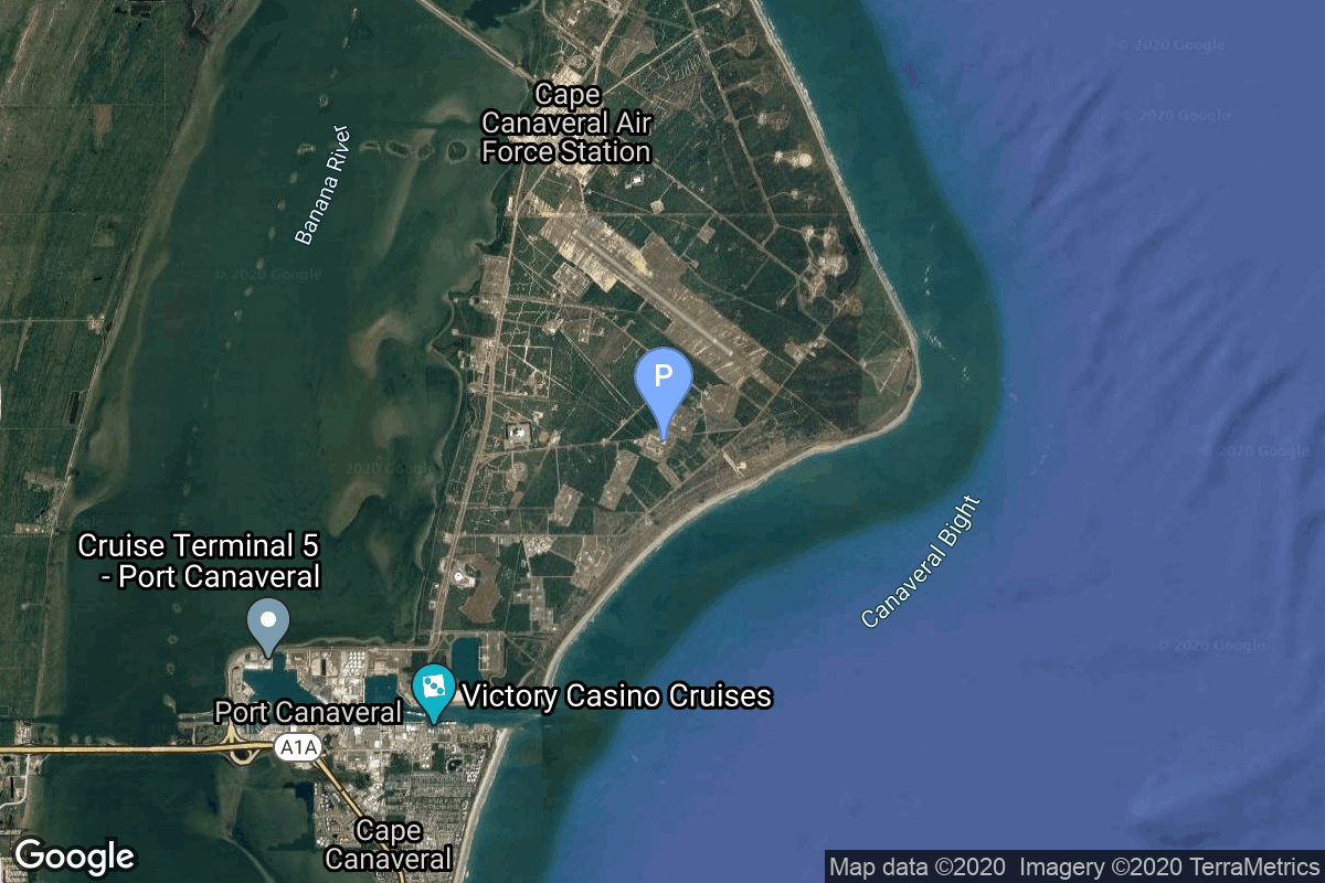
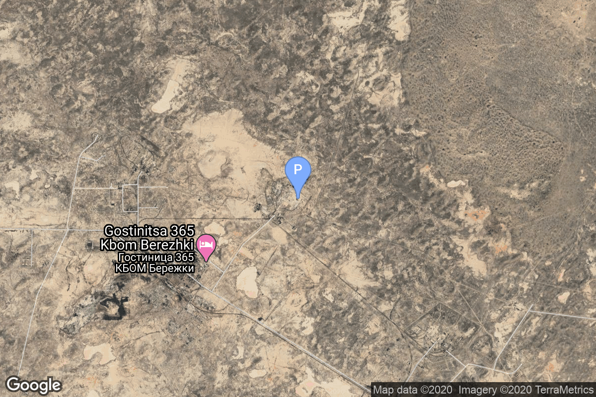
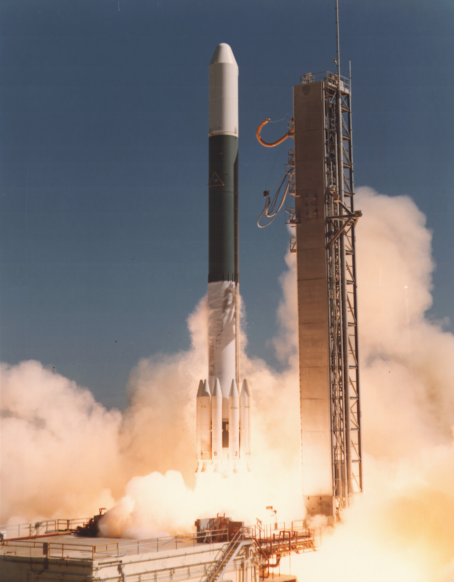
{ "count": 8136, "next": "https://lldev.thespacedevs.com/2.0.0/launch/?format=api&limit=10&offset=6660&ordering=id", "previous": "https://lldev.thespacedevs.com/2.0.0/launch/?format=api&limit=10&offset=6640&ordering=id", "results": [ { "id": "d0973bfe-c553-409b-b6da-8de33f485578", "url": "https://lldev.thespacedevs.com/2.0.0/launch/d0973bfe-c553-409b-b6da-8de33f485578/?format=api", "launch_library_id": null, "slug": "delta-ii-gps-iir-1", "name": "Delta II | GPS IIR-1", "status": { "id": 4, "name": "Failure" }, "net": "1997-01-17T16:28:01Z", "window_end": "1997-01-17T16:28:01Z", "window_start": "1997-01-17T16:28:01Z", "inhold": false, "tbdtime": false, "tbddate": false, "probability": null, "holdreason": "", "failreason": "", "hashtag": null, "launch_service_provider": { "id": 161, "url": "https://lldev.thespacedevs.com/2.0.0/agencies/161/?format=api", "name": "United States Air Force", "type": "Government" }, "rocket": { "id": 6764, "configuration": { "id": 159, "launch_library_id": 179, "url": "https://lldev.thespacedevs.com/2.0.0/config/launcher/159/?format=api", "name": "Delta II", "family": "Delta", "full_name": "Delta II 7925", "variant": "7925" } }, "mission": { "id": 5154, "launch_library_id": null, "name": "GPS IIR-1", "description": "GPS-2R (Global Positioning System) or Navstar-2R (Navigation System using Timing And Ranging) are the third evolution stage of the second generation of the GPS satellites.", "launch_designator": null, "type": "Navigation", "orbit": { "id": 12, "name": "Medium Earth Orbit", "abbrev": "MEO" } }, "pad": { "id": 14, "url": "https://lldev.thespacedevs.com/2.0.0/pad/14/?format=api", "agency_id": null, "name": "Space Launch Complex 17A", "info_url": null, "wiki_url": "https://en.wikipedia.org/wiki/Cape_Canaveral_Space_Launch_Complex_17", "map_url": "https://www.google.com/maps?q=28.4472,-80.565", "latitude": "28.4472", "longitude": "-80.565", "location": { "id": 12, "url": "https://lldev.thespacedevs.com/2.0.0/location/12/?format=api", "name": "Cape Canaveral SFS, FL, USA", "country_code": "USA", "map_image": "https://thespacedevs-dev.nyc3.digitaloceanspaces.com/media/map_images/location_12_20200803142519.jpg", "total_launch_count": 1132, "total_landing_count": 83 }, "map_image": "https://thespacedevs-dev.nyc3.digitaloceanspaces.com/media/map_images/pad_14_20200803143451.jpg", "total_launch_count": 145 }, "webcast_live": false, "image": "https://thespacedevs-dev.nyc3.digitaloceanspaces.com/media/images/delta2520ii_image_20190222030440.jpeg", "infographic": null, "program": [ { "id": 29, "url": "https://lldev.thespacedevs.com/2.0.0/program/29/?format=api", "name": "Global Positioning System", "description": "The Global Positioning System (GPS), originally Navstar GPS, is a satellite-based radio navigation system owned by the United States government and operated by the United States Space Force. It is one of the global navigation satellite systems (GNSS) that provide geolocation and time information to a GPS receiver anywhere on or near the Earth where there is an unobstructed line of sight to four or more GPS satellites.", "agencies": [ { "id": 1041, "url": "https://lldev.thespacedevs.com/2.0.0/agencies/1041/?format=api", "name": "United States Space Force", "type": "Government" } ], "image_url": "https://thespacedevs-dev.nyc3.digitaloceanspaces.com/media/images/global2520posi_program_20231229182501.png", "start_date": "1978-02-22T00:00:00Z", "end_date": null, "info_url": "https://www.gps.gov/", "wiki_url": "https://en.wikipedia.org/wiki/Global_Positioning_System" } ] }, { "id": "d09f2a5a-4a62-41a4-87c7-2045684d65b8", "url": "https://lldev.thespacedevs.com/2.0.0/launch/d09f2a5a-4a62-41a4-87c7-2045684d65b8/?format=api", "launch_library_id": null, "slug": "proton-tks-va-5-6", "name": "Proton | TKS-VA 5 & 6", "status": { "id": 3, "name": "Success" }, "net": "1978-03-30T00:00:00Z", "window_end": "1978-03-30T00:00:00Z", "window_start": "1978-03-30T00:00:00Z", "inhold": false, "tbdtime": false, "tbddate": false, "probability": null, "holdreason": "", "failreason": null, "hashtag": null, "launch_service_provider": { "id": 66, "url": "https://lldev.thespacedevs.com/2.0.0/agencies/66/?format=api", "name": "Soviet Space Program", "type": "Government" }, "rocket": { "id": 4945, "configuration": { "id": 95, "launch_library_id": 131, "url": "https://lldev.thespacedevs.com/2.0.0/config/launcher/95/?format=api", "name": "Proton", "family": "Proton / UR-500", "full_name": "Proton-K", "variant": "K" } }, "mission": { "id": 3361, "launch_library_id": null, "name": "TKS-VA 5 & 6", "description": "Reentry capsule of the TKS spacecraft", "launch_designator": null, "type": "Test Flight", "orbit": { "id": 8, "name": "Low Earth Orbit", "abbrev": "LEO" } }, "pad": { "id": 7, "url": "https://lldev.thespacedevs.com/2.0.0/pad/7/?format=api", "agency_id": null, "name": "81/24 (81P)", "info_url": null, "wiki_url": "", "map_url": "https://www.google.com/maps?q=46.071001,62.984999", "latitude": "46.071001", "longitude": "62.984999", "location": { "id": 15, "url": "https://lldev.thespacedevs.com/2.0.0/location/15/?format=api", "name": "Baikonur Cosmodrome, Republic of Kazakhstan", "country_code": "KAZ", "map_image": "https://thespacedevs-dev.nyc3.digitaloceanspaces.com/media/map_images/location_15_20200803142517.jpg", "total_launch_count": 1565, "total_landing_count": 0 }, "map_image": "https://thespacedevs-dev.nyc3.digitaloceanspaces.com/media/map_images/pad_7_20200803143454.jpg", "total_launch_count": 93 }, "webcast_live": false, "image": "https://thespacedevs-dev.nyc3.digitaloceanspaces.com/media/images/proton_image_20190207032625.jpeg", "infographic": null, "program": [] }, { "id": "d0a77912-bcaf-4aaa-af7c-4f8e0843bf52", "url": "https://lldev.thespacedevs.com/2.0.0/launch/d0a77912-bcaf-4aaa-af7c-4f8e0843bf52/?format=api", "launch_library_id": null, "slug": "thor-delta-c-explorer-28", "name": "Thor Delta C | Explorer 28", "status": { "id": 3, "name": "Success" }, "net": "1965-05-29T12:00:00Z", "window_end": "1965-05-29T12:00:00Z", "window_start": "1965-05-29T12:00:00Z", "inhold": false, "tbdtime": false, "tbddate": false, "probability": null, "holdreason": "", "failreason": null, "hashtag": null, "launch_service_provider": { "id": 161, "url": "https://lldev.thespacedevs.com/2.0.0/agencies/161/?format=api", "name": "United States Air Force", "type": "Government" }, "rocket": { "id": 3402, "configuration": { "id": 401, "launch_library_id": null, "url": "https://lldev.thespacedevs.com/2.0.0/config/launcher/401/?format=api", "name": "Thor Delta C", "family": "Thor", "full_name": "Thor Delta C", "variant": "Delta C" } }, "mission": { "id": 1822, "launch_library_id": null, "name": "Explorer 28", "description": "Explorer 28 (IMP 3) was a solar-cell and chemical-battery powered spacecraft instrumented for interplanetary and distant magnetospheric studies of energetic particles, cosmic rays, magnetic fields, and plasmas.", "launch_designator": null, "type": "Astrophysics", "orbit": { "id": 0, "name": "Elliptical Orbit", "abbrev": "Elliptical" } }, "pad": { "id": 1, "url": "https://lldev.thespacedevs.com/2.0.0/pad/1/?format=api", "agency_id": null, "name": "Space Launch Complex 17B", "info_url": null, "wiki_url": "https://en.wikipedia.org/wiki/Cape_Canaveral_Space_Launch_Complex_17", "map_url": "https://www.google.com/maps?q=28.4458,-80.5657", "latitude": "28.4458", "longitude": "-80.5657", "location": { "id": 12, "url": "https://lldev.thespacedevs.com/2.0.0/location/12/?format=api", "name": "Cape Canaveral SFS, FL, USA", "country_code": "USA", "map_image": "https://thespacedevs-dev.nyc3.digitaloceanspaces.com/media/map_images/location_12_20200803142519.jpg", "total_launch_count": 1132, "total_landing_count": 83 }, "map_image": "https://thespacedevs-dev.nyc3.digitaloceanspaces.com/media/map_images/pad_1_20200803143208.jpg", "total_launch_count": 132 }, "webcast_live": false, "image": "https://thespacedevs-dev.nyc3.digitaloceanspaces.com/media/images/launch_of_thor__image_20251127091608.png", "infographic": null, "program": [] }, { "id": "d0b1328a-0580-4bae-85e9-28394ecfb558", "url": "https://lldev.thespacedevs.com/2.0.0/launch/d0b1328a-0580-4bae-85e9-28394ecfb558/?format=api", "launch_library_id": null, "slug": "titan-ii-slv-noaa-16", "name": "Titan II SLV | NOAA 16", "status": { "id": 3, "name": "Success" }, "net": "2000-09-21T10:22:00Z", "window_end": "2000-09-21T10:22:00Z", "window_start": "2000-09-21T10:22:00Z", "inhold": false, "tbdtime": false, "tbddate": false, "probability": null, "holdreason": "", "failreason": null, "hashtag": null, "launch_service_provider": { "id": 161, "url": "https://lldev.thespacedevs.com/2.0.0/agencies/161/?format=api", "name": "United States Air Force", "type": "Government" }, "rocket": { "id": 7010, "configuration": { "id": 436, "launch_library_id": null, "url": "https://lldev.thespacedevs.com/2.0.0/config/launcher/436/?format=api", "name": "Titan II SLV", "family": "Titan", "full_name": "Titan II SLV", "variant": "23G" } }, "mission": { "id": 5399, "launch_library_id": null, "name": "NOAA 16", "description": "The NOAA K, L and M POES satellites begin the fifth generation of improved environmental monitoring in support of NOAA missions. The instrument payload has significant improvements and additions/deletions. The instrument changes have effected the spacecraft subsystems and data formats.", "launch_designator": null, "type": "Earth Science", "orbit": { "id": 17, "name": "Sun-Synchronous Orbit", "abbrev": "SSO" } }, "pad": { "id": 156, "url": "https://lldev.thespacedevs.com/2.0.0/pad/156/?format=api", "agency_id": null, "name": "Space Launch Complex 4W", "info_url": "https://www.astronautix.com/v/vandenbergslc4w.html", "wiki_url": "https://en.wikipedia.org/wiki/Vandenberg_Air_Force_Base_Space_Launch_Complex_4#SLC-4W", "map_url": "https://www.google.com/maps?q=34.63312,-120.61584", "latitude": "34.63312", "longitude": "-120.61584", "location": { "id": 11, "url": "https://lldev.thespacedevs.com/2.0.0/location/11/?format=api", "name": "Vandenberg SFB, CA, USA", "country_code": "USA", "map_image": "https://thespacedevs-dev.nyc3.digitaloceanspaces.com/media/map_images/location_11_20200803142416.jpg", "total_launch_count": 924, "total_landing_count": 37 }, "map_image": "https://thespacedevs-dev.nyc3.digitaloceanspaces.com/media/map_images/pad_156_20200803143351.jpg", "total_launch_count": 93 }, "webcast_live": false, "image": "https://thespacedevs-dev.nyc3.digitaloceanspaces.com/media/images/titan_ii_slv_image_20231231110038.jpeg", "infographic": null, "program": [] }, { "id": "d0c2674d-851f-4e6e-867a-22b2e7624495", "url": "https://lldev.thespacedevs.com/2.0.0/launch/d0c2674d-851f-4e6e-867a-22b2e7624495/?format=api", "launch_library_id": null, "slug": "delta-2914-westar-2", "name": "Delta 2914 | Westar 2", "status": { "id": 3, "name": "Success" }, "net": "1974-10-10T22:53:00Z", "window_end": "1974-10-10T22:53:00Z", "window_start": "1974-10-10T22:53:00Z", "inhold": false, "tbdtime": false, "tbddate": false, "probability": null, "holdreason": "", "failreason": null, "hashtag": null, "launch_service_provider": { "id": 161, "url": "https://lldev.thespacedevs.com/2.0.0/agencies/161/?format=api", "name": "United States Air Force", "type": "Government" }, "rocket": { "id": 4510, "configuration": { "id": 287, "launch_library_id": null, "url": "https://lldev.thespacedevs.com/2.0.0/config/launcher/287/?format=api", "name": "Delta 2914", "family": "Delta", "full_name": "Delta 2914", "variant": "2914" } }, "mission": { "id": 2928, "launch_library_id": null, "name": "Westar 2", "description": "Geostationary communications satellite developed by Hughes Aircraft Company", "launch_designator": null, "type": "Communications", "orbit": { "id": 1, "name": "Geostationary Orbit", "abbrev": "Direct-GEO" } }, "pad": { "id": 1, "url": "https://lldev.thespacedevs.com/2.0.0/pad/1/?format=api", "agency_id": null, "name": "Space Launch Complex 17B", "info_url": null, "wiki_url": "https://en.wikipedia.org/wiki/Cape_Canaveral_Space_Launch_Complex_17", "map_url": "https://www.google.com/maps?q=28.4458,-80.5657", "latitude": "28.4458", "longitude": "-80.5657", "location": { "id": 12, "url": "https://lldev.thespacedevs.com/2.0.0/location/12/?format=api", "name": "Cape Canaveral SFS, FL, USA", "country_code": "USA", "map_image": "https://thespacedevs-dev.nyc3.digitaloceanspaces.com/media/map_images/location_12_20200803142519.jpg", "total_launch_count": 1132, "total_landing_count": 83 }, "map_image": "https://thespacedevs-dev.nyc3.digitaloceanspaces.com/media/map_images/pad_1_20200803143208.jpg", "total_launch_count": 132 }, "webcast_live": false, "image": "https://thespacedevs-dev.nyc3.digitaloceanspaces.com/media/images/delta_2910_image_20231231105214.jpeg", "infographic": null, "program": [] }, { "id": "d0c9ea00-c69f-4236-9174-6d084c7fbb7f", "url": "https://lldev.thespacedevs.com/2.0.0/launch/d0c9ea00-c69f-4236-9174-6d084c7fbb7f/?format=api", "launch_library_id": null, "slug": "proton-almaz-t-1", "name": "Proton | Almaz-T 1", "status": { "id": 4, "name": "Failure" }, "net": "1986-11-29T08:00:00Z", "window_end": "1986-11-29T08:00:00Z", "window_start": "1986-11-29T08:00:00Z", "inhold": false, "tbdtime": false, "tbddate": false, "probability": null, "holdreason": "", "failreason": null, "hashtag": null, "launch_service_provider": { "id": 66, "url": "https://lldev.thespacedevs.com/2.0.0/agencies/66/?format=api", "name": "Soviet Space Program", "type": "Government" }, "rocket": { "id": 5915, "configuration": { "id": 95, "launch_library_id": 131, "url": "https://lldev.thespacedevs.com/2.0.0/config/launcher/95/?format=api", "name": "Proton", "family": "Proton / UR-500", "full_name": "Proton-K", "variant": "K" } }, "mission": { "id": 4311, "launch_library_id": null, "name": "Almaz-T 1", "description": "Radar imagery satellite based on the Almaz space station design", "launch_designator": null, "type": "Earth Science", "orbit": { "id": 8, "name": "Low Earth Orbit", "abbrev": "LEO" } }, "pad": { "id": 130, "url": "https://lldev.thespacedevs.com/2.0.0/pad/130/?format=api", "agency_id": null, "name": "200/40", "info_url": null, "wiki_url": "https://en.wikipedia.org/wiki/Baikonur_Cosmodrome_Site_200", "map_url": "https://www.google.com/maps?q=46.0336111,63.0266949", "latitude": "46.0336111", "longitude": "63.0266949", "location": { "id": 15, "url": "https://lldev.thespacedevs.com/2.0.0/location/15/?format=api", "name": "Baikonur Cosmodrome, Republic of Kazakhstan", "country_code": "KAZ", "map_image": "https://thespacedevs-dev.nyc3.digitaloceanspaces.com/media/map_images/location_15_20200803142517.jpg", "total_launch_count": 1565, "total_landing_count": 0 }, "map_image": "https://thespacedevs-dev.nyc3.digitaloceanspaces.com/media/map_images/pad_130_20200803143249.jpg", "total_launch_count": 64 }, "webcast_live": false, "image": "https://thespacedevs-dev.nyc3.digitaloceanspaces.com/media/images/proton_image_20190207032625.jpeg", "infographic": null, "program": [] }, { "id": "d0da8bb5-1990-486c-a941-a84e62ca2d0d", "url": "https://lldev.thespacedevs.com/2.0.0/launch/d0da8bb5-1990-486c-a941-a84e62ca2d0d/?format=api", "launch_library_id": null, "slug": "thorad-slv-2h-agena-d-kh-4b-11", "name": "Thorad SLV-2H Agena D | KH-4B 11", "status": { "id": 3, "name": "Success" }, "net": "1970-07-23T01:25:00Z", "window_end": "1970-07-23T01:25:00Z", "window_start": "1970-07-23T01:25:00Z", "inhold": false, "tbdtime": false, "tbddate": false, "probability": null, "holdreason": "", "failreason": null, "hashtag": null, "launch_service_provider": { "id": 161, "url": "https://lldev.thespacedevs.com/2.0.0/agencies/161/?format=api", "name": "United States Air Force", "type": "Government" }, "rocket": { "id": 4028, "configuration": { "id": 419, "launch_library_id": null, "url": "https://lldev.thespacedevs.com/2.0.0/config/launcher/419/?format=api", "name": "Thorad SLV-2H Agena D", "family": "Thor", "full_name": "Thorad SLV-2H Agena D", "variant": "SLV-2H Agena D" } }, "mission": { "id": 2446, "launch_library_id": null, "name": "KH-4B 11", "description": "The KH-4B (Keyhole-4B) was sixth optical reconnaissance satellite version in the Corona-program.", "launch_designator": null, "type": "Government/Top Secret", "orbit": { "id": 8, "name": "Low Earth Orbit", "abbrev": "LEO" } }, "pad": { "id": 93, "url": "https://lldev.thespacedevs.com/2.0.0/pad/93/?format=api", "agency_id": 161, "name": "Space Launch Complex 3W", "info_url": null, "wiki_url": "https://en.wikipedia.org/wiki/Vandenberg_Space_Launch_Complex_3#SLC-3W", "map_url": "https://www.google.com/maps?q=34.644,-120.593", "latitude": "34.644", "longitude": "-120.593", "location": { "id": 11, "url": "https://lldev.thespacedevs.com/2.0.0/location/11/?format=api", "name": "Vandenberg SFB, CA, USA", "country_code": "USA", "map_image": "https://thespacedevs-dev.nyc3.digitaloceanspaces.com/media/map_images/location_11_20200803142416.jpg", "total_launch_count": 924, "total_landing_count": 37 }, "map_image": "https://thespacedevs-dev.nyc3.digitaloceanspaces.com/media/map_images/pad_93_20200803143225.jpg", "total_launch_count": 81 }, "webcast_live": false, "image": "https://thespacedevs-dev.nyc3.digitaloceanspaces.com/media/images/thorad-slv2h_ag_image_20251204211604.png", "infographic": null, "program": [] }, { "id": "d0db5b2c-90c4-4259-8f5a-f4e1fd8dbbb0", "url": "https://lldev.thespacedevs.com/2.0.0/launch/d0db5b2c-90c4-4259-8f5a-f4e1fd8dbbb0/?format=api", "launch_library_id": null, "slug": "ariane-44l-intelsat-902", "name": "Ariane 44L | INTELSAT 902", "status": { "id": 3, "name": "Success" }, "net": "2001-08-30T06:46:00Z", "window_end": "2001-08-30T06:46:00Z", "window_start": "2001-08-30T06:46:00Z", "inhold": false, "tbdtime": false, "tbddate": false, "probability": null, "holdreason": "", "failreason": null, "hashtag": null, "launch_service_provider": { "id": 115, "url": "https://lldev.thespacedevs.com/2.0.0/agencies/115/?format=api", "name": "Arianespace", "type": "Commercial" }, "rocket": { "id": 7055, "configuration": { "id": 225, "launch_library_id": null, "url": "https://lldev.thespacedevs.com/2.0.0/config/launcher/225/?format=api", "name": "Ariane 44L", "family": "Ariane", "full_name": "Ariane 44L", "variant": "44L" } }, "mission": { "id": 5444, "launch_library_id": null, "name": "INTELSAT 902", "description": "Intelsat 902 (IS-902) was the second of 9 new Intelsat satellites launched in August 2001 at 62°E. It will provide telecommunications and television broadcast to Europe, Sub-Saharan Africa, Central Asia, the Far East and Australia through its 44 C band and 12 Ku band transponders.", "launch_designator": null, "type": "Communications", "orbit": { "id": 2, "name": "Geostationary Transfer Orbit", "abbrev": "GTO" } }, "pad": { "id": 124, "url": "https://lldev.thespacedevs.com/2.0.0/pad/124/?format=api", "agency_id": 115, "name": "Ariane Launch Area 2", "info_url": null, "wiki_url": "https://en.wikipedia.org/wiki/ELA-2", "map_url": "https://www.google.com/maps?q=5.232,-52.778194", "latitude": "5.232", "longitude": "-52.778194", "location": { "id": 13, "url": "https://lldev.thespacedevs.com/2.0.0/location/13/?format=api", "name": "Guiana Space Centre, French Guiana", "country_code": "GUF", "map_image": "https://thespacedevs-dev.nyc3.digitaloceanspaces.com/media/map_images/location_13_20200803142412.jpg", "total_launch_count": 336, "total_landing_count": 0 }, "map_image": "https://thespacedevs-dev.nyc3.digitaloceanspaces.com/media/map_images/pad_124_20200803143241.jpg", "total_launch_count": 119 }, "webcast_live": false, "image": "https://thespacedevs-dev.nyc3.digitaloceanspaces.com/media/images/ariane_44l_at_e_image_20240401082337.jpg", "infographic": null, "program": [] }, { "id": "d0dc1282-9e80-4b2f-8959-971b2a780b91", "url": "https://lldev.thespacedevs.com/2.0.0/launch/d0dc1282-9e80-4b2f-8959-971b2a780b91/?format=api", "launch_library_id": null, "slug": "kosmos-3m-zaliv-13", "name": "Kosmos-3M | Zaliv 13", "status": { "id": 3, "name": "Success" }, "net": "1973-06-20T06:16:27Z", "window_end": "1973-06-20T06:16:27Z", "window_start": "1973-06-20T06:16:27Z", "inhold": false, "tbdtime": false, "tbddate": false, "probability": null, "holdreason": "", "failreason": null, "hashtag": null, "launch_service_provider": { "id": 66, "url": "https://lldev.thespacedevs.com/2.0.0/agencies/66/?format=api", "name": "Soviet Space Program", "type": "Government" }, "rocket": { "id": 4370, "configuration": { "id": 102, "launch_library_id": 122, "url": "https://lldev.thespacedevs.com/2.0.0/config/launcher/102/?format=api", "name": "Kosmos-3M", "family": "Kosmos", "full_name": "Kosmos-3M (11K65M)", "variant": "-3M" } }, "mission": { "id": 2788, "launch_library_id": null, "name": "Zaliv 13", "description": "The first soviet navigation system called Tsiklon consisted of Zaliv satellites in low earth orbit.", "launch_designator": null, "type": "Navigation", "orbit": { "id": 8, "name": "Low Earth Orbit", "abbrev": "LEO" } }, "pad": { "id": 28, "url": "https://lldev.thespacedevs.com/2.0.0/pad/28/?format=api", "agency_id": 163, "name": "132/1 (132L)", "info_url": null, "wiki_url": "", "map_url": "https://www.google.com/maps?q=62.883229,40.868549", "latitude": "62.883229", "longitude": "40.868549", "location": { "id": 6, "url": "https://lldev.thespacedevs.com/2.0.0/location/6/?format=api", "name": "Plesetsk Cosmodrome, Russian Federation", "country_code": "RUS", "map_image": "https://thespacedevs-dev.nyc3.digitaloceanspaces.com/media/map_images/location_6_20200803142434.jpg", "total_launch_count": 1689, "total_landing_count": 0 }, "map_image": "https://thespacedevs-dev.nyc3.digitaloceanspaces.com/media/map_images/pad_28_20200803143254.jpg", "total_launch_count": 212 }, "webcast_live": false, "image": "https://thespacedevs-dev.nyc3.digitaloceanspaces.com/media/images/kosmos-3m_durin_image_20251101171325.jpg", "infographic": null, "program": [] }, { "id": "d0e570d4-c640-4092-9b20-6fcd99cafd9d", "url": "https://lldev.thespacedevs.com/2.0.0/launch/d0e570d4-c640-4092-9b20-6fcd99cafd9d/?format=api", "launch_library_id": 253, "slug": "long-march-3be-belintersat-1", "name": "Long March 3B/E | BELINTERSAT-1", "status": { "id": 3, "name": "Success" }, "net": "2016-01-15T16:57:04Z", "window_end": "2016-01-15T17:44:00Z", "window_start": "2016-01-15T16:57:00Z", "inhold": false, "tbdtime": false, "tbddate": false, "probability": null, "holdreason": "", "failreason": null, "hashtag": null, "launch_service_provider": { "id": 88, "url": "https://lldev.thespacedevs.com/2.0.0/agencies/88/?format=api", "name": "China Aerospace Science and Technology Corporation", "type": "Government" }, "rocket": { "id": 1900, "configuration": { "id": 50, "launch_library_id": 69, "url": "https://lldev.thespacedevs.com/2.0.0/config/launcher/50/?format=api", "name": "Long March 3B/E", "family": "Long March", "full_name": "Long March 3B/E", "variant": "B/E" } }, "mission": { "id": 99, "launch_library_id": 162, "name": "BELINTERSAT-1", "description": "The Belarussian satellite BELINTERSAT-1 (also known as ChinaSat-15) is a communications satellite that will provide TV, Radio broadcasting and internet access to European and Eastern regions. The satellite was built in close partnership with China and contains 20 C-Band and 18 Ku-band transponders. Stationed at 51.5 degrees east in a geostationary orbit the satellite is expected to remain operational for at least 15 years.", "launch_designator": null, "type": "Communications", "orbit": { "id": 2, "name": "Geostationary Transfer Orbit", "abbrev": "GTO" } }, "pad": { "id": 45, "url": "https://lldev.thespacedevs.com/2.0.0/pad/45/?format=api", "agency_id": null, "name": "Launch Complex 2 (LC-2)", "info_url": null, "wiki_url": "https://en.wikipedia.org/wiki/Xichang_Satellite_Launch_Center", "map_url": "https://www.google.com/maps?q=28.245504,102.026768", "latitude": "28.245504", "longitude": "102.026768", "location": { "id": 16, "url": "https://lldev.thespacedevs.com/2.0.0/location/16/?format=api", "name": "Xichang Satellite Launch Center, People's Republic of China", "country_code": "CHN", "map_image": "https://thespacedevs-dev.nyc3.digitaloceanspaces.com/media/map_images/location_16_20200803142513.jpg", "total_launch_count": 243, "total_landing_count": 0 }, "map_image": "https://thespacedevs-dev.nyc3.digitaloceanspaces.com/media/map_images/pad_45_20200803143520.jpg", "total_launch_count": 126 }, "webcast_live": false, "image": "https://thespacedevs-dev.nyc3.digitaloceanspaces.com/media/images/long2520march_image_20230907120240.jpeg", "infographic": null, "program": [] } ] }