Launch List
API endpoint that returns all Launch objects or a single launch.
EXAMPLE - /launch/
GET: Return a list of all Launch objects.
FILTERS: Fields - 'name', 'id(s)', 'lsp_id', 'lsp_name', 'serial_number', 'launcher_config__id', 'rocket__spacecraftflight__spacecraft__name'
MODE: 'normal', 'list', 'detailed' EXAMPLE: ?mode=list
SEARCH: Searches through the launch name, rocket name, launch agency, mission name & spacecraft name. EXAMPLE - ?search=SpaceX
GET /2.0.0/launch/?format=api&offset=340&ordering=id
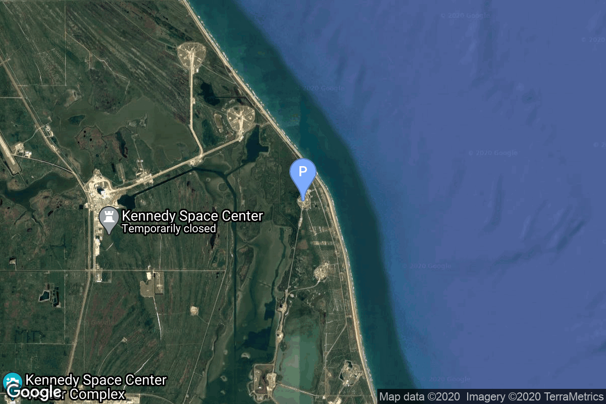
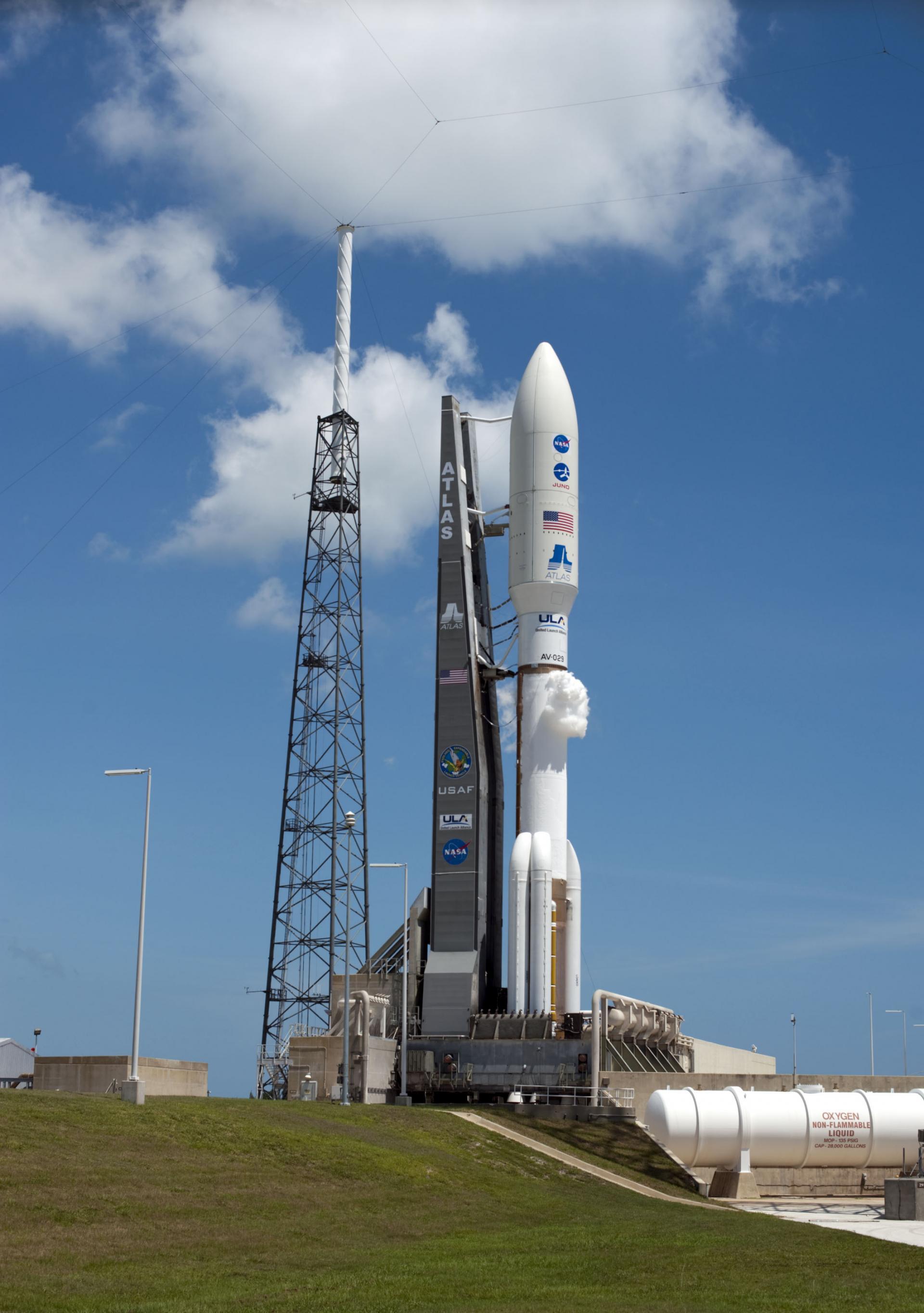
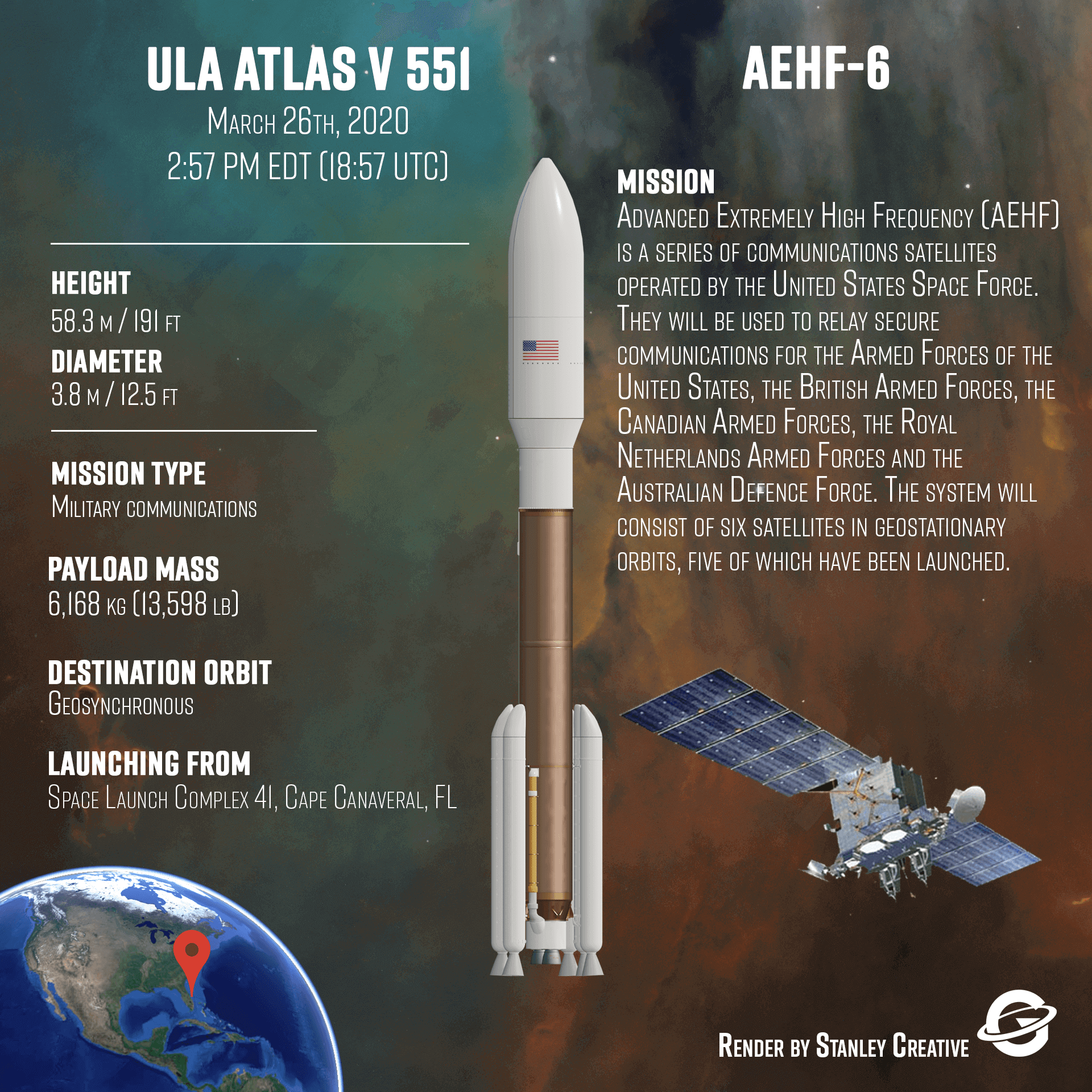
{ "count": 8136, "next": "https://lldev.thespacedevs.com/2.0.0/launch/?format=api&limit=10&offset=350&ordering=id", "previous": "https://lldev.thespacedevs.com/2.0.0/launch/?format=api&limit=10&offset=330&ordering=id", "results": [ { "id": "0b13e339-cdd1-48a7-8129-3bb11ea99953", "url": "https://lldev.thespacedevs.com/2.0.0/launch/0b13e339-cdd1-48a7-8129-3bb11ea99953/?format=api", "launch_library_id": null, "slug": "paektusan-1-kwangmyongsong-1", "name": "Paektusan 1 | Kwangmyongsong 1", "status": { "id": 4, "name": "Failure" }, "net": "1998-08-31T03:07:00Z", "window_end": "1998-08-31T03:07:00Z", "window_start": "1998-08-31T03:07:00Z", "inhold": false, "tbdtime": false, "tbddate": false, "probability": null, "holdreason": "", "failreason": null, "hashtag": null, "launch_service_provider": { "id": 40, "url": "https://lldev.thespacedevs.com/2.0.0/agencies/40/?format=api", "name": "Korean Committee of Space Technology", "type": "Government" }, "rocket": { "id": 6875, "configuration": { "id": 343, "launch_library_id": null, "url": "https://lldev.thespacedevs.com/2.0.0/config/launcher/343/?format=api", "name": "Paektusan 1", "family": "", "full_name": "Paektusan 1", "variant": "1" } }, "mission": { "id": 5265, "launch_library_id": null, "name": "Kwangmyongsong 1", "description": "Thir first attempt to launch a North Korean satellite ended in vain, as the third stage of the Pekdosan-1 (a.k.a. Taepodong-1) launch vehicle failed shortly before it reached orbital velocity. Kwangmyŏngsŏng 1 would have beamed propaganda songs from space, if it had reached a stable orbit.", "launch_designator": null, "type": "Test Flight", "orbit": { "id": 8, "name": "Low Earth Orbit", "abbrev": "LEO" } }, "pad": { "id": 184, "url": "https://lldev.thespacedevs.com/2.0.0/pad/184/?format=api", "agency_id": null, "name": "Satellite Launch Pad", "info_url": null, "wiki_url": "https://en.wikipedia.org/wiki/Tonghae_Satellite_Launching_Ground", "map_url": "https://www.google.com/maps?q=40.855799,129.665895", "latitude": "40.855799", "longitude": "129.665895", "location": { "id": 153, "url": "https://lldev.thespacedevs.com/2.0.0/location/153/?format=api", "name": "Tonghae Satellite Launching Ground", "country_code": "PRK", "map_image": "https://thespacedevs-dev.nyc3.digitaloceanspaces.com/media/map_images/location_153_20200803142503.jpg", "total_launch_count": 2, "total_landing_count": 0 }, "map_image": "https://thespacedevs-dev.nyc3.digitaloceanspaces.com/media/map_images/pad_184_20200803143423.jpg", "total_launch_count": 2 }, "webcast_live": false, "image": null, "infographic": null, "program": [] }, { "id": "0b161194-00d2-4e42-81b0-22e4c50d2b87", "url": "https://lldev.thespacedevs.com/2.0.0/launch/0b161194-00d2-4e42-81b0-22e4c50d2b87/?format=api", "launch_library_id": 1333, "slug": "atlas-v-551-aehf-6", "name": "Atlas V 551 | AEHF-6", "status": { "id": 3, "name": "Success" }, "net": "2020-03-26T20:18:00Z", "window_end": "2020-03-26T20:57:00Z", "window_start": "2020-03-26T18:57:00Z", "inhold": false, "tbdtime": false, "tbddate": false, "probability": 90, "holdreason": "", "failreason": null, "hashtag": "#AEHF6", "launch_service_provider": { "id": 124, "url": "https://lldev.thespacedevs.com/2.0.0/agencies/124/?format=api", "name": "United Launch Alliance", "type": "Commercial" }, "rocket": { "id": 110, "configuration": { "id": 27, "launch_library_id": 37, "url": "https://lldev.thespacedevs.com/2.0.0/config/launcher/27/?format=api", "name": "Atlas V 551", "family": "Atlas", "full_name": "Atlas V 551", "variant": "551" } }, "mission": { "id": 1095, "launch_library_id": 1293, "name": "AEHF-6", "description": "This is the sixth and final satellite in the Advanced Extremely High Frequency (AEHF) system, which is a series of communications satellites operated by the United States Air Force Space Command. It provides global, survivable, protected communications capabilities for strategic command and tactical warfighters operating on ground, sea and air platforms.", "launch_designator": null, "type": "Communications", "orbit": { "id": 2, "name": "Geostationary Transfer Orbit", "abbrev": "GTO" } }, "pad": { "id": 29, "url": "https://lldev.thespacedevs.com/2.0.0/pad/29/?format=api", "agency_id": null, "name": "Space Launch Complex 41", "info_url": null, "wiki_url": "https://en.wikipedia.org/wiki/Cape_Canaveral_Air_Force_Station_Space_Launch_Complex_41", "map_url": "https://www.google.com/maps?q=28.58341025,-80.58303644", "latitude": "28.58341025", "longitude": "-80.58303644", "location": { "id": 12, "url": "https://lldev.thespacedevs.com/2.0.0/location/12/?format=api", "name": "Cape Canaveral SFS, FL, USA", "country_code": "USA", "map_image": "https://thespacedevs-dev.nyc3.digitaloceanspaces.com/media/map_images/location_12_20200803142519.jpg", "total_launch_count": 1132, "total_landing_count": 83 }, "map_image": "https://thespacedevs-dev.nyc3.digitaloceanspaces.com/media/map_images/pad_29_20200803143528.jpg", "total_launch_count": 125 }, "webcast_live": false, "image": "https://thespacedevs-dev.nyc3.digitaloceanspaces.com/media/images/atlas2520v2520551_image_20190224012316.jpeg", "infographic": "https://thespacedevs-dev.nyc3.digitaloceanspaces.com/media/infographic_images/atlas2520v252_infographic_20200808051156.png", "program": [] }, { "id": "0b3161ac-8165-4659-b822-d82adeb5849b", "url": "https://lldev.thespacedevs.com/2.0.0/launch/0b3161ac-8165-4659-b822-d82adeb5849b/?format=api", "launch_library_id": 1618, "slug": "long-march-3b-yz-1-beidou-3-m13-m14", "name": "Long March 3B / YZ-1 | Beidou-3 M13 & M14", "status": { "id": 3, "name": "Success" }, "net": "2018-09-19T14:07:03Z", "window_end": "2018-09-19T14:07:03Z", "window_start": "2018-09-19T14:07:03Z", "inhold": false, "tbdtime": false, "tbddate": false, "probability": null, "holdreason": "", "failreason": null, "hashtag": null, "launch_service_provider": { "id": 88, "url": "https://lldev.thespacedevs.com/2.0.0/agencies/88/?format=api", "name": "China Aerospace Science and Technology Corporation", "type": "Government" }, "rocket": { "id": 2129, "configuration": { "id": 78, "launch_library_id": 89, "url": "https://lldev.thespacedevs.com/2.0.0/config/launcher/78/?format=api", "name": "Long March 3B/YZ-1", "family": "Long March", "full_name": "Long March 3B/YZ-1", "variant": "B/YZ-1" } }, "mission": { "id": 570, "launch_library_id": 868, "name": "Beidou-3 M13 & M14", "description": "These two satellites will be used to provide global navigation coverage as part of the Chinese Beidou (Compass) satellite navigation system.", "launch_designator": null, "type": "Navigation", "orbit": { "id": 12, "name": "Medium Earth Orbit", "abbrev": "MEO" } }, "pad": { "id": 45, "url": "https://lldev.thespacedevs.com/2.0.0/pad/45/?format=api", "agency_id": null, "name": "Launch Complex 2 (LC-2)", "info_url": null, "wiki_url": "https://en.wikipedia.org/wiki/Xichang_Satellite_Launch_Center", "map_url": "https://www.google.com/maps?q=28.245504,102.026768", "latitude": "28.245504", "longitude": "102.026768", "location": { "id": 16, "url": "https://lldev.thespacedevs.com/2.0.0/location/16/?format=api", "name": "Xichang Satellite Launch Center, People's Republic of China", "country_code": "CHN", "map_image": "https://thespacedevs-dev.nyc3.digitaloceanspaces.com/media/map_images/location_16_20200803142513.jpg", "total_launch_count": 243, "total_landing_count": 0 }, "map_image": "https://thespacedevs-dev.nyc3.digitaloceanspaces.com/media/map_images/pad_45_20200803143520.jpg", "total_launch_count": 126 }, "webcast_live": false, "image": "https://thespacedevs-dev.nyc3.digitaloceanspaces.com/media/images/long2520march_image_20231226100006.jpeg", "infographic": null, "program": [ { "id": 35, "url": "https://lldev.thespacedevs.com/2.0.0/program/35/?format=api", "name": "BeiDou", "description": "The BeiDou Navigation Satellite System is a satellite-based radio navigation system owned and operated by the China National Space Administration.[4] It is one of the global navigation satellite systems that provide geolocation and time information to a BDS receiver anywhere on or near the Earth where there is an unobstructed line of sight to four or more BDS satellites.", "agencies": [ { "id": 17, "url": "https://lldev.thespacedevs.com/2.0.0/agencies/17/?format=api", "name": "China National Space Administration", "type": "Government" } ], "image_url": "https://thespacedevs-dev.nyc3.digitaloceanspaces.com/media/images/beidou_program_20240102170615.png", "start_date": "2000-10-31T00:00:00Z", "end_date": null, "info_url": "http://en.beidou.gov.cn/", "wiki_url": "https://en.wikipedia.org/wiki/BeiDou" } ] }, { "id": "0b350ab4-745b-4fce-b7cd-4f636d13497e", "url": "https://lldev.thespacedevs.com/2.0.0/launch/0b350ab4-745b-4fce-b7cd-4f636d13497e/?format=api", "launch_library_id": null, "slug": "proton-tks-m", "name": "Proton | TKS-M", "status": { "id": 3, "name": "Success" }, "net": "1985-09-27T08:41:42Z", "window_end": "1985-09-27T08:41:42Z", "window_start": "1985-09-27T08:41:42Z", "inhold": false, "tbdtime": false, "tbddate": false, "probability": null, "holdreason": "", "failreason": null, "hashtag": null, "launch_service_provider": { "id": 66, "url": "https://lldev.thespacedevs.com/2.0.0/agencies/66/?format=api", "name": "Soviet Space Program", "type": "Government" }, "rocket": { "id": 5788, "configuration": { "id": 95, "launch_library_id": 131, "url": "https://lldev.thespacedevs.com/2.0.0/config/launcher/95/?format=api", "name": "Proton", "family": "Proton / UR-500", "full_name": "Proton-K", "variant": "K" } }, "mission": { "id": 4187, "launch_library_id": null, "name": "TKS-M", "description": "Space station module", "launch_designator": null, "type": "Human Exploration", "orbit": { "id": 8, "name": "Low Earth Orbit", "abbrev": "LEO" } }, "pad": { "id": 15, "url": "https://lldev.thespacedevs.com/2.0.0/pad/15/?format=api", "agency_id": null, "name": "200/39 (200L)", "info_url": null, "wiki_url": "", "map_url": "https://www.google.com/maps?q=46.039984,63.032093", "latitude": "46.039984", "longitude": "63.032093", "location": { "id": 15, "url": "https://lldev.thespacedevs.com/2.0.0/location/15/?format=api", "name": "Baikonur Cosmodrome, Republic of Kazakhstan", "country_code": "KAZ", "map_image": "https://thespacedevs-dev.nyc3.digitaloceanspaces.com/media/map_images/location_15_20200803142517.jpg", "total_launch_count": 1565, "total_landing_count": 0 }, "map_image": "https://thespacedevs-dev.nyc3.digitaloceanspaces.com/media/map_images/pad_15_20200803143530.jpg", "total_launch_count": 167 }, "webcast_live": false, "image": "https://thespacedevs-dev.nyc3.digitaloceanspaces.com/media/images/proton_image_20190207032625.jpeg", "infographic": null, "program": [] }, { "id": "0b44eca5-7b4c-46bd-8aa5-ceccd816e97a", "url": "https://lldev.thespacedevs.com/2.0.0/launch/0b44eca5-7b4c-46bd-8aa5-ceccd816e97a/?format=api", "launch_library_id": 625, "slug": "long-march-3be-chinasat-2a", "name": "Long March 3B/E | Chinasat-2A", "status": { "id": 3, "name": "Success" }, "net": "2012-05-26T15:56:04Z", "window_end": "2012-05-26T15:56:04Z", "window_start": "2012-05-26T15:56:04Z", "inhold": false, "tbdtime": false, "tbddate": false, "probability": null, "holdreason": "", "failreason": null, "hashtag": null, "launch_service_provider": { "id": 88, "url": "https://lldev.thespacedevs.com/2.0.0/agencies/88/?format=api", "name": "China Aerospace Science and Technology Corporation", "type": "Government" }, "rocket": { "id": 1612, "configuration": { "id": 50, "launch_library_id": 69, "url": "https://lldev.thespacedevs.com/2.0.0/config/launcher/50/?format=api", "name": "Long March 3B/E", "family": "Long March", "full_name": "Long March 3B/E", "variant": "B/E" } }, "mission": null, "pad": { "id": 45, "url": "https://lldev.thespacedevs.com/2.0.0/pad/45/?format=api", "agency_id": null, "name": "Launch Complex 2 (LC-2)", "info_url": null, "wiki_url": "https://en.wikipedia.org/wiki/Xichang_Satellite_Launch_Center", "map_url": "https://www.google.com/maps?q=28.245504,102.026768", "latitude": "28.245504", "longitude": "102.026768", "location": { "id": 16, "url": "https://lldev.thespacedevs.com/2.0.0/location/16/?format=api", "name": "Xichang Satellite Launch Center, People's Republic of China", "country_code": "CHN", "map_image": "https://thespacedevs-dev.nyc3.digitaloceanspaces.com/media/map_images/location_16_20200803142513.jpg", "total_launch_count": 243, "total_landing_count": 0 }, "map_image": "https://thespacedevs-dev.nyc3.digitaloceanspaces.com/media/map_images/pad_45_20200803143520.jpg", "total_launch_count": 126 }, "webcast_live": false, "image": "https://thespacedevs-dev.nyc3.digitaloceanspaces.com/media/images/long2520march_image_20230907120240.jpeg", "infographic": null, "program": [] }, { "id": "0b529484-17c2-48e9-94f6-5117a1fbe6be", "url": "https://lldev.thespacedevs.com/2.0.0/launch/0b529484-17c2-48e9-94f6-5117a1fbe6be/?format=api", "launch_library_id": null, "slug": "tsiklon-2-us-p-20", "name": "Tsiklon-2 | US-P 20", "status": { "id": 3, "name": "Success" }, "net": "1985-01-23T19:58:00Z", "window_end": "1985-01-23T19:58:00Z", "window_start": "1985-01-23T19:58:00Z", "inhold": false, "tbdtime": false, "tbddate": false, "probability": null, "holdreason": "", "failreason": null, "hashtag": null, "launch_service_provider": { "id": 66, "url": "https://lldev.thespacedevs.com/2.0.0/agencies/66/?format=api", "name": "Soviet Space Program", "type": "Government" }, "rocket": { "id": 5717, "configuration": { "id": 443, "launch_library_id": null, "url": "https://lldev.thespacedevs.com/2.0.0/config/launcher/443/?format=api", "name": "Tsiklon-2", "family": "Tsiklon", "full_name": "Tsiklon-2", "variant": "2" } }, "mission": { "id": 4118, "launch_library_id": null, "name": "US-P 20", "description": "Ocean surveillance satellite using passive ELINT devices", "launch_designator": null, "type": "Government/Top Secret", "orbit": { "id": 8, "name": "Low Earth Orbit", "abbrev": "LEO" } }, "pad": { "id": 132, "url": "https://lldev.thespacedevs.com/2.0.0/pad/132/?format=api", "agency_id": null, "name": "90", "info_url": null, "wiki_url": "https://en.wikipedia.org/wiki/Baikonur_Cosmodrome_Site_90", "map_url": "https://www.google.com/maps?q=46.081,62.929806", "latitude": "46.081", "longitude": "62.929806", "location": { "id": 15, "url": "https://lldev.thespacedevs.com/2.0.0/location/15/?format=api", "name": "Baikonur Cosmodrome, Republic of Kazakhstan", "country_code": "KAZ", "map_image": "https://thespacedevs-dev.nyc3.digitaloceanspaces.com/media/map_images/location_15_20200803142517.jpg", "total_launch_count": 1565, "total_landing_count": 0 }, "map_image": "https://thespacedevs-dev.nyc3.digitaloceanspaces.com/media/map_images/pad_132_20200803143344.jpg", "total_launch_count": 74 }, "webcast_live": false, "image": "https://thespacedevs-dev.nyc3.digitaloceanspaces.com/media/images/tsyklon-2_lifto_image_20240411113159.jpg", "infographic": null, "program": [] }, { "id": "0b55686a-8442-44cd-996d-dcc5000e4f47", "url": "https://lldev.thespacedevs.com/2.0.0/launch/0b55686a-8442-44cd-996d-dcc5000e4f47/?format=api", "launch_library_id": null, "slug": "titan-24b-kh-8-34", "name": "Titan 24B | KH-8 34", "status": { "id": 3, "name": "Success" }, "net": "1972-03-17T17:00:00Z", "window_end": "1972-03-17T17:00:00Z", "window_start": "1972-03-17T17:00:00Z", "inhold": false, "tbdtime": false, "tbddate": false, "probability": null, "holdreason": "", "failreason": null, "hashtag": null, "launch_service_provider": { "id": 161, "url": "https://lldev.thespacedevs.com/2.0.0/agencies/161/?format=api", "name": "United States Air Force", "type": "Government" }, "rocket": { "id": 4236, "configuration": { "id": 421, "launch_library_id": null, "url": "https://lldev.thespacedevs.com/2.0.0/config/launcher/421/?format=api", "name": "Titan 24B", "family": "Titan", "full_name": "Titan 24B", "variant": "24B" } }, "mission": { "id": 2654, "launch_library_id": null, "name": "KH-8 34", "description": "KH-8 Block 2 high resolution reconnaissance satellite.", "launch_designator": null, "type": "Government/Top Secret", "orbit": { "id": 8, "name": "Low Earth Orbit", "abbrev": "LEO" } }, "pad": { "id": 156, "url": "https://lldev.thespacedevs.com/2.0.0/pad/156/?format=api", "agency_id": null, "name": "Space Launch Complex 4W", "info_url": "https://www.astronautix.com/v/vandenbergslc4w.html", "wiki_url": "https://en.wikipedia.org/wiki/Vandenberg_Air_Force_Base_Space_Launch_Complex_4#SLC-4W", "map_url": "https://www.google.com/maps?q=34.63312,-120.61584", "latitude": "34.63312", "longitude": "-120.61584", "location": { "id": 11, "url": "https://lldev.thespacedevs.com/2.0.0/location/11/?format=api", "name": "Vandenberg SFB, CA, USA", "country_code": "USA", "map_image": "https://thespacedevs-dev.nyc3.digitaloceanspaces.com/media/map_images/location_11_20200803142416.jpg", "total_launch_count": 924, "total_landing_count": 37 }, "map_image": "https://thespacedevs-dev.nyc3.digitaloceanspaces.com/media/map_images/pad_156_20200803143351.jpg", "total_launch_count": 93 }, "webcast_live": false, "image": null, "infographic": null, "program": [] }, { "id": "0b5da6e2-9141-427b-ab22-bcdd3ca6520a", "url": "https://lldev.thespacedevs.com/2.0.0/launch/0b5da6e2-9141-427b-ab22-bcdd3ca6520a/?format=api", "launch_library_id": null, "slug": "falcon-9-block-5-starlink-group-15-13", "name": "Falcon 9 Block 5 | Starlink Group 15-13", "status": { "id": 3, "name": "Success" }, "net": "2025-12-17T15:27:50Z", "window_end": "2025-12-17T19:10:00Z", "window_start": "2025-12-17T15:10:00Z", "inhold": false, "tbdtime": false, "tbddate": false, "probability": null, "holdreason": "", "failreason": "", "hashtag": null, "launch_service_provider": { "id": 121, "url": "https://lldev.thespacedevs.com/2.0.0/agencies/121/?format=api", "name": "SpaceX", "type": "Commercial" }, "rocket": { "id": 8842, "configuration": { "id": 164, "launch_library_id": 188, "url": "https://lldev.thespacedevs.com/2.0.0/config/launcher/164/?format=api", "name": "Falcon 9", "family": "Falcon", "full_name": "Falcon 9 Block 5", "variant": "Block 5" } }, "mission": { "id": 7433, "launch_library_id": null, "name": "Starlink Group 15-13", "description": "A batch of 27 satellites for the Starlink mega-constellation - SpaceX's project for space-based Internet communication system.", "launch_designator": null, "type": "Communications", "orbit": { "id": 8, "name": "Low Earth Orbit", "abbrev": "LEO" } }, "pad": { "id": 16, "url": "https://lldev.thespacedevs.com/2.0.0/pad/16/?format=api", "agency_id": null, "name": "Space Launch Complex 4E", "info_url": null, "wiki_url": "https://en.wikipedia.org/wiki/Vandenberg_Space_Launch_Complex_4#SLC-4E", "map_url": "https://www.google.com/maps?q=34.632,-120.611", "latitude": "34.632", "longitude": "-120.611", "location": { "id": 11, "url": "https://lldev.thespacedevs.com/2.0.0/location/11/?format=api", "name": "Vandenberg SFB, CA, USA", "country_code": "USA", "map_image": "https://thespacedevs-dev.nyc3.digitaloceanspaces.com/media/map_images/location_11_20200803142416.jpg", "total_launch_count": 924, "total_landing_count": 37 }, "map_image": "https://thespacedevs-dev.nyc3.digitaloceanspaces.com/media/map_images/pad_16_20200803143532.jpg", "total_launch_count": 308 }, "webcast_live": false, "image": "https://thespacedevs-dev.nyc3.digitaloceanspaces.com/media/images/falcon2520925_image_20221009234147.png", "infographic": null, "program": [ { "id": 25, "url": "https://lldev.thespacedevs.com/2.0.0/program/25/?format=api", "name": "Starlink", "description": "Starlink is a satellite internet constellation operated by American aerospace company SpaceX", "agencies": [ { "id": 121, "url": "https://lldev.thespacedevs.com/2.0.0/agencies/121/?format=api", "name": "SpaceX", "type": "Commercial" } ], "image_url": "https://thespacedevs-dev.nyc3.digitaloceanspaces.com/media/images/starlink_program_20231228154508.jpeg", "start_date": "2018-02-22T14:17:00Z", "end_date": null, "info_url": "https://starlink.com", "wiki_url": "https://en.wikipedia.org/wiki/Starlink" } ] }, { "id": "0b606172-ce9f-4bff-9a87-1b301166d3f6", "url": "https://lldev.thespacedevs.com/2.0.0/launch/0b606172-ce9f-4bff-9a87-1b301166d3f6/?format=api", "launch_library_id": null, "slug": "vulcan-gps-iiif-sv03-ussf-15", "name": "Vulcan | GPS IIIF SV03 (USSF-15)", "status": { "id": 2, "name": "TBD" }, "net": "2029-12-31T00:00:00Z", "window_end": "2029-12-31T00:00:00Z", "window_start": "2029-12-31T00:00:00Z", "inhold": false, "tbdtime": true, "tbddate": true, "probability": null, "holdreason": "", "failreason": "", "hashtag": null, "launch_service_provider": { "id": 124, "url": "https://lldev.thespacedevs.com/2.0.0/agencies/124/?format=api", "name": "United Launch Alliance", "type": "Commercial" }, "rocket": { "id": 8579, "configuration": { "id": 200, "launch_library_id": 226, "url": "https://lldev.thespacedevs.com/2.0.0/config/launcher/200/?format=api", "name": "Vulcan", "family": "Vulcan", "full_name": "Vulcan", "variant": "Vulcan" } }, "mission": { "id": 7170, "launch_library_id": null, "name": "GPS IIIF SV03 (USSF-15)", "description": "Third GPS IIIF (GPS III Follow-on) mission", "launch_designator": null, "type": "Navigation", "orbit": { "id": 12, "name": "Medium Earth Orbit", "abbrev": "MEO" } }, "pad": { "id": 29, "url": "https://lldev.thespacedevs.com/2.0.0/pad/29/?format=api", "agency_id": null, "name": "Space Launch Complex 41", "info_url": null, "wiki_url": "https://en.wikipedia.org/wiki/Cape_Canaveral_Air_Force_Station_Space_Launch_Complex_41", "map_url": "https://www.google.com/maps?q=28.58341025,-80.58303644", "latitude": "28.58341025", "longitude": "-80.58303644", "location": { "id": 12, "url": "https://lldev.thespacedevs.com/2.0.0/location/12/?format=api", "name": "Cape Canaveral SFS, FL, USA", "country_code": "USA", "map_image": "https://thespacedevs-dev.nyc3.digitaloceanspaces.com/media/map_images/location_12_20200803142519.jpg", "total_launch_count": 1132, "total_landing_count": 83 }, "map_image": "https://thespacedevs-dev.nyc3.digitaloceanspaces.com/media/map_images/pad_29_20200803143528.jpg", "total_launch_count": 125 }, "webcast_live": false, "image": "https://thespacedevs-dev.nyc3.digitaloceanspaces.com/media/images/vulcan_image_20240107162928.jpeg", "infographic": null, "program": [ { "id": 29, "url": "https://lldev.thespacedevs.com/2.0.0/program/29/?format=api", "name": "Global Positioning System", "description": "The Global Positioning System (GPS), originally Navstar GPS, is a satellite-based radio navigation system owned by the United States government and operated by the United States Space Force. It is one of the global navigation satellite systems (GNSS) that provide geolocation and time information to a GPS receiver anywhere on or near the Earth where there is an unobstructed line of sight to four or more GPS satellites.", "agencies": [ { "id": 1041, "url": "https://lldev.thespacedevs.com/2.0.0/agencies/1041/?format=api", "name": "United States Space Force", "type": "Government" } ], "image_url": "https://thespacedevs-dev.nyc3.digitaloceanspaces.com/media/images/global2520posi_program_20231229182501.png", "start_date": "1978-02-22T00:00:00Z", "end_date": null, "info_url": "https://www.gps.gov/", "wiki_url": "https://en.wikipedia.org/wiki/Global_Positioning_System" } ] }, { "id": "0b675aa8-0a78-4ed6-bbca-6916c8a7206b", "url": "https://lldev.thespacedevs.com/2.0.0/launch/0b675aa8-0a78-4ed6-bbca-6916c8a7206b/?format=api", "launch_library_id": 499, "slug": "proton-m-briz-m-exomars-trace-gas-orbiter-edm-schi", "name": "Proton-M Briz-M | ExoMars Trace Gas Orbiter & EDM Schiaparelli lander", "status": { "id": 3, "name": "Success" }, "net": "2016-03-14T09:31:42Z", "window_end": "2016-03-14T09:31:42Z", "window_start": "2016-03-14T09:31:42Z", "inhold": false, "tbdtime": false, "tbddate": false, "probability": null, "holdreason": "", "failreason": null, "hashtag": null, "launch_service_provider": { "id": 96, "url": "https://lldev.thespacedevs.com/2.0.0/agencies/96/?format=api", "name": "Khrunichev State Research and Production Space Center", "type": "Government" }, "rocket": { "id": 1914, "configuration": { "id": 22, "launch_library_id": 4, "url": "https://lldev.thespacedevs.com/2.0.0/config/launcher/22/?format=api", "name": "Proton-M Briz-M", "family": "Proton / UR-500", "full_name": "Proton-M Briz-M", "variant": "Briz-M" } }, "mission": { "id": 307, "launch_library_id": 183, "name": "ExoMars Trace Gas Orbiter & EDM Schiaparelli lander", "description": "This is the first part of ESA’s and Roscosmos’s Mars exploration programme (ExoMars). The launch in the 2016 Mars window will consist of an orbiter and lander and will take 7 months to travel to Mars. The Trace Gas Orbiter will search for trace gases in the atmosphere such as methane and hydrogen. The Schiaparelli lander will travel with the orbiter until each reaches Mars, where it will attempt to descend through the atmosphere and land on the surface. The lander only contains a small array of scientific instruments, to conduct experiments over 4 Martian days.", "launch_designator": null, "type": "Planetary Science", "orbit": { "id": 6, "name": "Heliocentric N/A", "abbrev": "Helio-N/A" } }, "pad": { "id": 15, "url": "https://lldev.thespacedevs.com/2.0.0/pad/15/?format=api", "agency_id": null, "name": "200/39 (200L)", "info_url": null, "wiki_url": "", "map_url": "https://www.google.com/maps?q=46.039984,63.032093", "latitude": "46.039984", "longitude": "63.032093", "location": { "id": 15, "url": "https://lldev.thespacedevs.com/2.0.0/location/15/?format=api", "name": "Baikonur Cosmodrome, Republic of Kazakhstan", "country_code": "KAZ", "map_image": "https://thespacedevs-dev.nyc3.digitaloceanspaces.com/media/map_images/location_15_20200803142517.jpg", "total_launch_count": 1565, "total_landing_count": 0 }, "map_image": "https://thespacedevs-dev.nyc3.digitaloceanspaces.com/media/map_images/pad_15_20200803143530.jpg", "total_launch_count": 167 }, "webcast_live": false, "image": "https://thespacedevs-dev.nyc3.digitaloceanspaces.com/media/images/proton-m2520briz-m_image_20190224012317.jpeg", "infographic": null, "program": [] } ] }