Launch List
API endpoint that returns all Launch objects or a single launch.
EXAMPLE - /launch/
GET: Return a list of all Launch objects.
FILTERS: Fields - 'name', 'id(s)', 'lsp_id', 'lsp_name', 'serial_number', 'launcher_config__id', 'rocket__spacecraftflight__spacecraft__name'
MODE: 'normal', 'list', 'detailed' EXAMPLE: ?mode=list
SEARCH: Searches through the launch name, rocket name, launch agency, mission name & spacecraft name. EXAMPLE - ?search=SpaceX
GET /2.0.0/launch/?format=api&offset=180&ordering=-name
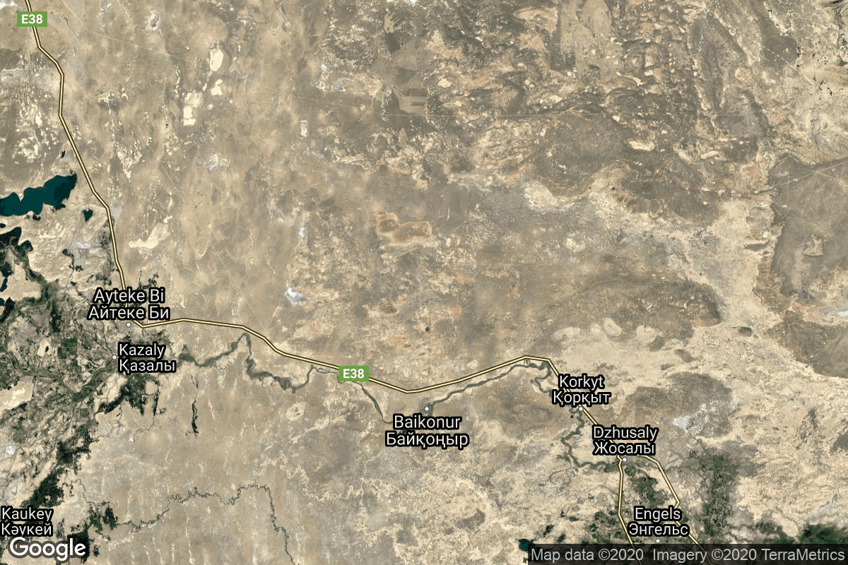
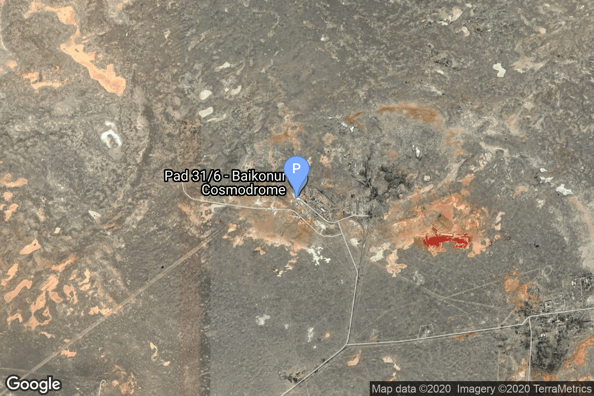
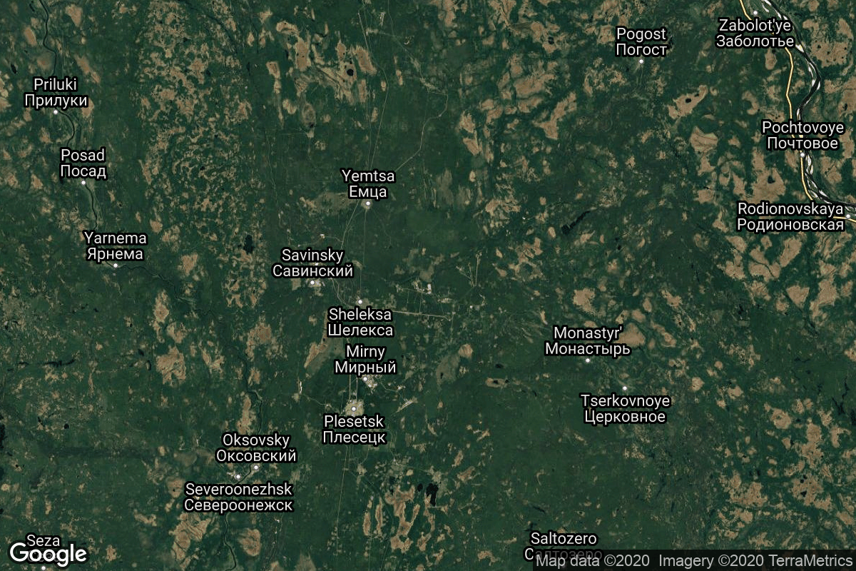
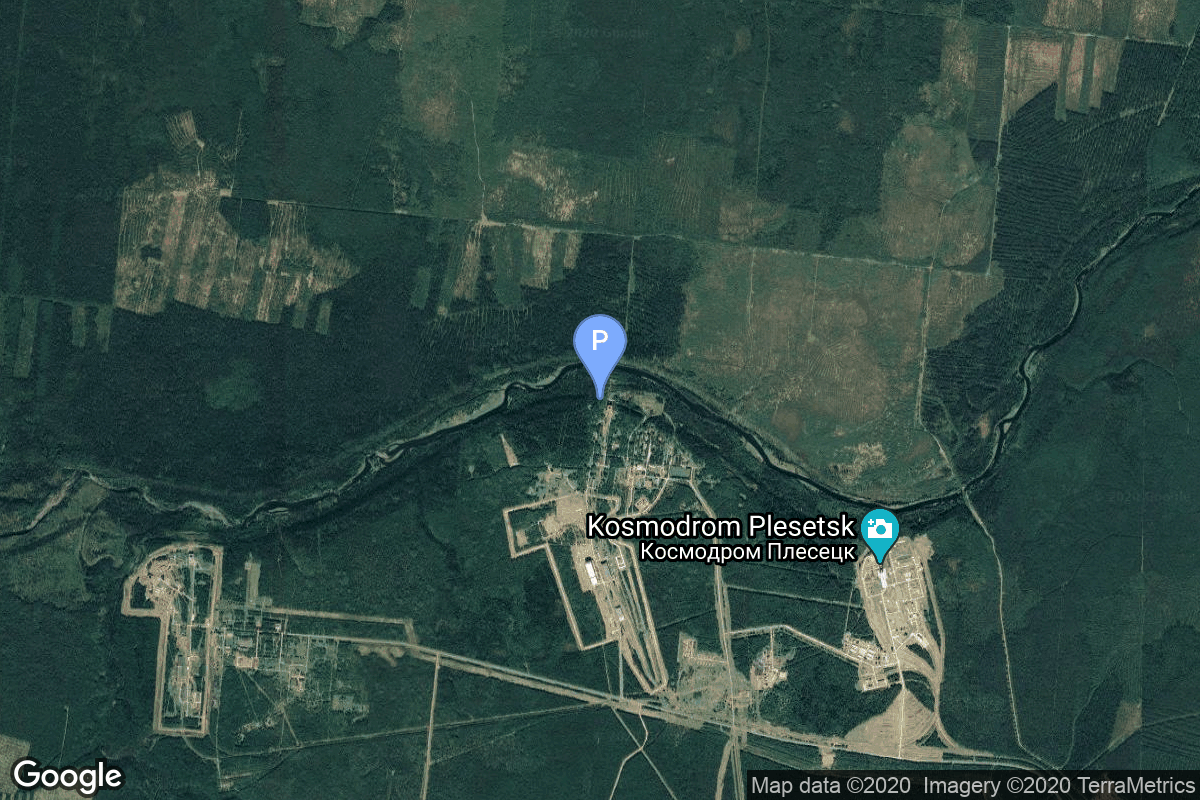
{ "count": 7916, "next": "https://lldev.thespacedevs.com/2.0.0/launch/?format=api&limit=10&offset=190&ordering=-name", "previous": "https://lldev.thespacedevs.com/2.0.0/launch/?format=api&limit=10&offset=170&ordering=-name", "results": [ { "id": "7f48ab22-25cd-4786-8f04-14aaa6de5d8c", "url": "https://lldev.thespacedevs.com/2.0.0/launch/7f48ab22-25cd-4786-8f04-14aaa6de5d8c/?format=api", "launch_library_id": null, "slug": "vostok-8a92-zenit-2-43", "name": "Vostok 8A92 | Zenit-2 43", "status": { "id": 3, "name": "Success" }, "net": "1966-11-19T08:00:00Z", "window_end": "1966-11-19T08:00:00Z", "window_start": "1966-11-19T08:00:00Z", "inhold": false, "tbdtime": false, "tbddate": false, "probability": null, "holdreason": "", "failreason": null, "hashtag": null, "launch_service_provider": { "id": 66, "url": "https://lldev.thespacedevs.com/2.0.0/agencies/66/?format=api", "name": "Soviet Space Program", "type": "Government" }, "rocket": { "id": 3595, "configuration": { "id": 451, "launch_library_id": null, "url": "https://lldev.thespacedevs.com/2.0.0/config/launcher/451/?format=api", "name": "Vostok 8A92", "family": "Vostok", "full_name": "Vostok 8A92", "variant": "8A92" } }, "mission": { "id": 2014, "launch_library_id": null, "name": "Zenit-2 43", "description": "Zenit-2 film-return and ELINT reconnaissance satellite.", "launch_designator": null, "type": "Government/Top Secret", "orbit": { "id": 8, "name": "Low Earth Orbit", "abbrev": "LEO" } }, "pad": { "id": 20, "url": "https://lldev.thespacedevs.com/2.0.0/pad/20/?format=api", "agency_id": null, "name": "31/6", "info_url": null, "wiki_url": "https://en.wikipedia.org/wiki/Baikonur_Cosmodrome_Site_31", "map_url": "https://www.google.com/maps?q=45.996034,63.564003", "latitude": "45.996034", "longitude": "63.564003", "location": { "id": 15, "url": "https://lldev.thespacedevs.com/2.0.0/location/15/?format=api", "name": "Baikonur Cosmodrome, Republic of Kazakhstan", "country_code": "KAZ", "map_image": "https://thespacedevs-dev.nyc3.digitaloceanspaces.com/media/map_images/location_15_20200803142517.jpg", "total_launch_count": 1563, "total_landing_count": 0 }, "map_image": "https://thespacedevs-dev.nyc3.digitaloceanspaces.com/media/map_images/pad_20_20200803143516.jpg", "total_launch_count": 428 }, "webcast_live": false, "image": "https://thespacedevs-dev.nyc3.digitaloceanspaces.com/media/images/vostok_launch_v_image_20251119053730.jpg", "infographic": null, "program": [] }, { "id": "f8669ce4-3e68-4318-85a9-36a7551089a1", "url": "https://lldev.thespacedevs.com/2.0.0/launch/f8669ce4-3e68-4318-85a9-36a7551089a1/?format=api", "launch_library_id": null, "slug": "vostok-8a92-zenit-2-42", "name": "Vostok 8A92 | Zenit-2 42", "status": { "id": 3, "name": "Success" }, "net": "1966-10-14T12:13:08Z", "window_end": "1966-10-14T12:13:08Z", "window_start": "1966-10-14T12:13:08Z", "inhold": false, "tbdtime": false, "tbddate": false, "probability": null, "holdreason": "", "failreason": null, "hashtag": null, "launch_service_provider": { "id": 66, "url": "https://lldev.thespacedevs.com/2.0.0/agencies/66/?format=api", "name": "Soviet Space Program", "type": "Government" }, "rocket": { "id": 3580, "configuration": { "id": 451, "launch_library_id": null, "url": "https://lldev.thespacedevs.com/2.0.0/config/launcher/451/?format=api", "name": "Vostok 8A92", "family": "Vostok", "full_name": "Vostok 8A92", "variant": "8A92" } }, "mission": { "id": 1999, "launch_library_id": null, "name": "Zenit-2 42", "description": "Zenit-2 film-return and ELINT reconnaissance satellite.", "launch_designator": null, "type": "Government/Top Secret", "orbit": { "id": 8, "name": "Low Earth Orbit", "abbrev": "LEO" } }, "pad": { "id": 168, "url": "https://lldev.thespacedevs.com/2.0.0/pad/168/?format=api", "agency_id": null, "name": "41/1", "info_url": null, "wiki_url": "https://en.wikipedia.org/wiki/Plesetsk_Cosmodrome", "map_url": "https://www.google.com/maps?q=62.941,40.526806", "latitude": "62.941", "longitude": "40.526806", "location": { "id": 6, "url": "https://lldev.thespacedevs.com/2.0.0/location/6/?format=api", "name": "Plesetsk Cosmodrome, Russian Federation", "country_code": "RUS", "map_image": "https://thespacedevs-dev.nyc3.digitaloceanspaces.com/media/map_images/location_6_20200803142434.jpg", "total_launch_count": 1685, "total_landing_count": 0 }, "map_image": "https://thespacedevs-dev.nyc3.digitaloceanspaces.com/media/map_images/pad_168_20200803143446.jpg", "total_launch_count": 310 }, "webcast_live": false, "image": "https://thespacedevs-dev.nyc3.digitaloceanspaces.com/media/images/vostok_launch_v_image_20251119053730.jpg", "infographic": null, "program": [] }, { "id": "17134ffb-3345-4219-ae2a-8eaefc1d8b18", "url": "https://lldev.thespacedevs.com/2.0.0/launch/17134ffb-3345-4219-ae2a-8eaefc1d8b18/?format=api", "launch_library_id": null, "slug": "vostok-8a92-zenit-2-41", "name": "Vostok 8A92 | Zenit-2 41", "status": { "id": 4, "name": "Failure" }, "net": "1966-09-16T09:30:00Z", "window_end": "1966-09-16T09:30:00Z", "window_start": "1966-09-16T09:30:00Z", "inhold": false, "tbdtime": false, "tbddate": false, "probability": null, "holdreason": "", "failreason": null, "hashtag": null, "launch_service_provider": { "id": 66, "url": "https://lldev.thespacedevs.com/2.0.0/agencies/66/?format=api", "name": "Soviet Space Program", "type": "Government" }, "rocket": { "id": 3569, "configuration": { "id": 451, "launch_library_id": null, "url": "https://lldev.thespacedevs.com/2.0.0/config/launcher/451/?format=api", "name": "Vostok 8A92", "family": "Vostok", "full_name": "Vostok 8A92", "variant": "8A92" } }, "mission": { "id": 1989, "launch_library_id": null, "name": "Zenit-2 41", "description": "Zenit-2 film-return and ELINT reconnaissance satellite.", "launch_designator": null, "type": "Government/Top Secret", "orbit": { "id": 8, "name": "Low Earth Orbit", "abbrev": "LEO" } }, "pad": { "id": 20, "url": "https://lldev.thespacedevs.com/2.0.0/pad/20/?format=api", "agency_id": null, "name": "31/6", "info_url": null, "wiki_url": "https://en.wikipedia.org/wiki/Baikonur_Cosmodrome_Site_31", "map_url": "https://www.google.com/maps?q=45.996034,63.564003", "latitude": "45.996034", "longitude": "63.564003", "location": { "id": 15, "url": "https://lldev.thespacedevs.com/2.0.0/location/15/?format=api", "name": "Baikonur Cosmodrome, Republic of Kazakhstan", "country_code": "KAZ", "map_image": "https://thespacedevs-dev.nyc3.digitaloceanspaces.com/media/map_images/location_15_20200803142517.jpg", "total_launch_count": 1563, "total_landing_count": 0 }, "map_image": "https://thespacedevs-dev.nyc3.digitaloceanspaces.com/media/map_images/pad_20_20200803143516.jpg", "total_launch_count": 428 }, "webcast_live": false, "image": "https://thespacedevs-dev.nyc3.digitaloceanspaces.com/media/images/vostok_launch_v_image_20251119053730.jpg", "infographic": null, "program": [] }, { "id": "42cd0632-1bbb-4e2f-88b2-47802d64e2b2", "url": "https://lldev.thespacedevs.com/2.0.0/launch/42cd0632-1bbb-4e2f-88b2-47802d64e2b2/?format=api", "launch_library_id": null, "slug": "vostok-8a92-zenit-2-4", "name": "Vostok 8A92 | Zenit-2 4", "status": { "id": 3, "name": "Success" }, "net": "1962-07-28T09:18:31Z", "window_end": "1962-07-28T09:18:31Z", "window_start": "1962-07-28T09:18:31Z", "inhold": false, "tbdtime": false, "tbddate": false, "probability": null, "holdreason": "", "failreason": null, "hashtag": null, "launch_service_provider": { "id": 66, "url": "https://lldev.thespacedevs.com/2.0.0/agencies/66/?format=api", "name": "Soviet Space Program", "type": "Government" }, "rocket": { "id": 3141, "configuration": { "id": 451, "launch_library_id": null, "url": "https://lldev.thespacedevs.com/2.0.0/config/launcher/451/?format=api", "name": "Vostok 8A92", "family": "Vostok", "full_name": "Vostok 8A92", "variant": "8A92" } }, "mission": { "id": 1563, "launch_library_id": null, "name": "Zenit-2 4", "description": "Zenit-2 film-return and ELINT reconnaissance satellite.", "launch_designator": null, "type": "Government/Top Secret", "orbit": { "id": 8, "name": "Low Earth Orbit", "abbrev": "LEO" } }, "pad": { "id": 32, "url": "https://lldev.thespacedevs.com/2.0.0/pad/32/?format=api", "agency_id": null, "name": "1/5", "info_url": null, "wiki_url": "", "map_url": "https://www.google.com/maps?q=45.92,63.342", "latitude": "45.92", "longitude": "63.342", "location": { "id": 15, "url": "https://lldev.thespacedevs.com/2.0.0/location/15/?format=api", "name": "Baikonur Cosmodrome, Republic of Kazakhstan", "country_code": "KAZ", "map_image": "https://thespacedevs-dev.nyc3.digitaloceanspaces.com/media/map_images/location_15_20200803142517.jpg", "total_launch_count": 1563, "total_landing_count": 0 }, "map_image": "https://thespacedevs-dev.nyc3.digitaloceanspaces.com/media/map_images/pad_32_20200803143513.jpg", "total_launch_count": 487 }, "webcast_live": false, "image": "https://thespacedevs-dev.nyc3.digitaloceanspaces.com/media/images/vostok_launch_v_image_20251119053730.jpg", "infographic": null, "program": [] }, { "id": "0a77a890-7cfc-4b15-93ab-3a3f91b920a2", "url": "https://lldev.thespacedevs.com/2.0.0/launch/0a77a890-7cfc-4b15-93ab-3a3f91b920a2/?format=api", "launch_library_id": null, "slug": "vostok-8a92-zenit-2-38", "name": "Vostok 8A92 | Zenit-2 38", "status": { "id": 3, "name": "Success" }, "net": "1966-05-06T10:58:00Z", "window_end": "1966-05-06T10:58:00Z", "window_start": "1966-05-06T10:58:00Z", "inhold": false, "tbdtime": false, "tbddate": false, "probability": null, "holdreason": "", "failreason": null, "hashtag": null, "launch_service_provider": { "id": 66, "url": "https://lldev.thespacedevs.com/2.0.0/agencies/66/?format=api", "name": "Soviet Space Program", "type": "Government" }, "rocket": { "id": 3521, "configuration": { "id": 451, "launch_library_id": null, "url": "https://lldev.thespacedevs.com/2.0.0/config/launcher/451/?format=api", "name": "Vostok 8A92", "family": "Vostok", "full_name": "Vostok 8A92", "variant": "8A92" } }, "mission": { "id": 1941, "launch_library_id": null, "name": "Zenit-2 38", "description": "Zenit-2 film-return and ELINT reconnaissance satellite.", "launch_designator": null, "type": "Government/Top Secret", "orbit": { "id": 8, "name": "Low Earth Orbit", "abbrev": "LEO" } }, "pad": { "id": 20, "url": "https://lldev.thespacedevs.com/2.0.0/pad/20/?format=api", "agency_id": null, "name": "31/6", "info_url": null, "wiki_url": "https://en.wikipedia.org/wiki/Baikonur_Cosmodrome_Site_31", "map_url": "https://www.google.com/maps?q=45.996034,63.564003", "latitude": "45.996034", "longitude": "63.564003", "location": { "id": 15, "url": "https://lldev.thespacedevs.com/2.0.0/location/15/?format=api", "name": "Baikonur Cosmodrome, Republic of Kazakhstan", "country_code": "KAZ", "map_image": "https://thespacedevs-dev.nyc3.digitaloceanspaces.com/media/map_images/location_15_20200803142517.jpg", "total_launch_count": 1563, "total_landing_count": 0 }, "map_image": "https://thespacedevs-dev.nyc3.digitaloceanspaces.com/media/map_images/pad_20_20200803143516.jpg", "total_launch_count": 428 }, "webcast_live": false, "image": "https://thespacedevs-dev.nyc3.digitaloceanspaces.com/media/images/vostok_launch_v_image_20251119053730.jpg", "infographic": null, "program": [] }, { "id": "22e0c3cb-e200-4bf9-ba0b-05caff4ed7a8", "url": "https://lldev.thespacedevs.com/2.0.0/launch/22e0c3cb-e200-4bf9-ba0b-05caff4ed7a8/?format=api", "launch_library_id": null, "slug": "vostok-8a92-zenit-2-37", "name": "Vostok 8A92 | Zenit-2 37", "status": { "id": 3, "name": "Success" }, "net": "1966-04-20T10:40:00Z", "window_end": "1966-04-20T10:40:00Z", "window_start": "1966-04-20T10:40:00Z", "inhold": false, "tbdtime": false, "tbddate": false, "probability": null, "holdreason": "", "failreason": null, "hashtag": null, "launch_service_provider": { "id": 66, "url": "https://lldev.thespacedevs.com/2.0.0/agencies/66/?format=api", "name": "Soviet Space Program", "type": "Government" }, "rocket": { "id": 3516, "configuration": { "id": 451, "launch_library_id": null, "url": "https://lldev.thespacedevs.com/2.0.0/config/launcher/451/?format=api", "name": "Vostok 8A92", "family": "Vostok", "full_name": "Vostok 8A92", "variant": "8A92" } }, "mission": { "id": 1936, "launch_library_id": null, "name": "Zenit-2 37", "description": "Zenit-2 film-return and ELINT reconnaissance satellite.", "launch_designator": null, "type": "Government/Top Secret", "orbit": { "id": 8, "name": "Low Earth Orbit", "abbrev": "LEO" } }, "pad": { "id": 20, "url": "https://lldev.thespacedevs.com/2.0.0/pad/20/?format=api", "agency_id": null, "name": "31/6", "info_url": null, "wiki_url": "https://en.wikipedia.org/wiki/Baikonur_Cosmodrome_Site_31", "map_url": "https://www.google.com/maps?q=45.996034,63.564003", "latitude": "45.996034", "longitude": "63.564003", "location": { "id": 15, "url": "https://lldev.thespacedevs.com/2.0.0/location/15/?format=api", "name": "Baikonur Cosmodrome, Republic of Kazakhstan", "country_code": "KAZ", "map_image": "https://thespacedevs-dev.nyc3.digitaloceanspaces.com/media/map_images/location_15_20200803142517.jpg", "total_launch_count": 1563, "total_landing_count": 0 }, "map_image": "https://thespacedevs-dev.nyc3.digitaloceanspaces.com/media/map_images/pad_20_20200803143516.jpg", "total_launch_count": 428 }, "webcast_live": false, "image": "https://thespacedevs-dev.nyc3.digitaloceanspaces.com/media/images/vostok_launch_v_image_20251119053730.jpg", "infographic": null, "program": [] }, { "id": "49e851eb-4e50-4028-bd1d-a23db715fbf2", "url": "https://lldev.thespacedevs.com/2.0.0/launch/49e851eb-4e50-4028-bd1d-a23db715fbf2/?format=api", "launch_library_id": null, "slug": "vostok-8a92-zenit-2-36", "name": "Vostok 8A92 | Zenit-2 36", "status": { "id": 3, "name": "Success" }, "net": "1966-03-17T10:28:42Z", "window_end": "1966-03-17T10:28:42Z", "window_start": "1966-03-17T10:28:42Z", "inhold": false, "tbdtime": false, "tbddate": false, "probability": null, "holdreason": "", "failreason": null, "hashtag": null, "launch_service_provider": { "id": 66, "url": "https://lldev.thespacedevs.com/2.0.0/agencies/66/?format=api", "name": "Soviet Space Program", "type": "Government" }, "rocket": { "id": 3501, "configuration": { "id": 451, "launch_library_id": null, "url": "https://lldev.thespacedevs.com/2.0.0/config/launcher/451/?format=api", "name": "Vostok 8A92", "family": "Vostok", "full_name": "Vostok 8A92", "variant": "8A92" } }, "mission": { "id": 1921, "launch_library_id": null, "name": "Zenit-2 36", "description": "Zenit-2 film-return and ELINT reconnaissance satellite.", "launch_designator": null, "type": "Government/Top Secret", "orbit": { "id": 8, "name": "Low Earth Orbit", "abbrev": "LEO" } }, "pad": { "id": 168, "url": "https://lldev.thespacedevs.com/2.0.0/pad/168/?format=api", "agency_id": null, "name": "41/1", "info_url": null, "wiki_url": "https://en.wikipedia.org/wiki/Plesetsk_Cosmodrome", "map_url": "https://www.google.com/maps?q=62.941,40.526806", "latitude": "62.941", "longitude": "40.526806", "location": { "id": 6, "url": "https://lldev.thespacedevs.com/2.0.0/location/6/?format=api", "name": "Plesetsk Cosmodrome, Russian Federation", "country_code": "RUS", "map_image": "https://thespacedevs-dev.nyc3.digitaloceanspaces.com/media/map_images/location_6_20200803142434.jpg", "total_launch_count": 1685, "total_landing_count": 0 }, "map_image": "https://thespacedevs-dev.nyc3.digitaloceanspaces.com/media/map_images/pad_168_20200803143446.jpg", "total_launch_count": 310 }, "webcast_live": false, "image": "https://thespacedevs-dev.nyc3.digitaloceanspaces.com/media/images/vostok_launch_v_image_20251119053730.jpg", "infographic": null, "program": [] }, { "id": "379fece8-04a2-4c60-b37e-a4c5cc8e47e5", "url": "https://lldev.thespacedevs.com/2.0.0/launch/379fece8-04a2-4c60-b37e-a4c5cc8e47e5/?format=api", "launch_library_id": null, "slug": "vostok-8a92-zenit-2-35", "name": "Vostok 8A92 | Zenit-2 35", "status": { "id": 3, "name": "Success" }, "net": "1966-02-10T08:40:00Z", "window_end": "1966-02-10T08:40:00Z", "window_start": "1966-02-10T08:40:00Z", "inhold": false, "tbdtime": false, "tbddate": false, "probability": null, "holdreason": "", "failreason": null, "hashtag": null, "launch_service_provider": { "id": 66, "url": "https://lldev.thespacedevs.com/2.0.0/agencies/66/?format=api", "name": "Soviet Space Program", "type": "Government" }, "rocket": { "id": 3489, "configuration": { "id": 451, "launch_library_id": null, "url": "https://lldev.thespacedevs.com/2.0.0/config/launcher/451/?format=api", "name": "Vostok 8A92", "family": "Vostok", "full_name": "Vostok 8A92", "variant": "8A92" } }, "mission": { "id": 1909, "launch_library_id": null, "name": "Zenit-2 35", "description": "Zenit-2 film-return and ELINT reconnaissance satellite.", "launch_designator": null, "type": "Government/Top Secret", "orbit": { "id": 8, "name": "Low Earth Orbit", "abbrev": "LEO" } }, "pad": { "id": 20, "url": "https://lldev.thespacedevs.com/2.0.0/pad/20/?format=api", "agency_id": null, "name": "31/6", "info_url": null, "wiki_url": "https://en.wikipedia.org/wiki/Baikonur_Cosmodrome_Site_31", "map_url": "https://www.google.com/maps?q=45.996034,63.564003", "latitude": "45.996034", "longitude": "63.564003", "location": { "id": 15, "url": "https://lldev.thespacedevs.com/2.0.0/location/15/?format=api", "name": "Baikonur Cosmodrome, Republic of Kazakhstan", "country_code": "KAZ", "map_image": "https://thespacedevs-dev.nyc3.digitaloceanspaces.com/media/map_images/location_15_20200803142517.jpg", "total_launch_count": 1563, "total_landing_count": 0 }, "map_image": "https://thespacedevs-dev.nyc3.digitaloceanspaces.com/media/map_images/pad_20_20200803143516.jpg", "total_launch_count": 428 }, "webcast_live": false, "image": "https://thespacedevs-dev.nyc3.digitaloceanspaces.com/media/images/vostok_launch_v_image_20251119053730.jpg", "infographic": null, "program": [] }, { "id": "86f552fc-1606-4e44-9d4d-57ef5e4517df", "url": "https://lldev.thespacedevs.com/2.0.0/launch/86f552fc-1606-4e44-9d4d-57ef5e4517df/?format=api", "launch_library_id": null, "slug": "vostok-8a92-zenit-2-34", "name": "Vostok 8A92 | Zenit-2 34", "status": { "id": 3, "name": "Success" }, "net": "1966-01-22T08:30:00Z", "window_end": "1966-01-22T08:30:00Z", "window_start": "1966-01-22T08:30:00Z", "inhold": false, "tbdtime": false, "tbddate": false, "probability": null, "holdreason": "", "failreason": null, "hashtag": null, "launch_service_provider": { "id": 66, "url": "https://lldev.thespacedevs.com/2.0.0/agencies/66/?format=api", "name": "Soviet Space Program", "type": "Government" }, "rocket": { "id": 3480, "configuration": { "id": 451, "launch_library_id": null, "url": "https://lldev.thespacedevs.com/2.0.0/config/launcher/451/?format=api", "name": "Vostok 8A92", "family": "Vostok", "full_name": "Vostok 8A92", "variant": "8A92" } }, "mission": { "id": 1900, "launch_library_id": null, "name": "Zenit-2 34", "description": "Zenit-2 film-return and ELINT reconnaissance satellite.", "launch_designator": null, "type": "Government/Top Secret", "orbit": { "id": 8, "name": "Low Earth Orbit", "abbrev": "LEO" } }, "pad": { "id": 20, "url": "https://lldev.thespacedevs.com/2.0.0/pad/20/?format=api", "agency_id": null, "name": "31/6", "info_url": null, "wiki_url": "https://en.wikipedia.org/wiki/Baikonur_Cosmodrome_Site_31", "map_url": "https://www.google.com/maps?q=45.996034,63.564003", "latitude": "45.996034", "longitude": "63.564003", "location": { "id": 15, "url": "https://lldev.thespacedevs.com/2.0.0/location/15/?format=api", "name": "Baikonur Cosmodrome, Republic of Kazakhstan", "country_code": "KAZ", "map_image": "https://thespacedevs-dev.nyc3.digitaloceanspaces.com/media/map_images/location_15_20200803142517.jpg", "total_launch_count": 1563, "total_landing_count": 0 }, "map_image": "https://thespacedevs-dev.nyc3.digitaloceanspaces.com/media/map_images/pad_20_20200803143516.jpg", "total_launch_count": 428 }, "webcast_live": false, "image": "https://thespacedevs-dev.nyc3.digitaloceanspaces.com/media/images/vostok_launch_v_image_20251119053730.jpg", "infographic": null, "program": [] }, { "id": "fbb21955-69d3-41e4-92d7-d04a65aaf81a", "url": "https://lldev.thespacedevs.com/2.0.0/launch/fbb21955-69d3-41e4-92d7-d04a65aaf81a/?format=api", "launch_library_id": null, "slug": "vostok-8a92-zenit-2-33", "name": "Vostok 8A92 | Zenit-2 33", "status": { "id": 3, "name": "Success" }, "net": "1966-01-07T08:20:00Z", "window_end": "1966-01-07T08:20:00Z", "window_start": "1966-01-07T08:20:00Z", "inhold": false, "tbdtime": false, "tbddate": false, "probability": null, "holdreason": "", "failreason": null, "hashtag": null, "launch_service_provider": { "id": 66, "url": "https://lldev.thespacedevs.com/2.0.0/agencies/66/?format=api", "name": "Soviet Space Program", "type": "Government" }, "rocket": { "id": 3478, "configuration": { "id": 451, "launch_library_id": null, "url": "https://lldev.thespacedevs.com/2.0.0/config/launcher/451/?format=api", "name": "Vostok 8A92", "family": "Vostok", "full_name": "Vostok 8A92", "variant": "8A92" } }, "mission": { "id": 1898, "launch_library_id": null, "name": "Zenit-2 33", "description": "Zenit-2 film-return and ELINT reconnaissance satellite.", "launch_designator": null, "type": "Government/Top Secret", "orbit": { "id": 8, "name": "Low Earth Orbit", "abbrev": "LEO" } }, "pad": { "id": 20, "url": "https://lldev.thespacedevs.com/2.0.0/pad/20/?format=api", "agency_id": null, "name": "31/6", "info_url": null, "wiki_url": "https://en.wikipedia.org/wiki/Baikonur_Cosmodrome_Site_31", "map_url": "https://www.google.com/maps?q=45.996034,63.564003", "latitude": "45.996034", "longitude": "63.564003", "location": { "id": 15, "url": "https://lldev.thespacedevs.com/2.0.0/location/15/?format=api", "name": "Baikonur Cosmodrome, Republic of Kazakhstan", "country_code": "KAZ", "map_image": "https://thespacedevs-dev.nyc3.digitaloceanspaces.com/media/map_images/location_15_20200803142517.jpg", "total_launch_count": 1563, "total_landing_count": 0 }, "map_image": "https://thespacedevs-dev.nyc3.digitaloceanspaces.com/media/map_images/pad_20_20200803143516.jpg", "total_launch_count": 428 }, "webcast_live": false, "image": "https://thespacedevs-dev.nyc3.digitaloceanspaces.com/media/images/vostok_launch_v_image_20251119053730.jpg", "infographic": null, "program": [] } ] }